Category Archives: Art and architecture.

BLUE PLAQUES IN LONGRIDGE.

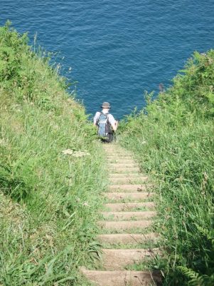
How to make the best of a sunny afternoon whilst I’m not able to climb the fells?

I have had in mind for some time a walk around my home town of Longridge visiting the buildings bestowed with a blue plaque. A quick piece of research of Longridge Heritage Committee information told me they had placed 15 in total – so off I went, camera in hand.

I intend to let the plaques give you the history whilst they are legible …

No 1. CRAMPOAKS MILL.

At the bottom of the main street, Berry Lane, is Booths Supermarket. From the front it could be any retail outlet but viewed from the side the telltale ‘saw tooth’ north-facing roof lights marks it out as an old mill, there were many such cotton mills in Longridge, spinning and weaving.           

No 2. Youth centre.

Across the road on the corner is an undistinguished building housing a community and youth centre with several notable past uses including the Bond Minicar developed in town.

No 3. The Towneley Arms.

A popular local pub situated next to the old station. An adjacent level crossing was used on Berry Lane where the line crossed to sidings for the mills and on its way up to the quarries.

No 4. The Old Station.

The station has been sympathetically restored as a Heritage Facility and a popular central cafe utilising the platform space as well as the station building. There is always a wealth of local information available in the heritage centre. Searches on the internet will soon provide more history on the Preston – Longridge railway and its unique branch to Whittingham Hospital which in its heyday was one of the largest Mental Institutions in Europe.

No 5. The Co-operative Building.

On the next block up is another imposing stone building previously holding our co-op. When I first arrived in town I would shop in the various departments of the large store. The plaque mentions the ballroom upstairs but I mainly remember the Polash Indian Restaurant up the stairs when the space had been divided – good old Ronnie was an excellent chef and I still have contact with his family in Burnley. The present co-op store has moved to a new building next door and the lower floor shops are now charity and betting – a sign of the times. The rest of the building is however used as semi affordable flats. Shame they didn’t restore the clock which is visible from most of the lane.

No 6.  Methodist Church.

This Wesleyan Methodist Chapel is now in private ownership having been sold off and the congregation incorporated into the United Reform Church down the road – now the thriving Christ Church. Needs must. I have never been inside it.

No 7. The Stone Quarries.

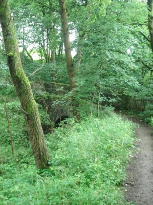
I hit a problem here – I couldn’t find the blue plaque! I presumed it was by the tunnel linking the railway to the quarries. In the past the railway line continued from the town centre through what is now John Smith’s Park and connected with a horse drawn incline up into the extensive quarries, Tootle Heights, producing high quality stone for many construction projects in the NW. Liverpool and Preston docks and many public buildings in Preston. The raison d’ètre of the line.

Tootle Heights Quarry in its heyday.

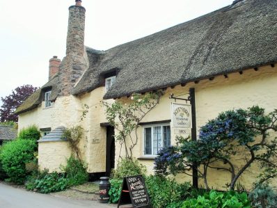
No 8. The Quarryman’s Arms,

Just below the quarries is this old pub building – now my favourite Thai restaurant.

No 9.  Club Row.

Walking back down Higher Road you come to a row of cottages on the left. They have an interesting history.

No 10. Cinema.

Unfortunately the cinema is under scaffolding at present, undergoing refurbishment with new owners who hope to continue operating it as private cinema. It has been a unique experience with ice cream usherettes, tea and coffee in mugs and the National Anthem, lets hope it continues to be.

Its noticeable how many properties in the old parts of town were previously involved with  hand-looming.

No 11.  Fell End.

Continuing down the hill there is an old building, now a funeral parlour, on the corner bearing the plaque. The Duke William pub opposite is now private housing.

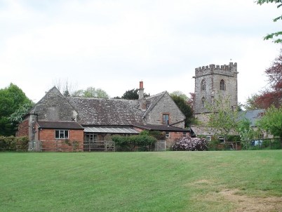
No 12. St. Lawrence’s Church.

Opposite across the main road is the parish church in a prominent position approaching the town.

No 13. New Town.

Round the corner on the busy Preston Road is an area known as New Town which is now a conservation area. The water pump has been restored. As a bonus here we get a Red plaque.

As it was…

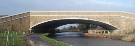
No 14.  Stone Bridge.

The busy roundabout at the end of Preston Rd is built on Stone Bridge where the railway entered town. Not the most salubrious environment – don’t hang around.

No 15.  St. Wilfred’s Church.

The prominent church further along Derby Rd is Roman Catholic, an important religion in the town.

So a walk of about 3 miles has included all the plaques but there are so many more interesting stone buildings in town that I feel I could produce another circuit.

LANCASTER CANAL 8. Sedgwick to Kendal.

For our last day the sky was blue, the ground hard with frost and the surroundings covered in snow – magic. Of course this was all planned.

We were soon back up to the line of the canal and making good progress through the fields on the edge of Sedgwick which seemed to have some pleasant housing tucked away from modern hectic life. The village first enlarged due to the nearby gunpowder works on the River Kent, subsequently residential properties have been built in what was probably the estate of Sedgwick Hall mentioned in my last post. The canal crosses a road on a skewed aqueduct in the middle of the village, these were built for strength.

Lovely countryside was traversed with drumlins to our right, isolated bridges and then woodland giving variety.

Looking to the east above St. Marks Church in Natland was an attractive Fell I didn’t recognise, looking on the map it is named The Helm and has an Iron Age Fort [Castlesteads] at its southern end. Yet another place to explore on a return visit.

Onwards under more isolated bridges with the lower Kentmere fells  in the background. This area is well walked being just a stroll out of town.One can see why Kendal is a popular place to live – a lively historic town in beautiful surroundings.

And then we were into the streets and parks of Kendal, the line of the canal still walk-able with frequent signs. A walking cycling corridor out of town. Passing behind the leisure centre the site of old coal wharves has been utilised by local schools to provide environmental studies. 


One renovated bridge had iron work alluding to the history of rope-making  hereabouts.

A crossover bridge is encountered and duly crossed, there have only been three on the whole of the canal. Obvious old mills are passed, the castle is up to the right somewhere. More filled in wharves at Lound, with informative interpretation boards,  and then the main terminal basin is reached, now only identified by warehouses. These are now used for other purposes though some have links back to the past. A small building is signed as being the original ticket office for the packet passenger boats. In the last warehouse, now modernised, is the head quarters of Gilkes manufacturing turbines on this site since 1856. Apparently inside are some original features of the basin.One can only imagine the industry and flow of goods right in the centre of Kendal in the 19th century. A return visit is needed to explore this industrial heritage further.

Below is an old aerial shot of the terminal basin [Stricklandgate House Trust]


Our way across Gooseholme Bridge was closed due to flood damage, so we braved the traffic on a road bridge to reach Baba Ganoush for a welcome bowl of delicious soup. This was followed by the three of us ‘running’ to catch the 555 bus, thanks to the driver for waiting for us.

So my journey up the canal from Preston is completed. It has been a very pleasant stroll helping my hip ligament rehabilitation but more than that has been full of interest and kindled my desire to explore this area further.


LANCASTER CANAL 7. Holme to Sedgwick.

We were the only ones stood waiting for a bus on the deserted slip road off the busy A590 roundabout but sure enough the 555 appeared and took us back to Holme and bridge 149 on the canal. Driving up the motorway this morning the snow covered Lakeland mountains looked majestic, blue skies and bright sun promised a good day – on the Lancaster Canal not those mountains.  I have just realised we are now walking in Cumbria so ignore my tagging of Lancashire, somebody moved the boundaries.

Today’s stretch is along isolated truncated parts of the canal which in its demise suffered at the hands of the road builders, notably the M6. Despite this there were some beautiful stretches of countryside as well as awful noise from the motorway.

The start on the edge of Holme is dominated by Farleton Fell to the East. we could trace defunct tracks used to bring limestone down from quarries to the canalside basins. Over to the west the cliffs of Whitescar were prominent with the Coniston range behind. Soon the canal was blocked by the M6. A diversion through fields alongside the motorway to a crossing meant backtracking, for the sake of completeness, to the point where the canal emerges from a culvert under the road. Swans were starting to nest build on this watery cul-de-sac. I recall the kingfisher that flashed past somewhere back near Galgate, haven’t seen much else but ducks, oh and the odd Heron.

Through Farleton remains of one of the stables used for the ‘fast’ packet boats was passed, horses were changed every 5 to 7 miles to maintain momentum. Remember, as the cars speed by on the M6 and trains on the nearby main line, the 57miles from Preston to Kendal took passengers 8 hours. The industrial haulage was more like a week for the round trip.

A little further on and there was an aqueduct over Farleton Beck, I dropped down to view the structure and found what appeared to be a fish ladder next to the beck, but I think is just an overflow from the canal.  Notice the first use of beck, a Norse word for stream used mainly in the north of England.

Another stretch by navigable water ended at a culvert under the A65, we used the underpass and again a short while later at the M6 again. There is no way the Northern Reaches of this canal will be restored. History is littered with bad, short sighted planning decisions. We are still making plenty of them unfortunately. In between on the short section of canal swans glide regardless of the situation. 

From here on to Stainton the canal is navigable if you can get a boat into it. The only craft we saw was the Lancaster Canal Trust’s small boat moored at Crooklands. The main canal feeder from Killington Reservoir enters, disappointingly as a mere trickle through a fence bordering an industrial unit. Killington Lake is known to many for its M6 service station on the way south. Up to 17 million gallons of water a day enter the canal here!

There is an aqueduct over the Peasey Beck which supplied the gunpowder factory mentioned below and is interconnected to the Killington supply. In the vicinity we passed a canal side coal wharf and the larger Wakefield’s wharf which was connected by a tram-way to a nearby gunpowder factory at Gatebeck, yet another place to explore. Saltpeter and sulphur came from foreign lands but the charcoal and water power were local.

Wakefield’s Wharf.

Lunch was taken at the Canal Trust’s restored packet stables but was interrupted by a short hail storm  on an otherwise sunny cold and clear day. Looking back on our meandering route Farleton Fell looked surprisingly close.

The section northwards was through glorious English countryside and would be a joy to canoe.

Another small feeder comes in and then an aqueduct over Stainton Beck. Storm Desmond two years ago caused serious damage to the stonework and repairs will be costly.

The semi functioning canal finishes  finally at a damn where the water no longer exists. The next length of canal, optimistically named First Furlong, is being cleared and re-puddled with the hope of returning to water. But a few volunteers will be no match for the hundreds of navvies working two centuries ago.

A dry section can be followed to the entrance to Hincaster Tunnel, the only one on the canal, When built to go under the hill there was no towpath so horses had to be taken over on the path we now follow. There is much interesting stonework associated with the canal structures here and the modern railway goes overhead. How often do the railways parallel the canal? Down the otherside is another packet stable.

A short stretch by the dry overgrown canal course is made interesting by installations of models, figures and other artifacts introduced no doubt by some local children who may have been involved in the clearing of the ‘towpath’. A nice touch much appreciated.

The canal has been demolished by the A590 and a lane is taken. Below is the estate of Levens Hall, which is well worth exploring. A short climb brings us up to the course of the canal, now in filled, and a field crossed to the obvious isolated canal  bridge,177. We are above the interesting Gothic like Sedgwick Hall which was previously a school and now converted to individual living accommodations.

Our car is not far away leaving us a short section of ‘canal’ to complete into Kendal.

Corniest boat name of the day category. We only saw one boat all today … Waterwitch, it will have to do.


LANCASTER CANAL 6. Carnforth to Holme.

A highlight of the day was a flash of turquoise – the first Kingfisher I’ve seen for a year.

Progress up the canal is being made slowly with my self imposed limit of 8miles flat walking, however there is no deterioration in the hip ligaments which are improving with my physio exercises. fingers crossed. I have just realised that in 60 years of walking and climbing this was the first time I’d sought the help of a physiotherapist.

Today’s companions were Peter and Denise again. My car was left at Holme and the bus taken back to Carnforth. I’m making good use of my bus pass on this walk, maybe this could be developed into a theme. There is one blogger I’ve come across who ticks off the Wainwrights using only public transport, well not the summits themselves but just getting to the areas.

We meander out of Carnforth with interesting road and railway bridges. The first bridge as we leave the town has been sympathetically widened at some time to accommodate more traffic. Bridges under the motorway are more brutal.

Rural calm returns as we reach the aqueduct over the River Keer, the converted mill below has a restored waterwheel and was coincidentally almost purchased by Peter and Denise when they moved to the area. Looked a bit dark and damp to me. Old milestones are visible along this stretch, 17miles to Kendal!

At nearby Capernwray we were entertained by a tractor trying to manoeuvrer a mammoth caravan down the lane under the railway bridge. The attached holiday site is in an old limestone quarry, Wegber, with cranes still visible and a little further a short canal branch into the quarry area for loading the limestone.

We passed by Borwick Hall, just visible through the trees on the other side, an Elizabethan manor house. And then we were at Tewitfield a significant location on the canal. So far I’ve walked 42 miles dead level on the 70ft contour but today things change and the canal, now defunct, rises 75ft in half a mile. This northern section to Kendal was opened in 1819 and was closed in 1968 with the building of the M6. 8 locks lifted the canal from the basin before level going to Kendal. The basin where the canal navigation now ends is a holiday complex with not particularly well-designed apartments.

END OF THE NAVIGATION.

Creeping alongside the motorway we reach the start of the ascending lock system. Plans have been muted for years to restore this northern section but they have come to very little.

At the top of the lock system the motorway delivers the final ‘coup de grâce’ …

We find a way across the M6 and resume our stroll along the towpath as if nothing had happened. Ahead was the distinctive outline of Farleton Fell, once one of our popular evening climbing venues on less than solid limestone.

Passing the settlement of Holme Mill we saw the millpond supplying a once industrious linen mill. Flax was grown in the area for the production of linen before King cotton took over.

We didn’t enjoy the boggy stretch of ‘towpath’ ahead…

However, there was a final triumphant flourish on arriving in Holme with the appearance of well-preserved coke ovens on the far bank. I mentioned these in my last post when we were unable to identify any. The ‘beehive’ ovens were used to produce better firing smokeless fuel from coal for the use of blacksmiths and bakers, and later for iron smelting.

Turned out to be an interesting day. Will be back to bridge 149 as soon as possible to complete the journey.

There were few boats on this section of the canal so my ‘Corniest boat name of the day’ has become ‘corniest boat of the day’

‘Sheds R Us’

LANCASTER CANAL 5. Lancaster to Carnforth.

Another change of personnel today,  JD joined Peter and I on a windy morning. The highlight of the day was crossing the Lune Aqueduct on the edge of Lancaster. The walk from the pedestrian bridge [103] in town was through the rather dull suburbs but by the time we reached the aqueduct open countryside was visible, or at least a golf course. Rennie’s aqueduct opened in 1797, after 5years construction, to much acclaim. There are five arches scanning 70ft 50ft above the Lune. Recently there has been a significant refurbishment with improvements to the lining and the stonework. We should have descended the steps to view the structure from the river bank. Instead  we strolled over the exposed towpath made safer by the ornate balustrade. Lancaster castle was glimpsed downstream. Lunesdale upstream.

The next landmark was the new ‘milestone’ bridge carrying the M6 relief road to Morecambe.  This was a massive structure compared to the usual arched stone bridges. One of the latter in the vicinity has been widened more sympathetically to accommodate the road, a date of 1921 is visible.

Along side the canal every 6-7 miles or so were stables for the fleet of horses enabling the ‘fast’ passenger boat from Preston to Kendal, done in 8 – 9 hours. The masonry remains of one is next the towpath, easily missed.

Through Hest Bank and Bolton-Le-sands we seemed to hover drone-like above the houses with views across Morecambe Bay. At one time ships would harbour on the Morecambe Bay coast here with goods to be transferred up to the canal, the opening of the Glasson Dock branch in 1826 superseded this. Somewhere between the two villages is a good example of a swing bridge, now leading to private houses. We contemplated on how it would be interesting to withdraw access to unwanted visitors by a swing of this bridge.

I was on the lookout for old coke ovens at two sites into Carnforth, bridges 125 and 127, but disappointed with the outcome. No real sign of the beehive structures across the other bank, the low sun making visibility difficult. The ovens were used to produce better firing smokeless fuel for blacksmiths and bakers and later for iron smelting. They are supposed to look like this…

The basin to the south of Carnforth was busy with boats and dog walkers but before we knew it we were back in a rural setting before the children’s playground announced bridge 128 on the Kellet road. Time to find a bus back.

Corniest boat name of the day…

LANCASTER CANAL 4. Galgate to Lancaster.


Today Peter’s wife, Denise, joined us for a shorter walk along the canal into Lancaster. It didn’t turn out as short as expected. Having completed our walk we caught an early bus back from Lancaster. As we were leaving the city several police cars, ambulances and a fire engine overtook us with lights flashing and sirens blaring. There was obviously trouble up ahead, possibly on the motorway but soon we were stopped and the A6 closed due to a serious accident. We were going nowhere. Students alighted from the bus and started walking up a side road and cycle path into the University. There was no choice but to follow and soon we were wandering through the extensive campus hoping to bypass the closure and walk into Galgate. This proved an interesting diversion, even getting a close up view of the silk mill there. The Air Ambulance helicopter was in action so I hope those involved in the accident are not seriously injured. Will donate to their charity on the next occasion.

Anyhow to get back to the start. Smoke was drifting up from several residential boats moored in the basin at Galgate. I noticed on a wall a bank of post boxes for the boaters, I suppose you need some sort of address for communication if you are permanently living on a barge. The usual gentle meandering walk took us into the countryside on what was a dull day so views to the hills were limited. Conditions under foot varied. Occasional roundels indicated we were sharing the route with a named walk, A Breath Of Fresh Air, which takes in interesting areas of the Lune, coast and canal around Lancaster. http://soulfulhorwich.org.uk/abofa/index.shtml

After just over a mile we entered the wooded Deep Cutting which takes the canal through glacial deposits to avoid a long detour, quite a contrast to the open land. Apparently this is the place to see kingfishers but not today.

At its northern end the outskirts of Lancaster are reached. On the left at the entrance to a new development, Aldcliffe, the old gate house has been left to rot, shame. On the contrary there are some splendid houses on the other bank. Glimpses of the castle came into view. After passing under the main railway line city centre wharves were  reached. On the right was the converted boat house where packet boats were repaired after being lifted into the upper floor. On the adjoining ex British Waterways yard are new developments with the old crane preserved. The tall chimney is the hospital incinerator. At one point we have to cross over to the other bank for a short distance, the bridge is constructed to allow the horses over without unhitching. Student accommodation has been built alongside the canal and with a few pubs in old warehouses the area has a good ambience. A lot of money has been spent in Lancaster in the last few years and by look of things quite wisely. There is a fine bridge bearing the name of a local blacksmith at the time, 1876, when the bridge was widened.Leaving the canal at a pedestrian bridge, we wander through streets to board the ill fated bus.


The Silk Mill back at Galgate …


Corniest boat name of the day…

The forecast is not good for the next few days so I’m not sure when I’ll be out again for episode 5, anyhow I think my hip needs a rest. I’ll just stick to the exercises my physiotherapist has given me.


And for completeness our homeward detour…

A DAY BY THE SEASIDE – Blackpool Prom.

A beautiful sunrise and minus 5° temperatures dragged me out of bed. After yesterday’s experimental stroll I was still able to put one foot in front of the other. Time to get going.

Almost to the year Sir Hugh and I were walking around the Fylde on The Wyre Way. Having walked from Fleetwood to Rossall we cut across country to the River Wyre itself to complete the route on a dismal December day. Today,  a not to be missed sunny one, with temperatures struggling to reach zero I was back: parked possibly illegally in Rossall School with the intention of walking 10 miles to South Shore terminus and catching the tram back. As a get out I could catch the tram at virtually any point if I was struggling.  Once on the promenade I realised the possible foolishness of this venture, the path was an ice rink even the dogs, which were outnumbering people, were skating about. Out came the walking poles to give me some security, I was here for some easy flat walking to test my hip not to fall and break something.

The sea played little part in today’s walk:  the tide was out, the waves flat and the sombre December weather blurred the horizon. So I could concentrate on the immediate surroundings of the promenade. Inland to start was dreary housing and apartments, retirement ‘I do like to be by the sea’ places. All very forgettable. But the new Clevelys promenade is all curves and a pleasure to explore.

The lighting installations reflect a Gaudi appearance.A striking memorial installation to all the ships lost on this coast …

Clevelys, Bispham and Norbreck passed by, the clock tower and the hotel notable landmarks. The sea front hotels in this area reflect back to a golden age with names redolent of fashionable London – The Savoy. Grosvenor, Imperial etc, all dated and out of sync in the modern era.

Out of interest, but maybe of importance, all the old toilets on the promenade have been closed down and replaced with infrequent pay to enter booths. Why spend all this money on refurbishing the front to a high standard and then charge 20p to pee. The answer is privatisation of what should be a public service. I didn’t have 20p so peed on the beach. Sorry but it was very cold.

Along this stretch they were dismantling the famous illuminations. I had a behind the scenes view and could only guess at some of the displays. One of my son’s birthday is October so it was a simple matter at the time to fill the car with his mates, drive them through the lights, fish and chip supper and home.

The sands stretched on and on regardless of the hinterland.

A striking sculpture recognising our emergency services   https://www.bbc.co.uk/news/uk-england-lancashire-23070443 

Now Blackpool Tower and the North Pier were approaching fast. Commercialism is mainly closed down in winter but there were still some venues screaming out at the punters with promises of untold entertainment. But mainly all was drab and shuttered. The golden mile closed down!        I even had to go inland a block to find somewhere to eat, yes you have to have fish and chips when in Blackpool.

Central and South piers were closed for winter as was the Pleasure Beach and just about everything else.    Walking on the beach looked attractive but turned out to be too strenuous. The day was getting colder and the prom stretched on for miles. It was with some relief that I arrived at South Shore tram terminus and negotiated a trip back to Rossall.


ZCapture.JPG blackpool

SOUTHERN NOSTALGIA.

I was a student of the ‘sixties’. Living in London, and when not enjoying drug fueled orgies, I acquired numerous strategies for free entertainment to eek out my grant of £10 per week. You didn’t get a lot of orgies on that. Cycling up to Hampstead Heath for sunny picnics, playing football in Hyde Park on Sunday mornings, free theatre tickets from the nurses home, BBC performances when they needed an audience, folk clubs enjoyed over a long solitary cup of coffee, Kew Gardens, British Museum.  You get the idea.

Close to where I lived was Portman Square which hosted The Courtauld Collection [of textile fame] another free facility. Maybe I had to show my university pass but I don’t remember. Often I would come along here and immerse myself in their intimate world of art. A few rooms depicting some of the world’s masterpieces. Medieval religious works, Rubens, Gainsborough, Degas, Pissaro, Monet, Manet, Cézanne, Gauguin, Renoir, Toulouse-Lautrec, Seurat, Van Gogh, Matisse, Dufy, Sickert, Mûnter. What a list. Those images have stayed in my brain all these years so it was time to refresh them. The Courtauld is now housed in the imposing Somerset House and has become a major attraction, attracting a considerable entrance fee. But all those mental pictures are still here although they have been diluted by more recent, equally brilliant, acquisitions. The atmosphere is not as personal but the rooms hosting the galleries are elegant in themselves, giving that quintessential English experience. A magnificent spiral staircase connects them, I used the lift.

The pictures below are only some of the ones I remembered, as you will see this is an amazing collection.  Thank you Mr. Courtauld. How many do you recognise?


CAMPIN. 1425


VAN DER WEYDEN. 1430

CRANACH THE ELDER.  1526

RUBENS. 1613

GAINSBOROUGH. 1778

MANET. 1863

DEGAS. 1871

MONET. 1873

RENOIR. 1874

MANET. 1881

SEURAT. 1886

VAN GOGH. 1889

CEZANNE. 1892

TOULOUSE-LAUTREC. 1892

GAUGUIN, 1897

MATISSE. 1905

DUFY. 1907

SICKERT. 1909

MUNTER. 1909

Outside in the square ice skaters were enjoying an early Xmas. Waterloo Bridge gave a view of the city with all the new high rise buildings and St. Paul’s tucked away. the bustle of Waterloo station brought me back to reality.

Whilst visiting Mel and Pat in Surrey we also crammed in Wisley Gardens, Mercedes Benz test track and showcase building, an exhibition of Turner’s art of the Thames Valley at Woking Lightbox, Asian street food, Polesden Lacy house and gardens, beer and curry at the opening of a new restaurant and a French Bistro. The weather was beautiful, blue skies and sunshine. The colours Autumnal.                                                                                    ***

                                                                                ***

                                                                               ***

On the way back to Euston I visited The Agra in Whitfield Street to prolong the nostalgia. This family-owned restaurant was established in 1954 and was reputedly the first establishment in Britain to install a tandoori oven. As students we would visit for the Tandoori Chicken and Naan Bread. The decoration and toilets have changed little over the years. The food however remains good quality ‘curry  house’  Perfect before boarding the Pendolino.

SW COASTAL PATH – GETTING BACK THERE.

Preston – Westward Ho!

Sometimes reaching the start of a walk can be an interesting day in itself.

At the very moment I was being picked up to be taken to the station half a dozen sheep appeared in my garden, this led to a few frantic minutes of attempted sheep rounding up. I made the station on time but I’ve no idea what happened to the sheep.

Ironically given my destination my morning coffee was purchased at the West Cornwall Pasty Company kiosk, I resisted their ‘traditional’ pasty as I’m sure there will be more to come.

The waiting room and buffet at Preston Station has interesting information relating to when it was at the hub of troop transport in WW1.

Back in Barnstaple I had time to explore more of the town and was amazed at their covered Pannier Market, in use for 160years, and the adjoining Butchers’ Row previously populated with rows of adjoining butchers’ shops. A reflection of the importance as a port and market town Barnstaple has been.

My hotel for the night was further from the centre than I’d hoped but luckily round the corner was the friendly Reform Inn with their own brewed Barum beer at £2.50 a pint, that was the last I’d see of those cheap prices in touristy Cornwall. 

It turned out two gents staying at the same hotel were on their last leg to Lands End having ridden on strange Monkey Motorbikes from John O’Groats in 6 days.

I’m here for a week to complete another section of my John O’Groats Lands End walk using mainly the SW Coastal Path in this region as it gives spectacular walking. Feels as though I’ve done a day’s walking already.


LEAFY SURREY.


An interesting weekend.

For the last 20 or so years Mel, a friend from school days, and I have completed an annual ‘pub to pub’ walking week on various long distance trails. We walked a stretch of The Thames Path last year and had hoped to continue this year but he has been in ill health so we didn’t make it. Instead to keep in touch I arranged to travel down to Woking for a weekend in Surrey, it turned out to be quite a busy few days.

First we walked a pleasant flat mile along the canal into Woking centre, rehabilitation exercise for him. This is the Basingstoke Canal which originally linked Basingstoke with the River Wey navigation and hence the Thames and London. Agriculture, coal and timber were transported from the end of the 18th until the early 20th century. Now a few pleasure boats use it but the towpath provides a pedestrian and cycle route between communities. The wildlife is reputed to be outstanding, we saw a couple of ducks. Linking the Living Planet centre, UK office for the WWF, to the town centre is the pedestrian Bedser Bridge built to commemorate the famous local cricketing twins, Surrey regulars in the 50’s. On either side of the bridge are statues of the pair, Alec bowling to Eric, but where’s the ball – lots of people were keen to point it out high on the wall of the nearby Civic Offices.

Our reason for crossing the bridge was to get to the Lightbox a gallery and museum centre. After paying our respects to H. G. Wells the author of The War of the Worlds, the Martians had landed on nearby Horsell Common, we enjoyed a coffee in their cafe. Short of time we omitted the main galleries with still life and sculptures in favour of the history of Woking. This fascinating exhibition highlighted Woking Palace, The Shah Jahan Mosque – the first purpose built mosque in the UK, Brookwood Cemetery – famous for being the London overflow cemetery during the 19th Century, Brookwood Mental Hospital, the importance of the railway to Woking, local heroes and commerce eg. Kenwood Mixers. All brilliantly laid out and explained – a worthwhile hour.

I walked wide eyed through the bustling shopping centre with its stalls of international street food and sculptures. 

‘Surrey Hills’
Sarah Holmes.
A local artist Inspired by 2012 Summer Olympics.

It is unusual for an arcade to be so alive. the afternoon drifted on but the evening was spoiled by a poor quality Indian Restaurant.

A sunny start next day and we were pottering on his allotment, The whole site was colourful and productive with plenty of keen gardeners doing their thing. I did some token weeding whilst Mel sprayed his heavy crop of tomatoes and as a bonus I came away with some nice fresh vegetables.

Another place where Mel could do some gentle flat walking was in Savill Gardens and that’s where, after a coffee in their extensive and crowded cafe, we found ourselves. We were almost the only ones wandering in the garden itself, don’t know where the other thousand people from the car park and cafe/shop ventured. The main event here is the spring Rhododendrons but I found plenty to enthrall me today. They have a splendid wild flower display for starters and the summer bedding was a blaze of colour. On the way were infinite colours of Hydrangea macrophyllia.

Next stop was the Air Forces Memorial, a memorial dedicated to some 20,456 men and women from air forces who were lost during WWII. Those recorded have no known grave anywhere in the world, and many were lost without trace. The name of each of these airmen and airwomen is engraved into the stone walls of the memorial, according to country and squadron. There is a complementary register with more individual details. This solemn and thought provoking site was opened in 1953 by Queen Elizabeth II and has an outstanding position above the Thames and Runnymede. Today there was scaffolding around the building and the upper terrace was blocked off but we still had views of Windsor Castle, the river Thames, a busy Heathrow and Wembley Stadium. An absorbing experience.


A late Buffet lunch was taken in the Runnymede Hotel on the river and what a buffet – everything you could think of was on offer, all first class quality – at a price. A lovely restaurant to relax in and watch the world go by on the Thames, the closest we got to walking the Thames Path this year.

It was in this vicinity that in June 1215 King John signed the Magna Carta giving political reform that has more or less survived the last 800 years. Hence a lot of tourists mingling along the riverside.

Home for a rest.


THE BURNLEY WAY. Day Five.

Portsmouth to Towneley Park.

If you google Burnley to Portsmouth by bus you can imagine the result –  a ten hour journey to the south coast. Today’s more modest journey went like clockwork, leave home 9.45, park up at Towneley Park, 10.43 bus to Burnley bus station, 10.55 bus to Portsmouth [the one in Cliveger Gorge] and I was walking back into Lancashire by 11.30. I’m becoming a bit of Burnley Bus nerd. The weather today was perfect for a change.  A track climbed steeply from the main Calderdale road and headed into the hills, unusually it was unmarked. Roe deer ran before me and disappeared in the bracken, only their barking could be heard. This was steep climbing and I was soon looking back down into Calderdale and up to distant Stoodley Pike.

Once above a remote barn conversion a smaller path made a beeline for Heald Moor.  A rough track then led along the ridge to Thieveley Pike which was marked by an Ordnance Survey Pillar, 449m,  the highest point on the BW. This was the essence of open Pennine walking just me, skylarks and cotton grass.

Halfway along the ridge was a stone marker plaque who’s origin I cannot find, any ideas?


The extensive views were back to the Coal Clough Windfarm, down Calderdale to Stoodley Pike and The Peak District, Lancashire Moors, Hameldon Hill, distant Bowland and then Pendle and the Three Peaks and more of Yorkshire…

  A subsidiary ridge went over Dean Scout Rocks  which made a convenient lunch stop looking down into the Cliviger Gorge. A steep track descended through more sections of the Burnley Forest. Going under the railway I joined a section of the Pennine Bridleway, this turned out to be a delightful peaceful pastoral passage past old farms on what must be an ancient track. Ripe raspberries in the hedgerows were a bonus.

I was circling a hillside plantation named the Fireman’s Hat though I couldn’t see the resemblance, this has been made even worse by a communication tower which has somehow been allowed to be placed in this prominent natural position, money must have changed hands. I walked my way through Walk Mill and payed a quick visit to the Barcroft Hall a 17th century building. Interestingly there was of those old American caravans in the garden.

I then entered the extensive grounds of Towneley Hall and met the masses enjoying a sunny day, children and dogs included. There are paths and avenues everywhere. An ice-cream van by the bridge over the Calder River was doing a good trade and I couldn’t resist a cornet. A stroll  past the hall itself, note to visit in future, and then up a mature lime avenue to the gates on the main road and my car.


So I’d completed The Burnley Way, in more days than planned and in poor summer weather conditions but had thoroughly enjoyed the experience. Met some lovely people along the way. Good varied walking with fascinating natural and industrial features in an area not known for its walking. My photos don’t do it justice. It is well waymarked and the guide leaflets from Burnley Council clear and accurate. I had learnt a lot more of this area and I highly recommend.


THE BURNLEY WAY. Day Four.

Worsthorne to Portsmouth.

Rain all morning, once again the summer weather had conspired against me but rather than be inactive I opted for another short stage. My lunchtime arrival in Worsthorne coincided with a brightening but showers were still in the air, however I didn’t need waterproofs for the rest of the day. A flagged path across a field took me into Hurstwood described as a delightful Elizabethan village with attractive buildings – most seemed to be under renovation at present so I didn’t dally. A lane crossed the infant River Brun which I had come across a couple of days ago in Burnley centre. The now cobbled lane passed isolated farmhouses onto the moor, I pondered on the man-hours  needed to construct these old highways. Dropping down into Shebden Valley the reason for the lane became apparent – an extensive area of quarrying. Apparently this was for limestone extraction using hushes and what remained was piles of unwanted stone, the sheddings. I joined The Pennine Bridleway at the bridge but for some reason I was directed to a smaller path into the workings, this soon became indistinct and my wanderings were more and more erratic until I hit the Long Causeway road.  [Stay on the bridleway!] This straight road possibly dates back to the Romans and was used as a packhorse trail in the 18th century. It is characterised now by the Coal Clough Windfarm which it runs alongside, I remember this as one of the first in this area. From up here Pendle dominated the skyline to the north.  At a corner a farm track continues on the original line and I just followed this although the footpath supposedly takes to the field. Another isolated farm is passed and a lovely little building which would make a good bothy but more likely an expensive holiday cottage.

The path traverses above a wild clough and passes through plantations which are part of The Forest of Burnley a lottery funded scheme to create new forest around the area, I had noticed secveral others on these walks. Pathfinding through the new plantations is not always easy and waymarking could have better. I found myself on the top of a gritstone cliff, Pudsey Crag according to the map, a diversion was taken to view it from the valley. It looked worthy of climbing but is apparently out of bounds on private land. Deep wooded cloughs are entered as one progresses towards the Cliviger Gorge, occasional cottages appear out of nowhere – this is a secret place. Coming out of one of the cloughs towards Brown Birks farm I was confronted by a large brown bull right on the track, I was so overawed I didn’t even get a picture. Backtracking I picked up another footpath circumnavigating the field and with a bit of ingenuity safely avoided the bovine obstacle. I was now dropping into Cliviger Gorge and looking at the climb out on the otherside which will start my next stage. Looking down were the back to back terraces of mill villages Cornholme and Portsmouth. I jumped on the bus to take my me back to Burnley but found it pulled off the main road to visit some smaller villages and I surprisingly saw I was only a mile from my start so I was dropped off and walked into Worsthorne. Another day of discovery.

THE BURNLEY WAY. Day Two.

Hapton to Briercliffe.

I must have been somewhat dazed when I left Hapton Station as within 15mins I was lost and heading back almost to where I started but once orientated I made a direct route into Padiham where I stumbled into an unexpected cafe [the Belly Buster] for coffee.

Anyhow after the coffee break my brain kicked into action and I was soon following the River Calder out of Padiham and into the Grove Lane Greenway. All peace and birdsong, it is difficult to imagine this area amongst the trees  hosted a coal colliery relatively recently . Across the fields was Burnley F.C. training ground and also Gawthorpe Hall. The latter is the end of The Bronte Way from Bradford which I hope to complete with Sir Hugh later in the year when he is fully recovered.

River Calder.

What looked on the map like a riverside path turned out to be a tarmacked lane so I made good progress. The day was overcast and warm, I seemed to be sweating profusely and not feeling good.  For no obvious reason I started to have a longing for chips. Were the two connected?

At a bridge across the Calder near an old ford, lots of sand-martins flying low, I met up with the said Bronte Way and also the Pendle Way [completed not without interest 20 years ago – another story involving the Mountain Rescue when I didn’t need rescuing.] Climbing steeply out of the valley the paths seemed to be little walked but the signing remained good and I kept on course. Mention of Pendle made me realise I had not seen this dominating hill today in the poor visibility but there across the valley it appeared out of the mist.

A series of horsey fields were traversed and suddenly I was looking down into the sprawling mass that is Burnley. Urban parks by the river led past a Holiday Inn, a holiday in Burnley? and down to join the towpath of the Leeds Liverpool Canal. This goes into the heart of Burnley and an area named the Weavers’ Triangle – a collection of 19th century mills and warehouses from when the town was a major cotton-weaving centre. There are ruined buildings and alongside renovated ones providing office and living spaces. Several weaving sheds were still visible with their distinctive sawtooth roofs giving Northern light. A covered wharf appeared and next to it a pub in a converted warehouse, The Inn on the Wharf. Despite the fact that I was carrying lunch the craving for chips got the better of me and I was soon sat with a pint of Copper Dragon, a salad sandwich and a portion of home made chips.

Burnley appears out of the murk.

Back on the canal after a couple of turns and more derelict wharves and mills you come to the ‘Straight mile’ where the canal runs along an embankment 60ft above the town. Easy walking with views to the new developments in town to the left and Turf Moor football stadium to the right. I am reminded of the former great days of Burnley FC with the outspoken Bob Lord at the helm, they won the league in 1960 – oh happy days. What struck me most about this stretch of the Leeds – Liverpool Canal was that there were no boats which is at odds with most stretches of our inland waterways. At the end of the embankment the canal crosses the river Brun [said to be the origin of Burnley’s name –  Brunlea]  A double back under the canal takes you into the Brun Valley Park a greenway leading out of town. A large part of this area was a former colliery though you wouldn’t know it today with all the mature trees in new parkland. Rather crudely carved wooden marker posts served this stretch of the Way bringing me out at Netherwood Bridge though there seemed a multitude of alternative tracks through the muddy woods. Hereabouts I took a more direct line up to the equestrian farm, busy with girls grooming horses and mucking out vast pile of manure. Further up the hill the Burnley way was rejoined for a stretch downhill into a hidden valley, orchids were plentiful on the damp meadows. At the bottom there was a little footbridge over the River Don, a stream really. What a lovely spot for a lazy Summer’s day – oh I had forgotten it is Summer.

A series of old stone flagged steps lead out of the valley, these steps go by the local name of Ogglty Cogglty whose meaning has been lost in time. At the top of the steep slippery ascent indistinct field paths go up towards Queen’s  Mill in Harle Syke. This large mill in a side street apparently is the last working steam powered mill but it all looked very closed to the public today.

To be continued…

THE BURNLEY WAY. Day One.


Towneley to Hapton.

I had chosen Towneley Hall as a convenient starting point for the 40mile Burnley Way which I’d broken down into three days’ walking. I’d obtained an excellent leaflet guide from Burnley Council which detailed the walk very well and it is marked on the 1:25,000 OS map OL21. I could see that a radial bus service would ease getting to and from daily start and finishing points, living so close it wasn’t worth paying for B and B.

A late start and a shortened day to let the morning’s rain abate. On the no 483 bus this morning was a man in full golfing regalia with trolley and bag so I knew we had arrived at Towneley Golf Club when he got off. I could have been anywhere but crossing the road I came across the first of the BW waymarks with the birds beak giving the direction up a little lane. I couldn’t make out the coke ovens which were supposed to be hereabouts but soon came across an art installation, part of the Wayside Arts Trail, a red brick kiln which is sadly falling apart or has been vandalised – a depressing thought. I realised I’d forgotten my camera so out came the phone.


Onto an affluent housing estate old tracks passed between properties, not the terraced housing one associates with Burnley, this is the west side of town.  Crossing a busy road I climbed up the hillside and was immediately looking down on the town and its moorland surroundings, this view was shared by the golfers I joined on an interesting looking course. I navigated my way between greens and across fairways without causing too much trouble and out onto the open fell. Up here apparently was the site of an Isolation Hospital serving smallpox and scarlet fever at the beginning of the 20th century and later TB patients, it was certainly isolated, how things have changed in a hundred years. Away to the left was the Singing Ringing Tree a well known sculpture I’ve visited on other occasions, its a shame it was not incorporated into the BW by following the Arts Trail. 

The Singing Ringing Tree from a previous visit.

Downhill in poor visibility towards Clowbridge Reservoir to cross another busy Pennine road linking the mill towns of the area, this one was heading to Rossendale I think. By the road were signs of previous mining activity with adits going into the hillside, this turned out to be the site of 19th century Wholaw Nook colliery. Four stones from the foundations have been carved by Ian Grant to represent Four Seasons in a Day, a reference to the local weather.


On the open moor track on the otherside of the road I met a couple from Bury who had been on the SW Coastal Path about the same time as myself so we swapped stories. They are hoping to backpack the BW in the near future. I found negotiating Nutshaw Farm a bit complicated with all the building work, I was not the only one as further on up a rough cart track was a delivery van with a puzzled driver trying to follow his satnav, I suggested he turned round while he could and sorted a route out for him on the good old fashioned 1:25,000 OS.

Approaching Nutshaw Farm.

A steady ascent above Clowbridge Reservoir and I was on Hambledon Hill, but not the trig point, with its various communication towers. Pendle Hill was visible to the north but south I couldn’t identify the moorlands. Even up here there was a burnt out car.

Looking back from Hameldon Hill over Clowbridge Reservoir to Thievely Pike.

Ahead was Great Hambledon but the BW doesn’t seem to bother with isolated summits, I was however drawn to a prominent cairn on the edge of the escarpment. This involved crossing boggy ground on a vague track with small stone quarries below me along the rim. The cairn gave me a chance to eat my sandwiches while watching the wind turbines to the east, these are always prominent from the A56 as you wind out of the Ribble Valley. Pendle was still misty and views into Bowland disappointing.

Towards Great Hambledon.


Murky Pendle above the Hapton Valley.

First of many windfarms.

Because I’d gone off route I had to find a way down the rocks which now encircled the moor and this proved tricky and time consuming. Once down there was a stretch of rough ground, an old firing range, an almost impregnable plantation and some irritating farm tracks. The plantation was one that had been developed with the help of lottery funding creating the Forest of Burnley project with many sites on the route. Then I was in Castle Clough Woods. I had been here before on The Hyndburn Way and was intrigued by the deep gorge apparently created by glacial meltwater. I was keen to explore further and left the BW once more and dropped into the gorge itself which has a small stream running down it. Heavily wooded steep slopes with quarried rocky outcrops must provide a diverse natural habitat – this is a hidden gem.

Deep in Castle Clough.

I managed to find a way out into Hapton playing fields and back to the station just as the weather was starting to improve.


CREATE LONGRIDGE. 2017.

It has rained most of the day. I have just come in from walking round the town admiring all the artists’ works – ‘Creating Longridge’. This is the second year this event has been staged and up to a hundred artists registered to paint and draw in the streets under the public view. A great showcase for local artists and a social occasion for us residents. Shame about the rain and all the jokes about water colours.                                                                                                             Berry Lane, the main street, had the highest concentration of artists some braving the outdoors under umbrellas whilst others sheltered in shops and under canopies. There was a wide variety of styles with some professional pieces, many of the scene in front of them. All the artists were cheerful and communicative despite the weather, it is Lancashire after all. Judging will take place later for the public’s choice.

On my way into the town I had passed the football club who were holding a beer festival, the tents looked bedraggled in the rain but no doubt the punters were having a good time despite the notice at the gates stating ‘no alcohol beyond this point’.

A good effort by the town. Next year the sun will shine.

HIGH POINT OF THE SW COASTAL PATH.

Heddon’s Mouth  –  Ilfracombe.

The dawn chorus woke me in this secluded hotel, there was no other noise, and the sun was already bright.  A good breakfast fortified me for the steady climb back up onto the cliffs. A well graded track led up through the gorse and heather with the bracken growing fast. Stopping for a break on a convenient stone was a mistake as I was immediately attacked by several ticks, this was tick city up here. Managed to remove them all before they had settled but was on the alert for the rest of the morning, I know I am stupid to be walking in shorts.On the way up there were good views back down to Heddon’s Mouth beach and yesterdays descending path. Looking back up the wooded valley there was no sign of my hotel. Patches of mist were coming and going in the valleys. Way down below were many inaccessible coves. This was good open walking with views up the coast past many unknown headlands and not forgetting to look back at previous points. Ancient stone walls capped with vegetation bordered the fields, Devon Hedges, with stones laid on edge. These are a superb habitat for lichens and plants.. Typically there was a loss of height down into a little valley before the long ascent onto the highest point of the SWCP Great Hangman Hill 318m, its cairn was already occupied by a couple of youngsters looking at their phones rather than the view. They were the forerunners of a large jolly party from Liverpool staggering up from the other side. More walkers were evident today enjoying the good weather, a Dutchman was walking the whole route.

Great Hangman ahead.

On the way down I avoided the ascent of Little Hangman and on a cliff path was able to hear the sea once more. Sea kayaks and speed boats were nosing into rocky coves and then I was looking down into Combe Martin beach packed with families.

Wild Pear Beach.

Wet suited people with boards were in the streets and the paraphernalia of seaside holidays for sale everywhere. I managed to find a cafe with a shaded balcony above the hubbub and enjoyed a late lunch featuring crab.

A fellow coastal walker finding it hard going.

Leaving after three I still had a long way to go and it was very hot and sunny. Little lanes and flower lined paths avoided for the most part the busy coastal road. I was never far from little beaches and busy campsites, this is a popular area. The natural harbour of Watermouth was  interesting but at low tide all the boats look forlorn. A family passed me on the way to a beach only to find it was ‘private’ there seem to be lots of those about.

Valerian, ox eye daisy and orchid.

Approaching Watermouth.

Watermouth harbour with Great Hangman behind.

The beautiful Widmouth Headland seemed to be hard work in the heat with lots of steep stepped sections. The bays of Ilfracombe were getting closer, and then I was onto a nasty stretch on the busy road. As you approach the town SWCP  ‘footprints’ are supposed to guide you along but I kept losing them. Again being low tide the harbour looked a bit cheerless… Since I was last here 10 years ago to catch the ferry to Lundy a statue by Damien Hirst, who lives in Combe Martin apparently, has been erected at the harbour mouth. ‘Verity’ is certainly very conspicuous at 20m tall, a pregnant lady with half her innards showing holding aloft a sword and referring to truth though the relevance to this Victorian seaside resort remains a mystery to me. The unusual theatre looking like two cooling towers is no doubt another attempt to update the town… A dated hotel in the backstreets sufficed me for the night. I was tired after a long day of ups and downs amongst stunning scenery,


SOMERSET INTO DEVON ON THE COAST PATH.

Porlock Weir – Lynmouth.

The sun is shining and by the time I leave after a hearty breakfast the temperature is more pleasant than the last few days. People are wandering round the quayside in holiday mood. The coastal path soon rose into the woods and contoured along nicely. There was only the sound of birds as the sea seemed so far below and was only occasionally visible. A group of three women appeared, they meet up at weekends for walking and are just starting on the coastal path – it will take them years. They skipped along happily chatting and laughing and I was somehow reminded of ‘Three little maids from school’, the tune from The Mikado. Guess what I was whistling all morning.

Not far along I spotted a church tower below in the woods and took the short detour to explore. It turned out that a service was just about to start – chaplain, organist and churchwarden were preparing and two parishioners appeared. The churchwarden, a local farmer, chatted to me in the sun about the church and several other topics until he was needed. The church is in the parish of Culbone although it is in the middle of nowhere. I was told it was the smallest complete parish church in England, for more information – https://en.wikipedia.org/wiki/Culbone_Church


I think I crossed into Devon at Coscombe Stream… Close by was Sister’s Fountain fed from a spring and topped with a cross. I’m not sure of the history of this place but the cool water was delicious. The track continued winding its way with occasional views of the inaccessible beaches below. More people were out strolling as well as the coastal path regulars, one lady carrying her little terrier who didn’t like walking. I decided to take the longer way round Foreland point, the most northerly part of Devon. A small locked bothy was passed on the path. There were extensive views back up the coast to Hurlstone Point. At the end there was a lighthouse and then a narrow exposed path, perched just above the cliffs, continued round the headland. The Coastal Path was rejoined at Countisbury where there was a small church and a busy looking pub. The path ran parallel to the road down into Lynmouth. A local taxi man was advertising by the road for anyone too weary for the last mile or so. Eventually I reached sea level at a lovely little sheltered beach.  Lynmouth is infamous for the serious flooding of 1952 killing 32 people and devastating properties. My hotel for the night was close to the meeting of the two streams which being in steep sided valleys couldn’t cope with the 9inches of rain coming off Exmoor. A later stroll round the harbour area gave perfect views in the evening light.

I had planned another three days or so but my wretched cold and sinusitis showed no signs of abating so next morning it was a bus out to Barnstaple and a long train journey home. Can’t wait however to return and continue in this beautiful area.

START OF THE SW COAST PATH.

Minehead – Porlock Weir.

Today I would follow the SW Coastal Path, a National Trail which covers over 600 miles from Minehead to Poole Harbour  –  wow. But first I couldn’t resist  a look around the station of the West Somerset Railway. The platform is in period style, stalls are selling railway memorabilia and coaches are waiting for an engine for the first trip of the day. Along comes 6960 Raveningham Hall to be hitched up and passengers start arriving for their 40 mile round trip. I tear myself away, railway nostalgia is deep in my soul having been brought up in Darlington and hearing the distinctive whistle of the Gresley A4 Pacific’s as they hurtled north every day,

On the promenade there are signs for the start of the coastal path. A couple with heavily laden sacks are just departing, they turn out to be New Zealanders just recovering from their first ‘full English breakfast’ They are here for a couple or so months to complete the trail.

Before long the path starts climbing on well graded loops up through the trees and ferns to reach the open moorland high above the sea, old tracks take me to the highest point, Selsworthy Beacon 308m with blurry views into Exmoor. Onwards easy leads towards Hurlstone Point where I meet a young scouser setting off on an adventure round the coastal path, I suspect to discover herself. On her arm she has a tattoo of an acorn [the National Trail Waymark] which she says is for motivation.  I leave her as I drop off the trail and traverse round the point on an exposed path with good coastal views. Round the other side past an old lookout I meet up again with the main route and head into a pleasant garden cafe in Bossington, the NZ pair had already found it. Tea and toasted teacake seemed perfect. Old narrow paths deposit me into Porlock village for a bit of shopping, I’m growing tired of pub meals so buy some salad and fruit to eat in my room tonight. There is a sign pointing to Porlock Weir through the woods, still on the Coleridge Way. This turns out to be a pleasant way walking alongside some beautiful rhododendron gardens in full bloom. Greencombe Gardens I find out. Later I pass one of those ‘Tin Tabernacles’ from the late 19th C, still having services.

The lane eventually drops into Porlock Weir and to my most expensive B&B, The Cafe. I enjoy a pint of Exmoor Ale in the quayside bottom Ship Inn although it upsets me when in a pub every bar table is reserved for diners. I know this is how they earn their money but what about us drinkers?


SOMERSET – meandering to the coast.

Williton – Minehead.

It was bright but there was still a cold easterly wind blowing as I left Williton. The sandstone church on the edge of town seems much younger than most of the Norman churches passed so far. A little lane was signed to a Bakelite Museum, outside the building were random exhibits – miniature egg shaped caravans, bikes,etc. Unfortunately it didn’t open till 10.30 so after a quick external peep I was on my way. The paths hereabouts seem to be part of an estate with walled sections and bridges over driveways. The lanes in the area have a reddish tinge to them caused by the farm vehicles from the red clay fields. The way was undulating to say the least with constantly changing scenes, tiny hamlets dotted the landscape, compass work was needed to navigate the network of unsigned narrow lanes. On paths, often the Macmillan Way, the vegetation was already high with nettles, the shorts I’d been tempted into today didn’t seem such a good idea now.

I arrived in Withycombe ready for a rest but was attracted to the squat towered church. To my surprise inside there was coffee and tea making facilities available to visitors so I enjoyed a sit down and refreshments. Thank you. The interior itself was interesting with some fine woodcarving. Two stone carved effigies, one of a lady with a dog at her feet and one of a man wearing a hat. There were also 15C stone carvings depicting ‘green man’ – these figures are apparently common in SW churches  All in all a worthwhile stop.

Effigy with dog.

Effigy with hat.

One of the Green Men.

I found a sign pointing up a lane, Dunster 2½ miles via Withycombe Hill. Soon I was up on top with views to Minehead, the Bristol Channel and into Exmoor, and behind back to the Quantocks. Further along the ridge was Bats Castle an Iron Age fort whose ramparts and ditches were clearly visible.

The Quantocks of yesterday.

Bats Castle and distant Exmoor.

I was glad to loose height out of the cold wind into forestry on the edge of Dunster. Until now I had seen nobody all day but suddenly there were car parks, signed ways and hordes of people. Dunster is a picturesque village with the added attraction of its castle. First though a visit to the Chapel House Tea Rooms for cheese scone and tasty tomato chutney, cream teas seemed popular with other tables. I wandered through the crowded streets and into the castle grounds but felt I didn’t have enough time for the castle itself so don’t know what I’ve missed.

I was keen to find lanes taking me to the coast for the last few miles. The tide was going out so I enjoyed an exhilarating walk along the sands rather than on the golf course above. All to soon I was passing a busy Butlins complex and checking into my cosy B and B in Minehead.


FASCINATING RURAL SOMERSET.

Bridgwater – West Bagborough.

I used quiet country lanes for a couple of miles, my attention was drawn to the roadside flora which was a few weeks ahead of our northern lanes.


Ragged Robin.

Horse Chestnut.

Hawthorn.

Comfrey and Cow Parsley.

I entered North Petherton via a series of alleyways and was unexpectedly confronted by a magnificent church. A 15th century minster with a highly decorated tower, Inside are some fine wooden furnishings and a replica of a gold Alfred Jewel said to have been found after the dissolution, the original is in the Oxford Ashmolean Museum. Opposite the church was a perfect little coffee shop – Truly Scrumptious – it was.

I now started climbing towards the Quantock range of hills, an area I had never explored. Kings Cliff woods were popular with dog walkers, the cliffs of sandstone looked very precarious. Oak and beech woodlands followed the steep valley running west to east, the bluebells were spectacular. Slowly I gained height in the valley and it opened up into farmland with some exclusive properties scattered on the hillsides.The stream coming down the valley had been dammed in many places to produce ponds and mill races. I spotted a fox walking towards me but despite my stillness he ran off before I could get a decent view or photo. At the top of the valley was the village of Broomfield and the NT Fyne Court. There is much to interest you here – an old church, schoolrooms, estate houses and the remnants of the estate. The estate was owned by the Crosse family whose most famous son was Andrew, the mystical ‘thunder and lightning’ man,who in the 19th century carried out complex electrical experiments using wires strung out through the trees in the estate.Little is left of the property which burnt down in 1894 but the NT have a wonderful little cafe in one of the surviving buildings. If you like home made cakes and scones this is the place! Whilst chatting to the staff I was given helpful instructions on how to proceed for the afternoon without having to loose much height. I took these with a pinch of salt as they only recognised  walking on roads and I didn’t want to miss Cothelstone Hill.  I was given a lovely hand penned map to help me on my way. But first I would explore some of the well marked trails through the estate – embarrassingly, I managed to get seriously lost! So I thought after all that their helpful advice could be useful and followed their more than adequate map along quiet, twisting  and undulating lanes. I found the path going off to Cothelstone Hill,332m, and was soon walking up open heathland. Exmoor ponies graze this area and they were posing for photographs at the Seven Sisters beech plantation  towards the top. There were good views down to the Bristol Channel, Wales and the Minehead headland. I passed an obvious burial chamber and then headed down through bluebell woods back to a road, Following my paper map I was soon heading steeply down into West Bagborough on the edge of the Quantocks. I’ve thoroughly enjoyed today’s variety.

I enjoyed an excellent B and B at Bashfords Farmhouse, they took pity on me as I was now in the middle of a nasty head cold – a long luxurious soak in their large bath.

The local pub was overrated and expensive, this is very much a riding and hunting area.