THREE AGAINST ALI – AROUND BLEASDALE.

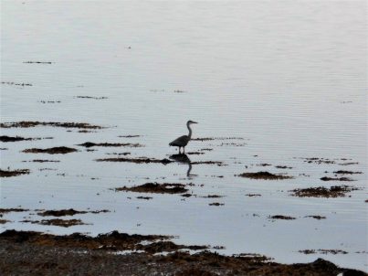
Most of the photos taken on my phone today are blurred. I was struggling to stand up in a 40-50mph gale, trying to keep my hood on as well as pointing the phone in the general direction of companions Sir Hugh and JD who couldn’t stand up either. After what I said in my last post about choosing the fine days to venture out, especially in the hills, today’s choice was obviously dubious in view of the forecast above. However unsteady my companions appear they have a resolution and resistance to be celebrated, we marched into the eye of the storm named Ali without a flicker of doubt.

Up and over the prominent steep Parlick along the ridge to the highest point of Fairsnape. So far so good, breezy but clear views. A newly flagged path soon disappears as we head into the peat bogs and evasive action is often taken to avoid the worst mires on the ridge. At the lowest point a vague path disappears down Fiendsdale towards Langden Castle, I think we’ll leave that adventure to another day. Our route westwards was again extravagantly flagged for some distance down the rake towards the bowl of Bleasdale. You could see the rain coming in on the storm and it hit us hard for the next hour, the wind was excessive straight at us and the rain in the air stinging on the face. Winter conditions within minutes and a good test for the waterproofs. It seemed a long way down. The usual erudite conversation from my companions was missing as we disappeared into our own worlds of survival. Salvation arrived in the valley as the worst of the rain passed, we could cope with the wind. We had more difficulty coping with some of the precarious stiles en route, Sir Hugh has two artificial knees and wasn’t happy with the contortions necessary to overcome them. Some situations when he was mid stride but hooked up to barbed wire became a mixture of uncontrollable laughter and panic as to his survival. We made it to Bleasdale church where a sheltered bench was gratefully used for sandwiches.

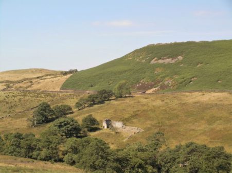
Vague paths across the bowl of Bleasdale led us to Blindhurst Farm through the usual stinking slurry and an outstanding farmhouse amongst the trash.

Despite our misguided attempts to reclimb Parlick we found some traversing sheep ‘tracks’ back to the car. The wind increased in intensity for our finale just to prove a point.

Not unsurprisingly we were the only car parked up.

Remind me next time to forge ahead and take some pictures from the front!

A day not to be missed.

*****

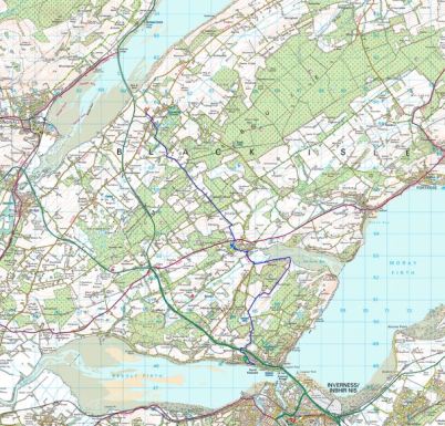
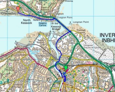
The map below is doubly important today, not only to show you the reader our whereabouts but also to give Sir Hugh an idea of where he had been.

MY DAILY WALK, [well almost daily].

The weather has not been good since my return from France, I feel Autumn is upon us.

It’s noticeable how often I comment on the state of the weather at the start of a post. Is that a British trait, am I obsessed with the climate or does it just reflect the close connection of conditions with my pastimes?  I remember when I was younger and outdoor time at a weekend was precious we would sally forth on walks or climbs whatever the weather. That would result in a fair share of days with no views and a good soaking on the hill or gripping climbs on cold slippery wet rock. Many of those occasions are vivid in my memory, proof of the importance to me of outdoor adventures and the companionships they bring. Character building was a phrase used. Now I take more heed of the forecast and try to choose the better days for my enjoyment or more likely head abroad to avoid the worst of our winter weather.

I’ve rambled off the subject.  I intend, now I’m free of the PMR stiffness, to  do a regular local walk most days to build up my fitness once again. How often have I said that? I have a 4mile circuit on my doorstep that suffices. Not only does one get some healthy exercise but also some physic benefits thrown in.  There are countless literary quotations extolling the virtues of walking, one of the simplest  –  “I have two doctors: my left leg and my right leg.”  G M Trevelyan.

I complain a lot, and will continue to do so, about the housing developments in Longridge destroying the character of the town but I’m still able to do this walk from my house into the country. Why drive anywhere in mixed weather when a walk can be accomplished from home.   A stroll down the road takes me past the cricket ground where today there was a match which I can stand and watch for a few overs. There’s something special about village cricket which makes it almost hypnotic to engage in, I think it is something to do with the enthusiasm of the players and the gentle clapping of the handful of spectators. Long may it be so. The lane I usually take up onto the fell gives a lovely view back across Chipping Vale to the Bowland Hills. The view is different with the seasons but gives a sense of space and nature within half a mile of leaving home. Today this was heightened by a pair of Buzzards wheeling and mewing above me. Time just goes by whilst you stand and watch. A glance over the reservoir at any other bird life – usually ducks and grebe. And a glance into Craig Y Longridge to see if anyone I know is climbing, not today with the damp conditions. My return down the town’s main street is more mundane but gives the opportunity for social engagement and grocery shopping.

A perfect little circuit, I’m off to do it again today when things will be different.

*****


A LITTLE MORE OF THE LOT.

It’s the end of August, and I’m back in the Lot Valley, France, for a couple of weeks as is usual.

The house of my friends is as welcoming as ever and the weather is perfect. The problem is I can’t get out of bed in the morning. My stiffness in shoulders and hips has intensified and nobody sees me until lunchtime when I’m the head chef. After that I’m semi OK and can walk up the easy Combe de Filhol behind the house. To my amazement on an oak tree I spot a luxuriant fungus. Orange and yellow bracts sprout from the tree, I’ve no idea what it is, but I suspect it is edible and return to cut off a few slices.

A quick search suggests, no proves, it is  ‘chicken in the woods’  – a delicacy in some regions. Without further to do I fry a piece up and season up with salt and pepper. It tastes good but more like a lemon flavoured mushroom than chicken. I start with a small piece, some people are allergic to them, but the next day fry up more pieces for friends who realise I’m not dead.

Nothing to do with the fungus, but I slowly become worse with the stiffness and pain, almost certainly PMR [look it up], and have to resort to the steroids prescribed to me. I take two after breakfast and two the same evening and miraculously the next morning I’m virtually back to normal. Life has returned; I’m able to do some gardening, swim and go on my usual walks around the area. I enjoy a lovely walk along the ridge to the communication tower and back along the vineyards. Buzzards flying above and butterflies fluttering alongside, blues and clouded yellows. From the ridge I have great views of Puy L’Eveque above the River Lot and am impressed by the size of the church above the town, arrowed below. I don’t think I’ve ever visited it,

So a couple of days later we make a pilgrimage to investigate. What a find!  The church of Saint Sauveur began in the 13th century and is in an elevated position with views over the valley. It is of course built from limestone giving it a clean bright appearance. There is an elegant arched entrance porch soaring up to the bell tower. Elaborate stone carvings are found above the door. The interior is generally plain with high vaulted Gothic arches, but there are fine stained-glass windows. Coming back outside we can see where the building was extended in the  C19th. High on the North East wall is a strange observation tower. Surrounding the church are masses of burial vaults.

Apart from that it is mainly eating and drinking at the numerous local hostelries. In particular Le Pigeonnier alongside the River Lot gives a fine view of Puy L’Eveque’s medieval houses rising from the valley. In contrast, Le Cote Lot restaurant in the Bellevue Hotel has a fine terrace room looking down onto the Lot below. Le Caillau courtyard restaurant close to the house has a romantic atmosphere with fine food but due to its popularity we found the service has deteriorated. More fine evening dining was experienced at La Venus Restaurant in nearby Prayssac and of course we made our usual pilgrimage to the Brit Hotel in Fumel for their fabulous lunchtime buffet.

Looking up at Puy L’Eveque from Le Pigeonnier.

Looking down from Cote Lot to the river.

Le Caillau courtyard.

The Brit’s Buffet.

Back at the house mirabelles, quince, plums and figs all collected locally gave a healthier balance to our diet.

It will be a wrench returning to the UK as Autumn starts.

DEEPER INTO CHIPPING VALE.

The Lazy Loud River.

There was a beautiful sunrise today which heralded good weather to come.

I’d arranged with JD to continue our intimate exploration of Chipping Vale by following as close as possible the little River Loud on its way to join the Hodder. My route was ambitious as from previous experience I know some of these paths are rarely walked. I was hoping for an easy day because of my recent stiffness and should have been concerned with the first stile we encountered off the road, awkward and overgrown.

Dr. Livingstone I presume.

To be honest we never really found a convincing path through the fields to the limestone Knainsley Quarry and once we were in its extensive area compass work was needed to get out. We emerged onto a lane bounded by expensive property conversions, lots of Range Rovers – that sort of place.

The next stile was impossible to negotiate, guarded by brambles and sloes, [reported to the authorities] but fortunately a gate took us into the same field to link up with a path that kept coming to more awkward overgrown stiles, but we slowly made progress to emerge probably on the wrong drive way at Loud Carr Side. All along this stretch we had wonderful views of the Bowland Fells to the north. Their road led us to Gibbon Bridge over the Loud. A substantial stile gave access to the river bank  here populated with Himalayan Balsam and more worryingly Japanese Knotweed, The river is small and flows along at a snail’s pace. Pushing on through the vegetation we made progress down stream, despite acrobatic stiles, to the stepping-stones  across the river. A few days ago there would have been little water here after the drought but we have had a lot of rain since and our crossing was a little tricky as some of the stones were submerged. A gentler stretch through fields and we emerged at Loud Mythom Bridge. What are these  iridescent beetles ‘feeding’ on dock leaves?  We walked on to Doeford Bridge where the Loud joins the much wider Hodder. A fisherman was casting in the Hodder below, a popular fishing river. We ate lunch at the bridge and watched many cyclists coming through from  the Trough of Bowland, and also speeding motorists having close shaves on the bends.

The Loud joining the Hodder just above Doeford Bridge.

We had considered continuing across the stepping-stones at  Stakes Farm but walkers coming in the opposite direction confirmed that they were impossible with missing stones and high water which is a regular problem. So we backtracked up the lane and onto a track heading for Greenlands, as we walked through the farmyard a, fortunately chained, dog leapt out of its kennel narrowly missing JD. That raised our heart rates.  More poor tracks and awkward stiles eventually brought us back to Gibbon Bridge. Cars were arriving for a wedding reception at the hotel. We didn’t have the heart to find the footpath through their grounds and spent the next half-hour or so lost in the fields which host the annual Chipping Steam Fair every May. Today turned out to be the Chipping Show held in fields on the edge of the village and we could hear loudspeaker announcements in the distance. The day was perfect for the show. From this side of the Loud we now had uninterrupted views south to Longridge Fell. A complicated series of fields, all thankfully well signed, took us from Pale Farm to the road and back over the Loud Lower Bridge to our car. We had achieved our idea of following the Loud but had found the walking difficult, in my condition, with overgrown paths and broken or blocked stiles.

*****

DEEP IN CHIPPING VALE.

One of the tags for my blog is ‘Chipping Vale’  and its used quite frequently.   I’m often looking down into this valley as it lies between Longridge Fell and the Bowland Fells. I’m not sure whether this is an official designation or a figment of my imagination. There is no mention on the OS maps, basically I’m referring to the Loud River catchment area which arises in the hills near Beacon Fell and meanders under Chipping into the Hodder at Doeford Bridge. Well today we’ll explore into this valley.

Chipping Vale from Longridge Fell.

There are several  points of interest – historic houses, ancient bridleways and limestone quarries. I’ve a book about limestone kilns and quarries in the area which highlights Arbour Quarry at Thornley as a major commercial  site, so I was keen to revisit it.

Since my trip up the NE coast of Scotland I’ve hit a problem – I suddenly overnight painfully stiffened up in my shoulders and thighs. After some prognostication I presented myself to my GP – Polymyalgia Rheumatica [PMR] was his initial diagnosis,  but the blood tests were equivocal. Give it another week and nothing much has changed, painful stiffness and similar bloods. I’m limiting myself to gentle walks around the village later in the day when I’m less stiff.

To hell with it I’m going for a longer walk and phone JD for companion, he’s strong enough to carry me if things become difficult.

So our venture into Chipping Vale commences. Field tracks out of Longridge are taken past ponds, where my lads used to fish for tench, to Gill Bridge over the River Loud, more of a stream than a river, where they had tickled unsuccessfully for trout. Private roads through the Blackmoss Estate formerly Lord Derby’s domain took us past converted barns and gentrified houses as is the norm around here. Indistinct field paths which seemed little walked brought us into the farmyard of Hesketh End a grade one listed C17th house.  The sandstone house has lovely mullioned windows and is noted for Latin inscriptions on the exterior telling of historic incidents.

Hesketh End.

Chipping Vale with Longridge Fell in the background.

A nearby  property was ruinous 20 years ago and is now a substantial dwelling. We came out onto the road close to the recently closed Dog and Partridge, many pubs are capitulating in rural surroundings. From here we crossed the River Loud by a wooden footbridge. The banks of the river were heavily overgrown with Himalayan Balsam, its scent pervading the area. The low-lying meadows here are frequently flooded in the winter months when our track would be underwater. We were heading for the extensive Arbour quarry, a source of limestone into the early C 20th. Lime was important to the farmers for improving their land. All that remains now are grassed over ridges and ponds, the latter having a large duck population. Sitting on a limestone outcrop for lunch we were covered with little black flies which fortunately were of the non-biting variety. We couldn’t identify them but they were similar to ones I call Thunder Flies, it was certainly very humid today. There was wild mint growing  everywhere giving a strong aroma and attracting Painted Lady butterflies. I had vague memories of a large limekiln somewhere here but we couldn’t find it today in all the summer growth. There is a photo in my book of it operational.

Crossing to the other side of the valley we climbed a lane to reach farms strung along the hillside of Longridge Fell on roughly the 150 m contour. I’ve often speculated this may be the spring line. Paths and lanes connect these properties and is known to some locals as ‘The Posties Track’. Some houses are still honest working farms but more and more are renovated as desirable properties, I must admit they all have superb views over Chipping Vale towards the Bowland Fells. We re-entered Longridge on the old railway line that ran along to stone quarries. The gentle walking was no problem but my stiffness made getting over the numerous stiles comical.

*****

JOHN O’GROATS TRAIL. 7 Brora to Helmsdale.

On the beach.

The route description “Sections on railway embankment are stony and narrow, overgrown vegetation and long grass make the going difficult in places, Loth Burn requires wading (could be impassable in spate conditions) ”  was not encouraging and I thought I was in for a long day.

I enjoyed a sociable breakfast with my hosts and managed that lift up the road to where I’d left off yesterday which gave me a good start. The tide was out so I was able to walk on the beach which in most places was easier than the poor track. The first stretch of sand was a joy seemingly going on for ever. Fresh boot imprints in the sand suggested I was not alone today and sure enough I caught up with a couple walking to Helmsdale. They are on their last stretch of a LEJOG pilgrimage over several years using a campervan backup. This time they have walked from the Southern Uplands and actually married in Peebles en-route. We exchanged the usual pleasantries and kept overlapping all day. These were the only ‘serious walkers’ I’d met all week and yet within an hour a couple appeared coming the other way with heavy rucksacs. They had only just started on their end to end and were not complimentary about the JO’G Trail further north which they’d found virtually impassable.

Happy honeymooners.

A long way to go for some.

The beach varied from sandy to rocky and from time to time I had to scramble up into the dunes adjacent to the railway, on one of these occasions I disturbed a sizeable adder which slithered off into the grass.

Adder territory.

Intermittently along the coast were groups of common seals both in the water and out on rocks. They were ‘talking’ amongst themselves or was it to me? a haunting sound. There was also an abundance of bird life but without binoculars only the commoner species were recognised.

Halfway along there was a better track in the dunes which took me past some caravans on an informal site. Outside one of these was Julie who invited me for a morning coffee. We sat in her ‘garden’ as she told me about her life there overlooking the sea. Very self-sufficient she’d slowly added to her encampment with storage vans, sheds, chairs and tables, barbeques etc. As I left she was about to start cutting up her winter wood supply, I imagine winters here can be pretty bleak.

The crossing of the burns was no problem today with all the dry weather and being on the beach. One had to take the rough with smooth as some of the beaches became extremely rocky. This added interest in itself with the variety of rocks. Many were of a conglomerate granite, probably technically breccia, almost artificial in appearance.  There were also black rocks that looked suspiciously like coal – I found out later that there was a coal mine in the past at Brora.Many bays later the route used a level crossing to climb into the hamlet of Portgower. Some nice wee cottages ideal for a quiet life. This village was just off the A9 which was crossed and then little lanes climbed into the countryside to find a quiet way into Helmsdale which was seen below with its prominent harbour. On the way in was another of those clock tower war memorials. Theres not a lot to Helmsdale once you’ve walked round the harbour and up the main street.

Portgower.

My hotel was central and characterful. The dining room something from the 60’s but with some good food and the bar had a good selection of whiskeys!  Veteran motorcyclists [their bikes – not necessarily them]  were staying here on their North Coast 500 trip, a  scenic route around the north coast of Scotland, which seems to be achieving widespread popularity if not notoriety.

I have to return home for the weekend, so I will be at the station early for a long train journey. The station apparently was an important staging post for troops on the journey up to Thurso and naval bases in both world wars. There were no facilities on the crowded trains so the WVS had a tea stall at the station. Hopefully today’s journey will be more comfortable.

I’ll return to complete the sections up to John O’Groats in the autumn when the vegetation has died back.

*****

JOHN O’GROATS TRAIL. 6 Golspie to Brora.

A perfect walk.

Breakfast was shared with a man from France who was taking a dog and a cat over to Orkney – that is a long story. The day was perfect – fresh and clear. The trail went out of town past the houses of the former Sutherland estate with their Duke’s statue looking down on them. In the close up photo below the quarry used for stone for the base can be made out. Onto the dunes  and a path towards Dunrobin Castle the largest house in the Highlands and once owned by the notorious Duke Of Sutherland. I saw it from below and it did look impressive, I was too early for their falconry display. A bit further on and I diverted up to Dun Liath broch expecting I’d be the only one there but a mini bus pulled in and discharged a group of tourists who were mainly interested in taking selfies of themselves. After they departed I wandered round the 2000 year old ruins in peace. After regaining the shore I dropped onto the beach as the tide was out. There were some interesting rocks covered in seaweed, one reminding me of Dougal the dog from The Magic Roundabout. There were seals on the rocks and exposed sandbanks, their calls were hauntingly human. I arrived into Brora by the harbour area where a few fishing boats were preparing to go out to their lobster pots. Nearby was the old ice house used when the harbour was more prosperous. This coast was famous for its herrings which would have been smoked locally. Up the road was a clock war memorial of unusual design. I lunched in the delightful Linda’s Cafe and enquired about a taxi who could pick me up if I walked a few more miles up the coast, none was available but they suggested I would be able to catch a bus back. So off I went again over the golf course onto the perfect beach for two or three miles. A swim was needed halfway to cool me down. At the end of the golfcourse I clambered over the railway and landed on the A9 where I managed to flag down a bus back to Brora.

Notice Trail waymark.

Brora Golf Course.

Endless sands.

My airbnb was good with plenty of time for stimulating conversation with the hostesses and the Jack Russell. There was a private episode in my bedroom when becoming concerned I may have a tick attached to my derrière.  I attempted to locate it without the benefit of mirrors with no success until I came up with idea of a selfie from my phone. Eventually I focused in to the right area, a false alarm as it happens, but I hate to think what Google may have done with my images.  Now all I have to do is persuade someone to drive me back up the A9 in the morning which will make for an easier day’s walk to Helmsdale.

*****

JOHN O’GROATS TRAIL. 5 Embo to Golspie.

Around the Fleet.

Ex-Little Ferry on the Fleet.

Crossing the Fleet today on the bridge far left.

At one time there was presumably a ferry service at the Little Ferry marked on the map but now a detour is needed to get round the estuary using the A9’s bridge.   It was refreshingly cool when I left Embo across the dunes which are apparently threatened by another golf course development. People were out dog walking and it is interesting to see how many are English who have moved up to this part of our land for peace and quiet. Everyone I met had warnings about the local tick population. Before long I’d joined the track of an abandoned railway which gave easy walking. This became tarmacked with the ruined C14 Skelbo Castle visible ahead on an outcrop above the Fleet. It was along this stretch that I also became aware of the prominent monument on Ben Bhraggie which overlooks Golspie. This is the statue to The Duke Of Sutherland who became notorious for the clearances forcing the population to resettle in favour of sheep. Apparently it is 100ft high and was erected in 1837 after the Duke’s death. The monument was a constant landmark for the next couple of days.

Railway hut and distant monument.

Typical makeshift JO’G Trail stile.

Typical cattle.

Ben Bhraggie and Sutherland Monument.

The road now followed the coast and there were ample opportunities for seal spotting as they lay up on the exposed sanbanks. These are Common Seals and have a head and tail up posture on land. They have probably just finished rearing their pups. After that pleasant interlude the trail came up against the A9 and entered woodland above the rocky shore. As it is in the making the route was very overgrown and vegetated, I stopped briefly and realised the place was teeming with ticks. I moved on quickly but became paranoid about any slight itch on my exposed skin.

Typical tick terrain.

The busy A9 had to be joined to cross a bridge over the River Fleet and was rather dangerous with a narrow verge. Looking down I was thrilled to see salmon leaping from the water. Once over I was glad to escape into a lovely wooded area on a well-marked path which if I had followed all the way would have brought me to the foot of a rock climbing venue, bolted routes on conglomerate rock. Looking back whilst I ate lunch I could see climbers in action and I regretted not having visited. I was back beside the railway line which was followed through fields to a level crossing.

Crossing The Fleet.

Missed crag.

A long narrow road headed back to the coast and into a forest park where I followed a nature trail. Another golf links was crossed on the outskirts of Golspie and then a gentle stroll along the dunes into town.

Deep in trouble.

Golspie.

My homely b and b was on a quiet backstreet and on their recommendation I walked into town to the Fish and Chip restaurant. There were queues in the street for takeaways and the restaurant was full, apparently people come from miles around and I suppose there are a lot of holidaymakers about. Not wanting to wait for ages I visited the reliable Co-op shop for some sandwiches to be eaten on a bench overlooking the harbour.   Back at my room a couple of ticks were removed from my legs.

*****

JOHN O’GROATS TRAIL. 4 Tain to Embo.

A day of two halves.

Two halves scenically and weather wise. It drizzled in the morning but was hot and sunny for the afternoon.

Dornoch Firth.

Breakfast in The Royal was excellent and made entertaining by a group of plonkers on a nearby table. On some sort of group activity holiday the 30somethings were engrossed in laptops and tablets and ignoring the staff. Their ‘leader’ announced that they had to leave at 9am and went off to rouse a couple of late risers. After 8.30 they eventually switched off, almost, their electronic devices and put in complex orders for the cooked breakfast. Not surprisingly they started getting frustrated with the slightest of delays and complaints were put to the waitress who dealt with the little darlings with restrained Scottish aplomb and a wry smile.

After passing the Glenmorangie Distillery little estate lanes were used before dropping down to another brush with the A9 to get across the Dornoch Firth – 30 minutes of fumes and speeding cars. I was glad to clamber down a steep bank onto the shore. The track eventually swung away from the coast onto a road past farms. Bulls guarded the fields and there was some equine presence at some stables. It was along here it started drizzling, so off with my shirt and on with the waterproof. A little further the JO’G Trail was signed into Camore Woods, pine woods standing on a gravel ridge from the ice age. Within this area were several obvious mounds which are the remains of hut circles and chambered cairns 3000 yrs old. A standing stone was seen in a field on the right seemingly reflecting the steeple of Dornoch Cathedral. As an aside I noticed for the first time the sound of rain falling on different trees – almost silent on the pines but waterfall like on the larger deciduous  leaves.

Dornoch was busy with tourists, I visited the cathedral with its beautiful vaulted ceiling and then found a little cafe in the square behind for a light lunch. The rain had now stopped, the sun was out and fortified I walked down to Dornoch Royal golf course which has been used for the open in the past. The fairways were narrow between the sand dunes and the bunkers looked horrendous. The track on the edge of the course was directly above the sandy deserted beaches and I couldn’t resist a paddle which turned into a brief refreshing swim.

I was dry by the time I walked through a large camping/caravan park and into the little village of Embo. This was made up of streets of small houses presumably a fishing industry in the past. My B and B for the night was comfortable and peaceful.


*****

JOHN O’GROATS TRAIL. 3 Invergordon to Tain.

Quiet roads.

It was only in the morning as I left that I noticed all the wall murals in town depicting the history and culture of the area. There is also a distillery on the edge of town, a part of Whyte & Mackay producing grain spirit for the blending industry.

The B817 road along Nigg Bay was almost absent of cars and for some of the way I could use the beach. Oil rigs were prominent in the bay.The villages passed had no facilities so I pushed on and found even quieter lanes inland. The odd cyclist passed me with a cheery greeting [not all cyclists are odd!] A petrol station appeared and an ice cream was purchased.

The A9 was perishingly close but I was able to continue on an old road which was slowly being reclaimed by nature. At its end it was a short hop across the main road to reach the rather isolated Shandwick Arms where I rested over a Belhaven ale and sandwich. Despite being refreshed I soon ran into blocked ways and escaped to fields and barbed wire crossings. Then all was all plain sailing on little used lanes passing small crofts. I didn’t try to join up with the JO’G Trail in the forests which I had heard was difficult. So I was soon dropping into Tain a prosperous looking town just above the Dornoch Firth. It was only in the last few hundred yards that I touched the JO’G Trail. An uneventful day’s walk through very pleasant scenery.

On the outskirts of town today a Highland gathering and games were taking place. My hotel was central and the games continued into the night by the sound of it.


*****

JOHN O’GROATS TRAIL. 2 Culbokie to Invergordon.

Over and along the Cromarty Firth.

After a breakfast of fresh farm eggs I took the lane dropping down to the Cromarty. The causeway bridge carrying the A9 was plainly visible, it looked a long way across. The traffic was heavy and fast but there was an adequate footway on the verge for my 30 minute crossing. As well as the traffic hazards terns were dive bombing me at the far side. I couldn’t wait to leave the road on the other side and I probably took the wrong path which led me up to the railway but no further. I resorted to trespassing along the line, The Far North Line, for a distance until I reached the level crossing I should have been on.  These private level crossings were a frequent feature across the single line railway, there aren’t many trains per day.  My track went up to a house and then onto a quiet country lane high above the water so there were good views all morning. The only people using the lanes were cyclists, many on a LEJOG trip. Groups of them were using backup transport which meant they could travel light. The busy A9 was somewhere out of sight and sound.

I arrived in sleepy Evanton at coffee time and the Novar Arms duly obliged. The B817 road was a bit busier but immediately out of the village was a signed cycle path in the trees alongside the road so the continuation was quite pleasant. Interestingly most cyclists persisted on the fast road leaving me to enjoy their cycle route. This gave me time to take in the views and high above me on a hill was the Fyrish Monument. Built in 1782 for Sir Hector Munro lord of the area who had served in India. It represents the Gate of Negapatam, a port in Madras, which General Munro took for the British in 1781. At the time the local population was being cleared off the lands they had worked for centuries to make way for profitable forestry and sheep. Survival was a problem and it is said the folly was built to help keep the locals in labour. The view from up there must be good but no time today. Along the road were signs of the Novar Estate, Sir Hector’s home. now concentrating on tourism of the shooting and fishing variety, somewhere in there is the big house. Out of interest his two sons were both killed in India one by a tiger and the other by a shark!  His daughter married and the estate passed into new hands.

The cycle path ran out leaving a stretch on a boring footpath adjacent the busy but safe road into Alness. A thriving little high street on which I found the basic Cafe Picante for a cheese toastie. I got the impression that most of the staff were central European as well as many of the clients. Oh and why do all these villages have so many, mainly Turkish, barbers?

Wanting to lengthen the day I pushed on a further 3 miles or so to Invergordon. This meant leaving the route of JO’G Trail, not that there had been much evidence of signage throughout the day. Again I was lucky as there was a cycleway out of town parallel to the road. I dropped down past the renowned Dalmore Distillerry to the shores of the Cromarty which I followed pleasantly into town. Along here I passed a standing stone marked as a Symbol Stone on the map. This is the Bronze Age Thief’s Stone which has three C6th or C7th  Pictish symbols carved on it, I couldn’t make them out. Looking back up the Cromarty I’m fairly sure that is Ben Wyvis in the back ground.

The views down the water were dominated by oil rigs in for repair. They looked strange with their legs up in the air.

Invergordon was an unpretentious town with a wide high street. It was at one time an important naval base and there are masses of old fuel tanks still on the edge of the houses. Aluminium smelting works closed and the oil rig business was a saviour. As I found later when wandering down to the harbour Cruise ships now call here because of its deep waters. One was being piped out this evening on its way further north.

The Marine Hotel where I stayed benefits from the cruises by the bus drivers and guides staying here, It was basic but friendly.

What had appeared to be a day on lanes turned very pleasant and interesting.

*****

JOHN O’GROATS TRAIL. 1 North Kessock to Culbokie.

The Black Isle lanes.

A delightful day’s rural walking.

Munlochy Bay.

The day started dull and moist but before long brightened up with ever increasing temperatures. From the tranquility of the waterside I ducked under the A9 and followed lanes up onto the Black Isle. It’s not an isle at all, just a peninsula and there doesn’t seem to be an adequate explanation of the ‘black’ bit either. Walking along I had time to award a top 5 of discarded cans in the ditches – Iron Brew, Dr. Pepper, Lucozade,  Red Bull and Tenants in that order. Wild flowers also drew my attention in a more positive way. There were wooden signposts which I wasn’t sure related to footpaths or roads. The road I was on soon became a dirt track anyway to isolated farms. At the first the farmer explained to me that the dominant crop on the Isle was potatoes, which weren’t doing well in the draught conditions, there was ample evidence where they went to.

Further on was a croft where the man expressed surprise at my presence, he proceeded to tell me how he existed in this remote place as buzzards wheeled overhead. His 4 wheel drive vehicle was backed up by several identical scrapped versions lying around – “for spares”. He proudly showed me the onward path down to the bay which he personally mows for his own route to the pub. It was therefore a pleasant stroll down to the water’s edge where I met up with the real JO’G Trail which had come through the forests. My hostess had warned me about ticks and in the high vegetation I was becoming paranoid about their presence.

Oyster catchers and Shelducks congregated on the bay. By the time I reached Munlochy village I was hot and sweaty and ready for a drink so the Allangrange Arms was irresistible. The locally brewed [Cromarty Brewery] Happy Chappy pale ale was perfect with a salmon bagel. In the village was an impressive church, unfortunately locked, with its presbytery alongside.

I followed a sign for forest footpaths, birch and pine, to the Clootie Well, a place of pilgrimage where a cloot or rag belonging to a sick person is hung in the hope of a cure. I wasn’t prepared for the vast amounts of rags deposited within a 50 yard radius of the well itself, every tree was festooned.

I used small lanes passing crofts and cattle but no traffic to take me over the hill to Culbokie, a small hamlet with a shop and a part time pub. I stocked up with salad items before going down to my evening’s B and B. This proved to be a characterful lodging with sociable hosts and dogs, lovely rooms and a view over the Cromarty Firth and distant Ben Wyvis. Whilst watching the sunset I got to sample Steve’s home brewed beers which were every bit as good as many a micro brewery.

*****


JOHN O’GROATS TRAIL. [Episode1] Inverness to Helmsdale a start.

There’s a new trail being developed up the coast north of Inverness, partly to keep ‘end to enders’ off the maniacal A9. This venture also hopes to highlight the magnifcent scenery in NE Scotland.

In some ways the route consists of two halves. The southern week’s walking is mainly flattish along the shoreline whereas the second  half north of Helmsdale is rugged walking over high cliffs.

The next few posts are of the first half from Inverness.

*****

The beginning of how to avoid the A9.  Inverness to North Kessock.

As part of my ongoing Lands End to John O’Groats exploits another week was looming. We are having such hot weather down here i thought Scotland could give some relief. A few weeks ago JD and I filled the gap in the Scottish Lowlands leaving me only a section north from Inverness. I had heard horror stories of people walking on the A9 and was determined to avoid it if at all possible. A little eleventh hour research came up with the John O’Groats Trail, a coastal route from Inverness.  Before I knew it, most of my trips are last-minute decisions, I was stepping off the train in Inverness. I was not impressed by the city – too many tourists, too many drunks and beggars, too many cheap high street shops. I was therefore glad I had booked a B and B across the river for the first night, this gave me an easy 4 miles evening walk to help me on the way and escape the city. I didn’t even stop for a coffee.

The official start of the trail is outside the castle where there is a fine statue of the Jacobite heroine Flora MacDonald, the one of Bonnie Prince Charlie fame. I did find a waymark for the JO’G Trail. Pleasant walking initially alongside the River Ness led into industrial estates where the only building of interest was Cromwell’s Tower – this is all that remains of a great fort here completed in 1682, It seemed incongruous in the industrial setting.

Once alongside the Beauly Firth the massive Kessock Bridge carrying the A9 made itself present. A scramble up the banking onto the pathway felt illegal. The way across was scary up close to thundering traffic which seemed to be ignoring the 50mph limit. It was a long way down to the water and my search for dolphins was futile.

Thankfully off onto quieter lanes at the far side life became tranquil once more. My B and B on this north side was a haven of peace overlooking the Beauly Firth. I slept well anticipating some interesting explorative walking.

*****

BIVI ON LONGRIDGE FELL.

A unique experience.

I’ve been meaning to sleep up on Longridge Fell during this good weather but other things keep getting in the way. Made an effort last night before I disappear off to Scotland and arranging a late evening lift up the road was a great help. So at about 8.45pm I set off on the familiar track to the trig point. A few stragglers were wandering back down to the carpark and they wished me well. A few sheep looked at me strangely. The sun was already low and would go behind the Bowland Fells soon. I wasn’t going to see the sun setting over the sea at this time of year from up here, may have to have a night up on Fairsnape soon for that which would complete my trio of local fell bivis – including Beacon Fell.  [Memo to myself – better sleeping bag, camera as opposed to phone and a tripod.]  By the time I reached the top the sky was changing and the sun disappearing, I sat and watched with the three peaks clear to the east. A kestrel hovered right above me but soon flew off into the gloom leaving nothing but silence.

There was a cool breeze blowing from the north so I decided to go over the wall for a sheltered bivi spot and luckily found an almost level site yards from the trig point. I heard deer barking but none appeared. I was probably asleep by 10 but woke about one feeling decidedly chilly. I had my lightest sleeping bag and no spare clothes so couldn’t do much about it. There is little light pollution up here, a few lights down in Chipping, so the stars were clear, the moon was almost full. The next time I woke, about 4.45am, the sky was colouring over Yorkshire so I sat up and watched the changing display until the sun was fully up, 5.30am.  A lot of misty patches hung in the fields below and there was heavy condensation on my bivy bag suggesting the temperature had dropped considerably in the night. I managed an hour or so fitful sleep before packing up and walking home to the village just as it was coming to life. Another fine summer’s day in prospect highlighted by my night on the fell.

*****

THAT SHORT WALK OUT OF LONGRIDGE – UPDATE.

I was thwarted a few weeks ago on one of my regular local walks by a completely obstructed path.

Well today I followed the same route to see if anything had improved.

I’m not sure if the local authority or the farmer have got round to doing anything but I’m pleased to find the way open. I suspect some local walker/activist, I know a few, has cleared the way – well done. I think that in future with financial constraints placed on local authorities and the ever increasing pressure put on rural societies that we will all have to take things into our own hands to preserve the footpath network.


I continued on my way back to Longridge on unobstructed and for the most part signed rights of way.

*****

THE HEAT GOES ON.

Beacon Hill, Grindleton Fell.

I’ve just eaten a punnet of cherries with a beer whilst watching Belgium beat Brazil in a World Cup  game . The lazy days of this summer are passing by and now we have Wimbledon and The Tour de France to distract us.

 The pieman and I met up at Chatburn earlier today. I was glad we made the effort. At one point when we were aimlessly wandering around in a field in the midday sun I questioned our sanity. We had descended from up high on Grindleton Fell and were aiming for the River Ribble but fences and obstructions were in our way giving rise to some scribbles on my route map below.

We had started off on an old lane out of Chatburn which when face to face with a massive limestone quarry took us down to the Ribble and along a concessionary path to the bridge. On the outskirts of Grindelton, a village worth exploring , we picked up a rising bridleway which passed by some interesting houses – Victorian Green Banks, Georgian White Hall and spacious and pretentious Cob House. The old Yorkshire expression ‘where there’s muck there’s brass’ came to mind as we speculated on who lived in these expensive properties. Then we were in the rough country above an old abandoned yet evocative farm.

We skirted the forest and ended up on the rarely visited Beacon Hill with a trig point at 305m, high enough for me today. We took the opportunity to relax, eat lunch and look at the views over the wooded Ribble Valley to Pendle and northwards towards the ‘Three Peaks’. A group of teenagers were struggling up the hill towards us, all heavily laden and no doubt on a DofE course. The ones at the front were chatty but the tailenders obviously had no desire to be where they were.

Hazy Pendle.

We passed through more desirable properties, thankfully guarded by docile dogs, before our episode of being lost, hot and bothered. Soon we were on The Ribble Way which in these parts upstream has been cruelly diverted away from the river by landowners with angling interests. We enjoyed our stretch of the river however as we headed back to Grindleton bridge and as the river was so low we contemplated a shortcut wading across. Oyster catchers and ducks lazed about on the rocks in the heat of the sun.

We cooled down with an ice cream from the famous Hudson’s shop in Chatburn, it was good to catch up with the pieman and we made plans for future forays.

*****

LOWS AND HIGHS IN THE LOT.


Attention, chiens méchants.

As we pulled into the house after our flight  a nightingale was singing in the maple tree, the one in front of the house with the misletoe. A great welcome. It continued its sweet song for the rest of the holiday but despite scanning the trees with binoculars I never convincingly saw that small brown songster. The Magnolia grandiflora was producing ‘grandiflora’ – all was lovely.

https://www.british-birdsongs.uk/common-nightingale/


Next door neighbours have changed and there were a couple of yappy dogs guarding their ‘secure’ enclosure. The next day mine hostess was walking up the road when the two dogs came out onto the highway and bit her severely on the leg. Fortunately she escaped relatively lightly with nasty bites and bruising. Apparently they have bitten before and have been seen chasing cyclists. The next few days were spent between doctor, mayor and the police. The neighbours were most unhelpful and denied any guilt, the worrying point is they have a two-year old child sharing the space with the dogs which turn out to be miniature Dobermanns! We will leave it with the local police to sort out but I’ve grave doubts about the outcome, surely enough is enough.

Not as pleasant as they appear above painful bites followed —


So what else? I decided to call it ‘save a tree week‘. Well not just one but several conifers which have been neglected and have other species growing up  within them destroying their lower branches which will not regrow. The species in question include oaks, cherries. maples. clematis, ivy and numerous unidentified sticky plants. This meant full on plant warfare. Clearing the worst before going in with the strimmer and mower, they should be OK now for a further five years.

As well as my gardening endeavours the fields of rape seed surrounding the house were harvested by massive machinery, this attracted the local buzzards looking for small prey.

All was not stress and work. The weather superb with the pool refreshing in the hot temperatures. We enjoyed some excellent French meals at various restaurants in the area.

Each day I walked/ran up the hill behind the house and then down the Combe De Filhol before breakfast. Not a major trip but one getting me back into fitness for the mountains this summer. I managed to wear out my trainers.

An eventful trip to The Lot which could have been so much better.


BOWLAND AT ITS BEST.

Looking up past Dunsop Bridge into the heart of Bowland.

14th June 2018. UK weather: Storm Hector batters Britain with winds of up to 100mph.

The above headlines in today’s papers were not encouraging but delving a little deeper and being three brave fellows we arranged a walk. We being ‘the rock man’, JD and myself. The idea was to stay low and leave late morning to avoid the worst of the storm. Leaving late was easily accomplished as the rock man was late anyhow. We parked up near Leagram Estate above Chipping avoiding any overhanging suspect trees. There was no sign of the wind abating.

Entering a windy Leagram Park.

Country lanes were used to weave through the fields bordering the fells. More and more barns have been converted into desirable residences and expensive 4×4’s kept pushing us into the hedgerows. The public road to the remote Burnslack was reached and followed before cutting off on the rougher track across the base of the fells. This is open country and felt wild today with the wind. Lickhurst was the next farm complex with new developments. The tenant, who was one of the last remaining true farmers, apparently has recently died. I had a long conversation with him when I last passed when he was telling me of his plans for retirement, sad news.

Lickhurst Farm.

Moving on we crossed the footbridge and headed up onto limestone pastures. These looked very dry as we’ve had virtually no rain for six weeks. The track down to Dinkling Green was found. JD and I had recollections of vicious dogs chained up here which would suddenly jump out as you passed through the farmyard. None today as the farmsteads have been gentrified. A nice stretch alongside a brook and we arrived at Higher Fence Wood, the farm with all those wooden hen houses.The rooster cockerel was proudly parading in front of his hareem. Free range eggs were advertised for £1.50 a dozen but unfortunately the cupboard was bare.

We were now in limestone country and relying on the rockman’s expert knowledge. There were limestone outcrops and signs of quarrying everywhere. We lunched under a limestone rockface of a long abandoned quarry. There were signs of chalk on the rock from modern-day boulderers.

Our lunch spot.

By now the sun was getting a little stronger but the wind was still bitterly cold. Tracks took us to New Laund Farm above the Inn at Whitewell which can be reached across the Hodder on stepping stones. Today however we stayed high and went into secretive mode for a little trespassing into the woods to locate Fairy Holes Caves. Once found we explored using our phone torches which proved far better than the old flashlight. I saw crinoid fossils which I had missed on previous occasions. The location is recognised as a Bronze Age burial site, probably dating to around 1800 BC.

The Inn at Whitewell.

Forbidden land.


We scrambled out onto the public right of way to Fair Oak , this gives some of the best views down into the Hodder Valley in both directions as it crosses a small col. See title picture for view NE. and below for River Hodder and SE to Longridge Fell.

‘Scrambling out’

From here on we wandered past old farmsteads all in a state of modern repair, Delightful residences but all so remote from anywhere. The old bridleway down from Greystoneley was followed over the ford.

Towards the end of the walk I wanted to explore a footpath I’d never used and it turned out perfect. From an old limekiln and quarry we went cross-country, unfortunately missing a crucial footbridge, back into the Leagram Estate. Delightful walking under the Fairsnape Fells with views across to Longridge Fell. The wind was still blowing strong when we reached the car but had detracted little from a grand day out.

My ‘new path’

Fairsnape Fells.

Longridge Fell.

*****

THE BRONTE WAY five.

Bailiff Bridge to Oakwell Hall.

The final day of our walk on the Bronte Way. By more good luck than management there was a bus stop outside the hotel to take us back to Bailiff Bridge. After some steep uphill road and lane walking we were once more in amazing rural areas. We had joined The Kirklees Way and a Brighouse Boundary Walk. There were some vicious dogs penned up in some of the properties we passed some on a running chain which is quite scary as they charge at you. We postulated what could happen if the chain snapped!

Some time was passed in a large pristine golf course, there’s always one on any long distance walk. Fortunately no fairways had to be crossed on this one. After crossing a motorway, M62, little lanes led into Liversedge where first we came across a quaker grave yard. Way back a man, who was a Quaker, had been refused a burial at Hartshead church, so he bought a piece of land for burials of his family. This is still being used today and there are four 17th century graves. It was on Hartshead Common that Luddites congregated in early 19th century to march on Arkwright’s Mill at Rawfolds with disastrous results. Could something similar happen in the future as robots take over workers jobs?   We are also sharing The Luddite Trail now, oh and did I mention The Spen Valley Trail. there must be a lot of keen walkers hereabouts.

A little further was a plant hire depot with some interesting old tractors, two looked as though they had come straight off the American prairie. And another aggressive guard dog going nuts as we stopped to take pictures.

We were now in the Spen Valley area which was the backdrop to Charlotte’s novel Shirley enacted at the time of the Luddites. This novel sounds interesting and will get a copy for holiday reading. On our route was a farm cafe which turned out to be an excellent stop for coffee and toasted tea cakes. The waitress was interested in our route and was clearly enthusiastic about Oakwell Hall. On leaving the cafe we spotted the resident cat waiting patiently on the back step.

Up the road was an old house, Clough House, bearing a plaque to the Rev. Patrick Bronte who lived here before moving to Thornton.

Some rather messy navigating through lanes and parks, all very rural though, brought us into the honest looking Shirley Estate, Gomersal. We wandered into the local church bazar hoping to find an old copy of The Bronte Way guidebook. On mentioning we were on the Bronte Way we were escorted to the grave of Mary Taylor a lifelong friend of Charlotte. Mary apparently was a Women’s Rights advocate who incidentally led a women’s group to climb Mont Blanc in 1875.

Open fields should have led us down to an entrance to Orwell Hall but probably distracted by females we took the wrong field. All was not lost and I think we had a better way into the grounds of this beautiful and obviously popular property. Oakwell Hall may have been the inspiration for ‘Fieldhead’  in Charlotte’s novel Shirley. This is the last of our Bronte associations but I wonder how many we have missed. We came out on the way we should have gone in, a far inferior way. A bus stop was on the main road and eventually a bus full of friendly locals delivered us to the efficient Bradford Interchange.

The end to a really varied and interesting five days of walking.  Sir Hugh’s new knee just about stood up to the whole trial.  We’ve seen a lot and learnt a lot.

Sign in the cafe.

*****

THE BRONTE WAY four.

Denholme Gate to Bailiff Bridge.

The train got us to Halifax almost on time despite having to make toilet stops at various stations en route, the train toilet being nonfunctional. The toilet stop at Hebden Bridge was cut short when it was realised that the station toilet was also nonfunctional, all very strange and can’t all be Northern Rail’s fault. Of course our bus waited for us and we were soon walking from the moorland Denholme Gate. Enclosed rough fields with ancient wall stiles took us eastwards into what looked like an urban setting but the route cleverly kept us mostly on green ways. Paths wandered past houses and barking dogs. We were heading to Thornton the birthplace of the Bronte sisters. Little streams added interest and then the largest cemetery I’ve been in for years. A moorland ridge above was home to Sir Hugh’s first house, as there was no plaque to commemorate this event we didn’t divert. Then we were in the main street of Thornton full off characterful houses off the beaten track and not a Japanese tourist in sight. No 74, was heralded as the Bronte sisters’  birthplace, their father Patrick being curate at the Chapel. A cafe-cum-museum here gave us a rest, coffee and entertainment listening in to the local ladies’ Yorkshire conversation.

A deep valley had now to be crossed but to be honest we seemed to be cruising along despite the long grass in parts. There were distant, if hazy, views down into Bradford city centre. My memory is of fields and lanes going nowhere, stone walls, buttercups and dog walkers eager to converse. The hidden world of West Yorkshire.

Somewhere we joined The Calderdale Way in a wild valley and eventually emerged into the affluent Norwood Green. More of the same took us down to the suburbs at Bailff Bridge and thankfully a bus into Brighouse for a night on the tiles – well not really – an early supper in our hotel by the canal followed by an early night.

Check out Sir Hugh for another version of today’s walk.

*****