THE BRONTE WAY three.

Stanbury to Denholme Gate.

Once the car shuffles had been completed we set off to walk back up to the Pennine Way/Bronte Way. The PW continues up to the isolated Top Withins farmhouse, with its solitary tree visible from down here. There is no convincing evidence to support the claim that the farm was the ‘original’ Wuthering Heights, but if it is not, it is certainly the type of place that Emily Bronte had in mind when she wrote her famous novel. The picture below is from a previous visit. 
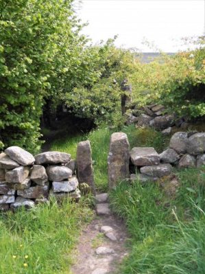
Our way today however branched off and headed into the valley of Staden Beck and down to Bronte Bridge, a stone clapper bridge across the beck. The water tumbles over a small series of rocks above and below the bridge. The area is somewhat optimistically known as Bronte Falls; it isn’t really a waterfall, but is a wonderfully picturesque spot and a popular area for picnics. The original stone bridge was swept away in a flash flood in 1989 and replaced the following year by the present bridge.

Signposts helped us onwards with addition of Japanese instructions reflecting their interest in the Bronte history. Signs kept coming thick and fast. 
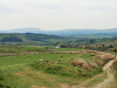
The track took us out of the valley and over Penistone Hill heavily quarried in the past. Now a country park there are confusing paths everywhere, popular with dog walkers who all seemed to have Cocker Spaniels. We arrived into Haworth by the atmospheric graveyard, the Brontes are not buried here but have a crypt in the adjoining church. Above was the Parsonage where the sisters lived, now a museum. Bronte associations were everywhere. Below in the main street tourists flocked into the gift shops and cafes.

The Bronte Parsonage.

Bronte School.

We of course were above such things, avoided hoards of Japanese and headed out on ancient tracks to Oxenholme. Here we found a bench for lunch which happened to overlook the Worth Valley railway line and in came a steam special hauled by a Standard Four locomotive, withdrawn for scrap from the Southern Railway in 1965 but subsequently restored.

Things went a little astray as we took to small lanes, too much time chatting and admiring both the scenery and the local properties. We found ourselves on a narrow lane a few hundred feet above where we should have been. I’d already remarked that we seemed to have missed most of Oxenholme, dammed right it was there below us. Fortunately a lovely path was found to reunite us with the correct way but we had enjoyed our diversion and had chance to meet one of the locals.

Charlotte, Emily or Anne?

No sooner were we back on track when we seemed to go wrong again on small streets in the village and ended up on the wrong side of Leeming Reservoir. No problem, just walk across the damn access road. The hot afternoon drifted on and once more we found ourselves on old flagged paths going where? A hill was climbed past old enclosures and water catchment culverts to arrive at a fine belvedere. An opportunity for a breather, a snack and drink and time to admire the view over fine countryside. From here a good lane just under Thornton Reservoir made for easy walking. A cyclist stopped to show us his electric assisted bike with a multitude of gears, impressive until I realised I couldn’t lift the beast. We emerged from Black Edge Lane into Denholme Gate where a parked car was waiting for us.

Onwards looked more urban, a bus passed signed for Halifax so we’ve come a long way into Yorkshire. The last two days may be better reached by train and utilising overnight accomodation.

*****


THE BRONTE WAY two.

Thursden valley to Stanbury.

We were back in the beautiful Thursden valley after a bit of car manoeuvering. The day didn’t get off to a good start on an overgrown path, which had been superseded we realised later,  involving some scrambling and barbed wire leading to torn shorts. Calm was restored on the open moor. A strange stone arch ‘The Doorway to Pendle’, the former New House farmhouse built in 1672 and occupied until the 1920s when the land was bought by Nelson Waterworks. It consists of a sandstone archway with a triangular head. An inscription relates to the Parker family in the 17th century. There must have been many similar isolated houses scattered on the moors.

A good track, popular with cyclists, was followed all along the northern flanks of Boulsworth Hill; an old way, flagged in parts, connecting scattered farmsteads. Lapwing, skylark and curlew country. At the far end the path is being ‘improved’ with alien chippings which at the present time are an eyesore. Escaping from this we found a delightful concessionary path sloping down the wooded hillside. Above were a series of boulders that looked climbable but I can find no reference to them, I’m kicking myself for not taking the short walk up to them. 

Eventually we crossed the stream that flows into Wycoller where begin a series of interesting and often photographed bridges. In historical order a ford, a clapper bridge, a supported clapper and a two arched packhorse bridge.

We rested and ate lunch in the shade of the ruins of Wycoller Hall, probably Ferndean Manor in Jane Eyre, In a previous visit, whilst walking the Pendle Way, I bivied in the massive fireplace without realising it was haunted.

A gentle stroll back out of Wycoller was made for chatting. A farmer out checking his sheep and lambs on his quad  bike bemoaned  that he would probably be dragged out by his wife this afternoon to a local event when he would rather be putting his feet up. We saw him later driving to Haworth. We walked below another group of rocks where Foster had done some daredevil leaping. Open moorland was once more gained and appeared to go on forever, Pendle Hill disappeared for the last time in the west. We congratulated ourselves for being here on a perfect summer’s day – it can be grim up north. Somewhere we crossed over from Lancashire into Yorkshire, God’s own country if you are so inclined.

After Watersheddles Reservoir the valley of the infant River Worth was entered, almost a lost valley despite its close proximity to the road. A rough track alongside the lively stream, gritstone boulders, rhododendrons and bird song, my first Cuckoo of the year, a lovely spot for a refreshment break. It turned out we needed it as the way on became more laborious climbing in and out of valleys towards Ponden Reservoir. Passing Ponden Hall [Thrushcross Grange in Emily’s Wuthering Heights] I recollected coming this way in 1968 on an early Pennine Way journey and I’m sure they served teas then. Not today! Lets not forget that The Pennine Way was the brainchild of Tom Stephenson, Wainwright’s guide, which we didn’t have at the time was a later publication. A few more switchbacks shared with the PW brought us to the end of quite a tough day in the heat. The car was parked down the little lane leading to Stanbury.


*****


THE BRONTE WAY one.

Gawthorpe Hall to Thursden.

Sir Hugh and I started at Gawthorpe Hall in Padiham. Many of the places we walk through have some connection to the Brontes or their novels. Gawthorpe Hall was the family home of the Shuttleworth family which Charlotte Bronte visited frequently as a friend of John Kay-Shuttleworth.

And a very stately hall it looked, but was closed today. We walk out of the grounds through a grove of chestnut trees. We were into farmland where we immediately got into the wrong field, no waymarks, and receive some advice from the farmer’s wife. Soon we drop down to a bridge over the River Calder where I’d been before on the Burnley Way. The river was a placid stream today but there was evidence of harsher days. Pleasant rural walking took us along and over a motorway and onto a canal. There was a large marina with people pottering about but little traffic on the water.

“That’s what a fish looks like”

We crept round Burnley and joined the River Brun into a park where we stopped for lunch. Despite us sitting on a park bench Sir Hugh felt obliged to demonstrate, not very convincingly, his new pocket folding chair. Lots of Asian families were walking past and in conversation we realised that Ramadan meant fasting from 4am till 9pm at this time of year, that can’t  be good for children.

Further along the river the local fire brigade were enjoying the weather on a splashing about exercise. Into fields and along a stream our instincts to follow the trodden path were ignored and we ended up lost near the ruined and abandoned Tudor Extwistle Hall [no connection to the Brontes]. Some time later after difficult barbed wire negotiations we were back on route near a small reservoir. Crossing a road we picked up a good lane to Swinden Reservoir where two farmers were trying to burn  accumulated years of rubbish.

We crossed a moor in lovely evening sunlight and dropped down through trees into the delightful Thursden Valley, the river was low due to lack of rain but still gave us a sparkling accompaniment to the road where a car was waiting.

A very pleasant introduction to The Bronte Way which probably doesn’t get a lot of traffic and has been poorly waymarked today.

*****

THE BRONTE WAY.


First of all I have to admit getting my Bronte’s mixed up.

They were a nineteenth-century literary family, born in the village of Thornton and later associated with the village of Haworth.  The sisters, Charlotte (1816–1855), Emily (1818–1848), and Anne (1820–1849), are well known as poets and novelists. Two other sisters died at a young age as did a brother Patric.

Like many contemporary female writers, they originally published their poems and novels under male pseudonyms: Currer, Ellis, and Acton Bell. Charlotte’s Jane Eyre was the first to know success, while Emily’s Wuthering Heights, Anne’s The Tenant of Wildfell Hall  were later to be accepted as masterpieces of literature.

The three sisters and their brother, Branwell  were very close and during childhood developed their imaginations first through oral storytelling and play set in an intricate imaginary world and then through the writing of increasingly complex stories.

The deaths of first their mother and then of their two older sisters marked them profoundly and influenced their writing, as did the relative isolation in which they were raised.

The ‘Bronte Way’ is a 44mile cross-Pennine route linking various places associated with the lives and works of the Bronte sisters. Starting at Gawthorpe Hall, visited by Charlotte, it goes by the Thursden Valley to Wycoller Hall (Ferndean Manor in the novel Jane Eyre), Ponden Hall [Thrushcross Grange in Emily’s Wuthering Heights] the moors to Top Withins (Earnshaw House in Wuthering Heights), Haworth Parsonage, where the Brontes lived and now a Bronte Museum, the Brontes’ birthplace at Thornton, along the hills west of Bradford to the Spen Valley (Shirley country) before finishing at Oakwell Hall (Fieldhead in the Charlotte’s novel Shirley).

You will be familiar with Sir Hugh from my previous posts, I should really have a tag to my walking companions. Well he has recently had his second knee replaced or whatever. He managed to walk thousands of miles on his first knee replacement much to the credit, amazement and interest of his orthopedic surgeon. He is keen to field test the latest operation so we have arranged a few short days walking on The Bronte Way. He has connections to the Yorkshire end of the walk so was keen to explore the route.

Sir Hugh’s new ‘new knee’

Guide books of the way are out of print but the route is marked on the OS maps so we should be OK.

*****


ANOTHER SHORT WALK – LONGRIDGE FELL.

Looking to Bleasdale Fells.

The last time I came up here the ground was the boggiest that I could remember, tonight after what seems like weeks of good weather it was completely different. In fact it is as dry as I  can recall. The walk turned out to be short not like the last one because of an obstructed stile, but from too much summit chatting. The distant Bowland and Yorkshire views were a little hazy. There was very little bird life, a couple of skylarks and a cuckoo in the woods. The bracken was rapidly beginning to thrust up its green shoots. The heather has some way to go. Chipping Vale below looked very fertile with many fields being cut neatly for silage.

My first encounter was with a mountain biker at the summit cairn, conversation started politely but we soon moved on to many shared cycling experiences and adventures. He had a huge knowledge of past bikes but I trumped him with my previous ownership of a 1940’s Baines ‘Flying Gate’ cycle in my teens. An hour must have passed before he shot off down the track just as a local couple arrived at the trig puffing and panting. They are trying to improve on their time from the carpark as well as finding those little painted stones that are appearing everywhere. Talk now turned to the Bowland Fells and tracks so by the time I left there was no time really to complete my intended circuit. I just turned round and trotted back the way I’d come. Actually there was some degree of urgency introduced when I realised I’d left my wallet in full view on the passenger seat. The car and wallet were of course intact when I arrived back.

I should do this walk or its longer variant more often in the summer evenings and there’s no knowing whom I’ll meet and what information will be gleaned.

*****

A SHORT WALK OUT OF LONGRIDGE.

I set off in the cool of the morning to walk a circuit of fields and lanes which is on my list of regular local outings. I was looking forward to a 5 mile walk with an emphasis on photographing the current flora. A footpath sign points off the road down a green track which opens into fields. A plainly waymarked stile crosses into the next field and I happily wandered on to where it goes through a hedge by a pond. Today however I could go no further as a new fence topped with barbed wire blocked the way and it was insurmountable, even for me.  I checked either side to see if the stile had been moved but no there was no access on this Public Right of Way. I had no option but to turn around and head home in not the best of moods.How can a landowner just completely ignore a well used Public Right of Way? There should be much harsher penalties for this brazen obstruction. I will not let them get away with it.

Lancashire County Council have an excellent on-line reporting service for problems with Right of Ways, you identify the position in question on a map and click. You are then given chance to describe the problem and hey-presto it is reported with an identifying number. Of course that is only the start and one has to hope the council take the matter up with the landowners.

http://www.lancashire.gov.uk/roads-parking-and-travel/fault-reporting?coords=,&type=default

I wonder if the obstruction miraculously disappears in the next day or two?

*****

A WEE DONDER. 8 Glasgow to Milngavie.

Change of plan – Milngavie to Glasgow, the Kelvin Walkway.

I’m still not absolutely sure, and it was my idea I think, why we changed our direction for today. An early morning train was taken from the Exhibition Centre to Milngavie.It was years since I’d been here and I was surprised at the amount of signage for the obviously popular West Highland Way. Several groups of backpackers were setting off on that journey. There was no mention of The Kelvin Walkway and we realised the River Kelvin didn’t even come through here. We set off on paths marked on the map and our first sign after a while was for the Allander Way which we’d never heard of. Still it seemed to be going in the right direction so we moved on, we had a train to catch later in the day and didn’t want too many problems. The Allander was more of a drainage ditch than a river but gave easy walking through a dull landscape.

We began to notice on the river banks a large yellow flowered plant which turned out to be the American Yellow Skunk Plant. A garden escapee which apparently has an unpleasant odour as it matures.

The river was narrow and meandering, at one point a very substantial girder bridge had been installed by the Royal Engineers, it should last forever. That is more than can be said for ‘Stan’s seat’  We didn’t really notice where the Kelvin joined forces. Our next landmark was the Balmuildy Pipeline Bridge which deposited us on a rather busy road. The map showed nearby evidence of the Antonine Wall and Roman Forts but our brief diversion revealed nothing. The Antonine Wall was built in AD 142 between the Forth and Clyde. It didn’t last long and the Roman Legions retreated to Hadrian’s wall.  As it was built mainly of wood and turf there is not much apart from its course to see on the ground.

Some pleasant riverside walking followed until we were suddenly diverted away onto roads near Maryhill. Left high and dry we followed our noses once more across Dawsholm Park and luckily [skillfully] rejoined the river. Now in a gorge and a more urban setting there seemed to be a plethora of abandoned railway bridges and at some stage we must have gone under the Forth-Clyde canal aqueduct of 1790. I wish we’d known as steps take you up to see Maryhill locks.

Signs for Glasgow appeared although I suppose we were already in it. The grounds of the Botanical Gardens were on the opposite bank and next an old flint mill site was passed.  Kelvin Bridge was an impressive structure with some ‘homeless’ camping under its arches, not the best of campsites. Also beneath the bridge in the water a Heron was waiting patiently.

Kelvin park was next. The Highland Light Infantry memorial remembered those men who died in the Boer war. We looked into here yesterday evening when the place was packed with sunbathers – pale skin and ginger hair don’t make for tanning.  All around are university buildings, churches and museums suggesting that Glasgow is definitely worth an extended cultural visit.

After all that the Kelvin runs into the Clyde almost unnoticed.

We had time for a celebration meal and drink in the Counting House, an interesting old bank-house a Wetherspoons acquisition, near Queen Street. The Modern Art Museum nearby was disappointing. Then on the train home to Preston.

So we had accomplished our venture, the Lanarkshire Link,  to join up the Pennine Way with the West Highland Way. The journey was more interesting than I had envisaged, thankfully as JD had come along. It would be good to see in the future an official Tweed – Clyde linkup,  it is 70% viable now.

*****


A WEE DONDER. 7 Uddingston to Glasgow.

The Clyde enters the big city.

The trains were back to normal this morning and we had a quick journey back to Uddingston. We dropped down to the Clyde and crossed a pedestrian bridge but immediately we were taken away from the river on undulating paths and roads through what looked like old mining or industrial areas which are slowly being developed with housing estates. Not particularly attractive. We eventually rejoined the Clyde near an abandoned railway bridge just upstream from an attractive weir, I think we were in Carmyle.  Somewhere along here was the stork’s nest on a lamppost. One benefit of the urbanity was a nearby supermarket whose well known value cafe we visited for morning tea and snacks. 

We crossed another old railway bridge onto the north bank of the river where we remained all day. On this side we came across new signs which detailed the route in minutes. The M74 was ducked under and then there were surprising stretches of pleasant countryside as well as modern housing. Somewhere we passed near by Parkhead and Celtic Park the home of Celtic FC.

Along here we were brought into conversation with [accosted by]  a well known Glaswegian on a bike with his dog. Tales of the slums of Glasgow,  a Barras stallholder, working with the London privileged in the 60’s [he showed us the scar on his hand from a bite from Christine Keeler’s dog!!] some sort of ongoing protest about a drugs/jewellery raid on his house many years ago and his subsequent life as an artist. James Donnelly, all is documented on the internet. For a flavour watch …

Anyhow onwards around a towering wall hiding old water treatment works. The cycle way we were sharing became busier with families out cycling and we spent a lot of time dodging bikes. Now into the parkland of Glasgow Green which houses the Peoples Palace Winter Garden glasshouse and Templeton’ s Carpet Factory brick facade. Through the park, today busy with families, is an obelisk built to honour Horatio Nelson.

Bridges come thick and fast now as we approach the centre. across the way was once the infamous Gorbals tenements. The route stays alongside the Clyde all the way but mostly with a busy road adjacent so there are no riverside developments or cafes to enjoy. Having just returned from the Thames Path through London I feel Glasgow has missed a trick. We could have easily diverted into the busy centre of Glasgow and all its historic buildings. The river also seems to lack any boat traffic.

The most interesting section on the river is the Exhibition Area in the west. Lots of modern designs are highlighted in this area as well as restored dock side relics. There is the Finnieston Crane and on either side of the river Rotunda which once housed lifting equipment for the passenger tunnel, closed in 1980.  The old tower and pump-house has been converted into a distillery. On the far bank is the BBC Studios, a science museum and an old paddle steamer.

This all culminates at the Riverside Museum with its Tall Ship alongside.

It is here where the Clyde Walkway finishes and the River Kelvin enters the Clyde. Tomorrow we will follow that river to Milngavie to complete our week.

*****

We could have been singing this as we walked the last few days. All together now –

*****

A WEE DONDER. 6 Dalserf to Uddingston.

On and off the Clyde.

There were two obstacles today: the large towns of Motherwell and Hamilton straddling the Clyde and a complicated motorway system where I had read that it may be necessary to catch a bus around major roadworks. We found more problems in the streets of Blantyre.

From our morning bus we recrossed Garrion Bridge and sped up the hectic road to seek The Clyde Walkway going off down a lane. it wasn’t signed, waymarks and posts have a mysterious habit of disappearing from roads. The traffic noise faded and soon we were in beautiful woodland and showing our, or at least my, lack of knowledge at tree identification.

We continued to see a garlic-like plant we had noticed for the last few days growing prolifically in the shade alongside the river, it looked introduced and invasive. Research showed it to be the Few-flowered Garlic, Allium paradoxum, which we had never seen before and is obviously a nuisance. I have in my garden the bluebell like Three-cornered Garlic Allium triquetrum a similarly invasive species which although attractive I am constantly battling with.

Most of our walk along the Clyde here was on a flood plain with lots of evidence of previous high waters, there were in fact signed alternatives for when the river was high. On the hill above us were high rise flats in the vicinity of Motherwell, are these the ones you see driving north on the motorway? But generally the towns had little impact on the walk. All seemed rural and peaceful especially looking back to our old friend Tinto Hill.

Around us was the old Hamilton Estate but to be honest we didn’t see any of the remaining ruins. If we had had more time it would have been interesting to explore some of the obviously popular paths around Dalzell House in the estate. There was a nature reserve, Barons Haugh, with observation hides over the marshes but without binoculars all we could see were the flats.

The  railway Ross Viaduct was a landmark high above us.

Heading for Strathclyde Loch and Country Park. we could hear it before we saw it. One minute this…

…the next this.

The boom boom of loudspeakers was an intrusive element of the day and totally unnecessary in a ‘country park’ but it was good to see people out enjoying themselves. We followed the masses alongside the artificial loch which was centrepiece for the 2014 Commonwealth Games water sports venue.

At the North end of the loch the River Clyde had disappeared somewhere and we ended up on roads to a restaurant at the Innkeepers Lodge where we enjoyed a coffee in the sun and discussed our options for onward travel. The bus transfer was still advertised but the new pedestrian bridges and walkways through the motorway complexes had literally just been opened days before so we followed our noses on a carousel of paths. I’m not sure what we crossed over or where we ended up but the Bothwell Bridge over the Clyde appeared  and at its far side a way-post down to the river path. Unfortunately this didn’t last long and soon we were back up on the roadside following our instincts. This we did through a good part of Blantyre urban area. A cyclist approached us looking for a cycle shop to buy inner tubes, he’d had a lot of punctures. We couldn’t help which was a shame as he also was on a LEJG journey. We eventually realised we must have missed something so before entering a huge shopping complex decided to strike off down a side street and under the railway to luckily join up with Clyde Walkway on a newly surfaced path which had come from we know not where.

Soon we were at The David Livingstone Centre. This includes the listed building of his birth, surrounding parkland, and a 3,000 piece David Livingstone collection. We managed unintentionally to miss it all, I presume it may have been closed.

An elegant iron cantilevered suspension bridge, built in 1952 but rebuilt more recently in 2000,  took us onto the north bank of the Clyde for our final stretch. And what a delightful stretch. woodland, bluebells, sparkling river, dippers and a kingfisher. Suddenly ahead up in the tree covered banks was a red sandstone castle looking impregnable. Boswell castle was started in the 13th century and played a major roll in the Scottish Wars of Independence.

We diverted off the route into a place named Uddingston to find the station only to find no trains running but there was a replacement bus which eventually arrived and took us into Glasgow for our two nights of accommodation.

*****

A WEE DONDER. 3 Broughton to Carmichael Visitor Centre.

The bit in the middle.

Our plan was to link up the Tweed with Clyde. The old railway line is a public footpath from Broughton to Biggar and after that we thought minor roads would suffice. So it was back to Broughton on a number 91 bus. A signed track went past Broughton Brewery the first microbrewery in Scotland, 1979. Unfortunately or perhaps fortunately they hadn’t opened when we passed by.

The walking along the old railway line through a flat landscape was not inspiring so we were soon back in Biggar. Having said that we met more groups of walkers on this section than we had seen all week.

A light lunch was taken in one of the cafes on Biggar High Street. The place still has a market town feel to it with independent shops and fine buildings in the wide main street, ‘biggar’ than most.

Spurning the opportunity to visit the Gasworks Museum, a Victorian Puppet Show or the more interesting Albion Motors display we passed an unusual installation of a stainless steel snowplough.   Having given the world the likes of television, pneumatic tyres, golf, mackintosh raincoats, tarmac and the telephone, the Scots have a fair reputation as inventors and pioneers. James Archibald Cuthbertson was the inventor of the high lift snowplough, celebrated here, as well as rubber vehicle tracks and unusual wheels for Land Rovers and amphibious vehicles. His engineering firm continues production in Biggar.  We wandered out of town by an old mill and ford. A ScotWays [Scottish Rights of Way and Access society] sign gave us the chance to keep to paths and avoid roads for a good section to Thankerton. This was undulating sheep country interspersed with small farms and those typical compact Scottish cottages. The bridge at Thankerton was over the Clyde but we weren’t to see it again until later tomorrow. 

The weather was not great with a cold wind and moisture in the air. To put a few more easy miles into the day we pushed on via a small lane to Carmichael House Visitor Centre under a misty Tinto. From here we were able to get yet another 91 bus, from a different operator, back to Biggar.

Mission accomplished. No more ‘Biggar’ jokes please.

*****


A WEE DONDER* a walk from the Southern Upland to the West Highland Way.

Innerleithen to Milngavie.

I finished the Pennine Way at Kirk Yetholm 50 years ago and started the West Highland Way in Milngavie 15years later. So as part of my humble protracted Lands End – John o’Groats I could fill that gap.  I’ve done K.Yetholm to Melrose on St. Cuthbert’s Way, and Melrose to Innerleithen on Southern Upland Way so I’m left with Innerleithen to Milngavie. Out with the maps and I realise by a combination of old railways and riverside paths I could have an easy week’s  walking. I’ve called it the Lanarkshire Link.

That highlighted a problem as rights of way are not shown on the OS maps of Scotland. There is no definitive map of rights of way as there is in England and Wales and no single place on the web where you can find out about them. Paths are marked with black dotted lines but that is no indication of whether they are passable. Finding out about footpaths through Scotways [Scottish Rights Of Way & Access Society] is cumbersome for a non local so we will just have to see how things work out on the ground. Interestingly ‘rights of way’ in Scotland can be lost if there is no evidence of their use over 20 years which seems heavily biased towards the landlords.

I happened to mention my plans to JD, of Canary Island GR131 fame, who jumped at the chance of a bit of exercise and within hours he’d booked a train heading north. Cost less than £15 for Preston to Galashiels via Edinburgh.  Finding accommodation in the various villages en-route wasn’t too big a problem although that will be more expensive.

So we found ourselves on an afternoon bus from Galashiels asking for a ticket to  Innerleithen, which we couldn’t pronounce. Even in the Borders the Scottish accent is going to be a problem.


*
DonderTo walk in a slow and carefree manner, not really concerned with how long it takes to arrive at one’s destination. Scottish slang.

That is a good maxim to follow.


A WEE DONDER. 5 Lanark to Dalserf.

The Clyde Walkway through the ‘orchards of Scotland’

We were on a roll now as there was a waymarked trail, The Clyde Walkway, it was signed from Lanark’s centre. We even had a useful app for the phone giving directions and points of interest. For a change it was warm and sunny. After a brief section by the river out of Lanark we had to cross over and follow the road through Kirkfieldbank before a lane led to a barrage at Stonebyres power station and a decent riverside path. The fourth of the Clyde Falls was downstream but we didn’t have a good view because of the tree foliage which is in its full flush of green.

Gentle strolling through open countryside along the banks of the river felt right for the warmer weather we were enjoying.

Are we in the wrong field?

Approaching Crossford there was extensive housing development near old properties of the Carfin Estate, looked like it would be a gated estate. This estate in the 19th century was extensive with orchards and gardens. Their old Iron Bridge across the Clyde was closed for repairs. We came out at the elegant stone road bridge just as an MG sports car rally drove across. The pub was closed and asking a local about a cafe suggested there was one close-by but after walking half a mile back towards Lanark we gave up and sat on a park bench with a banana and water – far healthier.

Where’s the cafe?
Oh and have you seen any MG’s?

The fields onwards were famous at one time for orchards and on the opposite bank were several garden centres doing a roaring trade. If we had been more observant we might have spotted an occasional apple tree. To give variety we had some ups and downs through woods on the Milton Lockhart estate.

More people were met as we neared the road, families out enjoying the sunshine. Two backpackers stopped to chat, they were from Manchester and doing a Dover to Cape Wrath journey! They quickly disappeared into the distance.

Off to Cape Wrath.

I meant to say that the Clyde Walkway markers had taken on Brobdingnagian proportions [word of the day]

Ahead was Mauldslie Bridge which with it’s elaborate gatehouse used to form the entrance to one of Lanarkshire’s oldest hunting estates.

Again across the river was sighted Dalserf church with its unusual clock tower. A ferry once operated across the Clyde at Dalserf, although this has long since been superseded by the nearby Garrion bridge.

We meandered with the Clyde and suddenly popped out onto a very busy road. This is where we diverted for our bus stop, walking thankfully down a pavement as the traffic hurtled by. The complicated two bridge roundabout at Garrion was traffic hell.

Stood in no-mans land at a solitary bus stop is a sobering experience: is the bus running today? did I read the time table correctly? how do I get a taxi?

Anyhow we made it back to Lanark and a good Italian meal.

*****


A WEE DONDER. 4 Carmichael to Lanark.

The Carmichael Estate, The Falls of Clyde and New Lanark – interest throughout the day.

The number 91 bus dropped us back at the entrance to the Carmichael Estate, the ancestral home of Clan Carmichael for 800 years. Luckily there is a series of marked trails through the extensive grounds which are farmed for beef and venison.  Carmichael House was built in 1754 on the site of an earlier castle. In 1952 the roof was removed to avoid property taxes and death duties, a short sighted action, and it is now a substantial ruin surrounded by woodland. We found our way up to it – what a place it must have been in its heyday. We were surprised the public are allowed to wander in and out of the decaying buildings in these days of health and safety. Our path leading west traversed the once substantial gardens and even went through a pets’ graveyard.

Once out of the estate we made our own way on quiet country lanes passing yet another abandoned railway and over The River Douglas. The small town of Douglas was only 5 miles away, Clan Douglas has associations there and JD’s ancestors were hereabouts. Tinto that pointed hill still loomed over us to the south.

Bridge over the River Douglas.

We were making good progress towards the Clyde and only had to worry about a lane leading to a possible river crossing. Gates across the lane looked ominous but we squeezed by onto the banks of the Clyde and yes there was a way across the bridge at a water extraction barrage. Thankfully we didn’t have to risk the older crossing.

We were now on a waymarked trail visiting the Falls of Clyde. The Falls of Clyde is the collective name of four linn (waterfalls) on the River Clyde. This afternoon we would pass Bonnington Linn, Corra Linn and Dundaff Linn, Corra Linn is the highest, with a fall of 84 feet.  [The lower falls of Stonebyres Linn would be seen tomorrow] I had previously never heard of this area so was delighted when we entered a wild sandstone gorge with waterfalls round every corner. Despite the river level being low, blame that water extraction plant, this was spectacular. We passed a peregrine lookout but apparently they haven’t nested here for a few years which is a bit strange, is there persecution occurring in the area?

At a viewing point overlooking the falls there was a series of interpretation boards – the most interesting related to William Wallace. Thats what happens if you lead a rebellion against England, take note Nicola Sturgeon.

To complete a great day we entered New Lanark, founded in 1786 by David Dale who built the mills with Richard Arkwright to take advantage of the water power of the waterfalls on the River Clyde.  Dale built the cotton mills and housing for the mill workers. With his son-in-law, Robert Owen, a social reformer, New Lanark became a successful business and an early example of a planned village environment. The New Lanark mills operated until 1968. Thankfully most of the buildings have been restored and the village has become a major tourist attraction and a UNESCO World Heritage Site. You come round a corner and there in front of you is the mill complex which was far bigger [not another Biggar joke]  than I had imagined. Large water power powered mills with workers cottages perched above. I was impressed. We wandered around but didn’t pay to go into the various sites but we did visit the cafe in one of the old mills. As well as reaching the Clyde we were now on the Clyde Walkway which should take us into Glasgow.

Resisting the road up into Lanark we followed the river for another half mile through delightful woods before a steep ascent up into Castlebank Park and to our wee b and b.

Lanark was an odd place with an even odder road system which seemed designed to kill pedestrians. We were here for two nights and would be using buses to help with logistics – surely not another number 91.

St. Nicholas Parish Church Lanark.

*****

A WEE DONDER. 2 Peebles to Broughton.

The 39 Steps…

John Buchan, the author and diplomat, spent time in Broughton where his grandparents lived. He became famous for his thriller novel The 39 Steps published in 1915. There is a museum to him in Peebles. The John Buchan Way is a 14mile walking route devised to link Peebles with Broughton.  We decided to follow the first half of the route this morning. It was waymarked with a book motif out of the town up alleys and out into to the open heading for Cademuir Hill. This hill has Iron Age hillforts but disappointingly the route doesn’t visit them. Some of the higher hills in the distance, I think the Pentlands, still had patches of lying snow. Our route descended to a minor road where we were glad to put on waterproofs not just for the rain in the air but to shield us from the biting wind. This is sheep country ‘par excellence’, acres and acres of grassy hills with the newborn lambs released onto.

Hill Forts to the right.

Looking back to Peebles with the Hydro prominent.

A minor col was climbed giving great views of the open Southern Uplands country. We dropped down to meet up with the Tweed again at Stobo.

I had read about the unusual church here so we made a short detour to visit…

Stobo Kirk is an ancient church of the Church of Scotland dedicated to St Mungo. retaining much of the original 12th-century building, including windows, the nave and chancel, unlike many other Roman Catholic churches which were destroyed after the coming of the reformed religion.The porch was added in the late 15th–16th century and is notable for the grooves in the left-hand doorjamb, created by pupils sharpening their slate pencils before class or possibly by the sharpening of arrow heads prior to the weekly after-church archery practice which became compulsory after the disaster of the Battle of Flodden 1513. The 12th-century Norman entrance into the nave has a door made from a single board of cedar wood from the nearby Dawyck estate.On the outer entrance hangs the old Jougs [yokes] used to punish recalcitrant members of the parish until some time in the 18th century.

The church looked a bit of a curiosity to be honest but we had a good look around at the features and then found a seat for lunch in the sun which had fortunately appeared to warm us. Many of the headstones in the graveyard were adorned with scary skull and crossbones, a Memento Mori, a reminder of our own mortality, an aide-mémoire, should it be needed, that you too will die one day. Time to move on.

Evil looking Jougs.

Scraper marks.

We didn’t follow the longer and hillier John Buchan Way continuation. i optimistically thought that the dismantled railway alongside the Tweed would give us an easy walk into Broughton. This was the Symington, Biggar and Broughton Caledonian Railway branch to Peebles, closed in 1966. On OS maps of Scotland paths are shown as black dotted lines but there is no indication as to their privacy or right of way.  The dotted line was promising as we followed the obvious trackbed. Then there was a house and garden blocking our way, this was bypassed by a scramble up to the road. At the next obstacle we bravely walked past their kitchen window, I kept a discrete distance behind JD in case of dog problems. Safely through we enjoyed a long stretch of embankment walking, with the occasional entanglement in vegetation and boggy ground.

All the while the stately Tweed was by our side with views down the valley to the pointed local summit of Tinto, 707m. which was to feature for the next few days, Eventually we parted company with the Tweed and followed Biggar Water, more of a drainage ditch than a river, to Broughton where there was no accommodation but a bus, the ubiquitous 91, took us to Biggar. The curiously named  Elphinstone Hotel, an old coaching inn, was our welcoming stop over. There was apparently a Lord Elphinstone at some point in history. Just call it The Elph.  They looked after us well, the beds were ‘biggar’ than most and the breakfast ‘biggar’ than we could eat.

With a little effort a viable walking route could be established that would link the Tweed to the Clyde utilising the old railway.

*****

A WEE DONDER. 1 Innerleithen to Peebles.

An easy half day on the Tweed Valley Railway track.

The bus from Galashiels deposited us in Innerleithen, book shops, printing workshop and historic woollen mills. More importantly, the high street Whistle Stop Cafe, [appropriate name considering today’s walk] favoured by cyclists, gave us a lunchtime soup. We wandered off to find the old railway track which has been utilised as a walking and cycling route to Peebles alongside the River Tweed.

Innerleithen.

We didn’t have time to visit Trachair House out of sight on the other side of the river,  a hunting lodge owned by the kings of Scotland. It later became the home of the Earls of Traquair and is still lived in by their descendants. It is known as the oldest inhabited  house in Scotland.

The walking was straight forward on the surfaced track. Originally part of The Peebles Railway Company who extended their Edinburgh to Peebles line as a single track to Galashiels, [or Gala as everyone calls it apparently] it closed in 1962. As we walked there were many reminders of the railway in the form of fences, bridges cuttings etc and even a small station which has survived and now runs as a café, Nashy’s. A pleasant surprise which we took advantage of for a coffee out of the cold wind.

The station was in the village of Cardrona which seemed to be set out as a model village all well ordered and clean. We later found out it had been built in 1999 – 2002 by a local farmer speculator, Tom Renwick. Further on was a fine looking golf course.

Cardrona.

We continued alongside the River Tweed, a lone fisherman was casting in the water. All around were the rounded hills characteristic of the Southern  Uplands.  Fields that were a giant flood plain led into Peebles where Wetherspoon’s Cross Keys Inn was more than adequate for the night.Peebles was a buy spot with a typical Borders high street of solid buildings, Initially a market town, it played a role in the woollen industry during the 19th and early-20th centuries. In the 19th century health tourism flourished with hydropathy centres, Peebles Hydro Hotel survives but was out of our price range.

It’s good to be back in Scotland.

THE THAMES PATH – Day 20. To finish at the Barrier.

Rotherhithe to The Barrier,

Back at Rotherhithe I had time to look round St. Mary’s Church where Christopher Jones, the captain of The Mayflower, is buried. There is a commemorative statue to him. The Mayflower set sail from Rotherhithe on its voyage to America with the Pilgrim settlers in 1620 and returned the following year. The Mayflower Pub, one of the oldest on the Thames, is near the departure point. The day started off well alongside the river by converted warehouses and new builds, old wharves still existed and views across the river to Wapping and Limehouse highlighted more development some better than others.

There was a lot of weaving around new apartment blocks. In places marinas have been created in the old wharves. At one point I found myself walking through a riverside hotel.The tide was out with a lot of mud exposed, a display mentioned the 19th century children who would scour the river bed for anything salvageable for a few pence – ‘mudlarks’.

Canary Wharf on the north bank is a glistening financial area rising phoenix like from the wastelands.

The naughty bit –

I was being diverted more and more into the streets away from the river which was frustrating. I was thinking to myself it would have been easier to have hired one of those Boris Bikes but I didn’t have the app. Round the next corner was parked one of those bikes, I was looking at it out of interest and realised it hadn’t been locked, there was no one in sight [honest I double checked] it had been abandoned. So for the next couple of miles I rode the rather unwieldy beast through the streets of Deptford towards Greenwich. A curiosity along the way was a reference to Peter The Great of Russia who in January 1698 came to Deptford to study shipbuilding. A rather odd statue at Deptford Creek marks his visit as well as an old mulberry tree he may have planted. The latter is receiving some care and attention at the moment. 
I cycled on to Cutty Sark, the famous clipper, where I locked up the bike which will be located by satellite. Greenwich was a tourist trap and there was too much to visit on my short transit. I’ve marked it down for a future visit. A former royal palace Greenwich developed as a naval college and is notable for the Meridian 0° longitude.  It is here that the footway under the Thames resurfaces in a small dome – another place to explore.

There was a pleasant cafe in the Old Brewery where I relaxed before the final stage around Blackwall Point and the Millennium Dome [the O2 arena]An area of Georgian Streets was a pleasant interlude before some awful walking. The way forward was blocked by building sites and you end up walking down a busy road towards The Blackwall Tunnel. An effort to get the path back to the river is down a fenced in lane and even when reunited high wire fences separate you from endless development. All fairly depressing.

Blocked path.

Not the best walking.

Even worse.


One building site after another.

Fenced in.

The O2 arena is being swamped by high rise apartments each tempting you to riverside luxury living.The river itself is busy with high speed ‘taxis’ plying between various quays. The far bank is all high rise banks above dockside buildings, so this is where our money goes. Above us the Emirates Cable Cars go back and forth from here to the Royal Victoria Dock on the north side. In the water at this quay is a Gormley installation ‘Quantum Cloud’.  Meanwhile there are fairly regular planes taking off from London City Airport.

Cable Cars, Quantum Cloud and plane.


The barrier comes into view around the bend and a further dreary mile, including a gravel extraction plant full of noise and dust, is accomplished to be alongside it. The high tech Thames Barrier can protect London being flooded from high tides and storm surges from the North Sea. I am happy to finish The Thames Path here although I believe there is now an extension 10 miles downstream to  Crayford Ness but I’ve had enough industrial landscape for now. It is debatable where the Thames actually finishes before becoming part of the North Sea.  Where I am now seems a long long way from the Thames Source trickling out into a field in the Cotswolds.

*****

THE THAMES PATH – Day 19. The South Bank and much much more.

Wandsworth to Rotherhithe.

There is a long list of sights today as the Thames Path weaves in and out of central London so it could make for slow progress and a long post. Iconic bridges cross the Thames at frequent intervals and new developments are everywhere.

The tide was out as I left Wandsworth Bridge this morning, all seemed peaceful and the streets were virtually empty of joggers and cyclists.  The new apartment developments on Brixton Reach took some navigating, signage was out of date and the river could be accessed more than was first obvious. One hopes that eventually it will be complete and that the developers don’t create ‘private’ frontages. Have planning controls been put in place and is anybody watching? In the middle of all this I found a Georgian Church, St. Mary’s. Inside a small choir were practicing and along with the organ filled the church with uplifting music.

The graceful Battersea Bridge is on a sharp bend and has been the scene of many nautical collisions. After Albert Bridge… …Battersea Park was an oasis of green and joggers, cyclists and dogs reappeared from nowhere. Good to see all the children cycling in this large traffic free area. My pit stop was at Pier Point Cafe next to the cycle hire depot.

I thought things were going well when I could continue under the railway bridge into land of the old Battersea power station but I didn’t get far before diversions around it had me in a maze of new apartments and cranes. It was a mile or so before I saw the river again on the Tideway Walk, even this had diversions in place. This is BIG development and I spent a lot of time looking up. Across the river was the more stately Chelsea, I might have been better crossing over to the North bank for a change.

Elegant Chelsea.

Once past the new ‘unfinished’ American Embassy [eat your heart out Mr Trump] access is improved and after Vauxhall Bridge the Albert Embankment can be enjoyed with its Dolphin [actually sturgeons] lampposts.  You squeeze past the austere MI 6 building and then see the headquarters of the International Maritime Organisation which has the bow of a ship bursting out of its frontage – a dramatic piece of art. The big open-top bus stops at Lambeth Palace. Historic St. Thomas’s Hospital brings back many memories and now I’m at Westminster Bridge with the Abbey, Parliament and Big Ben [still under scaffolding] across the water.  I used to cycle over here every morning on my way to college. A lot of this walk is now becoming a trip down memory lane so please forgive any indulgence.

The London Eye looms ahead and distant views down river reveal the changing skyline of London. Tourists have replaced joggers, the pavement is packed and hardly a word of English is heard. I keep bumping into people fixated on their phones. The Eye is extremely popular this morning but what have they done to the adjacent County Hall?  MacDonald’s, Shrek, Horror Dungeon and other paltry amusements – commercialism gone mad since the GLC moved out. Surely some better use could have been found for this stately building.

County Hall in 2005.  Adrian Pingstone

The next bridge Hungerford leading to Charing Cross now  looks spectacular with adjacent cantilevered footbridges.

By Waterloo Bridge is the concrete jungle of Royal Festival Hall, the National Theatre and National Film Theatre.The latter was almost a daily pilgrimage for me to view the old and new classics of cinema. I wonder if they still show ‘allnighters’   Colourful skate boarding has taken over the under belly of the area. ITV’s London Television Centre was new to me and the nearby Art Deco OXO Tower seems to be more difficult to see amongst all the new development, in fact I can’t find my photo of it. The Millennium Footbridge brings hoard of tourists over from the city and St. Pauls and deposits them on the doorstep of Tate Modern. Do you remember shortly after the bridge opened Health and Safety had a fit with its swaying. Popping into the Tate I only had time for a brief look in the great Turbine Hall which was exhibition-less – where is Louise Bourgeois’ Giant Spider?

The out of place Globe Theatre was thronged with visitors. The underground world of streets, tunnels and warehouses near the original Clink are still atmospheric, try them at night. The Anchor [from Shakespeare’s time] was a favourite lunchtime drinking venue of ours but that was in the days when the dockers and market workers still visited it. We used to have a good knees up there in the evenings. Just doesn’t look the same today and I couldn’t even get in the crowded door.Looking up there is a new kid on the block – The Shard – a  95-storey skyscraper designed by the Italian architect Renzo Piano. 309.7 metres (1,016 ft) high, the Shard is at present the tallest in the country.

I’ve never been enthused by the replica – yes it is only a replica dear tourists – of The Golden Hind sat in an old dock on Bankside.  The original Golden Hind galleon was sailed by Sir Francis Drake, sponsored by Queen Elizabeth 1st, around the globe between 1577 and 1580. Actually to give it its due the replica has achieved a similar modern voyage. Passing past Southwark Cathedral and Market onto Borough High Street. forgive me for diverting up St. Thomas Street to look into Guy’s Medical School. What a disappointment, there was construction work in the courtyard, even the statue of the founder Sir Thomas Guy has been removed. I walked in here most mornings for 6 years, I suppose I didn’t tell them I was coming today.  Inside the colonnades a statue of John Keats has been installed and I was able to sit alongside him. The alcove he sits in was from the Old London Bridge demolished in 1831. Keats trained at Guy’s  in that early 19th century period. There is a blue plaque for him but I couldn’t find mine.

The whole of the hospital is now dominated by the Shard.

Escaping through London Bridge Station and Tooley Street I was back besides the Thames wharves and warehouses but they have all been gentrified, mostly successfully, into apartments and coffee shops.

In

Hay’s Wharf where the tea clippers docked.

In the Pool of London HMS Belfast has been a fixture since the 70’s. one of our Naval Cruisers serving from 1938. In the background is Tower Bridge, yet another iconic sight.

The new City Hall has taken over from County Hall as headquarters for GLA. Designed by Norman Foster, former mayor Ken Livingstone referred to it as a “glass testicle” – but he had a grudge to bear.What was Bermondsy, an area of east end dockers, is now mainly converted warehouse apartments – I wonder whether the legendary camaraderie still exists across the balconies. The local pubs will have disappeared and I didn’t see many corner shops, plenty of coffee shops though.  On the other side of the river were more wharves looking like they’ve also been apartmentalised.

Rotherhithe has kept a more local atmosphere within its housing community and the locals are very friendly.

There is a museum, housed in the pumping house, dedicated to  Brunel who helped to create the first tunnel under the Thames which today is still used by the rail network. Further exploration will have to wait until tomorrow.


*****


THE THAMES PATH – Day 18. The world and his dog.

Teddington to Wandsworth. 

As I looked out of my window I spotted a fox skulking through the hotel flower beds. The sun was already strong and it was going to be a beautiful day.

I gave the expensive breakfast a miss but strolled down through the hotel gardens to the river to watch the water gushing out of the weir. Apparently last week the water almost reached the dining room but today was a couple of feet lower.

Recrossing the bridge I became tangled up in the Park Run which used the towpath. This towpath is very muddy but is being upgraded, fortunately no work at the weekend, and further on has been resurfaced as a broad lane. Not particularly sympathetic to the surroundings but no doubt necessary due to the heavy use by foot and cycle. Even after the Park Runners had turned back there was a constant stream of walkers, joggers and cyclists – this was to continue for the rest of the day – we are definitely in London now.

The river curves round towards Richmond and The Star and Garter Home is prominent on the hill, once a luxurious hotel, latterly a care home but recently sold for apartment development.   The beautiful Palladian Marble Hill house was built for Henrietta Howard mistress of King George II when he was Prince of Wales, arcadian life for the royals in the 18th century.

Morning coffee was taken at The Tide Tables cafe under Richmond Bridge, just under £3 and only average but a pleasant place to sit under the plane trees next to the river. The cafe had a relaxed feel to it. Plane trees are common in London and I had already passed the tallest this morning.

Richmond Weir was constructed to form a barrage to keep the water high upriver, Sluice gates hang down from the footbridge to control the flow. There is an adjacent lock which is the last on the river which from now on is at the mercy of the tides.

I am now  beside Richmond Old Deer Park but don’t see much of it. More interesting is Syon House on the opposite bank the last ducal (Northumberland) residence in London.

Kew Gardens came alongside reminding me of regular visits when I was a student in London, must have been free entry or something.

The constant stream of humanity continued and by now the sunshine and warm weather was putting everyone in a good mood. Chiswick Bridge meant I was now following in reverse the loop of the 4mile and 374yd Boat Race course as far as Putney Bridge.  There did seem to be more rowing crews out on the water on this stretch.

At Mortlake the riverside pubs were packed so I ventured up a side street and found the ideal Orange Pekoe cafe for a salad lunch with a large pot of tea amongst friendly people.The impressive display of expensive cars passing by with unnecessary revving emphasises the apparent affluence of the area.

More leafy path and I was under the impressive metal Hammersmith Bridge and Putney Bridge was soon seen round the next curve. The bridges over the Thames become markers on the walk as you pass from one to the next, Each one unique and becoming more iconic as I continue, I could write a blog on the bridges alone.

Hammersmith Bridge.

Craven Cottage football ground on the far bank was hosting a derby match later in the day and nearby was Fulham Palace, home to the Bishops of London from the 11th century until 1973, where are they now?

Following the crowds I was soon in Putney popular with oarsmen, several college boathouses lining the road with lots of activity. Crews who had been training on the river were coming ashore. Some had taken an earlier exit.

The crowds increased and sound levels rocketed dramatically around the pubs. The heavy police presence informed me of the local derby match between Fulham and Brentford this evening. I didn’t linger. There was a small park and then a maze of modern apartments to Wandsworth. The nondescript bridge here was erected in 1940 and painted blue as camouflage against air raids, it still is. As I’d a hotel booked in Putney I caught the train back when things had quietened down.,

*****


THE THAMES PATH – Day 17. The Barge Walk and more.

Shepperton to Teddington.

Hampton Court Palace.

The Barge Walk is the towpath from Hampton Court Bridge to Kingston Bridge around the grounds of Hampton Court, It has been part of the estate for 500 years. Until the late 18th century the easiest way for royal parties to reach the Palace was by elegant state barges. When the palace was opened to the public Queen Victoria and guests arrived by boat. Into the 19th century and till this day this stretch of the Thames has been popular with boaters, walkers, cyclists and fishermen.

This morning I couldn’t resist retracing my footsteps to use the ferry across the Thames. You ring a bell and the boatman appears from the chandlers. Apparently children use it to get to a school on the Weybridge side, a school ferry rather than a bus.The water is still high but landing was no problem although last week the ferry was cancelled as the river was well above the landing stage.

I was pleased I’d come this way as it gave a pleasant walk by the river to Walton rather than road walking through Shepperton. Jays, Parakeets and Cormorants were a strange combination for the river bank, there were no boats on the water and I just realised that I haven’t seen a single fisherman, maybe out of season. I took the opportunity to get out of the cold with a coffee in The Anglers Inn on the old wharf at Walton.

A short distance further was Sunbury lock. A small boat coming upstream, despite the warnings of strong currents, moored up to access the lock. This gave me chance to chat to the two men sailing it as they tried to get the lock to open with no power. They had sailed from Essex into the Thames mouth and were heading for the Kennet and Avon to go to Bristol and hence to Wales, it sounded ambitious to me. Their boat looked very cosy for two, I wished them bon voyage.

A stroll past islands, interesting houses and lots of moored boats brought me into Hurst Park and suddenly hoards of people mainly with children and dogs, it is still school holidays here.

I was recommended several kiosks for lunch but wanted to be inside so I chose the ‘Thyme by the River Cafe’ upstairs in the Molesey rowing club. According to the walls this club has had several Olympic Gold Medal athletes in recent times. The cafe was full of noisy infants, even my waitress seemed stressed by them, so I ended up outside after all. Fortunately  they had a balcony with a view over the Thames. The excess of dogs here was preferable to the noise level inside.

The busy road at Hampton Court Bridge took me by surprise after all the rural walking. People were streaming into Hampton Court Palace but the historic Barge Walk was a pleasant peaceful stroll to Kingston Bridge. A couple of cyclists turned out to be French and were cycling to John o’Groats, they had just started in Brighton this day. They looked a little unprepared for what lay ahead.

A barge moored on the Barge Walk.

Chestnut trees lined the towpath to Kingston Bridge which was heaving with cars, bikes and people. London’s Red buses even made an appearance.

A trip into Waitrose for provisions proved a disaster, too much choice, too high prices and an abominable queue to pay and get out. Fortunately pleasant riverside parks led all the way  to Teddington Lock where pedestrian bridges crossed into the town itself. Teddington Lock is the lowest on the Thames so from now on the river is tidal.

My choice of hotel for the night turned out to be the four star Lensbury complex whose mission statement is “to grow a sustainable leisure and hospitality business, enriched by an exceptional customer service culture delivering Exceptional Experiences”  Feeling like a fish out of The Thames I booked in, explained I was walking The Thames Path only to be asked for my car registration number!

Home

*****

THE THAMES PATH – Day 16. Walking through history.


Old Windsor to Shepperton.

Runnymede – the meadow by the Thames where King John sealed the Magna Carta on the 15th June 1215, the birthplace of democracy?  Runnymede’s associations with democracy, limitation of power, equality and freedom under law attracts a lot of curious visitors aided by the recent 800years anniversary celebrations

Was it the dull weather that dulled my early morning navigation? I seemed to struggle to find the Thames out of  Old Windsor. Once on the muddy path I was soon in Runnymede. Strangely the car parks were empty with only the occasional dog walker for company. I was here last summer. visiting the Commonwealth Air Forces Memorial and indulging in the Sunday Buffet at the Runnymede Hotel.  So today I wanted to see some of the other memorials relating to Magna Carta and its 800th anniversary but unfortunately the fields were flooded making access impossible. They are water meadows after all.

The flood ringed Magna Carta Memorial.

I did get to see The Jurors an art installation by Hew Locke, 12 bronze chairs decorated with images reflecting struggles for freedom and equal rights throughout the world in the past and ongoing. There was much to experience in textures, images and history. I was alone in my exploration as cars sped by on the main road. For more detail look here . I’ve just realised I didn’t actually sit on any of the chairs, I think I was overawed by the whole experience.

Conversely I was soon walking through the nearby slightly incongruous ‘pleasure grounds’ – not much pleasure in today’s cold and damp conditions. However there was an interesting statue of a young looking, Queen with adjacent time lines through history since the Magna Carta 800 years ago.


I couldn’t resist a morning coffee in the Runnymede Hotel, £4.50 is the highest so far but it was worth it for the relaxing sofa and the chatty young staff. Everyone else was in business meetings.

The path ducks under the M25 and as always the underbelly of bridges is fascinating.

As I’ve said the Thames was high, with flood alerts, and I only just got through on the towpath in places. Many of the riverside houses are built or rebuilt raised up to try and alleviate the problems of the inevitable floods.

The next stretch past Staines was not particularly interesting, suburbia by the river. I think it was made worse by nothing moving on the river due to  the strong currents. However to make things more interesting there was a bronze statue by Diana Thomson – The Swanmaster, related to the crowns right of ownership of Mute Swans. And nearby The London Stone marking the once upstream limit of the cities authority on the Thames.

I must have speeded up without realising and was at Chertsey Bridge in fast time. I’d not stopped or eaten so was tempted into The Kingfisher by the bridge where I was able to relax and kill time over a beer and sandwich. A friendly couple talked of the river and showed me pictures of their raised  house on an island I will pass tomorrow.  They have sailed the Thames many times but seemed intrigued with the notion of walking it. Three blokes were walking the path in stages one day a week when the weather allows.

Chertsey Bridge.

A riverside meadow was overrun by dog lovers. There followed an area of houseboats some of them quite creative in design. The strange thing is you never see anybody on these ‘boats’ presumably the owners are working up in the city. Then I was at the ferry over to the far bank where the path continues alongside the river through to Walton.

But I’d booked a night in Shepperton, in retrospect perhaps unwisely, so had to follow the ‘inland’ alternative. The 400 year-old Anchor Inn next to the church in the old part of town turned out to be a good choice.   http://www.anchorhotel.co.uk/

*****