THE THAMES PATH – day 15. An afternoon stroll.

Windsor to Old Windsor.

I’m back in Windsor. The train from Waterloo took about an hour, that represents about 4 days walking back down the Thames Path!

For this late afternoon I’d planned a short walk to Old Windsor. A coffee from the Eliza Coffee Co at the station set me on my way at the cost of £2,50. I’m going to check out prices, high and low as I move into London.

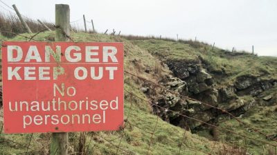
There seems to have been a lot of rain since I was last here. The river is running full and the path turned to mud again. The familiar, once a minute,  planes coming into land are still overhead somewhere in the mist.  On the map there seemed to be a good path all the way on the south bank through Home Park, how innocent I was – this is royal Windsor and security is discrete but high. As I found out us commoners must stick to the roads.

A lane leads past old water works into a small part of Home Park given to the people of Windsor by Queen  Victoria. There are views across the misty meadows to the Castle where preparations are being made for a Royal Wedding next month. In today’s paper it is announced that politicians won’t automatically be invited and money to charity rather than presents from well wishers. Harry and Meghan are trying to appear less ‘Royal ‘ but the cost is still over £30m and how those charities would love to get their hands on that. Windsor Castle – the largest and oldest occupied castle in Europe, protector of the Thames and Royal residence to this day. No wonder the tourists flock here but there were none in the mud with me today.

Victoria’s charity doesn’t go far as at the next bridge (Victoria) further access along this side of the river is blocked.

Victoria Bridge.

The forbidden path, notice the mistletoe in the trees.


Across the road bridge a muddy path follows the Thames for a short distance until forced onto a busy road through Datchet. At least I was making quicker progress than the rush hour traffic along side me. I wouldn’t want to travel that road every night. What a shame that the path through the Royal Castle gardens couldn’t have been used, memo to Harry and Meghan. Security would never allow it with republicans like me about.

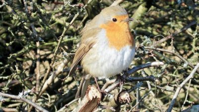
Of note since my last foray higher up the Thames is the absence of any Red Kites today and presumably from here on. Also in the intervening time more flowers are in bloom particularly Camellia and Magnolia in people’s gardens.

Another bridge (Albert- spot the theme) took me into Old Windsor and a perfect B and B which bizarrely was situated in the middle of a roundabout but turned out to be excellent, characterful old house in extensive gardens. The hosts being keen walkers helped.                    http://www.manorcottagewindsor.co.uk

Albert Bridge.

                                                                             *****


A SOUTHERN CIRCUIT ON LONGRIDGE FELL.


I’ve been up Longridge Fell three times this week, all from different directions. This lack of originality is partially based on my reluctance to drive far, partly on the weather [torrential rain on alternate days put boggy Fairsnape out of the question] and mainly on my slow re-acquaintance with hilly country. Anyhow it is a great little fell, the most southerly named fell in the UK with the easy to remember 350m height.

Today, Thursday 5th April, was fantastic, you couldn’t have wished for a better Spring like day. Blue skies, no wind and warmish sun [that’s that round yellow thing in the sky]. Of course the paths were still muddy and slippy but that’s par for the course at this time of year in Lancashire. A few groups were out on longer rambles and the dog strollers were making the best of the day.

I parked at Higher Hodder Bridge and  tackled the steep Birdy Brow road head on, One gains height quickly and just past Kemple End the forest track leaves the road zigzagging into the trees. I was already sweating as the morning warmed up. The forest track on a day like this reminded me of walking through Southern Spain on the GR 7 where there is much forest. I was going to say ‘wish I was there now’ but on a day like this you can’t  beat Lancashire. A hidden little path through the trees brings one out at a lovely open viewpoint with the Bowland Fells full on, the frosty Yorkshire peaks off to the East and Chipping Vale at your feet,

Higher on the fell I came across forest workers hand planting thousands of spruce saplings in rough ground that had been felled a couple of years ago. These are disease resistant ones and I will watch their growth over coming years.

Knowing that the track was blocked ahead with fallen trees I again took to smaller paths through the trees some of which are old Scots Pines, an enchanting place. I’ve been known to bivy in this secret place with the bonus of deer wandering past in the night. Further on is the ‘wall path’ leading towards the summit.  Years ago this path was hardly visible but has become more used and hence more boggy, most of the wall that ran alongside it has been now used as infill for the path.

Once out in the open the white trig point was clearly seen ahead with more stunning views of Chipping Vale and the Bowland Hills. If I had kept walking down the ridge I would have been home in an hour but I had a circuit to complete so headed south on forest roads, with Pendle Hill dominant ahead above the Ribble Valley, to come out at the road above Crowshaw Quarry where I had a bite to eat in the sunshine.

The bridle way down past Green Gore to Hurst Green is very familiar but I realised I nearly always walk it in the opposite direction. One of my favourite places is Dean Brook as it descends off the fell and through old mill placements at Hurst Green. The bridge there is a great launching pad for poo sticks.

I came out at the Almshouses which somehow were brought down from Kemple End. The Bayley Arms pub seems to be closed so I carried straight across on Smithy Lane through muddy fields and into the grounds of Stoneyhurst College.

I took the private road to Hodder Court where I picked up the popular footpath alongside the Hodder river. This is a roller coaster of a path in the trees above the river as I headed back to  Higher Hodder Bridge. A delight with the fast flowing Hodder below, emerging Wild Garlic under my feet and expectant bird song in the air.

That was 5 hours of my life well spent.

*****


What is happening up on Longridge Fell?

Another of my ‘whats happening?’ posts.

The day had not started well,  I’d set my alarm early, for me, so I’d get to my eagerly awaited dental appointment at 9am. I awoke feeling strange. Putting my hand out to the radio nothing happened. Pressing the light switch nothing happened. Checking my mobile twice or even thrice the time said 9.30.  9.30 where was I?  It dawned on me in the middle of an electricity cut. Not even my land line worked.  Reconnected later in the morning apologies to the dentist were due. I didn’t come round till lunchtime. By then my phone was ringing, the sun was shining and I’d arranged a walk up Longridge Fell.

Mike was recovering from a hip operation and I was keen to try my legs on rougher terrain. Mid afternoon we were parked up on the rough ground above Crowshaw Quarry.  I won’t bore you with our usual route on the forest tracks to the trig point and back.

A few things were different today…

Access onto the open fell from the forest was always by a through stile in the wall just below the trig point. Somebody, presumably, Lancashire County Council, has become disheartened by damage to the said wall and installed a metal kissing gate. Not really in keeping with a fell top but maybe more enduring.

It was wet on the way to the trig point. But we were soon at the top and greeted by a young Patterdale Terrier full of energy and inquisitiveness.

A little further on was the wooden gate which has breached the wall for years but suddenly seems to have been chewed to bits. The type of chewing seen round horse enclosures. No horses up here so we wondered deer, wild boar, beavers, yeti…  We walked on keeping a close eye behind us on the woods.

Arriving, without being chewed or worse, onto the forest road below we couldn’t believe the amount of damage from the storm a month ago. Our onward route at one point was completely obstructed by fallen trees.  I’d seen the same on Beacon Fell  a couple of weeks ago but for some reason hadn’t expected it here. Some of the trees were leaning ominously across the track but most had been completely uprooted or snapped. It will take some time with a chain saw to clear things. A way round was found.

A little further on and what is happening here …


We had walked through sun, rain and sleet, the road and car reached.

Nothing stays the same.

Some deep unconscious spark made me think of…


*****

THE THAMES PATH – Day 14. A morning stroll.

Maidenhead to Windsor.

Today I was going to see Mel who should, if not for his health problems, have been walking with me. I’m hoping to get to Woking from Windsor by train although the service is poor on a Sunday.

Never heard a thing of the live music in the night, bird song woke me. The best breakfast of the trip in the simplest hotel, why can’t those starred hotels do better. Well done the Thames Hotel.

I crossed the road bridge and onto the towpath which then ducked under a railway bridge, not just any railway bridge. The bridge was designed in 1838 by Isambard Kingdom Brunel. The railway is carried across the river on two elliptical brick arches which were the widest and flattest in the world. Where I came through is known as the Sounding Arch, because of its echos.

Being Sunday morning many oarsmen were out on the river, here and further on. This seems a popular stretch for rowing clubs.

Across the river at Bray in amongst the luxurious houses are the renowned restaurants of Heston Blumenthal. They are booked up for months. The Fat Duck was recently closed temporarily following an outbreak of norovirus – if you must eat oysters then this is the risk. Visible is The Waterside Inn another top restaurant, this one run by Alain Roux.

For a while the path was quite rural with cherry and blackthorn trees flowering. Peace was interrupted by the M4 roaring overhead but the arches were quite photogenic.Another road bridge later on had some splendid graffiti/murals. These turn out to have an interesting background. Painted for the 2012 Olympics by Cosmo Sarson “Talking Heads”, apparently if you download an app to your phone and point it at the various faces they ‘talk’ back to you.

Further along an adventure centre was training a group of stand up paddleboarders, this looks a curious unnecessary sport but I liked the guy with the dog.

On my landward side a running race with lots of participants  was progressing around a track adjoining the Eton Rowing Course. This was the basin built for the London Olympics 2012. Across the way was bust Windsor Marina and Windsor horse racing course though no activity today.

This was the largest boat I’ve seen on the Thames…

Suddenly a little church appeared – a flint built structure with a timber tower.St. Mary Magdalene.  Inside the wooden frames of the tower are prominent. The pews look ancient. The base of the church is 12th century the tower being added in the 15th century. It served bargemen on the Thames but now seems a little isolated. A beautiful site nonetheless.

Ahead were the ramparts of Windsor Castle. The whole area whether you live in a ridiculously expensive residence or are purely a tourist is destroyed by the noise of aircraft heading into Heathrow. I timed one every minute. And they are getting lower and lower as they cruise in over the castle. If they are thinking of moving the homeless out of Windsor for a forthcoming wedding will they be rescheduling flights?

I pushed my way past the Japanese tourists to reach the station. Windsor and Eton will have to wait for further exploration. Would you believe it railworks have diverted all main line trains through Staines so I was in Woking within half an hour. Met Mel at the Lightbox to look round the Picasso exhibition. An afternoon of catching up and an evening of indulgence lay ahead. Then I’ll have to return and continue to the Barrier.

*****


THE THAMES PATH – day 13. Mainly mud.

Hurley – Marlow – Maidenhead.

It had rained in the night. I skipped breakfast and bought a sandwich in the little village shop. A bus was leaving for Maidenhead, it would be there in 10mins! Only about 5miles direct whereas I would be doing over 10. One of those beautiful wooden arched bridges took me over to an island at Hurley Lock. There seemed to be channels everywhere with boatyards tucked down side inlets. A boat passing through was heading to the Kennet and Avon. It was good to see more boats moving now the river was calmer. After the next lock, Temple, the path became a quagmire and I was glad of my poles for balance. It continued like this into Marlow. Bisham Abbey and Church looked impressive on the south bank, apparently the buildings and grounds are now used as a National sports training facility. There were oarsmen on the river this morning. The approach into Marlow was stunning and I saw more people out walking by the river than I’d seen all week. 

Marlow was busy with Saturday morning shoppers and I struggled to get a table in Burgers for my morning coffee and croissant. Before leaving I pottered about in the churchyard of All Saints by the bridge where I came across a memorial to T S Eliot who had briefly lived here. The quote from the poem  Burnt Norton, one of his Quartets,  struck a note with me.

A Time past and time future.
What might have been and what has been
Point to one end, which is always present.

A curious walled path, must be an ancient way, twisted and turned through town and then the way by the river was closed for flood prevention measures. One tends to forget how badly some of these Thames towns have been flooded in the last decade. The diversion was badly signed and I ended up climbing over barriers and in even worse mud. Eventually parkland opened up with a popular path running through. The adjacent rugby pitches seemed to have a tournament in progress. The muddy paths continued all the way to Bourne End which was a haven for boaters. People were out tinkering ready for the spring launch. The path was often squeezed between fencing, private houses and gardens to the left and private river frontage to the right.

A footbridge attached to the railway took me to the opposite bank where I had been recommended a diversion to the characterful Bounty Pub. To be honest I was disappointed, it was rather scruffy with unfriendly bar-staff. Obviously for the well healed boaters its quirkiness  must be something out of the ordinary. They did serve the local Marlow Rebellion beer and their terrace must be a great spot to watch the river activity in summer, but can you imagine the crowds.

The next muddy stretch through meadows to Cookham was busy with families. Pretty Cookham is one of the richest villages in Britain with many houses well over a million pounds. Artist Stanley Spencer has a gallery here and author Kenneth Grahame lived here when young deriving inspiration for Wind in the Willows. Ignoring the posh shops and gastropubs I popped into the quaint Teapot Tea Shop, they don’t make them like this any more.

The next couple of miles once back on the river were surprisingly rural. I was amazed at how wide the Thames had become in the last few days. A few more house spotting opportunities and then road takes over into Maidenhead with a flurry of interest at Boulters Lock.

My hotel for the night, right on route, was of course ‘The Thames’, and very good it seems. It took me some time to get the mud off my boots before entering. They are advertising live music every Saturday night so it will be interesting how much noise there is.

*****


THE THAMES PATH – day 12. Posh and posher.

Sonning – Henley – Hurley.

High expectations of a scenic day and the forecast was good, it always seems to be down here.

Over the lovely brick bridge and onto a muddy path along the north side of the Thames. Hand painted signs add a little character to the route. Nothing much happened until Shiplake where there was one of those exclusive schools charging £10,000 a term basic fees. They had rowing facilities on the river naturally. The village itself seemed doomed to mass development with building proceeding everywhere. There was a great corner shop selling coffee and pastries, perfect for elevenses. Posh houses kept the path away from the river for awhile. One particular grand house had a miniature railway through the gardens. Lots of gates and cameras – who lives here?

Back on the river the area around Marsh Lock was fascinating. Wooden bridges weaved in amongst the lock and weirs. Volunteers were busy painting the lock fixtures ready for the season. Marsh and Mill Meadows had popular paths leading into Henley. Rich houses abounded with their boat houses and moored cruisers. No barges here, the size of your house determines the size of your boat. I don’t understand why you would need an ocean going yacht to potter up the Thames. The marina as you enter Henley is full of tourist boats offering river trips  all seemingly run by one organisation – Hobbs of Henley.

I found a basic cafe riverside, Chocolate Cafe, for the usual fillip. It seemed popular with cyclists, maybe the cheapest in town. The town itself was busy with shoppers and all the usual shops – best avoided. There are classic riverside properties. I did peep into the churchyard at Dusty Springfield’s simple grave.

On the other side of the river my onward journey took me past lots of rowing clubs, the Leander is one of the oldest in the world, 1818. The Remenham had a smart clubhouse.This is the site of the annual Henley Royal Regatta races downstream over a virtually straight 2000m course from Temple Island. I assume champagne takes as much importance as rowing. Anyhow I could see the Temple over 1mile ahead of me for the next up river section. Exclusive houses lined the route. At the bend before Hambleden Lock was Greenlands Mansion  once owned by W H Smith of newsagent fame, it is now  the business faculty of Reading University and very nice too. There is a plaque on the lock commemorating the first ever boar race in 1829.

I was diverted, yet again, away from the river into the little village of Aston and then into the Culham Estate. I don’t know what goes on here but they don’t really want you there, lots of officious signs and cameras in trees, woe betide if you step off the path – I expect you would be shot. There is a big house in the grounds and something that looks like a mausoleum on the hill. The deer seem to be white. The sky is full of free flying kites.

Eventually back on the river I escape from the estate and conversely walk through a humble caravan site. Above on the opposite escarpment is a large ostentatious white building, Danesfield House, now a hotel I could have stayed in for £300.

I walk into the quiet village of Hurley to my more modest evening in the 800yr old The Olde Bell, still costing an arm and a leg. The church had been a priory and the whole village has a monastic feel to it. One of the quietest and most delightful villages on the Thames so far.

A jolly evening was spent in the bar of The Olde Bell.

*****

THE THAMES PATH – day 11. Round Reading.

Pangbourne – Reading – Sonning.

I was a little apprehensive about today as the map showed mainly the city of Reading. The morning was also rather dull but I was soon on my way along the meadows by the river, a popular promenade for the Pangbourne dog walkers. Out into the flat countryside the railway was still very close and regular GWR trains flashed by, this continued all day. The trees being leafless showed up the balls of parasitic mistletoe which grows well in the south.

The latest craze of children painting stones and leaving them to be found has reached the Thames.


Hardwick House across the river is thought to have been an inspiration for the illustrations to Wind in the Willows. Mapledurham is a picturesque hamlet inaccessible on the far bank further on. The weir here, as others, has a fish ladder incorporated surprisingly only since the late 20th century. According to plaques they seemed to have been installed with the aid of local sponsors. Before the locks were constructed boats were hauled up basic weirs and took their chances floating down.

A curious walk through the streets of Purley eventually came back to the river and railway at Tilehurst. People are living on boats moored up along the next stretch as they can cycle the towpath, I was disappointed by the amount of rubbish some of them left.

A promenade led towards the outskirts of Reading. At Caversham Bridge I braved the traffic to reach a great little ‘transport’ cafe I’d been recommended, The Gorge. It was worth it for the usual tea and teacake. More of the same promenade continued through parks with varied architecture on view. The junction with the River Kennet was crossed on a horse shoe bridge. That route gives a link into the Kennet and Avon canal system. I passed a Tescos just as a couple appeared with their shopping bags and climbed into a small boat to motor back to their marina base, brilliant. Benches along the way had Thames related poems and stories inscribed.

Tesco shopping at its best.

The suburbs were left and rural walking resumed. Passing by the extensive  grounds of Reading Bluecoat School there was this poignant gate in memory of a drowned master. Sonning was a pretty village, lots of old cottages and an interesting church. Flint is used a lot in the walls. Next to the church is a Lutyens house with a Gertrude Jekyll garden but unfortunately hidden by high walls.

Staying at a The Great House tonight. The accommodation was superb but the dining arrangements poor. One big noisy party room full of pretentious diners and out on the terrace were plastic igloos for some sort of experience, I think food comes second here, who in their right mind would sit in a plastic dome all evening?

At 11pm the phone rang ” This the Olde Bell – are you coming to us tonight?”
“No I’m at The Great House in Sonning, I’m with you tomorrow night.”
I’d mixed up my dates but they were very understanding and re-booked me, fortunately without charge.
Of course when I did arrive the following night there was much hilarity at my mistake.

*****


THE THAMES PATH – day 10. Through the gap.

Wallingford – Goring – Pangbourne.

                                          Heading towards the gap.

The Thames pre ice-age flowed north through the area of East Anglia, when its exit was blocked it forced a way through the chalk at Goring Gap and hence to what is now London. On its north side now are the Chilterns and to the south Berkshire Downs. I had been here before on the ancient Ridgeway Path. Today busy road and railway share the gap with the Thames, frequent high speed GWR trains sped past and there was a constant traffic roar.

A gentle rural stroll out of Wallingford on a frosty morning, the mud was still frozen in the fields. A few oarsmen were out on the river, singles, doubles, coxed and coxless fours and even the odd eight. I watched with fascination as they sculled and rowed rapidly through the water. I have just learned that in rowing you have one oar and in sculling two – it adds up. There were several rowing clubs alongside the river including Oxford University from their state of the art Fleming Boathouse.


Passing under a beautiful bricked railway arch the path was diverted onto roads around schools and private properties. The Ridgeway I remember had a better route on the opposite bank. I dropped back down to the river at The Beetle and Wedge restaurant. They were preparing for a busy lunchtime, expensive riverside eating is popular, but the lads were happy to sell me a decent coffee. I sat outside with my muddy boots before the well healed arrived. The restaurant is in what was the boathouse to the original Beetle and Wedge. The unusual name refers to a beetle, an old term for a hammer used with a wedge to split wood.

From here on the path was a good surface through a well manicured landscape with the gap in the hills visible ahead. Moored boats becoming more luxurious, gardens more ornate and houses impressive. Birds were making their presence known as Spring approaches with lots of noise. The Kites, ever present in the sky, make a more whistling sound than the Buzzard’s cry. The geese, Canada and Greylag, are honking incessantly. Grebes, Cormorants, Coots, Waterhen and Swan get on with life on the water in a quieter manner. Herons seemed less common.

The bridge over the Thames at Goring gives good views of the lock and extensive weirs. I knew of Pierreponts Cafe on the far side and enjoyed a quiche and salad in the sunshine. Chance conversations with strangers, they are curious about the muddy boots and trekking poles, alerted me to the fact that George Michael’s house was just across the road. I couldn’t believe the amount of floral, memorabilia, flags and other tributes adorning the whole of the property.

Back on the river was a popular little promenade for locals and tourists. I was amused by two young au pair girls racing their charges in all terrain baby buggies along the next muddy section, I warned them of tossing the babies into the river. Again the railway was in close proximity.

A diversion away from the river had me walking through mature woodlands on the edge of the Chiltern escarpment. And what was this – a steep hill to climb as the path went higher, all a bit of a shock on the Thames Path. A private road was joined past gated and camera watched houses. This brought me out onto the road into Whitchurch and then down across a toll bridge [ pedestrians are now free ] over the river into Pangbourne.  The evening commuter rush and school run was underway – chaos. in a different age Kenneth Graham author of ‘Wind in the Willows’ was brought up on the Thames and retired to Pangbourne. Shepherd’s illustrations to his book are thought to have been inspired by the local riverside.  And lets not forget ‘Three Men in a Boat’ by Jerome K. Jerome which covered the Thames from Kingston to Oxford. I always was a Kenneth Graham fan when I was 5 or 6,  I think due to the illustrations and later in life felt that ‘Idle Thoughts of an Idle Fellow’ was Jerome’s better work.

My old coaching Inn for the night was bang in the middle of town with the railway on one side and the main road the other. A stroll out reveled a Lamborghini showroom next to a Bentley, next to an Aston Martin one. The local estate agent had houses advertised at over £3 million.

And there was an elephant round the corner, feels like Alice in Wonderland.

*****


THE THAMES PATH – day 9. Back on the trail.

                                                                Distant Dorchester Abbey.

Clifton Hampden – Dorchester – Wallingford.

In May 2016 Mel and I enjoyed a lovely few days walking from the source of the Thames to here. It is with some sadness that I am continuing alone. Mel’s health has deteriorated further and he probably won’t be tackling anything strenuous in future.  My plan is a few more days on the route before visiting him and his wife. I will need some good photos to show them.

Getting back to the thatched village of Clifton Hampden was not as easy as expected, since we were here they have stopped the bus from Abingdon. This hasn’t pleased the locals and I wasn’t that happy about forking out £10 for a taxi.

The day is murky, the Thames is running high but without flooding. The paths are muddy as the recent snow melts. I soon get back into stride alongside the river. There are few people about but within a mile I stop for a chat with a friendly couple walking up the Thames. She’s from Finland and he’s from Oregon they make an interesting pair and have travelled the world including sailing round it!

The moles are on the march also…

Ahead are the Sinodun chalk hills capped by ancient beech trees hence the name Wittenham Clumps, They also were known as Mother Dunch’s Buttocks, named after an unpopular local lady who was Oliver Cromwell’s aunt.  An Iron Age fort tops one of them and there have been other Bronze age and Roman discoveries.

Wittenham Clumps.

In the distance is Didcot power station a landmark we had  passed on the previous trip. It has the unenviable history of a collapse being prepared for demolition in 2016 killing 4 men, Grimly it took 6 months for their bodies to be recovered.

A little further and it’s the first Lock, Days Lock. An environment employee is checking the state of the river, there has been a red warning when no boats are allowed to move as the current is too strong. A vast amount of water is coming through the weir gates where they can regulate the flow to help prevent flooding.

The name Dorchester-on-Thames conjures up a vision of an ancient Wessex city. Iron Age Dykes partially surround it and are very obvious on the ground. It was a Roman town on the navigable river and later a Christian centre with an important Abbey.

Iron Age Dykes.

So I thought I’d better make the short diversion to have a look around. The place was so sleepy, presumably a commuting town now, the shop had closed, the cafe was shut and the old coaching inns had few customers. The highlight was the Abbey.

Back on the river for a while before being diverted annoyingly away onto the busy main road into Shillingford. Here by an old wharf is a wall charting flood levels – 1809, the highest, was about 8ft whilst 1768 beat 1947. Global warming or natural variation. You may need to click for clarity.

Near by some tree surgeons were in death defying situations.

A quiet stretch of river led to a busy mini marina at Benson Lock. The Waterfront Cafe here provided tea and teacakes. It even provided blankets for those wanting to sit outside in the hazy sunshine. Actually that sunshine was stronger than I thought and by the end of the day I was looking a bit red and going to the chemist for sunblock which I hadn’t brought.

It was just a stroll into Wallingford past the remains of a former Norman castle, later a Royalist stronghold eventually destroyed by Cromwell. There is a lot of history in this area. The town, once the largest Saxon fortified town in England, was full of interesting old buildings. A good start to a few days walking.

Seen along the way  – many wartime pill boxes defending us from attacks by boat, the first of many ornate boat houses, the first of very many Red Kites.

My airbnb was a time warp of 60’s music and a shrine to Dusty Springfield [more of her later].

*****


What is happening up on Beacon Fell ?

Quite a lot.

I’m busy today but need a bit of exercise whilst the sun is shining. Beacon Fell is an obvious local choice so I skip lunch and drive up. I park in the free eastern quarry. There are a few dog walkers around the pond. I feel a little disorientated at a path junction where I expected to see the ‘Black Tiger’ sculpture, is it being repaired? Anyhow onwards past lots of storm damaged trees. I check out the ‘The Walking Snake’, I’d heard it was rotting and found there was little left. The same with the nearby ‘Upside Down Bird’, only part intact. Nothing lasts for ever.

Remains of the Snake.

Slowly rotting Upside Down Bird.


I went into the cafe/info centre and asked the delightful volunteer lady what was happening to the sculptures. “Never mind the sculptures have you seen what has happened to the trees?”   I mentioned a few storm damaged seen as I had walked over. “The whole forest was devastated in the arctic storm we had a couple of weeks ago”  Yes it was a wild few days I replied, were you up here then?  “No I was in Lanzarote”  That was another story.  Apparently the tall trees experienced a ferocious wind from the east, not the usual, and with the thin soil hundreds were blown down or literally snapped. There has been a large cleaning up process to safely open up the pathways.There will be an even bigger replanting exercise.   Click to read…

Getting back to the sculptures she told me the Black Tiger had been stolen!!!

The others were rotting and may be replaced, funds permitting. The head of the snake was languishing in the display room. Apparently the new fad of embedding copper coins into wooden structures hastens their demise. So new sculptures will be higher out of reach of vandals, though not necessarily thieves. She mentioned some new installations for me to find, and off I went.

I took the long circuit round to the west and eventually arrived at the ‘Crocodile’ which may be a lizard and found that the tail has gone so perhaps the coins are causing damage. Back up to the dew pond to admire the new Kingfisher beautifully carved to show the grain of the wood. Nearby I found a Frog.

I next went up to the summit for views of the Bowland Fells and Morecambe Bay. Just below the summit is an Owl carving that I’m not particularly fond of, too sterile and more like plastic than wood. There were lots of children on a school educational trip nearby and when I took out my camera general panic ensued with the teachers ordering the children out of the way. I felt embarrassed that I had unwittingly flouted their child protection procedures. I took a quick picture of the average owl and slunk off into the trees feeling chastised and wondering what is happening to our world.

Not a child in sight.

I couldn’t find any other new installations so it gave me an excuse to return to the information desk for more precise directions. The Woodpecker and the Dragon Fly were up in trees so I hadn’t been observant enough.

“Remember to look up at the stars and not down at your feet”.  An appropriate quote from Stephen Hawking who passed away on 14th March, 2018.

With that in mind I soon found the Woodpecker and the Dragonfly.

Walking back to the carpark I was amazed at the damage inflicted by those arctic winds. Could have done with some of those trees for my wood burner.

It was encouraging today to see the number of school children out and about exercising and learning something about our glorious countryside. I don’t particularly want to sour this post with grumbles about litter but there was lots of evidence that those children, here on environmental learning courses, had not learnt about taking their litter home.  Teach them about this as well as the geology and trees. I came back to the car with pockets full of rubbish.


What is happening to our birds of prey?

I subscribe to the blog below. I realise that at times they have their own agenda directed against the ‘landed classes’ but each week there are reports of bird persecutions. We in Bowland have a long history of the magnificent Hen Harriers declining in number over the grouse moors. Tagging of birds is now providing more evidence of their disappearances.

I would like to share the following for your attention…


“They can hide the bodies. They can hide the tags. But they can’t hide the pattern” (Dr Hugh Webster) RSPB Press release: ANOTHER SATELLITE-TAGGED GOLDEN EAGLE ‘DISAPPEARS’ IN INVERNESS-SHIRE Conservationists are concerned about the safety of a young pair of eagles after news emerged that another satellite-tagged golden eagle has disappeared in the northern Monadhliath […]

via Yet another golden eagle disappears on a Scottish grouse moor — Raptor Persecution UK

SOUTH PENNINE RING – Marsden/Diggle to Ashton-under-Lyne.


Deja vu today.

This was probably the worst section of the ring, it started off well in the Pennines but became a dreary trudge after Mossley.

The Standedge Tunnel has no towpath so after a good breakfast in The New Inn, Marsden, I caught the bus over to Diggle. It has only just started going into the village after all the snow and ice they’ve experienced up here. This felt like cheating and I should go back one day and work out the route over the summit moors that the canal horses took to connect either end of the tunnel, it would only be about 4 miles. I’m told that in Summer boat trips can be taken through, that would be an experience. Anyhow this morning I’m at the southern gated tunnel entrance and setting off down the Huddersfield Narrow to Ashton. The surface of the canal is lightly frozen over but it is beautiful weather and the dog-walkers are out enjoying the sunshine.

Flights of locks head downhill quickly. This flight has uniquely single paddles top and bottom and on this side side of the Pennines have the suffix W denoting west. Local mills proclaim their names proudly from their chimneys or towers reminding one of the dominance of weaving in these hills. Shout it from the rooftops. Wool, cotton, coal, limestone were transported on the canal. Before long I was down eight locks and passing through Dobcross.

Just past was the old transhipment warehouse for transferring goods to mules prior to the Standedge Tunnel opening. I believe it is now used as the headquarters of the Huddersfield Canal Society. The smaller building was thought to have been a smithy. Also on the other side were old weaving sheds which have been transformed into unique accommodations.A massive railway viaduct looked familiar and further down stepping stones across the River Tame jogged my mind even more  – I had been here recently but couldn’t remember why. Uppermill was passed without realising it, a L&NW marker was a reminder of the railways takeover. A straight section had me alongside Tesco’s in Greenfield where the marina was backed by Alderman’s Hill with its obelisk. Snow patches clearly visible. I definitely had been here before but remember going off to the hills to the East. This time I kept to the towpath.

Woodend Mill and its chimney adjoining a lock at last jogged my memory – I had come out of the woods here on The Tame Valley Way just over a year ago.

At Mossley a mill building above me hissed, moaned, whistled, crunched and groaned like a Schoenberg symphony. apparently it is a timber recycling plant. Worth a listen…


Scout Tunnel could be traversed on a towpath in the dark before the countryside ran out.  The enclosed valley with canal, river, electricity lines, rail and road became increasingly grim. Past industries have left waste lands, an old coal conveyor bridge hangs above the trees in ruins, electric substations all a bit too close, And then you are in or mostly under Stalybridge, a lot of work was needed to reconstruct the canal through the centre of town.Rather grubby urban walking through a corridor of industry and dereliction followed and after a narrow cut the final lock,1W, joined The Ashton Canal at a small basin.  A couple were taking their barge for a spin, 10 years of restoration work on it so far – a labour of love. Disappointingly I was soon diverted away from The Ashton’s towpath as it disappeared underground somewhere. I found myself in an Asda car park with no obvious way out, not the end to the walk I’d imagined. However with a little improvisation and without getting run-over I found a way through and back down to the towpath just as it entered Portland Basin. This was a much more lively and pleasant place with a beautiful bridge over the joining Peak Forest Canal. The Ashton continues into Manchester but I’d walked that section in the past so my circuit of the South Pennine Ring was complete. I’d had 6 days exercise, varied scenery and lots of interest but I think I’ve had enough of canal walking for now.

*****


SOUTH PENNINE RING – Huddersfield to Marsden.


As the train emerged from Standedge Tunnel into Marsden the world changed to white. The roads around Huddersfield were treacherous with the snow that had fallen and frozen. It was all gone by lunchtime. Whilst at Huddersfield station I would recommend the little station buffet on platform 8, used mainly  by railway workers, providing cheap coffee and basic eats. Fortified I retraced my steps down to the Locomotive Bridge over the Huddersfield Broad Canal. The statue of Sir Harold Wilson [local boy made good]  by the station wore a hat of snow.

A short last piece of the Broad Canal took me to Aspley Basin with all its moorings taken. I shared the path with students from the surrounding University and the transition to the Huddersfield Narrow Canal occurs on campus.

Work building the Narrow Canal commenced in 1794 and though it was largely completed some five years later, the construction of 3.1 miles of Standedge Tunnel took a further eleven years. It runs 20 miles to join the Ashton Canal in Ashton-under-Lyne. Passing under the Pennines between Diggle and Marsden, the Tunnel is the longest, highest (above sea level) and deepest (underground) canal tunnel in Britain. The long narrow boats on this canal couldn’t access the shorter locks on the Broad, hence the need at Aspley basin for offloading and transfer. The Canal operated until 1944.  Many sections were infilled by the early 1960s and later developed. What remained of the Canal fell into dereliction. A major effort has restored it to navigable status.

Some of this major restoration has taken place in the city itself with several tunnels being rebuilt. I soon have to take to the streets to avoid one such section where there is no towpath. Heading out now all the usual canal side developments are underway. The River Colne runs alongside and is crossed from time to time. The river provided the power for the mills, supplanting handloom working, and the canals subsequently improved transport before the railways came.

Britannia Mil 1861.


One stretch had been drained to allow workers to repoint the walls, the sad looking canal exposing its normally hidden treasures. This area, not sure where I was, was all a bit run down. Not much civic pride and ne’er do wells hanging about under bridges. I was glad to pass through and head for the hills.

A whole series of narrow locks gained height. A design feature was just one paddle on the upper side yet two on the other end, I couldn’t understand the logic to this, opening one paddle is simpler than two but why not both ends. Incidentally the E on the lock number denotes East side of the system.

Fields opened up at Linthwaite and across the way was the massive woolen mill – Titanic, an iconic building in the Colne Valley. It was built the same year as that fated vessel,1911. It has been restored as apartments and a health spa.

The canal enters Slaithwaite in a narrow channel rebuilt to take it through the village. It has become an integral part of the central area which today was busy with shoppers and visitors enjoying the afternoon sunshine. The old Spa Mill and the Globe Worsted Mill look down on the bustle. There are locks right in the middle of town. All very pleasant and what’s more I was directed to the Handmade Bakery and Cafe in the Upper Mill where I enjoyed soup and a basket of their famous bread. The other half of the mill is occupied by a microbrewery, Empire, which I wisely did not visit as there was more climbing up to Marsden 3 miles away.

The River Colne was always in close proximity with its weirs and mill races. Trains kept rumbling by heading for their Standedge Tunnel.Near Sparth Reservoir, one of ten built to ensure the canal’s water supply, were pleasing cottages and their ruined mill, Cellars Clough.

Marsden, to which I will return to, was glimpsed down below and now in close proximity to the railway Standedge Tunnel was a short distance away. It’s entrance has been described as a Mousehole in the Pennines. The trains to and from Manchester have their own tunnels above. When they were horse drawn barges were ‘legged’ through the tunnel, taking up to three hours. The horses fol owed trails over the hill. The nearby information centre in an old canal warehouse is full of canal history and worth a visit.I walked back down to the surprisingly busy Marsden, a typical gritty Pennine town, to find my accommodation for the night – the welcoming New Inn. Yet another varied walk on this circuit.

*****


SOUTH PENNINE RING – Sowerby Bridge to Huddersfield.

As I stepped off the train in Sowerby Bridge I was face to face with an old climbing friend, Sandy, whom I’d not seen for a few years. A brief chat before the doors closed and he was on his way to Leeds. One of life’s unusual coincidences.

My walking trip around the South Pennine Ring was interrupted last week with the arctic weather which cut off this area.

From Sowerby’s main street the last section of the Rochdale Canal is reached and a couple of locks go down into the town’s basin. This morning I was pleased to see a barge coming up, a couple had taken 6 months leave to follow an ambitious circuit of the country’s canals. In the historic basin itself little moved. This was the beginning of a short section on The Calder and Hebble Navigation which travels to Wakefield and is part canal and part River Calder, hence the name ‘Navigation’. It was engineered by a renowned 18th century canal builder, John Smeaton. The work started in 1759 and the canal opened in 1764, much earlier than the others.

Walking out of town I was surprised by the amount of house building on low ground between the canal and the river- watch this space in a few wet winters’ time!  A long level towpath, popular with walkers and cyclists, brought me to Salter Hebble locks where previously a branch ambitiously climbed up to Halifax. Lots of interesting canal architecture on display as I dropped under busy road intersections to a calmer stretch. An electric guillotine lock lies at the bottom.  Down here are the usual grouping of canal, river, rail and road. There are some impressive arched bridges constructed by the railway companies.  More industrial heritage followed, some ruinous others renovated and reinvented. Balconies on mills mean apartments. I lost my way a bit in Elland where roads have blocked the towpath which swaps sides, a short diversion over a bridge and down Gas Works Lane had me sorted. Elland was noted for the production of Gannex Macs, a favourite of Sir Harold Wilson. More of him later.  High heeled office staff from canalside offices were walking to lunch, I was heading to Brighouse, The river was in close proximity ready to join in the action.

Two tall towers, disused wheat silos of Sugden’s Flour Mill, greet you at Brighouse. They are now unusual climbing walls.  My excellent lunch was taken at the busy No 43 cafe, canals get you to the heart of these Yorkshire industrial towns. The canal basin is alongside shops and car parks. Unfortunately soon my way was blocked and I took to the desert of an industrial estate, is this what keeps Brighouse alive?  Interspersed with the metal sheds were remnants of workers back to back cottages.Where do the workers live now, not in the luxury mill apartment conversions I bet.

Canal trust workers were busy tree cutting and lock mending but I squeezed past to a surprisingly rural section. Up to now the towpath had been a metalled walkway but from here on after the M62 was a muddy path, soon to get worse. Lancashire and Yorkshire Railway markers remind one that as the canals lost their influence the railways took over. The River Calder joined the canal for several sections. The path alongside became dangerous and I had doubts that I could reach Cooper Bridge where the Calder goes off to Wakefield and I would join the Huddersfield Broad Canal heading back up west. Opened in 1776 it was known as Sir John Ramsden’s Canal, a wealthy Huddersfield landowner at the time. Coal was carried from  East Yorkshire to power stations until 1953. A friendly man lives in the lock-keepers cottage at the start of the canal.

The canal immediately starts climbing. Industry reappeared, its never been far away in these valleys, with a mixture of derelict structures and modern sheds.  The light was fading as I entered Huddersfield, dubious characters and graffiti appeared so I cut short the day at the elaborately engineered  Locomotive Lift Bridge, a vertical lifting bridge from 1865 now under electric operation, and climbed past the seven storey Brierley mill to the station for a quick trip back to Manchester. Things will look better in the morning.


A long walk and hence a long post – two canals in one day.


*****


SOUTH PENNINE RING – Todmorden to Sowerby Bridge.

When I was a youngster I would travel alone across the Pennines by rail to stay with an Aunt and Uncle in Manchester. A whole new world would appear to me as the steam train travelled down Calderdale, I have a long lasting vision of steep sided enclosing valleys, running streams and tall weaving houses with mullioned windows. All very atmospheric.  Well I was here again today –  stepping out of the train, albeit a diesel rail car, onto a platform deep in the valley.

Notices told me that Todmorden was Incredible-edible, an initiative focusing on local food and growing vegetables for the community. Throughout the town are plots planted up by locals with information on eating and crops to pick, well there wasn’t much at this time of year. An applaudable venture but I wonder how successful.

Everywhere was quiet as I slipped back onto the towpath in the town centre where there is a watering station for the boaters. Immediately there were boats, I should really be calling them barges, which had been conspicuously rare on the previous sections of the Rochdale Canal in the last two days. A basin full of lived in boats, alternative lifestyles are common in this valley.

Many mills have been demolished and replaced by anonymous industrial sheds.

I caught a glimpse of Stoodley Pike high up on the moor but most of the day was hemmed in by the valley sides, it was bitterly cold when in their shadow.

A canal barge chugged by with jolly occupants, the first vessel I’ve seen in motion. Obviously this area will be busy in the better months with canal traffic. I noticed there were several companies offering canal trips.The river Calder runs alongside the canal and severe damage was caused by the catastrophic floods of Boxing day 2015. A lot of repair work has been carried out in the intervening years.

Approaching Hebden Bridge are Stubbing Locks and Hebble Mill, the workers cottages here are classic ‘back to back’. Hebden Bridge’s centre is a crystals throw from the canal and is thronged with tourists visiting the new age emporiums. Thankfully I find a cafe on the edge, it turned out to be far superior to what its appearance suggested. Cool music, excellent coffee and tasty homemade quiche. Its long list of fancy teas betraying the town’s hippy roots. Back on the canal all was peace and quiet man.       Mytholmroyd was virtually bypassed.  It was the area where counterfeit ‘coiners’ operated in the 18th century, the industrial revolution brought many mills and foundries to the town and it was the birth place of Ted Hughes, the late poet laureate, whose early work was influenced by local nature. A cast iron statue by Kenny Hunter of a hawk  commemorates Hughes’ poem Hawk Roosting and has  connotations to the nearby Hawksclough Mill.        Sympathetically renovated mills and warehouses contrast with the sheds further on.       The canal continues with the River Calder alongside. In the area of Luddenden Foot there must have been vast mill workings judging from the amount of derelict land. A large complex of weaving sheds are being used for other purposes. The surrounding country side is surprisingly green and the canal is a popular recreational pathway in Calderdale.Approaching Sowerby Bridge mills crowd in and then suddenly the canal comes into a town centre car park where I mingled with shoppers. In front is the prominent parish church.The deep Tuel Lane Lock takes the canal under the main road on its way to join the Calder-Hebble canal – but that’s for tomorrow. That prominent Wainhouse Tower in the distance on the edge of Halifax is the tallest folly in the world. The nostalgic Jubilee Refreshment Rooms at the train station provided a good beer whilst I waited for my train.

A couple of extras …

Don’t feed the birds.

Good use of an old mill.                                                                                

***

As I write this the weather forecast for tomorrow is dire. Siberian winds bringing in snow, subzero temperatures and a significant wind chill factor. Maybe the east side of the Pennines isnt the place to be.

***


SOUTH PENNINE RING – Rochdale to Todmorden.

Three lovely  ladies were clearing litter from the tow path this morning.  They do it twice a week and there is always bagfuls.  To cover the optimum length they are riding bikes!       A Canal and River employee is also walking the banks checking for any problems. So it seems that this stretch is well looked after but why are there no boats? Apparently the locks this side of the Pennines are difficult to operate, some moorings are unsafe and there is often low water due to reservoirs previously being sold off. That all seems a shame considering all the work and expense to reopen the Rochdale.  The more you think about it the more audacious does the plan in the late 18th century to take water in a canal over the Pennines become.

Today’s walk had started by a side branch serving the town itself though only a short length remains. Close by is a fine bridge. A few more derelict mills and some housing developments  are passed and then the countryside is reached through bridge 56 with the Pennines in the background.

The inspection man.

This seems a popular stretch. Alongside runs the Manchester to Leeds railway with a boundary stone evident. The towered Firgrove Mill has workers cottages attached… … its redundant steam engine is in the Manchester Museum of  Science and Industry,  watch

Ahead at Clegg Hall there are some well kept former weavers’ cottages and a refurbished mill with apartments.I am heading towards Littleborough but my attention is drawn to a clock tower in the NW, it belongs to the closed Birch Hill Hospital which was built as a workhouse and opened in 1877. It had wards for ‘imbeciles’ and ‘fever’ patients, in addition to an infirmary block.The canal slides past Littleborough but I need a coffee so make the detour into a town bedecked with Lancashire red rose flags, maybe they don’t like being part of Greater Manchester. A busy little place and I find a great little cafe frequented by locals, Rebecca’s, for coffee and toasted teacake. Back streets lead me to the canal where new houses are being built.

I’m now heading for Summit the highest point of the Rochdale Canal by a series of locks in open moorland.There are bays where stone from the quarries was loaded and more mills, mostly derelict. I got chatting to a man who’d worked in Rock Nook Mill, originally a cotton mill but diversifying under Fothergills to high performance textiles.  A fire in 2015 devastated the mill and it now stands forlorn and open to the elements.An abandoned mill further up is unexpectedly the base of a theatrical scenery production firm supplying the whole country.

A few more locks and I arrive at the west end of the Summit basin at 600ft. At the top lock there is a lock-keepers cottage and then the canal widens and contours through rough moorland for about about a mile to the first lock going down the east side of the Pennines.The train line has disappeared into a tunnel.

Passing into Yorkshire 8 locks take the canal down to Walsden, whose church spire is prominent from a distance. The industrial landscape reappears with mills and weaving sheds canalside.

A little group of post war ‘prefab’ bungalows seem out of place. One of their owners, of a similar vintage, is proud they have lasted this long. Nearby are a couple of modern rabbit hutches – wonder how long they will last.At Gauxholme warehouses and boats appear and the canal passes under a cast iron railway bridge with Gothic abutments. More locks drop the canal down quickly passing back to back cobbled streets and then in front of you is ‘The great wall of Tod’. This massive wall of blue brick supports the railway high above, quite dramatic and hidden away from the rest of the world. How many millions of bricks? A Dipper, that iconic northern water bird, was passing up the canal, a Waterhen taking a lift on a plank and a Robin singing its heart out on this sunny day.

The canal entered  busy Todmorden at the main street with an abrupt guillotine-like lock dropping it down on its way, without most of the tourists knowing its there.. I had a train to catch so exploring the town will have to wait.

*****


SOUTH PENNINE RING – Manchester to Rochdale.

This was a 12 mile day full of interest with old mills coming at me thick and fast. The Metrolink tram took me to Piccadilly and I quickly found my way onto the canal basin where the Rochdale Canal emerges from the depths having already passed 9 locks since Castlefield. 3 years ago Sir High and I had braved these subterranean passageways on our Cheshire Ring jaunt.

Today my way was blocked by a locked gate meaning I had to retrace my steps and try again on the opposite side. The numbers on the bridges didn’t seem to tally with my map until I realised I was confusing lock numbers with bridges.  Not a good start, you shouldn’t get lost on a canal!

The Ancoats area of Manchester where the Rochdale Canal next passes through is known, tongue in cheek, as The New Islington because of all the new buildings many which utilise the old mills and warehouses in luxurious conversions. Marinas dot the developments. It is good to see this rather than dereliction, vandalism and demolition. The cranes are busy again with city centre living.

Some famous buildings are passed – Brownsfield Mill the old AVRO factory for aircraft manufacture;  the Royal  Mill a rebuilt 20th century cotton mill now under residential use, originally named New Old Mill a plaque commemorates a royal visit in 1942 and hence the name change;  the Beehive a former cotton mill connected with Sankey’s soap at a later date now earmarked for commercial use. There are many more. Names allude to the past – Cotton Fields, Coal Pits Lock etc.

But before long I’m back amongst average housing, urban sprawl and litter. The honking Canada Geese are everywhere fouling the towpath. Even the graffiti is not up to standard. But the sun is shining, there are few people about and I feel glad to be setting off on a new exploration.

To compensate there is the fine 19th century Victoria Mill canal side, a former cotton spinning mill. It was designed as a 6 storey double mill with a shared central chimney. Now office and residential use.

The next area is Newton Heath which had an industrious past associated with the canal – die works, bleach works, a tannery, rope works, glass works, brick works as well as the textile mills. A row of maisonettes is named after one of the young Man United players killed in the Munich air crash, 1958, I wonder if the other 7 are likewise nearby, I wish I’d looked.

I nip up a side street for a morning coffee with toast and jam in a basic cafe frequented by locals lingering over their fried breakfasts. Modest housing fronts onto the canal in contrast to the large Regent Mill whose brickwork is exquisite.It bears the names of Russell Hobbs and Remington and I believe they are still trading there.

Failsworth arrives with Aldi, Lidl, Tesco and KFC, the latter temporarily closed due to lack of chickens which has almost reached a national disaster according to some news outlets. The canal continue obliviously to pass the large Ivy Mill. This cotton mill was converted for aircraft assembly during WW2 and is now office space.A brief stretch of ‘countryside’ was passed through before the canal is squeezed under the M60 without a towpath, an elaborate foot bridge over the motorway reunited me on the other side heading for the Boat and Horses pub. A name recollecting the passage of hundreds of horse drawn cargo boats, it did not look inviting today having become a rotisserie and carvery for roadside travelers. The  nearby J.W. Lees Greengate brewery has produced real ale since 1828 and is still family run. I couldn’t pass through the area without sampling their product so at the next more modest canalside pub, Rose of Lancashire, I had a quick half. This inn opened in the early 1800’s as the canal was being developed and was a haunt of local radicals and reformers trying to influence parliament to improve the lot of the working class. The Peterloo Massacre 1819, in Manchester, was a defining moment in that struggle. The canal winds its way through the outskirts of Oldham with the railway a constant companion. This is the Manchester to Leeds engineered by George Stephenson and opened in 1841, I was to become well acquainted with its course in the next few days.  In the vicinity the railway crosses the canal on a beautiful cast iron bridge.

Over the River Irk, past the open spaces of Chadderton Park before more locks rise at Slattocks.

The next barrier is the M62 where the canal has been diverted under a culvert with an ingenious floating towpath. The original line is a boggy passage to the left. A lad was fishing for pike with a large lure which he expertly cast down the water. A previous fisherman told me that it was too cold for the fish, there was almost a layer of ice on the water.

The way into Castleton was enlivened by a cheery mural from a local primary school.

Just when you thought you’d had enough mills the massive Arrow appears. Cotton has given way to storage. I’m not sure how the canal goes under the M627 but I was diverted through retail parks to meet up with it for the last pleasant mile into Rochdale where I was accompanied by many dog walkers. Well the canal, despite its name, ironically doesn’t go into Rochdale but skirts the town at a discreet distance. Things have changed in Rochdale since the mills closed.

The train journey back on that line to Manchester Victoria only took 15mins.

*****


SOUTH PENNINE RING – A CANAL WALK.

I can’t get away from canals at present. Family duties will see me down in Manchester for a few days so I decided to look at this circuit which I’ve had on the back boiler for awhile.

The South Pennine Ring is a 71mile circuit north of Manchester combining parts of the Rochdale, Calder & Hebble, Huddersfield Broad and Narrow and Ashton Canals.

Completion of the circuit by boat has only been possible since 2002 with the restoration of the Rochdale and of the Huddersfield Narrow. Enthusiastic and dedicated pressure groups made this feasible but major engineering work was needed, particularly where motorways crossed the defunct system. Money came from many sources and various plaques reflect the Millennium  Lottery Charity funding.There are a large number of locks, needed to cross the Pennines twice, and the highest and longest tunnel [Standedge] in Britain. The original canals played an important role in the area’s industrial and weaving heritage. Several interesting towns are visited and  there are reminders of the past everywhere. Obviously the only canal traffic now is pleasure boats but the towpath gives the additional benefit of a long distance circular walk.

The Canal & River Trust was launched in 2012, taking over from British Waterways, to oversee    canals, rivers reservoirs and docks in England and Wales. Throughout the walk there will be much evidence of their work, aided by volunteers, to maintain this important heritage.


I had previously walked most of the Ashton from Piccadilly to Portland Basin three years ago.  So the plan was to walk the rest in a clockwise direction over a few days using my son’s house in  Stretford as my base, taking public transport at the beginning and end of each day. An economical and fairly practical way of completing the ring. This would be another step towards my fully fit walking rehabilitation since overuse damage to my left hip’s ligaments last year.

An excellent map is available –


MY ANNUAL SERVICE AND MOT.

“Your car will be ready about 4pm, we’ll phone you”

I’m in one of the outlets on the vast ‘motor village’ out by the docks in Preston where one can buy just about any make of vehicle. It was just after 9am in the garage reception area, more like a lawyers office than a garage but the mechanics must be hiding somewhere. Last year I took the opportunity to cycle round the Preston Guild Wheel but I’m limited to easy walking at the moment. The day was perfect, blue skies and winter sun.  I had to make the most of it so I planned on walking a 7 mile stretch of the Guild Wheel, its NW segment. But first a free coffee and a read of the paper – I had a lot of time to fill.

I knew from past experience that I wouldn’t enjoy the first noisy mile alongside the main road but as soon as this was crossed and left behind peace and tranquility returned. One’s mind becomes clearer and the rural calm helps with those nagging problems. The sun always helps.

I found myself on the Ribble Link which gives access at long last from the Lancaster Canal to the rest of the network once across The River Ribble. On a whim I decided to follow it towards the river but after a short distance and a couple of locks the the ‘path’ was too boggy for my trainers. As it is a new structure, 2002, there was no need for a traditional towpath. This link is basically Savick Brook which has been widened and equipped with locks to make it navigable. At a nearby bridge I watched some regular dredging going on and was able to chat about the Link with the Canal Trust workers. I have never seen a boat on this length before and wondered about its usefulness but they assured me 300 boats passed through last year.

Through the UCLAN sports grounds and  alongside housing at Cottam on maturing paths, dog walkers, pram-pushers, runners and cyclists all sharing and happy in the sunshine.

Soon one wanders into new developments appearing everywhere in north Preston like the pox. Their names are fanciful. They never come up with Muddy Meadows, Crowded Copse, Restricted View, Non-environmental Nook, Flooding Fields, Ruined Manor…

Broughton village however has recovered its relative tranquility since the long awaited by-pass has opened. The road is barely recognisable. Where’s the traffic queue? Probably somewhere else but they deserve a bit of peace for awhile.In a slower mode I noticed for the first time a stone ‘pinfold’ [where stray animals were held until collected] by the path and also a war memorial.

I walked on crossing the new road, named in honour of a local man awarded the Victoria Cross in the WW1. I was eager to see what has become of the cycle route along Durton Lane since the road works, again it is a changed world. There is no longer any through traffic but engulfing housing will eventually destroy its character.

A couple of snippets from this area …

The sign says No fly tipping.

Wouldn’t like to learn to swim here,

I let my phone guide me through the residential streets near the hospital and then on familiar ground down Plungington Road to enjoy a late lunch in my favourite south Indian cafe, RK Sweets. Vegetable thali for £5.

Rather than catch a bus just yet I wanted to put more miles into the lovely day so on I walked through the University area and past the international cafes of Friargate. What an opportunity to look at the newly refurbished market hall which though not yet fully running could give some life back into Preston city centre. I don’t come into town very often and I ended up in Wilkinson’s Camera shop spending money on an impulsive purchase of a replacement compact. Nearby was the bus station which is also being refurbished as part of Preston’s improvements.  The crowded bus dropped me a mile short of the garage so in the end I’d walked about 13 miles by the allotted 4pm

“Everything is OK and you’ve passed the MOT”     So all’s well.


A NOTHING DAY ON LONGRIDGE FELL.

The weather was ‘nothing’ this morning, from my house I could see a mist hanging over Longridge Fell. The exciting curling match on TV, GB v Italy, had me enthralled and delayed any outdoor activity.  As an aside a curling ice rink is being constructed up the A6, there aren’t many around and the Winter Olympics coverage should give it a boost when it opens. I hazard a guess that they had scheduled its opening to coincide better with the Olympics.

A late decision was made to get out and walk the roads at the western end of Longridge Fell. A dry circuit on tarmac but with some steeper sections than I been willing to do recently. I didn’t expect any views but wanted to build on my recovery strategy and put my hip ligaments to the test. They have been improving with recent flat walking and my resistance-band side stepping exercises. To that end I completed the circuit quite quickly and was pleased with the 700 ft height ascended. Job done.

The road goes up past the Golf Course where a little activity was taking place – the wall running alongside the road took my attention for awhile as I admired the shades of green – the road itself has suffered this winter and like most others in the area will not be repaired quickly.

The busy New Drop inn is at the cross roads, the walls of this inn carry a white cross insignia and history records it was previously known as the White Cross Inn. Why the change and I wonder what the cross signified? The road I’ve travelled is the old road to Clitheroe over Longridge Fell which avoiding the valley bottoms. Turning left I follow a straight road which I always thought was part of the Ribchester Roman Road over Longridge Fell heading for the Salter Fell road and on to Carlisle but a dotted line on the map  suggests the Roman Road was to the west of the modern road.

There was only a vague view of Beacon Fell from Jeffrey Hill where the Roman Road changed direction. More nothingness.

On the return leg back to Longridge I couldn’t resist a look into Cardwell Quarry. Climbing here was banned by the landowner a few years ago and he has refused to be persuaded otherwise. I was surprised that the rock was not completely covered in vegetation due to lack of use. The outlook from here on a summer’s evening made a visit worthwhile – maybe someday.

Down past the golf course once again and today’s modest road circuit was completed. That constitutes a ‘nothing’ day in my eyes.

***

 Did you know the Americans celebrate an annual  National Nothing Day on January 16th, [I had my timing wrong].  Monty Python characteristically  took the idea further with their Adventures of Ralph Mellish – nothing happened …..