Tag Archives: Walking.

MISSION ACCOMPLISHED, CONFUSED ON CROOKRISE.

                                                   Crookrise and Embsay Crag in the early morning.

*

Most of what I have to say today is irrelevant. Putin is focused on invading Ukraine on false premises, and a peaceful nation is being annihilated.

*

The object of the day was to reach the trig point on Crookrise at 415m. Sir Hugh has had an ongoing mission to visit all the 76 trig points on OS map 103, mainly in the NW part of Lancashire, although today we are in Yorkshire. This would be the final summit, and he duly touched the shining white pillar early in the afternoon, congratulations on another challenge completed.

Fortunately, we had chosen a blue sky day and the views were sparkling. In the background, on the picture above, is the lovely little ridge of  Sharp Haw on the edge of the busy Dales town of Skipton. Down the Aire valley was all floods. In a northerly direction, the monument on Rylstone was prominent and the rift of Deer Gallows showed up clearly, reminding me of a long day when we climbed on all six crags on this edge of Barden Moor with a lot of rough walking between them.

Our rendezvous on this occasion was the free car park in Embsay village to make a hopefully interesting circuit, it turned out to be a full day in the hills. Above the historic village, once busy with mills, is the shapely Embsay Crag, and this was our first objective, although at the time we hadn’t realised it. In my mind, the path traversed below it en route to the reservoir, but no, we were slowly guided onto the summit. And what a summit, surrounded by gritstone craglets with a 360  degree view. The vast interior of Barden Moor with Deer Gallows, distant Beamsley Beacon, Embsay and its reservoir directly below, even more distant Pendle and the fell wall leading up to the Crookrise summit. Along the valley below, a steam excursion was puffing on the short stretch of restored railway.

C18th Embsay Kirk.


C19th Embsay Church of St. Mary the Virgin.


Embsay Crag.


Beamsley Beacon and Eastby Crag.

Looking back to Beamsley Beacon and Eastby Crag.


Embsay Reservoir and sailing club.

A problem was how to reach the route up onto Crookrise without loosing too much height, we failed and followed a decent path down to the reservoir. This took us past a secluded ghyll complete with a lively stream, magic.

Rough ground to Crookrise (top right)


Back up to Embsay Crag.

I was glad of not carrying a full climbing rack and rope up the steep track, past the perfect little boulders where we used to stop off for some warm up entertainment before the main event. Sir Hugh had promised a nostalgic visit to Crookrise Crag after the celebratory trig visit

Heading up newly flagged path.


Trackside boulders.


First view of the crag over the wall.


That trig point.


Floods in the Aire Valley.

 My regular climbing partner years ago lived in Skipton, still does, so Crookrise, on his back door, was a frequent venue for our early struggles on gritstone, I knew it well. From the trig point I thought I saw a way down to the base of the rocks – but our first attempt, and second, and third, ever more precarious, only landed us into a world of moss and conifers, many of those precariously toppled by recent storms. Obviously too far west. Back up to the top, we retreated several times and yet tried again without success. This was jungle warfare that stretched Sir Hugh, and I felt embarrassed and responsible. Let’s sit down and have lunch was my best solution. I didn’t know it as well as I remembered. I tried to distract him with views across to the splendid crag at Deer Gallows.

A tight squeeze.


Pulling on heather.


Temporary escape, time for lunch.


Deer Gallows and Embsay Crag.


Zoom to Deer Gallows.

Composure restored, we climbed the wall onto the access track and headed down the fell, our tails between our legs. More stiles were passed and investigated without any obvious ways down, but the last seemed to ring a bell in my memory. I was over and looking down on the End Slab of the main crag. Sir Hugh was ‘keen’ to follow, and soon we were stood below the slabs. The rock was in perfect condition, and I was regretting not throwing my rock shoes into my sack. But maybe my memories deceived me, the slab was steeper  and relatively holdless, drawing one on to even more difficulties higher up, which I may not be able to succumb. I was content therefore to admire smugly from terra firma. The rest of the crag stretching west into the trees will have to wait for another time, even I was loosing my enthusiasm.

There must be a way down.


At last.


Another time.


Can we go now?

Moving on…

Back on the descending track, we met up with a pleasant couple, ‘birders’ by the look of them, who were out for the day with their binoculars. In typical Yorkshire banter, they  commented on farmers, walkers and most emphatically irresponsible dog owners. On the whole, we had to agree with their sentiments, though we debated the finer points as we progressed down past the reservoir. Our contributions to bird watching were Greylag Geese on the water and Oyster Catchers swooping above.

Heading down.


Greylag Geese.


Oyster Catchers.

The industrial heritage of Embsay was in evidence, with mill chimneys and mill races as we entered the village past the Manor House. It was difficult to believe it was 4 o’clock back at the car, I’ve no idea where the time went. Sir Hugh hasn’t divulged his next project as yet.

Past history.


Manor House, 1665.


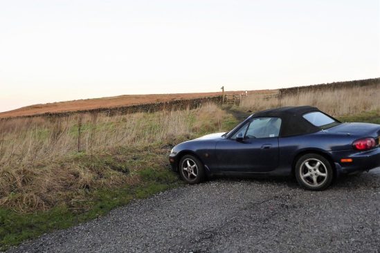
Could be interesting.

For Sir Hugh’s version of the day, see    conradwalks: Trigs 103 – Final trig of 76 – Crookrise Crag

and for those interested in the crags mentioned

UKC Logbook – Embsay Crag (ukclimbing.com)

UKC Logbook – Deer Gallows (ukclimbing.com)

UKC Logbook – Crookrise (ukclimbing.com)

    *****

ANOTHER INTERLUDE.

Wintry Bowland.

After the high winds, torrential rain and a morning of persistent snow the sun came out Saturday afternoon, enticing me (and many more Longridge residents) to walk around the block.

The air was still and almost warm, the hills were brilliant white and the birds were singing in the hedgerows. There were lambs in the fields. Simple pleasures.

I was glad I made the effort yesterday as today we are back to powerful winds and more rain. Don’t you just love British weather?

Here comes Storm Franklin.

A PLEASANT INTERLUDE.

My hatches are well and truly battened.  Storm Dudley has come and gone, and Storm Eunice is all around me. I won’t be venturing far – I have seen at close hand what a falling tree can do to a car. On the subject of trees falling, sadly I had one in my back garden yesterday, so I have been busy with the chain saw.

On a lighter note I had my family come visit me this week, a rarity in the last two years. There must have been an alignment of the planets so that both sons could join forces. We are still doing lateral flow tests before meeting – are we paranoid?  I appreciate their concern for their possibly vulnerable dad.

Along came my son from Preston and the partnership from Stretford with their two robust dogs. Seth, my cat, sensibly retreated upstairs for the rest of the day. After a healthy lunch I needed to get them out of the house and up the fell – referring to the dogs if not the adults.

I’ve mentioned before the plantation at Cowley Brook on Longridge Fell. This is where we headed for some exercise. The dogs made the most of it, charging through the undergrowth and jumping into any patch of water.

Phoebe watches on as Gizmo is all a blur.

Is nobody joining me?

Back home we relaxed whilst the dogs slept. To put it all into context I’ve watched the men’s and women’s teams make it through to the finals of the Olympic curling. Brilliant, as they say – ‘chess on ice’. And can anyone explain to me why Europe is on the verge of another world war?

AN INTERESTING AFTERNOON STROLL FROM CHIPPING.

There is a lot of bad weather about. Heavy rain most of the weekend and this morning, with storms forecast for the rest of the week. But there was a glimpse of sun this afternoon and I had something in mind. A post by Eunice (more of her later) and a comment from Sharon reminded me that it was snowdrop season, as if I didn’t know – having included a picture of a clump in one of my recent posts. Snowdrops are one of the first Spring flowers to bloom, helping us out of the winter gloom with shiny white petals.  I wanted to view a larger expanse such as at Lytham Hall or Bank Hall, Bretherton, but I knew of a ‘secret’ place nearby.

Leagram Hall sits on the hillside above our lovely local village of Chipping, originally a lodge for the Medieval Deer Park. It was replaced by stone structures in the C18-19th when the Weld family inherited  the estate from the Shireburns (of Stonyhurst). The present house was built in 1965 by the Weld-Blundell family. I’ve never visited the house but often walk past on a bridleway through the ancient deer park. I knew of a walled dell within their grounds which is renowned for snowdrops at this time of year. I was heading there today.

The elusive Leagram Hall.

In the parkland there were signs of tree damage from the storms of last year. An ancient oak was lying on the ground. How the mighty are fallen.

Farther up the lane and over the wall I had my first glimpse of the snowdrop spread. I was keen to get a closer look and even thought about climbing over the wall. Just then a woman appeared from the direction of the house. After a greeting and comments on the weather I asked her if she lived here. Yes she did. (She must be one of the Weld-Blundells!)  I stated I had come to see and photograph the snowdrop display and wondered whether there was any chance of getting closer. She explained the gardens were private but then proceeded to show me a hidden entrance, said be careful and left me to explore.

Over the wall.

Inside the sanctuary.

I could have finished there but as the weather was improving I decided to continue my walk up the lane towards the Bowland Hills. Laund Farm, (laund was a grassy area in a deer park)  home to a large herd of Blue Faced Leicester sheep. They pride themselves in the quality of the sheep milk cheese they produce. There was a new batch of lambs to boost the flock.

Pendle and Longridge Fell across the ‘laund’

Since I was last this way a new sign has been erected by the Peak and Northern Footpaths Society, along with its dedication to some local footpath activist. I’m always pleased to see these classy additions to the countryside and at one time considered tracking them all down – a mammoth task, no doubt completed by someone.


I continued on past the scattering of buildings at Birchen Lee, all slowly becoming more gentrified. The access lane from there onwards has been recently improved giving easy walking to the road under Saddle Fell, the starting point for one of my favourite ways of climbing onto the Fairsnape-Totridge fells. Today I ignored the heights and strolled down to a junction of interestingly named lanes. Some research needed there.

I didn’t drop down to Wolfen Mill, originally Dewhurst’s spindle and fly works supplying the burgeoning local cotton mills but continued down the steep lane, Saunders Rake.  Heading down to Chipping this passes the site of the Bond’s cotton spinning mill which later became Tweedy’s foundry, now occupied by a cheese factory. Farther on is the millpond for the still standing Kirk Mill, originally a cotton spinning business and later part of the chair making empire. There is a wealth of historical information on Chipping’s industrial past at https://kirkmill.org.uk/

Most of the chair factory across the road has been demolished and there were plans to develop the whole site into a hotel and venue complex. Not much seems to be happening on that front – we are all in for some difficult economic years.

Chipping was sleepy today. The Cobbled Corner Café,  thankfully recently reopened, but closed on Mondays and Tuesdays. I shall have to have a cycle ride another time for cups of tea and toast. I remembered the last time I came this way and popped into the graveyard to pay my respects to Lizzie Dean’s grave under of the old yew tree.

A good use of a February afternoon and I would recommend this modest circuit, all on tarmac,  for keeping your feet dry at this time of year. There is far more to discover in Chipping than I have mentioned.

But beware storms Dudley and Eunice are on their way…

*****


TOCKHOLES – END OF THE DARWEN TRILOGY.

For the third week in a row, we head to the Darwen Moors to complete another part of the footpath jigsaw. This time we park in Abbey Village, as do another 30 or so cars – a Bury rambling group is meeting up. The classic walk out of Abbey is through the Roddlesworth woods, past reservoirs, on route to Darwen Tower. We just managed to get a head start on this section.

Today we were heading in a round about way to Tockholes, that elusive village in the rough pastures west of Darwen Tower. Nobody just happens to drive through Tockholes, you have to search it out via narrow walled lanes, best done on foot as we were.

It is thought from archaeological findings that Tockholes was an ancient settlement from the Bronze Age. What is certain is that a significant Civil War battle took place nearby in the C17th, the remains of horses, cannonballs and bullets were found in a field in the village. After that, it became a centre for weaving and silk production. So what could we see today, there are over 20 listed buildings in the vicinity.

We entered the village from the moors above and came down Silk Hall Lane. The buildings here showed evidence of top floors used for weaving, with those long windows.

The footpath leading down to the rest of the village was a nightmare of awkward stiles and barbed wire, which were difficult for Poppy, the Airedale. Our thoughts turned to Sir Hugh and his wire cutting equipment. We were relieved to emerge opposite the grounds of St Stephen’s Church.  Dating from the reformation in the mid 16th century,  It was rebuilt in 1833 but fell into disrepair and was demolished and rebuilt again in 1961.

We sat in the relatively modern Lychgate (1906) for a brew and then explored the extensive graveyard which is said to contain 20,000 graves. An early C19th sandstone columnar sundial. There was an old school building from 1834 with a strange open air pulpit.  The stone porch of the 1833 building retained as an archway to the present insignificant church. Nearby on a cheese press base an old cross shaft and the rounded  Tocca stone beside it.  These are said to be Saxon, possibly a preaching cross, with the Tocca stone giving rise to the name of the village. ‘Tocca’  a Saxon surname and ‘hol’ a hollow. Probably not ‘touch stone’ as some legends have it, though the rounded stone was thought to have healing properties. We will never know.

‘The Touch Stone’

I seem to remember seeing a pinfold in the village on previous walks long ago, but could find no sign of it today. We did however come across an ancient well, again said to have healing properties, constructed with a so-called Norman Arch taken from a local hall. This would have been the only source of drinking water into the early C20th.

Time was passing, so we followed the ancient lanes past Tockholes Chapel, one of the first established non-conformist Chapels founded in 1662, the current building dating from 1880. Most of the old farmhouses and barns have been restored sympathetically to provide exclusive rural living.

Chapels Farmhouse.

Lower Hill.

I had bad memories of negotiating the rights of way through Red Lee Farms, where we were heading. It all seemed to go well today, we bypassed the lot somehow, which was good for progress, but I was disappointed not to see the old houses. We were back at the cars before the Bury ramblers.

Poppy seemed out of sorts today, I think she was telling us it was time for a change of scenery. Our trilogy is over.

Before we go I must make a mention of Abbey Village where we were parked. The name Abbey Village derives from Whalley Abbey, the major landowner until the reformation. Abbey Mill still remains the focal point of a largely intact early C19 industrial settlement. Established in 1840 by a John Park, it is one of the earliest surviving purpose-built integrated spinning and weaving mills in Lancashire. The rows of workers houses line the main street. The start of migration from cottage industries, as in Tockholes, to the mill towns.

*****

CATCH UP AROUND ALSTON.

                                                                             Yesterday.

Today is murky and damp, this morning I’m still in bed reading when the window cleaner appears on his ladder. He comes the first week of each month, and I have to pinch myself that we are into February already. I chat to him, standing in my dressing gown as he moves around the house. He reminds me that one or two of my windows probably need replacing, another job to put on the slow burner of my ‘things to do’.

I tend to go into slow motion in the winter months, particularly at the start of the New Year. Somewhere I have a SAD light, but significantly have not been bothered to use it. Past winters have been shortened by regular trips to sunnier climes, but that is a thing of the past for me in the present pandemic. Even my local walking is curtailed by the persistent plantar fasciitis. I have a list of friends to catchup with, many of them lying low. Parliamentary matters are not helping. Even my annual Big Garden Birdwatch didn’t go to plan. Oh well, it was good that yesterday I had phoned JD and arranged a walk with him to get out of the house and catch up with his news. The last time we were out together was in July last year!  There have been several times when his close family have been infected or isolating, touch wood I have steered clear of any forms of Covid.

A simple walk was planned around the Alston area, Preston not Cumbria. The little blue car was parked up on Alston Lane by 11am, it had been raining until then. Off we went along familiar lanes, through farms and down soggy fields, until we were walking alongside the River Ribble. No navigational decisions were needed, so we chatted away the rest of the morning, we share a broad church. A few mallards were spotted on the river, but otherwise any countryside life was keeping a low profile.

Opposite Balderstone Hall is an ancient ford crossing of the river, which JD has completed several times in summer conditions. Yesterday, he was upset that gates leading to the river bank on our side were obstructed and locked. The reason maybe the new development being undertaken here. A large “architecturally designed” property is slowly being completed, no doubt at significant cost. We wondered about the environmental impact of such a design on this rural riverside. Maybe it has already won an award. From there we made our way slowly back up the valley escarpment via rather convoluted field paths, I was trying to avoid the hard roads. In parts, we used the out of favour Ribble Way path and ended up on the wrong side of barbed wire several times. We almost had a Starling murmuration from these trees……but not quite.

JD always makes a good cup of coffee, so I was glad to drive back to his house for the rest of the afternoon. His wife, recovering from a hip operation, probably had walked farther than us on her daily exercise routine around the village.

I had not taken many photographs, due to the dull weather and too much conversation, so for a better impression of the scenery by all means look at a previous walk.

However, a couple of pictures, harbingers of Spring, probably will do more for me than that missing SAD light. Having posted this, it’s time for me to get out of the dressing gown and do something useful this afternoon. I believe in yesterday.

*****

WILD LANCASHIRE MOORS – CARTRIDGE HILL AND MORE.

I may be accused of plagiarism, today’s walk was almost a repeat of Michael’s recent exploration of these parts. I acknowledge his inspiration for this walk and accept that it would be difficult, nay impossible, for me to assemble a post of his standard. My delves into the internet came up with virtually the same history of the area.

We, the Rockman up from Bolton and I, start from the same Royal car park as last week but have another itinerary in mind. We noted the demolished mill’s pond on this occasion and then took the track up the moor. The Stepback Brook, culverted in parts, was followed past a pretty fall and into a sheltered copse known as Lyon’s Den, named after John Lyon, a seven-foot-high giant who apparently constructed a simple house of turf and heather here around 1790. There was no sign of his abode, but all around were signs in the landscape of abandoned coal pits and small stone quarries. The track we were following no doubt served one or the other.

We came out onto the windswept moors with views back to Darwen Tower wrapped in its temporary sheeting. Tracks go in all directions, but we take one to the west, leading to a shoulder with newish fencing and a gate. From there we make our individual ways, picking the driest parts up Cartridge Hill. At 402m this is the highest part of Darwen Moors and neither of us had visited it before. The hill itself was nondescript and rounded but had a stone cairn on the summit and excellent views over the Bolton hills and the Lancashire plain. Even wetter ground brought us down to pick up another pit track, this took us in the right direction under Turn Lowe. In these wild moors, finding a track you can follow relatively easily is a godsend not to be scorned.

Ruins of a farm appeared alongside the track – Higher Pasture Barn. Long since abandoned. I’m reading at the moment a book about the cruel Highland Clearances (On the Crofters’ Trail by David Craig) and I reflect back to all the ruined crofts I used to see on my Scottish stravaiges. In the late 19th and early 20th centuries many farmsteads on these Lancashire moors were abandoned either from natural relocation to the mill towns or by the water boards taking over the land for water catchment areas. A glance at the early OS maps shows their origins. I remember reading a learned history of the fate of the Haslingden Grane valley families when the reservoirs were constructed. A significant social clearing has occurred here on these  moors. Ironically, just down the road, Lower Pasture Barn has been saved from collapse and converted into an expensive luxury country residence.

Higher Pasture ruins.

More fortunate Lower Pasture.

But another extensive ruin was soon to be encountered on this walk. The short stretch of road to get there was a disgusting depository of rubbish – cans, bottles and take away plastic, that Bolton and Darwen can’t be proud of.

Hollinshead Hall has its own Wikipedia entry   I don’t remember visiting it before and was eager to explore the ruins. I wasn’t expecting such an extensive site. First we made use of some of the low walls for a bite to eat whilst a school trip played hide-and-seek. Once we had the place to ourselves, we could wander at will, postulating on the functions of the various spaces. Is there a master plan somewhere? What I had read about was the only remaining intact structure – The Well House and its spring. Probably the reason for the citing of the original C17th buildings, and also at one time a supposed cure for eye problems. We climbed up to have a look at it and to peer through the opening into the interior, where two large troughs are fed by an ornate Lion’s Head. The spring supplying the building is up above it, but I was distracted from further exploration by my phone falling out of a pocket into the precious waters.

The whole valley of the Roddlesworth, once meadows and pastures, has become a plantation after the water board’s purchase. We spend the next hour wandering along its old tracks, picking out sites of buildings slowly disappearing into the greenery. On the moors we meet few but down here dog walkers are out in force. We join some of them in the café for coffee and cake.

*****

ANOTHER DAY OUT WITH POPPY.

January 20.  Darwen Tower.

It’s almost 5 years since I had a day out with Poppy, the Rockman’s Airedale Terrier.

I didn’t remember the car park at Ryal Fold being so large, of course we ended up in different areas before successful rendezvousing. Whilst I was waiting, I got into an emotional conversation with  a gentleman from Darwen. He had walked up through Sunnyside Woods and was heading onto the fells, his local walk. He told me of the loss of his wife of 53 years during lockdown, and also of one of his sons. The conversation became tearful as he recollected their walks together and his now empty house. There is a huge amount of pent-up emotion from the last two years. I seem to come across these people.

The morning was perfect, frosty with bright sunshine, so lots of others were setting off on their perambulations. It was really too soon for a coffee in the café/information centre, so we just picked up the bridleway heading into the fold of hills past the workers cottages of Hollinshead Terrace. A cotton mill had stood where the car park is today. It was stone-built for Eccles Shorrock of Darwen in 1859. (He also owned India Mill in town, seen later today from above). At its peak, the mill had 333 steam-powered looms and employed 150 people. It was demolished in 1903.

National Library of Scotland, 1894 OS.

Once out onto the moor, Poppy went her own way, sniffing from grass to grass, the slow pace suited me. The frozen way led steadily uphill until it came alongside Stepback Brook. We were tempted to continue into the shady gorge and view its waterfall but decided to leave that for another day when we may explore the way farther south and perhaps the remains of Hollinshead Hall as well. No, we climbed up on a zigzag path out onto Darwen Moor. There were signs of disused mining shafts up here, ?coal. More tracks led away from long forgotten sandstone quarries.

A well-used track then headed straight to the tower. From our elevated position down to our right was Darwen, with the chimney of India Mill very prominent. More dogs joined in the fun with Poppy.

85ft high Darwen Tower, more correctly called Jubilee Tower,  was constructed in 1898 to mark Queen Victoria’s Diamond Jubilee, the year before, but more importantly to commemorate freedom of access to the local fells. A dichotomy of interests, nonetheless. It was always known to my children as ‘the space rocket’ seen from afar.

An extract from Wikipedia is worth a read —                                                                                   Packmen, peddlers, farmers, and labourers used tracks and moorland paths to go about their business. In the 1870s the Lord of the Manor of Over Darwen, the Reverend William Arthur Duckworth, blocked ancient rights of way preventing access to the moor even though he was an absentee landlord. Game rights were a valuable commodity, and Duckworth did not wish to have his land devalued by trespassers on the moors. William Thomas Ashton, manager of Eccles Shorrock’s mines at Dogshaw Clough and Entwistle Moss used the moorland footpaths as well to deliver coal to farmers and other customers. Whenever Duckworth’s gamekeepers blocked his way, Ashton cleared the paths. The struggle led to the courts where Duckworth lost and in September 1896 people resumed walking the moorland footpaths. Ashton had died in 1884, his sons led a procession onto the moors in celebration.

Renovations of sorts were being carried out on the tower, and it was cordoned off, cloaked in scaffolding and sheeting.  Over the years there have been several repairs including a new steel dome winched into place by helicopter in 2012., the last time I was up here.

On our way down the badly eroded old quarry track, modern steel industrial units glistened on the Industrial side of Blackburn, with Pendle looking rather diminutive behind. Poppy made friends with some horses in the adjoining paddock. There seemed to be tracks going off in all directions, no doubt reflecting the early industrial past.

We were heading for Sunnyhurst Woods, a public park purchased by Darwen Corporation in 1902 commemorating Edward VII’s coronation. The Sunnyhurst Inn was not open, so we continued and entered the woods through the Lychgate. It was like entering another world of trees, ferns and deep secret valleys. A handy metal seat provided by The Friends of Sunnyhurst Woods was ideal for a drinks break as it was in the sunshine. Once lower down, we came out between the paddling pool and the Greenway Shelter (the bandstand). We realised we had never been farther downstream where there are other attractions – again another time.

Lots of families and dog walkers were making the most of the sunshine and exploring the paths. How lucky to have this area on your doorstep if living in Darwen. We found our way up the valley past Earnsdale Reservoir, with the tower overlording it above. Fields took us to the original C17th farmhouse at Ryal Fold and back to the car park. The Royal Hotel was now open and  people were enjoying a socially distanced and probably cold drink in the garden.

The 4-mile walk was easy, but I didn’t feel that my plantar fasciitis appreciated it. I spent a lot of time chatting to the Rockman so wasn’t concentrating on photography, but here’s a selection….

Darwen Tower across the frosty fields.


Hollinshead Terrace.


Onto the moor…


… leading the way.


The ridge to the tower, Blackburn and Pendle in the distance.


The mill town of Darwen.


Rocket men.


The Rockman, Poppy and friend.


Entering the Rabbit Hole.


Not a day for paddling.


The bandstand.


Follow me, keep up.


Earnsdale Reservoir.

Ryal Fold from Historic England.

The Royal.

Poppy had a great time, hopefully so did the Rockman.

Thanks to Michael of The Rivendale Review fame for reigniting my interest in this area.

*****


I HAD A PLAN.

On recent trips up Longridge Fell, I came across a new, at least to me, path deep in the trees west of the highest point. I noticed, at the end of this narrow corridor, light coming from the west. I calculated that if I was there as the sun was setting, the light would be concentrated through that point. That was the plan.

So today, after watching another farcical Prime Minister’s Question Time, I parked up on Jeffrey Hill just after three pm. The sun was already low, and the temperature was dropping. I hurried up the drying path towards the trees leading to the trig point. The decorated Xmas tree had been stripped of tinsel and baubles. Strangely, the tree with more environmental decorations hadn’t, I removed the remaining cardboard stars, now considered as litter. I digress.

After visiting the top, I took the damp track into the forest and diverted onto the ‘new’ path. All was gloom as I walked deeper into the trees. It was obvious that I had missed the ideal time, and the sun was setting past my portal. I suspect that two weeks ago would have been the optimum for the sun shining along the corridor of trees. There is no way back, I will have to wait till next year to test my theory.

In the past I have visited places in the world where the juxtaposition of some physical feature with the sun, moon or stars, at various times of the year has had some significance for the local populace. Our forbearers took a keen interest in astronomy. They derived a cyclical calendar predicting changes in the seasons, which they connected to their agricultural practises and pagan beliefs. Having a fixed physical point in the natural landscape helped them identify the passing of the year and its recurrence. A hole in a rock on the hillside or a nick in the skyline gave some sense of time. It was then only a short step to create a megalith, sundial or more complicated celestial instruments and then observatories.  This is all a little farfetched from my little pathway lining up with the setting sun.

By the time I was back at the car park there was only one vehicle there, thankfully mine, and as I drove back to the village the setting sun was flaming the low clouds.

BEACON FELL – Déjà vu.

A couple of weeks ago I wrote of the devastating storm damage in the forests on Longridge Fell, well today I witnessed the same on Beacon Fell. The difference being that here, as it is a public park, the foresters have been busy clearing much of the damage making the place safe for the public. I imagine that at the time of the storms, early December, the public would have been excluded.

I only came up here this afternoon for a short walk, I seem to have been up and down Longridge Fell most days during the holidays – time for a change of scenery.

The sun was trying to make an appearance.

Parked up in the little quarry on the quieter east side of the fell, a modest circuit was completed from there. The little pond was looking particularly attractive in the low light. I wish I could paint. Round the corner piles of cut timber started to appear and it was obvious that there had been a lot of storm damage in amongst the trees. Logging machinery was scattered about, being a Sunday, nobody was working. I expect that when they replant, they will use more sustainable native species. Where there is destruction, there is hope.

Not a word about the virus.

AFTERMATH OF THOSE STORMS.

If you go up to the woods today, you’re in or a big surprise.

There must have been a lot of trees blown down in our recent storms, Arwen and Barra, I started to notice them as I walk farther along the fell. I haven’t been past the trig point on my tentative walks to see if my Plantar Fasciitis is improving. Today I intended to give it a sterner test, if you can call 6 miles a test.

It was when I met a couple who had turned back because of the difficulties that I questioned my sanity for continuing. Already I’d had minor diversions around fallen trees, but I fought my way through onto one of the obvious forest tracks on the ridge, thinking I had escaped the worst. Even this track was completely obliterated a little farther on as I approached what was named Sam’s View, a panoramic clearing. I had to go well off route to avoid the worst of the fallen timber. I could hear voices in the forest to my left and suddenly a family of four emerged looking rather dishevelled, they had been in there awhile trying to navigate around the damage. The father showed me their tortuous wanderings on his phone, I pointed them to a safer track.

I’d intended going as far as Kemple End on the ridge, but the way forward in that direction, a little difficult at the best of times, was wholly choked with fallen trees. I was glad just to return to the main forest road. Lots of families and lots of dogs were promenading this track, it was a Bank Holiday after all. I soon went my own way and traversed the fell back to my car. My heel is certainly improving, providing I stick to soft ground.

It was reassuring that most of the original Scots pines and Beech trees had withstood the storms.

Go careful up there.

OF THE SEASON.

I came out today and climbed the fell to try and capture a suitable photo for my season’s greetings. Maybe a robin, maybe a patch of snow or some holly berries or even a man in a Santa hat. No, I have failed, as you can see from my photo above. All was grey and gloomy.

It’s been that sort of week.  Most days I didn’t venture out into the raw weather. I was kept busy wrapping presents and mulling over wine. Making lists and peeling vegetables. Phoning distant friends not seen for months, even years. Avoiding the crowded last minute shopping. Enduring lateral flow tests and crossing fingers, already two of my grandchildren will be absent from the festivities. So this is Christmas.

  One bright spot today was a repainted slate poem in a cupboard with a humorous line – which made me smile.

Strange things happen on Longridge Fell.

HAPPY HOLIDAYS.

ANOTHER DAY — ANOTHER TREE.

I had been told by Clare, of Slate Poems fame, of another decorated Xmas Tree on the fell. I was up here to find it. Parking was difficult on this fine Sunday afternoon, remember the chaotic parking situation in our earlier lockdowns. The good weather had brought lots of families out at the start of the Christmas Holidays.

Would you believe it?  As I walked through the gate onto the fell, I bumped into Clare herself exercising her beautiful Collie.

I normally take the more northerly track overlooking Chipping Vale, I call it the ‘panoramic balcony track’, but there is also a track following markers going straight up the fell leading to boggy terrain, best avoided. Incidently this track goes through the site of some Bronze Age hut circles and burial grounds, I have tried unsuccessfully to locate these on the ground in the past. 

This was the way to the decorated tree and the way I followed today. The stone cairn has had an addition of balanced stones, often seen on rocky beaches, I suspect they won’t survive a winter storm. Not far past the cairn is the tree. It was decorated with more environmentally friendly items; fir cones, wooden ornaments and nut strings for the birds. Satisfied with my ‘find’ I continued on through those forementioned bogs to regain the regular track, which does have its own boggy moments.

The other Xmas Tree with its tinsel and Angel topping was passed, and I reached the Trig point. There were good views, but nothing compared to yesterday’s cloud inversion. Circling through the forest, I was surprised at the number of trees that must have come down in our recent storms.

Once looking across the Ribble Valley, Pendle and Samlesbury there was a repeat of the cloud inversion * in a southerly direction.

* Cloud inversions take place when the temperature is warmer higher up – such as on a hill or mountain – than it is down at the bottom of a valley

The colder air at the lower level traps mist and fog creating the impression of mountain summits floating above the clouds.

*****

Map showing the two Xmas trees…

AN ANGEL ON LONGRIDGE FELL.

I almost never set forth yesterday, the mist was so thick down in Longridge, but I wanted to continue with my renewed walking therapy. Friends had called in for coffee, so it was 2pm when I emerged out of the worst of the fog to park on Jeffrey Hill. The whole of Chipping Vale was a sea of cloud, with only the higher tops of the Bowland Fells visible across the way.  My route up the fell was shrouded in mist, giving a spooky feel to the place in the low sunlight. I had the feeling that I was being followed, but no one else was about. As I climbed the air cleared and soon I was above in blue sky with the ridge of Longridge Fell visible ahead.

I stopped briefly to place an angel on the top of the decorated Xmas tree, the reason for my venture after comments from my last post  –   https://bowlandclimber.com/2021/12/17/longridge-fell-christmas-tree/

At the summit was a lady with her Collie dog, she had been there awhile, enthralled by the views in front of her. It was indeed spectacular. Thick cloud filled all the valleys, and there above were the tops of the fells in sparkling clarity. Beacon Fell, Fairsnape, the Croasdale Fells and Waddington Fell. And in the distance the Yorkshire Three Peaks. All islands in the clouds. Looking down onto the mist I thought there was the arc of a broken spectre, but unfortunately it never really materialised.

Another walker arrived with his Springer Spaniel. Whilst the three of us chatted about the spectacle, the two dogs ran themselves ragged in a game of tag. I stayed longer than usual before drifting away as more people started arriving. I continued taking photographs as I came down the fell. By the time I had reached the road, a full moon rose from the east as the sun set in the west.

A perfect ending to a unique afternoon.

My pictures below don’t really do it justice.

THE LONGRIDGE FELL CHRISTMAS TREE.

A Christmas Tree has appeared on Longridge Fell, well actually there are already thousands in the forest up there. No, this particular one is garlanded with tinsel and festooned with baubles. You will find it as you climb the muddy track alongside the wall leading to the summit from the Cardwell parking on Jeffrey Hill. I don’t know when it began to be decorated, as today is the first time for weeks I’ve been up here.

The sun was shining brightly enough to tempt me out for a walk this afternoon. I was wary of my painful heel, but I figured that the ground would be soft. And it was. A few cars were parked up, but nothing compared to the chaos of recent lockdowns and travel restrictions. Are we going to see a repeat in the next few weeks as the Omicron variant outpaces our boosters? A conservative 93,000 cases today. I feel safe up here.

I take the panorama path high above Chipping Vale with the Bowland Fells across the way. The little spring as you start to climb was running full. This is where one has to hop around to avoid the worst of the bogs.

The Xmas tree is halfway up, adjacent to the watery path. To be honest, it is somewhat underwhelming. I make a mental note to possibly return tomorrow with some festive reinforcements to improve the look of the tree.

I continue up to the trig point and try to update my summit photos in the low winter sunshine.

Walking back down, I find it difficult to see where I’m placing my feet in the low sunshine. I complain to a passing walker ascending with the sun behind her, and she rightly rebukes me with “let’s be glad of the sun at this time of year”.

I was glad to be out on the fell on such a glorious day.

MILES AND MILES.

It’s that time of year again when one reflects upon journeys undertaken.

Sometime and somewhere earlier I signed up * to walk 1000 miles in the year, well I didn’t actually sign up but having seen the challenge I decided to keep a personal  tally of my mileages. Most years I do far in access of a thousand, but we were living in strange times and travel was limited. Doing less than three miles each day seemed easy enough. I was just going to count actual walks, not going to the shops etc.

*  I think it was one of my fellow bloggers that mentioned it first. Just found the website concerned   http://www.walk1000miles.co.uk

I was well on target by the middle of August, 900+ miles, despite the lockdowns and the ban on travels abroad. But then disaster struck, that’s a little strong, when whilst bouldering I landed badly on my right heel. I rested what I thought was just a bad bruise, but it persisted to the extent I couldn’t walk comfortably at all. The pain and disability started to resemble Plantar Fasciitis (self diagnosis). My walking was curtailed and I started on rest, ice and stretching exercises. Despite visits to a physiotherapist and a podiatrist, I’m still not back to fitness.

As you have noticed from my posts, to keep some sort of exercise going, I dragged my bike out of the garage, gave it a quick oil and started cycling around the area, keeping off busy roads as much as possible. A daily walk comes natural to me, but getting the bike out, gearing up and perhaps driving to a suitable venue is not as spontaneous and thus often missed.

So, how is my walking mileage tally working out if I want to equate to my cycling exploits. Let’s say I walk at 2.5 miles per hour (4.02 km/h) and cycle at 10 miles per hour (16.09 km/h),  a leisurely pace.  Does that make a 30-mile bike ride the equivalent of a 7.5-mile walk.  If you agree with that premise, all I have to do is divide the cycling miles by 4 to obtain the equivalent walked miles. Job done.

But it doesn’t feel like that. When I’ve finished cycling 30 miles in just over 3 hours, I think I’m more tired than when having walked 7.5 miles over similar terrain. I know I’m trying to compare oranges with apples, and I’m not very efficient using a mountain bike on roads. I could get scientific and talk about calories burnt – 200 cals walking and 60 cals cycling a mile. But I don’t worry about calories when I’m enjoying exercise outdoors. What about steps, which I’ve never counted, –  10,000 steps for 5 miles walking whilst roughly 16 miles equivalent in cycling. Both these examples give an approximate  ratio of 3 to 1 instead of my original 4 to 1. Thus, 30 miles cycling would be 10 miles walking.

I’m as confused as you by now. Sticking a pin in it, I think I’ll use the more conservative 4:1 and be done with it. So since I started cycling in September, I’ve “walked” at least an extra 140 miles, so my modest target of 1000 has been reached.

‘So what’  you may say.

.

ANOTHER LETTER TO YOUR MP.

On a regular basis, I call upon my friends to sign a petition or write to their MP on environmental problems that I become aware of, and I think need public interaction. On the whole, the government pay lip service to these issues and are inclined to take no positive action. Hence the need for the likes of us minnows to show solidarity and complain and object in any way we can. The recent National Trust decision to ban trail hunting on their lands was I’m sure due to the number of members expressing their feelings through petitions and votes.

Your local MP is dependent upon your support and if sufficient numbers of their constituents express concern on a topic they have to listen. This obviously often involves the ‘party line’ and therefore the more ground level public opinion goes against them the more important that this opinion is heard and heeded. Whichever government is in power, they shouldn’t be allowed to ignore this voice. Lets make them work for their salary and Xmas Party.

Yes, you have guessed it, I’m appealing for you to consider another issue ongoing at the time which will have serious consequences for our access to our countryside in the future. People need to connect to nature and the countryside in our increasingly complex world. Take a few minutes to read the Ramblers latest concern on the far-reaching Agriculture Act https://mailchi.mp/ramblers/accessnatureelm?e=4bf1748d16 and if, like me, you are sufficiently engaged to write to your MP using the simple links on the website.

Have a good day.

THE RIVER DUNSOP.

The River Dunsop runs for only 2.3miles from the junction of its tributaries, the Brennand and the Whitendale rivers deep in the Bowland Hills, to where it enters the Hodder below Dunsop Bridge. At its head are weirs and fish ladders, trout should be heading up stream at this time of year. I’ve had a couple of forays onto the Hodder and the Lune in the last week in search of leaping fish, with no luck. My plan today is to check out the weirs at the head of the Hodder. The rain isn’t due until lunchtime, so I’m away earlyish.

  Because of my troublesome heel I’m avoiding walking any distance and this is why the River Dunsop has been chosen. From the café in Dunsop Bridge there is a private road, recognised as a bridleway, conveniently running alongside the length of the river. In past times I would have cycled all the way from Longridge, but today the bike is in the back of the car until the car park is reached. The crowds of summer have gone and there are only two other cars parked up.

  I pedal along happily taking in the scenery with Middle Knoll blocking the head of the valley. Despite it being a dull autumn day the situation is as dramatic as ever. The weirs I was aiming for are by the bridge at the junction of the rivers.  I’ve come this way many times before and photographed it in the sunshine. Such as here.

   You’ve guessed it — I saw no fish.

    Not really disappointed, my chances of leaping fish were low, I cycled farther up the track to look up into the Brennand Valley which seems to go on for ever into the distance. I’ve not explored that area for some time. From the map there are possible tracks all the way to the remote Wolfhole Crag. Likewise, I then intended cycling up the right-hand track for a short distance to obtain a similar view into the Whitendale Valley, but a notice banned cycles. That is the way to more desolate moorland past the Duchy farm, which I last walked going through to Hornby on Wainwright’s Way. 

The Brennand valley.

  It was good to be in this wonderful place even if only on the humble road low down in the valley.  It was a quick turn around and a gentle ride back to the café for coffee. The larch trees turning yellow lend some colour to the scene. 

Back down the valley with rain approaching.

The bridge over the Dunsop.

Puddleducks’ cafe.

  For anyone wanting to sample the wildness of Bowland without the commitment, this short journey up the valley, preferably on foot, is highly recommended. You can tell I’m passionate about Bowland.

Whilst driving home for lunch the rain started in earnest. The morning had been well spent.


A LUNE INTERLUDE.


I was sure when I passed this way before there was a fish ladder next to the Halton hydroelectric installation on the Lune.  That vague recollection had brought the three of us along the banks today. I have not mentioned it, but last week Mike and I ventured down to the Hodder to try and see salmon leaping up its weirs. That was a complete failure, as had been my attempts last year, along the same stretch.

  Not be defeated it was time for another try. We engaged Sir Hugh into our quest, even if it was just to get him away from his models. Meeting up at the defunct Halton Station, This should be an easy walk for my damaged heel. The rain stopped as we stepped out of the cars and incidentally started once more in earnest when we were just arriving back at them. Good timing.

  We crossed the narrow road bridge built from the remains of an older rail bridge. Down below, the River Lune was running high and fast. I made my excuses then, saying there was probably too much water for the salmon leaping.

  We walked past the housing developments near the old Halton Mill and forge and in half a mile arrived at the weir. I pointed out the fish ladder, but they were not convinced, and there were certainly no fish. I began to doubt my research from last year when a ladder and automatic fish counter were mentioned at this site. We poked about at the turbine house and admired the view of the L shaped weir with its rushing flood water.

  My intention was to walk there and back, but somehow It was I who suggested carrying on and creating a circular walk via The Crook of Lune.  I’m regretting that decision now as I sit with an ice pack on my heel.

  Mike and Sir Hugh were pleased with the walk which was new to both of them, It’s difficult to take Sir Hugh somewhere fresh.

   We spent time on the bridges over the Crook of Lune with the views up the valley and immediate vicinity. Something new had appeared on the eastern rail bridge — a multitude of fresh flowers adorning the railings.  They certainly brightened up the scene and we pondered on their originator. It so happened that he was stood almost next to us and we were soon in conversation with him. From Transylvania and now Morecambe, he cycles here most days with the altruistic idea of brightening peoples lives. And he feeds the doves and pigeons. It’s a shame people go off with his best roses, but that’s altruism for you.

  We couldn’t dally any longer and set off back along the south side of the river stopping at the weir again where there was a fish ladder but of course no fish. As I said we arrived back at the cars as the rain started and drove off to nearby Caton and the Ship Inn where we enjoyed, yes you’ve guessed it — fish and chips.

It’s still raining tonight  and due to continue for a couple of days with more flooding, lets hope that may have some influence on the delegates at Glasgow’s international climate  summit.

  Any ideas where we can try again next week?

Too much water?


Turbine fish ladder.


Flower power.


The artist in situ.


More prosaic.


No fish this side either.


Halton’s station framed.

*****