Category Archives: Art and architecture.

A LANCASHIRE MONASTIC WAY.

I have stumbled across a guidebook written by John Convey for this walk through Lancashire. A two-section walk linking medieval monastic sites of Lancashire and South Cumbria, beginning in southwest Lancashire at Upholland, and making its way up to Furness Abbey in what is now Cumbria. The first section finishes at Sawley Abbey. The second starts at Cockerham Priory and continues to Furness Abbey. The author has researched the area thoroughly and writes a lively account of the history of the various localities. A third of his guide consists of references and sources to his research, lending authenticity to the places visited.  Time will tell if his walking route is worthwhile.

The guide gives good public transport information, and I intend to eschew my car for the duration. Out with the bus pass and Senior Railcard. I will hopefully complete the way on an ad hoc daily basis, with regard to the winter weather and other commitments. It should be ideal for the short daylight at the end of the year.

Convey has an obvious liking for the variety of landscapes in the ‘old’ Lancashire. As well as the monastic houses from Medieval times, he includes many other religious places of note along the way. As he says –

“Every time I see a church

  I pay a little visit

So when at last I’m carried in      

 The Lord won’t say ‘Who is it’?

*****

A SOUTHERN INTERLUDE.

Three ‘off the radar’ galleries.

My mate Mel always came up to Lancashire in November for a short walking, drinking and eating break. Alas, he is now on kidney dialysis three times a week so it is simpler for me to make the trip down south to visit him and Pat. Trains from the north were delayed by sheep on the line so I jumped on a train to Crewe and picked up an express train from Liverpool to Euston.

Across the road to the Wellcome.

Across the road from Euston is the Wellcome Collection an oasis of calm away from the busy road. This is a fascinating gallery with ever-changing exhibits related to medicine, health and the human condition. Today there was a gallery exploring our experiences of illness and mortality through the diaries of Jo Spence dying of leukaemia, a rather depressing experience. Alongside was a video installation from artist Oreet Ashley again exploring illness and our reactions to it in the digital age. Soft furnishings to recline in whilst watching the challenging films made me feel uncomfortable.

Moving into another gallery was an exploration of how as humans we affect climate change and its effects on the importance of water. One stunning video showed a quick food outlet slowly being submerged with flood water, the result of our planet pollution, with plastic straws and takeaway dishes floating through the screen. You get the idea.

In the same room was a Shonibare Refugee Astronaut, another comment on climate change and the forced immigration that will follow. ” as witty as they are terrifying”

Moving on the next morning we were in the fantastic Lightbox in Woking admiring a collection of paintings from The Scottish Colourists. 

I must admit I’d never come across their works before. S.J. Peploe (1871 – 1935), J.D. Fergusson (1874 – 1961), G.L. Hunter (1877 – 1931) and F.C.B. Cadell (1883 – 1935). A group of painters influenced by Post-Impressionism but moving into Modernism.

Wonderful landscapes, portraitures and vibrant still life. A splendid exhibition.

Still Life. S J Peploe

Villa Gotte Garden.   J D Fergusson.

Ben More from Iona.  F C B Cadell.

Alongside was a contemporary exhibition from the Royal Institute of Painters in Watercolours, all available to purchase.

My favourite.

Outside in the shopping mall was a Christine Charlesworth bronze of the disabled basketball player Ade Adepitan.

Sunday gave us a break as we visited the parkland in Windsor Great Park and Savill Gardens. We strolled around the lake and polo grounds. There was filming taking place in one area so we never saw the totem pole but nearby amidst stately cedar trees was the Cumberland Obelisk, in honour of the Duke of Cumberland [1721 – 1765] of Culloden fame, son of King George II.

The Guards Polo club has 160 playing members and 1000 social members. They play from April to September on Smiths Lawn [an airfield until 1945], that would be worth a visit. There is a bronze statue representing a polo player about to strike.

Another equine statue on our slow perambulation was in memory of Prince Albert.

We concluded our modest circuit of the lawns, Mel was pleased with his two and a half miles walk so I treated them to an expensive coffee in Savill Garden’s cafe.

Monday morning was set aside for a visit to Watts Gallery and Artists Village at Compton on the North Downs. I first came across this whilst walking the North Downs Way with Mel in 2011, [what a difference a few years make] it was closed for restoration then but somehow we enjoyed a cup of tea from them. This little complex of galleries is based on the home and studio of Victorian artist G F Watts and his ceramicist wife, Mary Watts, highlighting their work and offering workshops and other exhibitions. The North Downs Way which Mel and I had traversed follows in parts a pilgrimage route from Winchester to Canterbury and Mary created a Celtic-style cross was in memory of her husband George. The memorial was made from terracotta dug from the surrounding land and was moulded at the Compton Pottery. The cross bears a variation of a Celtic shield-knot, protection from evil spirits or danger.


First port of call was the Watts restored studio up at the Watts house, Limnerslease, where two guides gave us an insight into their methods and ideology. There were numerous artefacts from their time illustrating their artistic skills.

Limnerslease the Watts house with attached studio…

…studio.

Of particular interest was a reproduction of Mary’s method of communal tile manufacture for the Arts and Crafts Chapel down the hill [visited on the North Downs Way]. Alongside this was a vivid installation from a demolished Military Chapel in Cambridge, rescued just in time, which was meant to uplift the spirits of wounded soldiers.

Back in the main gallery, there is an outstanding space devoted to George Frederic Watts [1817 – 1904]  I am not a big fan of flamboyant Victorian artists but this exhibition won me over. First, his portraits of contemporary notables were striking, then there were several studies of beautiful wistful ladies which served as figures for him in his later grand allegorical canvases displayed in the gallery.

A smaller gallery of his sculptures didn’t really show off the massive plaster cast model for his equestrian statue, Physical Energy, for the best. A bronze cast of this is in Kensington Gardens and a newer cast is to be erected at Compton. More accessible was a plaster statue of Lord Tennyson and his dog, cast for a statue in Lincoln Cathedral.

If that wasn’t enough a temporary exhibition downstairs highlighted paintings by John Frederick Lewis [1804 – 1876] who became famous for his Oriental paintings. Some of his colourful depictions of street life in Cairo, where he lived for several years, could be replicated today. I have wandered through some of his markets. Yet another artist that I knew nothing about until this weekend.

We retreated to their excellent cafe for a rest before a bit of retail therapy in the shop where I was seduced by huge price reductions on many books. There is much more to see here and it will be worth another visit next time I’m ‘down south’.


WAINWRIGHT’S WAY – A KENDAL INTERLUDE.

A Kendal snapshot.

Nick Burton’s book Wainright’s Way is far more than a walking guide as he incorporates so much well researched biographical detail of AW. Already I’ve have covered his early life in Blackburn which included a look at the town where he lived from 1907 – 1941.

Now having reached Kendal, where AW lived from 1941 until his death in 1991, Nick takes a short tour of the town pointing out places AW was associated with and I found much of interest on my stroll around. Kendal Civic Society has placed green information plaques everywhere marking historic buildings, far too many for me to mention here, all I can say is that Kendal is worth a days visit.  It was not a town I was particularly well acquainted with, in the past queuing through the main street on the way to and from the Lakes, now it is thankfully by-passed.  Visits to the climbing wall in an old milk processing mill on the outskirts gave no time for exploring the town and anyhow the traffic is awful and parking difficult.

Today I start above Kendal Green, a lovely open space, at the end of a culdesac where AW had a house built in 1949. He lived here with his first wife, Ruth, and then with his second, Betty until his death. Being elevated he had good views to the Kentmere Fells. What a contrast to Audley Range in Blackburn.

AW would walk down past Kendal Green on his way to work, this is a large open space with mature trees. Halfway down is a plaque commemorating an oak planted in 1864 to celebrate Shakespeare’s 300th birthday. I wasn’t sure that oak was still standing but there is a further plaque for one planted in 1964, 400 years since his death. The link is explained in the first plaque.

At the lower end, you arrive at Windermere Road where AW caught buses to the Lakes on a Sunday. Here also is the corner shop where he stocked up on pipe tobacco.

The long straight road into the town is  Stricklandgate leading to the distinctive Town Hall where AW worked from 1941 to 1967, becoming Borough Treasurer in 1948.

To get here I passed the  Library, Stricklandgate House, and ‘Wainwright’s Yard’ The latter a newly developed shopping arcade made more memorable by the present-day premises of Westmorland Gazette who published most of AW’s books.

The ‘yard’ is one of the dozens off the main street that at one time hosted small industries and shops, most have been altered over the years but all are numbered and can be located with a leaflet from the tourist information. One nearby is named Webster Yard after the architect who designed much of 19th-century Kendals’ prominent housing. Another is C17th Sandes Hospital built with wool money, it now encloses rebuilt almshouses designed by Webster’s firm. Apparently many of the properties AW would have known were demolished in the 1970s.


Sandes Hospital

I wandered into the back yard/garden of The Brewery, formerly a Vaux brewery and now an arts centre and Yough Hostel, and was delighted to see the Leyland clock which I’ve discussed in a previous post about the A6 over Shap.


Further on are some ornate gates that lead to Holy Trinity Church. Built when Kendal was prosperous from the wool trade it is one of the widest churches in the country with five aisles. What an amazing church.

There is the Old Grammar School and Abbot Hall and I’m on the banks of the Kent for a riverside walk. A small park had a plaque referring to K Shoes, once one of Kendal’s largest industries. Howard Somervell of Everest fame, 1920, belonged to the family running K Shoes and naturally wore Kendal-made boots on the mountain. Nearby is a record of historic flood levels.

MIller Bridge, Webster designed, was built in 1818 as part of a complex of warehouses serving the terminal basin of the Lancaster Canal. Aynam Mills were originally for the wool trade but in AW’s time were the premises of a well-known tobacco and snuff manufacturer, Illingworth’s. I became a little lost in the maze of lanes amongst all these warehouses, many being put to good use.

My route took me along an elegant Georgian terrace the home of the all-encompassing Kendal architect George Webster. A little further was another terraced area with an open space where the residents dry their clothes to this day.

I passed another church and then Castle Dairy one of the oldest occupied houses in Kendal. Apparently, the Elizabethan interior is worth viewing as part of a meal in the restaurant now in the building.


Round the corner is the town’s Museum where AW was heavily involved for the time he was in Kendal. It was closed today so I was not able to view a collection of Wainwright memorabilia.

Over the busy Victoria Bridge with associated sympathetic warehouse accommodations alongside the Kent. Ahead back on Stricklandgate was the third of Kendal’s parish churches. On the next corner are the premises of Titus Wilson, printers since 1860, AW’s first publisher.

It was now a short walk back up the side of Kendal Green.

Kendal is certainly worthy of further exploration.  I can appreciate it would be a good place to live and did I mention Kendal Mintcake?


WAINWRIGHT’S WAY. 7. HAWES BRIDGE TO MITCHELLAND, B5284.

Westmorland Country.

Sir Hugh and I are progressing on our Wainwright Way journey, over halfway now. We’ve been able to do at least one trip a week between other commitments and weather windows. Today we pass through Kendal, AW’s hometown from 1941 to his death in 1991, featured prominently in his Westmorland Heritage book, 1974. Then we climb Scout Scar one of AW’s The Outlying Fells, 1974, “ a pictorial guide to lesser fells .. of Lakeland written primarily for old age pensioners…”  We were hoping for good views from this fell into Lakeland and in particular the Kentmere fells leading to High Street our objective in a couple of day’s time.

The day starts well with a gentle stroll along the River Kent into Kendal, we chose a riverside option over the suggested canal route which we have both very familiar with. Perfect, sunny and clear, boding well for the day ahead. The filled-in Lancaster Canal was joined on the edge of town as it headed for defunct wharves and warehouses at the heart of a previously industrial Kendal, the coming of the canal improved the supply of coal from Lancashire to those industries. However today we were diverted up past an enormous cemetery to visit what remains of Kendal Castle on its elevated hill. AW, when he first moved here lived in a council house just to the north-west of here.

Castle Grove AW’s first house in Kendal.

Many of Kendal’s dog walkers were up here this morning enjoying the weather and views, Scout Scar was prominent to the west whilst looking north to the Lakes there were some ominous clouds on the summits. The castle has guarded over Kendal since the C12th and has apparently strong links with Katherine Parr, the 6th wife of Henry VIII.

A Wainwright. 1975.

Heading down we walked through neat Victorian terraces, crossed the River Kent on a footbridge and joined the crowds on Kendals high street. The town hall where AW was Borough Treasurer stands proud at the top of the street.  When I explored Kendal recently I was unable to find Collin Croft one of the sites sketched by  AW in his Westmorland Heritage, I tried a little harder today and we found our way into a hidden maze of alleys typical of the town.

We then walked up leafy streets heading out of town. A sign above a gateway alluded to links with a previous Presbyterian Chapel. An obelisk appeared without any information. Over the Kendal bypass, interesting milepost,  we entered fields that are marked as an old racecourse and also the start of the Lake District National Park. The sky was clouding over despite the optimistic forecast. Scout Scar, or more correctly Underbarrow Scar, is a limestone escarpment popular with the people of Kendal and today walkers and joggers appeared from all directions.  We arrived onto the ridge near a large cairn with the trig point to the north. It was then that the heavy rain hit us, views disappeared and we walked on grimly towards the ‘mushroom’  shelter. Any semi-shelter was already taken and it was too cold to hang about so we just carried on to the end of the fell, a slight anticlimax to what should have been a memorable situation. The shelter was erected in 1912 in recognition of George V’s coronation. It has a 360-degree indicator which I had been interested in viewing but all that was lost in our haste to get off the fell.

A Wainwright. 1975.

Calmer sunnier conditions returned as we walked off nearby Cunswick Scar on Gamblesmire Lane, a bridleway we followed down into a different landscape. Undulating green fields, stone walls, sheep, whitewashed squat farms all make up the Cumbrian landscape, of course in AW’s time it was Westmorland. Gamblesmire Lane, almost Quagmire Lane in parts continued through this landscape. In sections it was a unique, hedge defined rollercoaster.

We eventually found somewhere to sit and eat and then it was field after field heading towards an isolated tower. A farmer was sorting out his sheep for market and seemed keen to chat, he must lead an isolated life up here. Eventually, we reached the restored bell tower of the C17th St. Catherine’s Church, the rest of the church was demolished and a new one built a short distance away, seen in the picture below.

A Wainwright. 1975.


More idyllic fields were traversed and we were soon back at the car and a drive home in lovely low sun.

*****

WAINWRIGHT’S WAY. 5. HORNBY TO HOLME.

Let it rain.

The good weather had to end – it had been raining all night and I was half expecting a ring from Sir Hugh to call off today’s walk. No, not really, he is far more resolute than that. And anyhow it would be drier by late morning, I do miss Dianne Oxberry giving us the NW forecast but there are some interesting successors.


The River Wenning in Hornby was probably running a good two feet higher than when I finished my last walk.

Hornby was short-lived and we were on a lane passing the motte and bailey of  Castle Stede, C10th, somewhat obscured by trees and rain. Down below was our first view of the River Lune which we crossed on the graceful Loyn Bridge. Wainwright sketched thsese in his Lune edition. It was here we left Bowland which has provided some excellent walking in a thankfully relatively unknown backwater.

A Wainwright. 1980.

We splashed our way through soggy fields, struggled over slippy awkward stiles, jumped or waded through little temporary rivers; all the time the rain came steadily down. Everywhere was drowning.  After the Gothic style Storrs Hall a tarmacked lane gave some respite although it was more like a river in parts [damp heading photo]. It climbed over pleasant hills but the views were minimal, vaguely ahead was Hutton Roof an area of limestone outcrops which we regularly climbed on. My camera was safely stashed most of the time.

Unhelpful.

Storrs Hall.

I’d never heard of the River Keer before although I must have crossed it many times by road, rail and canal as it winds its short way onwards through Carnforth to Morecambe Bay. Today it was a raging stream barring our progress but hidden in the trees was a small bridge. Unfortunately, a sign stated it was closed as it had been partially washed away in floods, we had no option but to trust it as we couldn’t have waded the fast-flowing water.  I sent Sir Hugh across first.

Pleased with ourselves for overcoming that problem we were nearly run down by a train whilst crossing the Morecambe to Leeds line.

Oh! and it was still raining into the early afternoon. More importantly, we had just left Lancashire and entered Cumbria, formerly Westmorland. Westmorland was a county of the Lake District until in 1974 it along with Cumberland and bits of Lancashire became Cumbria. Wainwright must have had a soft spot for Westmorland because he brought out an academic book on its history and villages – Westmorland Heritage, 1975, now out of print and expensive second hand.

More ups and downs followed on paths that receive very little usage. Eventually, there was a glimmer of blue sky as we reached a better path on a ridge, it was nearly two before we found somewhere dry to sit and eat a spot of lunch.  Here our topic of conversation turned from Brexit to Sir Hugh’s flask which he was convinced was not his, maybe the top was but certainly not the body. It seemed to pray on his mind as he was still debating it as we started on our way.

My camera had not been used much in the wet weather but now as things cleared we had views of Morecambe Bay, Arnside Knott and the southern Lakes. When I use the term ‘Lakes’ I am really referring to the Lake District and particularly its hills, odd that we use such a  contraction.

The distant ‘Lakes’.

Arriving at a familiar road leading out of Burton up to Hutton Roof, we are less than a mile from the former but WW climbed a wall and took us on a circular tour of the land around Dalton Hall [which we never glimpsed]. There didn’t seem to any logic for this but I suspect Nick Burton is taking us on a voyage of discovery based on AW’s Westmorland book. No complaints, except the extra mile, as the estate was quintessential English parkland of a certain era. A wonderful selection of trees planted way back when.

Dalton Old Hall Farm.

A pair of ‘kissing trees’.

We eventually arrived in Burton-in-Kendal, to give it its full name. People drive, too quickly, through its narrow main street, I’ve probably been guilty of that, but on foot you realise the wealth of architectural buildings in the village. At one time Burton was an important stopping off point on the Lancaster to Kendal carriageway. It became an important corn market in the C17-18 and its wealth is reflected in its houses. The canal and then the railway took all its trade to Kendal and it has not really improved since then. I was sorry to see the Royal Hotel, in the centre next to the market cross, looking closed and derelict, we used to drink a pint or two here after a climbing evening on Hutton Roof or Farlerton.

A Wainwright. 1975.

Our next objective was to join the Lancaster Canal for a mile or so into Holme. We followed a lane signed from when Burton had a station, the mainline trains just fly through now……as does the motorway with Farleton Crag above.

We took to the more sedate towpath of the Lancaster Canal for our final mile into Holme. I have walked this stretch before and the towpath was just as muddy. No boats use this northern section which has been cut off from the rest of the system by the motorway. Below us at one point is Holme Mill with its lake, at one time a flourishing C19 linen mill with flax grown locally. On the other side of the canal are some well-preserved coke ovens.

At bridge 149 we climbed out into Holme which we will have more time to explore on our next stage of WW. Apart from some dampness of my socks I had coped with the day’s rain and floods which had given us an extra perspective to a simple walk.

*****


WAINWRIGHT’S WAY. 2. WHALLEY TO LONGRIDGE FELL.

The Ribble at Dinckley.

A Ribble Valley walk of history, graveyards and conversations along the way.

As I wait for a bus to take me to Whalley a lady of a certain age enquires as to my journey, I’m in boots with a rucksack and attached walking poles.  When I tell her of crossing the Ribble at Dinckley Bridge she recollects a time when a ferryman would take you over for a penny. It was like that in AW’s early years when he explored the Ribble Valley north of his home in Blackburn.

My bus deposits me in the middle of busy Whalley at 12.30, I’m a late starter these days. Wainwright’s Way takes me past the ancient parish church, I make a mental note to revisit between 2 and 5 when it is open. I do however make the effort to seek out some Saxon crosses in the churchyard.

I walk past the Abbey grounds which I visited last weekend.   The lane out of town actually goes through the oldest West Gate.  It has an impressive ceiling but is somewhat diminished by the road passing through it. Almost immediately you pass through another arch, that of the railway viaduct, the longest and largest in Lancashire. 48 arches of immaculate brickwork. A functional ‘Old Sol’s Bridge’ crosses the Calder River, built in 1993 to replace the 1909 one of Solomon Longworth, a local mill owner. Backstreets of Billington, old and new, take me out through horsey country to cross the A59 and into a more rural scene. I wander across fields which have the clearest signing and stiles  I’ve come across, an example for other farmers to follow.  Although I’m aiming for Longridge Fell in the distance the view of Pendle behind me is ever present.

I recognise Old Langho Church, built using stones from Whalley Abbey after the dissolution. I take a picture to compare with AW’s Ribble Sketchbook.

A Wainwright. 1980.

I then make the effort to seek out, in a far graveyard, the memorial to 600 who died in the nearby Brockhall Hospital. The tablet is inscribed …

‘In an isolated institution located to the northeast of this stone there lived from 1904 to 1992 a large number of people who were thought to be too strange, too difficult or too challenging to be cared for in their own communities. The institution, in turn, was called Lancashire Inebriates Reformatory (1904) Brockhall Hospital for Mental Defectives (1915) Brockhall Hospital for the Mentally Subnormal (1959) Brockhall Hospital for Mentally Handicapped People (1974) and Brockhall Hospital for People with Learning Disabilities (1991). Although those who lived there carried heavier burdens than most they were part of our common family.

‘Brockhall Hospital closed its doors in 1992 and the land on which it stood was acquired by Gerald Shimon Hitman of Newcastle upon Tyne who raised this stone as a memorial to those who ended their days in the hospital and are buried here. God full of compassion grant perfect rest beneath the shelter of your presence to these your children who have gone to their eternal home. Master of mercy, cover them in the shelter of your wings forever and bind their souls into the gathering of life. It is the Lord who is their heritage. May they be at peace in their place of rest.’

Poignantly, Gerald Hitman, mentioned on the memorial is buried nearby.

I pop into the old Bull Inn for a pint but am dismayed at the internal  ‘improvements’ that have totally destroyed the place. What a shame, another pub ruined, I shan’t be returning.

The footpath now goes alongside a development of ‘luxury lodges’ extending into the open countryside. A lady occupant says that they are holiday lets but that quite a few are permanent homes. How to get around our flimsy planning regulations. Another field ruined.

A steep drop leads to a hidden footbridge over a lively Dinckley Brook. I’ve never been here before. Soon a lane is reached, the line of a Roman Road from Ribchester to Ilkley. At a farm along here, I watch as a golfer practises his drives across the fields, he has spent his life as a dairy farmer and only now has time for leisure pastimes. He too remembers, as a child, the ferry at Dinckley and much more.

At last, I’m on the lane dropping to the Ribble, Longridge Fell is ahead.  Two local ladies on their daily walk are also keen to chat refreshingly about the area until they realise they have to rush for the school pickup.

Dinckley Hall is too far away to observe behind ‘new’ barn conversions but the new shiny bridge is glimpsed below replacing the suspension bridge damaged by floods. The river scenery here is stunning and timeless. [heading photo]

A Wainwright. 1980.

Over the bridge The Ribble Way is joined – an ill-fated long-distance path but with perhaps the best-designed logo The lane up to Hurst Green goes on forever but there is an inn at the top if required. From up here, there is a view back to Whalley NabI had a snack sat on a bench next to a war memorial cross which unusually refers to The Boer War. It is inscribed – This cross commemorates the services of Frederick Sleigh first Earl Roberts K.G.V.C.and his companions in arms the soldiers and sailors of the Empire who fought in the South Africa Campaign 1899-1902.

Opposite on a small roundabout is the WW1/WW2 memorial. Higher in the village are the Shireburn Almshouses, sketched by AW, but when he was wandering this area as a youngster were still up on Longridge Fell. Erected in 1706 but removed and rebuilt in 1946 in the village providing accommodation for Stonyhurst employees. I’ve never discovered why they were high on the fell in the first place.

Hurst Green Almshouses.

A Wainwright. 1980.

Stoneyhurst College is intricately associated with the village and much has been written about it.  Up the road, circumventing the graveyard, The Our Lady Statue looking down the avenue to the College has been restored and is shining bright, I think I preferred it as before. It is not marble but steel painted white. That famous view is also timeless, that’s not me yomping up the road.

My accent of Longridge Fell continued by picking up an old bridleway, a favourite of mine, alongside lively Dean Brook with its old bobbin mills and then past buttressed Greengore, an ancient hunting lodge.

The day was passing and the forecast predicted rain by 5pm.  There has been a lot of change up here with storm and fungus damage to the trees so I used local knowledge to find my own familiar tracks to the summit. The Bowland Hills across the Vale of Chipping were darkening and rain was spreading across the Fylde towards me. I reached my previously stashed cycle and hurtled down to Longridge just in time. I shall regain Wainwright’s Way at the summit trig point when time and weather allow.  Bring on Bowland.

*****

WAINWRIGHT’S WAY. 1. BLACKBURN TO WHALLEY.

Escaping the city.

My train was full of lively pre-match Blackburn supporters. Most didn’t have tickets and exited the station somehow, I was glad I wouldn’t be on their train after the match. AW was a lifelong Rovers supporter.

Outside the station, as I gathered my bearings I was struck by the number of expensive-looking cars, with modified exhausts and booming stereos, cruising around aimlessly at high speeds. I refrain from comment.

I began the long walk up Audley Range. Mills at the lower end near the canal have gone and been replaced by budget shopping units. From the canal upwards AW would have had almost a mile of two-up, two-down terraced housing. There has been demolition in parts giving little cul-de-sac estates. a mosque and many Asian shops but the higher you get the more you are attuned into AW’s time when he trudged up and down from the centre to number 331, his birthplace and where he lived until 1931 when he married. Until 1935 a tram ran halfway up before going to Queen’s Park.

I couldn’t resist calling in at one of the little Asian ‘Sweet Shops’ to buy a couple of samosas for my lunch.

Fittingly there is a plaque on 331 to commemorate Wainwright though I wonder whether any of the Asian population hereabouts will realise the significance. Opposite his house is an open space formerly a brickworks producing the millions of bricks for the housing and mills.

I reached busy roads on the edge of town. Up here AW attended primary schools, now demolished under ring roads and Tescos. I was glad to turn down to the Leeds – Liverpool Canal at Gorse Bridge. The canal would have been lined by warehouses and mills and here is one of the last, the derelict Imperial Mill once employing 300 until closing eventually in 1958. Many of the mills diversified into minor industries after cotton had crashed.

The canalside walk took me past the Whitebirk Estate, shops and car salerooms, and under the maize of roads connecting with the motorway system. One always sees things differently from a canal and then the next time I drive around these roads I’ll reminisce to myself and try and spot the canal. I ate my samosas as I walked the towpath and realised they had quite a kick to them.

Before long I was in a more rural landscape and leaving the canal to climb steeply up onto the ridge of Harwood Moor. An old bridge is crossed, this is the line of the former Blackburn to Padiham railway. The industrial landscape is left behind and suddenly you have a view of Longridge Fell, the Bowland Hills, Yorkshire peaks and Pendle. It was these northern edges of Blackburn that AW  explored as a youngster and subsequently with work colleagues. A certain Harry Green wrote a regular walking column in the newspaper and produced some guidebooks to the area and into the Ribble Valley and Longridge Fell.  One of AW’s walking companions, Lawrence Wolstenholme, kept a diary of Harry Green inspired walks and his descendants still have a copy of Rambles by Highway, Lane and Field Path. H Green 1920. So it is certain that they walked these trails out of Blackburn.

I entered a farmyard patrolled by a bull and hesitated before rushing to the other side and safety. All the fields up here seemed to contain frisky bullocks so I did a little creative road walking to get me on my way. I was soon on a higher ridge with even more extensive views.

Looking back to Blackburn.

Longridge Fell and the distant Bowland Fells.

Down a reedy path to the Dean Clough Reservoirs with Pendle in the background and then I make my own way up above them to come out onto Moor Lane above Langho, it was only last week that I visited The  Lord Nelson Inn here for lunch. Its a very basic but friendly pub with good beer and a limited home-cooked menu,  a couple came in and asked about dining “have you a gluten-free option?”   “No!” was the simple answer.

I didn’t have time today to call in for a pint but marched off along the virtually traffic-free Moor Lane. At one point I glimpsed a deer eyeing me through the trees. Whalley Nab is at the end of the lane directly above Whalley and the River Calder. The River Calder flows through Whalley to join the Ribble, leaving behind its industrial hinterland where in the distance can be seen the Martholme Viaduct which carried the aforementioned Blackburn to Padiham railway. I had a birds-eye view of the Ribble Valley and Whalley, making out the street plan and the more famous railway viaduct over the Clitheroe – Blackburn line I travelled this morning. The Ribble Valley was one of AW’s many sketchbooks done in later life, Nick Burton has illustrated his text with some of these sketches.  It will be interesting to compare AW’s views with my own as I proceed.

A Wainwright 1980

Before I knew it I was crossing the Calder into the busy main street. The impressive 13thC church was closed. Whilst waiting for my bus I had a very short time to look round the Abbey ruins, free entry today – Heritage Week or something. They deserve more so I’ll return for a longer visit.


I’ve finished the first stage of Wainwright’s Way and I’m looking forward to the rural walking to come.

*****

WAINWRIGHT’S WAY – AN INTRODUCTION AND A VIEW OF BLACKBURN’S PAST.

Wainwright’s Way is a 123-mile long-distance route linking the place where he was born, a Victorian terraced house in Audley Range, Blackburn, with his final resting place, by Innominate Tarn on Haystacks in the Lake District.

The walk follows in his footsteps linking his youthful walks, the sights he sketched and wrote about in Lancashire and Westmorland, time in Kendal before entering the Lake District, land of his Pictorial Guides to the Lakeland Fells.

I have obtained a guidebook written by Nick Burton which as well as giving a route description goes into detailed aspects of Wainwright’s life. Nick’s first chapter is devoted to AW’s time in Blackburn and suggests a short tour of the sights that he would have been familiar with. I have already made a ‘pilgrimage’ to his Memorial on the hills above Blackburn and now I’ll explore the town centre.

Wainwright lived in Blackburn from 1907 until  1941. How different the town would have been when he went to school and from the age of 13 worked as a clerk at the Town Hall. Blackburn had been a boomtown based on the cotton industry which was slowly contracting, mills were still dominant and the pollution and noise must have been all invading. Rows and rows of basic housing accomodated the workforce of which many faced poverty in the slumps of the 20s and 30s. The town centre reflected its former glory with buildings of Victorian splendour and daily AW would walk to work at the Town Hall in the centre. So much has changed as Blackburn has been redeveloped but Burton tries to show you a glimpse of AW’s time. There’s not much left. The town seems to have suffered from the bulldozer more than others.

Nick Burton.

The bus station from where he departed for adventures further afield has been moved and the station forecourt ‘modernised’.

The Cathedral stands centre stage, the land around it has become a pleasing open space. There are tombs of past notaries such as the Fielden and Peel families. Queen Victoria’s statue occupies one corner while closer at hand is a modern statue.

Variety theatres have disappeared from hereabouts and the centre is dominated by a large shopping mall cum market. On Darwen Street is the old Post Office now a thriving Wetherspoons.

On a corner is the ornate old Lloyds Bank and then the remains of a Victorian Exchange Arcade. Northgate survives but with a poor selection of shops. Ahead is Gladstone’s statue pointing to King George’s Hall and courts.

Across the way is the impressive terracotta Technical School and behind is the shell of Blakey Moor Higher Elementary School where AW was briefly a pupil in 1919-20 before leaving for a job at the Town Hall.

The Italianate Town Hall is still standing and now connected to a multistorey extension overlooking the statue of W H Hornby a cotton baron who became Mayor in 1857.

Nearby are two other Victorian buildings from AW’s time. The scruffy Cotton Exchange, a cinema in the early 20th century,  and the former Library now a museum.

Georgian Richmond Terrace is mainly legal offices but was built for rich local gentlemen before they moved out to the countryside when the railways came.

James Street retains its cobbles if nothing else.

Alongside St. John’s Church is the earliest church in the town, started in 1789.  Recently run as an arts centre it was gutted by fire earlier this year and looks lost and forlorn. Somewhere in the grounds is a memorial stone to the Thwaites family, local brewers.

Speaking of which their town centre brewery is being demolished since they have moved away. The sight of dray horse waggons a memory. Past the bingo hall, Penny Street has become a large soulless car park next to the new bus station.

Nick Burton suggests a diversion up Old Eanam Road past the old Soho foundry to view a few remaining canalside buildings and wharves. Despite the coming of the railways, there would have still been commercial canal traffic in AW’s time.


In Nick Burton’s book, AW’s sketches from his many books are used to supplement the descriptions. I can find none of Blackburn.

Back to the station and time to escape to the country.


THE LOT. A HOLIDAY DIARY.

Puy L’Eveque on the Lot River.

I’ve just returned from three weeks staying in my friend’s house in the Lot Valley, France.  The weather as you can imagine, in August, was hot and sunny.

The first week was shared with the owners and their family, the second two weeks one of my sons came out with his family.

Here is a snapshot of daily life.

Day 1.  Hot air balloon. Awoke this morning to see across the vineyards a hot air balloon landing through the mist over towards Vire. They must have had a fantastic flight in the clear morning air. I don’t know where they launch from, an unusual start to the holiday.

Day 2. Men in orange. It turns out that this Thursday is a French Bank Holiday, we get caught out with the shops being closed.  This explains why the hunters are out in the combe, dogs try to flush out deer or wild boar into the open. Not a good time to go walking. Thankfully there were no shots heard this morning.

Day 3. Full moon. I seem to often visit whilst there is a full moon which shines brightly over the back of the house and garden whilst we are finishing supper.

Day 4. In the pool. The two young children make the most of the pool as the temperature sores into the 30s.

Children, father and grandma.

Day 5. BMF training. Saturday back home in Leeds is BMF training session in Roundhay Park so the exercises were recreated on the lawn. It all looked very energetic and powerful from my viewpoint on a lounger.

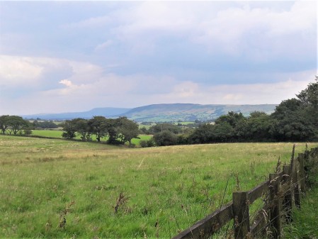
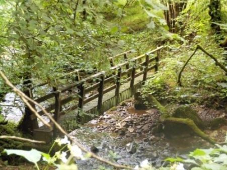
Day 6. French walkers. Each day I get out for a short walk, often before breakfast. My favourite is up the garden into the woods and then back down The Combe de Filhol. Today I extend my walk around the Orienteering Course in the woods across the way. I come across a group of French walkers, holidaying in the area, marching along with a map. Normally I see no one but today as I zigzag about I bump into the same group several times, they look a little uneasy as I keep appearing from the undergrowth.

Day 7. Hints of autumn.  On my walks I started noticing fungi pushing through the undergrowth. Unfortunately they looked poisonous, On the other hand, the mirabelles, small plums, were prolific and once stewed provided many delicious desserts with yoghurt or ice cream.

Day 8. All change. I take mine hosts back to the airport and await the arrival of my family group. They are quickly through passport control, how will this be next year after Brexit?   I drive them back with a short coffee break in Isseagac, a charming Bastide town.

Day 9. Garden games. A lot of time was taken up with games in the garden. Boules, table tennis, french cricket, croquet etc. The competitive spirit was well demonstrated in croquet where some most unfriendly manoeuvers were taken.

Day 10. On the bike. For some of my longer excursions, I took one of the bikes with me but ended up walking as much as riding due to the terrain and the bike’s gears’ obstinacy. One of my favourite trips which I hadn’t made for some time was over the hills to St. Martin le Redon in the Theze valley. Firstly over to Touzac then over the river Lot on a splendid metal bridge. Near here is a good swimming spot in the slow running river, popular in the heatwave, One of the GR routes is joined to go over another group of hills down into the Theze valley. St. Martin is a sleepy village but has gained a little cafe since I was last here; a welcome addition. In the valley is a string of limestone cliffs which I often climbed on in happier times. Hilly tracks take me over to Duravel and slowly back to the house.

Day 11. More exercise. As if last weeks exercises hadn’t been enough my own family started on more each day. Matthew and Lou’s seemed fairly casual but Sam was into serious workouts in between fast runs.

Day 12. Shush! there’s a deer in the garden. The orchard higher up the garden has numerous apple trees which drop their fruit at this time of year. It is a regular event for deer to visit the garden for this fruit and Alex spotted one tonight, well done; they don’t hang around long.

Day 13. Off to market. Sunday is market day at the nearby town of Montcuq.  There is a market somewhere every day but this one is very popular with locals and tourists. Every sort of stall [produce, clothing, antiques etc.] street entertainment and an interesting village to explore.

Day 14. The Poolman cometh. An ageing hippy drives up in his Morris Minor van, he has a collection of them, and cleans the pool.

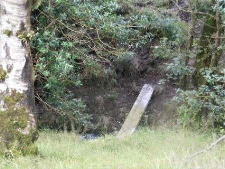
Day 15. Snakes and glow worms.

Day16. More pool activities.  The weather was perfect for relaxing in the pool. One of the challenges was to do a length on the banana,

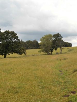
Day 17. Orienteering. In the woods I’ve set up a simple orienteering course. The family were keen to try it and being competitive split into two groups, I’ll call them the tortoises and the hares. They disappeared for an hour or so and needless to say the more careful tortoises came in first. This proved the hardest to find in a pile of stones in the middle of the trees…

Day 18. Eating in and out. We have mainly eaten at the house, two vegans to feed plus two picky ‘enfants’. Despite that, the family have eaten out at several local restaurants. Chips and salad is the best option for vegans in France. For a special occasion, I specifically booked the nearest place we could walk to. Le Caillau is a lovely courtyard restaurant with a reputation for good food. They told me they could cater for Vegans. My family appreciated the atmosphere and the food but I thought they could have been a little more creative with the seasonable vegetables, What have I missed out – wine tasting, Martignac with its Medieval church, lavoir and cazelle, Buzzards, Bastide towns, castles, mosquitos, kayaking and LOTS  more.

Day 19. Chez mois.  Je suis de retour a la maison maintenant, c’est l’Automne.   Que fait Boris?

AIREY HOUSES – PREFABS IN THE COUNTRY.

When I first moved to Longridge in the early seventies I remember pairs of Airey Houses scattered about on country lanes. I thought nothing about them except they looked very utilitarian, which in fact they were. Over the years most of the ones I knew have been transformed into modern properties by sensitive and hopefully efficient conversions. I passed two of these updated Airey Houses on Ford Lane whilst walking to Beacon Fell the other day…

That set me thinking on the origins of  Airey Houses.                                                                      They were in fact named after Sir Edwin Airey who designed them at the Ministry of Works after the Second World War when affordable housing was urgently needed. Basically, a frame of prefabricated concrete reinforced with steel recycled from military vehicles.  Concrete shiplap panels were then added to the exterior making them instantly recognisable. They were quick to erect on site but difficult to heat because of the poor thermal properties of the concrete. Approximately 26000 prefabricated Airey houses were built in the UK.

The three-bedroom semi-detached properties were built in rural areas, including Grimsargh and Goosnargh in the late 1940s and early 50s. They were council-owned but presumably many were privately acquired through the ‘right to buy ‘ scheme.

Here are some more local ones in various reincarnations…

There are more to discover around the area.

BEACON FELL FOR LUNCH!

I can see the tree-covered summit of Beacon Fell from home [photo above], only just as new houses spring up. Last night I thought it a good idea to walk from home up to Beacon Fell, have lunch in their excellent cafe and walk home again, The Grand Old Duke of York comes to mind.

This is a regular walk and I don’t need a map, which is fortuitous as I didn’t take one.  I rely on my phone for local mapping. This route to Beacon Fell is the one I use for the start of my Longridge Skyline Walk, LSW.  I faffed about this morning with various things, one of which was my camera’s lens cover which keeps getting stuck. WD 40 may not have been the best idea but I tried it and realised that it would take some time to clear itself. So I leave the camera at home and use my phone for pictures.  It was 11am when I left my house and bumped into a neighbour. He is used to my eccentricities and enquired where I was going  – “Beacon Fell for lunch”  “Oh!” was all he could say.

The fields were high in summer growth and at every stile I was faced with a barrier of nettles, brambles, Balsam and that sticky plant. I spent a lot of time bashing down the undergrowth. Shorts were not the best idea.  I was getting nowhere and becoming increasingly hot and sweaty.

Worse was to come when I reached what were previously open fields but now were transformed into parcels of equestrian land, paddocks I suppose, by electric fences. Large fields with footpaths and open access were now a no-go zone.  I was fuming at the lack of thought for us humble walkers. This was more like an obstacle course than a rural wander. After limbo dancing under some live electric fences, I started to become rebellious detaching the wire where I could, they were live! Knowing I was on a Right of Way  I ploughed through, Sir Hugh will understand. The last obstacle to a bridge was dealt with and I was on someone else’s land. On a serious note, I will be reporting this blatant obstruction of footpaths to Lancs County Council once the dust has settled using their excellent MARIO web site.

By the time I reached the fishing lakes at Horns Reservoir I was well behind schedule. I thought of curtailing the day, but no my obstinacy carried me forward. Exiting the field by the narrow Right of Way was impossible but I knew a way around. Later exchanging pleasantries with the landowner I couldn’t come to say “why don’t you clear the footpath?”  Writing this now I feel I should ride out there tomorrow and ask him.

Things improved and I made good progress through well-known fields. Lovely green grass hid a hare which set off at speed when I approached.  I was impressed at a stile where not only was the correct signage clear but there was also a small map showing the Rights of Way in the surrounding area. Brilliant. I can never understand why some farmers make it difficult to cross their land – why not sign the way and be done with us.

So much more helpful than ….A barn at Whinneyclough had some unusual, obviously historic, features and I was caught trying to get some close-up photos. Note the finials on the roof, the covered mullioned window and the dated door. The owner seemed insensible to my curiosity. The nearby farmhouse is also of architectural interest but was out of bounds.

On through the golf course where the trees have matured in the years I’ve been coming here. Nobody seemed to be playing at the moment. There were signs indicating ‘footgolf’ –  whatever next.

The diversion around Fir Trees Farm seems less irritating as the years go by. I still have no faith in the Planning  Authorities who allow it. The brick fronted farmhouse is Grade II listed.

Well trodden paths through Higher Barker and the burgeoning complex at the former  Cross Keys Inn.  When I first moved to this area this was a favourite place to drink, pre breathalysers, with the beer being served in the farm parlour. The way onwards is always boggy, you will be cursing me if following this route. But now Beacon Fell is there above. A couple of awkward fields and then a long traverse of green pasture brings me out on the road at Crombleholme where there is an impressive C17th house, today splendid with its colourful garden.

Up to the fields and into the woods and suddenly I’m in the main carpark of Beacon Fell. There are people everywhere enjoying the summer sunshine. I present myself at the cafe counter sweaty and dishevelled, probably the only person to arrive here under his own steam. The tea and sandwiches are perfect as I sit at one of the outside tables and watch humanity. Curiously I didn’t take any photos, battery running low but this what it was like.

Aa I didn’t visit the summit, it was all downhill to home. Away from the crowds the paths are eerily quiet. Concessionary paths have been established down to Carwags where a quiet road takes you onwards. Views open to Parlick behind and to Pendle and Longridge Fell ahead. by now my phone was running out of juice hence few photos and no map to follow. An even more rural lane with grass down the middle comes out at Loud Higher Bridge.

I follow the infant River Loud through fields some of which may be trespassing, no map remember, but I eventually come out at a deserted Loudscales Farm. I  know the way home from here. up the lane to the road and down to a junction of paths. Take the middle one up to Withinreap Farm, pass the ‘figure of eight’ ponds and arrive at Lancaster Farm where fields lead to Higher House Farm. From here there are more views to Beacon Fell, the Bowland Fells.

The football match down the road is notable for its spectators’ foul language drifting across the town. Welcome home. It is five o’clock when I turn down my road with a knowing nod to that neighbour.

*****


A RURAL RAMBLE FROM BASHALL EAVES.

28 years ago I remember a footpath above the River Hodder coming to an abrupt stop where a bridge was falling down. My son Chris and I were on a backpacking trip around the old Lancashire boundary. We had left Mossley, East of Manchester, and worked our way through high Pennine country, Pendle, Ribble Valley, and now we were heading north through Bowland towards Arnside. After getting through the no access, closed and danger barriers we balanced precariously across crumbling masonry high above a stream and carried on our way. Do I have a photo somewhere of that day?  I often wondered what happened to that bridge above Mill Brook. Today I set off to find out.

I parked next to the village hall in Bashall Eaves and set off along a farm track to Mason Green Farm. This turned out to be one of those almost industrial sized complexes. By chance I found a way around it and across fields, full of cows, in the right direction towards Agden Farm which seemed to be a Land Rover hospital. Numerous varieties of the marque were lined up in various states of repair, from a barn there were sounds of restoration.

The overgrown path dropped into a gully, the first of many today, and climbed out steeply on recently installed steps. Somebody must come here. I was now in pastures surrounded by all the familiar fells, Pendle, Longridge Fell and the Fairsnape group. I disturbed a few deer as I dropped into the next gully in Paper Mill Woods. This steep and rather slippery descent took me onto the banks of the River Hodder, full from the last few days’ rain. This is about the only access to the Hodder between Doeford Bridge upstream to Higher Hodder Bridge below. It makes me think that I must be on The Hodder Way a route devised by Clitheroe Ramblers and one I walked in recent times – I have no recollection of this demanding stage.  There was no bridge across the stream but it was no problem to hop across.

Climbing away from the river I pass three magnificent oaks. In the next field of long grass, my only objective is an ash tree on the horizon. Then it is down once more into woods and a difficult descent of a bluff to reach that bridge from years ago, now converted to a wooden structure spanning the stone abutments. There are references to Roman times but I think that is unlikely even though they passed by quite closely. This is a deep ravine, Mill Brook, and the new wooden bridge, rebuilt in 1997, is more impressive than in the photo.

A vague path climbed up through the woods to emerge into fields with open views of the fells. These were crossed and a final dip overcome to reach a track which follows a Roman road, Ribchester to Kirkby Lonsdale. It had taken me two hours to cover three miles and I was ready for a break and a snack.

Onwards I followed the lane to Lees House Farm, now supporting several developments. It’s called diversification. Steep paths lead down to a stream, Mill Brook once again.  Coming up the other side into an overgrown field was not easy if there was a path I didn’t find it.

From here to Micklehurst Farm was straightforward though I managed to herd a lot of sheep in front of me. This morning it had been all cows and now sheep everywhere. Barking dogs, thankfully chained, followed my progress through the farmyard. I’ve passed the road end to Micklehurst Farm many times, I think they are distant relations,  I never realised how far off the road they are.

On the corner is one of the entrances to Browsholme Hall, South Lodge, I sneaked a photo of the gatehouse and cottage.

Now I was onto little-used roads through woodlands some of which are described as nature reserves. I met a couple leisurely ambling down the lane, they had been out birdwatching.

Further on an old Alvis Speed was parked up. It was in fantastic condition. The owner working in a field nearby was obviously proud of the vehicle,1932,  – “all original bodywork”. He admitted that the engine wasn’t firing correctly, hence the bonnet was up for tinkering.

I continued down the lane to reach Saddle Bridge which I mentioned in a recent post.  It is always good to look at things from a different angle and I can’t resist a photo of a packhorse bridge.

Returning up the path, Rugglesmire is passed, I trespassed a little to try and see the grade II farmhouse.

Into the hamlet of Bashall Eaves, a few cottages with evocative names – The Old School House, The Vicarage, The Old Forge, The Post Office etc.

The Old Forge.

There is also an old Lancashire Cheese press.

Just down the lane is The Red Pump, now a thriving inn/restaurant, but it has a dark history. In 1934 a farmer, Jim Dawson, was shot whilst walking home from the Edisford Bridge Inn at Clitheroe and died later of his wounds. Investigations were hampered by a “wall of silence” from the villagers and the mystery has never been solved. There is talk of ghosts…..

I usually show a map of my wanderings below and I would suggest that any local readers of my posts try this unknown area. The first half of the walk is particularly scenic and interesting – the best of rural Lancashire, and the paths could with a bit more footfall.

*****


A HISTORICAL FOLLOW-UP – AROUND WADDINGTON.

A comment from Sir Hugh on my last post, – ‘You seem to have an endless supply of walks full of historical interest.’ made me realise that there is so much history embedded in walking the rural ways of Lancashire. I was intrigued by the part played by Henry VI in the War of the Roses and his subsequent hiding out in our part of Lancashire, the internet giving a version of history at your fingertips. Having been in safekeeping at Bolton Hall, Bolton-by-Bowland he escapes to Waddington Hall. Whilst staying here in 1465 he is betrayed and the Yorkist Talbots from Bashall Hall come after him but he manages to escape down secret stairs only to be caught at the Hipping [Stepping] Stones over the Ribble at Brungerley. He ended up in the Tower of London. So there are quite a few places to visit on today’s walk.

When I parked up on the lane at  Backridge there was mist in the Ribble Valley, Pendle was hiding but the castle in Clitheroe was visible. That was where I was heading and a clear path was discernible through the grass so without any thought or effort I’d arrived at Edisford Bridge and its eponymous Inn.

Tucked away behind a hedge is Edisford Hall of which I was previously unaware and today unable to get a good view of. The hall was apparently the site of a leper colony back in the 13thC. More history denied to the majority, the rich and powerful tend to keep their wealth and property hidden. I cannot deny them their privacy though, an ongoing theme in this post.

Edisford Bridge is medieval and the original ribs can be seen under some of the arches. The inscription on the parapet reminds one of the previous boundaries. The surrounding fields were the scene of a vicious battle [they all were] 900 years ago, but today all was tranquil with holidaymakers enjoying the sunshine on the banks of the Ribble.

I always find the route of the Ribble Way difficult to follow through this edge of Clitheroe. There are open spaces [for how long] but nothing is waymarked, then you are passing old cottages before being sucked into a modern housing estate, the likes of Kingfisher Way and Heron Mews.    Out past allotments the river is gained and followed to Brungerley. Last night’s thunderstorms had put more power into the water at a weir. Across from here one could see on the far bank Waddow Hall, idyllically situated above the river. An old house built in Tudor times by the Tempest family but modified by Jacobean additions.

Further on a family were preparing for a roasting and hi jinks in the river just before the bridge – ‘Brits on holiday’. Hottest day of the year?

Brungerley Bridge was built in the early 19th C, It was at the stepping stones here in the past that King Henry VI was captured. A steep stile climbs onto it, now with the obligatory safety rail.

Over the bridge a path is found into the grounds of Waddow Hall, unfortunately it goes round the back of the buildings. Waddow was bought by the Girl Guides Association in 1928 and it keeps its secrets well hidden, but not their exciting climbing tower which I sneaked a blurry picture of, sorry.

Coming out of the grounds a quiet road winds into Waddington 3/4 mile away. I know this village fairly well from eating in the three public houses and wandering around the church. The main street has a stream running down the middle with attractive and well-kept memorial gardens. For a short time in 1990 it became Granada’s “The Television Village” with its own broadcasts from the village hall.

I knew nothing of Waddington Hall, hidden behind high walls in the centre of the village, its origins going back to the 12thC. It was restored in 1901 by the Waddington family. It was here Henry VI attempted to escape from Yorkist followers.

Up the road is a long-standing café with an unusual frontage of metal posts, their famous pies were cooling off in the kitchen window – another time.

The prominent church is unusually dedicated to St. Helen. the tower is the oldest part from 1501. Inside there are some intricate wooden details. Nearby are the village stocks.

But by now the Lower Buck Inn was beckoning, and I succumbed to a pint of the finest Bowland Brewery’s Blonde Ale. They even allowed me to eat my own sandwiches in the beer garden. This is a great traditional village inn run by the same family for years. Try it sometime, even the dogs have their own brew.

Refreshed I found a hidden path, undoubtedly ancient judging by the clapper bridge, leading out of the village and into open fields with views opening up of Pendle, down to the Ribble Valley at Whalley and round to Longridge Fell. I passed in front of the impressive Colthurst Hall for which I can find no information, although there is A King Henry’s Grove nearby on the map.

An old bridleway leaving the road at Braddup House, Whinny Lane, was marked on the map and I decided to follow it up the fell to an area I hadn’t been to for ages. This was at the base of Waddington Fell which I had explored whilst trying to link up paths for my Longridge Skyline Walk, LSW.  It was good to be out in the high country again and I followed that route all the way back to Backridge.

Up here I was surrounded by hills, Waddington Fell, Pendle and Longridge Fell all felt within touching distance, time for a panoramic shot including all three.

On the way back I passed Talbot Bridge with its date stone obliterated by moss and age. 

The house above the bridge was originally a pub, The Woolpack giving an idea of the passing trade. Next door a Swiss-like house has appeared since my last visit, very twee.

My next point of call was the more graceful Saddle Bridge, 17thC but rebuilt last century, over Bashall Beck which has come down from Talbot Bridge. This packhorse bridge is also known as Fairy Bridge from a local legend.

Soon I was on a familiar track passing the intriguing Bashall Hall. This extensive building dates from the 16thC but has had many changes since in different stiles. It hides behind high garden walls but I managed a few more views today.  

It was from this house that the Talbots set out to capture King Henry VI. So I’ve come full circle on what has been an outstanding walk for historical interest and the best Lancashire scenery.

*****

HISTORIC BOLTON-BY-BOWLAND.


A rambling afternoon.

The village of Bolton-by-Bowland lies in the SE of The Forest of Bowland bordering onto the Ribble Valley.  Until 1974 it was part of the West Riding of Yorkshire and indeed the surrounding area has a feel of the Yorkshire Dales, its history goes way back into medieval times. The Pudsay family were prominently involved with the village, its church and nearby Bolton Hall [demolished in the 1950s, more of that later.]

I started my walk today at the upper green with the Old Courthouse and village school.  [Frontispiece above]    Further up the lane I entered fields leading up and over to the hamlet of Fooden. There were mature parkland trees and here and there evidence, dykes, of old field patterns, these were quite common throughout today’s walk. As I crested the raise I was surprised to see dozens of men wandering the fields with metal detectors and little shovels, it turned out to be an organised group search. One find already was a diamond ring but they were mainly unearthing modern-day coins.

  Entering the small hamlet I met a lady resident excitedly trying to position a weather vein, incorporating a deer, bought at Tatton Garden Festival last week, on her property.  Her husband seemed long-suffering. The further conversation discussed the nearby Grade II* hall building, now empty after the owner died a couple of years ago, its adjacent sulphur spa and the attractive Grade II* cottage with dovecote across the way. By the time I’d finished exploring the weather vain was up and running. What a delightful place to live.

I found a path leading above the River Ribble. Below out of sight was the limestone Rainsber Scar, named in one section Pudsay’s Leap where allegedly a 16thC William Pudsay [from Bolton Hall] leapt on his horse to avoid capture for forging his own silver coins. I did see a herd of Deer on the far bank which judging by their spots may have been Sika.

I was heading for Bolton Mews the remains of Bolton Hall estate converted into private dwellings. One historical note is that King Henry VIth stayed here with Sir Ralph in 1464 at the time of the War of the Roses. Apparently, his divining skills discovered a spring now preserved as King Henry’s Well. Most of the estate is now out of bounds but the covered well can be seen over a wall.

Having circumvented the grounds of the hall I dropped down to cross a footbridge at an old ford on Skirden Beck.  The fields further on to the next footbridge were impassible with maize so I took a short cut fording the low Holden Beck to climb up to the road directly in front of Bolton Peel. This is another interesting house, 17th century with mullioned windows and a fine porch. In front of the building is a preaching cross. The base is ancient, one of four in the area, but the cross is 19th C. The Peel family were early Lancashire industrialists and gave the country a PM in 1841, we are getting a new one tomorrow!

After a fraught but thankfully short stretch on the busy road a fingerpost pointed me into fields leading to the not so historic Hague Farm. I had a friendly, if noisy, greeting from their labrador. Upwards to Rodhill Gate where I joined a sunken bridleway, an old drove lane,  going steeply up the hill. At the top views broke out of a moody Pendle Hill, the Yorkshire hills towards Skipton and to the north Craven Hills with Pen-y-Ghent proudly in the distance. A splendid spot for a late lunch.

A beeline through fields led to Lower Laithe, an isolated barn. Then it was down into the hamlet of Holden. Braxup House was outstanding with its date stone and unique Yorkshire upper windows.

Across the road was the busy Holden Clough Nursery. I frequently visited here when establishing my own garden 40years ago, what a different place then with the owner Peter Foley searching chaotic nursery beds for a plant of your choice,  Now all is changed, son John has revitalised the nursery into a ‘garden centre’ but still with an emphasis on plants. I had no money on me for a cuppa in their cafe.

A strange narrow stepped stile in a wall leads out of the village. I’m heading for 17thC Hungrill farm across the fields. On arrival, the nearby barn conversion takes my attention. A forded lane takes one into a large garden area in front of the impressive building. Several expensive cars litter the forecourt. Obviously private grounds not for me. I slink around the back on a stony track. This leads to fields with no obvious path or waymarks. I think I was distracted by all the wealth on show that I wandered into the wrong fields, waded into small streams, climbed barbed wire fences before coming out onto a road. A right ramble.

Unexpectedly in front of me was a gate leading into a field by the Skirden Beck running down inro B-by-B at the bridge where I was relieved to arrive back unscathed.

I still had time to look around the village at its fine houses and lower green with a stone cross.

Higher was the parish church of St. Peter and St. Paul, rebuilt in the 15th century by Ralph Pudsay. Inside I knew was a remarkable memorial stone to Sir Ralph, a large slab of limestone engraved with images of himself. three wives and twenty-five children!

That was a well-spent afternoon with some lovely buildings to be viewed as well as the surrounding scenery. I was surprised at the underuse of footpaths in a popular area with good waymarking on the whole.

*****


NORTHING 438. HORSFORTH TO BARWICK IN ELMET.

It would be a challenge to find green footpaths across the north of Leeds so we ate a hearty breakfast. If we weren’t doggedly following SD38 we could have used the waymarked Leeds Country Way which skirts northern Leeds. Away at 9am the morning was cool but promised a clear day. Within a street or two of our hotel we entered Meanwood Park for an interesting mile of varied park and woodland – what a good start to the day. Even the incursion into strange David Lloyd territory gave us open access across a park into Moortown where we watched but failed to photo a low flying Red Kite, what a magnificent bird – how can people shoot them out of the skies?

Meanwood Park.

Anyone for the gym?

Blackthorn in profusion.

Our next aim was Roundhay Park and we had no option but to take to the pavements weaving through quiet streets.

Classic walking territory.

The park was busy with families enjoying the warm sunshine and open spaces. Our first priority was a coffee at the Mansion House overlooking the park. A stroll through the grass down to the lower lake, here we left the crowds and climbed up through the woods to cross Leeds Golf Course out onto a lane by Cobble Hall.

Grand entry to Roundhay Park.

Expensive coffee break.

Looking back at the Mansion.


Across another busy road was an industrial area where we thought we may be able to creep through to Red Hall, but no such luck new building is in progress and the whole area fenced and gated. We stood around wondering about some form of trespass when only 10yds away was a signed permissive path going in our direction. We skipped along pleased with our SD38 fortune and came out the other side en route.

No way …

… but how lucky are we?

A mile and a half straight rural road looked promising on the map but turned out to be the highway from hell, our worst section of the whole trip, I suspect it was a short cut out to the A1[M].

With relief we found a footpath, time for lunch and some peace and quiet. The scenery changed becoming rolling open fields, the start of the Wolds. Our destination was Barwick in Elmet a busy little village with a cross, the largest maypole I’ve ever seen [26m], a few good-looking pubs and more importantly a bus stop to Leeds.

Barwick in Elmet.

Leeds centre on a Saturday was all a buzz and we were glad to catch the crowded train back to Skipton. Two excellent days walking across the Bradford – Leeds corridor on surprisingly green paths.  We are now over halfway across our 438 line and looking forward to rural walking to the coast.

*****

NORTHING 438. SALTAIRE TO HORSFORTH [LEEDS]

What could have been an uninspiring day in the hinterland of Bradford and Leeds turned out to be almost a green corridor of pleasant walking. It was not difficult to keep close to our lateral line with the proviso from Sir Hugh to incorporate a visit to his primary school in Thackley.

From the rail station in Saltaire we quickly reached the Leeds – Liverpool Canal to follow it off and on throughout the morning. At first all was industrial, historically relating to the canal with some fine mill buildings brought into the 21st century.

There were a few scattered sculptures including this one which was a pun on the Salt Mill connection…Hanging on the wall of my garage is an Ellis-Briggs cycle frame, probably 40years old, so I was delighted to pass their establishment which has been building steel frames since 1936. The cycling scene was booming in the 1930’s and the other notable established builder was W.R. Baines, whose factory was based at Thackley, see above and further into the walk. Coincidentally I rode a 1950’s Baines ‘Flying Gate’ cycle for many years.


Some nondescript scenery followed enlivened by some dubious and unsuccessful canal boat manoeuvering, it is difficult to do a three point turn.

Climbing away from the canal on cobbled paths above railway tunnels we entered Thackley, a mixture of old stone houses and modern estates, and found Sir Hugh’s school still open and extended since his time. Up here was the local cricket club with a very challenging sloping pitch, Sir Hugh’s father had been a member.

From the map we were not sure whether we could access the canal towpath from open country but thankfully there was a bridge. Soon we were sat on a bench looking down locks near Apperley Bridge, this was a busy stretch with pedestrians but no boat movements.Crossing busy orbital roads took time unless there were lights. We switched from the canal to follow the River Aire alongside the sports grounds of Woodhouse Grove School. The river continued through remarkably rural scenery despite being close to the railway and new housing developments.

Pleasant suburbs gave us twisting streets heading for Hawksworth Park which turned out to be a wooded valley. More parkland and upmarket housing and we arrived at our excellent budget hotel for the night.

*****

NORTHING 438. OLDFIELD TO SALTAIRE.

There were several unexpected highlights on today’s walk and despite heading into the congested Aire Valley we enjoyed rural walking throughout on one of the warmest sunniest February days I remember.

Continuing our straight line walk meant once again logistics of two car parking. Sir Hugh suggested Saltaire as a finishing point so we arranged a rendezvous in the large free car park there, all went well with my journey until I became stuck in early rush hour traffic, not the best of starts for a day’s walking. With the late start and more traffic problems we drove back to our last point in the Ponden Valley.  Sir Hugh seemed to know all these intricate Pennine roads and little villages or at least the lonely Public Houses where he spent his money when living in the area as a young man. We were stunned when the lane up to our isolated parking spot was closed necessitating back tracking and finding an alternative route on what was becoming a frustrating morning.

At last we set off down a bridleway high above Ponden Reservoir only for Sir Hugh to realise he’d left his phone on the car, fortunately we hadn’t gone far. This initiated a conversation on things left behind on walks and the cut off distance where one is prepared or able to return. Poles, passports, waterproofs, cameras and particularly hats were prominent on the list. We ran into problems with unmarked, difficult to follow and blocked paths in the Oldfield area and at West House farm admitted defeat and took to the road for a while. None the less there were many interesting houses passed.

High above Ponden Reservoir.

Before he’d realised his loss.

We were concerned with our poor progress after the delayed start on what would be a long day but as often happens things suddenly improved and remained so all day. We encountered a deep gorge not apparent on the map and decided to take the old flagged path alongside down to the River Worth which was then followed for a mile or so through green fields. We reached a road at an old mill that had been restored to provide modern living accommodation. There were several pack horse type bridges on this stretch reflecting the days when the valley was thriving with small riverside mills.

On the edge of Haworth I had noticed on the map a ‘Railway Children’s Walk’. The Railway Children by Edith Nesbit, published in 1906, was set in Yorkshire and a 1970 film used The Keighley and Worth Valley Railway as a backdrop. I remember watching a BBC TV series back in the 50s. Thus Haworth’s tourism benefits from both the Bronte connection and the preserved steam railway.  We followed the lane across the Mytholmes railway tunnel made famous in the film …

… I regret now not going the extra few hundred yards to view the authentic Oakworth station featured prominently in the film. No trains today so we climbed up the steep hill to the busy Cross Roads and would you believe it – halfway up a steam train came into view way below us in the valley, bad timing. Up on the road the stone houses all bore that blackened look of the industrial past.

At Barcroft we reached high open countryside and enjoyed marching out with distant views to Bingley. In the fore ground was a prominent rocky tor, Catstones, and we speculated on the climbing possibilities and the height of the faces.

A bench below was perfect for lunch, I didn’t have the energy to ascend to the rocks. An inscription was dedicated to a Cllr. Ron Senior who pioneered a circular walk around Cullingworth, Senior Way. We felt well qualified to follow it.

We ended up just using the pavement through Harden but then entered St.Ives country park for a popular woodland walk to the edge of Bingley. The park is yet another old estate taken into council ownership providing a wide range of activities, we only skirted the edge.

A lane dropped down to bridges and fords at Beck Foot, a site of old mills, all very picturesque in the sun. An ecyclist proudly showed us his bike and extolled the virtues of battery powered leisure, not sure what it is doing for his fitness.

The River Aire, on its way into the industrial Leeds, was followed through fields to give another aspect to this day’s walk. Surprisingly rural although there was rubbish evident. A last stretch of woodland linked to the Leeds Liverpool Canal which took us into the heart of Salts Mill at Saltaire. Formerly a textile mill, now an arts centre, built by the philanthropic Sir Titus Salt in 1853, along with the adjoining Saltaire village in the hope of improving the conditions for working people. The whole complex is worthy of a day’s exploration. We found our car as the sun was setting and joined the heavy traffic home.

*****

NORTHING 438. BARROW TO NELSON.

We are out walking our Northing 438 line again. A lane leads steeply out of Barrow through mainly new housing, ribbon development if ever I saw it. Crossing the busy A59 we continued climbing into Wiswell, an interesting little hamlet with a famous gastropub. A van was delivering organic vegetables to houses, one of these expensive subscription ideas where you probably finish each week with a box still full of potatoes and carrots. From here the route became moorland onto a ridge which was really an outlier of Pendle Fell, the mast marked on the map seems to have disappeared. We had climbed 500ft in a mile and were beginning to steam in the mild weather. Sabden could be seen in the distance. Below us was the large hidden valley of Sabden Brook and we slowly made our way down to pick up tracks into the village. I mentioned the famous Sabden Treacle Mines of which Sir Hugh had no knowledge, sadly they are no more and I will leave those with curiosity to investigate. We followed lanes to the 19th-century church and then out past a farm from where a pipe led into the fields. This pipe actually came out of the midden slurry tank and snaked into the fields, a tractor pump was starting up to inflate the pipe which we followed almost hypnotically for several fields. Eventually, the pipe seemed to connect up with another tractor with spreading machinery, but nothing happened. By now we realised we were off track so diverted back onto a rough farm road. This led to the 16th century Dean Farm with its wonderful mullioned windows and incongruous 19th-century extension.  Muddy fields and rough reedy grass below the ridge of the so-called Forest Of Pendle led us to lunch on the wall of Tinedale House. A climb onto the grandly named Rigg of England which was mainly equestrian farms. Up here were good views back to the massive bulk of Pendle and across to Newchurch in Pendle which we had visited on The Lancashire Witches Walk. Below to the south was the industrial Burnley – Nelson – Colne corridor. It didn’t look too bad from up here. Ancient tracks down the hillside brought us into Fence alongside the White Swan pub where I recalled a seasonal wild garlic meal.  Where do these memories unexpectedly come from?

We made a mistake in trying to follow footpaths parallel with the busy road, we were hemmed in by unnecessary plastic ‘hedging’ on the boundary of more equestrian enclosures. Escaping eventually into a large graveyard, where we were surprised by the number of Muslim graves. We started dropping down into the valley alongside a small beck. Surprisingly green paths led us into the heart of the Lomeshaye Industrial Estate. At the large Wellocks complex we enquired what  ‘The perfect ingredient‘ was but unfortunately only Polish was spoken. Subsequently, we discovered that it was a high-end food distribution firm to the restaurant trade founded originally by a potato merchant whom Sir Hugh had known from his Yorkshire days. It was pleasant to enter Nelson through Victoria Park with its bandstand and paths alongside Pendle Water.

Under the motorway, over the canal and then a steep road heading up into Nelson town centre where we found the modern bus station which gave us a busy ride back to Barrow.

*****


A MISTY BEACON FELL.

Normally I can see Beacon Fell from my house – but not this morning. A freezing mist hung over the landscape. Not to be deterred I wanted to walk up there and back, in deference to the weather and my late start I took the car some part way. I know these footpaths well as I often do this walk or a variation, it is in fact the first section of my Longridge Skyline Walk.

The snow was disappearing from the fields as I set off. Soon I was walking through the first of several developments where an original farmhouse with its surrounding barns has morphed into an expensive looking ‘hamlet’. This one is based around Higher Barker.

Familiar field paths [I didn’t need a map today] lead to the Cross Keys Inn where holiday type units have been built around the site, none ready for occupation in what is a speculative development. The Cross Keys was a farm-cum-basic pub run by brothers and known affectionately and ironically by locals as The Dorchester. What of its future?

The lane ahead is always soggy and today was no exception. I could hear a woodpecker in the trees of Whitechapel.

The sun was trying to break through the mist as I crossed fields to Crombleholme Fold another group of houses old and new. The sheep were surprised to see me emerging from the gloom.

Still no view of Beacon Fell which I knew was looming up above me.  The trees were soon reached and as I entered them a small herd of Roe Deer passed in front of me seconds after taking this picture.

The car park at the visitor centre was virtually empty and I was the only one in the cafe where I enjoyed a good coffee. To reach the summit I followed the latest version of the walking snake, this one is expertly crafted from stone so should be more durable than the previous wooden sculpture.

I had the summit to myself with tantalising glimpses of Parlick and Fairsnape Fells through the mists.

A newish path, there are many since the storms of last year, and a concessionary bridleway through deciduos plantings took me out of the park.

A field footpath led me down to the fishing lake/holiday homes of Woodfold, another development which seems to be enlarging every time I pass this way. Do these places go under the planning radar?

My next aim was Barnsfold Farm environs where more sympathetic conversions were carried out decades ago.

Then it was muddy fields to Bullsnape Hall and back to my car just as the sun finally burst through. The final stile was a challenge.

An enjoyable day from nothing.

*****

NORTHING 438. SINGLETON TO INSKIP.

The night before I arrange with Sir Hugh where to meet up for our next stretch along northing 438 . I’m sat waiting at New Hall whilst he is sat waiting at Cuddy Hill a mile and a half away, a misunderstanding compounded by the wrong mobile numbers. Red faces and ‘mea culpa’ all round. Once communications are re-established we drive to Singleton to start walking later than we had planned. By now there is a glimpse of sunshine.

Singleton is an interesting village with an old PO, several lodges and halls, picturesque cottages, a fire engine shed and a Parish Church. The estate was developed from 1853 onwards by the Miller family, wealthy cotton manufacturers working with the Horrocks family in Preston. The estate is now held in trust and appears well maintained. There are permissive paths through the estate but we lack the maps to use them.

At Singleton Hall’s South Lodge the original gates bear the initials of Thomas Horrocks Miller and on the gate posts ‘Demi Wolves’ taken from the Miller coat of arms.

The old PO.

Lodge gates.

A Demi Wolf.

The timber-framed fire engine house is nearby, it has decorated plastered walls and a louvred bell tower. The engine was horse-drawn and before a fire could be attended the horse had to be rounded up in the adjacent field. 

Estate cottages lined the lane and worshippers were leaving the church as we passed.

Thistleton, Elswick and Inskip villages were visited in turn. Not far off is the site of Cuadrilla’s controversial fracking wells and the local feeling is demonstrated by all the anti posters.

Does fracking cause earthquakes?

Todays walking was easy through fields but we lost count of the high awkward styles and muddy farm tracks.

The farms we passed were a mixture of traditional working and modernised for rich commuters. The strangest was an old thatched cottage with a very modern residence built within yards of it. Strange, who would want to do that?

Everywhere were ponds, former marl pits, that look as though they are used for fishing and duck shooting.

Elswick is known for the Bond’s ice cream shop, now more of a restaurant.

Inskip is known for RNAS Inskip, a former forces base and airfield. It is now used as a military high-frequency radio transmitting station and the antennae can be seen for miles in this flat landscape.

The last farmyard was the worst for muck just before we reached the car. Jolly Japes.

Maybe you would be advised to read Sir Hugh’s account of the day. http://conradwalks.blogspot.com/

*****