Tag Archives: Flora and Fauna

PHEASANTS or PEASANTS.

There probably isn’t much difference in the eyes of the ultra shooters. The next massacre season is upon us.

Is this really happening in Britain today? I’m not eloquent enough to highlight the outrage felt by many, an increasing minority/majority. But that doesn’t stop my emotional reaction.  So please read this article and question your next conservative candidate if they dare step up to your doorstep. Any other candidate for that matter to restore the balance.

Your humble peasant.

Britain’s pheasant shooting season has begun. And a year-round massacre makes it possible | George Monbiot | The Guardian

THE WRONG ROUTE.

DSC00511

Following on from my last post which described a half aborted climbing session, today we now have a walk that didn’t quite work out. I’m on a losing streak. Again I’m with Mike reconnoitring for walks he could lead with his monthly walking group.

Remember the stipulations  “should start at a place with toilets, not too much rough ascent, between three and four miles, the fewer stiles the better and finishing at a pub for lunch”  He thought he had found one in a book of short walks in Lancashire, I didn’t catch the title. This time on the outskirts of Blackburn, Pleasington in fact, incorporating Wainwright’s Memorial on Billinge Hill and the popular Witton Country Park. Sounded promising when he invited me to join him.

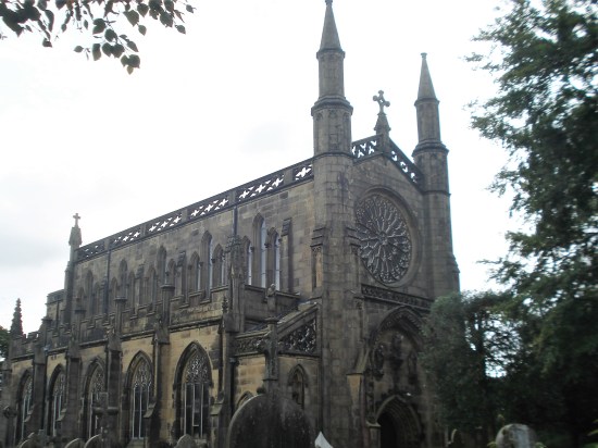
Things didn’t go well when we struggled to park near the Railway Inn, yes there is a station here for commuting into Preston or Blackburn. We eventually settled on roadside parking up the lane which wouldn’t be ideal. Shame that the nearby Butler’s Arms is closed. We set off, walking up the lane past the impressive Pleasington Priory. Pleasington Priory – Wikipedia We don’t even think to have a look inside, if it is open. DSC00478

Up a smaller lane past expensive building conversions to the gates of the Old Hall. DSC00483

A track goes left here, and we soon come to our next problem, a loose eroded bank leading to an awkward stile. Probably no go for those of his group not into mountaineering. I didn’t think to take a photo of the obstacle.

A wandering route through rough fields brings us out onto a lane I recognise from previous Witton Weaver Walks which we now follow up to the Yellow Hills, named from the abundant gorse that blooms up here – but not in September it seems. There are always a few people up here because of Wainwright’s Memorial plaque, a toposcope with a rather poor impression of Alfred in the centre. We gaze in all directions, but distant views are hazy, nevertheless a wonderful lookout. This ascent would have been better in reverse with the vista in front of you. Niggly. DSC00490

I never feel at ease through the next open field which always has cows and occasionally a bull. Today they all seemed very docile, perhaps it’s just my fears.

DSC00492Entering the woods of Billinge Hill we pay particular attention to the guide’s directions. There are paths everywhere up here, some I recognise, but mainly I am ‘lost’ blundering about in a hopeful direction. Using a bit of creative thinking we follow the steep and slippery paths down alonside a ravine. Mike is not happy, any of his group who may have made it this far would be now struggling. DSC00485DSC00493DSC00494DSC00497

We in turn struggle down to enter Witton Park and civilisation. Ice cream vans, car parks, sports pitches, dog walkers. DSC00498

We are lucky to have this rural expanse open to all on the edge of a major town. Witton Country Park covers 480 acres of countryside with pretty picnic spots, walks, nature trails, play areas, sports pitches and a visitor centre. The estate was once owned by the Feildens, a wealthy textile family, who built and lived in Witton House from 1800 and created the park at the same time. From 1900 the house was empty for long periods and during both world wars the house and estate were used by the army. Dry-rot set in. Witton House was demolished in 1952, after being sold to Blackburn Corporation in 1946 along with the estate. DSC00504

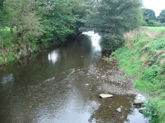
We join the crowds and follow the sluggish River Darwen down the valley to Butler’s Bridge. Now on a surprisingly busy road ahead are the gates leading to Pleasington Cemetery.  I’ve never ventured farther, but the notice board shows a vast complex of burial grounds. DSC00502

We divert to continue into the woods and up a sunken lane which eventually is captured by barbed wire into a most unfriendly narrow walkway back to the priory. DSC00508DSC00509

We have had 4 miles of exercise through an interesting environment. It took us for some reason three hours and Mike has ruled it out from his future itineraries.

Last year I did a similar, but better balanced walk , from Cicerone’s Walks In Lancashire, an excellent selection, which also took in Hoghton Bottoms in a seven-mile circuit.

Back to the drawing board for Mike.

***

 Witton (2)

A SHORT LOCAL STROLL.

DSC00427

I’m idly looking at the OS map for something new on my home ground. I’m only looking for a few gentle miles and I think I have spotted a footpath I’ve not knowingly been on before, however unlikely that seems. The weather is on the change, and it has been raining this morning, I bide my time until after lunch.

Being lazy I drive my car to the top of the village to start the walk rather than tramp the streets. There is parking next to Craig Y bouldering venue, part of the defunct Green Bank Quarry complex, The BMC secured Craig Y whilst the rest of the site has been developed into a housing estate. Passing through it is a bridleway leading to an ancient sunken lane, Written Stone Lane, did some of the quarried stone exit this way?  Today I wander down it coming out near the site of the Written Stone about which I’ve visited many times before and linked to   The Written Stone of Dilworth  for a detailed history. DSC00431DSC00436DSC00437

On across the road to go down a quiet lane to where my ‘new’ path should be found on the right. There is no sign, but I know I’m in the correct place. Ahead doesn’t look very inviting – farm buildings and all the usual associated junk. I wonder whether the way will be blocked, but no after having to open one gate styles start appearing in the field boundaries, although I doubt few come this way. In the fields there are several small ponds probably Marl Pits originally,they are teeming with Mallard families.DSC00439DSC00440DSC00441

DSC00442DSC00449

DSC00445

At one point a fishing lake has been created in Page Brook, here footpath signs are more evident taking you through and away from the private lake. All very civilised.DSC00446DSC00447DSC00448

I recognise Stonelands Farm in the distance from a different walk done three years ago. I am still none the wiser as to the origins of the carved stones, although the rounded one is definitely Roman. DSC00452DSC00457DSC00459

Crossing carefully the road on the bad bend by The Corporation Arms, one of many local pubs that did not survive lockdown and the continuing financial restraints. DSC00460

Soon off the busy road the Tan Yard track is taken back up into the quarries, what must Longridge have been like when they were all working. The caravan site is enlarging, and I notice some of the permanent vans have extensive views across the Ribble Valley – not a bad place to live. Pendle always manages to pop its head up. Himalayan Balsam is doing its best to obliterate the final stretch of path.DSC00462

DSC00465

DSC00469

The rain starts just as I arrive back at the car. That has been a pleasant afternoon’s outing, a new path found and plenty of interest along the way, all on the very edge of town. .

CaptureWritten Stone.

RECONNOITRING RODDLESWORTH RESERVOIRS.

DSC00418 (2)

Mike is looking for a walk for a group he leads from time to time. There are a few stipulations. It should start at a place with toilets, not too much rough ascent, between three and four miles, the fewer stiles the better and finishing at a pub for lunch. You can guess at the age of the audience he is catering for. After a bit of internet searching and my previous knowledge I come up with this outline suggestion. I know the area reasonably well as it is often a meeting up place with my friends from the Bolton area. The hottest day of the year forecast, maybe, a good day to be in the shade, so these woods could be ideal.

***

First some facts I learnt about the reservoirs…

Rake Brook Reservoir is fed by two streams, one being the  eponymous Rake Brook coming from Withnell Moor. It was constructed in the 1850s by a Thomas Hawksley for Liverpool Corporation Waterworks. The earth dam 85 ft tall and 1,490 ft long, with a capacity of 70 million gallons. A 3.75-mile channel called The Goit fed water through White Coppice into Anglezarke reservoir and hence into Rivington, from where a 17 mile pipe connected to Liverpool.

Lower Roddlesworth Reservoir was constructed at the same time as the above, again by Hawksley. Completed in 1857, 82ft high, 590ft wide holding 90 million gallons. It was fed by the River Roddlesworth coming down from Great Hill. This river subsequently ran into the…

Upper Roddlesworth Reservoir was completed if 1865. The earth dam 85 ft tall and 1,490 ft long, with a capacity of 70 million gallons.

***

CaptureAbbey.

***

We park opposite the Hare And Hounds pub in Dole Lane .which is already busy with cars, the area is very popular with dog walkers and fishermen. A walk that starts and finishes at a friendly pub. DSC00393DSC00424

Immediately the presence of the Victorian era is evident by the stately gates leading into the water board land, now United Utilities. They built things to last and to impress as will be seen in the engineering feats evidenced by the reservoirs. The proliferation of Himalayan Balsam is obvious from the start, it is getting worse by the year. Darwen Tower is seen in the hazy distance as we walk down the lane alongside the start of the Goit channel. Dropping down by an old waterboard cottage we cross the impressive outflow channel of the Lower Roddlesworth. I have never seen it so dry, it is usually a rushing curtain of water feeding the ongoing Roddlesworth Beck as it goes off to join the River Darwen. We are now looking across the lower reservoir’s dam, the surrounding area a forest of mixed woodland. Dogs are ‘unofficially’ paddling in the cooling waters. DSC00395DSC00396

DSC00397

DSC00398DSC00399

That may be one of the problems with these tracks – too many dogs, not too many ‘doggy poo bags’, but lots of dogs rushing to say hello to you. I have grown more mellow to well-behaved dogs in recent years (I am a Cat person, but I know cats can be equally threatening to others, but you are unlikely to be savaged) At least today the ground is dry so any over friendly dog doesn’t cover you in mud. To be honest most are on a lead and the others are docile and under control. The few cyclists we meet are also considerate.DSC00409DSC00406

We cross the dam and for most of the morning we just follow well-marked forest trails, most with a decent surface, but mud can be a problem. The plantations are a delight of old beech and oaks, interspersed in parts by mature pines probably planted when the reservoirs were being constructed. Coppicing of ash and hazel give some variety. I am saying to Mike that if his walk is done in Autumn the group will be rewarded with the rich colours as the trees head towards winter. Or there again come in Spring when all is a carpet of Bluebells.

DSC00405DSC00400

We climb steadily away from the reservoir on the main track, not too steep for his group’s needs and wide enough for the chatter that accompanies them. Down again to the Upper Reservoir dam where curious metal pencils act as a sieve to the overflow for any trees washed down in times of heavy rain. A small path shadows the edge of the water with some delightful picnic spots or just for stopping and perhaps meditating on the glory of it all. I’m sure the Victorians would have done that. DSC00402DSC00404

A bit more leg work takes one away from the water and into a long stretch in the trees. We have time to acknowledge the various dog varieties encountered, and occasionally to come into conversation with their owners. The turnaround point comes at a bridge crossing the River Roddlesworth. Time for a pause and rehydration, I did say it was the hottest day. As we rest dogs come and go, the most impressive being four generations of black and white collies.(only three caught on camera)DSC00410

If we had continued farther up we would have come to the ruins of Hollinshead Hall. It was demolished as the water board took over. I have visited it before and many of the old walls and gates are scattered around in the woods. But that is for another day.

Our path now leads through a rusty gate and follows the River Roddlesworth back down the valley. Not sure if I have walked this section before, but I’m impressed.  A deep rocky gorge with alternate waterfalls and quiet pools. Delightful even when the water level is low. The path we follow is obvious on the ground, even if not shown on the OS map, up and down on steps and boardwalks bringing us back to the upper reservoir. Turn left, and soon we are passing fishing stations out into the waters. The angling club car park is entered, but I’ve no idea how the road reached there. DSC00414DSC00413DSC00420

We are looking for a gap in the fence which should have us on an ongoing path, I think we find the right spot and continue on a manufactured but well maintained route , courtesy of United Utilities. Duck boards and bridges see us through and there on the right is the gracefully arched wooden bridge bringing us back to the Lower Reservoir dam. We know our way back from here. DSC00421DSC00422

We are soon sat in The Horse and Hounds enjoying a pint of ale, all in the purpose of research for Mike’s walk. DSC00394

Well it was the hottest day.


HALF A DECADE OF NOSTALGIA.

DSC00335

Yes, when I look back to 50 years ago I remember well the walks we took along the Lancaster canal with our two young sons. The youngest on my back and the other in a buggy pushed by my wife. Happy days. Somewhere I may even have photographic evidence.

I wait in this morning for the recovery company to arrive and take away my estate car to a garage, I know not where or even care, for remedial restoration.

Later looking for somewhere flat and easy to walk in this heat I recall those far off days and decide to revisit the canal in the Barton area, west of the A6 and combine it with a little farther exploration. Parking on the narrow roads, now much busier with traffic, doesn’t come easy.

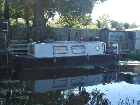
I eventually find a safe place near Moons Bridge Marina. I’m soon on the towpath which I remember as being very boggy a few winters’ ago. Today was all plain sailing, though that’s the last thing that some of the dilapidated barges moored alongside will be doing. DSC00353DSC00300

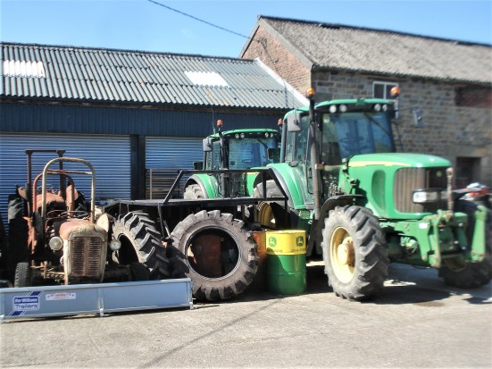
Leaving the canal at bridge 35 I take the lane leading to Bell Fold, an organic farm advertising free-range eggs, local honey and damsons. There didn’t seem to be an obvious shop, perhaps they were away for the day. As is common around farmyards there is an interesting collection of ancient and modern. Their collection of old tyres could grace The Tate. The ongoing lane must be one of the worst, I realise the muck I’m disappearing into is of animal origin rather than mud. I would imagine in winter it would be unpassable – very organic. Much, much worse than my photo portrays.  DSC00356

DSC00308DSC00309DSC00312DSC00313

I’m looking for footpaths alongside Barton Beck. The bright yellow markers made it easy to follow even though the ground showed little footfall. As everywhere Himalayan Balsam is taking over, but I do like the aroma, especially on a hot day like today. The water is a little sluggish, but I spot shoals of ?minnows. DSC00315DSC00318DSC00320

I leave the field via an ornate gate onto a lane alongside the extensive grounds of Hollowforth Hall, I always admired this property without knowing anything of its history. (It is in fact grade II listed, mainly mid C19th but based on a much older farm building) There were always noisy peacocks strutting around. Over the intervening 50 years since my early visits most of the surrounding barns have been upgraded into country residences. DSC00324DSC00321DSC00326

I didn’t know whether I could use the ongoing unclassified lane leading to Park Head, but there aren’t any ‘No Access’ signs, so I walk on to reach the canal bridge where I drop down onto the towpath for the peaceful return leg. DSC00328DSC00329DSC00330

DSC00332

The canal has a healthy growth of a small yellow flowering water lily. Dragon flies were flitting around, but I never seem to catch them stationary for a picture, have a look at this blog for how to capture wildlife.

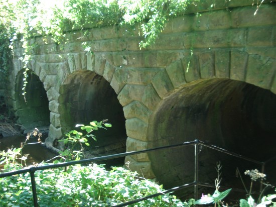
Along this stretch of canal one has a three arched aqueduct over Barton Brook as it winds through this rural Lancashire. I go down to explore and judging from the flood debris not a place to be after heavy rain. Farther on is an old swing bridge connecting farm tracks across the canal and then the extensive Moons Bridge Marina where I started.

DSC00336DSC00337DSC00343DSC00344

DSC00364DSC00360All pure nostalgia and a pleasant way to spend a lazy summer afternoon – reassuringly not much has changed in this rural environment.

CaptureBarton

HEATHER – and other things.

20230821_153408

Mid-August already. I’m losing this year somehow. I head up the fell for a short afternoon amble but find a grouse shoot taking place on Gannow Fell. Not the big ‘driven’ affair with lots of beaters, butts and toffs, but the ‘walked-up’ variety. A few guns walk up the fell hoping to flush out the grouse. To be honest I rarely see a grouse on this patch of fell and talking to one of the helpers they haven’t had a good session. No sympathy there from me.

I fall back on the haven that is Cowley Brook Plantation. I’ve mentioned it before as a pleasant place to walk around. An old plantation owned by United Utilities who cut some of the timber a few years ago and planted more mixed woodland species. At the same time they have opened up access to the public and paths have developed within it. I like the idea of spontaneous path generation, not all of them going anywhere in particular,that is part of the charm of the place. It’s good to watch the development of the different trees as the years come by. Normally the place is alive with birdsong, but today all is quiet, perhaps the guns from across the way have frightened them. At least the brook is gurgling away. P1020138

DSC00290

Mountain Ash.

DSC00291

DSC00292

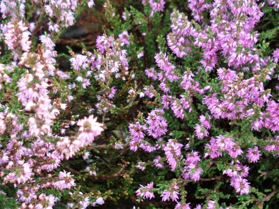
Oh, I forget, I titled this post ‘heather’ because of the sudden blooming of the fells up here. Most of the heather flowering at this time of the year, in various shades of purple, is Calluna vulgaris. One can smell the semi sweet musty aroma from the roadside. In another week or so there will be a haze of pollen blowing across the land. Get out and enjoy it while you can – providing they are not grouse shooting.

DSC00288DSC00287

20230822_143111

It may have passed your notice that Alison Rose, the NW Bank CEO, resigned recently as a result of  ‘a serious error’ relating to leaking Nigel Farage’s account. Yet today I read that she will still be paid a £2.3 million compensation package. Maybe it is time to change banks – any suggestions?

This seems to be a recurring theme. Business managers, multi nationals and politicians profiting from their negligence at the cost to Joe Public. You and me.

My short walk has failed to put me in a good mood. Every thing should be beautiful.

FORCE OF HABIT.

P1020680

With difficulties sailing up the Lune into Lancaster, Glasson became an important  port in the late C18th and was originally connected by canal to the Lancaster Canal, opened 1825. This has survived to this day, though only as a leisure facility.  A railway line from Lancaster to Glasson Dock opened in 1883, closed to passengers in 1930 and to goods in 1964. Time moves on and a cycleway has been created from Lancaster to Glasson on the bed of the old railway.

P1020675

The above photo shows that abandoned line heading to Glasson. And that is where I’m heading. I’ve not been out on my bike since May, two months ago when I visited, you guessed it, Glasson. Yes, I know I’ve done this cycle ride and written about it many times, but it is good to have a ready-made, tried and tested itinerary to fall back on. Force of habit indeed.

I do however wander off the tried and tested, as is my wont. After my coffee and snack at the shop in Glasson, cycling back along the line I notice a sign to Stodday off to the right. I’ve not been there before, a quick look at the map and I can see little lanes leading back to the Lancaster Canal on the outskirts of the city. Perfect. That’s how it turns out with narrow paths and quiet lanes lined by hedges full of flowers. I’m not sure if I found Stodday, but I do cycle past the few houses that constitute Aldcliffe.P1020681P1020682

Then it is all downhill to join the canal. There is a good towpath all the way through the heart of the city, well-used by local residents and the student population. What a fantastic facility and the canal side pubs busy with tourists.

P1020692

P1020686P1020688P1020691

Farther on it was good to see the family of swans who nest every year in the same spot. The six youngsters, almost as large as their parents, spent a lot of time upside down feeding on the plant life.  P1020707P1020696

I drop off the canal just before the aqueduct across the Lune, and I’m soon loading my bike into the car. Job done and a new variation added.P1020710

The lady in the tea van has not reappeared at the Halton car park this summer, sadly missed.

CaptureGlasson. (2)

TOAD IN THE HOLE.

20230727_164740 (2)

Those aren’t my walking boots, they are on hold for the moment, but my gardening shoes. I have a habit of leaning them upside down, to keep them dry, outside the backdoor after what is usually a short session of weeding or mowing. There they remained for a few days whilst we had an onslaught of continuous rain. You may recall the sad end to the Ashes Test at Old Trafford last week.

This morning I thought I would do a spot of rose deadheading, a relaxing activity unlikely to put a strain on any of my ongoing injuries. I shoe horn my right foot into the shoe, tying the laces. The left foot comes up against something soft and mysterious. Had I left a sock in there? Putting my fingers in I can’t dislodge the obstruction, but tapping the shoe on the floor brings out a toad to my surprise and amusement. He, they always look like a ‘he’, sits there unconcerned. I check the shoe for his mate but only find a slug presumably his lunch. Gardening is delayed whilst I retreat for another coffee. 20230725_095908(0)20230725_095903

Toad in the hole – the story relates that on an unspecified golf course a player’s ball was pushed out of the 18th hole after which the offending toad poked his head out to the amazement of the players. The chef at the golf club devised a dish immortalizing this episode; a sausage, the mole, poking its head out of the batter. This is how legends are born.

623_1_1438246938

Jamie Oliver’s Toad in the hole.

THE CRAVEN LIME WORKS.

P1020519

I’m enjoying a lunchtime pint of Tetley Bitter in the Craven Heifer in Stainforth. The last time I was here was at the end of February 2020 when I stayed a night mid-walk.  “It was Chinese New Year, and they were fully booked in the restaurant for a Chinese Banquet, but the chef was able to cook a fish and chip supper for me before festivities commenced.” There was talk in the bar of a new virulent virus spreading in China. We all know what happened next. P1020561

Hopefully the virus is now behind us, and it is good to be walking in Limestone Country. The barman says the pub closed during lockdown and only reopened under new managers last year. It is still owned by Thwaites, the present landlord has a five-year lease but grumbles that trade hasn’t really picked up. One problem is that the village is becoming dominated by holiday cottages, not many locals left, and the cottages are only occupied less than half the time. Who would want to run a pub in these cash strapped days?    I finish my pint and bid them good day.

I’m halfway on a short walk mainly devised to explore the Craven Lime Works. It was only recently that I was made aware of this Industrial Heritage site on the delightful Walking Away  site. I must have walked and driven past dozens of times without realising its existence.

There is further information from these two sites.

 Visit Settle – Craven Lime Works & Hoffman Kiln “Without doubt the centrepiece is the huge Hoffmann Kiln. Built in 1873 it is a huge industrial scale lime kiln” 

and more thoroughly  Craven and Murgatroyd lime works 400m north east of Langcliffe Mill, Langcliffe – 1020888 | Historic England

Good, that’s saved me trying to interpret and explain everything.

There is no signage off the road north of Langcliffe, but Hoffman Kiln Road  sounds promising, it leads to a large new purpose built office and light industrial complex in the grounds of the former lime works. A lot of money has been spent by Craven District Council with help from European cash – we are going to miss that. I only hope this is a successful enterprise as at the moment the majority of the units are standing empty.P1020623

The almost hidden car park for the Industrial Heritage site is impressively large even with electric charging points. It is situated directly below the massive old quarry on the hillside that supplied all the limestone for the kilns. We used to climb up there in the distant past, I think that is discouraged now. Today I am the only car parked on the site. P1020635

P1020619

I wander into the ‘preserved’ site, the interpretation boards are very good. This has been a vast industrial complex  – limestone from the quarries, converted in coal-fired kilns to lime which was transported off site by the integrated railway. As well as the kilns there are so many other associated ruins to see – inclines, winding houses. weigh bridges, water courses, tunnels, old rails, tram ways, spoil heaps.  The operation lasted from the mid C19th to the 1940s.

Capturelome works1909

1907 OS map.

First I look at the remains of the buttressed bases of a pair of massive vertical Spencer steel kilns. Difficult to visualise the scale of this operation that provided purer lime from the beginning of the C20th. P1020508P1020507

Back round onto the quarry floor and a dilapidated weigh house. P1020514

And then along to the Hoffman Kiln – wow it’s massive, think football pitch. In I go, you don’t need a torch as the frequent limestone inlet arches give enough light, in fact a magic image. I’m enthralled. There are the vent  holes for the smoke up to the now demolished central chimney; there are the holes in the roof for the coal inlets; there are the ageing firebricks; there are the miniature stalactites from the slow seepage over the years. Are there bats or giant spiders in here? I walk around the massive kiln twice, and even think about a third, this is so atmospheric. P1020629

P1020521

P1020624

P1020528

P1020529P1020527

P1020525

P1020543

P1020627

At the far end is a tunnel which accommodated a line bringing stone from the quarry above. A waterway used for counterbalancing a crane lower down delivering fuel into the kiln from the roof. Ingenuity far beyond our present engineers involved in the HS2 going above budget from week to week. They can’t even sort out the Euston terminus after 10 years, money down the drain, revised plans costing another £5bn!  How many cycle lanes could you build for that amount of money.

P1020534P1020535

The only part of the complex that wasn’t viable was the separate Murgatroyd quarry and overhead triple kiln next to the railway at the northern end of the site. A smaller scale operation which collapsed in 1887. Today I couldn’t make out the tops of the three kilns for the abundant vegetation, I realise now I should have dropped down to see the lower outlet of the kilns. P1020548

P1020549

Industrial history satisfied I walk through the fields up to Stainforth and my pint. I come back, not on the familiar riverside path but on a higher way through Stainforth Scar. Gently climbing out of the meadows into the trees on the scar and emerging on the limestone plateau. The way ahead is etched into the fields, signs of an ancient passage way to Winskill Farm. 1675 says the date stone with the initials NBCB. What history could these walls tell. It is surrounded by what look like traditional meadows with a variety of flowers and butterflies.P1020569

P1020590

P1020587

P1020573P1020558

From up here looking back over my right shoulder is the prominent Smearsett Scar and distant Ingleborough. Over my left shoulder Pen-y-ghent has suddenly appeared quite close by.P1020579P1020581

There are some tempting ways leading to Attermire Scar from here, but I’m only looking for a short day. My path is clear through stiles in the extensive network of fields and old lanes. The view is down the shallow valley with its patchwork of fields to Langcliffe. That’s where I was planning to head, part of Wainwright’s Pennine Journey, until I spot a vague path/sheep trod going between a wall and the Langcliffe Quarry, now alongside. Will it take me on a shortcut?  I said I was looking for a short day especially after that pint. Worth a try and yes it brings me out into the Lime Works without any serious obstruction, but don’t necessarily follow me on any of these walks. Mine was still the only car in the car park.P1020596

P1020592

P1020601

P1020608

P1020603

P1020617

I would highly recommend a visit to the Craven Lime Works with or without a walk.

***

CaptureHoffman Kiln. (3)

LEVEL FROM LEVENS.

P1020382It is good to meet up with Sir Hugh again. He has been out of action but keen to get going once more, I plot a fairly easy level route from Levens of about 4.5 miles, characteristically he promptly suggests extending it farther. We made the wise decision to cancel on Friday, it rained non-stop. We will take our chances today.

He knows where to park and off we go through Levens Hall Deer Park above the River Kent. I’ve been this way before but struggle to remember when. Just found it here and guess what it was with Sir Hugh, his memory is no better than mine. That day we had good views of the Bagot Goats and the Black Fallow Deer, not so successful today. We admire the ancient trees as we slowly gain height, there is no such thing as a level walk, Sir Hugh doesn’t seem to notice or let on, (re the height not the trees)

P1020356

River Kent.

P1020357

Ash.

P1020362

Sweet Chestnut.

P1020360 (2)

How insignificant we are.

Soon we are on the Lancaster Canal though no boats come this far. It is level now for the next couple of miles as we pass under the landlocked bridges. We look across to Sedgwick House and the nearby skew bridge below us, marvelling at the canal builders’ skills. P1020370P1020373P1020374

And who is this coming towards us? My cleaner and friend with dog. Pleasantries are exchanged , she has a caravan near here to escape to. P1020377

P1020379

Some time is spent trying to capture on film young martins being fed. This is the best I can do.P1020397P1020405

Leaving the canal we go down the lane to Hawes Bridge and admire the limestone geology in the river bed. P1020413P1020410

A seat under a spreading oak is taken for lunch, we are sheltered from the only passing shower of the day. A delightful stretch of the Kent is followed, we spot a perfect pitch for a backpacking tent. Perhaps those days are over for us. P1020414

We change sides courtesy of a swinging suspension bridge. Along this lane there are tantalising views of some waterfalls through the limestone. And then under the motorway close up on the river, there appears to be access from the opposite bank, worth further exploration. P1020419P1020420P1020421P1020424P1020426P1020428

Here is the hill I was concerned about, Sir Hugh cruised up it, but he did stop talking for a while. Now back into Levens Park and soon back at the car. P1020432P1020436P1020438

Almost a picturesque walk in the Victorian sense.

Here is Sir Hugh’s alternative report.

Statistics. A good 6.4 miles and on my reckoning 260ft of ascent according to the OS app, his Memory Map app gave 550ft. So much for modern technology. I manually counted the contours and came back to the lesser figure. The debate goes on, but there is definitely no such thing as a level walk. The advantages of modern technology are that I can write this whilst listening to the BBC Test Match commentary (Duckett’s just out for 83), picking up emails and keeping an eye on the British Bouldering Competition in Sheffield. Who says men cannot multitask?

***

CaptureLevens. (2)

CICERONE’S LANCASHIRE – ?FORBIDDEN BOWLAND.

P1020180Sat alone on the isolated true summit of Fairsnape, deep in Bowland, I’m poking at one of my sandwiches, egg and tomato, made a month ago. They went into the freezer when hot weather and circumstances cancelled an outing at the last minute only for them to re-emerge this morning. there is a distinct unappetising taste.  Should you freeze hard-boiled eggs? I’ve just traversed some of the loneliest hills up here and am in need of some sustenance.  The morning has been misty on the fells, however with a welcome cooling breeze. Distant views are restricted from my lofty perch, most of you will never have been here. Only a few curlew and grouse share my space. I poke again at the sandwich and decide to toss it into the heather for probably the seagulls, who now also patrol these heights, to scavenge.

As I say the day started off murky and cool with low cloud, quite the opposite of the mini heat wave we have been enduring. Ideal for a tramp across these Bowland hills. For a start don’t take Mark’s advice to leave your car in the Delph Lane car park, it’s none too safe and leaves you with quite an uphill walk before you start. There are suitable lay-byes nearer Stang Yule. Walk number 2 in the Cicerone’s Walking in Lancashire  book.

The way starts at a gate leading onto open access land. Welcome. On closer examination a notice says ‘No open access – temporarily closed at the land manager’s discretion’ Not a  good start at all. But wait, the date is 2021. This sign has not been removed or updated for two years. So much for the land manager.

P1020163P1020274

I try not to read too much into this as I stride boldly onto the access land. Nobody will see me in the mist. I’m enjoying the heather under foot, there is a path of sorts but not many come this way, put off by that notice possibly. Slowly I gain height and pull away from the plantation onto the open fell side, A track takes me across the slopes of Hazelslack Fell, a rarely visited spot. The last time I was up here was with Sir Hugh and JD on our straight line adventure between our homes. It’s as remote as I remember. P1020165

P1020169

The views back to the Fylde are supposed to be good.

P1020183

Approaching Hazelhurst Fell.

P1020186

Looking back with the track skirting below the summit of Hazelhurst.

I don’t bother with the 429 m trig point this time as I’m probably going higher shortly. The track dips down and climbs the contours gradually onto Winny Bank. The raison d’être for this track becomes obvious with the appearance of shooting butts. Not only the butts but also the small mammal  traps, thankfully decommissioned. The highlight of my week, if not the month, was witnessing a family of Stoats crossing a road on Longridge Fell. Distinctive with their black tipped bushy tails. Who would want to trap and kill these beautiful animals?? P1020188P1020189P1020197

Along the way is a stark memorial to airmen lost on these hills in WWII, I have a book somewhere  listing all these crashes and giving their accurate sitings. P1020196

The track starts to descend, and I have to be alert to pick up the ongoing path to Fairsnape otherwise I would be floundering, I know not where. The path begins somewhat unlikely with a few steps leading off a turning place. The stone flags don’t go far and one is left following intermittent white posts through the morass of peat. You will be glad you came here in dry weather, preferably a draught, also not a good place to be in thick mist. Stick with it, and you will arrive at a fence corner euphemistically named  Webster’s Meadow. (if you miss it you would be in ‘Dickey’s Meadow’) This is also known as Fiensdale Head, the way through from Langden to Bleasdale. A partially flagged path shows the way. it’s a long time since I’ve been down Fiendsdale, a good spot to see ring ousels. No idea who Webster was or Dicky for that matter.

P1020199

Turning spot.

P1020200P1020201

P1020205

The way down to Fiendsdale.

United Utilities have an information board explaining the work being carried out to try and reverse some of the peat erosion. When I was last up here they were helicoptering bags of stones in to be incorporated into ‘dams’, stopping further erosion from run off and re-wet the surrounding peat. Evidence of that work is all around with stone and fibrous matting in the peat cloughs. One does wonder how much we can do to repair the damage which must be on a vast scale in Bowland alone. Are you still able to buy peat based compost – I hope not? P1020204

P1020214P1020216

A few more flags are encountered, showing a way down to Bleasdale and ahead to Fairsnape. Then you are on your own again with the fence for company. The book talks of ‘hard going’ in the peat hags – ‘hopping over to the other side of the fence may help’ Today that is not necessary as it is as dry as it is going to get, but there are still boggy morasses you wouldn’t want to fall into, perhaps the re-wetting is working. Knees are allowed for climbing out of the deepest hags. P1020213P1020208P1020221

Anyhow, I’m soon sat at the 520 m summit contemplating my lunch. There is another informative board up here telling the same story. Some of the funding came from the EU, pre Brexit. How much will our own DEFRA run by Thérèse  Coffey put into environmental schemes? P1020222

It’s a dry run over to the other summit of Fairsnape, the one with the shelters and trig point. I’ve not seen anybody all day so far and can’t believe I’m the sole person at this popular top. Only when I get closer to the shelter do two heads pop up – a young couple having some private time to themselves. P1020228

The mist has lifted a little allowing the gliders from the club down below to take to the thermals, spookily and silently sliding past out of the thin cloud. P1020226

The way off, by a cairn, is down some zigzags into Bleasdale. I have always assumed these to be part of a sledging route for bringing cut peat off the fell. Beautifully constructed and a joy to walk whichever direction, up or down. Few people used them as most are linking Fairsnape with Parlick along the ridge. But Mark knows this area well, covering Bowland in detail, the secret is out. P1020230P1020232P1020241

P1020243

P1020259P1020273

What a contrast from the northern side of the fells – endless peat and heather as far as the eye can see and down here in Bleasdale with the green pastures stretching to Beacon Fell. The guide book takes you on tracks that would give access to Bleasdale Circle, but I’ve been there many times and at the moment it is a bit of a mess following storm damage to the trees, so I take a slightly different route through Bleasdale, past remote farms, past the old reformatory school buildings and past Bleasdale Tower. North Lancashire Reformatory for Boys, Bleasdale, near Garstang, Lancashire (childrenshomes.org.uk)

P1020278

That little lay-by.

The little blue car was waiting for me in that lay by, as a Duke Of Edinburgh group were going through, staggering in the heat under massive rucksacks. I wonder who had the better day?

***Capture Hazelhurst (2)

TOMORROW STARTS TODAY, A LONGRIDGE LOOP.

P1020116 (2)

It is a month since I have done a ‘long walk’. Health issues combined with all that heat kept me in doors. I’ve only managed a few walks of a couple of miles or so, enjoyable nonetheless in their own rights. Tomorrow I hope to take up the cudgel of another possibly strenuous Cicerone’s Lancashire walk. So I had better have a gentle warmer up to get my legs back into shape.

From my header photo you can see that the hawthorn flower has given way to the elderberry.

Juggling with the weather I need to get going before the afternoon rain comes in, our gardens need it. (it never arrived)

Let’s keep it simple and walk up the lanes from the village onto Longridge Fell. I’m only out for the exercise after all. Park at the little reservoir, Upper Dilworth, stop to watch the female tufted duck with her brood and then a brisk walk-up past the golf course onto Jeffery Hill. I can’t resist a look into Cardwell Quarry to see if the barn owl is still there. A couple of weeks ago I looked in and took a hurried photo of the roost which showed up the owl’s legs but nothing more! Today nothing at all. I sat for a while taking in the view over Chipping Vale and remembering all those summer evenings climbing up here with Longridge mates. It’s banned now due to some unfortunate contretemps between the landowner and some selfish youths. It doesn’t take much to destroy all the goodwill built up in the past. P1020112P1020115P1020128P1020130

P1010903

Two weeks ago – spot the legs.

Close by here the Roman Road was thought to have come up from Ribchester before a turn to head through the hills towards Newton, and then over to Lancaster. It is marked on the OS map, and today I can make out the line of it just below the modern road. P1020119

P1020132 (2)

Surprisingly there is only one car parked up on Jeffrey Hill where the walk-up onto Longridge Fell starts. I never meet the occupants. Taking the ‘balcony path’ along to the spring and then heading towards the ridge, it is bone dry. I am tempted to carry on up to the trig point, but sense tells me to go easy and besides I can see rain coming in across the Fylde Coast. Back down alongside the wall, past the ‘grim up north’ tree. 

P1020125

P1020134

Straight across and alongside the upper trees of Cowley Brook Plantation. This plantation is becoming a favourite of mine for an evening stroll, and today I cut down through it meeting up with the brook where it disappears under the road. P1020137P1020138P1020140P1020143

This road takes me eventually, there are lots of ups and downs, back to the village, passing the lower side of the manicured golf course this time.

P1020155P1020156

P1020158

Job done, now let’s see what the forecast is for tomorrow.

CaptureLOngridge Fell.

A SHORT WALK FROM HURST GREEN.

P1010994 (2)

***

I was deterred by these signs on what I thought was a right of way the other day. I didn’t have a map at hand, so I opted out and walked up the lane. There is a hidden side to Hurst Green, large expensive properties guarding their privacy, but public footpaths shouldn’t be lost or walkers intimidated. Officially all Public Footpaths should be signed where they leave a public highway but speaking to officers on the Local Authority these signs regularly disappear. P1020010

The morning’s heavy rain has passed, and I’m back armed with the latest 1:25,000 map and approach from the other end near the old bobbin mill on Dean Brook. There are predictably no waymarkers, but the start of the path is clear above the Brook. I walk past properties that were probably mill workers’ cottages in the past and soon come out onto the lane, The Dean, which drops from the village crossing the brook and climbs back into the countryside. Curiosity satisfied I’m on my way. P1020006P1020007P1020008

The quiet road heads upwards with views over the Ribble Valley opening up to the south. I know there is a path somewhere leaving it to climb Doe Hill , but I can’t find it initially in the heavy vegetation. Is that it, hidden away?

P1020012

The Ribble Valley.

P1020013

There is a stile in there somewhere.

Once into the field I can see the trig point, Doe Hill, one I’ve never knowingly visited before, a short distance away. More interesting is the nearby clump of beech trees, maybe 30 or 40, all growing as one. How long have they been here – a couple of hundred years or more? There is a vestige of a wall enclosing them, who planted them and why? A magic place, I half expect a troupe of fairies to be dancing around., it is  the summer solstice after all. Whatever it is a good viewpoint – Longridge Fell, Pendle and the Ribble Valley. P1020017P1020020P1020024P1020028

P1020035

I pick my way across fields full of buttercups, finding stiles in the appropriate places and come back out onto the lane heading to Greengore, a C16th hunting lodge for the Shireburn family, which I’ve photographed many times before. There appears to be some building work going on at an adjacent barn, let’s hope it doesn’t distract from the Grade II listed Greengore property. P1020037P1020038P1020040

I knew of the sturdy bench at the junction of lanes and was glad to sit for some refreshment, it was still a very muggy day. The lane dropping to Dean Brook, yes the same one, is bordered by hedges full of roses and honeysuckle, with foxgloves pushing through the bracken. P1020043

P1020045

P1020041P1020044P1020046

Crossing the bridge I am reminded of bringing my children and then my grandchildren here for the simple pleasure of ‘pooh sticks’. Even today I can’t resist dropping a stick upstream and watching it emerge farther down. P1020048

Hidden away just off the track is Sand Rock, all that remains of a large sandstone quarry  used in the construction of Hurst Green Itself. I divert here to see if my lost favourite orange cap is anywhere to be found, I last had it on when I came looking in here at the rock face a few days ago. Some lower boulder problems are chalked up, evidence of recent interest. We climbed a route up the middle of the quarried face, Vanilla Slice E2 5c, in 2002, it looks impossible to me now. No sign of my cap. P1020054P1020050

Onwards alonside the brook cascading down the soft sandstone rocks which have been smoothed into  beautiful curves over the ages. Plainly visible today are the remnants of the dam footings and ongoing leat supplying the bobbin mill farther down valley (where I started my walk today). P1010981P1010983

***

I’m back at my car after this short, 2.5 mile, but interesting exploratory walk. The black clouds have blown away, and the sun is beginning to come out. I have another site I want to look at, the Stonyhurst Roman Catholic cemetery just up the road. I’ve always been fascinated by the mausoleum type chapel visible through the railings from the roadside, but never visited. Going through the gates into the cemetery one is immediately drawn to a white statue of Christ with Pendle as a backdrop. The cemetery is laid out with mature coniferous trees forming stately corridors between the many vaulted graves. The Mortuary Chapel is dated from 1825, but I can’t find out if it is dedicated to any particular family. Does anybody know more details? P1020056P1020002

P1020058P1020062

P1020076P1020069

P1020063

Detail from a window.

P1020064

Through a window, showing it to be a chapel rather than a mausoleum.

***

CaptureHurst Green. (2)

NEW WAYS ON THE EAST END OF THE FELL.

P1010924

The heat goes on, we somehow have avoided the thunderstorms rattling around the North West. Lethargy is the order of the day. But there is a breeze from the east, so some solace may be found up on the far end of Longridge Fell. Not again I hear you say that’s the third time in a week up there, but I’ve approached  from three different but well-used directions.  The lethargy prevents me going farther afield and the heat limits my delicate body’s distance and exertion. And anyhow I like my local fell. 

When I moved to Longridge over 50 years ago few people used the fell for recreation. The forest tracks were constructed, but I don’t think the public were encouraged onto the land. I remember the spruce trees looked relatively young, as was I at the time. A few public footpaths criss-crossed the once open fell sides which must have been planted up in the late 60s to 70s. The 7th Edition, One inch to the mile, map of 1969 shows only a few scattered plantations with no forestry tracks. There was a way up from Jeffry (Jeffrey) Hill to the trig point, then 1148 feet (now350 m) but few went farther along the ridge. This involved for  the most part delicate, muddy and pathless walking between the young trees. 

CaptureLOngridge fell 1964

Compare with the modern map.

CaptureLongridge fell

Over the years, thanks to intrepid walkers, a path developed along the ridge from the trig point all the way to Kemple End where the fell drops steeply to the Hodder. This was mainly in the new forest planting and could be very muddy in the winter. Mountain Bikers started using the forestry tracks and signage eventually appeared on the public right of ways. Old walls started to crumble but were still good orientation points. It has now become a popular walking and cycling destination. But come full circle and some areas are being harvested and the devastation that that brings can often wipe out the unofficial paths that had developed. On top of that recent storms have brought down many trees and affected paths can be difficult or impossible to follow. Clearance is for some reason slow paced. 

My planned walk today would complete a trilogy of routes up Longridge Fell, from the West, South and now East. I would be walking some of those ‘unofficial’ paths and encountering both forestry and storm damage.

From the rough parking at Kemple End the main forest road traverses the fell, but I want to see how the little path in the trees to the north had survived. Starting on the left, SD 689406, down the road from the parking. The path looks well-used and the few trees that had blown down seem to have been cleared, all very promising. Buzzards circle overhead and blue butterflies flit around my feet. There is not much breeze although most of the time I’m in the shade. Steady progress uphill. At the first junction I know I could go left and regain the main forest road, but I go right to keep to the ridge. The path narrows and is enclosed in the trees, I recognise familiar landmarks. Before long though it comes up against some forestry work from a couple of years ago, a large area of felled trees on the northern scarp. People have escaped back left to the forest road. and that’s what I do. After 200 m on that road I spot an orange arrow on a tree at the edge of the destruction, is this a way back to the original path? After some haphazard wandering through orange dotted trees I give up and escape into the felled area onto a track of sorts used by logging vehicles. It leads me in the right direction westwards close to where the old path ran and if people use it will become an established way. Somewhere at the end where it joins with a forest road, more felling here, used to be a viewpoint (Sam’s View, I never found out who Sam was) but with new growth on the scarp it is no more. All in all a right mess. The latest OS map no longer tells the truth.

P1010916

A good start.


P1010918

Pushing on.


P1010922

The old way through the trees on the ridge…


P1010931

…soon disappeared in forestry devastation.


P1010933

New trees have already been planted.


P1010945

Orange hope?

P1010938

Sam’s view?

I don’t feel like tackling the still obstructed way up to the trig point so simply follow an established path down to the forest road. I turn left and saunter back down to the car with the bulk of Pendle ahead. 

P1010940

No farther.

P1010941

Escape path.

P1010944

The main road.

P1010946

Proud Pendle.

Last year there was a good crop of orchids along here but nothing to show at present. The Bird’s Foot Trefoil, Mouse-ear Hawkweed and ‘Fox and Cubs’ are all flowering.  What delightful traditional countryside names.

You may wonder why I’ve not yet included a route onto the fell from the north, well have a look at those contours. Longridge Fell is a ‘cuesta’ with a steep escarpment to the north and a gentle slope to the south. I have come up from the north many times but any ascent at the moment would be punishing in the heat. I will leave it to you to plan your own way up those footpaths from the Chipping side. 

I fear for the fells as we have had no rain for weeks. One careless cigarette or a disposable barbecue, the weapon of choice for moorland fires, and we will be loosing a valuable habitat once more. Go careful out there.

***

  Capture Kemple End..JPG


CaptureESRI

Latest ESRI.

CICERONE’S LANCASHIRE – MORE OF THOSE LONG LONELY BOWLAND MILES.

P1010746

                                                                      Catlow Fell and Bowland Knotts.


Mark Sutcliffe’s Chapter 4.  Bowland Knotts and Cross of Greet.

Driving the lanes to Slaidburn once more and this time taking the continuation towards the Tatham Fells to park at the Cross of Greet Bridge, deep in Bowland. The last time I started a walk from here along the River Hodder, November 2020, the whole area was waterlogged and virtually impassable.  I am hoping for better conditions today after a few dry days. It’s a Bank Holiday weekend, yet I’m the only car parked up by the river.P1010901

I skip across the marshy area and have no problem fording the stream this time. The walk-up to the isolated barn goes well. A barn owl is disturbed as I peep inside, it flies off, and the chicks go quiet. I don’t hang about. Outside was a rusting lime spreader manufactured locally in Clitheroe ? Vintage 1960.

P1010751

The infant Hodder.


P1010759

Kearsden Brook ford.


P1010760

The Hodder gathering pace.


P1010764

The barn.


P1010770

Abode of owls.


P1010772

Atkinson Spreader, Clitheroe.

The way onto Pike Side is rather vague, and I end up following sheep tracks and even sheep. I realise that somewhere I have gone wrong arriving at an old lime kiln next to the wall, SD 725591. There are shake holes marked on the map, so there must be underlying limestone near about. With a bit of rough ground I regain the route by the gate, SD 723593. There are the ruins of an old barn here, and I follow the straight access track all the way to the road at Bowland Knotts, although at times it disappears underwater.

P1010777

Sheep track.


P1010788

Limekiln  SD 725591. 


P1010792

Gateway. SD 723593.


P1010808

To the road at Bowland Knotts.

There are craggy outcrops either side of the road and some are suitable for bouldering.  I find a seat not far off the road for lunch with Ingleborough in full view.

P1010816

Roadside bouldering in Yorkshire.


P1010817

Roadside bouldering in Lancashire.


P1010818

Peggy and John Phillips seat.

Tracks follow the wall westwards towards a trig point, 430 m,the highest point of the Bowland Knotts also recorded as Crutchenber Fell, a ladder stile crosses to it. This is a rough tramp, but there are good, if hazy, vistas into Yorkshire, Stocks Reservoir, Pendle and the Bowland Hills.

P1010821

Crossing to Crutchenber Fell.


P1010824

Trig 430 m.


P1010823

Bowland Knotts.

I stay on the south side of the wall for the undulating mile to the next feature, Cold Stone Crag. There is a path of sorts. There is climbing on this remote crag, but I doubt if many come this far, you might as well boulder back at the road. On one occasion I made the boggy walk in to photograph the crag for a new guidebook, only to arrive after the sun had moved round. The process was repeated the next day at an earlier hour. From up here the whole of the Pendleside panorama is visible.

P1010829

P1010831

P1010834

P1010837

Forever onwards alongside the wall and a gentle climb up to a height of  486 m, no cairn denotes the ‘summit’. The miles are long up here. An undecipherable boundary stone is encountered. The maps vary on the name of the hill – Great Harlow, Hailshowers Fell, Raven Castle or perhaps Catlow Fell.

P1010838

Catlow or Hailshowers Fell.


P1010845

Boundary Stone – Lancs/Yorks.


P1010847

Ravens Castle stones?

A little farther and a fence line leads me down to the road at the Cross of Greet. By the cattle grid is a large stone with a shallow square hole in the top. It stands at the Lune/Ribble watershed. formally the Lancs/Yorks border and may have had in the past a stone cross inserted into it.  Or was it a plague stone? nobody knows. I think it’s more likely to have been a cross at an important passage through these remote hills. 

P1010854

I chat to some cyclists riding the classic round from Slaidburn. Up to the Cross of Greet, over Tatham Fell past the Great Stone, maybe a brew at Bentham or Clapham and then back over Bowland Knotts, through Gisburn Forest to Slaidburn. I did it once with my mate Tone, never to be forgotten. P1010858

Down the road for 800 m then follow one of the faint paths down to the stream”  Well I’m not sure about the 800 m, and I don’t find any obvious paths. It will be even worse once the all encompassing bracken has grown. But I do find myself down at the Hodder, not the magnificent river it will later become, and hop over to the other side. P1010863P1010864

A slight climb and I am on the brink of an abandoned quarry. Stone from here was transported by rail to build the dam of Stocks Reservoir as the valley was slowly flooded in the 1930s for the Fylde Waterboard. Only the church was saved, stone by stone and rebuilt on higher ground. There is lots of archive material online.  The quarry is atmospheric particularly with the surviving, but rusting dinosaur of a steam crane. P1010868

P1010871

P1010877

P1010875

P1010884

At the edge of the quarry is the base of the Far Costy Clough, a worthwhile scramble up onto White Fell I’m lead to believe. Yet another one to add to my list. Another day.P1010880

I’m content to just to follow the old rails  out of the quarry back to the  Cross of Greet Bridge. Another longish day out in Bowland.P1010885

P1010891


P1010897

P1010900


***

CaptureCross of Great (3)

RURAL RAMBLING – BROCK’S BOTTOM.

P1010736

After last week’s heroics in the high Bowland Fells today was a gentle rural walk. My son suggested a walk for his day off. Where? I asked. “What about Brock Bottoms, I’ve not been there for years”  I’m writing it up as a 4-mile walk some of you may want to follow, a perfect evening stroll.

We used to take the boys along the Brock getting on for 50 years ago, so I’m pleased he still has it in his mind set. (I must have done something right in their upbringing) I remember paddling down the stream to the remains of the mill in the valley all those years ago, not for us the riverside path. I have written before on the history of the mill – Brock Mill was once a thriving water-driven cotton spinning mill with up to twenty cottages in the valley for the workers.  The mill was probably built in the 1790s. After a chequered history and two reincarnations as a roller making factory, and then a file making factory the mill finally closed in the 1930s. For some time the ground floor of the mill operated as a café, whilst the top floor was used for dancing on Saturday nights! 

What will we find today?

Along with my son Chris I’ve enlisted Mike for a short walk with promises of a curry afterwards. Surprisingly the picnic car park at Higher Brock Bridge itself is quiet. What a contrast from those Covid days when every space was taken by cars isolating from each other.

A few dog walkers are around but within 200 m of the car park we meet no one else. The water level is very low reflecting the recent dry spell. I seem to think the path has been ‘improved’ over the years. Lots of wild garlic, fading bluebells, stitchwort, red campions, hawthorn and other Spring blossoms deserve our attention. The valley is very steep sided along here.

We leave the main path to explore the ruins of Brock Mill. Until now, we have been walking along the line of the mill race or Leat.  There is little left to see. Where were the associated cottages? Where was the main wheel? All is jungle with Himalayan Balsam taking over. P1010712P1010717

P1010713P1010714P1010716

Rather than go back to the main path we struggle on a riverside trail, not recommended. Once out into the open meadows the going is easier and we soon reach the elegant Walmsley Bridge. For some reason the road is blocked and yet everything looks OK with the bridge. It was only when we walked up the lane did we find a landslide that had taken half the road down into the Brock. Could be a while before this lane is reopened, fortunately no premises have been cut off. P1010724P1010726

At the corner we take a farm lane I’ve never used before. The farm turns out to be massive agricultural sheds in the modern manner. A traditional cockerel guards the approach, but  the path goes around the edge of the buildings with little fuss, no doubt an unofficial diversion but no problem. The farm house itself is named Throstle Nest with one of its barns converted to luxury living. The access lane soon has back on the minor road. P1010727P1010729P1010730

A bridleway could have taken us back down to Brock Bottom, but we stay on the quiet road for half a mile, passing some delightful Lancashire farmhouses. Another footpath I haven’t used before takes us straight through fields below Beacon Fell onto the lane which drops us back down to the picnic spot where we are the only car remaining. P1010733

P1010734P1010735P1010737P1010739P1010740

A very pleasant 4 mile round through the Lancashire countryside.

The hastily put together curry supper was a success as well.

***

CaptureBrock

CICERONE’S LANCASHIRE – REMOTE BOWLAND.

P1010516 (2)

I’m running out of titles for my series of walks in Bowland as set out by Mark Sutcliffe in his Walking In Lancashire book. He has certainly covered the area well. Highest, Best of, Heart of,  and today Remote or even the Remotest…  How many of you have been to Wolfhole Crag  or Whitendale Hanging Crags? This is a long post I’m afraid – it was a long day.

I enjoy the familiar drive into the hills with the roof down. Along the Hodder Valley; farmers busy silage cutting in the fields; over the Roman road with views to Ingleborough; down to picturesque Newton; along to stately Slaidburn and up Woodhouse Lane to my parking place just before the fell gate. I say my parking place as it was a regular spot when we were developing the bouldering potential of Croasdale’s Bullstones all those years ago. Not many drive up this far, but Mark mentions the single space, there is a little more back down the lane.

P1010468

Newton on the Hodder.

The hike up the rough Hornby Road, a Roman Road again, (aka Salter Fell Track) has been done dozens of times and I pass familiar landmarks. The war memorial to airmen lost on these fells; the ancient sheep folds and bothy down in Croasdale where I have stayed with my grandson; the culvert where one can still see the Roman workmanship; the large quarry where the peregrines nest; the bridge where the road has been saved from sliding into the valley; the Tercet stone demarking the Lancashire Witches fateful route to the assizes in Lancaster;  over to the right the bouldering playground of Bullstones and later the vague track dropping into upper wild Whitendale. P1010473

P1010484

P1010485

P1010492

P1010489

P1010494

P1010507

P1010527

Along here somewhere I meet two RSPB workers checking on nesting Hen Harriers. It is good the birds have returned and let’s hope more survive the persecution by the shooting fraternity this year. No photos and as they say on the news “their anonymity and location have been protected”  The road goes on over the watershed.P1010503

After four miles I leave the road for another four miles of mostly trackless and waterlogged ground. Mark says “the next stretch is very boggy and needs careful negotiation” Go no farther if you are unsure or if the weather is bad. This is remote country with no easy escape routes. My walking poles disappear into the mire quickly followed by my boots. Jack be nimble. It is not so bad – I survived. There is beauty there if you look closely.P1010534P1010536P1010541P1010540

P1010539P1010535If I close my eyes I could be at the seaside, the sound of gulls is everywhere. I think they are Black Backed, Great or Lesser?, a large colony exists up here. I try for a video, more for the sounds than the fleeting fly overs. They are becoming more aggressive, dive-bombing me. I look down and there below my feet is a scrape of a nest with three eggs. Better move on taking extra care where I place my feet. 

P1010599

P1010555P1010590

It doesn’t take much to persuade me to take the ‘optional’ diversion to Wolfhole Crag half a mile away. One wouldn’t come this far in good weather and not go to the highest point. There is a trig point, 527 m, and also an interesting collection of gritstone boulders. I can’t resist a few simple boulder problems, keep them simple as you don’t want to break an ankle up here. The longer routes look fearsome. Somewhere there is a shallow cave in the rocks – the original wolf hole. P1010552P1010559

P1010567P1010569P1010577

A good place to eat my sandwich, wish that had been two as the day panned out. All around – The Lakes, Yorkshire Three Peaks and most of East Lancashire. Pendle is always visible. All a little hazy in today’s heat. P1010578

Walking back down the fence line, no navigation needed, is not easy because of more bogs. Maybe it is better on the other side, No it isn’t I tried. White Crag is nothing but a few boulders. Whitendale Hanging Stones are not much bigger. But according to the gravitational method to establish Britain’s centre of gravity  OS calculated that the geographical centre of the British Isles, including Islands, lies at SD 6419 5654 virtually where I’m stood. I’m too weary to take it in. In fact as I drop down very steeply I’m just too pleased to see the small tarn on the col between Brennand and Whitendale. The walls and fences aren’t too easy to negotiate. I lose even more height as I descend to the Duchy farm at Whitendale where my route ahead climbs back up zigzags for 800ft onto Dunsop Fell. P1010614P1010609

P1010611

White Stones.


P1010619

Whitendale Hanging Stones, centre of Britain.


P1010632 (2)

My way down.

P1010643P1010646

Small mammal traps remind me I’m on shooting lands, the hunting class have some barbaric practices. P1010637P1010636

I collapse onto a wall at the farm, nobody is about, I’m even wondering if I should phone my son for a cop-out evacuation, but a drink and a banana fortify me for the final stage. Thankfully once back on a stony trail my steps become stronger, and I push on up.  The trail disappears into peat, but there are some posts and cairns to guide me to Dunsop Head, a vague col with a wall, gate and another of those crafted signs. Looking at the map and the terrain I realise I’ve never been on Baston Fell to the north, today is not the time to visit. Let’s just get down.  

P1010642 (2)

My way back up.

P1010648

P1010649

Looking back down to Whitendale with Hanging Stones above somewhere.

P1010654P1010655

P1010659

Go east across more bog. By the time Stocks Reservoir comes into view you are almost home and dry, although your feet are probably wet by now. Eventually the bridleway becomes more visible as a sunken way and the airmen’s memorial appears. There is my car down the lane with Pendle still watching over us. Seven hours of remote walking, one to talk about in the pub later.  

P1010664

P1010667

P1010668

***

CaptureWolfhole. (2)