Tag Archives: Walking.

CLITHEROE – CROSSHILL QUARRY AND THE SCULPTURE TRAIL.

After my pleasant interlude in the Primrose Nature Reserve I drove across town to visit the Cross Hill Nature Reserve, managed by the Lancashire Wildlife Trust.

“Colonised by orchids and teaming with butterflies, Cross Hill Quarry is a shining example of how nature reclaims the relics of our industrial past.”

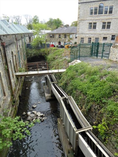
I found parking difficult on the road used by all the lorries visiting the cement works but eventually found a quiet spot on the Pimlico Road.  The area is dominated by the works, limestone Cross Hill Quarry was apparently abandoned in the early 1900s. I entered by the path next to the railway to walk round in a clockwise direction.  What struck me most was the notice board for the Ribble Valley Sculpture Trail. in  This was established in 1993 to make art accessible to all whilst enjoying the walks in the park. Artists liaised with the local community to produce works relating to the specific environment. I had previously passed a few of them on the riverside walk, part of The Ribble Way through Brungerley Park. There have been many newer installations, so why not follow the whole trail today?   Download your own leaflet here.

The first sculpture is one of several by Halima Cassell,  a flower head of  Great Burnet, 2009. Made up of many ceramic bricks it displays strong  patterns reflecting her Islamic heritage which you will recognise in her other works.

To start with the path was very close to the industry on the left, but one soon lost oneself in the greenery. I diverted to see the Tawny Owl Seat, 2018, created out of sandstone by the prosaic Ribble Valley Stonemasonry. I wasn’t impressed, but it did have a good view of the Ribble and distant misty Bowland.

There was a good showing of Cowslips in the meadowland here, but I realised I was probably a month too soon for the orchids and butterflies, although I did spot a solitary male Orange Tip.

Back on the peripheral path were a stunning pair of Sika Deer, 2007, by Clare Bigger. These life-sized minimalistic animals sprang out of the woodland in a flury of movement.

A little farther and there was another of Halima Cassell‘s geometric ceramics – Fir Cone.  Very grand and distinctive.

In contrast, was the diminutive stainless steel Butterflies, 2007, the first of three waymarks by David Appleyard. He developed these in collaboration with local schools.  The symbolic nature of the cutouts demand a much closer attention.

A little farther is another of his installations – Ivy, 2007.

The higher path led into the more formalised Brungerley Park. A workman was busy blowing the leaves off the paths, work I always think of as lazy and ultimately unproductive when the next winds blow. Here was the strangest of sculptures in the park. The Cook House, 2000, Helen Calaghan.  Apparently depicting a pan of boiling  tripe, is there a history of this in the quarry?  She has incorporated fossils, as found locally, into the goo.  Very strange.

Back to the more familiar at the gate – Common Comfrey, Halima Cassell, 2009.

I left the park through the ornate gates with a Latin inscription beyond me…

…only to re-enter the park lower down near Brungerley Bridge.

Again a comforting installation from Halima Cassell welcomed me back – Alder Cone, 2009.

This path now was closer to the river. The garden blower was still at work but had time to explain to me how at one time there was a landing stage for pleasure boats here and long before the bridge was built hipping stones across the shallows, with links to Henry VI’s capture in the C15th.

Disappointedly I couldn’t make much of Tom Dagnall‘s  Two Heads in an elm tree from 1993. I know the artist but couldn’t see one head never mind two. I think they must be on the other side or have rotted away.

Down some steps to the riverside I found Fish Mobile, 2007, by Julie Ann Seaman. Depending on where you stand the fish either swim in the Ribble or leap above the water. Mine did neither.

Onwards I retraced my steps on the outbound route and then dropped to the river again where I found another of David Appleyard‘s steel waymarks, Brook, 2007. Symbolic of flowing water.

Down here was also As the Crow Flies a compass feature in wood by David Halford from 1994.  Wooden sculptures don’t seem to last long in the damp NW. The next ceramic mosaic was inspired by Victorian shop doorways in Clitheroe,  Wildlife,  from Louise Worrell,  2000. It looked more  Roman than Lancastrian.

Another Halima Cassell brick creation Lords and Ladies, 2009. Nearby were the real flowers.

Alongside the riverside track were three Mosaic Waymarkers created by Paul Smith in collaboration with Clitheroe primary schools in 2005. They depicted wildlife found in the area with glass and ceramic mosaics.


My side trip into the quarry was not a great success, I forgot to look for Thomas Dagnall’s Footprints as I examined the slanting strata of the limestone. I was too soon for most flowers, though the delph was alive with birdsong.

Where the Ribble Way leaves the park to follow the river there was a striking sculpture of an Otter in white limestone, Fiona Bowley, 2007. I don’t know why, but it reminded me of the Little Mermaid on the waterfront in wonderful Copenhagen. I have yet to see an otter on the Ribble.

Down by the river was the jolly The Ribble King an imaginative piece created by Matthew Roby, 2007, from recycled materials. At least I often see Kingfishers on the Ribble.

Fittingly, as her geometric representative floral statues composed of multiple ceramic bricks have been a highlight of the trail, my last as I left the reserve was Halima Cassell’s Thistle. Again this had been installed in  the relative recent 2009 which explains why I had not seen them on my infrequent visits.

An eclectic collection of statues all having some relevance to the Ribble Valley environment. I like the way schools have been involved in some installations but from a purely visual impact the more professional statues had the most impact on my limited appreciative sensibilities. My favourite has to be the Sika Deer.

I appreciated the bench in the park and the sentiment.

Back at the car and looking at the map there was another disused quarry on the other side of the road with a green public right of way around it. I couldn’t resist it, but unfortunately the quarry has been in filled and the path is fenced in most of the way, so there was little to see. At least I tried.

Salthill Geological trail will have to wait for another day, perhaps in early June when those rare orchids may appear.

*****

CLITHEROE – A SURPRISE IN PRIMROSE NATURE RESERVE.

Clitheroe is just down the road from my home and at the back of my mind was an excellent  post from Shazza regarding a nature reserve in town. Three in particular I wanted to visit; Primrose, Crosshill Quarry and Salthill. 

I got away at lunchtime and eventually found somewhere to park adjacent to the newish Primrose Nature Reserve. I remember the excellent Primrose Nursery which used to trade across the road – now an Aldi. There is a bridge above the lodge dam and below is the new fish ladder allowing fish and eel access to Mearley Brook. The mill buildings are being converted to apartment living spaces. Work has been carried out to improve the water environment and access to it. Community And Wildlife | Primrose Nature Reserve | Clitheroe (primrosecommunitynaturetrust.org)

The lodge was created to supply Primrose Mill, opened for cotton spinning in 1787, the  arrival of the Industrial Revolution in Clitheroe Subsequently the mill was used for calico printing and later became a paper mill. The paper mill at Primrose had a relatively short life until1890, but the lodge continued to feed a Lower Mill which ultimately became a bleaching and dying works and continued to operate until 1963. The lodge became silted up. 

I stood at the bridge for some time intrigued whether the heron was real or not, it didn’t move an inch.  

I found a way into the reserve and down to a viewing platform – a few ducks only. The path through the reserve strip was followed with Blackbirds and Chiffchaff noisy in the canopy somewhere. I stopped at the ‘Manet’ bridge to view some water sluices when along came along a black Labrador which I thought I recognised from Shazza’s posts – Hugo. Of course, he was with Shazza herself, so I bravely introduced myself. What an amazing meeting of bloggers. She was as charming as her posts, and it was a joy to meet her.

I let her carry on with Hugo’s exercise as I left the reserve on to the main Whalley Road. The trustees and volunteers have created a vital green space in the centre of Clitheroe which will only improve as it matures.

Ahead of me was St. James Church looking almost as an L S Lowry painting in its starkness.

I walked back along the road and on crossing the lodge bridge once more I saw that the heron had changed its stance proving its existence.


  I next went to explore Crosshill Quarry Reserve but became distracted by the Ribble Valley Sculpture Trail, so I think I will leave that to another post.

CICERONE’S LANCASHIRE – Whalley Nab.

Whalley Nab from the station.

Another walk below 5 miles from Mark Sutcliffe’s excellent Lancashire guide, this will be the last of his easy walks to test out my knee. The train took some of the strain today. I parked up outside Whalley rail station next to the impressive many arched brick viaduct. This is the longest railway viaduct in the county. It has 48 arches and two have been built to reflect the Abbey in architecture. It took seven million bricks, and they were all made on site of local clay. I hope it will show up later on my photos from on high. The platform slowly filled with shoppers and football fans heading to Blackburn. Being a Bank Holiday I was anxious that the trains would be running but the 11.30 arrived almost on time. It trundled slowly across the viaduct with the River Calder way below. Five minutes later I was the only one alighting at Langho station. The village had a small but colourful floral display.

My walk nearly came to an abrupt end on the narrow clough leading on from Whinney Lane. The enclosed path ran alongside a stream and a storm damaged tree blocked the route. I was glad no one was able to see me crawling through the fallen branches. I only just made it and then realised a family above were watching my antics with interest. Somewhat disillusioned the father made an effort to get through but then decided it was too difficult for his wife and children, and they retreated – I pushed on.

Jungle warfare – there’s a man crawling in there somewhere

Lanes then led up to York, a cluster of houses and an inn, which seems to have had a renaissance as a gastropub. Open ground with gritstone outcrops formed a ridge which would have been good to follow, but my way took me over and down to the dam of Dean Clough Reservoir and across to farm lanes weaving through these hidden valleys. Ahead was always the distant Pendle Hill but nearer at hand was a pointed peak which I later identified as Bowley Hill, there was no obvious way up it and as my knee was hurting I didn’t feel like adventuring.

Bowley Hill.

The ongoing lane was closed due to works on the bridge over Dean Brook, more contortions were needed to outflank the blocked way. Fittingly I next passed Sunny Bank Farm as sheep and lambs were relaxing in the warm sunshine. Just emerge yourself into Lancashire’s finest. A bit of naughty signage, Private No right of Way, had me doubting the onward path but there was an obvious track up to a stile and out onto more open moor. I could have reached this point easily, and possibly more scenically, from the reservoir dam. I took the less obvious way through the woods and emerged onto Moor Lane. I thought I had been here before on either Wainwright’s Way or my Lancashire Monastic Way. Pendle was again prominent ahead as was the transmitter on Whalley Nab. Over to the left was Kemple End on Longridge Fell and the hazy Bowland Hills behind.

The lucky young occupants of the cottage above Nab Side Farm were chatty despite being engrossed in their extensive hillside garden. A little farther round the hillside I took a break overlooking Whalley and its viaduct.

An enclosed and steep monk’s trod challenged my knee ligaments on the way down to the elegant bridge over the Calder.

I passed the old Abbey corn mill, now an apartment block and I noticed for the first time the water wheel preserved within. Somehow I missed the Abbey’s gateways and went through the streets, past the ancient parish church, back to the Station to complete my afternoon’s stroll.

Now could I do something similar tomorrow?

*****

HAIGH HALL SAMPLER.

At the risk of sounding unappreciative or even worse, condescending I’m not one for walking in large parties. One can miss so much of the nature and environment you have come to experience unless led by an experienced historian, geologist or biologist. Today however I was invited to join a group on their short walk from Haigh Hall near Wigan, of which I had no knowledge, They meet once a month for a walk and a pub lunch to follow. Sounded just right for a non committing outing.

The sat-nav negotiated unfamiliar lanes to state that we had arrived at our destination in the large car park of Haigh Woodland Park. (£3.50 all day parking) Our merry group of 12 assembled, I knew three or four of them. Two hours later we were back having followed our leader of the day on what appeared an interesting three-mile circuit. Most of the interest however was passed by as conversation took preference between the friendly crowd. We retired to a local eatery for more of the sociable chat and an excellent meal, a pleasant way to spend a few hours, and I was very grateful for being included.

There was not much opportunity to take photographs as the hoard marched on.

On my return home perusing the maps and  websites here  and here I found so much more to occupy a repeat visit, probably alone. The area is full of history. Bah humbug, mea culpa.

This was roughly our circuit from memory.

CICERONE’S LANCASHIRE – A regular Ribble ramble.

A walk I must have done dozens of times. I was looking for a short flattish walk to test out my knee. Walk 22 in the Cicerone guidebook fitted the bill, and I was anticipating the woods full of bluebells. It turned out to be a day of bright sunshine but with a violent wind out of the east.

The Shireburn Arms in Hurst Green was busy with the sunny weekend weather. I didn’t use their car park but found a spot in the village near the war memorial. Lambing Clough Lane took me down past the C17th Trough House (they have a fetish for weighing scales) to the new Dinckley bridge over the River Ribble. The river was running low with the exposed pebbly beaches accessible.

This stretch seemed to be popular with dog walkers today – but doesn’t everyone own a dog or two now. Entering Marles Wood the path threads between the trees often awkwardly over the exposed roots. The bluebells were only just starting, but there was a good display of  Wood Anemones and the Lesser Celandines were hanging on. The new beech leaves were the greenest of greens.

At Sales Wheel the river was completely placid, compare with conditions when running high – SALES WHEEL – THE RIBBLE POST-FLOOD.

One of the problems with this circuit is the kilometre of road walking from Salesbury Hall to Ribchester bridge. The road however was quiet and my attention was directed to the wayside plants. The blooms of the Blackthorn are fading to be replaced by the emerging Hawthorn. Yellow Dandelions and white Dead Nettles covered the verges. Soon I was crossing the elegant bridge which has seen some recent damage from vehicles.

Onwards past the farm and into the riverside woods where flood debris is always piled up, but thankfully someone has been collecting the plastics. Unfortunately the right of way leaves the river, what a shame – if only access could have been obtained all the way back to Dinckley Bridge. I have in the past persisted in trespassing alongside the river but remember it being difficult. On this day in 1932, hundreds of folk marched on the famous Kinder Scout protest, and we are approaching a time when we may need to resist the Tory’s crackdown on our access to land.

I’ve always found navigating the fields here a bit of a challenge and Mark’s  directions didn’t really help. The bluebells in the woods at Starling Brook compensated for my previous disappointment. Wild garlic was also showing well, I must pick some for a delicious meal with poached egg.

There are good views of Pendle and the Ribble Valley from these hills. With luck, I arrived at the bridge over Dean Brook, the stream I followed to find Raven Lumb Falls last April.

A steep climb led back to Lambing Clough Lane and into Hurst Green.

As an aside on the way home I spotted another of those evocative slate poems next to St. John’s Church.  Poignant thoughts.

Anyone wanting to follow this walk could shorten it by parking at Marles Wood and avoid the loop into Hurst Green.

*****

CICERONE’S LANCASHIRE – under Pendle.

Walk no. 33 in Mark Sutcliffe’s guide explores the foothills of Pendle from Downham. I was just able to park in the picture postcard village at 10am. The sunshine had brought everyone out to explore the surrounding limestone countryside. A large walking party was  manning up for perhaps an ascent of Pendle brooding above. Time to be on my way. This 5 mile stroll should be within my ever decreasing limits, the bad heel and bad back were still niggling me. On top of that my recent cycling tumble has left me with a painful ligament on the inside of my left knee. Anyhow, I’ve strapped up my knee, so I can enjoy the best of the Spring sunshine.

Familiar paths alongside Downham Beck  get me ahead of the crowds. Soon I was climbing up to Clay House the first of  several attractive  farmhouses on today’s walk.  There was no letup as I continued upwards, past a barn at Lane Head and then over the access lane to Hollins Farm. Up to Hecklin Farm where a diversion around to the right and then fields towards Ravens Holme. The wall stiles are solid, none of those namby-pamby metal gates with yellow catches, and marker posts have guided me through the fields. That’s how it should be.

Leaving by Downham Beck

C19th Clay House.

C18th Hollin’s Farm.

How much in a garden centre?

C17th Hecklin Farm.

C17th Raven’s Holme.

Spring is definitely in the air with lambs, blackthorn blossom, primroses and celandines all around.

Ups and downs in these folded foothills took me up to Throstle Hall Cottage. All the while Pendle gazed down on my slow progress. Whilst Mark’s directions have been spot on he has become confused with the names of the farms along here. A simple mistake for which there is no excuse. I was now on paths new to me as I descended towards Hill Foot farm. Now out onto open limestone pastures with little quarries all around. I emerged onto the lane by the defunct mill pond to Twiston Mill.  TWISTON_MILL.pdf (downhamvillage.org.uk)

Twiston Mill.

I couldn’t resist the short walk up the hill past the Lime Kiln to have a look into Witches Quarry, a favourite limestone venue of mine for years. The sun doesn’t get round to the face until late. Climbers were on one of the sustained HVS’s in the centre of the wall, The Spell. The routes here tend to have ‘witch’ themed names, this is Lancashire Witch country after all. I chatted for a while and then left as they were starting up the VS Thrutch. I was feeling a little envious as I walked down the lane and in fact the quarry could be seen from a fair bit of my ongoing track which surprised me as one tends to think of it being hidden from close up.

The Spell.

Thrutch.

Zoom back to the quarry half a mile away.

The paths I used were well trodden heading down the beck, but then  I crossed on a footbridge and climbed past a cottage, Springs, onto a higher ridge, possibly a Roman way, for a grand finale back to  Downham, now even busier with families enjoying the sunshine and ice creams from the little shop. I came in by the pretty cottages, pub and church.  All the while Pendle was proudly overlooking its gentle foothills. For more of Downham read here.

Springs.

An ideal walk for a perfect Spring day, though I don’t think I’ll be out for a while as my knee has played up.

*****


CICERONE’S LANCASHIRE – Accrington’s finest.

In less than 20 minutes it is reported that 241 died and 392 lay wounded from the 700-strong Accrington Pals battalion of the East Lancashire Regiment on the first day of the Battle of the Somme, July1st1916.  Lord Kitchener was responsible for devising ‘Pals’ battalions from the same neighbourhood so that recruits could fight alongside their friends. Unfortunately, when there was a massacre, losses were concentrated on single towns. Accrington was one such town. More of that later – but first I have a hill to climb, Great Hameldon, another chapter from Mark Sutcliffe’s Cicerone book.

I have parked up just below Peel Park and find my way up woodland paths to the view point and Peel Monument. The crowded streets of Accrington slowly retreat down below. There is also an unexpected trig point up here on the Northern rim. I then follow the edge of the hill around above the A56 speeding though the gap below, a road familiar to me with the quarried walls either side. There is a way under the carriageway and I head up to, but circle around and above, the farm onto Moleside Moor. Behind a wall are a couple of ‘slate poems’ but I think from a different pen than the ones around Longridge. Rough ground and then bog bring me to the base of Great Hameldon for that steep ascent to the trig point. I’m not sure whether I have been here before. All is space with extensive views, unfortunately hazy despite the bright sunshine and strong wind. Pendle always dominates, and away to the East is the weather station on  Hameldon Hill. There is nobody else up here except the skylarks, singing above me.

From the trig, a vague path takes me south to a wall next to an ancient well. //thejournalofantiquities.com/2015/03/01/mary-hoyle-well-hyndburn-moor-lancashire/

Strangely, a reservoir to the right has been decommissioned. Then I’m on a sunken bridleway passing through a quarried landscape. I have to get across the busy A56 before following a golf course to find myself in a housing estate.  The guidebook sees me through this maze, out through Lounds Wood and into  Haworth Park below the House which serves as an art gallery.

This brings me to the second part of my post. A friend visited the Haworth Gallery recently and commented on their unique collection of Tiffany Glass, all unknown to me. Time for a visit, this walk happens to come this way – how convenient.

The Haworths were successful mill owners and William had Hollins Hill, now the Haworth, built in a Tudor style, by  Walter Brierley in 1909. He lived there with his sister, but died in 1913, followed by his sister in 1920. The house and its collection of paintings and antiquities were bequeathed to the people of Accrington. It has remained a gallery ever since, with preservation and restorations over the years.

The link to Tiffany is through a Joseph Briggs, born in Accrington in 1873 and until he was 18 worked as an engraver in his father’s Calico printworks. He then emigrated to America and in due course was employed at the Louis Comfort Tiffany glass works, famous for innovative art nouveau design. Briggs did well at Tiffany’s and when Tiffany retired in 1919  Joseph was in charge of Tiffany Studios producing windows, mosaics and lamps. Fashions changed, and the company faltered in 1932. Tiffany died in 1933 leaving Briggs to dispose of unwanted stock, throwing much of it away. But then he started sending some of the finest pieces over to Accrington.
Joseph Briggs died in New York on 28 March 1937, aged 64. Originally the collection was displayed in Oak Hill Museum but later sent to the Haworth Gallery only to be packed away during the Second World War. It was only in 1976 that this world-famous collection of Tiffany Glass went on show again.

The house itself is imposing, with views across the valley to Great Hameldon and my morning’s route. The grounds are extensive, and apparently the rose garden has to be seen in season. But today I am more interested with the interior; wood panelled rooms, feature fireplaces, a curving staircase. A welcome from the friendly staff, and I’m off to their in-house café for a coffee. This seems a popular meeting place for lunch, the plates all looked very appetising.

Revived, I commence my tour of the Tiffany Collection. The history and techniques were fully documented, and the variety and styles of glass was amazing. Only later did I notice that photography was not allowed. In any case the shades, different lustres and forms of the glass have to be appreciated directly. The collection filled rooms on the ground floor and spread up to the next floor. The elegance of the rooms fitted well with Tiffany’s artistry.

Also up here was an exhibition of watercolours in the corridor and oils in one of the adjacent rooms. These were the work of a Paddy Campbell and depicted scenes from the local moorlands. Some robust, larger oils were very impressive, interpreting the wildness and lighting perfectly. He has definitely been out there capturing the magic. This temporary exhibition had just opened and the artist himself was wandering around, all too pleased to expand on his canvases.

Before leaving, I visited in the grounds an Accrington Pals Memorial,  which brings me back to my introduction to this post. This is a replica of one in Serre (built with Accrington Bricks), on the site of the battle of the Somme.

Farther down into town, I came into Oak Hill Park, where on the highest point was a war memorial erected in 1922. Tablets name 865 fallen from World War I and additionally 170 from World War II. One further name has been added, for Northern Ireland, and two from the Falklands Campaign.

Soon I was in the centre of Accrington and its grand stone Victorian buildings from the cotton era, where next to the church was a further smaller memorial (2002) to the Accrington Pals and other Lancashire regiments losses.

I had a slow trudge back up through the streets to find my car.

*****

CICERONE’S LANCASHIRE – Nicky Nook, the quiet way.

                                                                                    The busy way.

Most people climb Nicky Nook, north of Garstang, for the view; Lancashire’s coastal plain, Morecambe Bay and the southern Lakes. I’ve been up it many times and that was my intention today, the sun was shining, and the weather set fair. On parking, I did a time check on St. Peter’s Church spire, 10.45. Yes, this is the familiar spire seen as you speed up the M6. Built in 1878 by the well known Lancaster architects Paley and Austin.

I’d walked a few hundred yards when it started to rain. I’m on the Wyre Way again. By then I was alongside the squat Wesleyan Methodist Church, built in 1843 when Methodism was strong in the area, there was no pub in the village. Here was a map of the three churches in Scorton – the next, the catholic St. Mary and St. James, 1861, was just up the lane. It seems half hidden behind the substantial priest’s house.

The three churches in order of appearance…

I’d become distracted by church history. Time to get going on my walk, another from Mark Sutcliffe’s Cicerone Lancashire guide. Crossing the motorway,  a couple asked me the way to Nicky Nook – I pointed them in the right direction even though that was not my route today, I was going round the back on quiet lanes. Conversation drifted to the weather, we are British, after all.  She postulated that as we were close to Morecambe, the tide was probably coming in – hence the rain. I’m still pondering on that.

Going my own way, I passed by the Wyresdale Estate offering a café, wedding venue, fishing, woodworking, personal training and much more. I’m not totally comfortable with commercialism of the countryside. Brought up tramping freely on the moors, wild camping and nature watching, it doesn’t fit easily into my psyche. But judging by the number of SUV’s parked up, there is profit to be made through nature.

The rest of the morning passed as I used public ways around the back of Nicky Nook. But trouble was brewing when a large gate appeared across the track I was following, a way through was grudgingly available to the side. Timid walkers may have turned back at that point, which was probably the intention of the owners. This farm then took it upon themselves to divert the footpath away from their property, now a country residence. The sign said the right of way still existed through their yard, although that was contradicted by a sign saying guard dogs running loose. I felt pressurised to follow the diversion, which in fact turned out to be quite pleasant. But the point is that the landowners rather than pay for an official diversion, which they may not be granted, act in an almost threatening way. ‘We are rich, and we don’t want you on our land!’ I am  concerned that Lancs County Council, funded by the public, are apparently complicit with this outdated view. An update to Mark’s guide is needed.

Rant over and I soon made good progress on my quiet way into the foothills, I still hadn’t met another walker. You are right on the edge of the Bleasdale Fells up here. I surprised myself at the speed I reached the trig point on Nicky Nook. It was here that I met with the steady stream of people walking up from Scorton, header photo. Additional adornments are starting to appear on trig points which affront my personal sensitivity. I would have removed them if I’d been alone, but it felt churlish to do so in the company of the other eager summiteers. There was little view, it was freezing, so I quickly turned around and set off down to Grizedale.

Edge of Bleasdale.

The artificial reservoir looked black and barren, but the valley lower down, with its sparkling beck and native trees, was a delight. I struck up to Higher Lane, popular with hired dog walkers, Slean End and through the fields to the road where I’d parked. Just then, the sun came out.

I had time for a good coffee from the Covid Citroën parked up in the village.

*****

CICERONE’S LANCASHIRE – A lazy Sunday Wyre Walk.

Sunday and I take the easy way out again as lunchtime comes around. I pick another walk from Mark Sutcliffe’s Cicerone Lancashire guide. Not wishing to drive far, I find a low level circuit from Great Eccleston in the Fylde. It turns out to be one of the flattest routes in the county, with only a few feet of ascent on the return leg. It was good to get this rural walk out of the way before the cattle are put out into the fields.

My plan when I revisited this book was to maybe do one walk a week as an incentive to get me walking farther, but somehow I’m up to number four in just over a week. So far I’m impressed with Mark’s style, he has chosen well, and his directions have been spot on – suitable for the casual walker. Today’s walk was complicated in places, and yet I didn’t put a foot wrong.

I find a place to park in the main street only to see it is an electric charging point. Having moved the car I walk out of the village past the old pinfold, on across the main road and down a well-used, dog walkers mostly, path to the river Wyre. Here is a fairly unique private toll bridge next to the Cartford Inn. The ‘cart – ford’ prior to the original C18th bridge. In the grounds of the inn are modern staycation ‘pods’. I recognise these from a walk I found for myself last winter, or was it the one before – the pandemic seems to have confused my recall.

Easy walking along the riverbank to a footbridge where I crossed to the road near the extensive and impressive, possibly haunted, grounds of White Hall. I often wonder who owns these multi-million pound properties – Russian oligarchs?

Using farm tracks, I joined The Wyre Way, linking farms in this flat rural landscape. This is the way I should have come on my disastrous attempt on this section when I almost drowned and then lost my map, leaving me with no alternative but to follow the road.

The guidebook said, “head for the grain silo” and it was correct, the silo stood out across the field, one of the tallest I have seen.  In the distance were the Bleasdale fells,  everywhere else was flat,  a strange landscape for one accustomed to the hills.

Turnover Hall was next. There were duck ponds with piles of grain to fatten the birds before they are shot. The Hall is surrounded by hundreds of caravans, whether for sale or in storage I couldn’t make out.  Oh, and just for good  measure, the obligatory junk waiting  to be recycled.

I rejoin the Wyre embankment and walk into St. Michael’s, arriving at the road bridge near the chocolate box cottages and the Medieval church across the way.

You know I like an interesting church when I see one, this one is Grade I listed. It is thought a church existed here, near a safe river crossing, from 640AD. The Domesday book mentions a church on the same site. The present structure dates from the C15th. When you enter the church, the most obvious and unusual sound is the loud ticking of a clock, the giant pendulum hanging on one side of the tower. There are two naves and a northern Chapel. This Butler chapel has older Medieval stained-glass fragments, seemingly randomly incorporated into the windows. In the same window is a C16th Flemish sheep shearing scene. In the west wall is a striking modern window depicting the parable of the ‘sower’. Outside is a ‘Norman’ door and an ancient mounting stone. In the graveyard are  three unusually shaped graves,  these are the ‘Soldiers Stones’ dating from 1643 when a Spanish ship was wrecked on the Wyre estuary and thought to be for Spanish sailors. 

Time to move on, and I take a lane heading towards a large modern house. Whoever built it had visions of grandeur now biting the dust, the house being an empty shell.     

The rest of the afternoon I follow drainage dykes across the landscape, eventually to rejoin the Wyre for the last time before re-entering Great Eccleston.  The two bulls face each other across the high-street, with a period Austin7 on show.                                               

  That’s quite a lot for a lazy Sunday walk in this quiet corner of west Lancashire.

*****  

LET’S LOOK AT SOME LIMESTONE.

I’ve not been far from base recently. There is a cousin, ‘the pieman’, living in Skipton whom I’ve not met up with for two years. Admittedly, he has phoned me on several occasions with a suggestion for a walk, but I have always declined with the excuse of injury. This can’t go on. It turns out he is suffering also, so when I suggest a short walk, on his home territory, the die is cast.

Yorkshire Limestone has been a favourite climbing venue for me over the years. Malham, Gordale, Attermire, Twistleton, Crumack Dale, Oxenber – the list goes on. The last time I visited the imposing Pot Scar the polish on the holds was unnerving, so in recent years, we retreated to the safer bolted climbs of Giggleswick. Why not revisit some of these venues on today’s walk.

There used to be a garage or was it a café on Buckhaw Brow above Settle, but now all is bypassed, and my mind is clouded. In the past, buses came this way, struggling up the hill from Settle. We are parked on the Craven Fault. Limestone high on the left and gritstone down below on the right where the land has slipped. My knowledge of geology is rudimentary.

The pieman’ is proud to display his vintage wool Dachstein Mitts, once an essential item of all climbers, famed for their warmth and water resistance. They had the added advantage that when winter climbing, they could virtually glue you to the ice. Are they still available?

The little roadside crag is examined, yes there would be routes on it, and then we are off along the airy escarpment. A path is followed, linking stiles in the substantial stone walls, with views down the fault to Settle. Up to our left are limestone cliffs with hidden caves, we are heading for Schoolboys Tower, a cairn associated with Giggleswick School down below. Stones were added to the cairn by pupils on their last, or was it their first, day. A smaller nearby cairn has been named Schoolgirls once the school had admitted the other sex.

Having reached the ‘tower’, looking a little dilapidated, we went in search of Schoolboys Cave down below on the steeper escarpment. A bit of scrambling, and we found the entrance to what was only a short cavern, curiosity satisfied we then peered into the more cavernous quarry nearby, now redundant.

What followed was a mistake. I wanted to link up with The Dales High Way coming out of Stainforth. The obvious way would have been to follow the River Ribble or even the quiet road up the valley from Stackhouse. No, I eschewed both for some cross-country  escapade involving some inelegant and illicit wall climbing. I hope the farmer is not reading this, although despite risking damage to his walls, our clothing and appendages, not a stone was dislodged.  As a diversion, we were treated to  excellent views of  the stately  Pen-y-ghent.

Things improved once we were on a signed path. Over the rise, the long escarpment of Smearsett Scar led us on. We started to meet more (sensible) walkers. The last time we were here, we climbed to the trig point on the Scar for its views, today we were less enthusiastic and settled into a wall for lunch. I regret not recording for historical evidence the size of ‘the pieman’s‘ sandwiches.

My eyes were scanning the cliffs of Pot Scar for routes often climbed. Will I ever return to those steep walls?

The farm at the head of Feizor was busy with cattle being let out onto the higher fields. We stood aside as the stockmen herded the cows, calves and a moody bull. Feizor was always a sleepy hamlet, but now there is a café and several holiday lets. Despite this, I think It will always be at the back of beyond.

As we gained height, looking back to Feizor the distinctive top of Ingleborough could be made out. New finger pointers show us the way back across clipped limestone grasslands to Buckhaw. We were both feeling the effects of a short but unintentionally fairly strenuous day.

Make that a splendid day.

*****


CICERONE’S LANCASHIRE – Parlick and Fairsnape.

I don’t often stand on the summit of Parlick Pike. If I’m heading up to Fairsnape and beyond, I take the easier traversing path bypassing it to the west, overlooking Bleasdale. But today I’m following another of Mark Sutcliffe’s walks from his Cicerone guide. I’m having a lazy week and doing walks without any planning on my part, just follow the guide step by step.  Marcus Tullius Cicero was a Roman statesman and scholar. His extensive writings showed learning and eloquence and the term Cicerone, to guide and explain, came to be. Hence, the name of the guidebook dynasty started by Walt Unsworth and Brian Evans.

So I’m stood on the pike, 432m, the wind is trying to blow me off it, but the sky is clear, and the sun is bright. A perfect Spring day. The hard work is done,  I can enjoy the rest of the afternoon on one of my favourite walks. This circuit used to be my once a week fell run years ago, I’m just pleased that I arrived here today without stopping, well apart from those sneaky photo stops. Strangely, I nearly always did it the other way around –  I’ve looked into the reasons for choice of route recently.

Down into the dip and then a choice of routes either side of the wall, dogs one side and not the other, but I never understood which or why. The wall is a masterpiece of construction, stretching up towards the summit of Fairsnape. I remember once  seeing a squirrel running along the top of it, bound for Fiensdale?, there is not a tree in sight along the ridge. These walls and fences are excellent handrails when the fell is in thick mist, which it often is. The wind is too strong for the parapenters or gliders, so I have the space and the views down into the bowl of Bleasdale to myself.

The grass has taken on that dry straw colour regularly seen after the winter months when the sun shines on the steep slopes. I was so taken by it a few years ago that I asked a local artist, Rebecca Wilmer, if she could interpret it on canvas. She knew exactly what I meant, and in fact had some slides she had taken of the very hillside matching mine. A commission was agreed, and I proudly have the painting in my living room, not everyone sees it in my eyes or the artist’s, but I saw it up here today.

There is a distant haze from the summit of Fairsnape, 510m, but I know where Blackpool Tower, Morecambe Power Station, the Isle of Man and Black Coombe should be, so I don’t have to linger in the biting wind. Shapes emerge from the summit shelter, where they have been enjoying a sheltered lunch. I was last up here in June last year, when I spent a cold night bivvying near the cairn. But of course this is not ‘the summit’, to visit it you have to run the gauntlet of the local peat bogs in an easterly direction until some stone flags appear leading you to the highest point, 520m. Since my last visit, a large cairn has been built and there is a board telling you how efforts are being made to stabilise the peat hags and reduce the water run off.

It’s all downhill, literally, from here. A good manufactured path leads to a fence from where sunken tracks head on down Saddle Side. I pass the ruin with a tragic history. It is good to be out of the wind, skylarks are singing and once the fields are reached the sound of curlews and lapwings stir strong memories of the upland countryside of my youth. A dip into the valley of Chipping Brook and then the Wolfen estate road leads me back to my car. Wolfen Hall lies below Wolf Fell – possibly the last stronghold of wolves into the C15th.

I followed Cicerone’s guide easily, but I had to branch off to visit the highest point. Mark does not include this in his instructions, but his map does. Ah well, people will find their own way.

Full-frontal Parlick.

Decision time – straight up.

Parlick summit with Fairsnape behind.

That dry yellow grass.

Dogs?

Fairsnape summit’s furniture.

Boot sucking peat.

A reminder that the area was once a military firing range.

Point 520 m, with Totridge Fell in the distance.

The tragic scene on Saddleside.

Spring in the valley.

Wolfen Hall.

***

                                     Artistic impression from Parlick.  Rebecca Walmer. 2010.

*** 

CICERONE’S LANCASHIRE – Rufford and Mere Sands.

Another day, another walk. I was liable to miss the best of this sunny day as I procrastinated in bed with coffee and news feeds on the Ukraine disaster. I feel ashamed to be British as we turn away refugees at our border, Priti Patel is not my favourite politician. I would be all too happy to offer up a couple of my rooms for the most needy, as have done hundreds of Germans. Bugger Brexit and Boris and Putin.

To salvage the day and my mental state, I pick up that volume of Lancashire Walks published by Cicerone. What about 6 miles from Rufford, visiting a nature reserve I had no knowledge of despite being a supporter of Lancs Wildlife Trust.

I park up next to Rufford St. Mary’s Church, which is open to the public today. When I was last here, I learnt of the choir in the past accompanied by musical instruments, including a bassoon played by a Richard Alty. Apparently, the said bassoon is preserved in a case in the church. I was disappointed that I could not find it.

My next disappointment is that I did not visit the NT Rufford Old Hall; instead, as the day was slipping by, I set off along the Leeds Liverpool Canal and looked across to the hall which had a fantastic display of purple blue crocuses in their grounds.

I stretched my legs along the busy towpath, with flat fields all around. To the east, Winter Hill and Great Hill were prominent, but Longridge Fell looked a long way off. Soon I was heading inland and along Sandy Lane. All straight lines and winter fields.

In a yard of lorries, the owner talks of high fuel prices and a lack of drivers. Boris, Brexit and Putin again. He has an awful lot of money tied up in those vehicles.

My entry into Mere Sands Reserve was by the back door over a little footbridge. I hung my binoculars around my neck to look professional. In Medieval times, the whole area was part of Martin Mere. Attempts to drain it commenced in the C17th, and it was planted up as woodland as part of the Rufford Hall Estate. In 1958, it was sold for sand extraction which created the lakes and in 1982 sold to Lancashire Wildlife Trust for a nominal fee, thus creating the reserve we see today. The path winds around the back of the mere, where a hide looks out onto the waters. There are ducks and geese in the distance. Farther on, I came across a couple hand feeding the robins. Coots are diving. All part of a busy little reserve. The café was too busy for my patience, so I carried on to the far end of the reserve. My only criticism is that there were not many places where you get near enough to the water. Oh, and the adjoining roads sound like Silverstone with all the Sunday racers, very distracting.

The abandoned observation post above is of unknown vintage. I found a path alongside a dyke which leads me through the fringes of Rufford, somehow Venice came to mind. And then I’m back on the canal, which has been drained for this stretch, along past the Marina, and I was back into the village. The Hall had already closed, some other time.

What a pleasant way to spend a sunny Sunday afternoon. Another thumbs up to my new Cicerone guide.

CICERONE’S LANCASHIRE – Brock and Beacon.

Last year, when it was published, I ordered a copy of the new Cicerone guide book, Walking in Lancashire, by Mark Sutcliffe, I didn’t expect to find much new ground in its 40 walks that I hadn’t covered, but I thought it would be an incentive to get out in what still was some degree of Covid lockdown. Maybe one a week. Well, all that was scuppered by my plantar fasciitis, which virtually stopped me walking from August onwards. I would have been better with ‘Cycling in Lancashire’. Time has moved on, it is now March 2022, my heel is slowly improving, and I want to expand my walking distances and venues. I’ve been up and down Longridge Fell too many times.

The other day I picked up the Cicerone guide from my pile of ‘books to read’ and decided to start working my way through its offerings of day walks. A bit of a project, as my friend Sir Hugh would say. Opening the book, Walk 1 happened to cover Beacon Fell and the Brock valley, an area I know well, but it would provide a good introduction to the guide and Mark’s style of writing.

“Park at Brock Bottom. 5 miles with 800ft of ascent. 3hr.”

“This pretty route combines a riverside woodland walk through an intimate valley with a steady climb to the modest 266 m summit of Beacon Fell, which punches well above its weight when it comes to expansive views”

I wasn’t confident of those expansive views when I set off this morning in low cloud and moist air. The last two Covid years you wouldn’t have been able to park anywhere near Beacon Fell, but today only a couple of cars were in the Brock Mill picnic spot. In fact, I walked for 4 miles without seeing a soul. The riverside woodland walk was indeed a pretty route. The lively river Brock and the ancient mixed woodland was alive with birdsong. I reckon I can recognise most species on sight, but how I wished I could recognise their hidden songs.

A stretch of boardwalk looked decidedly dodgy.

Passing through the Waddecar Scout camp, which seems to have ready erected tents, I was wary of the flying tomahawks.

Most of this walk I did in June 2021and knowing the terrain, I was tempted to go my own way, but a bit of discipline made me follow Mark’s route – his directions were spot on. This led me to use a footpath up Gill Barn Clough, never before used. If you look carefully you can see the remains of the barn still visible under the moss which cloaks everything in the valley.

Emerging out of the clough into empty fields, the panorama of the Bleasdale Fells stole the show, as is mentioned in the guidebook.

I had never noticed this lone tree on the skyline before.

I was soon climbing up onto Beacon Fell. No sooner than they had cleared the damage from the storms at the end of 2021, then along came more storms last month, bringing down more trees. The views from the trig point were, as expected, a little hazy, definitely punching below weight. I couldn’t resist a coffee at the café, one must support local businesses.  A couple sat on the next table described how their Alsatian had been  spooked out by the coin encrusted crocodile.

Down through the new plantations, one a remembrance wood, into the coppiced willows and back to the car park where D of E Award expeditions were resting up – red, blue and yellow groups. They had a wet camp last night, but I hoped tonight would be better for them. They were all in good cheer.

I’m glad I’m coming home to a hot bath and a comfortable bed. A good introduction to Cicerone’s Lancashire walks.

NEWS FROM LONGRIDGE FELL.

*****

The last four days I’ve been up on Longridge Fell, four short walks. Today, the weather is too bad to contemplate going outdoors. Looking out of my window, I can now just see the lower slopes of the fell above the roofs of the ghastly building site. In the fields opposite, soon all will be brick.

Saturday, I was feeling stiff from our excursions on Crookrise the day before. But the afternoon was too good to miss, so I thought I would have another look at the tree damage on the ridge path through the forest. Nothing much has changed, and it is still difficult and awkward to follow. In one or two places, a chain saw, person unknown, has been in action to cut a way through.

I met a chap and his energetic Springer Spaniel walking far quicker than I over the fell, a  quick hello was all I managed before he sped into the trees. On the return journey, a recognisable Springer appeared at my heals and yes, looking behind was his master rapidly gaining ground. To cut a long story short, after some pleasant conversation, with the chap not the dog, it turned out he’d suffered a heart attack several years ago and following bypass surgery in Blackpool made a good recovery. His daily heart physio was a brisk walk on the fell, I applauded him on his fitness and expect to bump into him again if I can keep up. A positive lesson to us all.

Boundless.

Sunday came and almost went before I roused myself and suggested to Mike an afternoon stroll around the Cowley Brook Plantation on the edge of the fell. We caught up on our goings-on and enjoyed the warmth of the weak sunshine. We used some firebreaks through the conifers to the lower water intake and then followed the lively stream back up the hill. All very pleasant in this United Utilities land recently opened up for public access.

Monday morning, after arriving back from shopping, JD was on the phone stating confidently that there was a two-hour break in the rain and proposing a walk on the fell. He is not usually that optimistic. A quick change and we were leaving his house for a well-used walk along the northern base of the fell. The fields were decidedly boggy, and we often seemed to go astray on occasions linking up the farms. In the past, we have had trouble through the pheasant shooting woods where fences seem to cut through the rights of way, today was no exception with the odd fallen tree also blocking our way.

But what was to follow was unbelievable. The path goes steeply up the hillside through the woods to reach the golf course. We found the majority of the trees snapped or uprooted, a scene of complete devastation. I was too shocked to take my camera out. We battled on to find even worse, with a new sign saying the way was closed due to the tree damage. It was too late to go back, so a wall and fence were carefully climbed and then the worst of the devastation avoided reaching the empty golf course closed due to waterlogging. Of course, where we exited was a notice saying the way was closed. Too true. By then, our two-hour slot was over, the rain followed us all the way back to town. We were thoroughly soaked by then, and I just wanted to get home for a hot bath.

Tuesday and the sun appeared again. My lunchtime walk up the fell was accompanied by the sounds of joyful skylarks, a sure sign of spring. I had the trig point on Spire Hill to myself, which is unusual these days. As well as the Bowland Fells across Chipping Vale, the more distant Yorkshire three peaks were hazily visible on the horizon. I framed a photo of the trig point for a new desktop background. My usual ‘secret’ path back through the forest was also disrupted by fallen trees, It will be years before many of the damaged trees up here will be cleared. The car park at Cardwell House was filling as I arrived back.

Counting Crookrise on the Friday, that’s five out of five.  Not bad for this time of year. Today I’m content just to walk up to the supermarket.

Go careful up there.

MISSION ACCOMPLISHED, CONFUSED ON CROOKRISE.

                                                   Crookrise and Embsay Crag in the early morning.

*

Most of what I have to say today is irrelevant. Putin is focused on invading Ukraine on false premises, and a peaceful nation is being annihilated.

*

The object of the day was to reach the trig point on Crookrise at 415m. Sir Hugh has had an ongoing mission to visit all the 76 trig points on OS map 103, mainly in the NW part of Lancashire, although today we are in Yorkshire. This would be the final summit, and he duly touched the shining white pillar early in the afternoon, congratulations on another challenge completed.

Fortunately, we had chosen a blue sky day and the views were sparkling. In the background, on the picture above, is the lovely little ridge of  Sharp Haw on the edge of the busy Dales town of Skipton. Down the Aire valley was all floods. In a northerly direction, the monument on Rylstone was prominent and the rift of Deer Gallows showed up clearly, reminding me of a long day when we climbed on all six crags on this edge of Barden Moor with a lot of rough walking between them.

Our rendezvous on this occasion was the free car park in Embsay village to make a hopefully interesting circuit, it turned out to be a full day in the hills. Above the historic village, once busy with mills, is the shapely Embsay Crag, and this was our first objective, although at the time we hadn’t realised it. In my mind, the path traversed below it en route to the reservoir, but no, we were slowly guided onto the summit. And what a summit, surrounded by gritstone craglets with a 360  degree view. The vast interior of Barden Moor with Deer Gallows, distant Beamsley Beacon, Embsay and its reservoir directly below, even more distant Pendle and the fell wall leading up to the Crookrise summit. Along the valley below, a steam excursion was puffing on the short stretch of restored railway.

C18th Embsay Kirk.


C19th Embsay Church of St. Mary the Virgin.


Embsay Crag.


Beamsley Beacon and Eastby Crag.

Looking back to Beamsley Beacon and Eastby Crag.


Embsay Reservoir and sailing club.

A problem was how to reach the route up onto Crookrise without loosing too much height, we failed and followed a decent path down to the reservoir. This took us past a secluded ghyll complete with a lively stream, magic.

Rough ground to Crookrise (top right)


Back up to Embsay Crag.

I was glad of not carrying a full climbing rack and rope up the steep track, past the perfect little boulders where we used to stop off for some warm up entertainment before the main event. Sir Hugh had promised a nostalgic visit to Crookrise Crag after the celebratory trig visit

Heading up newly flagged path.


Trackside boulders.


First view of the crag over the wall.


That trig point.


Floods in the Aire Valley.

 My regular climbing partner years ago lived in Skipton, still does, so Crookrise, on his back door, was a frequent venue for our early struggles on gritstone, I knew it well. From the trig point I thought I saw a way down to the base of the rocks – but our first attempt, and second, and third, ever more precarious, only landed us into a world of moss and conifers, many of those precariously toppled by recent storms. Obviously too far west. Back up to the top, we retreated several times and yet tried again without success. This was jungle warfare that stretched Sir Hugh, and I felt embarrassed and responsible. Let’s sit down and have lunch was my best solution. I didn’t know it as well as I remembered. I tried to distract him with views across to the splendid crag at Deer Gallows.

A tight squeeze.


Pulling on heather.


Temporary escape, time for lunch.


Deer Gallows and Embsay Crag.


Zoom to Deer Gallows.

Composure restored, we climbed the wall onto the access track and headed down the fell, our tails between our legs. More stiles were passed and investigated without any obvious ways down, but the last seemed to ring a bell in my memory. I was over and looking down on the End Slab of the main crag. Sir Hugh was ‘keen’ to follow, and soon we were stood below the slabs. The rock was in perfect condition, and I was regretting not throwing my rock shoes into my sack. But maybe my memories deceived me, the slab was steeper  and relatively holdless, drawing one on to even more difficulties higher up, which I may not be able to succumb. I was content therefore to admire smugly from terra firma. The rest of the crag stretching west into the trees will have to wait for another time, even I was loosing my enthusiasm.

There must be a way down.


At last.


Another time.


Can we go now?

Moving on…

Back on the descending track, we met up with a pleasant couple, ‘birders’ by the look of them, who were out for the day with their binoculars. In typical Yorkshire banter, they  commented on farmers, walkers and most emphatically irresponsible dog owners. On the whole, we had to agree with their sentiments, though we debated the finer points as we progressed down past the reservoir. Our contributions to bird watching were Greylag Geese on the water and Oyster Catchers swooping above.

Heading down.


Greylag Geese.


Oyster Catchers.

The industrial heritage of Embsay was in evidence, with mill chimneys and mill races as we entered the village past the Manor House. It was difficult to believe it was 4 o’clock back at the car, I’ve no idea where the time went. Sir Hugh hasn’t divulged his next project as yet.

Past history.


Manor House, 1665.


Could be interesting.

For Sir Hugh’s version of the day, see    conradwalks: Trigs 103 – Final trig of 76 – Crookrise Crag

and for those interested in the crags mentioned

UKC Logbook – Embsay Crag (ukclimbing.com)

UKC Logbook – Deer Gallows (ukclimbing.com)

UKC Logbook – Crookrise (ukclimbing.com)

    *****

ANOTHER INTERLUDE.

Wintry Bowland.

After the high winds, torrential rain and a morning of persistent snow the sun came out Saturday afternoon, enticing me (and many more Longridge residents) to walk around the block.

The air was still and almost warm, the hills were brilliant white and the birds were singing in the hedgerows. There were lambs in the fields. Simple pleasures.

I was glad I made the effort yesterday as today we are back to powerful winds and more rain. Don’t you just love British weather?

Here comes Storm Franklin.

A PLEASANT INTERLUDE.

My hatches are well and truly battened.  Storm Dudley has come and gone, and Storm Eunice is all around me. I won’t be venturing far – I have seen at close hand what a falling tree can do to a car. On the subject of trees falling, sadly I had one in my back garden yesterday, so I have been busy with the chain saw.

On a lighter note I had my family come visit me this week, a rarity in the last two years. There must have been an alignment of the planets so that both sons could join forces. We are still doing lateral flow tests before meeting – are we paranoid?  I appreciate their concern for their possibly vulnerable dad.

Along came my son from Preston and the partnership from Stretford with their two robust dogs. Seth, my cat, sensibly retreated upstairs for the rest of the day. After a healthy lunch I needed to get them out of the house and up the fell – referring to the dogs if not the adults.

I’ve mentioned before the plantation at Cowley Brook on Longridge Fell. This is where we headed for some exercise. The dogs made the most of it, charging through the undergrowth and jumping into any patch of water.

Phoebe watches on as Gizmo is all a blur.

Is nobody joining me?

Back home we relaxed whilst the dogs slept. To put it all into context I’ve watched the men’s and women’s teams make it through to the finals of the Olympic curling. Brilliant, as they say – ‘chess on ice’. And can anyone explain to me why Europe is on the verge of another world war?

AN INTERESTING AFTERNOON STROLL FROM CHIPPING.

There is a lot of bad weather about. Heavy rain most of the weekend and this morning, with storms forecast for the rest of the week. But there was a glimpse of sun this afternoon and I had something in mind. A post by Eunice (more of her later) and a comment from Sharon reminded me that it was snowdrop season, as if I didn’t know – having included a picture of a clump in one of my recent posts. Snowdrops are one of the first Spring flowers to bloom, helping us out of the winter gloom with shiny white petals.  I wanted to view a larger expanse such as at Lytham Hall or Bank Hall, Bretherton, but I knew of a ‘secret’ place nearby.

Leagram Hall sits on the hillside above our lovely local village of Chipping, originally a lodge for the Medieval Deer Park. It was replaced by stone structures in the C18-19th when the Weld family inherited  the estate from the Shireburns (of Stonyhurst). The present house was built in 1965 by the Weld-Blundell family. I’ve never visited the house but often walk past on a bridleway through the ancient deer park. I knew of a walled dell within their grounds which is renowned for snowdrops at this time of year. I was heading there today.

The elusive Leagram Hall.

In the parkland there were signs of tree damage from the storms of last year. An ancient oak was lying on the ground. How the mighty are fallen.

Farther up the lane and over the wall I had my first glimpse of the snowdrop spread. I was keen to get a closer look and even thought about climbing over the wall. Just then a woman appeared from the direction of the house. After a greeting and comments on the weather I asked her if she lived here. Yes she did. (She must be one of the Weld-Blundells!)  I stated I had come to see and photograph the snowdrop display and wondered whether there was any chance of getting closer. She explained the gardens were private but then proceeded to show me a hidden entrance, said be careful and left me to explore.

Over the wall.

Inside the sanctuary.

I could have finished there but as the weather was improving I decided to continue my walk up the lane towards the Bowland Hills. Laund Farm, (laund was a grassy area in a deer park)  home to a large herd of Blue Faced Leicester sheep. They pride themselves in the quality of the sheep milk cheese they produce. There was a new batch of lambs to boost the flock.

Pendle and Longridge Fell across the ‘laund’

Since I was last this way a new sign has been erected by the Peak and Northern Footpaths Society, along with its dedication to some local footpath activist. I’m always pleased to see these classy additions to the countryside and at one time considered tracking them all down – a mammoth task, no doubt completed by someone.


I continued on past the scattering of buildings at Birchen Lee, all slowly becoming more gentrified. The access lane from there onwards has been recently improved giving easy walking to the road under Saddle Fell, the starting point for one of my favourite ways of climbing onto the Fairsnape-Totridge fells. Today I ignored the heights and strolled down to a junction of interestingly named lanes. Some research needed there.

I didn’t drop down to Wolfen Mill, originally Dewhurst’s spindle and fly works supplying the burgeoning local cotton mills but continued down the steep lane, Saunders Rake.  Heading down to Chipping this passes the site of the Bond’s cotton spinning mill which later became Tweedy’s foundry, now occupied by a cheese factory. Farther on is the millpond for the still standing Kirk Mill, originally a cotton spinning business and later part of the chair making empire. There is a wealth of historical information on Chipping’s industrial past at https://kirkmill.org.uk/

Most of the chair factory across the road has been demolished and there were plans to develop the whole site into a hotel and venue complex. Not much seems to be happening on that front – we are all in for some difficult economic years.

Chipping was sleepy today. The Cobbled Corner Café,  thankfully recently reopened, but closed on Mondays and Tuesdays. I shall have to have a cycle ride another time for cups of tea and toast. I remembered the last time I came this way and popped into the graveyard to pay my respects to Lizzie Dean’s grave under of the old yew tree.

A good use of a February afternoon and I would recommend this modest circuit, all on tarmac,  for keeping your feet dry at this time of year. There is far more to discover in Chipping than I have mentioned.

But beware storms Dudley and Eunice are on their way…

*****


TOCKHOLES – END OF THE DARWEN TRILOGY.

For the third week in a row, we head to the Darwen Moors to complete another part of the footpath jigsaw. This time we park in Abbey Village, as do another 30 or so cars – a Bury rambling group is meeting up. The classic walk out of Abbey is through the Roddlesworth woods, past reservoirs, on route to Darwen Tower. We just managed to get a head start on this section.

Today we were heading in a round about way to Tockholes, that elusive village in the rough pastures west of Darwen Tower. Nobody just happens to drive through Tockholes, you have to search it out via narrow walled lanes, best done on foot as we were.

It is thought from archaeological findings that Tockholes was an ancient settlement from the Bronze Age. What is certain is that a significant Civil War battle took place nearby in the C17th, the remains of horses, cannonballs and bullets were found in a field in the village. After that, it became a centre for weaving and silk production. So what could we see today, there are over 20 listed buildings in the vicinity.

We entered the village from the moors above and came down Silk Hall Lane. The buildings here showed evidence of top floors used for weaving, with those long windows.

The footpath leading down to the rest of the village was a nightmare of awkward stiles and barbed wire, which were difficult for Poppy, the Airedale. Our thoughts turned to Sir Hugh and his wire cutting equipment. We were relieved to emerge opposite the grounds of St Stephen’s Church.  Dating from the reformation in the mid 16th century,  It was rebuilt in 1833 but fell into disrepair and was demolished and rebuilt again in 1961.

We sat in the relatively modern Lychgate (1906) for a brew and then explored the extensive graveyard which is said to contain 20,000 graves. An early C19th sandstone columnar sundial. There was an old school building from 1834 with a strange open air pulpit.  The stone porch of the 1833 building retained as an archway to the present insignificant church. Nearby on a cheese press base an old cross shaft and the rounded  Tocca stone beside it.  These are said to be Saxon, possibly a preaching cross, with the Tocca stone giving rise to the name of the village. ‘Tocca’  a Saxon surname and ‘hol’ a hollow. Probably not ‘touch stone’ as some legends have it, though the rounded stone was thought to have healing properties. We will never know.

‘The Touch Stone’

I seem to remember seeing a pinfold in the village on previous walks long ago, but could find no sign of it today. We did however come across an ancient well, again said to have healing properties, constructed with a so-called Norman Arch taken from a local hall. This would have been the only source of drinking water into the early C20th.

Time was passing, so we followed the ancient lanes past Tockholes Chapel, one of the first established non-conformist Chapels founded in 1662, the current building dating from 1880. Most of the old farmhouses and barns have been restored sympathetically to provide exclusive rural living.

Chapels Farmhouse.

Lower Hill.

I had bad memories of negotiating the rights of way through Red Lee Farms, where we were heading. It all seemed to go well today, we bypassed the lot somehow, which was good for progress, but I was disappointed not to see the old houses. We were back at the cars before the Bury ramblers.

Poppy seemed out of sorts today, I think she was telling us it was time for a change of scenery. Our trilogy is over.

Before we go I must make a mention of Abbey Village where we were parked. The name Abbey Village derives from Whalley Abbey, the major landowner until the reformation. Abbey Mill still remains the focal point of a largely intact early C19 industrial settlement. Established in 1840 by a John Park, it is one of the earliest surviving purpose-built integrated spinning and weaving mills in Lancashire. The rows of workers houses line the main street. The start of migration from cottage industries, as in Tockholes, to the mill towns.

*****

CATCH UP AROUND ALSTON.

                                                                             Yesterday.

Today is murky and damp, this morning I’m still in bed reading when the window cleaner appears on his ladder. He comes the first week of each month, and I have to pinch myself that we are into February already. I chat to him, standing in my dressing gown as he moves around the house. He reminds me that one or two of my windows probably need replacing, another job to put on the slow burner of my ‘things to do’.

I tend to go into slow motion in the winter months, particularly at the start of the New Year. Somewhere I have a SAD light, but significantly have not been bothered to use it. Past winters have been shortened by regular trips to sunnier climes, but that is a thing of the past for me in the present pandemic. Even my local walking is curtailed by the persistent plantar fasciitis. I have a list of friends to catchup with, many of them lying low. Parliamentary matters are not helping. Even my annual Big Garden Birdwatch didn’t go to plan. Oh well, it was good that yesterday I had phoned JD and arranged a walk with him to get out of the house and catch up with his news. The last time we were out together was in July last year!  There have been several times when his close family have been infected or isolating, touch wood I have steered clear of any forms of Covid.

A simple walk was planned around the Alston area, Preston not Cumbria. The little blue car was parked up on Alston Lane by 11am, it had been raining until then. Off we went along familiar lanes, through farms and down soggy fields, until we were walking alongside the River Ribble. No navigational decisions were needed, so we chatted away the rest of the morning, we share a broad church. A few mallards were spotted on the river, but otherwise any countryside life was keeping a low profile.

Opposite Balderstone Hall is an ancient ford crossing of the river, which JD has completed several times in summer conditions. Yesterday, he was upset that gates leading to the river bank on our side were obstructed and locked. The reason maybe the new development being undertaken here. A large “architecturally designed” property is slowly being completed, no doubt at significant cost. We wondered about the environmental impact of such a design on this rural riverside. Maybe it has already won an award. From there we made our way slowly back up the valley escarpment via rather convoluted field paths, I was trying to avoid the hard roads. In parts, we used the out of favour Ribble Way path and ended up on the wrong side of barbed wire several times. We almost had a Starling murmuration from these trees……but not quite.

JD always makes a good cup of coffee, so I was glad to drive back to his house for the rest of the afternoon. His wife, recovering from a hip operation, probably had walked farther than us on her daily exercise routine around the village.

I had not taken many photographs, due to the dull weather and too much conversation, so for a better impression of the scenery by all means look at a previous walk.

However, a couple of pictures, harbingers of Spring, probably will do more for me than that missing SAD light. Having posted this, it’s time for me to get out of the dressing gown and do something useful this afternoon. I believe in yesterday.

*****