A rambling afternoon.
The village of Bolton-by-Bowland lies in the SE of The Forest of Bowland bordering onto the Ribble Valley. Until 1974 it was part of the West Riding of Yorkshire and indeed the surrounding area has a feel of the Yorkshire Dales, its history goes way back into medieval times. The Pudsay family were prominently involved with the village, its church and nearby Bolton Hall [demolished in the 1950s, more of that later.]
I started my walk today at the upper green with the Old Courthouse and village school. [Frontispiece above] Further up the lane I entered fields leading up and over to the hamlet of Fooden. There were mature parkland trees and here and there evidence, dykes, of old field patterns, these were quite common throughout today’s walk. As I crested the raise I was surprised to see dozens of men wandering the fields with metal detectors and little shovels, it turned out to be an organised group search. One find already was a diamond ring but they were mainly unearthing modern-day coins.

 Entering the small hamlet I met a lady resident excitedly trying to position a weather vein, incorporating a deer, bought at Tatton Garden Festival last week, on her property. Her husband seemed long-suffering. The further conversation discussed the nearby Grade II* hall building, now empty after the owner died a couple of years ago, its adjacent sulphur spa and the attractive Grade II* cottage with dovecote across the way. By the time I’d finished exploring the weather vain was up and running. What a delightful place to live.


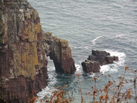
I found a path leading above the River Ribble. Below out of sight was the limestone Rainsber Scar, named in one section Pudsay’s Leap where allegedly a 16thC William Pudsay [from Bolton Hall] leapt on his horse to avoid capture for forging his own silver coins. I did see a herd of Deer on the far bank which judging by their spots may have been Sika.
I was heading for Bolton Mews the remains of Bolton Hall estate converted into private dwellings. One historical note is that King Henry VIth stayed here with Sir Ralph in 1464 at the time of the War of the Roses. Apparently, his divining skills discovered a spring now preserved as King Henry’s Well. Most of the estate is now out of bounds but the covered well can be seen over a wall.

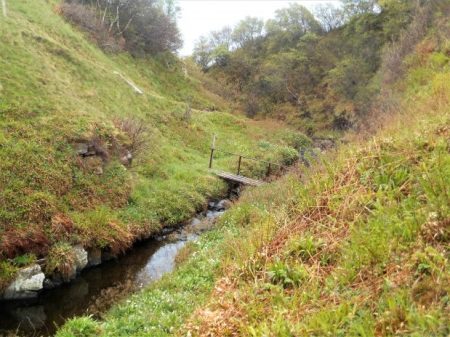
Having circumvented the grounds of the hall I dropped down to cross a footbridge at an old ford on Skirden Beck.  The fields further on to the next footbridge were impassible with maize so I took a short cut fording the low Holden Beck to climb up to the road directly in front of Bolton Peel. This is another interesting house, 17th century with mullioned windows and a fine porch. In front of the building is a preaching cross. The base is ancient, one of four in the area, but the cross is 19th C. The Peel family were early Lancashire industrialists and gave the country a PM in 1841, we are getting a new one tomorrow!


After a fraught but thankfully short stretch on the busy road a fingerpost pointed me into fields leading to the not so historic Hague Farm. I had a friendly, if noisy, greeting from their labrador. 
 Upwards to Rodhill Gate where I joined a sunken bridleway, an old drove lane, going steeply up the hill.
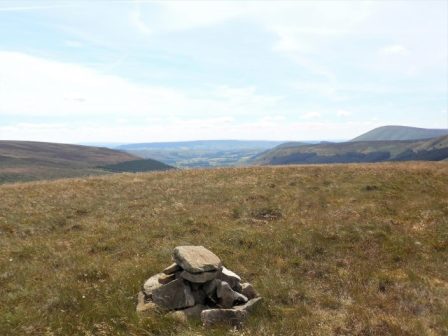
  At the top views broke out of a moody Pendle Hill, the Yorkshire hills towards Skipton and to the north Craven Hills with Pen-y-Ghent proudly in the distance. A splendid spot for a late lunch.


A beeline through fields led to Lower Laithe, an isolated barn.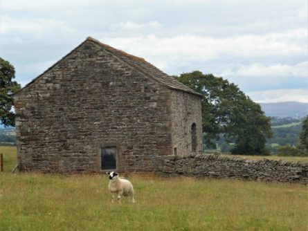 Then it was down into the hamlet of Holden. Braxup House was outstanding with its date stone and unique Yorkshire upper windows.
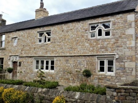


Across the road was the busy Holden Clough Nursery. I frequently visited here when establishing my own garden 40years ago, what a different place then with the owner Peter Foley searching chaotic nursery beds for a plant of your choice, Now all is changed, son John has revitalised the nursery into a ‘garden centre’ but still with an emphasis on plants. I had no money on me for a cuppa in their cafe. 
A strange narrow stepped stile in a wall leads out of the village. I’m heading for 17thC Hungrill farm across the fields. On arrival, the nearby barn conversion takes my attention. A forded lane takes one into a large garden area in front of the impressive building. Several expensive cars litter the forecourt. Obviously private grounds not for me. 
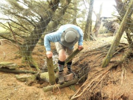
 I slink around the back on a stony track. This leads to fields with no obvious path or waymarks. I think I was distracted by all the wealth on show that I wandered into the wrong fields, waded into small streams, climbed barbed wire fences before coming out onto a road. A right ramble.


Unexpectedly in front of me was a gate leading into a field by the Skirden Beck running down inro B-by-B at the bridge where I was relieved to arrive back unscathed.

I still had time to look around the village at its fine houses and lower green with a stone cross.


Higher was the parish church of St. Peter and St. Paul, rebuilt in the 15th century by Ralph Pudsay. Inside I knew was a remarkable memorial stone to Sir Ralph, a large slab of limestone engraved with images of himself. three wives and twenty-five children!

That was a well-spent afternoon with some lovely buildings to be viewed as well as the surrounding scenery. I was surprised at the underuse of footpaths in a popular area with good waymarking on the whole.
*****

|
|
|
|
|
|