A Catching Yellow. A mundane post mainly about gate catches, oh! and the moon if you get to the end.
“It’s crazy”, as Manuel would say in Fawlty Towers. It’s Easter and the weather is crazy. A few days ago, I was out in sleet and hailstones, so bad we had to curtail the walk early in one of our excellent hostalries. Then calm and warm. Then along comes Dave, the latest storm. My windows rattled all night, but this morning the sun comes out, even though I can hardly stand up in the wind. And this evening all is peaceful, and I’m looking forward to a brilliant sunset.
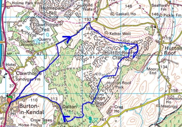
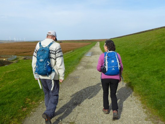
I have just returned from a six or seven-mile walk around Longridge. Blown and blasted by the wind, but invigorated by the sunshine. My mission was to investigate changes on the ground of my, or anybody else’s, Round Longridge Walk. I have talked about the origins and development of this route over the years. The problem is that Longridge is bursting at the seams, its wasteline expanding with all that Easter chocolate. Where there were fields, hedges and trees, we now have desirable countryside housing estates, you know the language. Bowland Meadows, Primrose Drive, and Linnet Lane. All imagined in the developers’ world and all destroying what they represented. Sorry, I have gone off on one there. I keep doing that. But as Manuel would also say, “I know nothing”
I walk down Green Nook Lane. (The term “Nook” refers to a secluded, “out of the way” place.) The lane leads to a secluded house, but we are diverted away over a bridge spanning the infant Savick Brook, which winds its way to Preston and the Ribble. It doesn’t look that clean as it passes. This is not surprising, but not excusable, as we are in the centre of an industrial complex.
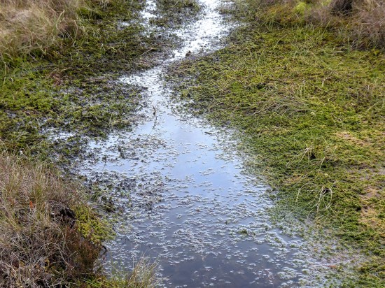
I walk alongside the touchline of one of the football pitches. It’s heavy going after all the rain, wouldn’t want to be running with the ball. I reach a bridge, followed by a new metal gate with one of those fluorescent yellow catches. Said to be hard-wearing and visually clear to all, they are becoming more common in the countryside. The field edge is better going until a dodgy bridge that will need replacing soon. A concrete track is not much better, often disappearing into mud. Originally, I used to follow this track through the farmyard out onto the main road, but there is now a gap into Alston Grange waste land. Last year, this was obstructed, but I’m pleased to find another one of those new metal gates with a yellow catch leading into the ponded area linking to paths that bring me out directly opposite Pinfold Lane.
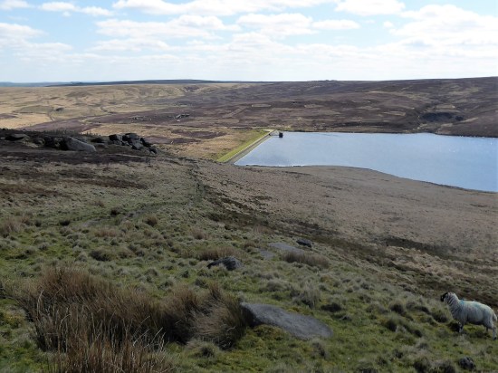
A familiar route was taken down the lane which leads to a few isolated ‘farms’. It is rare to see a car along this stretch, but here’s one coming towards me – the driver’s window reveals a friend happy to chat. The lane had just reopened after a tree blew down last night, someone has cleared it – a large beech. I suspect there will be others down in the area. I pass by the observation hides looking over a disused reservoir. It’s too windy for many birds to be out, though there are swans on the water. The lane leading back up to the village is known locally as Happy Alley, don’t ask me why; there is a graveyard at the top. I don’t follow it that far, but take a wooden gate into the field north of the reservoir. Sheep and lambs are everywhere. I struggle to get over the wobbly stile out of the field and almost turn back, somehow, climbing over the gate was the easiest option. I daren’t risk a fall before seeing the shoulder specialist at the end of the week.
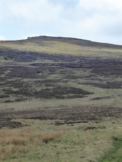
I stick with the roads until I can turn up Tan Yard lane heading steeply up to the top of the village. There had been a tannery up near the quarries at one time. There has been some minor rerouting of the PRofW recently, an improvement that keeps it in the field rather than through houses. A new metal gate, complete with a yellow catch, leads the way. There is another one up ahead. This elevated path gives great views across Dilworth Reservoirs and across the Ribble Valley to Whalley and Pendle Hill.
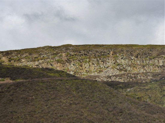
I skirt the caravan park and come out right next to Craig Y Longridge, our renowned bouldering venue. Three youths are enjoying their first visit and doing their best to avoid the wind. A lot of my local walks seem to end up here at present.
To follow my Round Longridge walk further would involve several stiles, so I’m happy to walk down Higher Road back home. I am pleased with the new gates I’ve encountered and can update my description.
Being Easter Sunday, the shops are closed. I had been hoping to look around our new bookshop in the old chapel at the top of the main street, exciting news for Longridge. Something for next week.

Green Nook Lane.

The first bridge and galvanised gate.

The dodgy bridge.

The new gate with yellow catch.


Either way, past ponds.

Pinfold Lane.

Happy Alley, with St. Lawrence’s and the Dog Inn prominent on the skyline.


Dodgy stile.


New gate, yellow latch.

And the next.

Dilworth reservoirs and the Ribble Valley.

Distant Pendle Hill.

Into the caravan site.

Out of the caravan site.

Craig Y Longridge.
*
All of a rather mundane walk today, but in view of the ongoing NASA Artemis space mission around the moon, a good excuse for a post in order to play…


 An earth slide proved popular with children and my not-so-young grandsons.

 … and impromptu rounders.


 More fun was had on the gymnastic apparatus.


 I hear the joyful cries of children long before I see them sledging down the field.


 Around the corner, a friend, JD, is building a snowman for his grandchildren.
  All jolly good fun.


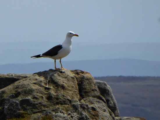
 If I close my eyes I could be at the seaside, the sound of gulls is everywhere. I think they are Black Backed, Great or Lesser?, a large colony exists up here. I try for a video, more for the sounds than the fleeting fly overs. They are becoming more aggressive, dive-bombing me. I look down and there below my feet is a scrape of a nest with three eggs. Better move on taking extra care where I place my feet.