
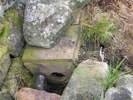
I’ve been impressed so far with the walks from Mark Sutcliffe’s Cicerone guide to Walking in Lancashire. It’s a big county covering all types of terrain from the Coast to the Pennines, and he has chosen well. I must have walked most of his routes many times in the past, but he keeps throwing up little gems of variations new to me. Today was no exception. Nobody in their right mind would climb Pendle up those steps from the overrun village of Barley, I did in October 2020 as the lockdown restrictions for Covid were being relaxed. Never seen so much congestion on the roads or hill, but I was on a mission that day to find Fox’s Well. Mark takes us the quiet but long way up from the little village of Pendleton, a hamlet (tun) close to Pendle.
Pendle Hill dominates the landscape as you drive along the busy A69 though the Ribble Valley. It was along here I came today before branching off into the peace and quiet of Pendleton. I paid my dues and parked in the village hall’s car park as suggested in the guide, Walk 34 – ‘a challenging walk‘. I have been slowly increasing the mileage that my knee injury will cope with, it is nearly a year since the cycling accident that tore the medial ligament. Time is a slow but reliable healer, today’s rough 10 miles would be a test.
The sun is out as I walk past the Swan with Two Necks, I have visions of a pint outside on the return. Pendleton is unusual in that it has a stream running down its main street making it a favourite Ribble Valley venue. The pub regularly wins awards for its beer and food. Higher up the village the Fiddle Stone, once a clapper bridge across the stream now curiously spanning a patch of grass


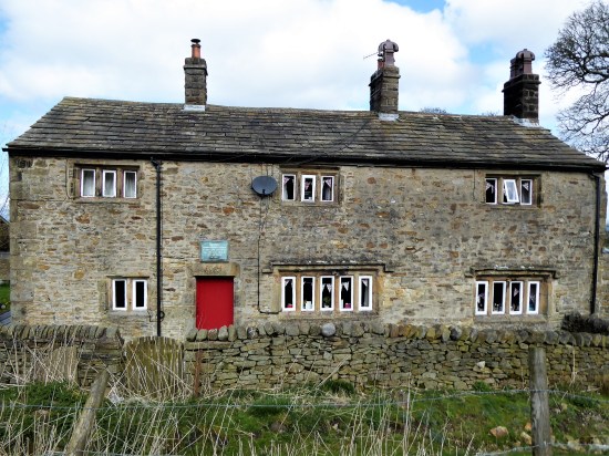
Leaving aside thoughts of beer, I soon take a lane into fields which rise up to Wymondhouses, a Pennine farm once used as a chapel. The plaque above the door states that the first Congregational Church in north-east Lancashire was founded here in 1667, a Mr Thomas Jolly being the nonconformist preacher. 


Rougher pastures and a sunken way led me onwards higher to come out onto the road at the Nick of Pendle, a low pass through these hills between the Ribble Valley and Sabden. A popular stopping off point for motorists seeking a picnic and a view. There were quite a few cars parked up this morning, the first people I had come across.

Back to Longridge Fell and Bowland.


Sabden down in the valley.
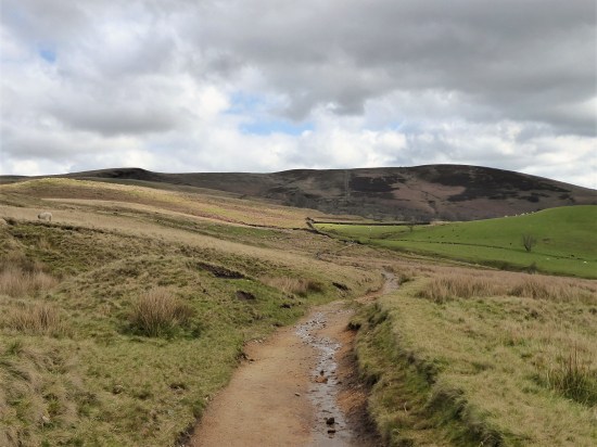
I was quickly back to peace and quiet on an obvious bridleway heading for Churn Clough and the Deerstones.

Bridleway with Deerstones on the horizon.
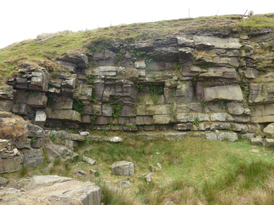
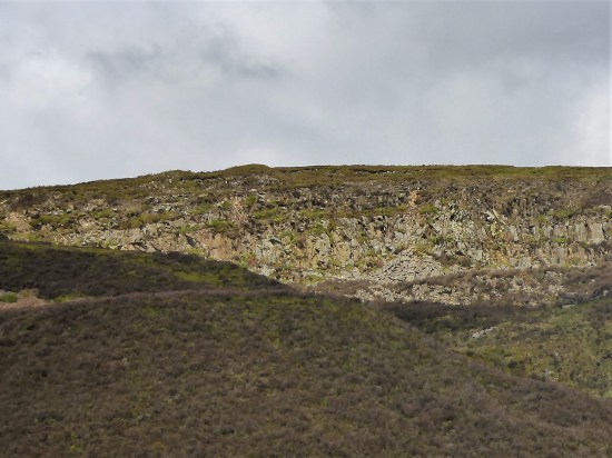
Below is the almost circular Churn Clough Reservoir, now used for fishing. Our path crosses the clough and then climbs steeply up its right bank heading for the Deerstones marked on the OS map. It is quite a pull-up. The day has changed, the sun has disappeared, and dark clouds fill the sky. The Deerstones look menacing in this light. At the back of my mind there is something of interest in the quarried stones, but I don’t divert without good reason. (I later read of the Devil’s Footprint. This feature was natural and caused by nodules of iron rich stone eroding out the harder gritstone bedrock. The legend is that the footprint was left by the Devil as he gathered stones in his apron to hurl at a nearby church. He then clumsily dropped them at nearby Apronfull Hill. I suspect that without prior knowledge the footprint would have been difficult to find. 


The Deerstones.
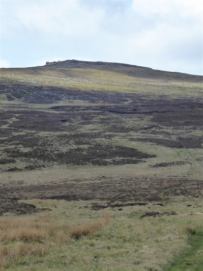
The path comes out onto the open moor at a gate. Paths go in all directions. I just head north on the vaguest of paths to join the main route coming up from the Nick. Pendle is a big hill and I feel minute in this landscape, it wouldn’t take much to get lost in its vastness on these SW slopes. All is sky and skylarks. You can’t capture this with a photograph, especially now that it is so dull.

Could be anywhere.
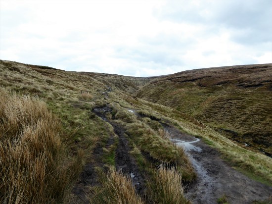
The path becomes more defined on the lip of the prominent Ogden Clough, a highlight of the day so far. 


I have distant memories of ploughing directly up that clough in a hard winter when all other tracks were obliterated. Today the going is good and as one approaches the summit the path has been ‘flagged’ to prevent erosion. There are still very few people using this way, but I fall into conversation with Max and his dog. He is full of tales of Lakeland walking, recently having completed the 214 Wainwright’s. He admits to being a little nervous on some of the Lakeland scrambles, I encourage him to take on Sharp Edge on Blencathra and maybe even Jack’s Rake on Pavey, I am not sure if he is convinced.

Wes, dog and flags.
By now we have reached the summit Trig point, at 557 m,and realise the place is thronged with people from the Barley side, what a contrast to our way up. Nonetheless, it is a good viewpoint over Pendleside and a sit down for a snack, but not for long as under the cloud it is decidedly chilly.


 A new path has been fashioned from the top of the Barley steps to the trig point. I must admit it blends as well as possible into the plateau and must save a lot of erosion. There is also a new stone shelter built into the nearby wall. Once through the wall as if by magic everybody disappears, and I have the whole of Pendle Moor to myself. There is no wind today, so it is almost perfect silence apart from all those soaring skylarks.

Empty spaces – skylark country.
Past the stone shelter and on to Scout’s Cairn, the path is very boggy all the way. The Yorkshire Peaks are a bit hazy, but I’m focused on Kemple End, Longridge Fell and Parlick, Fairsnape Fell framing Beacon Fell straight ahead. As I said photography is difficult in this light. 
The moor goes on forever. But is that sunshine returning? And now for that little bit extra. After a memorial cairn I drop steeply down into the extensive Ashendean Clough, a deep incision in Pendle’s SW slopes. This could be Scotland.

Memorial to two Clayton-le-moors Harriers members.

Down steeply to Ashendean Clough. Can you spot the Nick on the horizon?

The guide says to cross the stream, but that is not so easy today without getting my feet wet or even worse. A perfect little valley full of bright yellow gorse. A footbridge by a barn and I’m into rough pasture aiming for the next barn which I cannot see, but we get there in the end and come out onto the lane by Mearley Hall. That has been quite some hill day.


Howcroft Barn.


I arrive back in Pendleton and treat myself to that beer, sat outside in the late sunshine. Perfect. Reflecting on what has been a connoisseurs walk, mostly away from the popular Pendle routes. That has been quite some hill day.
***


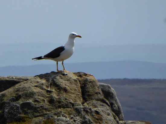
 If I close my eyes I could be at the seaside, the sound of gulls is everywhere. I think they are Black Backed, Great or Lesser?, a large colony exists up here. I try for a video, more for the sounds than the fleeting fly overs. They are becoming more aggressive, dive-bombing me. I look down and there below my feet is a scrape of a nest with three eggs. Better move on taking extra care where I place my feet.


 I have a few ideas for some hilly walks now the weather has improved, but they would involve travelling on the busy Easter roads, so I manage to procrastinate the morning away. Let’s just stay local and have a wander up Longridge Fell checking out a few bird habitats at the same time. I’m keen to see the Great Crested Grebes performing their mating dance on the little reservoir at the top of the village. This is where I park my car. Craig Y Longridge is busy with climbers.


 The clocks have changed, but my body hasn’t caught up as yet. Today had a sparkling alpine start and promised to be the best of the week. I struggled to get up having lost an hour somewhere. But with the minimum of faffing I’m away by 10.30. It only takes me a half hour to drive out to Dunsop Bridge. I know the sun doesn’t set tonight until after 7pm, so there is no rush, that’s the way I like it.


 The lime kiln gives a clue as to the bedrock hereabouts, but I shall soon be high in gritstone country.
 The track soon peters out, and I’m left on boggy pathless territory forever upwards. This is designated as a bridleway, and I remember coming this way on a mountain bike 35 years ago with my son. No chance now. This area is isolated from the usual Bowland haunts, and I’m surprised to meet three walkers descending the pass. A friendly trio and we exchange banter. They have driven up from Manchester, preferring this area to the crowded Peak District. They soon become a dot on this vast landscape as they descend towards the Trough Road and I struggle upwards. Across the way Totridge Fell keeps its head above most of the fells around here.


 Looking back I was surprised to see how steep and craggy are the northern slopes of Whin Fell. At Brennand Farm (notice how it complements Sykes Farm passed earlier) all is pleasant with newborn lambs in the fields, no Spring walk is complete without some lamb photos. On down the Brennand Valley and then strangely back upwards to join Whitendale.


 This week I have been alternating short walks and flat cycle rides with nothing of note to report. Everything came to a standstill yesterday with the collision of cold winds from the north with a front from the south. Amber warning. My son cancelled a lunchtime visit from Manchester and I watched the snowflakes falling in the afternoon. During the night things must have turned nasty as today I woke to a couple of inches of snow. (The radio told of far worse conditions in the Pennines) It was interesting to try and identify the tracks across my back garden, one doesn’t know what transpires in the night. Something I should resolve either with sitting up into the wee hours or more likely installing a motion detecting camera.


 I may have used this title for a post in the past. Whilst fellow bloggers are exploring Manchester, White Nancy, Covid and Wildlife crimes I’m content with a walk around my local lanes. After my drubbing, is that a word, the other day on the Guild Wheel cycle route contentment is the prime objective. I live on the edge of the countryside, but only just with all the new developments, so for many walks I don’t need my car – just set off from the front door.

 I stop to talk to a farmer about the winters we never have these days. (tempting fate I know). Along comes a car which stops to reveal a dog walking friend fresh off the fell and heading for a nearby farm café, a good catch up ensures. I’m then admiring the hedge layering skills along the way and am lucky enough to come across the skilled labourer himself. A chain saw now makes the labour easier, but he has to be careful with the final close cut. A bill hook finishes off the branch severing, leaving a slender life giving, bent over, horizontal, stem for further growth. The whole process is to keep the hawthorn hedge thick at the base and stock proof in the future. He seems happy in his work and as he says ” jobs a goodun”


 Not bad for a local walk of 5 miles.


 Down on the River Wyre in St. Michael’s a tragic drama is transpiring, a 45-year-old local lady, Nicola Bulley, has gone missing whilst walking her dog by the river. You will have seen it on the national news, the trauma her family are going through as the days pass, without resolution, doesn’t bear thinking about.


