Tag Archives: Art and architecture.

ARTY THINGS IN THE EDEN VALLEY.

P1090554

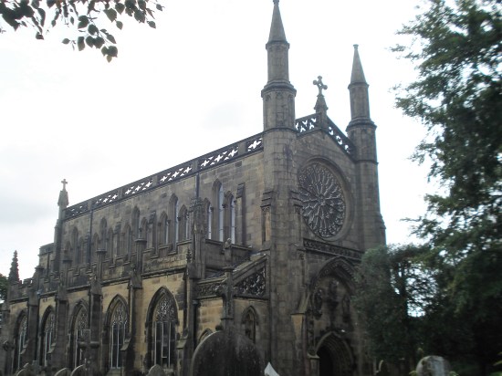
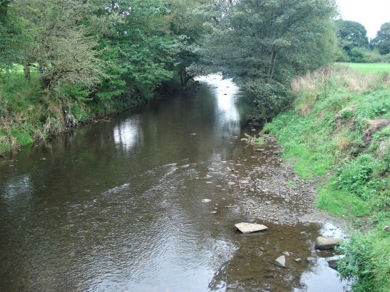
It must be 40 years since I walked  ‘The Eden Way’, which as the name suggests follows the River Eden from its source in the fells above Mallerstang, through Kirkby Stephen and Appleby, past Carlisle to the Solway Firth. I remember I only took a bivy bag for lightness and ended up quite damp several mornings.

It’s an area a little out of comfortable reach from Lancashire and I have neglected it over the years. Some recent climbing nearby has brought it back to my attention and it so happens that one of the many books I have read in this month or so of poor weather was ‘The Stream Invites Us To Follow’ by Dick Capel. ( I seem to recollect John Bainbridge recommending it, that is one of the joys of Blogging, your readers, few though they may be, often come up with suggestions which you have overlooked. Thanks John )

Dick Capel came to Cumbria in 1982 working as a warden in the National Park as it was then. He changed areas in 1991 starting work for the East Cumbria Countryside Project, ECCP. This aimed to promote the conservation and enhancement of the natural environment of East Cumbria.  During this time he became heavily involved with the Eden Valley and particularly in developing a series of sculpture trails reflecting the area. He  writes evocatively of the area and his own trials and tribulations. In particular he highlights The Eden Benchmarks, The Poetry Path and a series of Goldsworthy Pinfolds that appeared under his watch.

*

The Eden Benchmarks.

The  Benchmarks are a series of ten contemporary stone sculptures located at intervals along the length of the river Eden between its source above the Mallerstang valley and to the Solway Firth.

“Ten sculptor’s were chosen as part of the East Cumbrian Countryside Project, ECCP. The artists’ brief allowed creative freedom to produce site-specific sculpture, which harmonises with the landscape and captures the essence of each unique locality. The sculptors worked in residence for six weeks and this enabled them to formulate their ideas by familiarising themselves with the locations and talking with local people, including schools, who were encouraged to visit their workshops to see the sculptures taking shape”

“Collectively the sculptures give visual expression to our awareness of the river’s ecology and the need to look after it; individually they foster a profound sense of place, their capacity as seats accommodating an interactive focus for quiet reflection”.

*

The Poetry Path.

Encouraged by the success of Eden Benchmarks Capel’s next arts project was the Poetry Path by the Eden on the edge of Kirkby Stephen interpreting the hill farmer’s life and love for the Eden Valley.

“Twelve short poems, written by Meg Peacocke, have been carved by lettering artist Pip Hall on blocks of stone installed at intervals along a circuital route either side of the river Eden. Decorative motifs with each poem depict some of the activities associated with every month of the hill farmer’s year”  

“The aim of the Poetry Path is to introduce a permanent and integrated interpretative experience into the landscape, which is assimilated as part of the heritage it promotes and conveys a powerful message about the farmer’s potential role in maintaining a sensitive but viable hill-farming regime in relation to the natural environment as a resource both for nature conservation as well as food production”.

  I could not have written that.

*

Andy Goldsworthy’s Pinfold Cairns.

In the area there are six of these stone cones built into village pinfolds, which used to hold stray animals,  Created by the sculptor Andy Goldsworthy (1996 – 2002) supposedly based on the prominent piles of stones called the Nine Standards above Kirkby Stephen. At one time Goldsworthy lived in the area.

*

The funding ran out in 2008 for the ECCP.  But the art remains. Sculptures and poems reflecting the area’s heritage and beauty, and hopefully enhancing peoples enjoyment and understanding of the countryside and environment.

Dick’s book has acted as a catalyst for some exploration on my part. I find myself visiting friends up here so I have decided to stay on, I’ve booked into the Black Bull in Nateby for a few days. P1010169

A related website  provides all the information you need on all the installations. I have quoted above from that site.

P1010171

*

“The stream invites us to follow…and certainly, there is no more fascinating pastime than to keep company with a river from its source to sea”  W H Hudson, Afoot in England.

WHERE WATERS MEET.

P1000585

On our doorstep are two of the North’s great rivers, the Hodder and the Ribble. I don’t need an excuse to walk along either of them, and today I combine the two where they merge at Winkley on past Hurst Green. I park at the prominent bus stop just before the road drops down to the Lower Hodder Bridge. My previous posts on this area contain far more history and information than I’m about to give you on today’s short walk.

Hop across the road into fields and I’m on the popular Tolkien Trail and the not so popular Ribble Way. The well trodden ground shows just how popular anything to do with Tolkien has become, I estimate that 50% of people visiting Hurst Green walk the trail. Today I’m only sampling it. Soon I’m into the grounds of Winkley Hall and then become distracted by some fine bracket fungi. P1000566P1000592

P1000564

Past the farm with its ancient moat, now boasting a new ‘duck house’, and there is the Winkley Oak. Today I measured the circumference of the bole, 13m which is over 40 feet. somewhere I have read that it is almost 500 years old. This tree is an old friend of mine and I am pleased to see it in fine form. P1000576P1000578P1000583

By the fishermen’s hut the River Hodder slides into the River Ribble which continues it’s stately way to the sea. It is helped on its way a little farther by the smaller Calder coming from Burnley via Whalley. This latter junction is where the Hacking Ferry boat plied its trade until the 50s. The boat house is a little farther round the bend. I have always been intrigued by the tumulus marked on the map nearby and I try a long distance shot of it. The river is in gentle mood today but flood debris in the trees shows how turbulent it can become after heavy rain. P1000584P1000593P1000597P1000588P1000594P1000601

Soon after Jumbles I’m off the regular trail and heading up the hill to Cross Gills Farm. On the way I meet the lady farmer driving her buggy and checking on her sheep which she can recognise individually. We chat about all things farming, she is uncertain as to the future now that perhaps food can be created in the laboratory. A frightening thought. I’m offered a lift in her buggy up the steep hill to her farm, but that would be cheating wouldn’t it? and I may have missed these fungi and the view over the Ribble. P1000602P1000606P1000607

Straight across the main road into Stonyhurst College land. I circle the cricket pitch with it’s lovely period pavilion. P1000613

Out past Gardener’s Cottage  onto the road  leading back to my car. Halfway along I’m accosted by a lady, doesn’t happen often, who knows me from my past. Once I recollect who she is we spend more time lamenting the demise of all things important to the fabric of our society.  That’s two conversations today reflecting on our past and our future, and I was only out for a bit of exercise. That’s how it goes around here with such lovely folk. I reach the car just as it starts raining – serendipity. And there is Pendle as ever keeping a watch over the Ribble Valley.

P1000563

***

CaptureWinlkey.

FUNGAL FUN AT BROCKHOLES.

P1000406

I am a born again Mycologist. I’ve seen the light.

I’d signed up for an ‘Introduction to ‘Fungi Walk’ at Brockholes. In the depths of Brockholes’s Nature Reserve Jim, our ‘guide’, holds a small piece of twig with some even smaller black and white stems – Candlesnuff Fungus, for us to examine.  This minute organism may even provide the compounds to fight cancer. He emphasises the importance of fungi in evolutionary terms and future research. Fungi, neither animal nor plant, have been on this earth 1.5 billion years. There are millions of varieties, but we only know of a small percentage. They have helped our environment to evolve. And what may they hold for the future?

What is the world’s largest living organism he asks? – not the Blue Whale or the Sequoia Tree – no there is a fungus that occupies some 2,384 acres in Oregon’s Blue Mountains. 1,665 football fields, or nearly four square miles. A truly humungous fungus. I like the style of our ‘funguy’ Jim. P1000382

Jim, has only this week been on the telly, BBC Northwest Tonight  with everybody’s favourite Roger Johnson in a feature on Brockholes Nature Reserve. Have a look Here if it is still available.

We are in the presence of an amateur expert though even he can only identify a fraction of the thousands of UK’s fungi. Perhaps a hundred or so noted at Brockholes. And the general advice is don’t eat any of them unless they are on the shelves at Tesco. (other supermarkets are available) The names of some of them give a warning. Death Cap, Destroying Angel, Funeral Bell.

***

It didn’t stop raining all night, and I was expecting a wet morning ahead so dressed for the occasion with full waterproofs as I parked outside the reserve in the Crematorium grounds, (saving the £5 parking fee). This gave me a brisk mile walk down through the woods to the Floating Visitor Centre meet up. There were maybe 20 of us, an eclectic bunch. The sun shone throughout the morning and hence I sweated undercover.P1000347P1000348P1000353

P1000357
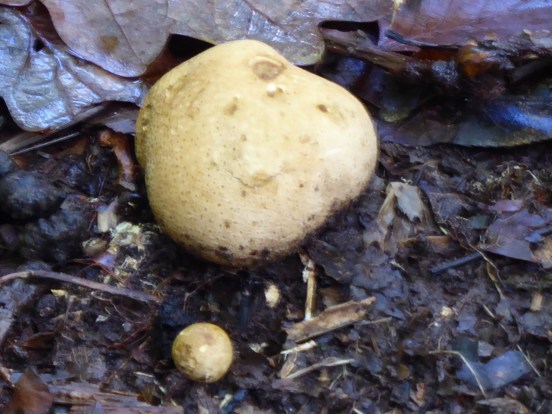
Jim led us out into the reserve, and we had only gone a few metres before he stopped on a grassy verge. A keen eye was needed to spot the tiny fungi, Blackening Waxcaps, They slowly revert to a black mess. I would have walked straight past them or even worse squashed them. The more studious followers were making notes.

P1000363P1000362

Then onwards into the woods. Puff Balls, Brackets, Slime, Jelly Ears etc etc. Here are some of my hurried photos. P1000366P1000365P1000369P1000368P1000375P1000379

Jim was a wise general naturalist as well as a fungus finder and imparted words of Lancashire wisdom as we proceeded. All very entertaining. Buzzards flew overhead and Long Horn Cattle grazed the meadows. All too soon the adventure was over, and we headed back to the floating visitor centre and more importantly the café. P1000386

After a coffee I had a stroll around the rest of the reserve. There wasn’t a lot happening, so I headed to the River Ribble and followed its banks back to Red Scar Woods and the climb back up to the crematorium high above the river. I was peering around me and examining every bit of dead wood for specimens, I didn’t spot many but I am full of resolve to get out tomorrow with my new-found enthusiasm for fungi. I need to download one of those apps to my phone to help in identification. P1000383P1000350P1000389P1000391P1000394P1000396P1000398P1000399P1000403

The Autumn colours are finally coming through and the cherry trees in the Crematorium were particularly dazzling. I had ended up walking about 6 miles in my wanderings.

A SUNDAY STROLL AROUND BLEASDALE.

P1000336

This is one of my favourite walks for the wetter months. Virtually dry underfoot the whole way and yet in touch with the imposing Fells of Bowland. I’ve been walking these paths for 50 years since moving to the area. We used to push our two young sons around in a double buggy in the early seventies, remember those. CaptureBuggy

I keep returning and have since introduced my grandchildren to the delights.  But looking back at my recent traverses, there have been many on here, I always seem to have walked anti-clockwise from Bleasdale Church. Time for a change.

I am always looking for somewhere new to explore locally. Today, despite the clocks going back and giving me an extra hour in bed, I’m not really up and going till midday. I have missed my chance to cycle the Fylde Coast or even the Guild Wheel, it will be dark or gloomy before five. So I fall back on the tried and trusted – Bleasdale Estate. But let’s look at the map and why not go clockwise for a change or even for the first time for years, unlikely though that seems.

The mention of Bleasdale Estate may jog memories in some of you of the disastrous court case in 2018 of their gamekeeper, James Hartley, accused by the RSPB of raptor persecution. Technicalities ruled the damming video evidence of his crimes inadmissible. I still question the partiality of the judge. Is Mr Harley still employed on the estate? Have a read for yourself – Case against Bleasdale Estate gamekeeper collapses as RSPB video evidence ruled inadmissible – Raptor Persecution UK

Putting that all aside I park near the Lower Lodge, I’ve always wanted to live there, it’s so cute. The road is still marked Private, but pedestrians seem allowed, I’ve never been challenged, famous last words.  Now that the estate have introduced a ‘Glamping’ site quirkily called ‘Lantern and Larks‘  on their property (more of that later) there is more traffic up and down the private lane. P1000304

I must say that everything about this estate, maybe apart from their raptor persecution problems common with most shooting estates, is immaculate. They obviously take a pride in their appearance. The driveway past the lodge is newly mown either side to perfection. The Bleasdale Fells are in the background of every view on this walk. Since I was last here there has been a lot of clearance of the mixed plantation on the right which was becoming invaded with the dreaded rhododendrons. It will be interesting to see how they develop it further with plantings. P1000306P1000305P1000311P1000310

Across the way, as I walk down the manicured lane, Bleasdale Tower, built in the early 19th century sits at the base of the fells. The sun is not quite making an appearance, but the temperature is high for almost November. There is not a drop of wind and all is silence as I stroll up towards the Tower. Well not quite because a delivery van keeps passing backwards and forwards looking for some address.  It won’t be easy out here when the post code covers a vast area. A lady dog walker helps him out – hopefully as he speeds past me to the remotest of houses. P1000308

P1000312P1000313

I walk on past the buildings that at one time in the C19th served as a Reformatory School for Preston.   North Lancashire Reformatory for Boys, Bleasdale, near Garstang, Lancashire (childrenshomes.org.uk)  P1000314

The lady with the dog catches me up as I’m taking photographs of stone walls. I’m reading a book by Angus Winchester all about Dry Stone Walls, recommended by Walking Away,  and I’m keen to put it into practice. I would hazard a guess that these walls are mid C19th when the estate was being established. Her dog photo bombs my picture of an old ‘gate’. P1000315P1000316P1000321P1000323P1000325

The lady lives in a property on the estate and tells me she was born at Vicarage Farm along the way. That brings back memories of my attending that house in the middle of the night, when GPs did home visits. I’m talking about the late 70s or early 80s. She recalls her mother telling her of an occasion requesting a visit to her ailing aunt in this remote farm and the doctor saying put on all your lights, and I’ll be able to find you. That was probably me. What a small world.

She talks of living out here and attending the local school and church. The school is now closed, but the church, St Eadmer, is open and has a service once a month. She disappears into a farm to meet a friend but tells me to look out for the original site of the school marked by some stones along the way.

On the old track, now grassed over, and in my own world I startle to hear a bike bell ringing behind me. A cyclist is taking a shortcut home to Chipping. He dismounts, it’s muddy anyway, and we walk together chatting about all things cycling. I forget to look for the old school foundations after the vicarage, next time. We also pass the diversion to Bleasdale Circle, though I doubt I would have taken it as the fields are so waterlogged. At the little school I take the estate road going west, and he pedals off down the main track. P1000328P1000329P1000330

P1000332P1000333P1000334

P1000331

It is along this stretch of lane are the Glamping pods, Lantern and Larks. They don’t look the most attractive, a cross between a shed and an awning from this vantage point. Turns out they are part of a National Group with other locations. As you can imagine they are not on the cheap side of accommodation, but where is nowadays? In their blurb they talk about the wild life to find in the surrounding area and highlight the Hen Harrier. It is these grouse shooting estates that are responsible for most of the deaths of the Harrier, a mixed message there.P1000335P1000340P1000338

Just past here on the right over the infant Brock is an old packhorse bridge said to have been on the way from the estate properties to the church and school. I would like to know more. Cutting across some fields I’m soon back at the car from there.  P1000341P1000342

Well that has been a very satisfying round.

***

CaptureBleasdale.

PENNINE POETRY – MIST.

P1000172

Simon Armitage’s Stanza Stones – Mist.

We, Clare, JD and I, are well on schedule for our quest to visit the final Stanza Stone for today. After the Snow and Rain along comes the Mist.

The scenery changes on our onward Northern drive, deep wooded valleys crowded with solid stone terraced mill houses.  Cragg Vale, Mytholmroyd (birthplace of Ted Hughes, Poet Laureate 1983 – 2008) Hebden Bridge, Pecket Well. We start dropping off the moor into Oxenhope when a steep narrow lane brings us back into the hills looking for somewhere to park under Nab Hill.

CaptureMist.

A muddy track leaves the lane, we check GPS that it is the correct one, a Stanza Stone waymark is soon noticed. Passing small quarries, no soaring climbing faces here, the rock is softer and splits into thin slabs possibly to be used as stone roof tiles common in Yorkshire at the time. We are on the lookout for a larger quarry on the right and then a stone cairn. Wind turbines look down on our wanderings. The problem is that there are several piles of stones on the edge of the moor, when is a pile of stones or a stone shelter a cairn? I dismiss the first stones and head farther towards an obvious larger cairn, ignoring smaller ones on the way. There is doubt in the team. The clue we have is to drop below the cairn to find slabs of rock. Nothing obvious here, how far down the slope should we go? We repeat the process under the other ‘cairns’. JD wanders off to pinpoint the OS map’s indication of the stone with his GPS, that doesn’t help. Clare scouts the lower ground, there are lots of slabby rocks about. I ponder that not being able to find the Mist Stone in the mist would be ironic, we are having difficulty on a perfect day. At last back at the first pile of stones we discover the correct slabs. P1000198P1000218

P1000220

P1000201P1000202P1000204P1000208

The story goes that one slab was lifted in situ for Pip Hall to carve, it had a hairline crack down the centre and as the stone was moved it split, much to the consternation of the workmen. Undaunted Pip carved each one independently to later place them together, so that the lines hopefully read as one. (The picture of the split comes from their book) One has to give some thought to this lady out on the moor in all weathers carving away. These slabs are of a softer grit than the ones previously visited, Snow and Rain, and the lettering paler. Simon’s poem is equally evocative though, looking out over the valleys and moors where the Bronte Sisters once roamed for inspiration. Lichens are spreading out over the letterings giving them a more ancient look than their mere 12 years – come back in another 12 years. Someone’s ashes are scattered around and will slowly be blown across the moor or crushed underfoot.

P1000233

The split slab back in 2011 before repositioning.  

P1000212P1000206P1000213P1000215P1000210

Mist.

Who does it mourn? What does it mean, such
nearness, gathering here on high ground
while your back was turned, drawing its
net curtains around?

Featureless silver screen, mist
is water in its ghost state, all inwardness,
holding its milky breath, veiling the pulsing machines
of great cities under your feet, walling you
into these moments, into this anti-garden
of gritstone and peat.

Given time the edge of
your being will seep into its fibreless fur;
You are lost, adrift in hung water
and blurred air, but you are here.

The three Stanza Stones we have visited so far have exceeded my expectations and I can’t wait to return with our team to the Ilkley Area, home of the Literature Festival where the idea was born, to discover the remaining three, Dew, Puddle and Beck. Wouldn’t it be great to find the fabled seventh, but I suspect that will only appear to an alert walker somewhere on the Stanza Stone Trail.

***

My navigation skills have improved for the drive home, – these are roads I know well up above Wycoller. We even have time to stop off to look at one of East Lancashire’s  Panopticons, The Atom. Both a shelter and a viewing point over the valley and to Pendle Hill. I am sure from memory that when it was first installed there was a stainless steel atom in the centre of the ‘Molecule’ – no sign of it now.

(The other three are Colourfields in Blackburn, The Singing Ringing Tree above Burnley and The Halo above Rossendale.) P1000231

P1000232P1000230

The day couldn’t have gone better. Sunshine, excellent company and three poems found and enjoyed.

PENNINE POETRY – RAIN.

P1000172

Simon Armitage’s Stanza Stones – Rain.

15 miles of scenic driving on open moorland roads and then through densely knit and gritty Pennine communities brought us to the White House Inn on the road out of Rochdale. We have just come from Marsden where up in Pule Hill quarry we found and admired our first Stanza Stone, Snow, a water themed poem by Simon Armitage skilfully inscribed by Pip Hall. This is one of six, or maybe even seven, scattered on the rugged Pennine Watershed between Marsden and Ilkley. There is a 45-mile walking trail between them all, but we have chosen to use the car and visit them individually. We have resisted the idea of visiting each stone according to the weather depicted. Let’s enjoy today’s sunshine.

The White House is an iconic moorland inn situated where the Pennine Way crosses from the peaty horrors of the Peak District peat to the pleasanter Yorkshire Dales. Many long distance walkers have been known to give in here. Most people today are either enjoying lunch in the pub or doing short walks from the road, as are we. CaptureStanza 2

The Pennine Way is followed alongside an aqueduct connecting several reservoirs. All level walking. I camped along here once with my young son on a Lancashire Borders Walk. Sensibly we had eaten well in the pub beforehand and only needed water for a brew. The brown peaty solution didn’t need a tea bag, today my tea was already brewed safely in my flask along with a picnic lunch.1qhsxyqg

P1000177P1000179P1000180

A miniature arch took us over the water and into Cow’s Mouth Quarry. This is where I become boring once more as I try and trace routes climbed way in the past. They are mainly slabs, with often little protection available, needing a steady head. Nowadays with bouldering mats the picture has become blurred between a roped route and a high ball boulder problem. P1000189

P1000195

But I’m not here to climb today, I’m with Clare and JD looking for the second of Simon Armitage’s Stanza Poems – Rain. This one is easy to spot being at the base of a rock face right by the path. Pip had a lovely canvas to write on, but advice was first taken from climbers so that no footholds were destroyed, or new ones created. Pip’s carving seems more pronounced than on Snow back at Pule Hill, this rock, being more compact, maybe helping. The letters are imbued with gold.  We read aloud the poem marvelling at Simon’s turn of phrase. P1000181

P1000186

P1000185P1000188

Again here is the poem in case you can’t make it out in the pictures.

Rain.

Be glad of these freshwater tears,
Each pearled droplet some salty old sea-bullet
Air-lifted out of the waves, then laundered and sieved, recast as a soft bead and returned.
And no matter how much it strafes or sheets, it is no mean feat to catch one raindrop clean in the mouth,
To take one drop on the tongue, tasting cloud pollen, grain of the heavens, raw sky.
Let it teem, up here where the front of the mind distils the brunt of the world.

We find a sheltered spot for lunch. I forget to take a picture of the extensive views across the moors with distant reservoirs, wind farms and mill chimneys. I am on too much on a high from the poetry – tasting cloud pollen. We wander back with shared tales of moorland adventures.

Fellow us farther on our poetry quest.

PENNINE POETRY – SNOW.

P1000172

Simon Armitage’s Stanza Stones – Snow.

Simon Armitage is steeped in Pennine Grit. Brought up in West Yorkshire and living in Marsden in particular, his works have been influenced by the rich heritage of the area. I have been reading a few of his books and poems recently and feel an affinity to his working class background. When you delve deeper you realise the profound and original intellect of the man and his ever widening focus. That’s why he is Poet Laureate.

My friend JD, who has featured many times in these posts, told me about some of Simon’s readings on the radio, such as his journey as a modern day troubadour down the Pennine Way, and more interestingly his series of poems carved and brought to life in the rocks of the high Pennines. The Stanza Poems, six poems on the theme of water in various forms: Snow, Rain, Dew, Puddle,Mist and Beck,  a collaboration between himself, Pip Hall the stone carver, and local expert Tom Lonsdale, a landscape architect. Those looking hard enough might stumble across a seventh Stanza Stone, a secret stone left in an unnamed location within the Watershed area, waiting to be discovered and read. As far as I know nobody has.

I bought the book and was immediately fascinated. Stanza Stones a book by Simon Armitage, Pip Hall, and Tom Lonsdale. (bookshop.org)

What they have produced is truly magical and the insights of the protagonists brought to life in the book. I take my hat off to the literacy skill of Simon but equally so to the dedication and art of Pip the sculptress which will be borne out in our efforts to locate the stones.

A fairly tough trail, considering the moorland terrain, of 50 miles or so has been worked out between the carved stones from Marsden in the south to Ilkley farther north. Suffice to  say JD and I never got around to walking it, mainly because I thought some of the 20-mile days across rough moorland with no bed at the end was too much for me to contemplate. I happily compromise and suggest a motorised raid to the individual stones. The idea catches fire and in a conversation with the ‘Slate Poem Lady of Longridge Fell’ (another story enacted in my lockdown posts) we have a willing and knowledgable accomplice. Welcome aboard Clare, one of her slate poems in her garden says it all.

P1000145

Messenger. Mary Oliver.

Cometh the day cometh the hour. We are off to Marsden with a fair forecast. I’m afraid to say my navigational skills fell short of the sat nav lady whom I chose to ignore. We came at the first site in a round about way, but the moorland scenery and deserted roads were worth it. Mutterings from the driver and the other passenger who kept well clear of any navigational mistakes. CaptureStanza 1

An unpretentious lay-by below Pule Hill, west of Marsden, is our starting point. The steaming brick ventilation shafts of the Manchester to Huddersfield railway are obvious above us on the hillside. As well as the railway down there somewhere the narrow Huddersfield Canal goes through the Standedge Tunnel, the longest, highest and deepest canal tunnel in Great Britain. Their combined  history is worth a read, it’s a lot more complicated than you think. Above all that are the ramparts of Pule Hill quarry and rocky edge on the skyline. Fortunately for us the original quarry incline is still intact giving an easy climb up into the workings. Memories of plodding up here with ropes and gear for a day’s climbing come flooding back, and I feel a quickening in my step. We are impressed with the amount of quality stone work just giving access to the quarries. What a substantial industry of men must have worked away on these slopes. P1000147

P1000149P1000150

I’m distracted by the quarry rock faces I have ascended in the past whilst the other two go off in search of the poems engraved in stone. P1000168

P1000151

Nature’s art.

P1000155

At the far end of the quarry are two large blocks built into the wall and there is our first poem laid out in front of us, letters carved into the two stones bringing out the colours of the rock from those past quarrying days. We trace with our fingers across the rock surface. Already after 13 years the patina is changing, and green lichens are crossing the letters, what will another decade bring. There is already some slight damage caused by man. P1000167P1000160

P1000163P1000164

Here is the poem transcribed as it is difficult, but not impossible if enlarged, to read in the photos. The stanzas cross between the two stones.

Snow.

The sky has delivered its blank missive. The moor in coma.                                   

Snow, like water asleep, a coded muteness to baffle all noise, to stall movement, still time.

What can it mean that colourless water can dream such depth of white?             

We should make the most of the light.                                                                           

Stars snag on its crystal points. The odd, unnatural pheasant struts and slides.

Snow, snow, snow is how the snow speaks, is how its clean page reads.

Then it wakes, and thaws, and weeps.     S A.

Before we leave, we discover a beautifully constructed curving wall seat inscribed with ‘Ilkley 45 1/4 miles’ which is the distance to the last stone via the trail, thankfully we have the car to take us onwards.P1000170P1000169

We skip happily down that incline, pleased to find the first stone and captivated by the scenery and the poem it now holds. Let it snow.P1000176

***

A SOUTH LAKELAND RIDGE.

P1000055

I smile to myself as I reply to the email from Sir Hugh. He has plotted a walk for us from Cartmel taking into consideration our combined physical failings. I did the same for him on our last walk and his immediate response was ‘we could perhaps extend it farther’ by using some other paths. All turned out well – LEVEL FROM LEVENS. My immediate response this time, without a good deal of thought, is that we could easily extend his proposed route from Cartmel. No more is said until the decision time comes later in the day. Somewhere along the line is a hidden understanding of the other person’s idea of a good walk, I don’t think we have ever crossed that line though we have had some exciting episodes close to it.

What is going on in Cartmel? There are cars parked alonside every road and a one way system in operation. We follow it blindly into the racecourse car park where we had meant to park in the first place. £2 for the day as we scramble to find some change. There is a Medieval Pageant in the village explains the man on the gate. (Subsidised parking with medieval prices, normally £4 for the day or a hefty £10 on race days) 

P1000014

Sir Hugh trying to look enthusiastic at the start of the walk.

It takes a bit to orientate ourselves in the massive car park which is filling fast. We are the only ones taking a bearing across the racetrack to enter the woods on the northwest side. Once in the woods the path is not as clear as we had expected but a bit of steep climbing, not Sir Hugh’s favourite at the moment, and we were out onto little lanes and on our way. 

P1000015

On your marks. 

P1000019

Steeper than it looks.

P1000021

On our way.

The little lanes connect up with isolated properties on the hillside – Well Knowe, Hard Crag, Wall Nook, Over Ridge and finally Speel Bank. Each unique in its own way but all bearing the mark of Lakeland vernacular architecture from the C17th- C18th. They all look in good condition in stunning scenery and in the last decade or so most of the outbuildings have become out of the way holiday cottages. Though in a hard winter would be difficult to access.

P1000037

Halfway up we come across an agricultural machinery graveyard. Old tractors, strange looking implements, old cars and strangely up here a speed boat, all rotting into the vegetation. We find it a bit spooky and once Sir Hugh mentions some American horror movies it is time to get going. Only just last night I had rewatched Psycho for the first time for years – remember the cars in the pit.

P1000025

I then took to photographing the various stiles we squeezed through or climbed over.

A couple of girls pass us brandishing what looked like a well presented leaflet of walks in the area, though their map was somewhat basic for the almost identical walk that Sir Hugh has us on. I will look into finding this publication as we are well impressed with the area so far. We never see them again.

P1000038

The ridge is up ahead.

The lane keeps going up past the last farmhouse, which shows no signs of gentrification for the Airbnb set. P1000040

Soon we were onto what I’m calling Ellerside Ridge, volcanic rock outcrops everywhere, we even spot a few bouldering areas. Lakeland in miniature.P1000039

P1000044

A last stile over a high wall and suddenly we are looking down on the Greenodd/Cartmel Estuary. There is Ulverston, there is the railway viaduct from Cark and there is Chapel Island off the coast from Conishead Priory. I seem to remember being told that one could walk out to the island at low tide, not something I will be doing. All places familiar to us from previous expeditions but never seen from up here before. We are thrilled with the way the walk is turning out even though rain clouds are massing over the sea. The undulating ridge gives us plenty of time to take in all the views. P1000041P1000063P1000052

After about a mile we can see from the map a nearby trig point on How Barrow, a lowly 170m but one we could not walk past without visiting. Fortunately a gate gave us access to that side of the fell and the proud little craggy summit was soon reached, A perfect spot for lunch. Others also reached the summit for the first time, and all proclaimed its vantage point despite the incoming rain, we are a hardy lot.P1000057

P1000059

P1000062P1000064

P1000065

From up here Cartmel village was a little hazy but the backdrop of Hampsfell reminds me of the last time I visited Cartmel on my trek around Lancashire’s monasteries. P1000056

Back on the other side of the wall a couple with a smart Airedale seemed to be hanging around. “could you tell us where we are and how do we get back to Cartmell?” They have no map and had been wandering in completely the wrong direction. Sir Hugh demonstrates the usefulness of GPS and sends them confidently on their way – we never see them again. 

The meat of our walk is over but decision time has arrived – walk back down the road into Cartmell or keep to tracks on a more circuitous route through the woods. Yes, you guessed it, into the woods we plunge. I have used these tracks before, but all looks different today until we realise that there has been extensive forest clearing on the estate following the storms of 2021. A curiosity passed on the way is a walled enclosure – we speculate on a pinfold, but there is no evidence of a gate. Perhaps some sort of water collecting reservoir? Anybody know?

P1000067P1000068

The light rain accompanies us all the way back to Cartmel. P1000066

We don’t venture into the village festivities but set off in the car on a long diversion to get us out of the racecourse, an hour later and there would be a queue of traffic trying to leave. 

I complement Sir Hugh on his choice of route, a good 5 miles, or rather 6 miles after I had gently twisted his arm for that little extra, equally enjoyed by both of us. And in my mind it never really rained until the journey home.

I will give a link to Sir Hugh’s version when he has posted. Here it is, hot off the press – conradwalks: Five miles or six miles?

***

Capturecartmell

BITS OF LONGRIDGE HISTORY.

2

               Anybody can make history. The one duty we owe to history is to rewrite it.                                                                                                            Misquoting Oscar Wilde.

Storm Agnes is coming, batten down the hatches. But our little group complete the short morning walk around Longridge before the rain arrives. We are safely in The Alston eating lunch as the trees begin to sway – not a day to be out and about. CaptureAlston Arms.

When I say our group I’m including myself into their group who meet once a month for a sociable walk of historical interest. I was out the last two weekends researching possible future walks with one of the group’s regulars for when it is his turn to lead. I am invited along today as a ‘guest’ mainly because the walk is in Longridge itself and comes past my house.

It’s a year or so since I walked with them, so I had to reacquaint myself with names and faces in the car park of The Alston. I’m not a group walker at the best of times, but they are a friendly lot, and selfishly a short walk today suited my diminishing exercise needs. There is some debate amongst the flock as to the needs of waterproofs and boots, faffing is increased disproportionally with the number of people involved.

Our leader has us away relatively promptly – Storm Agnes is making an appearance at noon, we need to get a move on. He, our leader, has a job on keeping the attention of the 20 or so walkers. But he is an ex-teacher, including having taught my children, so he keeps us in order. He has lots to tell us of the history of the area and has done his research thoroughly. He starts by quoting Oscar Wilde so that any later errors may be excused.

Moving on past my house, proudly illustrated in the header photo, we come across a series of interesting sites scattered around the village. The attention of the group fades somewhat as we progress. Our passage creates mild panic on the roads, think Moses parting the seas, and obstructions on the pavements, most passers-by stand aside to our onslaught.

The Alston Arms; Old Rib Farmhouse; Green Nook; the railway to Grimsargh; Pinfold Lane; Reservoirs; St. Lawrence’s; war memorials; the Old Station; mills; various pubs and bustling Berry Lane all play a part.

I don’t risk my newly repaired camera to the elements today, so you will have to be content with these sepia postcards of Berry Lane and The Old Rib.

376578228_10160500768637278_6805891727814825576_n

The OLd Rib.1

Nowadays with the spider’s web, it is easy to find their histories elsewhere if you are interested, either true or rewritten as Oscar would say. Anyhow, thanks for having me along.

***

It seems superfluous to include a map but keeping to my usual habit here is our route, a mere four miles but full of history.

Jo's Longridge

WALKING UP THE AVENUE.

DSC00530


It’s a while since I’ve given you some music –

This song was in my mind, but I couldn’t remember where it came from – of course it is an Irving Berlin number, A Couple of Swells, from Easter Parade performed originally by Fred Astaire and Judy Garland way back in 1948. 

So we’ll walk up the avenue
Yes we’ll walk up the avenue
And to walk up the avenue’s what we like

They were probably singing about 5th Avenue, New York, but I have the more humble Avenue in Hurst Green as my walk today. 

The morning was one of those frustrating ones, all apparently too common in these days of modern technology. Attempted phone calls and online machinations. Car.  insurance first, last year I paid £371 and this year they are quoting £832. Time for a change. Money Supermarket seemed easier to navigate than the popular Confused.com once you have all your information to hand. Prices came up from £450, I settled for £480 with the Bank of Scotland. Insurance is a minefield. I still need to ensure the original insurers don’t automatically charge my card – can’t get through on the phone.

On the subject of insurance my car is still away being repaired after my unfortunate run in with a wall. They said it would be ready last week, no word from them. After half an hour on the phone line I gave up.

Also, I’m still trying to ensure that repairs to my camera are carried out under the guarantee. My telephone calls to the shop are all answered by different personnel, and they never get back to me. My random poor pictures today are therefore from my ageing phone.

By now it is lunchtime and the sun is shining. Time for a short walk to keep my legs going. Bouldering is out of the question, my left arm is sore as hell from the Covid jab yesterday and my right arm equally so from the flu jab. Was it wise to have them both at the same time? The ‘Avenue’ walk appeared out of the depths of my mind. It would be on good surfaces and not too long or steep, I’m taking my physio’s advice and moderating my exercise. 

The Avenue starts in Hurst Green and goes all the way to Stonyhurst College. CaptureHurst Green

Depressingly the Bailey Arms pub is still closed but “open for refurbishment if a new licensee can be found”, an all too familiar story. There used to be three pubs in the village in recent memory but only the Shireburn Arms is still trading in Tolkien territory. DSC00569

I walk up the Avenue, past little cottages, past the famous Almshouses, through Stonyhurst’s gates, past the spooky graveyard and the even spookier Madonna statue, Our Lady of the Avenue. I place a foot on Cromwell’s Stone and cast my eyes down the continuing Avenue all the way to the college itself. There is a lot of history around these parts, much of it covered in my many other posts on the area. DSC00514DSC00515DSC00521DSC00523

Are you still singing that song, I am?

At one time you could walk the full length of the Avenue past the fish ponds up to the college facade. Now there are closed gates and notices to make you aware there is no right of way, fair enough, but after walking up the road past the golf course towards Longridge Fell you can take advantage of a Public Path into the grounds and then directly across that very facade. Not the grandest of entrances but us commoners will have to make do. DSC00526DSC00535

They don’t like you taking photographs in the grounds, child protection explained the security guard the last time I was here. They can’t begrudge a photo of the exquisite St. Peter’s Church, not a child in sight. Seriously though they have probably some children boarding from very rich foreign countries, so security must be a nightmare. DSC00537

I could have taken the path down through the fields past the clay pigeon shooting range, you have to ring a bell before continuing and being shot, but I wanted to keep my feet dry and avoid the slippery slopes, we have had a lot of rain if it hasn’t escaped your notice. So on I go past the observatory and gardens using the farm track. Groundsman are mowing which must be an almost continuos ongoing task  on the estate to keep it up to scratch.

Round the back well out of view are a couple of soccer pitches and then the wonderfully positioned cricket square with its iconic brick pavilion and views over the Ribble Valley and Pendle. DSC00555DSC00557DSC00562

I come out past more estate cottages to the busy Whalley Road. I could have carried on across and down to the river to join the Tolkien Trail back to Hurst Green but as I said I wanted to keep my boots clean. Having already established from Google Earth that there was a continuous footway beside the road back to the village that is what I follow.

The Shireburn Arms is open, now part of a group, James’ Places which seems to be the way these rural inns can survive. Opposite is the village green with three interesting crosses, but you will have to search for the oldest, have a look here.

A pleasant afternoon stroll on the Avenue. 

And for a contrast if you like rocksteady – 

THE WRONG ROUTE.

DSC00511

Following on from my last post which described a half aborted climbing session, today we now have a walk that didn’t quite work out. I’m on a losing streak. Again I’m with Mike reconnoitring for walks he could lead with his monthly walking group.

Remember the stipulations  “should start at a place with toilets, not too much rough ascent, between three and four miles, the fewer stiles the better and finishing at a pub for lunch”  He thought he had found one in a book of short walks in Lancashire, I didn’t catch the title. This time on the outskirts of Blackburn, Pleasington in fact, incorporating Wainwright’s Memorial on Billinge Hill and the popular Witton Country Park. Sounded promising when he invited me to join him.

Things didn’t go well when we struggled to park near the Railway Inn, yes there is a station here for commuting into Preston or Blackburn. We eventually settled on roadside parking up the lane which wouldn’t be ideal. Shame that the nearby Butler’s Arms is closed. We set off, walking up the lane past the impressive Pleasington Priory. Pleasington Priory – Wikipedia We don’t even think to have a look inside, if it is open. DSC00478

Up a smaller lane past expensive building conversions to the gates of the Old Hall. DSC00483

A track goes left here, and we soon come to our next problem, a loose eroded bank leading to an awkward stile. Probably no go for those of his group not into mountaineering. I didn’t think to take a photo of the obstacle.

A wandering route through rough fields brings us out onto a lane I recognise from previous Witton Weaver Walks which we now follow up to the Yellow Hills, named from the abundant gorse that blooms up here – but not in September it seems. There are always a few people up here because of Wainwright’s Memorial plaque, a toposcope with a rather poor impression of Alfred in the centre. We gaze in all directions, but distant views are hazy, nevertheless a wonderful lookout. This ascent would have been better in reverse with the vista in front of you. Niggly. DSC00490

I never feel at ease through the next open field which always has cows and occasionally a bull. Today they all seemed very docile, perhaps it’s just my fears.

DSC00492
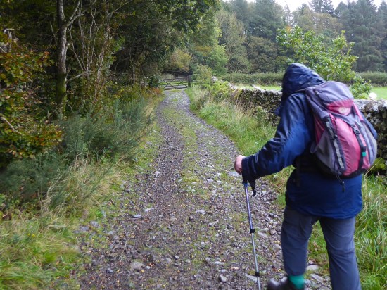
Entering the woods of Billinge Hill we pay particular attention to the guide’s directions. There are paths everywhere up here, some I recognise, but mainly I am ‘lost’ blundering about in a hopeful direction. Using a bit of creative thinking we follow the steep and slippery paths down alonside a ravine. Mike is not happy, any of his group who may have made it this far would be now struggling. DSC00485DSC00493DSC00494DSC00497

We in turn struggle down to enter Witton Park and civilisation. Ice cream vans, car parks, sports pitches, dog walkers. DSC00498

We are lucky to have this rural expanse open to all on the edge of a major town. Witton Country Park covers 480 acres of countryside with pretty picnic spots, walks, nature trails, play areas, sports pitches and a visitor centre. The estate was once owned by the Feildens, a wealthy textile family, who built and lived in Witton House from 1800 and created the park at the same time. From 1900 the house was empty for long periods and during both world wars the house and estate were used by the army. Dry-rot set in. Witton House was demolished in 1952, after being sold to Blackburn Corporation in 1946 along with the estate. DSC00504

We join the crowds and follow the sluggish River Darwen down the valley to Butler’s Bridge. Now on a surprisingly busy road ahead are the gates leading to Pleasington Cemetery.  I’ve never ventured farther, but the notice board shows a vast complex of burial grounds. DSC00502

We divert to continue into the woods and up a sunken lane which eventually is captured by barbed wire into a most unfriendly narrow walkway back to the priory. DSC00508DSC00509

We have had 4 miles of exercise through an interesting environment. It took us for some reason three hours and Mike has ruled it out from his future itineraries.

Last year I did a similar, but better balanced walk , from Cicerone’s Walks In Lancashire, an excellent selection, which also took in Hoghton Bottoms in a seven-mile circuit.

Back to the drawing board for Mike.

***

 Witton (2)

A SHORT LOCAL STROLL.

DSC00427

I’m idly looking at the OS map for something new on my home ground. I’m only looking for a few gentle miles and I think I have spotted a footpath I’ve not knowingly been on before, however unlikely that seems. The weather is on the change, and it has been raining this morning, I bide my time until after lunch.

Being lazy I drive my car to the top of the village to start the walk rather than tramp the streets. There is parking next to Craig Y bouldering venue, part of the defunct Green Bank Quarry complex, The BMC secured Craig Y whilst the rest of the site has been developed into a housing estate. Passing through it is a bridleway leading to an ancient sunken lane, Written Stone Lane, did some of the quarried stone exit this way?  Today I wander down it coming out near the site of the Written Stone about which I’ve visited many times before and linked to   The Written Stone of Dilworth  for a detailed history. DSC00431DSC00436DSC00437

On across the road to go down a quiet lane to where my ‘new’ path should be found on the right. There is no sign, but I know I’m in the correct place. Ahead doesn’t look very inviting – farm buildings and all the usual associated junk. I wonder whether the way will be blocked, but no after having to open one gate styles start appearing in the field boundaries, although I doubt few come this way. In the fields there are several small ponds probably Marl Pits originally,they are teeming with Mallard families.DSC00439DSC00440DSC00441

DSC00442DSC00449

DSC00445

At one point a fishing lake has been created in Page Brook, here footpath signs are more evident taking you through and away from the private lake. All very civilised.DSC00446DSC00447DSC00448

I recognise Stonelands Farm in the distance from a different walk done three years ago. I am still none the wiser as to the origins of the carved stones, although the rounded one is definitely Roman. DSC00452DSC00457DSC00459

Crossing carefully the road on the bad bend by The Corporation Arms, one of many local pubs that did not survive lockdown and the continuing financial restraints. DSC00460

Soon off the busy road the Tan Yard track is taken back up into the quarries, what must Longridge have been like when they were all working. The caravan site is enlarging, and I notice some of the permanent vans have extensive views across the Ribble Valley – not a bad place to live. Pendle always manages to pop its head up. Himalayan Balsam is doing its best to obliterate the final stretch of path.DSC00462

DSC00465

DSC00469

The rain starts just as I arrive back at the car. That has been a pleasant afternoon’s outing, a new path found and plenty of interest along the way, all on the very edge of town. .

CaptureWritten Stone.

THE GUILDED WHEEL.

20230815_130119

My camera went into ‘frozen mode’ after a short time on my latest cycle around Preston’s Guild Wheel. Gone for now are the pictures of the Ribble in flood mode, the harmful Giant Hog Weeds and the cautionary notice to dismount on the steep descent to Brockholes. I had no reason to ignore the latter, I’ve been going from one injury to another in the last month, so caution was uppermost. I had parked in the Crematorium grounds after all.

Ospreys have been regular visitors to the nature reserve recently, but obviously not today. They do have a problem with Himalayan Balsam though. It was surprisingly quiet considering the good weather and school holidays. They must be all at Blackpool, not the ospreys just the crowds.

The rural ride from the reserve along the Ribble Flood Plain into town is unfortunately virtually the last of the green fields on the wheel, housing has taken over elsewhere  in the last few years.

My phone camera comes into action on the tree lined boulevard into Avenham Park. Miller Park is looking immaculate, although the former, now empty, Park Hotel overlooking the scene has run into planning and financial problems as have many civic schemes in these cash strapped days. 20230815_12370220230815_124108

Plenty of cash is being spent on flood defences along Broadgate. I manage to squeeze through wheeling my bike on the numerous diversions/obstructions which I should have or could have taken, I persist with the directissimo. It is all green paint for updated and complicated cycleways at the bottom of Fishergate Hill, I survive into Docklands. No steam trains today. And no more photos.

20230815_125046

After the car showrooms the newly opened Western Distributor road linking the M55 with the western edge of Preston seems to be working fine, but at the end of the day is only there to link up with all the new housing developments. The traffic just keeps multiplying without any structured environmental planning. Planting a few trees alonside the new road fools nobody. I have never seen a boat on the Ribble Link – more money misplaced?  At least it is more carbon friendly if that makes any difference.

One now enters Lea, Cottam, Fulwood and Broughton or wherever. It is all housing, housing with a regulation 5 m square front garden often enclosed in the most unfriendly hedgehog fencings. At least the Guild Wheel has been preserved as a corridor to the other end.

I stop for a snack and contemplation opposite the war memorial on Garstang Road  and all I can hear are builders bulldozers in the land behind me. Nothing is sacred.

I’m flagging now through those green corridors, surprisingly lots of ups and downs. 21 miles is far enough, but I have guilded the wheel, even though it is becoming a little tarnished.

“both the water of life and the river of death”

Amazon_logo.svg

The walking  and even the gardening has been put aside, and I’m spending a lot of time reading whilst it rains outside. My cousin has just published a comprehensive history of the parish of Bolton by Bowland. (Spot the B connection). He has lived there for many years and has spent much of his time researching the history, geology, genealogy, ecology and everything else interesting relating to the village and surrounding area. I’m already well through my complimentary copy and have learnt so much more of our nearby neighbourhood and English history in general.

(Our Craven Parish. Bolton by Bowland.  John Pallister.  ISBN 978-1-911138-39-6.  Amazon doesn’t stock it. When I see John next week I’ll find out where it is available.)

That brings me to that other subject – my aversion to Amazon. I don’t like to be controlled by some giant all invading corporation.  I have no wish to subscribe to Amazon Prime when I try to order a paperback. Can one control the internet?  I suspect not. Unfortunately all of us are hooked, even by innocently reading this post you are being tracked. I use the independent Blackwell’s or Abe books wherever possible. I now find out that Abe, even though they support smaller suppliers, is connected to Amazon!  What is the future for independent bookshops? They need the internet to sell their hidden volumes and yet Amazon must be contributing to the physical bookshops closing every week.  “both the water of life and the river of death”  is a quote from Simon Armitage, our current Poet Laureate

I’m presently into Simon Armitage, with an ongoing project to visit the Stanza Stones, his poems carved into Pennine rocks by Pip Hall.  http://www.stanzastones.co.uk/

Walking Home by Simon, his journey on the Pennine Way back to his home in Marsden. is a book I have just finished. A modern troubadour paying his way by poetry recitals in a variety of venues along the way. I found his writing engaging and romped through the volume. So it was back to Abe for the follow-up Walking Away. a similar trip bringing to life the SW Coastal Path. All Points North is a gritty and amusing  predecessor. He certainly does have a passion for observation and words.

It’s still raining, so I will start on something different, the next book.  A Celebration of Lakeland in Winter by a John Pepper. A recommendation from George at  Lakeland Walking Tales ‹ Reader — WordPress.com  That’s the value of blogging and linking into far more professional sites than mine.

My simple reading list is endless, and maybe I have added to yours.

THE CRAVEN LIME WORKS.

P1020519

I’m enjoying a lunchtime pint of Tetley Bitter in the Craven Heifer in Stainforth. The last time I was here was at the end of February 2020 when I stayed a night mid-walk.  “It was Chinese New Year, and they were fully booked in the restaurant for a Chinese Banquet, but the chef was able to cook a fish and chip supper for me before festivities commenced.” There was talk in the bar of a new virulent virus spreading in China. We all know what happened next. P1020561

Hopefully the virus is now behind us, and it is good to be walking in Limestone Country. The barman says the pub closed during lockdown and only reopened under new managers last year. It is still owned by Thwaites, the present landlord has a five-year lease but grumbles that trade hasn’t really picked up. One problem is that the village is becoming dominated by holiday cottages, not many locals left, and the cottages are only occupied less than half the time. Who would want to run a pub in these cash strapped days?    I finish my pint and bid them good day.

I’m halfway on a short walk mainly devised to explore the Craven Lime Works. It was only recently that I was made aware of this Industrial Heritage site on the delightful Walking Away  site. I must have walked and driven past dozens of times without realising its existence.

There is further information from these two sites.

 Visit Settle – Craven Lime Works & Hoffman Kiln “Without doubt the centrepiece is the huge Hoffmann Kiln. Built in 1873 it is a huge industrial scale lime kiln” 

and more thoroughly  Craven and Murgatroyd lime works 400m north east of Langcliffe Mill, Langcliffe – 1020888 | Historic England

Good, that’s saved me trying to interpret and explain everything.

There is no signage off the road north of Langcliffe, but Hoffman Kiln Road  sounds promising, it leads to a large new purpose built office and light industrial complex in the grounds of the former lime works. A lot of money has been spent by Craven District Council, with help from European cash – we are going to miss that. I only hope this is a successful enterprise as at the moment the majority of the units are standing empty.P1020623

The almost hidden car park for the Industrial Heritage site is impressively large even with electric charging points. It is situated directly below the massive old quarry on the hillside that supplied all the limestone for the kilns. We used to climb up there in the distant past, I think that is discouraged now. Today I am the only car parked on the site. P1020635

P1020619

I wander into the ‘preserved’ site, the interpretation boards are very good. This has been a vast industrial complex  – limestone from the quarries, converted in coal-fired kilns to lime which was transported off site by the integrated railway. As well as the kilns there are so many other associated ruins to see – inclines, winding houses. weigh bridges, water courses, tunnels, old rails, tram ways, spoil heaps.  The operation lasted from the mid C19th to the 1940s.

Capturelome works1909

1907 OS map.

First I look at the remains of the buttressed bases of a pair of massive vertical Spencer steel kilns. Difficult to visualise the scale of this operation that provided purer lime from the beginning of the C20th. P1020508P1020507

Back round onto the quarry floor and a dilapidated weigh house. P1020514

And then along to the Hoffman Kiln – wow it’s massive, think football pitch. In I go, you don’t need a torch as the frequent limestone inlet arches give enough light, in fact a magic image. I’m enthralled. There are the vent  holes for the smoke up to the now demolished central chimney; there are the holes in the roof for the coal inlets; there are the ageing firebricks; there are the miniature stalactites from the slow seepage over the years. Are there bats or giant spiders in here? I walk around the massive kiln twice, and even think about a third, this is so atmospheric. P1020629

P1020521

P1020624

P1020528

P1020529P1020527

P1020525

P1020543

P1020627

At the far end is a tunnel which accommodated a line bringing stone from the quarry above. A waterway used for counterbalancing a crane lower down delivering fuel into the kiln from the roof. Ingenuity far beyond our present engineers involved in the HS2 going above budget from week to week. They can’t even sort out the Euston terminus after 10 years, money down the drain, revised plans costing another £5bn!  How many cycle lanes could you build for that amount of money.

P1020534P1020535

The only part of the complex that wasn’t viable was the separate Murgatroyd quarry and overhead triple kiln next to the railway at the northern end of the site. A smaller scale operation which collapsed in 1887. Today I couldn’t make out the tops of the three kilns for the abundant vegetation, I realise now I should have dropped down to see the lower outlet of the kilns. P1020548

P1020549

Industrial history satisfied I walk through the fields up to Stainforth and my pint. I come back, not on the familiar riverside path but on a higher way through Stainforth Scar. Gently climbing out of the meadows into the trees on the scar and emerging on the limestone plateau. The way ahead is etched into the fields, signs of an ancient passage way to Winskill Farm. 1675 says the date stone with the initials NBCB. What history could these walls tell. It is surrounded by what look like traditional meadows with a variety of flowers and butterflies.P1020569

P1020590

P1020587

P1020573P1020558

From up here looking back over my right shoulder is the prominent Smearsett Scar and distant Ingleborough. Over my left shoulder Pen-y-ghent has suddenly appeared quite close by.P1020579P1020581

There are some tempting ways leading to Attermire Scar from here, but I’m only looking for a short day. My path is clear through stiles in the extensive network of fields and old lanes. The view is down the shallow valley with its patchwork of fields to Langcliffe. That’s where I was planning to head, part of Wainwright’s Pennine Journey, until I spot a vague path/sheep trod going between a wall and the Langcliffe Quarry, now alongside. Will it take me on a shortcut?  I said I was looking for a short day especially after that pint. Worth a try and yes it brings me out into the Lime Works without any serious obstruction, but don’t necessarily follow me on any of these walks. Mine was still the only car in the car park.P1020596

P1020592

P1020601

P1020608

P1020603

P1020617

I would highly recommend a visit to the Craven Lime Works with or without a walk.

***

CaptureHoffman Kiln. (3)

A SHORT WALK FROM HURST GREEN.

P1010994 (2)

***

I was deterred by these signs on what I thought was a right of way the other day. I didn’t have a map at hand, so I opted out and walked up the lane. There is a hidden side to Hurst Green, large expensive properties guarding their privacy, but public footpaths shouldn’t be lost or walkers intimidated. Officially all Public Footpaths should be signed where they leave a public highway but speaking to officers on the Local Authority these signs regularly disappear. P1020010

The morning’s heavy rain has passed, and I’m back armed with the latest 1:25,000 map and approach from the other end near the old bobbin mill on Dean Brook. There are predictably no waymarkers, but the start of the path is clear above the Brook. I walk past properties that were probably mill workers’ cottages in the past and soon come out onto the lane, The Dean, which drops from the village crossing the brook and climbs back into the countryside. Curiosity satisfied I’m on my way. P1020006P1020007P1020008

The quiet road heads upwards with views over the Ribble Valley opening up to the south. I know there is a path somewhere leaving it to climb Doe Hill , but I can’t find it initially in the heavy vegetation. Is that it, hidden away?

P1020012

The Ribble Valley.

P1020013

There is a stile in there somewhere.

Once into the field I can see the trig point, Doe Hill, one I’ve never knowingly visited before, a short distance away. More interesting is the nearby clump of beech trees, maybe 30 or 40, all growing as one. How long have they been here – a couple of hundred years or more? There is a vestige of a wall enclosing them, who planted them and why? A magic place, I half expect a troupe of fairies to be dancing around., it is  the summer solstice after all. Whatever it is a good viewpoint – Longridge Fell, Pendle and the Ribble Valley. P1020017P1020020P1020024P1020028

P1020035

I pick my way across fields full of buttercups, finding stiles in the appropriate places and come back out onto the lane heading to Greengore, a C16th hunting lodge for the Shireburn family, which I’ve photographed many times before. There appears to be some building work going on at an adjacent barn, let’s hope it doesn’t distract from the Grade II listed Greengore property. P1020037P1020038P1020040

I knew of the sturdy bench at the junction of lanes and was glad to sit for some refreshment, it was still a very muggy day. The lane dropping to Dean Brook, yes the same one, is bordered by hedges full of roses and honeysuckle, with foxgloves pushing through the bracken. P1020043

P1020045

P1020041P1020044P1020046

Crossing the bridge I am reminded of bringing my children and then my grandchildren here for the simple pleasure of ‘pooh sticks’. Even today I can’t resist dropping a stick upstream and watching it emerge farther down. P1020048

Hidden away just off the track is Sand Rock, all that remains of a large sandstone quarry  used in the construction of Hurst Green Itself. I divert here to see if my lost favourite orange cap is anywhere to be found, I last had it on when I came looking in here at the rock face a few days ago. Some lower boulder problems are chalked up, evidence of recent interest. We climbed a route up the middle of the quarried face, Vanilla Slice E2 5c, in 2002, it looks impossible to me now. No sign of my cap. P1020054P1020050

Onwards alonside the brook cascading down the soft sandstone rocks which have been smoothed into  beautiful curves over the ages. Plainly visible today are the remnants of the dam footings and ongoing leat supplying the bobbin mill farther down valley (where I started my walk today). P1010981P1010983

***

I’m back at my car after this short, 2.5 mile, but interesting exploratory walk. The black clouds have blown away, and the sun is beginning to come out. I have another site I want to look at, the Stonyhurst Roman Catholic cemetery just up the road. I’ve always been fascinated by the mausoleum type chapel visible through the railings from the roadside, but never visited. Going through the gates into the cemetery one is immediately drawn to a white statue of Christ with Pendle as a backdrop. The cemetery is laid out with mature coniferous trees forming stately corridors between the many vaulted graves. The Mortuary Chapel is dated from 1825, but I can’t find out if it is dedicated to any particular family. Does anybody know more details? P1020056P1020002

P1020058P1020062

P1020076P1020069

P1020063

Detail from a window.

P1020064

Through a window, showing it to be a chapel rather than a mausoleum.

***

CaptureHurst Green. (2)

IT’S SPRING AT SIZERGH.

P1000578 (2)

At 10 o’clock this morning I was stood in a queue waiting for my latest, I’ve lost count of how many, Covid booster. Nervous pleasantries were passed with the vaccinator nurse. I was thankfully not as old as most of the other customers. Never felt a thing. So back out into the Lidl car park on a beautiful sunny morning, no time for shopping, Soon I was home for a delayed breakfast. Despite warnings of possible side effects, take paracetamol and rest, let’s get out and enjoy the Spring weather.

At the back of my mind was a short walk from Sizergh Castle highlighted recently by fellow blogger John Bainbridge and others. Native daffodils in the woods aroused my curiosity. Noon found me parked in the grounds of Sizergh Castle, along with many more. My NT card saved me £9 in parking fees. Not for me the delights of the garden or castle, I strode purposefully upwards. The National Trust here have been at work creating a serviceable path to  Holeslack Farm, under scaffolding but with its original orchard attached. Not many followed me. Wild garlic in profusion. 

P1000505

P1000508P1000512

P1000514

A quiet lane took me up to the church of St. John the Evangelist. Thankfully it was open, and I was able to get a good view of the stained-glass windows and the painted mural, a memorial to the lost from the WW1.  P1000524

P1000521P1000522P1000523

Outside there was a view over the Kent Estuary with Arnside Knott on one side and Whitbarrow the other. The main event however, the Lakeland Hills, was a hazy distant blur though the  plaques showed me what should be seen on a clear day. Worth returning for.P1000536 P1000531

Out onto Scout Scar all was blue sky, the limestone ridge dotted with low growing trees. One can wander at will up here, but I stuck to a path along the edge of the escarpment watching the line of cliffs unfold with the Lyth Valley down below. I didn’t know the path dropping off this western side, but the map indicated a cairn. The cairn appeared and what a fine one. The track off was clear, but first I sat on the edge for a break whilst I had the views, though the far hills still hazy. I ate the last of my Xmas cake and topped up on water, a buzzard flew majestically below me. P1000537

P1000542

P1000545

P1000554

P1000550

P1000559

The way down was steep and stony through the trees. All of a sudden you are into pastures full of sheep belonging to Barrowfield  a wonderfully situated homestead. The farmer was sorting out his lambs, an age-old routine not changed for generations. P1000556

P1000577

Back into woods a narrow path threaded its way down the valley. New growth was appearing on the trees, the young beech leaves the brightest green. Continuing on a lane I bypassed Brigsteer and stayed high to the remote cottages at Well Garth. Then down through fields to Park End a picturesque C17 farm. P1000579P1000581

P1000586P1000589

P1000593

P1000594P1000596

A couple of fields, and I was into Brigsteer Woods. I just followed whichever path seemed to be in the right direction. These woods were traditionally coppiced, so light gets through to the forest floor. Everywhere were woodland flowers – primrose, cowslip, celandine, dog violet, dandelion, bluebell, wood anemone, wood sorrel, wild strawberries the list goes on. But I was too late for the native daffodils, they were well past their best. P1000604

P1000608

Native daffodils?

Out of the woods there was a short stretch through what had been an ancient deer park presumably connected with the castle estate. Back at the Castle the café was doing a roaring trade in ice creams, I was surprised by the number of children about – some must have longer holidays than others. I couldn’t resist a wander around the grounds and gardens before leaving. P1000612P1000642

P1000613P1000617P1000629P1000619P1000632P1000636P1000634

A varied area worth more exploration. I should visit Brigsteer village and maybe have a look at the bird hide on the edge of the mosses. Even a trip around the castle.

***

CaptureSizegh. (2)

MORE MORECAMBE.

DSC00181

You may wonder why I keep coming back to the Bay. My cycling is for leisure and pleasure these days, and there is no pleasure on the busy roads around Longridge. The old railways, cycleways and canal up here are ideal and one has the added benefit of the ocean breeze and those views across the bay. Oh, and it’s all relatively flat.

I suspect that sometimes I am bewitched by that view and neglect little details on the promenade. Well today I paid more attention to what was under my feet, I mean wheels, and I ended up walking stretches of the front so as not to miss things.  I had arrived onto the front near Heysham via a new route, for me, which diverged off the old railway/cycleway and wound its way through the White Lund Industrial Estate, lovely.

From the start at Sandylands I notice several, about three dozen, round interpretative discs set into the promenade telling the story of Heysham, Morecambe and the Bay. A quirky addition to the front. For a more detailed history and lots of old photographs and archive material it is worth visiting the Maritime Museum on the quayside in Lancaster. Morecambe has certainly had a chequered history – but the future with The Eden Project hopefully under way should be more positive. It is frightening to realise that I am part of that recent history, bringing my family up to the amusement parks and aquarium still in existence 50 years ago and now no longer. I try to remember if the central pier, mentioned more than once in the discs, was still standing on our visits. It is suspicious that there were so many fires on the derelict piers. DSC00195

DSC00182

DSC00189

DSC00190

DSC00193

DSC00203

DSC00208

DSC00210

DSC00211

DSC00209

DSC00217

DSC00226

DSC00229

DSC00230

DSC00232

DSC00192

Capturepier

Morecambe in the 1940s. The two piers highlighted.

So there you have it. On the way I passed this house painting, an old pier/breaker, a couple of turrets and these elegant Edwardian terraces. Fading glories.

DSC00228

DSC00218

DSC00248DSC00221As I approached the west end of Morecambe I was intrigued by a large building set back from the front. The building now known as The Battery once marked the boundary between Morecambe and Heysham. (in 1928 the two districts merged). In the nineteenth century the site was occupied by an old mill and the area was later used as a firing range, with an artillery battery stationed there because of fear of an invasion by the French. The mill, then known as The Roundhouse, was used for storing ammunition. The Battery Inn was built in 1863 and in 1900 it expanded to become The Battery Hotel, later acquired by Thwaites Brewery and functioned into the 1980s. It has recently been bought by a property developer for conversion into luxury flats. I’m not sure whether much progress has been made.

DSC00237

I don’t think the adjacent Beach Cafe is the best of architectural designs.

DSC00243

My informative circles had finished, but something on the road caught my eye –  half a car to cut your motoring costs, an effective advertising gimmick.

DSC00252And what’s more on the other side of the road a series of artistic panels brightening up an otherwise drab development hoarding at the former Frontier Land. I now remember Eunice from the Mouse House mentioning them here and here in far more detail than my pictures below. Local artists are highlighted. Several showing Eric the town’s celebrated son.


DSC00254

DSC00261

DSC00256

DSC00258

DSC00264DSC00263DSC00266DSC00260DSC00268

I hope the Midland Hotel is given anew coat of paint before Eden arrives.

DSC00240

By now my hands were frozen in the cold northerly wind whipping down the promenade. Time to get cycling again. On past the Midland, Happy Mount Park, Hest Bank and onto the Lancaster Canal back to Lancaster. I had just about warmed through by the time I reached my car at Halton. It’s only half an hour back down the motorway, but I have a sense of lingering guilt that I shouldn’t be driving farther than I’m cycling.

***

CaptureMorecambe

ALL QUIET ON THE WESTERN FRONT.

DSC00050

A calm sunny day out of the blue. A day that shouldn’t be wasted. Cycling will be better for me than all that weight-bearing walking on my dodgy knee. Yes it has officially become dodgy. Most people parked up on the front at Fleetwood are content to sit in their cars with the heater on, gazing out across the Wyre Estuary to Morecambe Bay. Somehow the statue of the waiting family took on a more poignant significance as the nation waits for news of Nicola Bulley who has vanished higher up the Wyre at St. Michaels.

DSC00048

In a sombre mood I pedal off along the seafront, Rossall, Cleveleys, Bispham, North Shore, The Golden Mile, the Pleasure Beach and South Shore. All familiar landmarks of the Fylde Coast at Blackpool. There are few people about, despite the sun it is still chilly. Mainly dog walkers. I eat my sandwich at Squires Gate, I’ve come far enough and turn around to do it all again in reverse. This is a favourite ride of mine, flat all the way with lots of interest and all that good ozone and vitamin D producing light.

DSC00017

The peaceful winter promenade.

DSC00007

Mary’s Shell in the tide. The Ogre was under water – more of them and the Mythic Coast another time.

DSC00031

The tower silently watching.

DSC00011

A Ringed Plover? posing. Not a grouse in sight.

I stop briefly to chat to a fisherman casting into the sea from the shingle beach, it’s high tide. Dabs and cod could be on the menu tonight but the only catches I witness are seaweed. A patient sport angling.

DSC00004

What’s for supper?

That was it really. All quiet on the western front.

DSC00023

CICERONE’S LANCASHIRE – THE UPPER WYRES.

DSC03324Down on the River Wyre in St. Michael’s a tragic drama is transpiring, a 45-year-old local lady, Nicola Bulley, has gone missing whilst walking her dog by the river. You will have seen it on the national news, the trauma her family are going through as the days pass, without resolution, doesn’t bear thinking about.

***

The River Wyre comes out of the Bowland Hills above Abbeystead, the Tarnbrook Wyre and the Marshaw Wyre join forces there and head off into the Fylde to reach the sea at Knott End/Fleetwood. A dramatic journey. I walked the whole of the Wyre Way in 2014, can’t believe it is so long ago. Today I’m parked up in a lay-by alongside the Marshaw Wyre at Tower Lodge as suggested by Walk 11 in Mark Sutcliffe’s Cicerone guide book, exploring these two upper Wyres.

I’ve just driven through the ‘Trough’ from Dunsop Bridge, a way through the hills beloved of NW Lancashire cyclists. There were plenty this morning, the forecast being good with sunshine and little wind. In fact the last time I came this way was on my cycle way back in 2014, I remember it being a tough ride in this direction. I would need an electric bike I think for such exploits now. I have previously walked a version of this route in reverse, again in 2014.

I thought the lay-by might have been full by the time I turned up at 11am, but there were only a couple of cars. Boots on and immediately a steady uphill begins. By chance, I’m heading into The Duke Of Westminster’s territory once more. I was disparaging about grouse moors in my recent post on Clougha Pike, so today I start optimistically with only healthy thoughts of the great outdoors. I can’t believe it the first WW stone marker, of which there were many better examples along the way, depicts a rifle and a grouse. Condescending bastards.

DSC03281

Putting that aside I march over the hill to views of the Clougha Pike/Ward’s Stone ridge above the Tarnbrook Wyre. I’m glad I’m not going up there today – it’s a tough long walk, although the Duke’s new motorway had made it easier in parts. We used to go up there to climb/boulder on Thorn Crag before it was open access, often resulting in being forcibly ejected. The CRoW act of 2000, despite its limitations, has been a gentle step forward. I cross the infant Tarnbrook Wyre without much thought to its journey from up on Ward’s Stone.DSC03285

DSC03312

DSC03310

The last time I came through Tarnbrook, an old farming settlement at the end of the road, I got talking to an elderly gent, born and bred there and the last remaining permanent resident. (his family checked up with him every day). I doubt be is still here as the properties all seem to be in the process of modernisation – for rich incomers or holiday lets? A lot of history possibly lost.

DSC03306DSC03304

Turning my back to the hills I make my way across multiple fields westwards. Yes the stiles are rickety and not easy to spot in the low light. A few adjustments are needed after my phone GPS mapping is consulted, in the past I would have been much more careful with map and compass.

DSC03314

DSC03319

A friendlier waymarker.

Abbeystead is reached without too much trouble and the Tarnbrook Wyre, (header photo) now more sizeable is crossed at Stoops Bridge, a popular parking area. The hamlet is the centre of the Duke’s Abbeystead estate with the mock Elizabethan estate offices, cottages and old stables.

DSC03323

Gated entrance to the Duke’s Abbeystead House.

DSC03325DSC03327

My path takes off from the road at the far end of the village, taking me high above the Reservoir and then down below the dam and a footbridge over the Wyre. The reservoir is silting up and there is a constant cascade of water over the beautifully curved dam. All very dramatic.

DSC03330DSC03333DSC03334DSC03335DSC03338DSC03346

The concessionary path alongside the water is in a dreadful state. Too many feet on the muddy terrain. There is an alternative higher path to the south via Marl House and Hawthornthwaite, longer but more sustainable.  It takes an age of slippery sliding to reach dry land again near the Stoops Bridge parking.DSC03347DSC03350DSC03356DSC03349

DSC03351

The Tarnbrook meets the Marshaw Wyre.

Then the parkland of Abbeystead House, the raison d’être of the area, is traversed with tantalising views of the enormous property. Lots of fields and stiles often high above the Marshaw Wyre. I must have fallen asleep and come out onto the road well off route. My map shows it all.

DSC03357

DSC03362DSC03363DSC03367

The Marshaw Wyre is then followed closely back up the Trough road to those well known pines alongside the river. Tower Lodge was a welcome sight. I was getting tired and have measured my route as 8.5 miles as opposed to Mark’s 7.25. Some of that was me getting lost.

DSC03376DSC03379DSC03381DSC03384

I have reservations about this walk, yes stunning scenery in parts but lots of field stiles to negotiate, needing careful navigation. The section to the south of Abbeystead Reservoir is horrendous, muddy and awkward. I think the route would be more balanced starting in Abbeystead, with an option to take the difficult reservoir 1.5 mile loop. The road up Marshaw was tedious at the end of the day, it would be so much more enjoyable early in a walk that gradually gained height and then brought you back anticlockwise down to Abbeystead.DSC03377

***

CaptureWyre Way