Tag Archives: Lancashire

BACK ON HOME GROUND (Should that be bog)

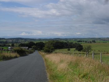
After two weeks out in a hot and sunny Spain it came as a shock to find myself walking across a boggy Lancashire hillside.

North of Great Hill.

North of Great Hill.

I had not been to Anglezarke for several years, which is where I had arranged to meet Alan. The large carpark has now a barrier on it which is closed at 5pm and that made me nervous, would we be back in time. At least it hadn’t become pay and display. We opted for roadside parking, as had many more, wondering about the local authority’s parking policies for what is a popular walking area. When I think about it – it’s probably water board land.

Golden Tower, Anglezarke.

Golden Tower, Anglezarke.

A bright Autumn morning …….. as we wandered along by the reservoir joggers, dog walkers and mountain bikers all mingled happily. Walking under Stronsey Bank we reminisced over summer evenings there. Several of us would meet every Wednesday evening after work in one or other Lancashire quarry for a climbing session. Wilton, Anglezarke, Denham, Troy and Cadshaw were the most regular venues. They were all popular with climbers, less so nowadays I fear. The rock up in Stronsey was not the best but it had a pleasant outlook. Interestingly a new guidebook to Bouldering in Lancashire has just been published and smaller bits of rocks scattered about these hillsides are given prominence.

Stronsey Bank.

Stronsey Bank.

The paths follow the Goyte ‘canal’ which links the reservoirs here to those near Abbey village.

White Coppice.

White Coppice.

Soon past the delightful White Coppice cricket pitch and on into Brinscal Woods.

Within this setting there are many derelict buildings. Their origin has always been a mystery to me but no longer, I’ve just found this wonderful little website dedicated to the history of the area. In detail and with good photos it delves into the origins of the ruins hereabouts. Fascinating, well done whoever you are.

http://www.white-coppice.co.uk

Confusion set in for the next hour as we tried to navigate eastwards across the fell, walls didn’t seem to be going the right way and the farm ruins were all in the ‘wrong’ place. Solomon’s Temple ( despite the name only some farm ruins) was our saviour, from there we picked a way across the surprisingly boggy ground.

Solomon's Temple.

Solomon’s Temple.

Crossing the A675 we disappeared into more waterlogged ground in the woods on the other side. A stream in a glen was a pleasant diversion before we started the climb up to Great Hill.

tmp_SAM_57311949540485

Looking back to Great Hill.

Again we passed several ruined farms in outstanding situations, maybe the hard living there would not have been outstanding!.

By the time we were back at the car tiredness was creeping on, we were glad there was no panic with a 5 o’clock parking deadline. The nights are drawing in and it was distinctly cool. We called in at an old haunt, The Bay Horse, for a pint and discussion as to how far we had actually walked today!  Maybe 10 maybe 12 miles, but they were rough and boggy so we were satisfied. (More so now I’m able to read the history of the land)

PENDLE AT LAST.

If you have been following my last few posts you will know an ascent of Pendle Hill, 557 m, has alluded me.  Luckily I phoned my walking cousin the pieman this morning suggesting an outing, he was going to be in Clitheroe today, so a hasty meeting was arranged. Would you believe it but his bus broke down?  We were delayed in setting off from Downham, but that wasn’t a problem as we only needed a short afternoon to climb Pendle.

Pendle from Downham.

                                         Pendle from Downham.

Today I had a purpose apart from said ascent, I needed to meet up with the pieman to arrange a forthcoming trip to Le Chemin de R L Stevenson and needed to check out my new phone’s camera and ability to post from it. Trying to drag myself into this century’s technology!

Our walk up and down Pendle proved no problem.

Scout Cairn on the ascent of Pendle.

                     Scout Cairn on the ascent of Pendle.

We descended off the Big End Of Pendle via a different track than usual, taking us into the little valley down past Clay Farm and back to Downham.img_20140815_154841_731-e1408172512785 Our arrangements proved more complicated, and I’m not sure of the phone, but if you are able to read this all must have worked. Actually, I tweaked it a bit on the laptop. The pics were just OK, but I had difficulty inserting them into the post on the phone, will get that sorted.

ZCapture.JPGpen

DEJA VU ON LONGRIDGE FELL.

I didn’t make it to Pendle as planned. On Saturday morning, a good friend phoned to say he was in the area and fancied a short walk in the afternoon. We caught up over a light lunch and debated our destination. He had never been to the top of Longridge Fell, despite knowing the climbing crags dotted over the fell. So decision made. We parked near Cardwell House exactly as I had done yesterday and I took him on an extended version of the same walk. The weather today was perfect and the views much clearer, so I got some better shots of Chipping Vale, the Bowland Fells and the Three Peaks. The scenery, especially with the heather mentioned yesterday, was stunning and he seemed very impressed with our short tour of the fell and forest.

A clearer view of Chipping Vale.

A clearer view of Chipping Vale.

The Trough hidden in the Bowland Fells.

The Trough hidden in the Bowland Fells.

Despite him being a philosopher, our talk drifted to past climbing days which we have shared, both being out of action at present. In general climbers have a vivid memory of routes done, probably because of the intensity of the moment, and a little reminiscing does no harm. I have been able to find an old photo of him climbing a problem on Bullstones which I’m emailing to him.

Mark at Bullstones. ?2008

Mark at Bullstones. [2003 A. Bates]

Whilst up there I had time to show him Crowshaw Quarry where there has been some recent bouldering activity. It was good to be out enjoying the company and the sunny weather as tomorrow we are going to get the ‘back-end’ of Hurricane Bertha. Shame because one of my grandsons is in Prudential Ride London-Surrey 100mile event.

IN PRAISE OF HEATHER.

“And fragrant hills of purple heather”        Bonnie Auld Scotland      G. Bennett. 

I should have been going up Pendle this morning, but as I set off the forecast changed, possible heavy rain by midday. I must admit the sky looked black out to the west. So I quickly diverted to the parking at the west end of Longridge Fell. I traversed what I call the balcony path with views, today murky, into Chipping Vale, Morecambe Bay and the Bowland Hills. Then it was upwards through the new heather towards the trig point. Have done this walk hundreds of times but today the heather seemed to take prominence colour wise, there was an additional fragrance and lots of busy bees. The fell is transformed at the end of summer by the heather. The summit views were a little muted with the oncoming storm. Found a new path south off the summit, probably initiated by mountain bikers, judging from the built-up jumps. Over the many years that I have been coming up here, more and more of these paths have appeared amongst the trees, so there is still a sense of exploration following them.I was soon back on the main circular descent but made an arduous detour to the small metalled fenced area on the western part of the fell. Have never known what this was for, there is nothing inside it. The OS map indicates stone circles on this part of the fell, but I can never find them.   http://www.megalithic.co.uk/article.php?sid=27144

zCapture.JPGlong

I was back at the car just as the first heavy raindrop landed. Maybe Purple Pendle tomorrow?

BREAKING THE 50 MILE BARRIER.

Despite being rather disparaging about my cycling exploits in a recent post  [Irwell Valley 1]  I’ve been out for shorter rides [20 – 25 miles] mainly around, rather than over, Longridge Fell. All of a sudden I feel some fitness returning, that toe is not complaining too much and I’m enjoying the weather. Why at my age do I still feel the need to get fitter? Of course, I know the answer — I want to keep active as long as possible, exploring the outdoors at home or abroad. So my fate is sealed. After my cycle through ‘The Trough’ the other day, I muttered about doing 50 miles next. Today I had in mind to cycle through the Trough again but in the reverse direction, which I reckoned would be harder.

The doorbell rang at 9am and there was Al in cycling mode. Are you going through the Trough?  I enquired.  No, I’ve just been,  he replied!    He’s always been known for his early starts, today he’d left Preston at 6am and was hoping to be working by 10. But first cups of tea and catch-ups.

No excuse now. Pedalled away up past Chipping and into the Hodder Valley, feeling rather sluggish I was dawdling along towards Whitewell in my own thoughts.  Alongside came a fit-looking cyclist and rather than speed past as most do, he slowed down for a chat. He gently mocked my ancient gear changing leavers [Campag!] — any gear will do scenario. He’d already cycled from Bolton and was in for a long day. This was nothing for him as he’d just returned from cycling in the Alps including an ascent of Alpe d’hues. I felt my pace quickening to keep up.  I relaxed when he turned off to Slaidburn. Uplifted by our meeting I sped along Langden valley but was soon struggling on the steeper Trough itself.  OK — I walked the last few hundred feet, admiring the purple heather which has just bloomed. It is harder from this side!

I came back to life on the descent and was soon through Dolphinhome and across the A6. Here I decided to make a longer loop home, so I ended up in Cockerham where I hoped to find a café — nothing. Made a mistake of going out towards Knott End and not able to find a road going south towards St. Michaels, the lane I chose meandered me back to Cockerham!  Down the road, however, I was saved by a café/ice cream parlour, The Pudding House. Most people were queuing for massive ice creams….…. but I was happier with a pot of tea and a lifesaving date slice — thank you.

Knew my way from there via Garstang and Inglewhite and arrived home rather weak legged — 52 miles!  Had also climbed 2500ft, so it turned out a hillier 50 than I had intended.

IRWELL VALLEY TRAIL. 2. INTO MANCHESTER.

Left Ramsbottom on what promised to be a warm sunny day, no shops were open yet. Soon picked up better waymarking which persisted all day – different local authorities. Leaving the river for fields I found the path weaving between Rose Bay Willow Herb and Himalayan Balsam, the latter had not reached the popping stage which will be dramatic here.

A lovely long stretch of cobbled path took me to an old cotton mill at Brooksbottoms, no doubt this is the way the workers tramped to and from their employment.  Then I walked close to the East Lancs railway and passed through Summerseat station….….before dropping down to the river and a climb into fields with views back to the prominent Peel Tower above Ramsbottom.

The walking maintained a high standard alongside the Irwell through Burrs Country Park.Actually found some sculptures in the old mill area of the park.

STONE CYCLE

PICNIC TABLE

The stones came from an old bridge in Bury and the picnic table could be a ‘trap’ for tourists. Slipped out of Bury on Cycleway 6, an abandoned railway, past the Elton sailing reservoir and then along the overgrown and defunct Manchester, Bolton and Bury Canal. All this was unexpected rural walking. Got chatting to an elderly man taking his daily walk home along the canal, his wife thinks he catches the bus, he was 92 after all.The canal took me right through Radcliffe where a butty bar provided tea. Further on field paths took me to rejoin the cycle way track which led for a couple of miles through remote feeling woods. This was the site of Outwood Colliery which closed in 1931 after a fire.

Further stone statues were in evidence –

After crossing the busy M62 motorway I entered Prestwich Forest Park,  under the 13 Arch Old Railway Bridge,  with well signed and used cycle and walking routes. I was walking alongside the Irwell but views were restricted by the abundant vegetation, another wild area where Giant Hogweed has established itself.After all this rural walking it was a shock to walk down the first busy road of the day. I did a rather pointless large loop with the Irwell, this is probably bypassed my most. It was only when I was alongside the Irwell in Salford that I started whistling Ewan MacColl’s Dirty Old Town. The 551ft Hilton Tower acted like a beacon to guide me through streets to near where the Irwell empties into the Manchester Ship Canal. I had walked 18miles today, an exploration of Salford docks can wait till another occasion.

Trinity Bridge over the Irwell linking Salford and Manchester.

   Trinity Bridge over the Irwell linking Salford and Manchester.

IRWELL VALLEY TRAIL. 1. WITH OR WITHOUT SCULPTURES.

Having been out on the bike for a few days I’ve come to realise that despite the good exercise nothing really happens. You don’t get to chat to many people and your way is fairly delineated, little variation in terrain apart from up and down and few decisions to make. Dare I say ‘mechanical’. To make cycling more interesting I think you have to throw in some exploratory options on a longer trip – maybe more of that later in the year.

So I found myself on a bus, on a train and in a taxi to get to the start of The Irwell Sculpture Trail above Bacup in the rather bleak Pennine Hills south of Burnley. Nothing to mark the start of the trail, you might have expected some waymarking or a sculpture. Anyhow the infant River Irwell appeared and was to be my companion for two days. Gritty moorland tracks took me down the valley with some careful and imaginative navigating. I passed one recognisable ‘sculpture’ – The Sentinel basically a glorified cairn but incorporating some excellent dry stone craft. Bacup was a disappointment. Lots of good back to back housing, a period decaying Bingo hall [probably an old cinema] and no cafe. Onwards on the wrong route over Huttock Top, some scruffy walking through back streets and parks at least by the Irwell, an old railway tunnel [illegal] …. …. brought me to Waterfoot. Lots of industrial heritage, not necessarily preserved, in evidence throughout the walk. The Duke of Buccleugh provided a sit down, a half pint of Moorhouse’s Pride of Pendle with an illicit sandwich. Located another old railway track, no help from any waymarking which took me past a strange cave like structure without realising it was Spaces 9.XXXV’94 – exploring the depths of the human-psyche and our relation to mystic natural forces’. Have I lost you there?

Coming back to the Irwell, now more of a river despite being hemmed in with urbanisation, a man was fishing for trout. A good sign that things have been cleaned up. More importantly there was a great little cafe tucked away in Lambert’s Mill, ‘cotton was king’ don’t forget in Lancashire. Have to give a shout for the very friendly Annie Peaches Tea Room! More old mills in Rawtenstall have been converted into flats and in one innovative case a Primary Care Medical facility. The  cricket team were losing to local rivals ‘Rammy’ in the competitive Lancashire League as I walked past. A bit of dalliance at the East Lancs Railway followed to view the LMS ‘Crab’ steam locomotive 13065,SAM_5316 but why oh why do they have to put a Thomas the Tank face on it ????? Once out of town there was some lovely countryside walking towards Ramsbottom. Passed a sculpture or two, the most impressive was In the picture framing the riverside fields. Through an industrial estate, they are never far away, and into ‘Rammy’ my attention was drawn to an apiarist calmly trying to get an unwanted swarm of bees from a fence into a box. By the Irwell bridge I was fascinated by the next sculpture called The River, an 88m stainless steel path meandering through a park with inspirational quotations inscribed into it. The next installation was the Vase directly in front of my lodgings for the evening. The pub bar was full of the local alcoholics when I arrived but I must say the room was perfectly comfortable and peaceful. Anybody who knows Ramsbottom will realise the extravaganza of eating establishments at your disposal. So I enjoyed a Thai meal at The Spice Garden.

In summary a good and enjoyable 13mile walk through varied scenery, poorly way marked [didn’t see an IST sign till the last couple of miles] and not really incorporating many of the sculptures in the valley.  Tomorrow’s second stage?

LONGRIDGE TOWN “PLANNING”

  • LONGRIDGE.    “8000 friendly people, wonderful countryside and a great social life!  What else do you need?” — a quote taken from their own website. That at present is quite true, but there is trouble afoot. Due to a lack of forward local planning, developers are highlighting areas of land around our villages to appease the Government’s hypothetical and unrealistic targets for housing needs in the next decade. The map above shows the problem with up to 2500 houses projected [in red]. Roads, Schools, Doctors, Sewers — where are those plans? There is a genuine feeling of anger in the village over the proposals, but the councils seem unable to call a halt to these Developers’ speculative plans.     

To celebrate the millennium, Ribble Valley produced leaflets and waymarked six excellent walks in and around Longridge exploring the diverse landscape and heritage. [Available from our thriving local library] One of these is a 6-mile circular tramp around the village making use of tracks through the surrounding green spaces, these are the very same spaces that are now highlighted in red in the above plan. So today I thought it was an opportunity to repeat and enjoy this walk before all the changes. Bowland Homes have already filled in one corner of the Eastern rural approach to Longridge. Across the road from there are lovely fields earmarked by Taylor Wimpey so destroying this atmospheric entrance into the village. I followed the green lane up the side of this area into the quarried part of Longridge, with views over several reservoirs. Across the road into fields and one has the most wonderful views over Chipping Vale with the Bowland Fells behind. Surely this must be saved for our dependents.  The next area under attack, from Barretts, is all the fields around the cricket pitch on the road in from Chipping. This again will totally change a rural entrance into the village. The old neglected  ‘Gypsy Lane’ goes through fields onto Inglewhite Road and a field path leads to Halfpenny Lane. Here Gladmans have been given permission to develop the green fields across to the village. No buffer zone in the form of farming land any more. What is nature losing?  A few hundred yards around the corner and  Urbanregen  [how ugly a word is that?] have already started to prepare the destruction of Green Nook Lane! Further on the walk, in Pinfold Lane, United Utilities have decommissioned a reservoir to produce a wetlands environmental area with public hides for observing the wildlife. Highly commendable, but at the same time they are hoping to develop a housing estate on the north side of the site. Double standards or am I being cynical?  One has to be where land, development, planners, government and money are all involved. So my pleasant rural circuit around Longridge is complete — but for how long will you be able to experience these few countryside hours in the proximity of the village?  There are too many question marks in this post and I’m too afraid of the answers.

As one ages, it is said you don’t easily adapt to changes — count me in on that.

.

111111

CYCLING THROUGH ‘THE TROUGH’

It had to be done. This is the classic ride from the Preston area. After recent trips on my bike, slowly building up strength, I knew that the next challenge was to cycle through The Trough of Bowland. Had not done this for 20 years, too busy climbing and walking. Set off today at lunchtime. The fells which I had to circumvent had ominous black clouds above them as I left Longridge. Was soon into Garstang and on to Scorton where the traditional stop at The Priory for coffee and cake was duly taken.   Got chatting to a fellow cyclist [I have put myself into that bracket now] turned out he was staying in Longridge for a couple of days and had escaped the family to ride today. I was glad of the cake as I followed twisting, undulating lanes towards the fells.

One particularly steep little hill climb caught me out and had me standing on the pedals. Once on the Trough road at Marshaw I just had to keep going at a steady pace and I was at the summit before I knew it. Set at 968ft is the Grey Stone of Trough marking the pre1974 boundary between Lancashire and West Riding of Yorkshire.

Heading towards Marshaw.

Wonderful scenery abounds up here in the Bowland Fells and today the conditions were perfect, clear warm and sunny and most important – no wind.  Great swooping descent to Dunsop Bridge.

Onwards by the Hodder to Whitewell, with it’s celebrated Inn.

The River Hodder.

I enjoyed the trip down the valley to Chipping and the short stretch back to Longridge in the late afternoon sunshine.

Feeling rather smug tonight with my modest achievement and dreaming up longer and longer cycling days.  LE to JOG?  Hang about — I’d better try 50 miles tomorrow first!

THE WYRE WAY. UP TO THE TWO BOWLAND SOURCES.

Again I have a late start, parking up in Dolphinholme. This was an important mill village at one time with many interesting buildings. Today I’m more interested in the vegetable gardens near the bridge. A man is erecting a new greenhouse to complement his vegetable beds – all very neat. I’m quickly away up into the fields of freshly cut grass, a smell so evocative of childhood summers. The Bowland Fells remain as a backdrop all day. Through woods I come down to cross the River Wyre ………..and follow it’s north bank to a pumping station and a memorial to the people who lost their lives in the explosion of May 1984. There is little water today on the dramatic overspill of Abbeystead Reservoir, opening photo. Abbeystead Village is its usual sleepy self.  There are two Wyres from here on, the Tarnbrook Wyre coming from the Ward’s Stone / Brennand Fells and the Marshaw Wyre coming out of the Trough of Bowland.  The WW does a loop around them. In this upper part of the walk there are frequent WW markers expertly carved from stone and depicting local interests, I wonder who was responsible for them? 

Fields, with abundant lapwings calling, are crossed to reach the hamlet of Tarnbrook and a reuniting with the Tarnbrook Wyre. Chatted to an elderly man in one of the 18th-century cottages, he had lived here all his life and is now the only permanent resident. I crossed the Tarnbrook Wyre for the last time at Gilberton Farm.The afternoon was very hot and sticky but I had clear wide open Bowland vistas as I crossed the watershed, Hind Hill, between the two tributaries. The Trough of Bowland road can be seen. I found the track down to Tower Lodge, originally the gatehouse to the abandoned and now derelict Wyresdale Tower. The walk back down the Trough road next to the Marshaw Wyre passed pleasantly until I was back in riverside fields again. The thought crossed my mind that I should do the classic cycle ride through The Trough again, will have to get a bit fitter on the bike first. Further down the valley one gets glimpses of the grand Abbeystead House and gardens, Lancashire home for the Duke Of Westminster. The two Wyres have united at the reservoir and it’s alongside here in the trees that the path becomes boggier and awkward, crocodile country. From the weir I left the previously walked WW section and followed indistinct field paths back to near Dolphinholme. I had been out for six hot hours, and so arranged to meet a friend living close by for a pint at The Fleece Inn. We met to find it closed Mondays/Tuesdays!  The Plough in Galgate provided suitable alternative refreshments within its sunny beer garden.

*****

Today’s walk has been a very satisfying conclusion to The Wyre Way, brilliant scenery and interesting locations. My rather scathing criticism of the first leg of the walk may need to be tempered, would probably be great if you follow the correct way, at the right tides and when the vegetation is low!  So I would highly recommend THE WYRE WAY for a few days varied walking.

THE WYRE WAY. A QUIET INTERLUDE, ST. MICHAEL’S – SCORTON.

Dull and misty this morning, so I was in no rush to get out. Enjoyed a lazy breakfast with one of my sons who is staying over. He intended a  cycle ride over Longridge Fell and round the local lanes, I didn’t feel I could keep up with him so I set off for more of the Wyre Way.

This time I had a decent scaled map showing the route and I was determined not to proceed without a WW sign. Things went well out of St. Michael’s on a good path by the River, well-used by dog walkers. For some reason the signs soon had me back on the main road for a noisy stretch, motorbikes ++, before rejoining the river bank. Surely a better way could be negotiated nearer the river. Himalayan Balsam has taken over on the river banks on this stretch. I was glad I hadn’t stripped down to shorts yet as the path vegetation was quite aggressive, though at one point near Land House farm someone had done a good stretch of strimming, thank you. The village of Churchtown provided  a pleasant diversion with its church and old houses. Between here and Garstang I felt I was in ‘no man’s land’, quiet country lanes and field paths either side of the A6. Glad to see one farmer clearing up the usual junk into at least one pile. Nothing much moved, not even the gigantic wind turbine at the cheese factory which is a prominent sight whilst driving the A6 north of Preston.  The way creeps up on Garstang and you suddenly find yourself on the Lancaster Canal by a small basin. Here there is a tempting pub, on this hot day, unfortunately on the wrong side of the water. The Wyre is rejoined by climbing down steps from the canal  at an interesting Aqueduct. Soon, one is in Garstang’s [advertised as the World’s first free trade town??] main street. A small diversion would take you round the interesting parts of this attractive market town, but as I have done precisely that many times I took the early turn off to the riverside path again. This path is a favourite of the residents and visitors alike, and today was busy with families enjoying the weather. Ice creams were being consumed, a cricket match was in progress, kids were in the shallow waters and lots of dogs were being exercised. As one leaves the town a newish flood barrier has been developed. To prevent flooding further downstream in Churchtown and St. Michael’s, this can be closed and the excess water fills the flood plain above. On a day like today this area is open fields with pedestrian access providing good leisure facilities and a sculpture trail. The Wyre is by now reduced to stream size. The railway and M6 are crossed quickly ….….and then leaving the river, an old cobbled path leads through woods to the outskirts of Forton with its prominent Church Steeple. I was last here a few weeks ago whilst climbing Nicky Nook to Dolphinholme and returning by the WW – http://bowlandclimber.com/2014/05/31/nicky-nook-and-wyre-way/

ON THE WATERFRONT – THE WYRE WAY, KNOTT END TO ST. MICHAEL’S.

This turned out to be a bad day for myself,  whom I took to be an experienced walker. No one else has that assumption. Having become interested in the Wyre Way, which I had encountered further up near its source I ‘planned’ a few days walking its 41 miles. Today I intended to explore upstream from the river mouth at Knott End/Fleetwood. Buses were taken from St. Michaels via Poulton to deliver me at Knott End on a beautiful sunny day. What better relaxing way to start the day than with tea and toasted teacakes in Knott End Cafe. This building was originally part of the station at the end of the Garstang-Knott End Line and has many interesting old related photos on the walls. Eventually I set off as the ferry was coming across the Wyre from Fleetwood with the Lakeland Hills in the background.

Knott End Ferry.

I had hit upon low tide and as this exposes lots of mudbanks the river did not look at it’s best. Flocks of waders were feeding at the edges, mainly Dunlins and Oyster Catchers I thought.  Crossing a golf course I arrived in seaside bungalow suburbia which I found difficult to navigate out of. No signs for the WW which I thought would be in abundance,  I only had with me the old 1:50000 map and I had not marked on it the line of the route.   Big mistake no.1.  Soon I was out into the fields on a good path which eventually deposited me off route in Preesall on the main road I had just travelled.  No problem I connected via paths back to the coast and onto the sea ‘wall’ A minor Burrows Lane, never met a car, was followed to the yacht mooring’s at Wardley’s Pool.

Mud births at Wardley’s.

From here I had a run-in with another holiday park which I felt lucky to escape from to the river again. The path now seemed to follow the marshy waters edge towards the new Shard Bridge. Sea-lavender was very profuse and colourful on this stretch. After all my delays the day was passing and the tide was coming in once more – had never given that a thought.  Big mistake no. 2.   Reached the Shard Bridge pub with dry feet just! The last time I was here there was still the old toll bridge and it always seemed a bit of an adventure to visit this pub. Was glad to find they were serving Bowland Brewery ‘Hen Harrier’ on draught so I relaxed over a pint in the sunshine on their patio overlooking the river. The route was signed straight from the pub along the water’s edge and  I stepped straight onto the, by now waterlogged, path.  Big mistake no. 3.

Things became quickly worse as the tide rose further and I was fighting my way through sea grasses in a foot of water. By now there was no sign of a path and survival became uppermost on my mind [but strangely not to turn back]. When my floundering in the water became dangerous/comical I managed with difficulty to scale the brier and nettle covered embankment and threw myself across the barbed wire fence into the sanctuary of the higher field. Trespassing along the first field boundary was no problem but having yet again climbed over barbed wire I now found myself in a head high maize crop – jungle warfare. This repeated itself for many a field with only crop rotation providing easy or difficult progress. Nothing fit on my map [without field boundaries] and the afternoon became hot and sticky. Salvation seemed to be close as I reached a recognisable farm on the marsh edge. Stopping to ask for advice I was immediately attacked by two overgrown  ‘pit bulls’, a mastiff and the usual terrier. The farmer came to my rescue, of course saying they wouldn’t bite me. We ended up having a pleasant chat about the area, the river and the fact that the tides had been at their highest. He reassured me that as now the tide was retreating there would be no problem following the path through the marshes. So on I went, now with the occasional WW waymark there had been none before as I was mostly off route. Stopping to check my position I realised I had lost my fairly useless map but I thought I could manage without it now the going was easier with occasional way markings.   Big mistake no. 4.   The walking across the marsh was indeed easier for awhile. Jellyfish were a common sight either high and dry or isolated in saltwater pools. Before long the path became overgrown and I was once again fighting through reeds, tripping over and generally lacerating my legs and pride. The occasional tantalising waymark drew me into worse territory. It was with relief that I staggered onto a road. By now my sodden boots and socks seemed to have dried out! The lack of a map meant I couldn’t pick up any WW footpaths and none were signed so I trudged along the riverside lanes. The last mile I was able to take to the river defences for a pleasant walk into St. Michael’s,  the river now contained between the fields.

I finished battered and bruised at the bridge over the Wyre next to the church and close to the Grapes Inn where I enjoyed a Timothy Taylor  ‘Landlord’ as payment for my parking all day in their carpark.

Cottages and pub St. Michaels.

I’m sure I made even more mistakes than highlighted above but the day has turned out to be quite an adventure and once I’ve bought another better map I will continue on the Wyre Way.  One bonus of today I have not mentioned were excellent views of the Bowland Hills across the Fylde. It is in these hills River Wyre originates and where I will be heading towards next.

As a postscript, I do have to comment that the route is not well waymarked and apparently little walked.

FAIRSNAPE FELL – ONCE MORE.

Parlick and Fairsnape across Chipping Vale.

If I had a pound for the number of times I’ve climbed Fairsnape I  ….  so here I go again. I have one of my grandsons staying with me and need to keep him occupied and off his smartphone, certainly smarter than mine. He was keen to have a day’s walking and preferred reaching a summit rather than just rambling. So a circuit of the fells above Chipping was hastily planned, there was no rush, being a teenager he wasn’t up till well after nine. We parked at Chipping and walked up past the old Kirk Mill with its delightful mill pond and resident ducks. Soon we were into fields and suffering hay fever together from the long grasses – a family allergy. I displayed my knowledge of the area by getting slightly lost on farm tracks and then on rough ground before reaching Burnslack Farm. This isolated farm now seems to be converted into the formula country house or two, though an original well pump remains. Would be interesting to see how they would cope with a severe winter up here. As a child, I lived on an isolated farm and in the exceptional winter of 1947, my family spent days trying to dig out the track to a road, have photos of 8ft snowdrifts! No helicopter ‘rescues’ in those days. Soon we were up Saddle Fell and on to the good track leading to Fairsnape’s highest point 520m. This is now approached on a flagged path reminiscent of the Pennine Way. After several weeks of good weather the peat hags had dried up and were a joy to walk on making the short journey to the Fairsnape trig point, 510m, effortless.

The views across Morecambe Bay and back to Yorkshire’s three peaks was good. No sign of Wales though. Our onward walk to Parlick was accompanied by several gliders picking up the thermals at great speed.

Nick’s Chair.

Then down onto lanes into a valley with old mills. By now the fit young grandson, who can easily cycle 100miles in a day, was fading and had to be refreshed with ice cream in the wonderful Cobbled Corner Café in Chipping. Made me feel what is 50 years difference if you are still keen and able. Home to watch the end of today’s Tour.

LE PETIT DEPART.

Cycling fever pitch is rising this weekend with Le Grand Depart of the Tour de France in Yorkshire.

To ease my left big toe pain I ended up doing a few short cycling trips  whilst in France last week.  After my last forays on my old road bike in the local hills I decided I needed lower gearing, so whilst I was away I had the front rings replaced to improve matters. The last couple of days I’ve been out on my bike again in Lancs. Many of the roads nearby are ‘classified’ as quiet country lanes – not that that makes much difference to the boy racers or the posh 4×4 brigade.

There has been an effort in the last few weeks to resurface some of the worst potholed sections which I have to be grateful for. Enjoyed a pleasant, short, circular ride today out to Bashall Eaves and back via Chipping in rather dull weather but it never rained. The hamlet of Walker Fold passes by in a flash, even at my speed.  The bridge over the River Hodder is the lowest point on the ride and today the river is running low. Uphill to Bashall Barn, a popular cafe developed in the need for farm diversification. The hamlet of Bashall Eaves is only a few scattered properties. The pub is sadly only open now at weekends, rural pubs are having a hard time round here. Called The Red Pump it has a history of a mysterious, unsolved murder in 1934.

Once past Browsholme Hall with its Tithe Barn [another cafe!] and the small hamlet called Cow Ark I was onto an old stretch of Roman Road, Watling Street linking Chaster to Carlisle. It can be traced over Longridge Fell visible down Chipping Vale.

Passed an old cheese press near a dairy. Chipping Vale produces a lot of Lancashire cheeses to this day.Quicker progress was made down the lanes into Chipping with its narrow streets. I resisted the café as I was home in 15 mins with no sprint finish.

OUT ON THE LOOSE AGAIN. Clougha Pike and Grit Fell.

Clougha Pike.

Following on from my post of a few weeks ago  we had unfinished business in the West Bowland hills.

A sunny Bank Holiday Monday found the four recycled teenagers [old gits] in the Rigg Lane car park above Quernmore. A quern is a grinding stone which, along with Grit Fell, gives a clue to the bedrock in these parts and there appeared to be lots of rocks visible on the hillsides above. As we followed the path up alongside Rowton Brook several old mills were passed, all now restored and converted into desirable rural residences. The brook was followed onto the open moor.

Soon we were sitting in one of the stone summit shelters on Clougha Pike 413m enjoying the extensive views over Morecambe Bay, ranging from Wales to the Lakes.

Onwards now towards the rather featureless Grit Fell on a boggy path, passing above some prominent boulders.

On the way I noticed some prominent stone structures to the North and recalled reading of Andy Goldsworthy installations for the Duke of Westminster’s Abbeystead estate. So a diversion over rough ground (hence the blip on the map) brought us to the three pillars set in an abandoned stone quarry.

Several photos later, we retraced our steps to eventually reach stone cairn on the rounded Grit Fell 467m. From here we looked over the heart of Bowland and Wards Stone where we capitulated last time, what a desolate yet strangely alluring area.

Turning North the path took us past many shooting butts, who would want to be a grouse up here, to a well-constructed estate road. Range Rover access for the rich assassins is obviously essential, but the road certainly disfigured the moors. We’ve had this argument before.

More uplifting were the stately outlines of Ingleborough and it’s neighbours, dominating the skyline to the NE.

 The ‘road’ winds its way back towards the coast past many small stone quarries where the rocks were split to produce slabs and shingles. As navigator, I was relying on a 20yrOld OS version which had little detail of these new tracks and I failed to spot our path heading northwards Littledale. At one point we came within 100m of the Goldsworthy statues we had made an arduous detour earlier! Three tall stone cairns, more crudely built, dominated the skyline as we approached the sea.

Committed to, but becoming bored with, the hard surface, we followed it down to the edge of some woods. Rather than taking the easy option of a direct return to the car park, I tried a footpath eastwards into the valley of Littledale.

This indeed gave us some variety, only to become lost climbing walls, barbed wire and dilapidated bridges on non-existent paths through Cragg Woods. This was a lost world and clearly private. We staggered on passing what looked like illegal, short noose rabbit snares to emerge onto the road, at least there had been no man traps.

Again my map was wanting and concessionary paths through the woods back to the car park were ignored for a long tramp along the road.

I didn’t get many marks for navigation today. I made up for it though, the motorway was packed, so I took us through Preston to have a great curry at Bangla Spice just off the motorway near Leyland.

Off to buy a new map of the area tomorrow.

*****

LET IT RAIN.

To fit in with our ‘6 day a week’ workers, Sunday was set aside for a walk. It had rained heavily for two days and the forecast was not encouraging, so the weaker members of our team even thought of aborting the day. Several phone-calls later, they were brought into line and we would get out whatever. This was my adapted low-level walk to suit the conditions —

The meeting in Downham was not auspicious as dark clouds hung overhead. Only one of our party didn’t show up — we were down to four heavily waterproofed assailants.

Turning our backs on Pendle a pleasant stroll past limestone knolls led to the Ings Beck, with its old corn mill and up the valley profusely carpeted with bluebells and wild garlic — what perfumes!  The rain stopped as we emerged onto a lane next to a large limekiln. In a field behind is the quarry which produced the limestone  years gone by. This quarry is known to rock climbers as Witches Quarry, and most of the climbs names allude to The Pendle Witches’ tales. We couldn’t resist the short diversion into this delightful spot to recall the many sunny evenings climbing here.

Gaining the brow of the small hill just north of the quarry usually gives the most extensive views over The Three Peaks and the Craven valley, but today mist curtained most of it.

Maybe because of this I looked behind and realised the outstanding situation of Witches under brooding Pendle. (Header Photo)

Rural lanes and wet fields led through isolated farmsteads and an early lunch perched on some stones at Hollins Hall. A diverse collection of sandwiches appeared — Beetroot with feta, Tomatoes with mayonnaise, Cheese and pickle,  Ham and mustard. Setting off again, talk continued on culinary matters and our own version of TripAdvisor for the local eateries. During this we managed to get lost in long grass and were faced with a fast flowing stream before some back tracking revealed a footbridge heading the correct way. Safely over the busy A59 we picked up the Ribble Way, now sadly and controversially diverted away from the river, Through farms with the odd agricultural relic — they rarely throw anything away.

It was a bit of a shock after our quiet country wanderings to arrive at the pub on the Ribble at Sawley and hordes of people out for Sunday lunch. The Cistercian  Abbey is mainly ruins now but is in a dramatic situation and as we walked by we were aware of all the surrounding medieval field systems.

A cobble lane led back over the A59 and down to a beautifully situated arched bridge over Swanside Beck. I remember camping here on one of my backpacking trips through Lancashire.

The rain returned briefly as we headed back up to Downham and a visit to the open fired bar of The Assheton Arms. As we supped our pints we felt quite smug with our simple day’s  walk snatched from the dire rain of the forecast.

EPISODE TWO – ON ROUTE 622, PRESTON GUILD WHEEL.

On the spur of the moment I decided to cycle the Preston Guild Wheel again after my last rather troublesome  trip.

Having replaced all my brake and gear cables as a precaution and having a few more miles under my wheels I set off with confidence. To ring the changes I cycled anti-clockwise this time which gave a different perspective to the scenery and of course different hills to climb.

The weather was forecast to be bright and breezy, that’s always good for walking but on a bike I’ve re-realised  you have to take account of the wind strength and direction. Today it was from the west so got that out of the way early on as I rode out through Cottam and towards Blackpool before following the River Ribble back through Preston.

The route was very busy with cyclists, of all shapes and sizes, coming past me in the more popular clockwise direction. Cheery greetings to all. For a while I made a mental number, into the hundreds, of those passing until I realised  I was encountering people from earlier in the day for the second time. I don’t know how much Preston spent on this project, but judging from its popularity, it must be one of the more successful endeavours with our council tax.

The dockland railway was in operation and I was able to have a ‘race’ alongside the steam train as it cruised into Preston.               

The parks were all looking spic and span in the Spring sunshine.

MILLER PARK.

The cherry trees were still blooming and in the woods there was the first flush of bluebell blue.

                                                                                                                                                                          By the end of my trip I was flushed with the exercise as I climbed the last steep hill in the hinterland of Fulwood. Must have a closer look at the map to see exactly where I’ve been. Some interesting place names were encountered – Lightfoot Green, Nog Tow, Frenchwood, Midgery Lane. I will endeavour to look into their derivations.

Have a walking trip planned for the end of the month, so will keep cycling to get fit and hope my foot copes with the actual walking then.

KEEPING IT LOCAL — THE REELERS TRAIL.

Wake-up call.

This little chap woke me up this morning with his cheerful chirping. Time to get going.

As part of my rehabilitation, sorry to bore you again, yesterday I managed 5 miles in the boggy fields around Goosnargh and today met up with a mate to walk 8 miles on The Reelers Trail. The location was a convenient half way meeting point between us. This is one of four varied circular walks in Lancashire on The Witton Weavers Way — a 32mile route around Blackburn using historic tracks and visiting many industrial sites and period settlements.

Look for your self at — http://www.blackburn.gov.uk/Pages/Witton-Weavers-Way.aspx

The mist was just clearing as we left Abbey Village on a lane down to the Roddlesworth Reservoirs.

RODDLESTONE RESERVOIR, DARWEN TOWER IN THE BACKGROUND.

It was relatively early due to the clocks leaping forward. A calm section through woods led to a steep field path up towards the picturesque village of Tockholes with many 17th century buildings. We passed several listed buildings of this period including Higher Hill Farm, a small room jutting out of the first floor was the en-suite toilet of the age.

Apparently the track we were on was a Saxon bridleway connecting Rossendale to Preston.  One interesting site was an old intact parish pinfold  [pound] for stray animals.

Many of the cottages we passed were old hand weavers’ dwellings, now in great demand for semi-rural living. One small holding was using a llama to guard the poultry. Unusual sight in these parts!

Before long we were walking in close to proximity to the M65 motorway and into urban housing estates in Feniscowles.

NOT IDEAL WALKING.

The sun was out and the day took on a more friendly nature with leisurely canal-side walking, along with family cycling groups,

LEEDS LIVERPOOL CANAL.

A steep climb up towards Stanworth Farm and then we ducked back down under the rumbling motorway bridge.

UNDERNEATH THE ARCHES.

From here we entered a  deep incut, almost secret, valley clothed in ancient woodland, rich in wild life. We were in a different world to the motorway.

This valley, which seems to be a tributary of the River Darwen, is a delight to follow and eventually brought us back to Abbey Village, the Hare and Hounds pub and a welcome pint outside in the warm Spring sunshine.

Simple short day but satisfying with lots of chat and not too much of a problem with the foot. Though I think I’ll be back on the bike this week!

PRESTON GUILD WHEEL – A CYCLE CIRCUIT.

Preston Guild Week takes place every 20 years – I’ve witnessed three. It is an ancient tradition celebrating the Merchants Guilds who traded in the town, now city.

     In 1179, King Henry II granted Preston the right to have a Guild Merchant and awarded the town its first royal charter. The Guild was an organisation of traders, craftsmen and merchants, who had a monopoly of trade in the town.  Gatherings for renewing membership were infrequent, from 1542 Preston Guild took place every 20 years. In 1790 there was freedom of trade in the town, which abolished the need for a Guild.  But people continued to celebrate the Guild, as its festivities had developed into prestigious social occasions, which continues to this day.

The Guild Wheel has been created as a lasting legacy of  the 2012 Preston Guild. The 21 mile route makes the most of the different landscapes that surround the city, creating a rich and varied environment for people to enjoy on foot and cycle.                                                                      For more information and downloadable maps visit https://www.lancashire.gov.uk/leisure-and-culture/cycling/guild-wheel/

GUILD WHEEL IN RED.

This was therefore an obvious challenge for my new-found cycling enthusiasm.  Cometh the moment, cometh the man. Unfortunately the man made two predictable mistakes .

   1   I didn’t have a map, expecting my local knowledge and the way marking to be ample.   

   2   I strangely decided, despite being out testing my road bike for a week, to use my    ‘Mountain  Bike’ which had not been out of the garage for years.

Anyhow, parked up and ready to go on a blustery, cool day. The route has a start outside the Pavilion Cafe in Avenham Park, which today, a Saturday, was quite busy. The route is punctuated with mileposts giving the distance in either direction.

Start and Finish.

I opted for a clockwise circuit. I set off confidently, whizzing along the riverside track and soon arrived at the old bridge in Lower Penwortham.

The wrong way!

I was distracted by all the cyclists coming over this cobbled way and intuitively went the same way and on to a good cycle track. Only after some distance, as I headed up into Penwortham, did I realise this wasn’t the ‘Wheel’. My pride was too much just to turn around and go back, so totally disorientated I did an irrational loop into housing estates, cul de sacs and parks before having to ask a group of teenagers the way back to the river.   Great start!   By now I had also noticed my second mistake — my ageing cable to the rear derailleur had snapped, so I had to cycle the rest of the route in one gear!!!

Safely back over the bridge I was able to follow the correct way along the north side of the Ribble past the docks’ railway, no steam today, but I will return to check out their locomotives. Passed one in need of care and restoration.

Onwards through the docks’ area [one of the largest in Europe in the 19th century] another café at the Marina, and onto the seaward section of the Ribble, complete with seagulls and cormorants. Next there was a stiff incline [in the one gear] heading west into the wind alongside Riversway until a bridge took me over the busy road and back along a canal — The Ribble Link. This is the only canal constructed in the last century, connecting the Lancaster canal with the rest of the system via the Leeds Liverpool.  This looks miniscule, and I wonder how many canal boats make the passage.

Onwards on surprisingly rural cycleways in Cottam and through the UCLAN sports fields, all areas I had no knowledge of. Still lots of cyclists coming both ways and with all being   communicative it felt a very social day out. Somehow bypassed Eastway, past the ‘Hoppers sports ground over the M55 and ended up alongside the A6 in Broughton.

Quietness returned to Durton Lane with its speed bumps. Next I was going along the long neglected Longslands Lane and coming across the Asda superstore. Some steep inclines brought me onto the M6 motorway access at Bluebell Way [well, not quite] and Roman Way.

I was soon cycling  through the grounds of Preston Crematorium, certainly plenty of variety!

A lovely section through Bluebell Woods, too early for the eponymous flowers, and steeply down the escarpment…

… to enter the Brockholes Nature Reserve with lots of earnest bird watchers’ binoculars trained on the lakes. Another location to revisit.

Good flat cycling alongside the River Ribble all the way back into Preston and Avenham Pavilion Café.

What a great trip out, though still stiff from the effort, and congratulations to Preston for making it all possible. Far too much interesting stuff for one post!

I’ll be back with a reliable bike, more fitness and a Map!

Next time I wonder about making a day of it and stopping at every single café en route – that would be quite an endurance trip.

T Dagnall’s’ Broody Duck’.

OUT WITH THE BIKE.

Bike and Bowland.

Have not made much progress with my walking, go up to the shops for the paper and back in the morning, that’s about it. Not wanting to push the pain too far.  So for two months I’ve lived the proverbial couch potato and it’s not suiting my psychology. Didn’t think I would be able to pedal my bike with the post-op foot but last week out of desperation dragged my old trusty road bike out of the garage and gave it a spin around the village. Pleasantly surprised to manage with minimal discomfort, kicking myself for not trying earlier!

On the fair weather days I’ve pedalled around the flattish lanes realising how unfit my old body has become.  Today was one of the better with lovely almost warm sunshine and little wind. So in late afternoon I cycled out to Chipping and back, feeling much invigorated by the gentle exercise. Chipping is a delightful village at the foot of Parlick in the Bowland fells. It was mentioned in the Domesday book and is a fascinating place to look around. At the cobbled entrance to the old part is the building originally used as Brabins School established in 1684 and round the corner is a shop/cafe, built by the same John Brabin in 1668, said to be the oldest continuously trading shop in Britain. Two of the three pubs are still open. The Anglican Church of St Bartholomew’s presides over the village. So lots to see. Sadly the last remaining wood turning mill has closed.

Brabins School.

Another reason Chipping deserves its popularity for, especially with cyclists, is the  welcoming Cobbled Corner Café and that’s where I headed for today!

                                                                                                                                                             All is not rosy for the cyclist in these parts — motorists use the lanes as race tracks and if they don’t get you the proliferating potholes might.

  I need to readjust to two wheeled transport, somehow it doesn’t connect to the land as much as walking does for me. Still I may get fit and loose some weight.

The Preston Guild Wheel next.