Tag Archives: Ribble Valley

A HISTORICAL FOLLOW-UP – AROUND WADDINGTON.

A comment from Sir Hugh on my last post, – ‘You seem to have an endless supply of walks full of historical interest.’ made me realise that there is so much history embedded in walking the rural ways of Lancashire. I was intrigued by the part played by Henry VI in the War of the Roses and his subsequent hiding out in our part of Lancashire, the internet giving a version of history at your fingertips. Having been in safekeeping at Bolton Hall, Bolton-by-Bowland he escapes to Waddington Hall. Whilst staying here in 1465 he is betrayed and the Yorkist Talbots from Bashall Hall come after him but he manages to escape down secret stairs only to be caught at the Hipping [Stepping] Stones over the Ribble at Brungerley. He ended up in the Tower of London. So there are quite a few places to visit on today’s walk.

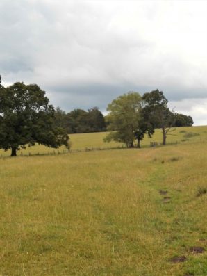
When I parked up on the lane at  Backridge there was mist in the Ribble Valley, Pendle was hiding but the castle in Clitheroe was visible. That was where I was heading and a clear path was discernible through the grass so without any thought or effort I’d arrived at Edisford Bridge and its eponymous Inn.

Tucked away behind a hedge is Edisford Hall of which I was previously unaware and today unable to get a good view of. The hall was apparently the site of a leper colony back in the 13thC. More history denied to the majority, the rich and powerful tend to keep their wealth and property hidden. I cannot deny them their privacy though, an ongoing theme in this post.

Edisford Bridge is medieval and the original ribs can be seen under some of the arches. The inscription on the parapet reminds one of the previous boundaries. The surrounding fields were the scene of a vicious battle [they all were] 900 years ago, but today all was tranquil with holidaymakers enjoying the sunshine on the banks of the Ribble.

I always find the route of the Ribble Way difficult to follow through this edge of Clitheroe. There are open spaces [for how long] but nothing is waymarked, then you are passing old cottages before being sucked into a modern housing estate, the likes of Kingfisher Way and Heron Mews.    Out past allotments the river is gained and followed to Brungerley. Last night’s thunderstorms had put more power into the water at a weir. Across from here one could see on the far bank Waddow Hall, idyllically situated above the river. An old house built in Tudor times by the Tempest family but modified by Jacobean additions.

Further on a family were preparing for a roasting and hi jinks in the river just before the bridge – ‘Brits on holiday’. Hottest day of the year?

Brungerley Bridge was built in the early 19th C, It was at the stepping stones here in the past that King Henry VI was captured. A steep stile climbs onto it, now with the obligatory safety rail.

Over the bridge a path is found into the grounds of Waddow Hall, unfortunately it goes round the back of the buildings. Waddow was bought by the Girl Guides Association in 1928 and it keeps its secrets well hidden, but not their exciting climbing tower which I sneaked a blurry picture of, sorry.

Coming out of the grounds a quiet road winds into Waddington 3/4 mile away. I know this village fairly well from eating in the three public houses and wandering around the church. The main street has a stream running down the middle with attractive and well-kept memorial gardens. For a short time in 1990 it became Granada’s “The Television Village” with its own broadcasts from the village hall.

I knew nothing of Waddington Hall, hidden behind high walls in the centre of the village, its origins going back to the 12thC. It was restored in 1901 by the Waddington family. It was here Henry VI attempted to escape from Yorkist followers.

Up the road is a long-standing café with an unusual frontage of metal posts, their famous pies were cooling off in the kitchen window – another time.

The prominent church is unusually dedicated to St. Helen. the tower is the oldest part from 1501. Inside there are some intricate wooden details. Nearby are the village stocks.

But by now the Lower Buck Inn was beckoning, and I succumbed to a pint of the finest Bowland Brewery’s Blonde Ale. They even allowed me to eat my own sandwiches in the beer garden. This is a great traditional village inn run by the same family for years. Try it sometime, even the dogs have their own brew.

Refreshed I found a hidden path, undoubtedly ancient judging by the clapper bridge, leading out of the village and into open fields with views opening up of Pendle, down to the Ribble Valley at Whalley and round to Longridge Fell. I passed in front of the impressive Colthurst Hall for which I can find no information, although there is A King Henry’s Grove nearby on the map.

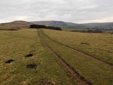
An old bridleway leaving the road at Braddup House, Whinny Lane, was marked on the map and I decided to follow it up the fell to an area I hadn’t been to for ages. This was at the base of Waddington Fell which I had explored whilst trying to link up paths for my Longridge Skyline Walk, LSW.  It was good to be out in the high country again and I followed that route all the way back to Backridge.

Up here I was surrounded by hills, Waddington Fell, Pendle and Longridge Fell all felt within touching distance, time for a panoramic shot including all three.

On the way back I passed Talbot Bridge with its date stone obliterated by moss and age. 

The house above the bridge was originally a pub, The Woolpack giving an idea of the passing trade. Next door a Swiss-like house has appeared since my last visit, very twee.

My next point of call was the more graceful Saddle Bridge, 17thC but rebuilt last century, over Bashall Beck which has come down from Talbot Bridge. This packhorse bridge is also known as Fairy Bridge from a local legend.

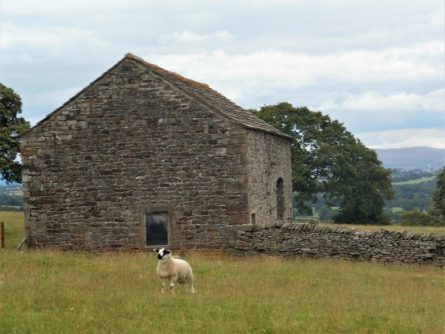
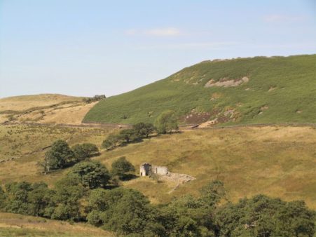
Soon I was on a familiar track passing the intriguing Bashall Hall. This extensive building dates from the 16thC but has had many changes since in different stiles. It hides behind high garden walls but I managed a few more views today.  

It was from this house that the Talbots set out to capture King Henry VI. So I’ve come full circle on what has been an outstanding walk for historical interest and the best Lancashire scenery.

*****

HISTORIC BOLTON-BY-BOWLAND.


A rambling afternoon.

The village of Bolton-by-Bowland lies in the SE of The Forest of Bowland bordering onto the Ribble Valley.  Until 1974 it was part of the West Riding of Yorkshire and indeed the surrounding area has a feel of the Yorkshire Dales, its history goes way back into medieval times. The Pudsay family were prominently involved with the village, its church and nearby Bolton Hall [demolished in the 1950s, more of that later.]

I started my walk today at the upper green with the Old Courthouse and village school.  [Frontispiece above]    Further up the lane I entered fields leading up and over to the hamlet of Fooden. There were mature parkland trees and here and there evidence, dykes, of old field patterns, these were quite common throughout today’s walk. As I crested the raise I was surprised to see dozens of men wandering the fields with metal detectors and little shovels, it turned out to be an organised group search. One find already was a diamond ring but they were mainly unearthing modern-day coins.

  Entering the small hamlet I met a lady resident excitedly trying to position a weather vein, incorporating a deer, bought at Tatton Garden Festival last week, on her property.  Her husband seemed long-suffering. The further conversation discussed the nearby Grade II* hall building, now empty after the owner died a couple of years ago, its adjacent sulphur spa and the attractive Grade II* cottage with dovecote across the way. By the time I’d finished exploring the weather vain was up and running. What a delightful place to live.

I found a path leading above the River Ribble. Below out of sight was the limestone Rainsber Scar, named in one section Pudsay’s Leap where allegedly a 16thC William Pudsay [from Bolton Hall] leapt on his horse to avoid capture for forging his own silver coins. I did see a herd of Deer on the far bank which judging by their spots may have been Sika.

I was heading for Bolton Mews the remains of Bolton Hall estate converted into private dwellings. One historical note is that King Henry VIth stayed here with Sir Ralph in 1464 at the time of the War of the Roses. Apparently, his divining skills discovered a spring now preserved as King Henry’s Well. Most of the estate is now out of bounds but the covered well can be seen over a wall.

Having circumvented the grounds of the hall I dropped down to cross a footbridge at an old ford on Skirden Beck.  The fields further on to the next footbridge were impassible with maize so I took a short cut fording the low Holden Beck to climb up to the road directly in front of Bolton Peel. This is another interesting house, 17th century with mullioned windows and a fine porch. In front of the building is a preaching cross. The base is ancient, one of four in the area, but the cross is 19th C. The Peel family were early Lancashire industrialists and gave the country a PM in 1841, we are getting a new one tomorrow!

After a fraught but thankfully short stretch on the busy road a fingerpost pointed me into fields leading to the not so historic Hague Farm. I had a friendly, if noisy, greeting from their labrador. Upwards to Rodhill Gate where I joined a sunken bridleway, an old drove lane,  going steeply up the hill. At the top views broke out of a moody Pendle Hill, the Yorkshire hills towards Skipton and to the north Craven Hills with Pen-y-Ghent proudly in the distance. A splendid spot for a late lunch.

A beeline through fields led to Lower Laithe, an isolated barn. Then it was down into the hamlet of Holden. Braxup House was outstanding with its date stone and unique Yorkshire upper windows.

Across the road was the busy Holden Clough Nursery. I frequently visited here when establishing my own garden 40years ago, what a different place then with the owner Peter Foley searching chaotic nursery beds for a plant of your choice,  Now all is changed, son John has revitalised the nursery into a ‘garden centre’ but still with an emphasis on plants. I had no money on me for a cuppa in their cafe.

A strange narrow stepped stile in a wall leads out of the village. I’m heading for 17thC Hungrill farm across the fields. On arrival, the nearby barn conversion takes my attention. A forded lane takes one into a large garden area in front of the impressive building. Several expensive cars litter the forecourt. Obviously private grounds not for me. I slink around the back on a stony track. This leads to fields with no obvious path or waymarks. I think I was distracted by all the wealth on show that I wandered into the wrong fields, waded into small streams, climbed barbed wire fences before coming out onto a road. A right ramble.

Unexpectedly in front of me was a gate leading into a field by the Skirden Beck running down inro B-by-B at the bridge where I was relieved to arrive back unscathed.

I still had time to look around the village at its fine houses and lower green with a stone cross.

Higher was the parish church of St. Peter and St. Paul, rebuilt in the 15th century by Ralph Pudsay. Inside I knew was a remarkable memorial stone to Sir Ralph, a large slab of limestone engraved with images of himself. three wives and twenty-five children!

That was a well-spent afternoon with some lovely buildings to be viewed as well as the surrounding scenery. I was surprised at the underuse of footpaths in a popular area with good waymarking on the whole.

*****


MID-SUMMER MISCELLANEA.

Double rainbow over Longridge out of my window.

Haven’t much to report since arriving back from France, how can I be jet-lagged after an hour and a half flight.

The fields opposite my house are being cut by a flotilla of agricultural vehicles, what a contrast to the old days of hay cutting that I was involved with as a youngster.

The weather here has been predictably hot and dry so I’ve been out bouldering on Longridge Fell at three of my favourite crags – Kemple End, Crowshaw and of course Craig Y Longridge.  These three give me choices of sun or shade at varying times of the day so I can escape the sun if needed. Up at Kemple I ventured onto Hodder Buttress to solo the easy slabs and arriving at the top I was concerned about some loose flakes above the climbs, I had great fun trundling these onto the quarry floor thus making the routes safer. Over on the main wall I found that I was struggling on some of the traverses I normally cruised, I blamed this on lack of confidence since my enforced layoff. The view over the Ribble Valley this evening was splendid.

At Crowshaw I was completing a topo of the problems to the left of the main buttress. The quarry bowl here is a delight as the heather starts to bloom and the bilberries ripen. I am content on an evening just to sit here and listen to the bird song.

After these two backwaters Craigy is hardcore bouldering, 100m of overhanging rock, with a regular clientele. I have a section at the far end that is less severe and I can do circuits on relatively good jugs to keep fit.

Whilst up on the fell I popped into Cardwell Quarry where climbing is now banned because of unsociable behaviour by some ‘climbers’. I was surprised to see that not too much vegetation has returned in the lean years. I must go and have another word with the farmer to try and restore climbing here.

I was out in the Ribble Valley today and popped into Witches Quarry. A secluded limestone venue where you drive into the field and park conveniently under the crag! The rock was in good condition and I traversed a little and then soloed the amenable Cracklap, I’m sure this used to be VD. Strangely a gooseberry was growing from the start of the crack.

EVEN MORE OF DINKLEY ON A GOOD FRIDAY FAMILY WALK.

The successful walk last week along the Ribble must have been at the back of my mind when some of the family pitched up on Good Friday. So after a quick lunch of soup I suggested something similar as the weather was perfect. Parking at the Marles Wood site was tricky but we luckily managed a space as someone drove away. Since last week the bluebells have moved on a touch and the ‘blue carpet’ was making an appearance in the woods.

Sales Wheel.

A steady stream of walkers made their way through the woods to and from the river at Sales Wheel, early picnickers on the banks had been testing the cold water and were now relaxing with beers – typical Brits on holiday, some will have red skin tonight.

We pressed on to the open area along the river and descended to the shingle beach for a prolonged session of enthusiastic stone skimming. Despite the abundance of perfect flat stones none made it to the opposite bank.

After some time simple stone chucking became the order of the day before a drinks stop.

We admired the new bridge and noticed the plaque from the 1951 opening of the original suspension bridge, which I’d missed last time.

Rather than walk the long way back along the opposite bank, protestations from the grandchild, we decided to head uphill to the road on this side. Looking at the 1:25,000 I spotted a track going virtually all the way without too much road walking. Of course this was not a right of way but looked inviting so we went for it. This worked well and we followed tracks of sorts all the way without obstruction except at the end emerging onto the road where the gate was locked with dire warnings to trespassers. I was particularly pleased with the route which gave magnificent views back down to the river and the bridge as well as more distant views of Hurst Green, Longridge Fell and Pendle Hill, and brought us back to the car without too much family stress – we had only covered two miles in two hours.

‘forgive us our trespasses’


Back to my place for beers, bagatelle and Ratatouille.

*****

MORE OF THE RIBBLE WAY AND DINKLEY BRIDGE.

Following on from last Saturday’s walk from Hurst Green, JD and I decided on a section of the Ribble Way taking in the newly opened Dinkley Bridge.

We parked at Marle Wood carpark and crossed the road away from the river into fields rising above the valley behind what was Salesbury Hall. Unfamiliar views opened up over the Ribble Valley with Longridge Fell in the background as we ascended, and then suddenly Pendle was alongside us. No sooner than we were up, we were down, back at Ribchester Bridge over the Ribble. We were guided alongside properties converted from the former De Tabley Arms.

Downstream past the de Tabley.

Upstream.

Here we joined the Ribble Way, which goes upstream alongside the river as you would expect, but before long is diverted away from it because of anglers ‘rights. This has been a problem for this long-distance path in several places, thus depriving the walker of beautiful stretches of the river, an access problem that was never resolved, and I think resulting in the walk never gaining the popularity it could have. It feels a little neglected now.

The woods hereabout always have evidence of flooding, lots of twigs and logs, along with lots of plastic, but it is a delightful stretch nonetheless. Soon we were at Dinkley Bridge, reopened after several years since flood damage. The old suspension bridge has been replaced with an elegant, modern-looking structure with ramps at either end for access. Hopefully, it stands well above flood levels; it certainly doesn’t wobble like the old one.

I searched my photos for a picture of that suspension bridge in vain, so here is one from Lancashire Life.

On the far side, we rejoined the riverbank for the stroll downstream, which gave the best views of the bridge. We walked through fresh wild garlic, the bluebells were just starting to colour, wood sorrel, celendines and wood anemones were plentiful.   This mile alongside the river is popular because of the car park, which gives access to the shingle banks, goes through Marle Wood and looks over Sale Wheel, a whirlpool on a bend.

Long may this spring weather last.

*****

ANOTHER HURST GREEN CIRCULAR.

JD suggested a walk from Hurst Green, well actually he first suggested a circuit of Fairsnape Fell but I wasn’t feeling up to that but the day was too good to miss.

Our object today was to see if Dinkley Bridge over the Ribble was open again after a major rebuild following damage from Storm Desmond back in 2015 when flood waters buckled the upper part of the 1951 structure.   All pictures from my cheap phone.

We parked up in the village and made our way down to the magic Dean Brook. Just off the path  is a hidden rock face on which we put up a hard route 20 odd years ago, I was keen to have another look to assess any bouldering possibilities. The rock was still a bit green from the winter but there appeared to be plenty of clean rock low down, I will return to investigate.

Our route was to be circuitous to explore some unknown paths.  Searching for the first of these had us wandering into the back garden of the old hunting lodge of Greengore, we hastily retreated into the neighbouring field. Hidden stiles guided us across splendid Lancashire countryside to arrive at Higher Hud Lee Farm where an unlikely route took us through the untidy yards. On our way through we were press-ganged into helping two farmers push a car onto a low loader.

A stroll down the lane brought us to the long closed and now derelict Punch Bowl where another lane left the road heading for Bailey Hall. After a short distance we diverted to follow fields down to the thickly wooded Starling Brook and a footbridge. Once onto the next lane we were on familiar territory, or so we thought as all these lanes have a similar appearance. Strangely a small pond alongside seemed to have the remains of a speedboat embedded in it.

The Ribble Way joined us from the right and we followed the waymarks to Trough House where a diversion to the new Dinkley footbridge was made. What a splendid structure it appears though a trip to the far side would be needed for a proper view, an idea for next week. The old cantilevered structure has been  replaced. We were content to watch the Ribble flowing from the middle of the bridge. A lot of people were out and about enjoying the sunshine, many no doubt attracted by the new bridge’s opening.

The dogs at Trough House were in fine voice. Lambing Clough Lane climbed back up to Hurst Green where a wedding was in progress in The Shireburn Arms – what a day for it.

PS. The tyres on mountain bikes are getting bigger…

*****


SKIPTON TO LONGRIDGE 4 – A sunny Longridge Fell.

Longridge Fell from the south, Kemple End is the steep bit at the right.

Higher Hodder Bridge to Longridge.

JD and I are sat in the bus station at Clitheroe waiting for the Skipton bus to arrive with the pieman on board. The alloted time passes and we wonder if we are in the right place, we circle the area in our car but no sign of him or the bus. The phone call elicits that the bus broke down! We look at each other and as the day is dismal and I lack enthusiasm we drive home  for other pastimes,  ie gardening.

Fast forward 24 hours and we are sat in Clitheroe bus station once again. I must admit the weather was far better today so we hoped the pieman would arrive. He did and within 10 minutes we are parked up at Higher Hodder Bridge at the base of Kemple End, the east end of Longridge Fell. After a stretch by the Hodder we start a fairly easy zigzag ascent of the fell. Behind us were views across the Ribble Valley to Pendle and Waddington Fell. We emerged at the road and stripped down to shirts for the rest of the 1000ft ascent in increasing temperatures.

Higher Hodder Bridge.

Climbing Kemple End, Pendle in the background.

Layers coming off.

A mixture of tracks and paths through the forest where there has been a lot of clearances of late, a magic route opened up in front of us. The lighting seemed to transport us to some alpine approach but there were no snowy peaks above. Familiar tracks head up the fell though in some places wind damaged trees create diversions. We came out of the trees at a well known viewpoint overlooking Bowland, the Three Yorkshire Peaks were in haze.

Magic light amongst the trees.

There is a way through.

More uprooted trees.

That viewpoint.

Our guest from Yorkshire is impressed by the scenery and we eventually arrive at Spire Hill the summit of Longridge Fell at 350m. At the trig point is a man talking on short wave radio as part of the Summits on the Air scheme.  He was mainly concerned with radioing his position although he requested a summit photo. Listening in to his pointless conversation with some unknown person made me think why we climb summits. We were sweating from our exertion, ready for lunch, breathing in the air and enjoying the situation and views particulrly of Chipping Vale and the Bowland Hills. It takes all sorts.

Radio ham.

Well deserved lunch with a little Brexit chat.

We had been climbing steadily all morning but from now it was gently downhill. The view over the Fylde was rather hazy but the sunshine became warmer as the day wore on. There was some unavoidable road walking past the golf club. This now popular venue had humble beginnings as a 9 hole course which was amalgamated with Preston Cycling Club at the beginning of the 20th century. They built an early clubhouse shared with the golfers and as time passed the golf developed and the cyclists moved elsewhere but the badge still remembers the joint beginnings.

Heading down with Parlick and Fairsnape in the distance.

When it all started.

Present day signage.

We took to fields again and entered Longridge via the old railway line used by the stone quarries. We had spent the whole time walking Longridge Fell, about 7miles as the crow flies, hence its name. Cutting through the streets we completed our house to house route from Skipton. Well that’s another of my straight lines accomplished and very enjoyable it has been; beautiful varied scenery, interesting history and good companionship with enough exercise on each occasion to fill a winter’s day. But now Spring is upon us thoughts drift to wider horizons.

*****

THE TOLKIEN TRAIL.

                                           THE WINKLEY OAK.

I was weary from my day’s exertions with Sir Hugh on our SD 38 walk which involved quite a bit of travelling time today so I asked JD to sort something out for the morrow whilst I soaked in the bath.

He had researched in a book ‘Birdwatching Walks In Bowland’ by David Hindle…

… and came up with The Tolkien Trail.

Author J.R.R. Tolkien regularly stayed at Stonyhurst College in the Ribble Valley whilst his son was studying there. It is thought, perhaps optimistically, that he derived inspiration for his Lord of the Rings trilogy from the surrounding scenery. So JD had conjured up a historical and ornithological walk for this lovely sunny day, if I’d thought I would have brought my binoculars.  There is plenty of information for The Tolkien Trail on the VisitLancashire web site.

We started in Hurst Green and were surprised at the amount of housing development creeping into the green fields. A well used path into Stonyhurst College sports grounds, but there is a new sport, clay pigeon shooting, and warning signs have been erected as well as a probably ineffective ‘alarm bell’.

I had recently been reading of the original observatory at the college built in 1838 and succeeded by the modern one in 1866. So as we approached the school buildings I was keen to identify them both, old and new.

We walked out past the gardener’s cottage and then the houses of Woodfields were masters live. Pleasant fields take you into Over Hacking Woods and a staircase down to meet the Hodder. We hadn’t seen many birds up to this point, apart from Robins singing full throat, but the woods had a truly Tolkien atmosphere.

Below us were the original ruined changing rooms for the college’s swimming lessons in the river, I think they have an indoor pool nowadays. I mentioned these in a recent post when we passed this way. Up the slope is Hodder Court previously a preparatory school, but now private dwellings with a statue of Gandalf in one of the gardens. shame the trail leaflet doesn’t mention it. See the above post for pictures.

An Australian couple were following us with their friendly dog and it couldn’t wait to get immersed in the river. We saw a few ducks along this wonderful stretch of the Hodder.

This was the third time I’d arrived at Lower Hodder Bridge in a week so didn’t intend to show more views of ‘Cromwell’s Bridge’ however when we joined The Ribble Way and rose above the river there was a good view back down to the two bridges.

We knew about the heronry in the tall trees next to Winkley Hall Farm and sure enough we saw Herons flying in to their nests. Whilst watching them I spotted a small bird flitting through the hedge, a rare sight of a Gold Crest.

Where the Hodder meets the Ribble we found a fisherman’s hut with a bench, a perfect spot for lunch and watching the rivers run by.

Along the next stretch is the site of Hacking Ferry used until 1955, the last boat is in Clitheroe Castle Museum apparently. Across the river is the 17th century Hacking Hall near where the Calder enters the Ribble.

An Egret was spotted on the far bank, a couple of Canada Geese also but no Kingfishers or Dippers.

Before long we left the river and headed back to Hurst Green coming through the car park of the Shireburn Arms, we were tempted by a pint but looking at the state of our muddy boots decided not to. All day Pendle had been brooding in the background.

*****

NORTHING 438. BARROW TO NELSON.

We are out walking our Northing 438 line again. A lane leads steeply out of Barrow through mainly new housing, ribbon development if ever I saw it. Crossing the busy A59 we continued climbing into Wiswell, an interesting little hamlet with a famous gastropub. A van was delivering organic vegetables to houses, one of these expensive subscription ideas where you probably finish each week with a box still full of potatoes and carrots. From here the route became moorland onto a ridge which was really an outlier of Pendle Fell, the mast marked on the map seems to have disappeared. We had climbed 500ft in a mile and were beginning to steam in the mild weather. Sabden could be seen in the distance. Below us was the large hidden valley of Sabden Brook and we slowly made our way down to pick up tracks into the village. I mentioned the famous Sabden Treacle Mines of which Sir Hugh had no knowledge, sadly they are no more and I will leave those with curiosity to investigate. We followed lanes to the 19th-century church and then out past a farm from where a pipe led into the fields. This pipe actually came out of the midden slurry tank and snaked into the fields, a tractor pump was starting up to inflate the pipe which we followed almost hypnotically for several fields. Eventually, the pipe seemed to connect up with another tractor with spreading machinery, but nothing happened. By now we realised we were off track so diverted back onto a rough farm road. This led to the 16th century Dean Farm with its wonderful mullioned windows and incongruous 19th-century extension.  Muddy fields and rough reedy grass below the ridge of the so-called Forest Of Pendle led us to lunch on the wall of Tinedale House. A climb onto the grandly named Rigg of England which was mainly equestrian farms. Up here were good views back to the massive bulk of Pendle and across to Newchurch in Pendle which we had visited on The Lancashire Witches Walk. Below to the south was the industrial Burnley – Nelson – Colne corridor. It didn’t look too bad from up here. Ancient tracks down the hillside brought us into Fence alongside the White Swan pub where I recalled a seasonal wild garlic meal.  Where do these memories unexpectedly come from?

We made a mistake in trying to follow footpaths parallel with the busy road, we were hemmed in by unnecessary plastic ‘hedging’ on the boundary of more equestrian enclosures. Escaping eventually into a large graveyard, where we were surprised by the number of Muslim graves. We started dropping down into the valley alongside a small beck. Surprisingly green paths led us into the heart of the Lomeshaye Industrial Estate. At the large Wellocks complex we enquired what  ‘The perfect ingredient‘ was but unfortunately only Polish was spoken. Subsequently, we discovered that it was a high-end food distribution firm to the restaurant trade founded originally by a potato merchant whom Sir Hugh had known from his Yorkshire days. It was pleasant to enter Nelson through Victoria Park with its bandstand and paths alongside Pendle Water.

Under the motorway, over the canal and then a steep road heading up into Nelson town centre where we found the modern bus station which gave us a busy ride back to Barrow.

*****


SKIPTON TO LONGRIDGE 3 – the two rivers.

Chatburn to Hodder Bridge.

As you may know I’m juggling a couple of routes giving winter walking, the northing SD38 across England with Sir Hugh and this shorter walk with The Pieman between our two towns. We meet up outside Hudson’s Ice Cream Parlour where we finished last time. I’ve enrolled JD [aka Doug] into today’s stroll, The Pieman appears from behind the ice cream cone.

We left the road by the church and followed paths down towards the river. An area popular with dog walkers judging by the number of poo bags hanging in hedges, I’ve given up commenting.

The Ribble was full with last night’s rain and snow melt. We were now on The Ribble Way skirting round the massive Horrocksford complex which produces a significant amount of England’s cement. The first bridge we came to was at West Bradford. After this we entered  a sculpture trail on the outskirts of Clitheroe. I think we missed most of the sculptures but noticed a few. None was outstanding.

After Brungerley Bridge we looked across to the impressive Waddow Hall a 17th century building owned by the Girls Guide Association and nowadays used as a wedding venue.Somewhere along here we passed muddy paddocks and then got sucked into new housing developments, they are everywhere, to arrive back onto the road at the sports centre. In the recreational ground we found a bench to watch the river go by and eat lunch. Edisford Bridge was built, at a former ford, in the 14th century and until 1600 was the only bridge upstream from Preston.

On the far side of the bridge is the eponymous hotel, having eaten we walked on by.

Complicated field paths led across to the complex of buildings at Withgill. All the while Kemple End, the eastern end of Longridge Fell, loomed above us, our onward route for another day.

The scenery improved and the paths became more interesting as we dropped down to the River Hodder.The river was crossed by the Higher Hodder Bridge with its historical boundary markings.This bridge is on our Skipton to Longridge line and from here our route will be up Kemple End and along Longridge Fell. But to finish off today we want to show the Yorkshireman some stunning scenery alongside the Hodder between the bridges.The familiar path undulates above the Hodder in splendid isolation. At one point a cross is seen, it has no inscription and local opinion is that it marks the spot of a drowning.Above us is the Stonyhurst estate and the long established Jesuit College. Down by the river are the remains of bathing houses where pupils changed before a bracing swim.And yet above us are buildings previously used by St. Mary’s Hall, a preparatory school for Stonyhurst College. It was closed in 1970 and converted into high-end living accommodation. There is a connection between Stonyhurst and Tolkien and hence there is a carving of Gandalf, the wizard, in the garden.

All that remained was a stroll alongside the Hodder to the Lower Bridge where the customany diversion was made onto Cromwell’s Bridge.

We had finished for the day. Rather mundane but highly enjoyable.

*****

SKIPTON TO LONGRIDGE 1 – another straight line.

Skipton to Barnoldswick.Following on from the success of the straight line from Longridge to Arnside completed with Sir Hugh at the end of last year I have persuadedthe piemana resident of Skipton to undertake a similar scheme between our respective abodes.

The Pieman.

He is a lifelong friend, possibly blood related though I tend to ignore that, with whom I’ve shared many backpacking trips throughout Europe but recently we have not been able to meet up as much as required. So this was a good opportunity to get 2019 off on a better note. Thus I was drinking coffee in his house in Skipton early this morning before setting off on what could only be described as a drab day.

My local guide takes us across Aireville Park, where I used to play as a child, over the Leeds Liverpool Canal and out of town through an industrial estate with some interesting relics awaiting restoration.

Airedale Park.

We crept under a main road and crossed the placid River Aire on an old track into Carleton. This essential bridge for our route was just within the mile either side of our arbitrary straight line  The C19 mill in the village was originally for cotton-spinning but I remember buying carpets there in the 70s, apparently it is now luxury apartments.

Carleton.

Today we didn’t visit the village but took to unmarked footpaths through green drumlin fields. I have to concede that satellite tracking maps were a great help in navigating this section. We were going parallel to a disused railway [Skipton to Colne] and eventually we found ourselves walking along it for convenience until stopped by vegetation.Possibly we touched on a Roman Road leading to Elslack where there was a fort. Our priority was to find a picnic bench and there right in the middle of the hamlet was one in some sort of memorial garden. Having put his instant coffee powder into a cup he looked for the flask containing the hot water, unfortunately it was on the worktop back in Skipton. I had hot apple tea in my flask so he ended up with a strange brew.

We walked past the C15 Elsack Hall but at a discreet distance and then along the abandoned railway into Thornton-in-Craven joining the Pennine Way for a short stretch. The village has interesting old houses but no shop or pub and the heavy traffic deterred us from lingering.

Tree planted for the Coronation of Queen Elizabeth.

?Millenium Clock.

On the edge of the village are Almshouses built for poor women, there is not much of that charity evident today.

By the church a sign guided us to a Holy Well in the grounds, dating from Saxon times it is covered by an octagonal structure erected in 1764 by the rector.

On a short stretch of golf course we joined The Pendle Way. It weaved around a church and graveyard where every grave was decorated with flowers, presumably from Christmas.

Rolls Royce have a large presence in Barnoldswick and we passed one of their factories before joining the Leeds – Liverpool Canal for the final stretch into town. My overall impression today was of green fields and a rich historical background.

*****

ALSTON – LOOPING THE LOOP.

As the crow flies it is 4 miles from Longridge to Samlesbury, where BAE Systems [previously British Aerospace] is based, however the River Ribble is only bridged at Ribchester or Preston both giving a far longer journey. A friend of mine would in summer take a short cut down Alston Lane and ford the river with his bike straight to work. Today I tried to identify the place he crossed but of course there was a lot of water running, I think the above photo is roughly the spot and I shall investigate further next summer.

Anyhow back to the beginning. Lethargy and other pressing problems these last few days have kept me in; it is easy to slip into this mood when the clocks change and Winter approaches, that is the reason I normally go off to sunnier climes. I planned this route last night and set the alarm so I was committed to venture forth. There was a window in the weather so timing was crucial which still gave me a leisurely breakfast. I was parked up at 10am,  My clockwise circuit ment walking on the main road for a few hundred metres alongside the ghastly development of new houses, all dumper trucks and lorries. Why have they seen fit to obliterate over a 100m of hedging to gain access to the fields? This did not put me in a good mood.

Thankfully I soon turned down Pinfold Lane  [pinfold – a pound for stray animals] and looked into the adjacent field where I found the base of the ancient Bolton Fold Cross which I’d not noticed before.

There were a couple with binoculars in the hides overlooking the wetlands adjoining the lane. I couldn’t see anything of interest except a long view to St. Lawrence’s Church and the prominent Dog Inn in Longridge.

Over towards Pendle there were darker clouds contrasting with the sunlit autumn foliage. Lanes linked little farms, most now converted into modern residences. A lot has changed since I last came this way. I bumped into the father of climbing brothers from the past and we chatted about old times. A farmer further on was more expressive [forthright as only farmers can be] about the world’s problems. All in a day’s walk. Hereabouts The Ribble Way crossed my path heading towards Ribchester on the line of a Roman road, of which there is little evidence.

Not all has been beautified.


This guy means business.

Dropping down fields I seemed to be heading to a cul-de-sac but there in the corner was a stile and a footbridge over the stream, all very delightful.


“falling leaves hide the path so quietly”
John Bailey

At last the object of my walk, the River Ribble, was glimpsed through the trees below. The river here makes a looping curve around flat fields with an escarpment on the south side. Ducks were floating in groups and when disturbed fired off in all directions like some of this weeks explosives. I do not understand why the Ribble Way doesn’t follow this delightful stretch of rural Lancashire.

Once past the ‘ford’ I was looking for C17th Old Alston Hall but only had a glimpse of it across private gardens. Higher up the lane is the C19th gothic Alston Hall which was used as an education centre by Lanc’s County Council until being sold to a private buyer. I won’t add fuel to the rumours of its recent extensive fire and plans for redevelopment. The observatory run by the University seems unaffected.

Old Alston Hall.

New Alston Hall and observatories.

It was a relaxing walk up Alston Lane, noticing all the recent residential conversions, back to my car. As I reached it the rain started in earnest – it’s all about timing.

*****

Possible ford in red.


THE HEAT GOES ON.

Beacon Hill, Grindleton Fell.

I’ve just eaten a punnet of cherries with a beer whilst watching Belgium beat Brazil in a World Cup  game . The lazy days of this summer are passing by and now we have Wimbledon and The Tour de France to distract us.

 The pieman and I met up at Chatburn earlier today. I was glad we made the effort. At one point when we were aimlessly wandering around in a field in the midday sun I questioned our sanity. We had descended from up high on Grindleton Fell and were aiming for the River Ribble but fences and obstructions were in our way giving rise to some scribbles on my route map below.

We had started off on an old lane out of Chatburn which when face to face with a massive limestone quarry took us down to the Ribble and along a concessionary path to the bridge. On the outskirts of Grindelton, a village worth exploring , we picked up a rising bridleway which passed by some interesting houses – Victorian Green Banks, Georgian White Hall and spacious and pretentious Cob House. The old Yorkshire expression ‘where there’s muck there’s brass’ came to mind as we speculated on who lived in these expensive properties. Then we were in the rough country above an old abandoned yet evocative farm.

We skirted the forest and ended up on the rarely visited Beacon Hill with a trig point at 305m, high enough for me today. We took the opportunity to relax, eat lunch and look at the views over the wooded Ribble Valley to Pendle and northwards towards the ‘Three Peaks’. A group of teenagers were struggling up the hill towards us, all heavily laden and no doubt on a DofE course. The ones at the front were chatty but the tailenders obviously had no desire to be where they were.

Hazy Pendle.

We passed through more desirable properties, thankfully guarded by docile dogs, before our episode of being lost, hot and bothered. Soon we were on The Ribble Way which in these parts upstream has been cruelly diverted away from the river by landowners with angling interests. We enjoyed our stretch of the river however as we headed back to Grindleton bridge and as the river was so low we contemplated a shortcut wading across. Oyster catchers and ducks lazed about on the rocks in the heat of the sun.

We cooled down with an ice cream from the famous Hudson’s shop in Chatburn, it was good to catch up with the pieman and we made plans for future forays.

*****

A SOUTHERN CIRCUIT ON LONGRIDGE FELL.


I’ve been up Longridge Fell three times this week, all from different directions. This lack of originality is partially based on my reluctance to drive far, partly on the weather [torrential rain on alternate days put boggy Fairsnape out of the question] and mainly on my slow re-acquaintance with hilly country. Anyhow it is a great little fell, the most southerly named fell in the UK with the easy to remember 350m height.

Today, Thursday 5th April, was fantastic, you couldn’t have wished for a better Spring like day. Blue skies, no wind and warmish sun [that’s that round yellow thing in the sky]. Of course the paths were still muddy and slippy but that’s par for the course at this time of year in Lancashire. A few groups were out on longer rambles and the dog strollers were making the best of the day.

I parked at Higher Hodder Bridge and  tackled the steep Birdy Brow road head on, One gains height quickly and just past Kemple End the forest track leaves the road zigzagging into the trees. I was already sweating as the morning warmed up. The forest track on a day like this reminded me of walking through Southern Spain on the GR 7 where there is much forest. I was going to say ‘wish I was there now’ but on a day like this you can’t  beat Lancashire. A hidden little path through the trees brings one out at a lovely open viewpoint with the Bowland Fells full on, the frosty Yorkshire peaks off to the East and Chipping Vale at your feet,

Higher on the fell I came across forest workers hand planting thousands of spruce saplings in rough ground that had been felled a couple of years ago. These are disease resistant ones and I will watch their growth over coming years.

Knowing that the track was blocked ahead with fallen trees I again took to smaller paths through the trees some of which are old Scots Pines, an enchanting place. I’ve been known to bivy in this secret place with the bonus of deer wandering past in the night. Further on is the ‘wall path’ leading towards the summit.  Years ago this path was hardly visible but has become more used and hence more boggy, most of the wall that ran alongside it has been now used as infill for the path.

Once out in the open the white trig point was clearly seen ahead with more stunning views of Chipping Vale and the Bowland Hills. If I had kept walking down the ridge I would have been home in an hour but I had a circuit to complete so headed south on forest roads, with Pendle Hill dominant ahead above the Ribble Valley, to come out at the road above Crowshaw Quarry where I had a bite to eat in the sunshine.

The bridle way down past Green Gore to Hurst Green is very familiar but I realised I nearly always walk it in the opposite direction. One of my favourite places is Dean Brook as it descends off the fell and through old mill placements at Hurst Green. The bridge there is a great launching pad for poo sticks.

I came out at the Almshouses which somehow were brought down from Kemple End. The Bayley Arms pub seems to be closed so I carried straight across on Smithy Lane through muddy fields and into the grounds of Stoneyhurst College.

I took the private road to Hodder Court where I picked up the popular footpath alongside the Hodder river. This is a roller coaster of a path in the trees above the river as I headed back to  Higher Hodder Bridge. A delight with the fast flowing Hodder below, emerging Wild Garlic under my feet and expectant bird song in the air.

That was 5 hours of my life well spent.

*****


WALKING OFF SAD – NEEDS MUST.

Introduction…
Seasonal affective disorder (SAD) is a type of depression that comes and goes in a seasonal pattern.
SAD is sometimes known as “winter depression” because the symptoms are more apparent and tend to be more severe during the winter. The symptoms often begin in the autumn as the days start getting shorter. They’re typically most severe during December, January and February.

Symptoms of SAD can include:

  • a loss of pleasure or interest in normal everyday activities
  • irritability
  • a persistent low mood
  • feelings of despair, guilt and worthlessness
  • feeling lethargic (lacking in energy) and sleepy during the day
  • sleeping for longer than normal and finding it hard to get up in the morning
  • craving carbohydrates and gaining weight.
The exact cause of SAD isn’t fully understood, but it’s often linked to reduced exposure to sunlight during the shorter autumn and winter days. The main theory is that a lack of sunlight might stop a part of the brain called the hypothalamus working properly, which may affect the:
  • production of melatonin – melatonin is a hormone that makes you feel sleepy; in people with SAD, the body may produce it in higher than normal levels
  • production of serotonin – serotonin is a hormone that affects your mood, appetite and sleep; a lack of sunlight may lead to lower serotonin levels, which is linked to feelings of depression
  • body’s internal clock (circadian rhythm) – your body uses sunlight to time various important functions, such as when you wake up, so lower light levels during the winter may disrupt your body clock and lead to symptoms of SAD                                                                                            
  •   Treatments for SAD

  • lifestyle measures – including getting as much natural sunlight as possible, exercising regularly and managing your stress levels
  • light therapy – where a special lamp called a light box is used to simulate exposure to sunlight
  • talking therapies – such as therapy.
  • antidepressant medication.
      from  nhs.uk


Why am I telling you all this – well most winters I disappear to sunnier climes as I’ve found over the years that it prevents all of the above. As well as the improved climate I am usually involved in some semi-challenging walk giving me loads of exercise. This year I’ve been grounded because of my hip problems brought on by excessive exercise. Recent posts will have shown how I’ve partially dealt with it, sorry for the maudlin tone to those. Why don’t I just go abroad for a couple of weeks you say – well I’m not good at ‘lazy’ holidays by the pool, would probably just eat and drink too much.

Thus I’m still battling on, physio next week. So when the sun shone this morning I needed to get out. Luckily JD, of GR131 fame, phoned and within 30 mins I was at his house with a plan to do a relatively easy walk to Ribchester and catch the bus back. Off we went with bus passes at the ready.

The watery sun shone, as planned, whilst we walked past the extensive Longridge reservoirs.

The stroll down the quiet Hothersall Lane was a pleasure, as it warmed up I could feel all that lovely Serotonin fighting off the nasty Melatonin. The usual  juxtaposition of irreverent [me] and intellectual conversation [JD] bowled us along and soon we were dropping down the steep escarpment to Hothersall Lodge an outdoor centre run by Lancs County Council. Nobody was about but signs of activity were everywhere, climbing wall, zip wire, grounded canoes, archery ranges, nature walks etc. A great place to introduce people to the outdoors. We were now following the Ribble Way, a flawed route due to private fishing interests unnecessarily diverting the path higher up stream.

Further on was Hothersall Hall, a Gothic style building refurbished and providing privileged accommodation to some persons.  I tried in vain to relocate the Hothersall Boggart – a slightly grotesque stone head in the fork of a tree with associated legends. No luck today but I know its there somewhere.

All was going well with the walking until now, a good surface and fairly flat going. I had forgotten the little hill to be crossed on muddy fields – it was not a pretty sight as I struggled to cope with the terrain. Thankfully I’d brought my tracking poles, not to be separated from them these days. There were good views down to the River Ribble.

That hill!.


We had time to look across the Ribble to the extensive Osbaldeston Hall on the south bank. A path led off towards it and presumably some ancient ford crossing. JD remembered wading the river here on some previous walk but not today thank you.After that it was a stroll to walk into Ribchester, were we on a Roman Road?

Eschewing the Roman artifacts and other attractions of the village we headed past the now closed White Bull with its ‘Roman columns’ to the friendly Black Bull where we enjoyed a quick slurp of Bowland Brewery’s Buster before catching the rattly bus to Longridge.

Needs must so SAD can SOD off.  I’ve plans for the next week or so if the weather is good.


LONGRIDGE FELL – YET AGAIN.

I had no sooner booked a trip to the Canary Islands, to get away from our dismal weather, when the temperature here shot up and the sun was shining. Will it last? Better get out, make the most of it and do a bit of training. Now when I say training I mean go for a short walk. I chose Longridge Fell again as I was hoping for clear views, but which way up?  It is so easy to park up near Cardwell House but I decided to reverse my usual routes for variety. This turned out to be quite different and not entirely successful, for some reason my anti clockwise circuit was strangely unbalanced. I couldn’t really say why – the wrong views, the wrong gradients, the wrong approach.

So what was new today, apart from the sunny weather?  There has been a lot of timber extraction on the fell in the last few years, partly due to the Ramorum fungus and also with maturity. Interestingly I’ve spent a few days recently cutting down a Blue Spruce in my garden. It suddenly lost all its needles a couple of years ago and has not recovered. Spruces are susceptible to the disease and I wonder whether I brought it back from the fell on my boots. The tracks on the fell have been improved to take the heavy machines and lorries involved. They only need to quarry superficially into the fellside to obtain  hardcore for the tracks. I had just passed one of these quarries when I came across a lorry and trailer being loaded with cut timber. It looked a slick operation.

Distant Pendle Hill.

Ready made hardcore quarry.

Smaller tracks took me to the top and the views were clearer than the other day, the Yorkshire Three Peaks were prominent and across Chipping Vale the Bowland Fells distinct. On my way down the ‘balcony’ path I started to meet people coming up from the now busy carpark.

A good 5.5 miles. I was home for lunch.


LONGRIDGE FELL – UP AND DOWN DUDDEL BROOK FROM RIBCHESTER.


Oh, The grand old Duke of York,
He had ten thousand men;
He marched them up to the top of the hill,
And he marched them down again.

And when they were up, they were up,
And when they were down, they were down,
And when they were only half-way up,
They were neither up nor down.

Today’s walk followed that futile theme and the rhyme filled my head.

Duddel Brook rises quite high on the southern slopes of Longridge Fell and reaches the Ribble in Ribchester. This Brook has carved its way down the hill and created a wooded valley [seen on the OS map as a green caterpillar] for the most part secretive. The other obvious stream is Dean Brook passing through Hurst Green. Their importance in the past was related to the many small mills powered by the rushing waters and hence they are worthy of exploration today.

From near the Roman Museum in Ribchester, I set off along the Ribble to where the Duddel Brook issues close to a Roman bathhouse whose outline has been excavated. Normally field paths from Stone Bridge would lead across to Gallows Lane but at the moment they are virtually flooded so I followed the main road before turning up the Lane. A mullioned cottage at Lower Dutton is outstanding. I gained access to the brook a little higher and wandered through the beech woods alongside the water. An old mill appeared with signs of a mill race, lodge and ruined wheel installations. I believe that bobbin making was the main industry here but I may be wrong. Above the deep valley there was a brief view of Dutton Hall a prominent C17 house with a commanding aspect over the Ribble Valley. I crossed the brook on bridges and eventually deep in the valley recrossed by a shallow ford.

Start and finish – Duddel Brook entering the Ribble.

Roman Bath House.

Dutton Hall.
Wikipedia.

The path climbed away from the stream into fields. A lone oak tree, perhaps 300yrs old, was a waymarker across the field. On the road a small wholesale unit purveyed vitamins as well as ‘sweets’, I didn’t 

only half-way up – neither up nor down

  Again I took the easy drier tarmac option, walking up Huntington Hall Lane past several expensively converted houses and barns. After a steep section, Huntington Hall itself appeared on the right, a 17century house which has had a lot of money spent on it in recent years. At the road corner I was back into the fields with views back to the Ribble Valley, I meant to say this was a rare, sunny, dry day. Cresting a hill Intack Farm came into view, again a place spending lots of money with a horse arena right across the footpath but the diversion was no problem and well signed – but is it legal? A quick peep into Crowshaw Quarry showed it to be remarkably dry, could be bouldering here later this week. Crossing the road the main forest track was taken eventually leading up to the trig point on Longridge Fell. Chipping Vale and the Bowland Hills were fairly clear but that was not really today’s objective.

Huntingdon Hall.

Longridge Fell Trig Point.

when they were up, they were up


I came down by the track to Lennox Farm near where the Duddel Brook probably starts life.  A lane took me past Goodshaw Farm where the new lambs were being tended, the farmer told me he had 600 sheep to lamb this year and was concerned about the wet fields he was placing them into. Below the farm was an old barn, Smith Bottom, which on close inspection revealed two perfectly shaped cruck frames thus giving a clue to its medieval age. Down steeply through beech woods overgrown with rhododendrons to a bridge over our brook. This lane leads up to the highly secretive Dutton Manor in its cloak of trees.

A young Duddel Brook.

Smith Bottom cruck barn.

Trees hiding Dutton Manor.

Across the next road was Duddel Farm on its exposed hill. The farmer was feeding cattle in the barns and bemoaning the wet conditions, but despite that remained cheerful and chatty – we had many mutual friends and interests. He was right about the conditions as the next few fields leading back to Ribchester were almost afloat and the mud slowly crept above my knees.


I don’t normally take selfies.

I was keen to reach the last two listed buildings at Stydd. First was St. Saviours a simple C12 chapel. Its plane interior has a flagged floor with ancient gravestones, a stone coffin and wooden pulpit and rails. Very evocative. Further down the lane is Stydd Almshouse built in 1728 to house the poorest parishioners. It is an architectural gem with its central staircase and diminutive size.

St. Saviours.

So back to where I started.

when they were down, they were down


I would like the challenge of an entire ascent of Duddel Brook – obviously in dry summer conditions and with a good degree of so called trespassing. Watch this space.

BROCKHALL – OLD AND NEW.

Last week I attended the annual Chris Mayo Memorial Lecture hosted by our Bowland Pennine MRT, for whom Chris had been a doctor; always a sad occasion for me. I worked with Chris and he was a good friend. At the end of January 1993 I did a long walk in the Bowland Hills with Chris as part of my preparation for climbing Mount Kenya and Mount Kilimanjaro in the next month. Whilst I was abroad, and totally unknown to me, 45year old Chris, his 15yr old son Matthew, both from Longridge, and his 40 yr old brother from Edinburgh were killed in a tragic accident in Coire an Lochan in the Cairngorms. Long shall we remember them.
I am worn out from lots of tree felling and pruning in the garden and too many sessions at the climbing walls, its too wet and wild for anything else. So I needed a short relaxing walk at the weekend. Deciding to stay low and sheltered Mike and I headed for Old Langho in the Ribble Valley to explore the area around Brockhall Village. We parked next to the 16th century St. Leonard’s Church.This little sandstone chapel built  c1557 with stones coming from the recently dissolved Whalley Abbey, on the outside are several carved features from the abbey. We were lucky that the church was open, it no longer hosts services but is maintained by the charitable Churches Conservation Trust, so were able to investigate the inside features. Walking past the entrance to Brockhall Village, more of this later, we crossed fields outside Hacking Wood to reach the lane leading to Hacking Hall a grade1 listed early 17th century property. We had distant views of the massive hall with its mullioned windows and prominent garderobe. Closer at hand was Hacking Barn an interesting early Cruck  structure. The exterior has been much modified but the interior cruck trusses are impressive, the agricultural surrounds are a mess.

St.Leonards.

St.Leonard’s.

Hacking Hall.

Hacking Hall.

Cruck barn.

Cruck barn.

We next went down to the River Ribble just where the Calder joins from the south. The path downstream was washed away in parts and even today a large volume of water was charging down to Preston. A couple of canoeists were thoroughly enjoying their rapid transit. It was near here that there was a historic 17thcentury ferry and I believe an old wooden boat was in Clitheroe Museum. The house across the river was apparently occupied by the ferryman up to the 1950s.

Ribble/Calder confluence.

Ribble/Calder confluence.

Hacking Boat House, Kemple end behind.

Hacking Boat House, Kemple End behind.

At the end of Brockhall Wood, above the turbulent water of Jumbles Rocks,  we turned ‘inland’ towards the farm and former site of Brockhall Hospital. From 1904 to 1992 this functioned as one of Europe’s largest mental institutions. On its closure [care in the community!] a property developer Gerald Hitman bought the lease and developed a gated village of 400 properties. Blackburn Rovers have their extensive training grounds here, Mr Hitman also built his own contemporary home in extensive gardens, The Old Zoo. We skirted around the youth football fields and at the first road walked up into the village. On our left was the well secured Old Zoo but we spotted a lake, a few sculptures and a beech hedge maze, it would be fascinating to look around the grounds but I don’t know who now owns the property. The streets wandered through a variety of properties, a few adapted from the hospital buildings, many newish apartments and a scattering of architect designed detached mansions. There didn’t seem to be much soul to the village, no obvious shop or pub, commuting hell or heaven? On the way out through the permanently manned barriers, to keep out the riff raff, we passed an upmarket restaurant next to the modern Rover’s training facilities.

How times have changed here.

Hospital conversion.

Hospital conversion.

Hospital cottage.

Hospital cottage.

More upmarket.

More upmarket.

Oh! for a peek.

Oh! for a peek.

Rusty Rover.

Rusty Rover.

THE LANCASHIRE WITCHES WALK – Clitheroe to Slaidburn.

The scenery changes today as we leave the Ribble Valley and climb into the Bowland Hills. Rain is forecast and its rather dull in Clitheroe. Canoeists float downstream as we cross the river at Brungerley Bridge  and a group of youngsters are on the field path learning navigation.  We soon leave them behind and cross fields around Waddington, most of the farms/barns look hundreds of years old but many have had expensive makeovers.  Looking back Pendle Hill is in cloud. The hay meadows we pass through are full of flowers and brighten up a dull day. I have a painting at home representing the same scene. As we climb onto the moor on a drove road we realise we have been here together before whilst exploring Easington Fell last winter.There are no views today in the low cloud which is a shame as this is a wild and desolate moor. On the map are marked The Wife and Old Ned but they turn out to be disappointing piles of stones. A good track, presumably shooting, takes us down the fell to a shooting lodge marked as Fell Side. Dogs are caged up and greet us excitedly. At the moment we arrive the rain starts so we are lucky to find shelter and tables outside the lodge, lunch is taken. On the approach I had stuck my walking pole under a stone and a metal trap snapped shut almost breaking it, I couldn’t imagine what it could do to fingers. What are they trying to catch? Our lunchtime was enlivened by a ‘turkey’ parading about in front of the windows. The rain stopped and we continued on our way over a hill and down into Slaidburn, usually seen with a backdrop of Bowland Fells, but not today. Our tercet was in the carpark. The village was busy hosting a small steam fair which kept us entertained for awhile though the crowds and vehicles detractied from the normal tranquility of this lovely village. Familiar paths through woods and then open fields gained height, Curlews and Lapwings became a constant sight and sound. On past a graveyard for farming implements which looked like a ‘herd’ of dinosaurs across the land. We finished the day under the Bowland Fells just before the start of Roman Road over Salter Fell. We will want better visibility for that next section.


.


Catch it while you can … a Ribble Round.

Perception of our weather can sometimes belie reality. It seems as though it has rained for a month, in fact it largely has but there have been a few windows of brightness. The forecast, why are we so dependent, hinted at a dry Sunday morning but with worse to come. Catch it while you can.  So a quick dash for a couple of hours walking by the River Ribble from the graceful bridge at Ribchester. This was once a favourite walk with my young family and later with my ageing father.

Perversely within a few minutes of starting it was raining  but within a few more minutes there was blue sky and rainbows were appearing.. This is part of The Ribble Way. The banks of the river show the aftermath of recent flooding, debris washed up 2 or 3 meters above the normal level. Unfortunately plastic seems prominent along the ‘high’ water mark.

The path is forced away from the river edge after a mile or so. There is an anglers’  track continuing but we are denied it, although I have on previous occasions followed it. Having spent some time this year in Bavaria and Austria, where recreational paths seem to have higher prominence, I ponder what damage we could inflict on the angling community. How have the privileged classes hung on to this injustice, higher up the river things get worse where ‘public’ paths have been closed. This is supposed to be The Ribble Way. The only benefit was that as you climbed away from the river views opened up to Pendle and the distant Dinkley footbridge.

Soon I was crossing that bouncy Dinkley suspension bridge back over the turbulent Ribble, the floods last week must have been a few inches below the bridge. Previously there was a ferry at this spot until the bridge was opened in 1951.  I walked back along the river bank with a chatty lady and four dogs. Before the road is Sail Wheel where the river does a dog leg and interesting currents and eddies develop below the rocks.


The road back passes  grandiose gates giving access  to  extensive meadows which  occasionally host the Royal Lancashire Show. The success annually depends upon the amount of summer rain and mud, not possibly the best site. White Elephant springs to mind……

Rain settled in again as I reached my car and probably will continue to the end of the year. At least I caught a little sunshine.