Category Archives: Bowland Fells.

RADHOLME and BROWSHOLME.

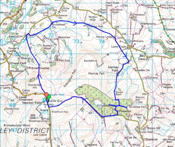
Tuesday,  10th November.   6.5 miles.  Browsholme.

My road to Whitewell was closed, so I hurriedly chose another route. I was on the way to complete another interesting looking walk from my bumper book of Bowland Walks by Jack Keighley. I found a different parking spot on the circuit which also meant I avoided some unnecessary climbing in and out of Whitewell. There was no reason to include Whitewell as I’m already well acquainted with it. It was nearly 12noon when I set off across the fields where there are some limestone craglets  and an old limekiln. When my children were small we used to come here for a scramble about. The views of the Bowland hills are not so good today.

The first farm was Radholme Laund. I got chatting to the farmer in the yard, and he told me that at one time Matthew Brown breweries leased it and spread their brewing wastes on the land. Matthew Brown started in Preston in 1830 and moved to Blackburn in 1927. In 1984, they acquired Theakston but were eventually bought out in 1991 by Scottish and Newcastle. I well remember their Lyon Ales and many local pubs were tied to them. Radholme goes back to the Domesday Book and was originally a hunting lodge, Laund usually denotes a deer park.  A large area of Bowland was set aside for deer hunting until farming took over in the C16-17th. The present house was built in the C19th and has an impressive southern facade.

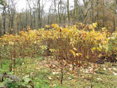
Boggy fields took me down past woods which had lost most of their leaves. Longridge Fell was always in the background. The cattle are now all in their winter quarters [the best place for them did I hear you say?] at Higher Lees Farm.  Then I was in and out of a stream before coming out onto the familiar road at Middle Lees. 
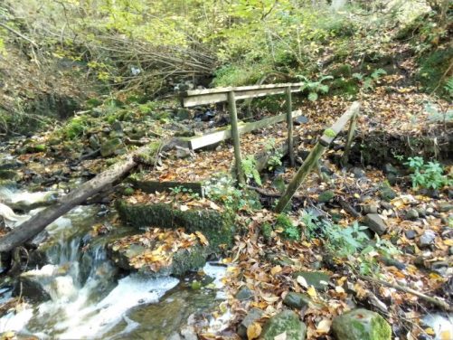
I crossed the course of the Roman Road and followed the farm lane to the cluster of houses at Lees House. I already knew the awkward path going steeply down to a hidden footbridge over Mill Brook and then steeply up the rough ground on the other side where I disturbed pheasants galore. Sheep pastures were climbed to the barking dogs of Micklehurst. I met the farmer who talked of  Covid-19 and the fate of local pubs. Most of these hill farmers must live an isolated life and yet are happy, nay keen to engage in topical conversations  I missed the path further on and ended up with more road walking than necessary. Until now the day had been bright but I seemed to enter low mist and drizzle and yet behind me Longridge Fell and the Ribble valley were in brightness.

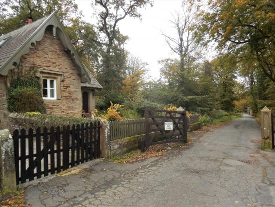
I entered the drive of Browsholme Hall by its elaborate gatehouse but saw nothing of the Jacobean house still occupied by the Parker family who were the ancestral owners since 1507. Most of the land I’ve been walking on today at one time was part of their estate.  I’ve added a photo of the hall courtesy of visitlancashire.com As I made my way went up the fields Pendle came into view, I was heading towards the prominent Browsholme Spire. It is said that its castellated folly was built as a landmark for shooters on the nearby rough fells. It has been adorned with satellite communication dishes in recent years no doubt earning rent from telephone companies. A case of selling one’s soul. On a good day up here the Yorkshire fells are seen but today it was just the rather murky local Bowland Hills. At the bottom of the hill in the trees a sulphur spa is marked on the map, so I searched it out but was disappointed  to find only a boggy spring with the water only faintly tasting of sulphur.

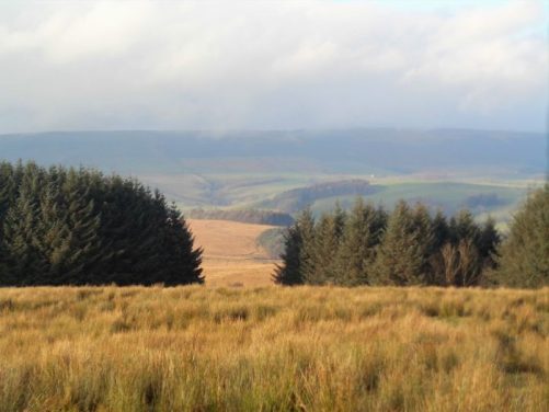
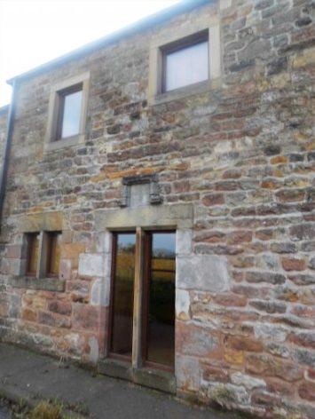
Crossing over that Roman Road once more I took the lane to Crimpton with its seven hand loom upper windows. After the reformation a wooden image of Our Lady Of White Well was brought to the isolated Crimpton for safety. Hence, the farm was well known to Roman Catholics as ‘Our Lady Of The Fells’. I found a seat for a snack looking out over Birkett Fell with Mellor Knoll and the Bowland Hills behind. 
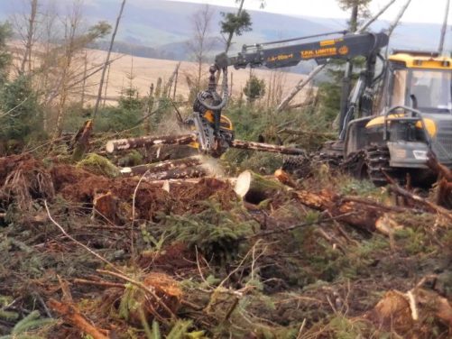
I knew the next stretch through the forest was muddy and awkward but I couldn’t believe my eyes, most of the trees had been cut down and a machine was clearing up. The operator was able to grab a tree trunk in the machine’s claws, whizz it through stripping the branches and then cut it to length and place in a pile. Unbelievable – lift, strip, chop all in one go.

The day was getting on with all these distractions and I wanted to search out some caves in the limestone on the way back to my car. First was Hell Hole in a fenced off copse. There seemed to be two dangerous open deep shafts and a low cave entrance all connected to the same stream system.

Further on over more barbed wire was Whitewell Cave at the base of a rocky outcrop, a small stream disappeared underground leaving a dry cave entrance that would worth a crawl with a torch. There is another pothole down the road but that will have to wait for some other time.

By now it was almost dark, there was no sunset just a little light out to the coast, but I had only a short distance to go up the road.

Another shortish walk with plenty of new interest for me. I’ve just realised I never saw another walker – a perfect lockdown walk.


*****

THE CHAIGLEY SIDE OF LONGRIDGE FELL.

Saturday 7th November.   3.5miles.    Chaigley.

I’ve just returned from a short but worthwhile walk over Longridge Fell on some paths I don’t ever remember using before.

Walker Fold consists of maybe six houses but has won Lancashire Best Hamlet accolade in the past. I park up next to the village seat. I’m late today, faffing in the morning and then calling in at Craig Y Longridge on the way up the fell and chatting to an old climbing friend. There were too many people climbing today with no social distancing, so I continued on my way.


Craig Y Longridge.

Walker Fold.

I wasn’t sure whether this was their winter log pile or part of the construction of the porch…

It is misty and the sun has disappeared for the day. My path is not signed from the road but there is a stile as there are in the next few field boundaries. There is no evidence of recent use but I get through, just. The heavily forested slope of Longridge Fell are up on my right. There is well-marked diversion navigating me around Chaigley Hall Farm, in ruins the last time I passed, if only other landowners would do the same. I now join a line of stunted trees and a sunken track which has the feel of antiquity linking to the next farm. I pass a seat I used on a hot day back in August, today’s view of Pendle is totally different.

Well waymarked!

Chaigley Hall Farm.

Coming out at Kemple End I meet the crowds, cars parked everywhere and a steady stream of folk using the forest tracks. At times there are more dogs than people, what a contrast to the quiet fields on the Chaigley side.  Another old climbing friend approaches me coming down the track. We catch up on news, I’m sorry to hear that he badly injured himself mountain biking in Gisburn Forest a couple of years ago and now is unable to climb or walk long distances. A sobering thought as bikers swoosh past. Some tracks they have created are death defying and I encounter one later on my steep descent of the fell.

I leave the main track and creep through the trees to that well known viewpoint overlooking the Chipping valley with the background of the Bowland Hills. It is all rather hazy today but I can pick out Walker Fold and my car way down below. The footpath is steep and slippy but nothing compared to the near vertical mountain biking courses alongside.

My steep way.

Mountain bikers’ direct way.

I spot a vivid toadstool growing in the farm at the bottom.

Driving home I hear the welcome news on the radio that Trump has been defeated, although he may mount legal challenges. I’m keeping my fingers crossed that the USA will come out of its last divisive four years and move forward as a respected nation.

*****

DEJA VU – LONGRIDGE IN LOCKDOWN?

Friday October 30th.  5.5 miles.  Longridge.

I’m stood at the entrance to Sainsbury’s giving my hands a good sanitising wash and wiping down the handles of my basket. Probably a half dozen other shoppers pass me going straight into the isles without even the most rudimentary hand sanitisation. The scientists say we have to go into stricter measures to combat the virus. The politicians vacillate. The public obviously can’t be bothered. Go back six months to April and I had stopped coming out to shop, home deliveries were the thing. People stepped aside to let you pass on the pavement. We clapped the NHS on a Thursday. What’s changed? The virus hasn’t, the scientific advice hasn’t – ‘way past the worst scenario’. Unfortunately the politicians have stopped daily updates, too much bad news – 274 deaths today. So the public have stopped listening.

I’m not sure I will be coming out to Sainsbury’s again, could it be classified as a superspreader?

*****

This afternoon as the sun came out I felt emboldened with my new boots to walk some sodden field paths around Longridge.  I used these in the height of lockdown for relatively safe exercise as one didn’t meet anyone. Time to resort to them once more as the local virus count escalates. We have been in the third tier restrictions for a while.

Back in Spring, remember that lovely weather when we were all frightened, these paths were well-used by locals getting their daily exercise. Today I feel I’m the only one.

I splodge on through the wet fields. I’m out in the open and free and get my fill of views to all the surrounding hills.

Longridge Fell.

Parlick and Fairsnape Fells.

One of the local pheasant/partridge shoots are relaxing at the inn, Ferraris Country House. Ironically another, The Dog and Partridge,  has closed under the stringent economic circumstances. Incidentally today DEFRA and the government have been dragged into some sort of legislation of Game Bird shooting. We do not know the effect of releasing millions of Pheasants and Partridges into local environments. And can you believe we are still allowing the use of lead shot?    https://raptorpersecutionscotland.wordpress.com/2020/10/30/licensing-scheme-for-release-of-pheasants-red-legged-partridge-in-england-following-wild-justice-legal-challenge/

I calm down and cross the road into Little Town Dairy who have continued to keep their shop and café open during the present crisis. Notice the clever use of milky flowers on their sign. I meet up with the matriarch of the family business, and we talk about past times. Somehow I end up in her kitchen where all the family decisions are enacted.

By the time I get to Sainsbury’s the sun is setting.

Sorry but I won’t be calling in to my local pub. The country needs an efficient lockdown now.*****

NICKY NOOK ANOTHER WAY.

Wednesday Oct 28th.  6.75 miles.  Scorton.

When I phoned Sir Hugh and suggested Nicky Nook there was some hesitation in the air. Maybe he was tired from his daily walk, maybe he was tuned to Autumn Watch, maybe the forecast was dubious but most probably he had ‘done’ Nicky Nook too many times in the past. Of course, being the gentleman that he undoubtedly is, he agreed tomorrow  – Scorton. 9.30am SD 503 485.

I had visited the summit back in February just before lockdown proper and again recently with the Cheshire set.

*****

9.30 AM. I was stood taking pictures of my new boots when he arrived. It was several hours later that we met many other walkers at the trig point on Nicky Nook. Sir Hugh kept reminding me that we had been walking uphill all day, a slight exaggeration.

Lanes had taken us out of Scorton with a delightful stretch of old pathway into lower Grizedale. There is a footbridge which I’ve passed many times with an inviting path up into the woods on the other side. Today that’s the way we went.  Delightful. The boggy field at the top was not so good,  I was glad of my new boots with high ankles. We passed quickly through the grounds of Burns farm. Suddenly we were high above the coastal plain and could pick out various landmarks, notably Blackpool Tower although you can’t see it or much more in the picture below. Good waterboard tracks led us around the two Barnacre Reservoirs up to the three wireless stations. This was moorland walking on the edge of the Bowland Hills and I think we reached a point higher than our intended summit. We were still climbing.

We came out onto the fell road at a point where in the past we had followed the River Calder up to Arbour, of rhinoceros fame, as part of the straight line route linking our houses. Walking down the road we could see Nicky Nook from its far side. The car park at Grizedale Bridge was full and lots of walkers started appearing. More squelchy fields took us past the large and untidy Fell End Farm. Some drainage pipes served as seats for lunch when we had the only drops of rain all day. Rams were sparring and butting each other to try and win the affections of a passing ewe.  At last, we set foot on Nicky Nook and slowly made our way to the top. What you think, hope, is the top turns out to be a surveying column from the reservoirs’ construction. There are always people on top and today was no exception. We studied the motorway trail up through Lancashire, picking out the Forton Service station tower and further on Lancaster University. The lakes were in cloud and I forgot to look for the Isle of Man. Whoever Nicky was he had superb views.

The track down has been resurfaced and stepped awkwardly. The lane at the bottom was busy but not as chaotic as earlier in lockdown, where does everybody come from? Some day I will have to walk alongside Wyresdale lake, the hall there was apparently designed by the renowned Lancaster architect Paley. The Priory, where I always stopped for a coffee when cycling the ‘Trough’, looked closed and the Barn busy, so we were soon back at the car close to the church with the spire that you see from the motorway.

My new boots performed admirably and I’m looking for a long association.

*****

AN AFTERNOON AROUND BARNACRE.

Monday 26th Oct.  5.5miles.  Barnacre.

I was kicking myself by lunchtime today. The forecast was for rain but there was hardly any and now the sun was shining. Could easily have had a meet up with friends for a day’s walk. My new boots haven’t arrived yet, tomorrow?, so walking in trainers I need to stay on dry ground which is difficult around here at the moment. A cursory look at the map and I had inspiration for a quick afternoon’s outing on lanes around Barnacre, a rural area to the south and east of Garstang.

In less than half an hour’s drive I’m parked by another deserted looking pub, the Kenlis Arms.  originally  an 1856 hunting lodge,

The walk itself is on quiet lanes on the edge of the Bowland Hills passing a few farms and lots of sheep.

White sheep of the family.

My first real  objective is the Church of All Saints, yet another designed by Austin and Paley of Lancaster, 1905. Set in a peaceful woodland area its red roof stands out across the fields and its tower is castle-like. A lane takes me down to cross the motorway and main railway line.

Forge Lane passes the old forge where the family are splitting logs with a hired machine, looks great fun.

The lane continues down to a ford on the swollen Wyre but fortunately there is a nearby footbridge. This whole low-lying area is part of the local flood defences when water can be diverted into the fields to reduce the flow downstream. I walk through the Millennium Green past the hydraulic weirs for controlling the flow of the Wyre. It must be quite a sight to see the floodplain filling up. I’ve been this way before on The Wyre Way.

Millennium Green with a misty Nicky Nook in the background.

A diversion into Garstang’s High Street highlights several interesting buildings.

The old grammar school, C18th.

The old Town Hall. 1760.

I walk over the twin arched bridge on the Wyre and a little later drop down to the Lancaster Canal for about a mile of quiet towpath back to my car.

Garstang Castle.

A walk snatched from nothing and dry feet at the end of it.

*****


MORE OF THE BROCK.

I’ve spent too much time today researching some new boots on the internet. I still haven’t made a choice but I need to soon as my present pair are deteriorating rapidly after, I admit, 2 years of heavy use. It was raining when I logged in and now when I look out the sun is shining. I had a 7 mile walk in mind alongside the River Brock and over Beacon Fell, did I have time to complete it. Let’s see. I park at a strategic place giving me road walking at the end in case I run out of daylight. 3 pm start.

I’m soon going down an old track to meet up with the River Brock at a footbridge where I cross to the northern side. Up to Brock Bottoms parking this is a popular walk and I meet a few families splashing about in the river. At the bridge there are plenty of cars parked.

Once past the parking/picnic site I meet nobody for the next hour or so. Slippy boardwalks seem dangerous, the paths are merely boggy. Autumn colour is appearing everywhere. I complete my stretch along the Brock at Jack Anderton Bridge, no I don’t know who he was.

Then I’m on that wonderful lane, lined with beech hedges, on the edge of Bleasdale.  Parlick peeps over the hedge like an extinct volcano.

Now some brisk road walking with the Bleasdale Fells in the background. The sun is already low in the trees as I climb up onto Beacon Fell. There is always somebody at the trig point though the car park on the other side is virtually empty. A new path, to me, takes me steeply off Beacon Fell down alongside a little clough to emerge next to the beautifully situated Salisbury House. All I have left is a mile or so of quiet roads to my car. 6pm finish.

The clocks change this weekend so don’t forget your head torch.

*****

A BIT OF COUNTRYSIDE NORTH OF BOLTON BY BOWLAND.

I had to check the map this morning to ensure I wasn’t straying out of Lancashire on today’s walk, we are in Covid-19 Tier 3 after all. An extra mile and I would have been in Yorkshire but I don’t think anyone would have known.

Another route out of Jack Keighley’s Bowland walking guide taking me into the farmlands north of Bowland-by-Bowland. I have walked from B-by-B many times but this route promised some good riverside tracks unknown to me and probably unknown to any as I discovered.

After my recent rather long-winded posts I hope this will be more concise, it all depends on what I find.

There is a little car park in the village next to the bridge and surprisingly I was the first in this morning. I went south for a short while towards Sawley passing a sandstone cross base isolated in a field, I’m not far from Sawley Abbey. The last time I approached Bolton Peel from a different direction I had to ford the beck, so I was a little apprehensive of what I would face today after heavy rain. To my delight there was a footbridge alongside the ford, and I was soon up to the road at Bolton Peel. This is a sturdy C17th farmhouse with a preaching cross in front of it. From the original Peel family came Sir Robert Peel, he of police fame. There was nobody about this morning, so I had a sneaky peek into the adjacent barn with its cruck roof beams.

Now heading north I used a path by a lively beck into the little hamlet of Holden. There were some impressive waterfalls deep in the gorge. I have been visiting Holden Clough Nursery for years but now in younger hands it has become a thriving garden centre. Plants are still at the heart of the business, but they run a café and shop which I hoped would be open.  On with my mask and through the gift shop, I got their first brew of the day. The first time I’ve been in a café for 7 months – maybe the last.

Across the road is the exquisite Broxup House.

I knew the next stretch from a previous walk. It starts through the narrowest of gaps.  I was soon passing the C17th Hungril Farm and its posh barn conversion neighbour.

The next farm along was equally expensively renovated and yet round the back was the ubiquitous rubbish ‘waiting for Godot’

Muddy fields took me higher to the road at Broad Ing. Up here was expansive rolling farming lands with views to Pendle [in cloud] and Weets Hill. My heading photo depicts the scene and if you click to enlarge and look closely flocks of Lapwings or Redwings, perhaps both, can be made out above the trees. They were a common sight today.

Climbing higher I arrived in the farmyard of Wittons where a few waymarks wouldn’t have gone amiss. I blundered on into the next valley where some delicate barbed wire climbing was needed on the steep pull up to an old barn. Round the corner was an arrow pointing down a better route, one at the bottom pointing up would have been useful.

From Lower Flass my guide [admittedly 25years old] describes a permissive path alongside Monubent Beck, just follow the ‘white arrows’. A Right of Way took me down to a footbridge and it then climbed the hillside away from the beck. The permissive path was nowhere to be seen, so I just set off close to the water imagining I was on a track. A stile appeared and the odd footbridge but in between was jungle. It was obvious that nobody comes this way any more, there were certainly no white arrows. I was more concerned I might get shot if there was a pheasant shoot on. A bonus was that I glimpsed several roe deer running off through the trees. Every time I came to a stile I was emboldened to go further.

Eventually after this interesting trespassing section I came out the far end onto a road which I recognised from our cut through way to Settle and the limestone crags. By the bridge the Monubent Beck joined into Skirden Beck. This group of houses around the bridge is called Forest Becks and on foot I was able to see them better than when driving through. A lot of them have had recent facelifts.

A little further on the road I also Had a closer look at Stoop Lane house, 1703.

A familiar path above Skirden Beck led me straight back to my car at the bridge. I didn’t explore the village of B-by-B as I have covered it in a previous post.

*****

AMBLING AROUND ABBEYSTEAD.

*****

http://www.map-of-uk.co.uk/maps/map-of-lancashire.gif

The green area on the above map is the County of Lancashire which as you may well know has, as of this last weekend, gone into the highest Covid-19 restrictions – Tier 3.  So my wanderings in the foreseeable future will be solely in the Red Rose County. There are far worse places to be. As it happens I was already planning to visit Abbeystead today for a walk plucked out of Jack Keighley’s  Cicerone ‘Walks in the Forest of Bowland’  guide which seemed to have several points of interest. I’ve been following quite a few from this guide in the last weeks and have been impressed by their quality. The forecast is for cloud so a low level walk suits.

*****

I arrived at the carpark at 12noon to find it full, I’d half expected that. Fortunately a couple of early birds were just finishing their walk so I grabbed their spot. The River Wyre has two initial tributaries, The Marshaw and The Tarnbrook. I started my walk alongside the latter and soon came to the former. My curiosity had me bashing through the undergrowth to find the confluence of the two – a Dr. Livingstone experience. The two small streams meet and soon the River Wyre takes on a more majestic flow. Satisfied I go back to where I had started, it’s going to one of those days.

Marshaw Wyre bridge.

Meeting of the Waters

The Wyre flows on.

I took some photos of these large plants growing profusely along the banks – I don’t know their name? I thought the leaves were too large for Japanese Knot weed but I’m not so sure now.

My path left the Wyre Way and shot up some steep stone steps which kept on going. Eventually fields followed to come out onto the road at Hawthornthwaite with the fell road heading across to the Trough of Bowland just above me. All around were the Bowland Fells looking a bit dismal today.

The mole catcher has been working overtime.

A farm track took me past Marl House and then into open fields with no obvious track. For this walk the guide states “A somewhat complex route requiring careful reference to map and directions”  Well I was soon searching for the next stile and essential footbridge across a formidable little gorge, Cam Brook. Walking up and down my GPS didn’t seem to be helping. I persisted with my search and finally found a new looking bridge across but not where shown on my map. Anyhow, I was across and climbing fairly new steps but at the top where I should have gone right to an old mill a new pheasant fencing blocked my way and shepherding me upwards. I tried an open space in a hollow but at its end a high gate. I could see no path continuing, so I decided to head for a barn shown on the map and follow the track from there.   As I walked on I spotted three walkers coming the other way towards where I should have been. After pleasantries with them, I set forth or was that back, determined to find the mill ruins. After a couple of stiles I came across them in the woods, sad reminders of a bygone time. It had been a water driven cotton spinning mill until destroyed by fire in 1848. Associated workers’ cottages were disappearing nearby. That hollow I had been walking in half an hour ago was in fact the old empty mill pond.

Satisfied I returned to pass again the cheerful three sat on a log having lunch.

Last of the summer wine.

Now I knew where I was going – Little Catshaw 1763 and Catshaw Hall 1678. I passed through here before with Sir Hugh on our straight line walk from Longridge to Arnside in November 2018.

Little Catshaw.

Catshaw Hall.

The steep track led down over a sparkling side stream and to the Wyre in its heavily wooded valley. A sturdy bridge was crossed before stone steps went straight up the opposite hill to Lentworth Hall. These tracks must be centuries old linking farms and maybe going to the church where I was heading.

More stone steps.

A gate at the top of a field, suitably full of sheep, admitted me into the churchyard of Christ Church, The Shepherds’ Church.  [The gate has its own story which I thought was a joke at first] The church dates back to the C14th but was rebuilt in 1733 and a spire added to its tower later.  Its stained-glass windows depict Biblical shepherd scenes, these would have been better appreciated from the interior but it was locked. In the porch are rows of hooks supposedly for visiting shepherds to hang their crooks. Above the door is an old inscription –  ‘O ye shepherds hear the word of the Lord

I found a bench to sit on for lunch, it was 2.30 after all.  Next to me was a war memorial with a thought-provoking inscription perhaps aimed at the agricultural soldier.

My next objective was a Friends Meeting House and Quaker burial ground up the hill at Brook House. As well as the meeting house there had been a school and schoolmasters house in this little complex of buildings, now residential conversions. The graveyard with its simple uniform headstones was accessible and was a very calming place. Apparently the Friends Meeting House In Lancaster has use of it but there didn’t appear to be many recent burials.

I was now quite high on the northern flanks of the Wyre Valley but views were limited by the weather. More fields took me past Chapel House Farm with its barking dogs and over a rickety stile to the road at Summers House.

Then a walk across rough country in worsening light to Grizedale Bridge over the Tarnbrook Wyre. A cart track was followed back to Stoops Bridge.

Grizedale Bridge.

Stoops Bridge.

Before I got my car I had a wander into Abbeystead  itself. All the C19th buildings are now part of the Duke of Westminster’s vast estate and built in an Elizabethan style. The big house is hidden from view. The hamlet is named after an Abbey founded here in the C12th by Cistercian monks from Furness. It didn’t last long and was soon abandoned.

All I needed was a bit of sunshine to bring out the Autumn colours.

For a walk visiting the reservoir and dam itself have a look here..

*****

THE LUNE AT AUGHTON.

This was the first half of a walk from the Crook Of Lune Car park. There was so much of interest that I’m posting in two halves.

Feeling generous, I paid a pound to park all day at ‘The Crook of Lune Car Park and Picnic Site’.

I’ve a walk planned up the Lune to Aughton and then back on higher ground. I have to give Sir Hugh credit for suggesting this route and I’m doing it while he is ‘hors de combat’.

The Autumnal mist is just lifting from the valley as I set off through green fields. A couple of dog walkers have beaten me to it. The river flows gently beside me,

I pass a weir and in some places there is a rushing of water round eddy pools.

Ahead is the bridge carrying the Thirlmere Aqueduct in giant pipes on its way to Manchester, unusually for waterboard bridges it also provides a foot crossing. Next I’m in an ancient forest; oaks, beeches, birches and ash. It once provided charcoal for iron smelting but is now a nature reserve managed by the Lancashire Wildlife Trust. The path does a roller coaster through the trees before depositing me on a green beach. There is a gulch ahead which I don’t fancy jumping. Sir Hugh had already said the large loop of the Lune here was boring, so I decide to go straight across the neck of the isthmus. That works OK although I don’t see much more of the river. Ingleborough is just coming out of the mist. Across the Lune is smoke from the Claughton brick factory  which I wrote about a few  weeks ago. As I’m keeping fairly local my walks all seem to be linking up with each other. I’m soon at the large agricultural barn marked on the map. More interesting is the cottage being upgraded a little further on before the steep hill up into Aughton. It  is  steep and brings me out at a miniature village green with a few cottages. The next steep stretch brings me to the higher part of the village where I go in search of the church marked on the map with the old school house next door. A bench in the sun is perfect for lunch. Walking up the minor lanes is a joy with Ingleborough behind, distant Lakes across the bay and closer at hand across the Lune are Caton Moor wind turbines with the Bowland Hills behind. I seem to be on a cycle route judging from the number of cyclists passing by, all with a cheery wave. A local dog walker passes the time of day and explains the different pronunciations of Aughton – orton. ayton, eighton. Take your choice.

The lane steepens heading back down towards the Lune. A herd of sheep are being brought up the road by sheep dogs, as soon as their job is done they can’t wait to jump on the back of the quad bike. The large house at Halton Park was a surprise. From here I can see the C18th cotton mill at Caton, originally powered by the Lune and later steam driven, now converted for residential use. The bridges on the Lune where my car is parked show up well, the surrounding trees taking on Autumn colours. Part two to follow.

*****

A CIRCUIT OF PENDLE HILL VISITING A WELL HIDDEN WELL.

                                                                              Evening light on Pendle.

As I lazed away this morning reading I came across a comment about Fox’s well on Pendle Hill.

George Fox was born in 1624 and was in his 20s at the time of the civil wars between the Royalists and the Parliamentarians. This was also a time of questioning the established religious ideas. Fox was travelling the country preaching an alternative simpler Christian message. By the 1650s he was in Northern England and in 1652 according to his journal…

“As we travelled we came near a very great hill, called Pendle Hill, and I was moved of the Lord to go up to the top of it; which I did with difficulty, it was so very steep and high”                                    “When I was come to the top, I saw the sea bordering upon Lancashire. From the top of this hill the Lord let me see in what places he had a great people to be gathered”                                                   “As I went down, I found a spring of water in the side of the hill, with which I refreshed myself, having eaten or drunk but little for several days before”

Hence, the name, Fox’s Well, in memory of his visit. He went on to found The Religious Society of Friends, the Quakers. Many parts of the North became Quaker strongholds and because of his vision Pendle Hill became a special place for Quakers.

*****

Well no time to lose.                                                                                                                                 The sun was shining but it was already 11am, I’m slow to get going these days.                          The well is not marked on the OS maps but I had a grid reference SD 80494200, I must have walked past it on my last visit here.                                                                                                          As I drove across I was planning a route in  my head, park in Barley and walk the hill on its steep side, the Big End. Coming down the road that cuts across the east side of Pendle I was astonished to see a line of parked cars stretching for half a mile, negotiating past them wasn’t easy.  Things were even worse in the village with the car park full to overflowing and lots of desperate drivers cruising about. So this is a Covid-19 day out for half of Lancashire. I curse myself – I shouldn’t have come to a honeypot on a Sunday.

Just as I’m thinking of going elsewhere I remember a safe and legal pull in on the road perfect for my little car. So Just after mid-day I’m walking back up the hill past all those badly parked cars. I then join the crowds along to Pendle House and then up the steep stepped path. Not really my idea of a day’s fell walking but I have an objective so it’s a matter of head down and grin and bear it.

As if by magic as soon as I cross the stile at the far end the masses disappear, they are on the way to the crowded Trig point which I can happily miss today. I pick up the track heading down the north side and before long I can hear running water. It becomes a gushing sound and there on the hillside is flowing water from a spring. Just above is the metal cover of the well and lo and behold when I lift it  there is the goblet to fill with the clearest of water to quench my thirst. The best water in Lancashire it is said, I wouldn’t disagree.

Feeling pleased with myself I ponder my onward journey. I have no intention of joining the masses on the summit, so I pick up a traversing path going west. This takes me to a stone shelter on the edge of the northern escarpment where I’d planned a lunch stop. Perfect. As I’m finishing a youthful foursome from Liverpool arrive. I share the seating with them and enjoy their banter. Onwards to the Scouting Cairn and then I decide to go over Spence Moor, Pendle’s little brother. I forgot to mention that the views are outstanding today in all directions. I have a birds eye view of Clitheroe in the Ribble Valley. Over towards Longridge Fell and Bowland parapenters are circling. The Three Peaks, Skipton and East Lanc’s hills, Winter Hill and the distant Welsh mountains complete the panorama.

I’m surprised to find a recently improved track heading my direction, probably coming from The Nick of Pendle. Reluctantly I soon have to leave it to maintain height to Spence Moor. There is nobody about and on the rough pathless ground I put up grouse, snipes and skylarks.

On the way across boggy ground I come across a sheep on its back – riggwelted.           Riggwelter takes its name from Yorkshire dialect with Nordic roots; “rygg” meaning back, and “velte” meaning to overturn. A sheep is said to be rigged or ‘riggwelted’ when it has rolled onto its back and is unable to get back up without assistance. You can experience the same by drinking a few pints of Black Sheep Brewery’s Riggwelter beer. Anyhow, I came to the rescue of this girl although she didn’t seem very appreciative.

There are no markers to announce my arrival at the rounded summit of Spence Moor. A little further and I pick up a soggy path going east. Down to my right are the East Lancs towns of Nelson and Colne. While over to the left is a different view of Pendle, my steep ascent path is clearly seen on the right.

I decided, perhaps wrongly, to drop steeply down to the two Ogden reservoirs, it would have been better in retrospect to have carried on high towards Newchurch.

A tarmacked lane descended to Barley Green where there has been a tasteful conversion of old Nelson Waterboard 1930 buildings to living accommodation. And then I was back into Blackpool, err no,  sorry – Barley. There were no-parking signs everywhere and I can only imagine the hassle that the locals have had during this strange pandemic when the world and his dog have to go walking. Normally this is a pleasant village to wander through.

I’ll come on a weekday in the future.

*****

THE OTHER HALF OF BLEASDALE.

I parked up rather late in the day, to be honest I had missed the sunshine but roused myself for some much-needed exercise. It was 4pm and there was rain in the air. I choose one of my local  ‘wet weather walks’ knowing all the fields were supersaturated. Once more this week I have a hard surface to walk on. I was up here a few days ago with Mike doing the ‘other half’ of the ‘Bleasdale Circuit’.

I walk up the estate road from the delightful South Lodge. Ahead of me are the bleak Bleasdale Fells with Bleasdale Tower, the big house, sheltered below. I pass cottages originally associated with the C19th reformatory school established here for juvenile miscreants. There is still an old post box in the wall.

The lane skirts the big house and heads off across the fell side. There is an upper lodge on the lane.

Now there are more open views across the fields to the surrounding fells, a rainstorm is approaching Beacon Fell.

I come out onto the high road heading over to Oakenclough and Dolphinholme. The Fylde coastline at Blackpool is prominent in the incandescent light, Blackpool Tower is always something to focus on if you can spot it.

A long downhill stretch of road and I’m almost back at the car. There is a prospering trekking centre and Tootle Hall, an old farm which used to be a café in my heyday.

The last time I walked this particular variation of Bleasdale was at the beginning of Lockdown in March when I was trying to avoid the crowds, not a lot has changed!  https://bowlandclimber.com/2020/03/22/social-distancing-walk-mark-iii/

I’m getting itchy feet and need a change of scenery. Think I’ll risk all and get away for a few days before we are locked in again. Tally-ho!

*****

BLEASDALE BIMBLE.

Bleasdale.

Today I do a short walk on the Bleasdale Estate lanes with Mike who has all too recently lost his wife to dementia.

I’m not the best of companions as I become as upset as him.

We have done this walk many times in the past before returning home to his wife’s excellent lunches.

Today I provide the soup and support, I hope.

The butterfly below brightened the day.

A Red Admiral making the most of the October sunshine.

*****

THE HODDER FROM DUNSOP BRIDGE – NEW PATHWAYS.

JD and I make the best of this lovely late September weather on another section of Lancashire’s loveliest river. We find paths under the Bowland Hills that neither of us have traversed.

We leave a quiet Dunsop Bridge at 10am and walk the familiar track lined with giant redwoods  to Thorneyholme Hall and then head upstream through fields next to the Hodder. The grass is wet hinting that the cold nights of Autumn have arrived. A fisherman appears and instantly recognises JD from their mutual BAE Systems workplace. Pleasantries are passed, and we wish him success at catching a trout.

Across the river we spy the Sugar Loaf hill, a limestone knoll which has been quarried for the kiln below. It is said that at one time a gibbet stood on its summit. I keep meaning to go and have a closer look.

Further up the river we cross a wire suspension bridge which bounces alarmingly. When and why was it built?

The road is reached at Boarsden Farm, and we walk along it for 1/4 mile leaving the river, there is no traffic. A footpath cuts up the fields past the largely unseen Heaning Farm. Some soggy fields later we pop out onto a tarmacked road only to acutely turn back into fields leading to Gamble Hole Farm. Just above it is a large hole formed when a cave system collapsed. We are in limestone country and there are several sinkholes in the next large field. There is also a bull with his cattle, so we keep the other side of barbed wire and exit eventually into the aptly named Bull Lane. Lunch is taken in the warm sunshine and I decide to alter our route. Over the wall I’ve spotted a series of paths along the base of Burn Fell, so we backtrack a little to walk up a minor road before heading to Burn House Farm and its barking dogs. This farm is at the back of beyond with amazing views to Pen y Ghent, the Easington/Waddington fells and all the familiar Bowland fells surrounding the Trough road.

Farms under Burn Fell.

Wide views.

Our track contours the base of Burn Fell and there is a memorial to several WW2 aircraft crashes in the vicinity. I visited one on Burn Fell last year.

A delightful interlude takes us into trees and a hidden clough. Eventually we arrive at Beatrix Farm which was on my original route. This has been a stock rearing centre since the C13th and was once a busy hamlet with its own market. There are traces of grassed-over foundations of long vanished dwellings but I’m not sure we recognise any. Ahead Totridge Fell and Mellor Knoll increasingly dominate  the scene.  Bowland at its best. Chatting away we soon reach Wood End Farm with its diversified herds and then Dunsop Bridge. There is not enough social distancing available in the café for tea and cake.

An excellent round on paths new to us alongside the Hodder and some remoter farms of Bowland.

*****

NEWTON AND SLAIDBURN.

                                                     The Hodder between Newton and Slaidburn.

A short walk was all I needed today.

I’m always driving through these two villages, so I thought it was time to visit in more detail. During this Covid-19 pandemic everyone seems to be out and about. All the car-parks are overflowing and the honey spots overwhelmed, I’ve usually kept well clear but today I had to park up in Newton. Mea culpa.  I found a safe spot outside the village but noticed some thoughtless blocking of farmers’ gates etc.

I first wandered around the olde worlde hamlet of Newton – in – Bowland.

Georgian Newton Hall.

Salisbury Hall.

John Brabbins Old School. 1757.

Old school 1842.

Old reading room. Late C18th.

United Reformed Church. 1887.


Then I was ready to start the riverside walk to Slaidburn. The River Hodder.

Ahead was the limestone bluff above Dunhow Hall.

There are cliff faces up there in the trees and I had time to climb up and explore. On closer acquaintance the rock was overhanging and compact, not much scope for my style of climbing, i.e.  too hard. Whilst I was up here I explored further and came out into meadows on top of the hill with good views towards Slaidburn. I wandered down to re-join the path near the gatehouse and then walked into Slaidburn on a short stretch of busy road. The 15th century St. Andrew’s Church turned out to be open, I had never visited it but read of rich internal features. Most of the interior was taped off, so I only had a glimpse of the elaborate screen, Norman font, box pews and pulpit. Outside there was a sundial from 1796 and a shaft of a Medieval Cross.

Next door was the Old Grammar School founded in 1717 and still in use as a village school.

Rows of 16/17 C cottages lead into the village and there in front of you is The Hark to Bounty pub.

The inn’s name is from the sound of the C19th Squire’s dog, Bounty.

At the top of the steps was the old courtroom of the district. On the outside of the iron rail the lower steps  were used for horse mounting.

The war memorial is on an island and an old Wesleyan Chapel has been restored.

Chapel Street.

The café on the village green was doing a roaring trade from passing travellers. Some impressive motorbikes were on display.

Leaving the hubbub I climbed away from the bridge and crossed into fields heading over into the Easington valley I’d been in a few days ago. The weather conditions today were much pleasanter with clear views of Easington Fell.

At Broadhead Farm I chatted to the farmer as he selected lambs to go to auction.

Following Easington Brook…… I came to the impressive Easington Manor House once again. Easington hamlet was as quiet as normal. Onwards through fields by Easington Brook to join the Hodder and a path back to the elegant Newton Bridge. And that was just a short walk.

*****

THE ‘SAFE SIX’ CLIMB NICKY NOOK.

My last trip to Nicky Nook was in February just before Storm Ciara and, without realising it, before the more devasting storm Covid.

I grew up with Enid Blyton – The Famous Five and the even better Secret Seven. Maybe my sense of adventure was instilled into my developing psyche from these innocent tales.  I’ll not spoil this post with any historical racial or sexual criticism of her works.

Anyhow today there were six of us  – the  safe six of these Covid times.

From http://www.gov.uk     When meeting friends and family you do not live with (or have formed a support bubble with) you must not meet in a group of more than 6, indoors or outdoors. This is against the law and the police will have the powers to enforce these legal limits, including to issue fines (fixed penalty notices) of £200, doubling for further breaches up to a maximum of £6,400.

We met up at a secluded carpark down single track lanes.  The other five had travelled from South Manchester and Cheshire and had invited me along for no particular reason, the only link being blog posts we mutually follow.

Introductions completed we set off suitably distanced.

Everyone took photos of this unusual School Bus Stop. I don’t know which school or which bus but there can’t be many pupils.I didn’t pay much attention as to which way we went but we passed through several typical Lancashire farms and I have to admit the waymarking was on the whole excellent. With our intrepid leader, follow the orange cap – phreerunner in another guise, striding out confidently we were soon onto the fell road skirting the wild Bowland Fells. We then dropped back into farming country and a lane where we came across a Wyresdale shooting party, ‘ducks and partridges’ season apparently. I met up with an acquaintance from Longridge who takes his dogs along for retreaving. they were heading off for lunch at the hall. No invites for us but there was a bench for a coffee break. My new friends excelled at this point by bringing out some homemade delicacies, Paul’s Fridge Cake was my favourite but Martin’s Chocolate Thingy was a close second. [My regular walking partners please take note – I expect better in future.]

Shooting party.

Coffee bench. In memory of a beekeeper.

A steady climb past a false summit and we were at the trig point, repainted since I was last here but sadly graffitied by the ‘was here’ brigade. Despite the biting wind we enjoyed views in all directions. Someone spotted the Isle of Man, someone else Blackpool tower and even North Wales. My pictures fail to show them well.

Leaving the crowds and doubling back on ourselves we took the steepish, but not the steepest, path through invasive rhododendrons into the delightful Grize Dale valley. Everyone was impressed by the path alongside first the reservoir and then the bubbling stream.

Another rememberance bench on cue signalled the lunch stop. I had to pass on the offered goodies.Fields took us into Scorton passing by the parish church whose spire is a well known M6 landmark.  Before long we were back at the carpark. An enjoyable stroll in Lancashire’s finest. I didn’t take as many photos as usual as I was too busy chatting but you can see more in Martin’s post and also read the true story.

*****

EASINGTON AND HARROP.

                                                                             Misty Easington Fell.

Two places hidden away in Bowland. I’ve driven through Easington but don’t remember end of the road Harrop Fold.

I planned to include Easington Fell into the round so I parked up at the top of the Waddington Fell road. I was the only car there on a misty morning and I hoped visibility would improve – it didn’t.

By the road side up here is Walloper Well.    Jessica Lofthouse (1976) described the place.

In the days of horse and pedestrian traffic none passed Walloper Well without stopping  to ‘quaff the clear crystal.’  Long ago, hill men, hunters, forest wardens and farmers off to Clitheroe markets and fairs, pedlars, lead miners from the nearby workings, all met here.  The name is thought-provoking. Why Walloper? From a word meaning a ‘fresh bubbling spring’, which this is, fresh from the moorside into stone troughs.  Age, wartime army practice and vandalism of 1974 made renewal of the trough necessary, but the flow has been constant.  One must drink, just as one throws pennies into the Roman fountain, to ensure one comes back again.”

So nothing to do with the frequently told story [very nonPC]  about the old man and his wife

Today there is no flowing water, I don’t know if this is the permanent situation.

After that disappointment I set off across the fell and immediately lost the path, if there ever was one. The ground was rough, what I call reedy walking, and you never knew if your feet would hit land or water.

Haircap Moss.

Persistence paid off and I spotted a cairn from where vague trods aimed to the barn shown on the map. From the hillside I could just make out Newton-in-Bowland, Easington and Dunnow Hall.

I was now on pleasant grasslands though this meant a herd of cows with accompanying bull. I was rather circumspect as was he. A teacher has just been killed near Richmond by cows.

Anyhow I arrived in to Easington unscathed and had time to look at the four dwellings making up the hamlet. The most interesting appeared to be the Manor House.

The Manor House.

I now followed the diminutive Easington Brook for a mile or so passing Broadhead Farm to Harrop Hall. On my approach to the latter the farmer shooed his herd of cows plus a large bull across the field for me to pass, a service I don’t normally receive. I realised at the remote Hall that I had visited before with a friend from Grindleton maybe 40 years ago to collect two kittens, Bonnie and Barnie I subsequently christened them. They were an adventurous pair climbing in through upper windows of my house and even venturing to the pub on the corner where customers fed them and returned them at closing time.

Harrop Hall.

Harrop Lodge was next, another building with interesting features including a Venetian window in the gable end and other bits of architecture.

Barn window.

Wall niche.

This stone footbridge took me into the wrong field from which it was difficult to extricate myself.At Harrop Gate I came out onto a little road through an isolated metal kissing gate.

200 yards up this road was Harrop Chapel with benches outside for my lunch stop. The chapel was built in the early 1820’s and has been in continual use since. It ceased to be Methodist in 1969 and now holds Evangelical services.

Refreshed I strolled up the road to the hamlet of Harrop Fold, only half a dozen neat dwellings. Of particular note is a large white house , an original C17th Lancashire Longhouse which provided accommodation for the family at one end and the livestock at the other. On the other side is the Manor House of a similar age.

So far the walking had been very rural but now I headed back up the fell past a barn and into Grindleton Fell Forest where my troubles started. The paths didn’t go where I thought they should and didn’t correspond to my map.  The trees limited visibility and the mist descended. I walked in many directions without finding my intended onward route. I was glad to hit upon a track heading out of the forest to join a lane prominent on the map. It was now easy to follow across the fell until I came out onto open moor once more. Up here the views back down to the Ribble Valley must be stunning on a clear day. Ahead of me was the vague outline of Waddington Fell with its mast acting as a beacon to aim for. By now it was cold and damp and I was glad to reach my car. I’d clocked up 10 miles.

Not many of you will have explored Harrop – ‘the valley of the hare’

*****

LITTLE BOWLAND VARIATIONS.

Little Bowland is the area west of the Hodder River below the Totridge fells. Limestone predominates giving springy turf to walk on. There is one minor road through the centre.

I often walk in this area but today, a hot sunny Sunday, I find some new paths and ascend a little hill previously missed. What follows is a rather dull description of this beautiful area.

I park near the entrance to Leagram Hall and walk up the lane through the park. As usual there are hundreds of sheep at Laund Farm, supposedly Blue Faced Leicesters. I take a track off to the right going over a hill to cross Leagram Brook at ParkGate farm where there has been a minor path diversion. Over more hills and down to Park Style which was being renovated last time I passed, there has been some progress but it looks unloved and deserted. So onwards to pass the buildings of Lickhurst and over a limestone knoll to Dinkling Green, another cluster of houses. Don’t they have some nice names around here. I usually continue further into limestone country from here but today walk down their farm lane until a sunken track takes me over a little col and down to that minor road I mentioned. I become distracted here by some crags just off the road. On closer inspection they are low and broken but there are some fine Maidenhair spleenwort ferns growing out of cracks.

Down the lane is a quarried reef knoll where there is some hard bouldering.

On reaching it I decide to climb the hill behind as there are no intervening walls as far as I can see. New Laund Hill a modest 229m. though what a fantastic view point it turns out to be. North up the Hodder towards the Trough Of Bowland and its surrounding fells, distant Pen-Y-Ghent, Waddington Fell and then down the Hodder to Longridge Fell and Chipping Vale.

By coming up this way I miss New Laund Farm and Fairy Hole caves. Through the interesting buildings of  Fair Oak, a barn has a date stone 1729, and on to Higher Greystoneley, my friends are out so I miss out on a brew.

I hardly recognised the next bridleway as most of the trees seem to have been cut down since the last time I was here.

There is another limestone quarry behind the prominent limekiln. I have a poke about and find some interesting faces which could be worth exploration.

I always have difficulty over the last stretch, there is a crucial bridge over Leagram Brook and I struggle to find it. I admire the mature trees in the park… … and contemplate the symmetry of Pendle and Longridge Fells.

I have only seen two people all day.

*****

CLAUGHTON BRICKS, CATON FELL, THE PLAGUE AND THE LUNE.

I have lost my camera with this day’s photos on. When I say lost I mean I can’t find it but I’m certain it’s in the car or the house. After much searching it still hasn’t turned up. My mind’s not focused as it is the funeral of my best friend.

Yes, it has turned up under the carseat!

The day itself, a week ago, was brilliant.

As you drive through Claughton on the Kirkby Lonsdale road an aerial ropeway crosses above you carrying clay in buckets down from high on Caton Fell to the brickworks by the road. I’ve always been curious as to what’s at the top of the ropeway. The other end of the rainbow. Today I intended to find out and dragged Sir Hugh along for company.

We parked at The Fenwick Arms, sadly closed as a result of lockdown and other financial pressures. One of the many casualties.

A steady 1000 ft. ascent on a previously cobbled track with not much to see, Claughton Hall was hidden behind trees and Claughton Beck could be heard but not seen. Near the top we walked under the upper part of the ropeway. The buckets were trundling up and down by gravity feed. Constructed in 1924, this is the last gravity feed aerial ropeway operating in Britain. We crept into the upper quarry to see where the buckets were coming from – the answer was a shed where presumably the shale and  clay was loaded. There was a large quarry behind. We need not have trespassed as there are plenty of YouTube videos.

We came out onto the open moor near the wind farm and past the restored Moorcock Hall – certainly one of the remotest houses in Lancashire with a splendid view over Morecambe Bay.

A diversion was suggested to the trig point, 361m, of Caton Moor. We had walked past here on The Witches Way in 2016 without visiting the top. It was fairly barren up here but there were good views over the northern Bowland fells with the shapely ‘peak’ of Mallowdale Pike catching our eye, one for another day?  Ingleborough of cause made an appearance.

On the way back Sir Hugh spotted a couple of workers on one of the wind-turbine blades, I think I would have walked past without noticing. They must have abseiled down for some repair work which looked perilous from below.

I tried an arty shot with the juxtaposition of wind power against nuclear, Morecambe Power Station in the blurry background.

After the excitement we found a picnic bench for a civilised lunch stop. Two ladies on an adjoining bench were having a conversation where they both spoke at the same time.

The tarmacked lane down to Brookhouse went on for ages in the ever increasing heat of the sun.

Brookhouse is a charming olde worlde village which modern times and the main road have passed by. We were glad of a sit-down in the church yard where fresh cool water was found. St. Paul’s church dates from the !6thC. Built into the West wall is a Norman Arched doorway. Set into it are stones from former buildings, various Medieval marked stones. Rather a shambles really.

Whilst in the pretty village we had time to find the Plague Stone. Set into the parapet of the bridge next to the pub is a large stone with a hollowed-out top. In Medieval times plague epidemics killed thousands of people up to the late C17th. Victims socially distanced themselves outside towns but collected food from the stone. It is thought that the depression in the stone was filled with vinegar to act as a sanitiser for the coins left in payment. Does this all sound familiar in the twenty-first century?

A field path took us to the busy A683 which we crossed to get onto the disused railway line [Lancaster to KIrkby Lonsdale] this provides a cycle way out of Lancaster city centre but sadly comes to an end near here as far as public access is concerned. The River Lune curves elegantly through the fields and despite its attractiveness there is little in the way of a marked path. A lady was swimming in one of the pools; it looked very inviting in the hot sunshine. Ahead was Ingleborough with Hornby Castle prominent upstream. Fields separated us from the brickworks with the windmills visible on the moor above.

Heading back into Claughton we crossed the site of the old railway line at Gatekeepers Cottage. There was no sign of life at The Fenwick Arms.

On the drive home I stopped to take a photo of the aerial ropeway and its yellow buckets crossing the road, I now know where they come from.


*****

FAIR DAY ON FAIRSNAPE.

                                                         Looking back along the Fairsnape ridge.

JD and I set off from St Eadmer’s Church for a round of the Bleasdale fells. It was warm and sunny from the start. As is usual in these Covid 19 days we caught up with each other’s news and discussed the state of the nation as we walked up the estate road. Before long we were faced with the long rake across the side of the fell up to Fiendsdale Head, it seemed steeper than before. Drinks were taken half way up as we suffered from the heat.

The way onwards to the summit is always boggy but with a judicious choice of cloughs and some changing of sides over the fence we made it with dry feet. There are not enough flags.

We were kept entertained by a helicopter making repeated trips with some payloads to the distant White Moss. An even stranger sight greeted us we reached the 520m true summit of Fairsnape, a substantial digger perched on the peat hags.The operator was sat in the cab so we could ascertain his mission. United Utilities [North West Water to you and me] are trying to stop peat erosion and water run off. He evens out the cloughs, the helicopter drops stones to form a barrier before heather is replanted. Easy.

Stones emptied into the cloughs.

Well on a good day like today its good work but in a storm it would be a different matter. He spoke of trying to avoid the monster getting sucked into the peat. We left him to it but wondered at the effectiveness of man in such a huge scale of wild moorland.

The trig point, 510m, and cairn of Paddy’s Pole [no idea of its origin] on the western edge of Fairsnape are easy to locate in today’s clear weather but this area can be a nightmare in bad conditions and poor visibility. We both had tales of aimless wanderings.

In these conditions an easy stroll across to the trig and Paddy’s pole..

The shelter gave us a place to sit and eat lunch. I was on the lookout for flat soft areas for a future bivi night.

Along the ridge towards Parlick we were keen not to miss Nick’s Chair a lofty rocky prominence.

Nick’s chair – easy to spot in this direction.

Here is a 2014 picture of my grandson on the chair featured in one of my ‘lockdown’ quizzes.

We didn’t bother with climbing to Parlick’s summit but took a traversing path around it before descending the Zigzags down the rough fell side to Blindhurst.

Blindhurst with Beacon Fell in the distance.

Blindhurat Farmhouse.

It was then an easy walk across fields back to the church. A well devised route from JD. I believe I had a touch of sunburn.

The last time we did a similar route was almost 2 years ago to the day in Hurricane Ali, what a contrast.

*****

WHELP STONE CRAG – Gisburn Forest.

                            Distant view of Whelp Stone Crag peeping out of vast acres of Gisburn Forest.

I parked in Tosside; a church, a village hall, a war memorial in the middle of the road and an inn that is closed.

St. Bartholomew.

War memorial and ‘pub’


On the map the track leading to Whelp Stone Crag looked straightforward, a lane to a farm and then a footath alongside Gisburn Forest. As far as the farm the lane was good but the path onwards diabolical, difficult to follow on the ground, encroaching trees and waterlogged for most of its length. Why do I always seem to find these horrors?  I could hear the mountain bikers on the Gisburn Forest trails whooping with delight, I hope they could not hear my cursing. I would not recommend this approach, there are probably better traks within the forest.

The crag in sight over more rough ground.


Anyhow I arrived at the trig point, 371m, on top of a fragmented gritstone edge. Ravens were cavorting about in the updrafts. There must be some good bouldering on these rocks. From here I could look down on the bikers speeding along the trails. There were 360 degree views over Pendle, Bowland and into Yorkshire although the higher peaks were cloud covered. I was the only person up here.

After a snack as I was preparing to leave a couple arrived on the summit. ” That was the worst path we have ever been on” was their opening conversation. I had no idea what they meant.

The ongoing ridge was a delight before trackless slopes took me down to squelshy fields where farmers were rounding up their sheep. Across the valley, A65, were the limestone hills of the Settle area.

The unmarked footpath just about navigated me through or around, I was never sure which, several farms called Brayshaw. They all had a well worn look to them and were undoubtably of vintage.

Passing a smarter residence I reached some tarmac on a minor road. I threw in the towel and followed it back to Tosside. I think I was in Lancashire most of the afternoon but the oulook was Yorkshire Dales country.

*****