JUNE JUST BURST.
2 Replies

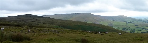
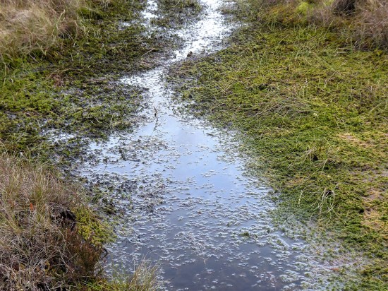
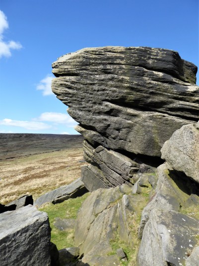
Well there were JD and me, the three scientists doing a peat survey for some research organisation, the Three Stone Men who have been there for who knows how long, and a few others stone ones scattered around. The peat survey was interesting as we are just waking up to the importance of peat as an important carbon storage resort. We were happy to sit in the shelter of the Three Men as there was a distinctly cold breeze coming from the Northwest. A good opportunity to take a break and eat our sandwiches.
Our journey up the motorway had not been straight forward as I missed the turn-off to Caton and the Lune Valley. Another junction farther north and JD’s phone chose an alternative route over towards Kirkby Lonsdale, although eventually on the A65 we ignored the lady navigator and followed the sign up to the little hamlet of Ireby. I shall not reveal where we parked, but there should be space by the telephone (book) box. Surely we are in Yorkshire by now, but no the Lancastrians have pushed a finger into Cumbria and Yorkshire. We are in fact out to climb the highest (allegedly) hill in the Red Rose county, walk number 16 in Mark Sutcliffe’s Cicerone guidebook.
Up to now we have been walking on a distinct lane out of Ireby and then the tarmac road heading up the fell from Leck. All easy going, gaining height almost effortlessly, at least we could keep up a good conversation without getting out of puff. JD is super fit at the moment having recently completed a pilgrim route to Santiago, a Scottish trip and The Dales Way. I was hoping that his all-inclusive hotel stay in Menorca with his wife might have slowed him down. We are in limestone territory. 


This road leads to a remote sheep farm. I used to park up along here for exploring the nearby Leck Fell potholes. Short Drop Cave was always a favourite, lowering yourself in with your feet dangling in fresh air in the darkness, dare you let go of the rock? Of course, you did and only dropped a few inches! You could explore the channel for some distance and then worry about getting out again. But today we were heading up to those stone men visible on the hillside above. Conversation dwindles on the steepest scrambling bit, look at the contours, and we are all too ready for that rest at the Three Men. 

The Three Men.

The Three Ladies.

Lunch over we chat to the peat surveyors before strolling the last section to the lonely trig point on Gragareth, 627 m, the highest in Lancashire. Now this is where some debate comes in, farther north across the barren moor is Green Hill, still in Lancashire, and marked on the OS map as 628 m. We don’t fancy the two-mile boggy trudge up there. But help is at hand – in 2014 the Database of British and Irish Hills suggested “Gragareth replaces Green Hill as Lancashire county top”. Gragareth having a height of 628 metres, 100 metres east of the trig point, while Green Hill is 627.5 metres. Who knows? 
Anyhow, we slink off along the wall southwards. But I have forgotten to tell you about the views from that highest point. Morecambe Bay, Lakeland hills, nearby Barbon fells, all those rounded hills up to Dentdale, Whernside and of course stately Ingleborough, distant Pendle and the Bowland Fells, quite a collection.

Northwards.

Whernside.

Ingleborough.
On down along the wall and then a vague path down to the ‘Turbary Road’ above Kingsdale, a track used by peat cutters – yes we have been destroying the land long before climate change was thought of. This area is full of caves, potholes and dry riverbeds, but the way missed most of them out. On reflection a few small diversions to peer into these limestone features would have added interest. 


Marble Steps Pot.

Twistleton Scar End.

Turbary Road.
Once on the lane we made good progress stopping only at a bench for a drink, out of the vegetation crept a giant dung beetle. 
Masongill looked delightful.
Freshly cut green fields, and we were soon crossing the ancient clapper bridge into Ireby.


It was good to be back in Limestone Country, as you can see the weather improved as the day went on. Eight and a half miles with 1700ft of ascent – I’m still thinking imperial.
***

 Sat alone on the isolated true summit of Fairsnape, deep in Bowland, I’m poking at one of my sandwiches, egg and tomato, made a month ago. They went into the freezer when hot weather and circumstances cancelled an outing at the last minute only for them to re-emerge this morning. there is a distinct unappetising taste. Should you freeze hard-boiled eggs? I’ve just traversed some of the loneliest hills up here and am in need of some sustenance. The morning has been misty on the fells, however with a welcome cooling breeze. Distant views are restricted from my lofty perch, most of you will never have been here. Only a few curlew and grouse share my space. I poke again at the sandwich and decide to toss it into the heather for probably the seagulls, who now also patrol these heights, to scavenge.
As I say the day started off murky and cool with low cloud, quite the opposite of the mini heat wave we have been enduring. Ideal for a tramp across these Bowland hills. For a start don’t take Mark’s advice to leave your car in the Delph Lane car park, it’s none too safe and leaves you with quite an uphill walk before you start. There are suitable lay-byes nearer Stang Yule. Walk number 2 in the Cicerone’s Walking in Lancashire book.
The way starts at a gate leading onto open access land. Welcome. On closer examination a notice says ‘No open access – temporarily closed at the land manager’s discretion’ Not a good start at all. But wait, the date is 2021. This sign has not been removed or updated for two years. So much for the land manager.


I try not to read too much into this as I stride boldly onto the access land. Nobody will see me in the mist. I’m enjoying the heather under foot, there is a path of sorts but not many come this way, put off by that notice possibly. Slowly I gain height and pull away from the plantation onto the open fell side, A track takes me across the slopes of Hazelslack Fell, a rarely visited spot. The last time I was up here was with Sir Hugh and JD on our straight line adventure between our homes. It’s as remote as I remember. 

The views back to the Fylde are supposed to be good.

Approaching Hazelhurst Fell.

Looking back with the track skirting below the summit of Hazelhurst.
I don’t bother with the 429 m trig point this time as I’m probably going higher shortly. The track dips down and climbs the contours gradually onto Winny Bank. The raison d’être for this track becomes obvious with the appearance of shooting butts. Not only the butts but also the small mammal traps, thankfully decommissioned. The highlight of my week, if not the month, was witnessing a family of Stoats crossing a road on Longridge Fell. Distinctive with their black tipped bushy tails. Who would want to trap and kill these beautiful animals?? 


Along the way is a stark memorial to airmen lost on these hills in WWII, I have a book somewhere listing all these crashes and giving their accurate sitings. 
The track starts to descend, and I have to be alert to pick up the ongoing path to Fairsnape otherwise I would be floundering, I know not where. The path begins somewhat unlikely with a few steps leading off a turning place. The stone flags don’t go far and one is left following intermittent white posts through the morass of peat. You will be glad you came here in dry weather, preferably a draught, also not a good place to be in thick mist. Stick with it, and you will arrive at a fence corner euphemistically named Webster’s Meadow. (if you miss it you would be in ‘Dickey’s Meadow’) This is also known as Fiensdale Head, the way through from Langden to Bleasdale. A partially flagged path shows the way. it’s a long time since I’ve been down Fiendsdale, a good spot to see ring ousels. No idea who Webster was or Dicky for that matter.

Turning spot.


The way down to Fiendsdale.
United Utilities have an information board explaining the work being carried out to try and reverse some of the peat erosion. When I was last up here they were helicoptering bags of stones in to be incorporated into ‘dams’, stopping further erosion from run off and re-wet the surrounding peat. Evidence of that work is all around with stone and fibrous matting in the peat cloughs. One does wonder how much we can do to repair the damage which must be on a vast scale in Bowland alone. Are you still able to buy peat based compost – I hope not? 


A few more flags are encountered, showing a way down to Bleasdale and ahead to Fairsnape. Then you are on your own again with the fence for company. The book talks of ‘hard going’ in the peat hags – ‘hopping over to the other side of the fence may help’ Today that is not necessary as it is as dry as it is going to get, but there are still boggy morasses you wouldn’t want to fall into, perhaps the re-wetting is working. Knees are allowed for climbing out of the deepest hags. 


Anyhow, I’m soon sat at the 520 m summit contemplating my lunch. There is another informative board up here telling the same story. Some of the funding came from the EU, pre Brexit. How much will our own DEFRA run by Thérèse Coffey put into environmental schemes? 
It’s a dry run over to the other summit of Fairsnape, the one with the shelters and trig point. I’ve not seen anybody all day so far and can’t believe I’m the sole person at this popular top. Only when I get closer to the shelter do two heads pop up – a young couple having some private time to themselves. 
The mist has lifted a little allowing the gliders from the club down below to take to the thermals, spookily and silently sliding past out of the thin cloud. 
The way off, by a cairn, is down some zigzags into Bleasdale. I have always assumed these to be part of a sledging route for bringing cut peat off the fell. Beautifully constructed and a joy to walk whichever direction, up or down. Few people used them as most are linking Fairsnape with Parlick along the ridge. But Mark knows this area well, covering Bowland in detail, the secret is out. 


What a contrast from the northern side of the fells – endless peat and heather as far as the eye can see and down here in Bleasdale with the green pastures stretching to Beacon Fell. The guide book takes you on tracks that would give access to Bleasdale Circle, but I’ve been there many times and at the moment it is a bit of a mess following storm damage to the trees, so I take a slightly different route through Bleasdale, past remote farms, past the old reformatory school buildings and past Bleasdale Tower. North Lancashire Reformatory for Boys, Bleasdale, near Garstang, Lancashire (childrenshomes.org.uk)

That little lay-by.
The little blue car was waiting for me in that lay by, as a Duke Of Edinburgh group were going through, staggering in the heat under massive rucksacks. I wonder who had the better day?
***

It is a month since I have done a ‘long walk’. Health issues combined with all that heat kept me in doors. I’ve only managed a few walks of a couple of miles or so, enjoyable nonetheless in their own rights. Tomorrow I hope to take up the cudgel of another possibly strenuous Cicerone’s Lancashire walk. So I had better have a gentle warmer up to get my legs back into shape.
From my header photo you can see that the hawthorn flower has given way to the elderberry.
Juggling with the weather I need to get going before the afternoon rain comes in, our gardens need it. (it never arrived)
Let’s keep it simple and walk up the lanes from the village onto Longridge Fell. I’m only out for the exercise after all. Park at the little reservoir, Upper Dilworth, stop to watch the female tufted duck with her brood and then a brisk walk-up past the golf course onto Jeffery Hill. I can’t resist a look into Cardwell Quarry to see if the barn owl is still there. A couple of weeks ago I looked in and took a hurried photo of the roost which showed up the owl’s legs but nothing more! Today nothing at all. I sat for a while taking in the view over Chipping Vale and remembering all those summer evenings climbing up here with Longridge mates. It’s banned now due to some unfortunate contretemps between the landowner and some selfish youths. It doesn’t take much to destroy all the goodwill built up in the past. 


Two weeks ago – spot the legs.
Close by here the Roman Road was thought to have come up from Ribchester before a turn to head through the hills towards Newton, and then over to Lancaster. It is marked on the OS map, and today I can make out the line of it just below the modern road. 

Surprisingly there is only one car parked up on Jeffrey Hill where the walk-up onto Longridge Fell starts. I never meet the occupants. Taking the ‘balcony path’ along to the spring and then heading towards the ridge, it is bone dry. I am tempted to carry on up to the trig point, but sense tells me to go easy and besides I can see rain coming in across the Fylde Coast. Back down alongside the wall, past the ‘grim up north’ tree.


Straight across and alongside the upper trees of Cowley Brook Plantation. This plantation is becoming a favourite of mine for an evening stroll, and today I cut down through it meeting up with the brook where it disappears under the road. 


This road takes me eventually, there are lots of ups and downs, back to the village, passing the lower side of the manicured golf course this time.


Job done, now let’s see what the forecast is for tomorrow.


***
I was deterred by these signs on what I thought was a right of way the other day. I didn’t have a map at hand, so I opted out and walked up the lane. There is a hidden side to Hurst Green, large expensive properties guarding their privacy, but public footpaths shouldn’t be lost or walkers intimidated. Officially all Public Footpaths should be signed where they leave a public highway but speaking to officers on the Local Authority these signs regularly disappear. 
The morning’s heavy rain has passed, and I’m back armed with the latest 1:25,000 map and approach from the other end near the old bobbin mill on Dean Brook. There are predictably no waymarkers, but the start of the path is clear above the Brook. I walk past properties that were probably mill workers’ cottages in the past and soon come out onto the lane, The Dean, which drops from the village crossing the brook and climbs back into the countryside. Curiosity satisfied I’m on my way. 


The quiet road heads upwards with views over the Ribble Valley opening up to the south. I know there is a path somewhere leaving it to climb Doe Hill , but I can’t find it initially in the heavy vegetation. Is that it, hidden away?

The Ribble Valley.

There is a stile in there somewhere.
Once into the field I can see the trig point, Doe Hill, one I’ve never knowingly visited before, a short distance away. More interesting is the nearby clump of beech trees, maybe 30 or 40, all growing as one. How long have they been here – a couple of hundred years or more? There is a vestige of a wall enclosing them, who planted them and why? A magic place, I half expect a troupe of fairies to be dancing around., it is the summer solstice after all. Whatever it is a good viewpoint – Longridge Fell, Pendle and the Ribble Valley. 


I pick my way across fields full of buttercups, finding stiles in the appropriate places and come back out onto the lane heading to Greengore, a C16th hunting lodge for the Shireburn family, which I’ve photographed many times before. There appears to be some building work going on at an adjacent barn, let’s hope it doesn’t distract from the Grade II listed Greengore property. 


I knew of the sturdy bench at the junction of lanes and was glad to sit for some refreshment, it was still a very muggy day. The lane dropping to Dean Brook, yes the same one, is bordered by hedges full of roses and honeysuckle, with foxgloves pushing through the bracken. 


Crossing the bridge I am reminded of bringing my children and then my grandchildren here for the simple pleasure of ‘pooh sticks’. Even today I can’t resist dropping a stick upstream and watching it emerge farther down. 
Hidden away just off the track is Sand Rock, all that remains of a large sandstone quarry used in the construction of Hurst Green Itself. I divert here to see if my lost favourite orange cap is anywhere to be found, I last had it on when I came looking in here at the rock face a few days ago. Some lower boulder problems are chalked up, evidence of recent interest. We climbed a route up the middle of the quarried face, Vanilla Slice E2 5c, in 2002, it looks impossible to me now. No sign of my cap. 

Onwards alonside the brook cascading down the soft sandstone rocks which have been smoothed into beautiful curves over the ages. Plainly visible today are the remnants of the dam footings and ongoing leat supplying the bobbin mill farther down valley (where I started my walk today). 

***
I’m back at my car after this short, 2.5 mile, but interesting exploratory walk. The black clouds have blown away, and the sun is beginning to come out. I have another site I want to look at, the Stonyhurst Roman Catholic cemetery just up the road. I’ve always been fascinated by the mausoleum type chapel visible through the railings from the roadside, but never visited. Going through the gates into the cemetery one is immediately drawn to a white statue of Christ with Pendle as a backdrop. The cemetery is laid out with mature coniferous trees forming stately corridors between the many vaulted graves. The Mortuary Chapel is dated from 1825, but I can’t find out if it is dedicated to any particular family. Does anybody know more details? 


Detail from a window.

Through a window, showing it to be a chapel rather than a mausoleum.
***


The heat goes on, we somehow have avoided the thunderstorms rattling around the North West. Lethargy is the order of the day. But there is a breeze from the east, so some solace may be found up on the far end of Longridge Fell. Not again I hear you say that’s the third time in a week up there, but I’ve approached from three different but well-used directions. The lethargy prevents me going farther afield and the heat limits my delicate body’s distance and exertion. And anyhow I like my local fell.
When I moved to Longridge over 50 years ago few people used the fell for recreation. The forest tracks were constructed, but I don’t think the public were encouraged onto the land. I remember the spruce trees looked relatively young, as was I at the time. A few public footpaths criss-crossed the once open fell sides which must have been planted up in the late 60s to 70s. The 7th Edition, One inch to the mile, map of 1969 shows only a few scattered plantations with no forestry tracks. There was a way up from Jeffry (Jeffrey) Hill to the trig point, then 1148 feet (now350 m) but few went farther along the ridge. This involved for the most part delicate, muddy and pathless walking between the young trees.

Compare with the modern map.

Over the years, thanks to intrepid walkers, a path developed along the ridge from the trig point all the way to Kemple End where the fell drops steeply to the Hodder. This was mainly in the new forest planting and could be very muddy in the winter. Mountain Bikers started using the forestry tracks and signage eventually appeared on the public right of ways. Old walls started to crumble but were still good orientation points. It has now become a popular walking and cycling destination. But come full circle and some areas are being harvested and the devastation that that brings can often wipe out the unofficial paths that had developed. On top of that recent storms have brought down many trees and affected paths can be difficult or impossible to follow. Clearance is for some reason slow paced.
My planned walk today would complete a trilogy of routes up Longridge Fell, from the West, South and now East. I would be walking some of those ‘unofficial’ paths and encountering both forestry and storm damage.
From the rough parking at Kemple End the main forest road traverses the fell, but I want to see how the little path in the trees to the north had survived. Starting on the left, SD 689406, down the road from the parking. The path looks well-used and the few trees that had blown down seem to have been cleared, all very promising. Buzzards circle overhead and blue butterflies flit around my feet. There is not much breeze although most of the time I’m in the shade. Steady progress uphill. At the first junction I know I could go left and regain the main forest road, but I go right to keep to the ridge. The path narrows and is enclosed in the trees, I recognise familiar landmarks. Before long though it comes up against some forestry work from a couple of years ago, a large area of felled trees on the northern scarp. People have escaped back left to the forest road. and that’s what I do. After 200 m on that road I spot an orange arrow on a tree at the edge of the destruction, is this a way back to the original path? After some haphazard wandering through orange dotted trees I give up and escape into the felled area onto a track of sorts used by logging vehicles. It leads me in the right direction westwards close to where the old path ran and if people use it will become an established way. Somewhere at the end where it joins with a forest road, more felling here, used to be a viewpoint (Sam’s View, I never found out who Sam was) but with new growth on the scarp it is no more. All in all a right mess. The latest OS map no longer tells the truth.

A good start.

Pushing on.

The old way through the trees on the ridge…

…soon disappeared in forestry devastation.

New trees have already been planted.

Orange hope?

Sam’s view?
I don’t feel like tackling the still obstructed way up to the trig point so simply follow an established path down to the forest road. I turn left and saunter back down to the car with the bulk of Pendle ahead.

No farther.

Escape path.

The main road.

Proud Pendle.
Last year there was a good crop of orchids along here but nothing to show at present. The Bird’s Foot Trefoil, Mouse-ear Hawkweed and ‘Fox and Cubs’ are all flowering. What delightful traditional countryside names.


You may wonder why I’ve not yet included a route onto the fell from the north, well have a look at those contours. Longridge Fell is a ‘cuesta’ with a steep escarpment to the north and a gentle slope to the south. I have come up from the north many times but any ascent at the moment would be punishing in the heat. I will leave it to you to plan your own way up those footpaths from the Chipping side.
I fear for the fells as we have had no rain for weeks. One careless cigarette or a disposable barbecue, the weapon of choice for moorland fires, and we will be loosing a valuable habitat once more. Go careful out there.
***


Latest ESRI.

Every fell has an easy and hence popular way up it. The Victorians talked of ‘Tourist Routes’ up the Lakeland Fells, I have a copy of a 1960s Baddeley’s Lake District, a Ward Lock Red Guide aimed at the new tourist who wanted to explore the fells without any serious mountaineering. Wainwright popularised the fells, but give him his due he did seek out the less populated ways. A trade route or tourist way is the most frequently used route for ascending and descending a hill or mountain. Farther afield the term the “Yak Route” was used for climbing Mount Everest on a commercial expedition, you have seen the pictures of the queues on the South Col.
Well I’m not in the Himalayas or even the Lakes but on the humble Longridge Fell. I’ve been up it three times this week already, it’s in my backyard so to speak, trying to build up my fitness again after an enforced lay-off. There are three main entry points for climbing the fell. a path from Jeffrey Hill car park, my usual way. The forest track up from the lower fell road parking above Crowshaw. And the forest track from Kemple End at the far end of the fell road. Judging from the amount of cars parked up the middle option is the favourite, a simple march up the made up and wide forestry track.
So that was my option today,the hottest of the year so far. Despite my stating this to be the most popular way there were very few people about. Too hot for most and down in Longridge it was field day. Field days years ago were a community gathering, my children on many a themed float. A family day out. Nowadays, it has become a bit of a rebel rouser with the riot police usually in evidence later in the day. One to be avoided. English society has taken a downturn in the last decade.
That links me into the ‘trade route’ up Longridge Fell. I almost changed the title of this post to ‘the irresponsible dog walkers’ route. I came across a dozen discarded dog poo bags within the first hundred yards from the road. And there were more sporadically as the track gained height. Trying to be impartial, who do these people, it’s not the dogs, think will clear up the mess? Not a good start to my walk. 
The shade I had hoped for was lacking due to recent forestry operations but once on the open ridge there was a cooling easterly. Before long I plunged back into the trees for the tricky section through windblown trees from the ‘beast from the east’, was it really 2018? Nothing much has been done to restore the path, in fact due to exposure more trees have come down since then. I’m beginning to know the best way through now. 


Onwards down a track through naturally regenerating forest from harvesting a decade or so ago. I love this stretch past some of my favourite oak and beech trees. Although one of the ageing giants has fallen. 


If you know it there is a shady path back avoiding walking on the road. 
So a trade route up but a more adventurous way back down. Plenty of variety in three miles. Did I take any photos on my phone? Just a few. I was glad I had some water to drink back at the car. It may thunder tonight, I hope it will. in fact, it is right now.


The gardening can wait. It’s hot and stuffy and my hay fever is irritating. Time to escape to higher ground not to far away. A quick lunch and I’m parked on Jeffrey Hill. It’s not rained for days and the ground is looking parched. What is usually a boggy path is now bone dry and trainers are all I need. There is a welcome breeze, and I’m soon ‘walking on sunshine’ with the familiar panoramic Bowland Fells stretching out above the vale of Chipping. Newly cut meadows adding to the patchwork. Yorkshire’s three peaks are in the far haze.

All very idyllic you will think, but I also choose to do a litter pick at the same time. I thought there was less rubbish than usual on the path to start with, but by the time I’d completed my 3-mile circuit my sac was full. Dog poo bags, tissues, empty water bottles, cans and strangely a pair of underpants. I declare the fell litter free – but for how long?


As an afterthought on the way home I called into our local bouldering Craig Y Longridge to check out any litter there. I’m pleased to say there were only a couple of bottles to remove and these had probably been thrown from the road above. Well done climbers for looking after their own environment. By now the crag was in the shade and I enjoyed a bit of exercise on some of the easier problems.
Back to the garden and those weeds. 
***


Catlow Fell and Bowland Knotts.
Mark Sutcliffe’s Chapter 4. Bowland Knotts and Cross of Greet.
Driving the lanes to Slaidburn once more and this time taking the continuation towards the Tatham Fells to park at the Cross of Greet Bridge, deep in Bowland. The last time I started a walk from here along the River Hodder, November 2020, the whole area was waterlogged and virtually impassable. I am hoping for better conditions today after a few dry days. It’s a Bank Holiday weekend, yet I’m the only car parked up by the river.
I skip across the marshy area and have no problem fording the stream this time. The walk-up to the isolated barn goes well. A barn owl is disturbed as I peep inside, it flies off, and the chicks go quiet. I don’t hang about. Outside was a rusting lime spreader manufactured locally in Clitheroe ? Vintage 1960.

The infant Hodder.

Kearsden Brook ford.

The Hodder gathering pace.

The barn.

Abode of owls.

Atkinson Spreader, Clitheroe.
The way onto Pike Side is rather vague, and I end up following sheep tracks and even sheep. I realise that somewhere I have gone wrong arriving at an old lime kiln next to the wall, SD 725591. There are shake holes marked on the map, so there must be underlying limestone near about. With a bit of rough ground I regain the route by the gate, SD 723593. There are the ruins of an old barn here, and I follow the straight access track all the way to the road at Bowland Knotts, although at times it disappears underwater.

Sheep track.

Limekiln SD 725591.

Gateway. SD 723593.

To the road at Bowland Knotts.
There are craggy outcrops either side of the road and some are suitable for bouldering. I find a seat not far off the road for lunch with Ingleborough in full view.

Roadside bouldering in Yorkshire.

Roadside bouldering in Lancashire.

Peggy and John Phillips seat.
Tracks follow the wall westwards towards a trig point, 430 m,the highest point of the Bowland Knotts also recorded as Crutchenber Fell, a ladder stile crosses to it. This is a rough tramp, but there are good, if hazy, vistas into Yorkshire, Stocks Reservoir, Pendle and the Bowland Hills.

Crossing to Crutchenber Fell.

Trig 430 m.

Bowland Knotts.
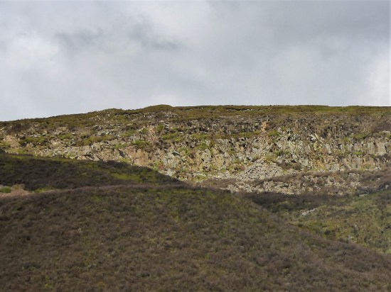
I stay on the south side of the wall for the undulating mile to the next feature, Cold Stone Crag. There is a path of sorts. There is climbing on this remote crag, but I doubt if many come this far, you might as well boulder back at the road. On one occasion I made the boggy walk in to photograph the crag for a new guidebook, only to arrive after the sun had moved round. The process was repeated the next day at an earlier hour. From up here the whole of the Pendleside panorama is visible.


Forever onwards alongside the wall and a gentle climb up to a height of 486 m, no cairn denotes the ‘summit’. The miles are long up here. An undecipherable boundary stone is encountered. The maps vary on the name of the hill – Great Harlow, Hailshowers Fell, Raven Castle or perhaps Catlow Fell.

Catlow or Hailshowers Fell.

Boundary Stone – Lancs/Yorks.

Ravens Castle stones?
A little farther and a fence line leads me down to the road at the Cross of Greet. By the cattle grid is a large stone with a shallow square hole in the top. It stands at the Lune/Ribble watershed. formally the Lancs/Yorks border and may have had in the past a stone cross inserted into it. Or was it a plague stone? nobody knows. I think it’s more likely to have been a cross at an important passage through these remote hills.

I chat to some cyclists riding the classic round from Slaidburn. Up to the Cross of Greet, over Tatham Fell past the Great Stone, maybe a brew at Bentham or Clapham and then back over Bowland Knotts, through Gisburn Forest to Slaidburn. I did it once with my mate Tone, never to be forgotten. 
“Down the road for 800 m then follow one of the faint paths down to the stream” Well I’m not sure about the 800 m, and I don’t find any obvious paths. It will be even worse once the all encompassing bracken has grown. But I do find myself down at the Hodder, not the magnificent river it will later become, and hop over to the other side. 

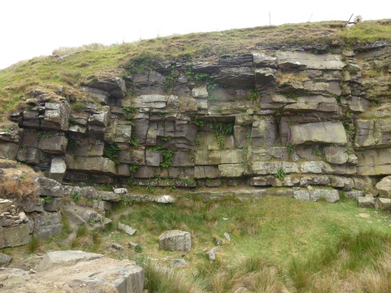
A slight climb and I am on the brink of an abandoned quarry. Stone from here was transported by rail to build the dam of Stocks Reservoir as the valley was slowly flooded in the 1930s for the Fylde Waterboard. Only the church was saved, stone by stone and rebuilt on higher ground. There is lots of archive material online. The quarry is atmospheric particularly with the surviving, but rusting dinosaur of a steam crane. 


At the edge of the quarry is the base of the Far Costy Clough, a worthwhile scramble up onto White Fell I’m lead to believe. Yet another one to add to my list. Another day.
I’m content to just to follow the old rails out of the quarry back to the Cross of Greet Bridge. Another longish day out in Bowland.


***


After last week’s heroics in the high Bowland Fells, today was a gentle rural walk. My son suggested a walk for his day off. Where? I asked. “What about Brock Bottoms, I’ve not been there for years” I’m writing it up as a 4-mile walk, some of you may want to follow, a perfect evening stroll.
We used to take the boys along the Brock getting on for 50 years ago, so I’m pleased he still has it in his mindset. (I must have done something right in their upbringing) I remember paddling down the stream to the remains of the mill in the valley all those years ago, not for us the riverside path. I have written before on the history of the mill – Brock Mill was once a thriving water-driven cotton spinning mill with up to twenty cottages in the valley for the workers. The mill was probably built in the 1790s. After a chequered history and two reincarnations as a roller making factory, and then a file making factory the mill finally closed in the 1930s. For some time, the ground floor of the mill operated as a café, whilst the top floor was used for dancing on Saturday nights!
What will we find today?
Along with my son Chris, I’ve enlisted Mike for a short walk with promises of a curry afterwards. Surprisingly, the picnic car park at Higher Brock Bridge itself is quiet. What a contrast from those Covid days when every space was taken by cars isolating from each other.
A few dog walkers are around, but within 200 m of the car park, we meet no one else. The water level is very low, reflecting the recent dry spell. I seem to think the path has been ‘improved’ over the years. Lots of wild garlic, fading bluebells, stitchwort, red campions, hawthorn and other Spring blossoms deserve our attention. The valley is very steep-sided along here.
We leave the main path to explore the ruins of Brock Mill. Until now, we have been walking along the line of the mill race or Leat. There is little left to see. Where were the associated cottages? Where was the main wheel? All is jungle with Himalayan Balsam taking over. 


Rather than go back to the main path, we struggle along on a riverside trail, not recommended. Once out into the open meadows, the going is easier, and we soon reach the elegant Walmsley Bridge. For some reason, the road is blocked, yet everything appears to be in order with the bridge. It was only when we walked up the lane that we found a landslide that had taken half the road down into the Brock. It could be a while before this lane is reopened, fortunately no premises have been cut off. 

At the corner, we take a farm lane I’ve never used before. The farm turns out to be massive agricultural sheds in a modern manner. A traditional cockerel guards the approach, but the path goes around the edge of the buildings with little fuss, no doubt an unofficial diversion, but no problem. The farmhouse itself is named Throstle Nest, with one of its barns converted into a luxury living space. The access lane soon has us back on the minor road. 


A bridleway could have taken us back down to Brock Bottom, but we stay on the quiet road for half a mile, passing some delightful Lancashire farmhouses. Another footpath I haven’t used before takes us straight through fields below Beacon Fell onto the lane, which drops us back down to the picnic spot where we are the only car remaining. 


A very pleasant 4-mile round through the Lancashire countryside.
The hastily put-together curry supper was a success as well.
***


I’m running out of titles for my series of walks in Bowland as set out by Mark Sutcliffe in his Walking In Lancashire book. He has certainly covered the area well. Highest, Best of, Heart of, and today Remote or even the Remotest… How many of you have been to Wolfhole Crag or Whitendale Hanging Crags? This is a long post I’m afraid – it was a long day.
I enjoy the familiar drive into the hills with the roof down. Along the Hodder Valley; farmers busy silage cutting in the fields; over the Roman road with views to Ingleborough; down to picturesque Newton; along to stately Slaidburn and up Woodhouse Lane to my parking place just before the fell gate. I say my parking place as it was a regular spot when we were developing the bouldering potential of Croasdale’s Bullstones all those years ago. Not many drive up this far, but Mark mentions the single space, there is a little more back down the lane.

Newton on the Hodder.
The hike up the rough Hornby Road, a Roman Road again, (aka Salter Fell Track) has been done dozens of times and I pass familiar landmarks. The war memorial to airmen lost on these fells; the ancient sheep folds and bothy down in Croasdale where I have stayed with my grandson; the culvert where one can still see the Roman workmanship; the large quarry where the peregrines nest; the bridge where the road has been saved from sliding into the valley; the Tercet stone demarking the Lancashire Witches fateful route to the assizes in Lancaster; over to the right the bouldering playground of Bullstones and later the vague track dropping into upper wild Whitendale. 


Along here somewhere I meet two RSPB workers checking on nesting Hen Harriers. It is good the birds have returned and let’s hope more survive the persecution by the shooting fraternity this year. No photos and as they say on the news “their anonymity and location have been protected” The road goes on over the watershed.
After four miles I leave the road for another four miles of mostly trackless and waterlogged ground. Mark says “the next stretch is very boggy and needs careful negotiation” Go no farther if you are unsure or if the weather is bad. This is remote country with no easy escape routes. My walking poles disappear into the mire quickly followed by my boots. Jack be nimble. It is not so bad – I survived. There is beauty there if you look closely.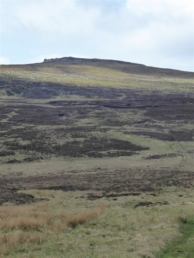


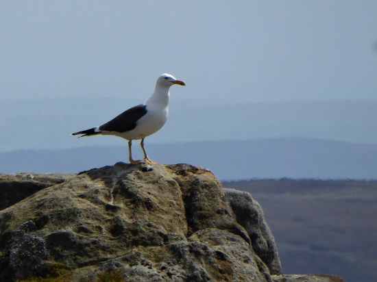
 If I close my eyes I could be at the seaside, the sound of gulls is everywhere. I think they are Black Backed, Great or Lesser?, a large colony exists up here. I try for a video, more for the sounds than the fleeting fly overs. They are becoming more aggressive, dive-bombing me. I look down and there below my feet is a scrape of a nest with three eggs. Better move on taking extra care where I place my feet.


It doesn’t take much to persuade me to take the ‘optional’ diversion to Wolfhole Crag half a mile away. One wouldn’t come this far in good weather and not go to the highest point. There is a trig point, 527 m, and also an interesting collection of gritstone boulders. I can’t resist a few simple boulder problems, keep them simple as you don’t want to break an ankle up here. The longer routes look fearsome. Somewhere there is a shallow cave in the rocks – the original wolf hole. 


A good place to eat my sandwich, wish that had been two as the day panned out. All around – The Lakes, Yorkshire Three Peaks and most of East Lancashire. Pendle is always visible. All a little hazy in today’s heat. 
Walking back down the fence line, no navigation needed, is not easy because of more bogs. Maybe it is better on the other side, No it isn’t I tried. White Crag is nothing but a few boulders. Whitendale Hanging Stones are not much bigger. But according to “the gravitational method to establish Britain’s centre of gravity OS calculated that the geographical centre of the British Isles, including Islands, lies at SD 6419 5654“ virtually where I’m stood. I’m too weary to take it in. In fact as I drop down very steeply I’m just too pleased to see the small tarn on the col between Brennand and Whitendale. The walls and fences aren’t too easy to negotiate. I lose even more height as I descend to the Duchy farm at Whitendale where my route ahead climbs back up zigzags for 800ft onto Dunsop Fell. 


White Stones.

Whitendale Hanging Stones, centre of Britain.

My way down.


Small mammal traps remind me I’m on shooting lands, the hunting class have some barbaric practices. 

I collapse onto a wall at the farm, nobody is about, I’m even wondering if I should phone my son for a cop-out evacuation, but a drink and a banana fortify me for the final stage. Thankfully once back on a stony trail my steps become stronger, and I push on up. The trail disappears into peat, but there are some posts and cairns to guide me to Dunsop Head, a vague col with a wall, gate and another of those crafted signs. Looking at the map and the terrain I realise I’ve never been on Baston Fell to the north, today is not the time to visit. Let’s just get down.

My way back up.


Looking back down to Whitendale with Hanging Stones above somewhere.


Go east across more bog. By the time Stocks Reservoir comes into view you are almost home and dry, although your feet are probably wet by now. Eventually the bridleway becomes more visible as a sunken way and the airmen’s memorial appears. There is my car down the lane with Pendle still watching over us. Seven hours of remote walking, one to talk about in the pub later.


***


I was weary from climbing at Kemple End yesterday, so I only wanted a short walk. The sunny afternoon was ideal for this Fulwood circuit of about 7 K.
Since my visit in March the trees have certainly greened up and most are in full leaf giving dappled lighting. Oak, Sycamore, Beech, Chestnut, Birch, Ash and Wild and Bird Cherry were all present. 
The bluebells were flowering in profusion, most were English Bluebells, Hyacinthoides non-scripta, as opposed to the Spanish ones, Hyacinthoides hispanica, although some were possibly hybrids. 
Here is what the NT has to say about bluebells –
Apart from the bluebells there were many other flowers showing themselves. I still haven’t found a decent identification app that works with my ageing phone.


Mason’s Wood is a wonderfully secluded valley, Wild Garlic pervading the air throughout.


I continued on the public footpath alongside Savick Brook to try and find a way back by Sandy Brook avoiding the busy Eastway. All routes were private and hidden behind locked gates. I tried my best and had to return to the path alongside Preston Golf Club, whose course was looking immaculate. I suppose we forget the importance of green spaes provided by golf courses in cities. Mark Twain famously said “Golf is a good walk spoilt” but now it looks like “a good ride spoilt”.

Crossing Eastway was braved, there is no obvious way without it, and I finished the walk along the delightful Sandy Brook back to Fulwood Row. 

Lots of green spaces and I think I have my possible guide to them almost complete. I will post it here whenever.
***


We are back at our secret crag, the sun is shining and all’s well. The day passes, and four new climbs are accomplished. All on beautiful clean rock, each one a different style and difficulty. I can’t tell you more, but all will be revealed soon.
Oh, well just a glimpse… 

The hills were in low cloud late into the morning, including Hutton Roof which we explored a couple of days ago. But it didn’t matter – today was for cycling. I was hoping the lady would be in the Halton car park with her coffee wagon, but no sign of her. I hope she returns this summer, Last year I looked forward to her cheerful smile and cheap coffee as I drove up the motorway.
Rather than the round trip to Morecambe I think I’ll have an easy day and just go to Glasson Dock and back on the old railway. The fragrance of the hawthorn flowers hits me as I get out of the car. There are very few people about in the rather gloomy conditions. But the day brightens up by the time I reach Glasson. The usual collection of motorcycles and their ageing drivers around the fish and chip van. As always I choose to cross the bridge to the shop on the other side of the harbour. They normally have a good supply of freshly baked pasties and pies but alas today the van has broken down and none have arrived. I have to contend with a chocolate éclair which goes perfectly with my coffee. 


There are usually some locals sitting outside and today was no exception. I catch up on the news.
The sunken boat that has been in the marina for years was lifted, but by some cowboys who kept lifting as it came out of the water rather than let it drain. Most of it then broke up under the force and went back down to the bottom in pieces.
The pub on the other side of the harbour, The Victoria, has been closed for years and is looking in a sad state, but there are plans to reopen it as a pub once more. We shall see. The locals don’t have a lot to say about The Dalton Arms tucked away around the corner.
Next to the shop The Smoke House people have built a retail outlet for their products but are having trouble installing the heavy-duty electricity need for the freezers. Once open I’m sure this will be a popular shop with the tourists who flock to Glasson in the summer.
I cannot vouch for the truth in these stories. 


The new Smoke House shop.
The ride back is uneventful, it’s about a 20-mile round trip. The tide had come in whilst I’d been away. The Millennium Bridge over the Lune and Ashton Memorial were looking good in the afternoon sunshine. 


I spend the rest of the afternoon drinking tea in the sunshine at Over Kellett with longstanding friends.

As I write this today, with the rain coming down, yesterday’s welcome sunshine seems a distant memory. After several Lancashire walks taken directly from a guide book it was time to visit a different area and plan a route for myself in hopefully contrasting scenery. It worked out better than expected.
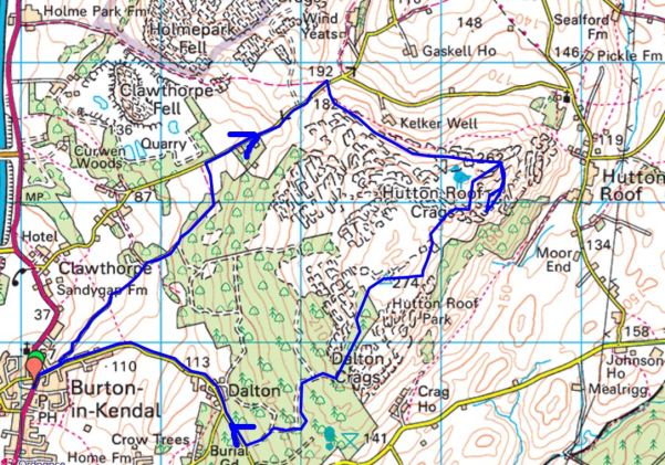
We were up the motorway out of Lancashire and into Cumbria, but only just. Not the Lakes but a quiet corner hidden away in the extreme south of the county. In the past I travelled here often to climb and boulder on Hutton Roof crags, beautiful sculptured limestone in the exquisite landscape above Dalton. It was time for a revisit and going over the map the night before I came up with a circuit including the summit trig point which I had not knowingly visited before, my focus then being primarily on the climbing area. It’s complicated up here with several ‘rakes’ of rock running across the fell, presumably fault lines in the limestone, creating miniature walls of rock. Paths are everywhere, but don’t always go anywhere and once the bracken is up it’s like finding your way through a maze.
I phoned Mike at a respectful time in the morning to see if he fancied a walk, but he was due to visit family on this Coronation weekend. Maybe I should therefore go for a longer walk in Bowland? Before long however he phoned back to say he thought, taking advantage of the good weather, he would postpone family to another day. I outlined my planned walk with only vague ideas of how we would navigate across the limestone plateau. Sandwiches hurriedly made we set off.
It was almost noon when we parked up in Burton-in-Kendal, but this worked to our advantage as the misty morning had given way to bright sunshine and blue skies. The first pleasant surprise was the old bridleway, Slape Lane, leading out of the village. A Panoramic Viewpoint has been erected to honour Queen Elizabeth’s Golden Jubilee in 2002, the distant Lakeland Hills depicted were unfortunately hazy in reality. At least closer at hand Farleton Fell appeared prominent. 

Between hedges and walls the bridleway snaked slowly up the open fell side, first through farmland and then into forestry. Our attention was taken with the spring flowers and the unidentified bird song in the trees.


Cumbria Wildlife Trust seem to have a hand in managing the woodlands and provide helpful information boards and permissive paths going who knows where. We stuck to the bridleway which came out onto a short stretch of road leading to a col where the Limestone Link footpath crosses Farleton Fell on its way from Kirkby Lonsdale to Arnside or vice versa. Nearby Newbiggin Crags look worthy of exploring.


Turning right we followed the footpath through coppiced woodlands and then onto more open limestone fell. Purple Orchids sporadically appeared giving a splash of colour. What a place for our lunch, looking out over fertile farmland and farther into Cumbria and the distant Howgill Fells. 
I knew, or thought I did, my way to the climbing area, marked as The Rakes on the map. Soon we spotted climbers along the edge. Most were doing roped routes, and we stopped to watch for a while – what a perfect afternoon for them. Can you spot South America? 


Now for the difficult bit. There was a path leading away from The Rakes which I thought might take us to the trig point, but it kept going down. Trying to make a straight line back up the hill was impossible across the shrub covered limestone blocks. Not wanting to break a leg we surrendered and back tracked on the path we had come in on. This brought us back to our lunch spot! I glossed over this by praising the weather and suggesting to Mike it was good training for him, he’s off to the Amalfi Coast in a couple of weeks. We struck off on a higher path heading in the right direction only to find it twisting and turning through the rocks. Forward visibility was obscured by the vegetation, one just had to keep going the most obvious way. Junctions caused some serious discussion, but we might as well just have tossed a coin. A runner appeared coming in our direction, on asking him if he had come from the trig point he looked baffled obviously not recognising the term. Onwards. A well-used path came up from the valley, so we joined it. A couple of dogs came past us followed by their owner who gave the impression of knowing the way but in fact this was her first time too. We followed the dogs and suddenly came out on to the more open top with the summit trig clearly visible.


A true 360 degree viewpoint, now with Ingleborough coming out of the cloud. The Bowland Hills were clearer than the Lakes. Morecambe Bay was a silver shimmer and one could see Blackpool Tower through binoculars if you wished. I don’t seem to have taken may picture at the top. It would be worth getting up here early one morning in the crisp air to make the most of the visibility. And what sunsets you could witness. 

If we didn’t get a move on we might have been seeing one of those sunsets. But once into Dalton Hall’s woods the forest tracks lead us unerringly down to a lane through the few houses of Dalton and down eventually to Burton. 
It was 6 o’clock back at the car – oh well I could forget about cutting the lawn.
What an exceptional walk this turned out to be. On reflection, I see on the map public footpaths from Dalton that would have taken us to Burton without the road walking, maybe next time as I’m sure there will be a next time.
***

Walk 37. Weets Hill from Barnoldswick.
Barlick, until local government reorganisation in 1974, was in the West Riding of Yorkshire. It then found itself in Lancashire, the locals were not happy and many still see themselves as Yorkshire folk. Back in the day, until 1992, you had to be born in Yorkshire to play cricket for the county and I seem to remember special dispensations being given to players from Gisburn/Barnoldswick area when they were in Lancashire. Or was that just a rumour at the time. I do remember well however White Rose flags flying defiantly in Gisburn as you drove through.
None of this has any relevance to today’s walk except to point out we are in the far east of the county where Lancashire mills give way to Yorkshire dales. A 10-mile day of easy navigation, gentle gradients, canal towpaths, a Trig point and lots of fields. Stick with it – there is plenty of interest.
I approached the recommended Greenber Field car park down the narrowest of lanes, I was almost giving up when it suddenly appeared hidden in the trees. On my return I took a wider road, the B6252, back into Barnoldswick and I would recommend that as your approach. Unfortunately the café on site was closed due to staffing shortages, a common problem of hospitality in these strange times. That’s the second day in a row I have been deprived of my coffee. Still the day was promising with warm sunshine and blue skies.
I set off with enthusiasm along the canal towpath on the edge of town. Easy strolling with lots of friendly and well-behaved dog walkers, pram pushers and cyclists. I passed three of the prominent manufacturers in town – Rolls-Royce, Silent Night beds and Esse stoves. All but one of the many cotton mills have gone. The canal was busy with boaters. On my longer canal walks I often try to pick out the most humorous, or more likely corniest, boat name of the day, Mr. Grumpy won today. All making for an enjoyable start to my day’s walk.


In fact the morning was disappearing fast – made more so by an extended chat with an enthusiastic walker. We got onto the subject of the Lake District which he seems to have just discovered. Out came his phone with pictures of Coniston, Helvellyn and Scafell etc, many in selfie mode. I had to make my excuses to get under way again.
Once I had left the canal I saw virtually no one else for the rest of the day.
My way up onto White Moor was mainly on well surfaced bridleways, that PBW again. As height was gained the views opened up, with my recent ascents of Bouldsworth and Black Hambleton prominent to the south along with the rest of the Pennine Chain, and there was little Blacko Tower. Perhaps I was distracted, but I took to the moors sooner than I should have, up a well trodden track (SD 869 441). On past a plantation obvious on the map, that’s when I realised my mistake, but the track alongside a wall was good, so I just kept going until I was within a stone’s throw of the summit. Birds eye views of Barnoldswick appeared way down below.


What did I say about easy navigation? As it happened this was possibly better than the longer way round and up the tarmacked lane to Weets House, it was easy to navigate once I knew I was lost – if you follow my logic.
The summit was adorned with a shiny white Trig Pillar and even better as I was ready for lunch a memorial bench. And what a panorama – the nearby bulk of Pendle, Longridge Fell, the Bowland Hills , Ingleborough and Pen-Y-Ghent and lots more. The Ribble Valley stretching out in front of the hills completed the scene. 


It was only after some time sat there enjoying the view that I noticed beneath my feet little plaques set into the soil, each one a memorial to a departed family member whose ashes were no doubt scattered up here. I like the idea of being scattered from one’s favourite hill, but I thought the plaques possibly out of place. No offence to any family concerned who had the wishes of their departed granted.


Time to head down, and I followed the track I should have come up to Weets House, an isolated property as you could wish for. Back on the PBW I headed north wondering who had travelled this way in the past centuries attending to their trades. Miners, pack horses, farmers, soldiers? The map depicts ‘ancient earth works’ from early times and there is a Roman Road crossing my track at one point. 


A quiet road, Brogden Lane, winds down the hillside past upland sheep farms and comes to a right angle corner at The C18th Manor House, what you see from the lane is actually the back of the house. A ford then leads to Brogden Hall. That was my way and I circled around what is a large equestrian centre with only a glimpse of the hall itself. Out into the fields I crossed a motor cross circuit – the penny dropped I have been here before. It was when I was walking the West Craven Way in 2015. 


The pastures were full of deep grass which surprisingly makes walking through it tiresome. It’s that time of the year when the dairy herds are let out for some proper food. Passed a reservoir, and I was into a field with one of the largest herds of cattle I’ve encountered. They can be frisky at this time of year and being cautious I took to a path on the other side of the wall. After my minor trespass I was back on route up a slope now with grazing sheep and their lambs. I couldn’t resist a spring lamb photo, or two. Can’t you just taste that luscious grass? 


I worked my way through the gardens of some nouveau riche house, their garden furniture was more stylish than my lounge. I’m not jealous, but it set me wondering if they were entertaining would you be offered a drink en passant. 

This was on the edge of the little hamlet of Bracewell where there had been a former hall. The church, St Michael’s, dates back to the C12th but most of the present fabric dates from the C16th, though there is a Norman style arched doorway and apparently inside a Norman font. (it was locked today) For some reason I ignored adjacent Hopwood House and Farm, both grade II listed. But my attention was drawn to the ‘Old Post Office’ with its inscribed plaque, but why on earth did someone build a porch whose tiles obscure that plaque. 


I have a gripe with Mark for the next part of his route down the busy and twisty B6251 road. This is dangerous considering the speed of traffic along it. Driving back along that stretch on my return I was behind an articulated lorry doing well over the permitted 40mph, no chance of that stopping quickly. Looking at the map there is a footpath leaving Bracewell to the abandoned village of Stock where there may be earthworks to see. A public footpath from there crossing Stock Beck would bring one back onto the bridleway route. I wish I had taken that way, which as well as avoiding the dangerous road looks to be of interest in itself. I would recommend you do.
I didn’t, and I had to brave the oncoming traffic for half a mile until I could escape onto a peaceful bridleway. If you look closely at the contours of the countryside here you will see lots of small hillocks. These are drumlins, glacial deposits of boulder clay on the surface limestone. Today with the abundant Spring greenery they took on a magical landscape over which I expected troops of elves to come skipping along. It was however a good place to watch lapwings in their rapid flight. 

The walk ended through Greenber Field Farm. All very neat and tidy but far removed from the farming as I knew it. Massive sheds, computerised cows and not a farmer in sight’. The C18th house itself is Grade II listed.


Well not quite the end as I spent some time watching canal barges come through the lock gates, the summit of the Leeds -Liverpool Canal. 


***


It’s peaceful on the Preston Guild Wheel today, there is no wind. Very few people out, not even many dog walkers. I cycle slowly round, not having been on the bike for nearly two months. I’m in no rush and have time to see what Spring is bringing to the route. The woods have greened up since my last visit and bird song is everywhere. It is in the woods, Red Scar in particular on the early part of my circuit, that the floral display has changed. The celandines are fading to be replaced by the spreading sea of bluebells. Wild garlic is looking fresh, and its white flowers are opening up. Patches of cowslips and cuckoo flowers light up more open spaces. The green hawthorn has started to flower, it’s probably time I cast a clout, but the fickle weather changes day by day. 


The notoriously muddy section at the bottom of the hill as you enter Brockholes Reserve has been drained and a decent hardcore surface created. I call in at the first hide to see what’s happening on the water. I’m not carrying binoculars, but I make use of the shop selling binoculars and telescopes. Their equipment is so much better than my antiquated items. Maybe time for an upgrade, but the assistant baffles me with his enthusiastic technical sales talk. At least I checked out the lake with his powerful scope.


On alonside the Ribble, through the parks and then the docks. The long drag alongside Blackpool Road went on forever as I pass the nearly finished junction for the Western Link Road. The Guild Wheel now goes under the bridge carrying this road. 
My favourite café, The Final Whistle on the University’s playing fields, is surprisingly closed. I have to make do with one of their benches for a sit down with some water and a banana. I find the ‘hilly’ sections through Fulwood a bit of a chore and have a few spells of walking. Just over 21 miles in Spring sunshine.

Black Hambledon.
Another skylark day.
I hadn’t decided where to walk this morning but after a bit of faffing I hurriedly opted for a ready-made route, no 39, in Cicerones’s 40 Lancashire walks book by Mark Sutcliffe. It is described as the Reservoirs of Worsthorne Moor, but it is far more; traversing post-industrial landscapes, wild gritstone boulders, trackless moor, endless views and the summit of Black Hambledon, Hoof Stones Height, 479 m. I haven’t knowingly been up Black Hambleton before and today’s route virtually circled it before committing to the top.
It was almost lunchtime when I parked up on The Long Causeway, an ancient route from Pendle through to the Calder Valley, now dominated by wind turbines. A fell runner was just returning from his morning circuit, there was still a chill in the air. (we’d had a ground frost)
Some of the early tracks I remembered from The Burnley Way done back in 2017. Leaving the wind turbines the way drops down Shedden Clough into an old limestone mining area where they used ‘hushes’, dammed watercourses to uncover the limestone. There was evidence of industrial activity wherever you looked. 


A man from Salford was exercising his two dogs down by the bridge. He escapes up here for fresh air and tranquillity. The young dogs were having a great time, I think they were pleased to be out of Salford too. A couple of mountain bikers came through and after that I met no one until almost finished. 

I was on the Pennine Bridleway heading towards Cant Clough Reservoir set deep in the hills. Normally one can go across the dam, but there was maintenance work in progress which meant a tiresome diversion down the valley and back up again. They were ‘repuddling’ the clay lining, probably the first time since the construction at the end of the C19th. You may remember the 2019 panic when the reservoir dam above Whaley Bridge was put under strain and threatened the area with flooding. 

In another extensive quarried area I soon left the PBW, for a while anyway, and headed on a smaller path bordering the wild Rams Clough up into the hills towards an unnamed 468 m summit. All was quiet except for the joyous skylarks. I was soon looking back at Cant Clough Reservoir. The path became steeper and rougher – a sign of things to come?


I reached a bridge in the middle of nowhere carrying the BBW where I managed a photo of a Wheatear which flew from post to post, I remember several of them in this very same place on my Burnley Way outing. 

Passing into Yorkshire, Gorple Upper Reservoir now came into sight below and there above me the Gorple Stones, which looked as though there would be bouldering possibilities. But how often do you get a day like this up there? 

Ahead now was the prominent Gorple Buttress. I recall the excitement in the climbing magazines back in 1995 – “John Dunne has climbed an E7 on the jutting prow of Gorple” Walking below it today it looked as impossible as ever, overhanging and slopy, I wondered if anybody has repeated it. Dunne went on to produce an even harder more direct line at E9 three years later. A good spot for lunch gazing down at the remote reservoir and across to Black Hambleton. 


John Dunne on Eternal E7, cooler day. David Simmonite.
Stirring myself I was soon down to the dam. Mark’s route goes a little down the valley, towards the lower reservoir, before climbing again, but I spotted a level path getting to the same point by crossing, possibly illegally, the dam and using the estate’s shooters’ track. Not advised in the killing season. There were some very attractive little gritstone buttresses above that valley, I may need to return. 


Gorple Lower Reservoir.
Across the way were the hauntingly fascinating ruins of C16-17th Raistrick Greave, presumably abandoned when the reservoirs were constructed, around 1930. It had been a large farm and buildings, one suggestion is that it may have been also a stop-over on the local packhorse trails. Reaps Cross is nearby and of course The Packhorse Inn over at Widdop. 

To be honest I never really picked up the path again. The ground is very rough and tussocky, when I thought I was back on track I usually ended up on a sheep trod going nowhere. I just battled up the hillside keeping to a southerly direction avoiding Clegg Clough for more than one reason. All around was that dry straw-coloured moorland grass so attractive from afar in the winter months. 
Boggy paths started to appear on Hoar Side Moor and I followed one until I hit the fence which I could follow westwards up Black Hambleton at last. All very bleak and isolated. 


The trig point eventually appeared. I found a rock to sit on straddling the Lancashire /Yorkshire boundary. All around were the familiar Pennine Hills. Bowland, Pendle, Ingleborough, Boulsworth, StoodleyPike and many unnamed ones to the south.Way down below I could see a Barn Owl quartering the rough pastures.

Pendle in the distance.

Bench marked rocky seat.
I wish the walk could have ended up here as I never found the proper path off to the southwest, the rough ground making it hard going, and the mile alonside the busy road was scattered with litter. But ignoring that last hour this had been a stunning walk of variety and remoteness, sorry I was distracted by all those boulders. I was tired by the end. 
***


It was alarming that my car radio suddenly switched from Radio Lancashire to BBC Cymru as I turned off the A6 towards Dolphinhome in deepest Lancashire. Had I taken the wrong turning somewhere down the road? it turns out their frequencies are very similar, still a bit strange. I was on route to the heart of Bowland not Bangor. Tarnbrook’s few houses lie at the end of the road alongside the northern branch of the River Wyre. They are part of the Duke of Westmorland’s vast Abbeystead estate. I’ve covered this area many times before, most recently here in my Cicerone series. Parking along this narrow lane has always been an issue and the estate are discouraging us going past a suitable lay-by at the entry to the valley. I go along with this even though I know of a large grassy verge higher up the lane. These parkings are both mentioned in Mark Sutcliffe’s walk number 10 onto Ward’s Stone in the Cicerone Lancashire Walks guide book, my objective for today. It looked far off on the horizon.
What a day, clear blue skies and sunshine. Rare enough in these northern hills. But there is a cool easterly wind blowing even down here as I start my walk along the lane to Tarnbrook. I add a few extra warm garments to my rucksack. The quiet lane runs alongside the Tarnbrook Branch of the River Wyre and its joyful passage keeps my attention on the mile or so morning walk up the valley, and of course the lambs. I pass Ouzel Bridge leading to a farm. The Ring Ouzel, or mountain Blackbird, is found in the tree lined cloughs in the Forest of Bowland. Will I see any today, I have previously? 


Once into the hamlet I take the concessionary path straight up the fell into open access land, roughly following Tarnsyke Clough. Unfortunately not a Ring Ouzel in sight but there are plenty of lapwings and curlews flying around. This is essentially a Land Rover track to take shooters up to the butts on the fell. In the past, before the CRoW act, it was jealously guarded by the keeper living in the hamlet. Us climbers wanting to go up to the forbidden Thorn Crag, seen up on the right, often resorted to devious tactics, walking up a longer, but permitted, way to the plateau and then dropping down to the crag. We came unstuck one day when my climbing partner uncoiled his new rope, a fluorescent yellow. We could be seen from Blackpool never mind from the keeper’s cottage in Tarnbrook. Session over we would walk boldly down the estate track knowing we would be rudely accosted but also knowing they would have to let us out at the hamlet, stalemate. Things changed with the implication of the access agreement, the same gamekeeper who had sworn at us the last year now wished us a good day. The worm turns. There are no confrontations today and I just plod on upwards at my steady pace. I can’t believe I used to carry a bouldering pad up here. 

Thorn Crag and boulders.

Looking back down to Tarnbrook with Hawthornthwaite Fell behind.
I reach the ‘Luncheon Hut’, park your Range Rover here sir. 
Onwards, I ignore the track off to the right and continue on to a division of tracks not specifically stated in the guide. It mentions contouring to the left, I somehow ignore this and follow the tempting main track upwards to its terminus, SD593578, and then pick up a fainter path linking a series of shooting butts rising up the fell. All very pleasant although the modern butts resemble WW1 fortifications. I am obviously wrong but take a compass bearing on the trig point and climb onwards. With relief the conspicuous weather station up here comes into view, I was then only a few hundred metres from the summit. It would all be far more difficult in mist. Probably would have been better to stick more closely to Mark’s directions.

End of the road.

Old pony track.

Grouse bunker.

The Fylde plain and Morecambe Bay lie down below, all a little hazy, as I reach the trig point, 560 m. The Lakes and northern Pennines were imaginary. By now the wind was almost gale force making any movement awkward. Fortunately there is a gritstone boulder, the Ward’s Stone itself, nearby behind which I cowered and added more layers of clothing. I used my spare balaclava to keep my cap from blowing away. Even with two pairs of gloves my hands were frozen. I was the only person out on the fell which was probably good considering my appearance.

560 m trig with nearby Ward’s Stone.

Grit Fell to the west and Morecambe Bay.

Over to Caton wind farm with the Lakes hiding behind.

Ready for battle at Ward’s Stone.
Half a mile across the sea of peat was another trig point one metre higher, so at 561 m the highest in Bowland. Why there are two so close together I can find no reason. All is Bowland emptiness to the east, except for Ingleborough’s distinctive summit across the Craven Fault. The book says head for Ingleborough, but I found a vague path going to its right and meeting up with a fence line that comes from nowhere. It’s all too easy in clear weather like today.

Heading just right of Ingleborough.


Queen’s Chair.
The going was good to firm on what after rain can be a quagmire of peat. The fence gave way to a wall, which gave me a bit of shelter from the wind. Another fence lead me down the fell. The Three Peaks remained unclear but ahead the remote Wolfstones and White Hill were obvious. These latter two are rarely visited trig points in deepest Bowland. Having said that not a lot of people come this way, the path along Ward’s Stone ridge is not heavily used.

The wall with Distant Pendle. I was having difficulty holding the camera steady.

White Hill.
This part of the fell was being used as a seagull roost, and I was dive bombed a couple of times. Judging from the number of gulls this won’t bide well for vulnerable eggs and chicks of Lapwings or Curlews. 
Suddenly I was onto one of his lordship’s roads coming over the hill from the north. This took me all the way down alongside the upper Tarnbrook Wyre in Gables Clough to the valley bottom. Farmers were busy with their sheep and lambs. 


In the hamlet the estate houses were being done up for a new lease of life. I remember a few years ago talking to a lovely old gentleman outside his house. He had lived there all his life and was the last resident still there. it will be interesting to see how gentrified the place becomes with new residents moving in. 

July 2014.
It seemed a long trudge back along the lane to my car. The extra road walking brings the mileage up to 10, more than the 7 1/4 stated in the guide. With hindsight, given the strength of the wind, it would have been an easier day in reverse.
***
This is what you may find on shooting estates. A snare cage trap on a log which is meant to kill predators such as the stoat or weasel. The problem is that other small mammals can easily enter and if the dimensions of the entrance are not correct so can larger animals. All very nasty to my mind. You wouldn’t want to put your hand in one! They make a resounding loud snap if touched with a ski pole.

***

BOWLAND.


At 10 o’clock this morning I was stood in a queue waiting for my latest, I’ve lost count of how many, Covid booster. Nervous pleasantries were passed with the vaccinator nurse. I was thankfully not as old as most of the other customers. Never felt a thing. So back out into the Lidl car park on a beautiful sunny morning, no time for shopping, Soon I was home for a delayed breakfast. Despite warnings of possible side effects, take paracetamol and rest, let’s get out and enjoy the Spring weather.
At the back of my mind was a short walk from Sizergh Castle highlighted recently by fellow blogger John Bainbridge and others. Native daffodils in the woods aroused my curiosity. Noon found me parked in the grounds of Sizergh Castle, along with many more. My NT card saved me £9 in parking fees. Not for me the delights of the garden or castle, I strode purposefully upwards. The National Trust here have been at work creating a serviceable path to Holeslack Farm, under scaffolding but with its original orchard attached. Not many followed me. Wild garlic in profusion.


A quiet lane took me up to the church of St. John the Evangelist. Thankfully it was open, and I was able to get a good view of the stained-glass windows and the painted mural, a memorial to the lost from the WW1. 


Outside there was a view over the Kent Estuary with Arnside Knott on one side and Whitbarrow the other. The main event however, the Lakeland Hills, was a hazy distant blur though the plaques showed me what should be seen on a clear day. Worth returning for.

Out onto Scout Scar all was blue sky, the limestone ridge dotted with low growing trees. One can wander at will up here, but I stuck to a path along the edge of the escarpment watching the line of cliffs unfold with the Lyth Valley down below. I didn’t know the path dropping off this western side, but the map indicated a cairn. The cairn appeared and what a fine one. The track off was clear, but first I sat on the edge for a break whilst I had the views, though the far hills still hazy. I ate the last of my Xmas cake and topped up on water, a buzzard flew majestically below me. 


The way down was steep and stony through the trees. All of a sudden you are into pastures full of sheep belonging to Barrowfield a wonderfully situated homestead. The farmer was sorting out his lambs, an age-old routine not changed for generations. 

Back into woods a narrow path threaded its way down the valley. New growth was appearing on the trees, the young beech leaves the brightest green. Continuing on a lane I bypassed Brigsteer and stayed high to the remote cottages at Well Garth. Then down through fields to Park End a picturesque C17 farm. 


A couple of fields, and I was into Brigsteer Woods. I just followed whichever path seemed to be in the right direction. These woods were traditionally coppiced, so light gets through to the forest floor. Everywhere were woodland flowers – primrose, cowslip, celandine, dog violet, dandelion, bluebell, wood anemone, wood sorrel, wild strawberries the list goes on. But I was too late for the native daffodils, they were well past their best. 


Native daffodils?
Out of the woods there was a short stretch through what had been an ancient deer park presumably connected with the castle estate. Back at the Castle the café was doing a roaring trade in ice creams, I was surprised by the number of children about – some must have longer holidays than others. I couldn’t resist a wander around the grounds and gardens before leaving. 


A varied area worth more exploration. I should visit Brigsteer village and maybe have a look at the bird hide on the edge of the mosses. Even a trip around the castle.
***
