TAME VALLEY WAY. 2 Stalybridge to Stockport.

The cobbled steps down into Stalybridge were icy, I crossed the River Tame and continued on the Huddersfield Canal. There is something about canals as they pass through towns, graffiti and rubbish unfortunately abound and here was no exception. The canal has been restored, no doubt at great expense, as part of a millennium project and should be a great asset to the town but sadly it provides a haven for ‘ne’er-do-wells’. Enough said, but we have moved on from…

Dirty Old Town – YouTube

The river and canal are in close proximity, but the route favours the towpath just because of its existence. Crossing from one to the other I used The Alma road bridge constructed in the same year, 1854, as the first major battle of the Crimea War. On the outskirts the usual light industry flourishes and there always seems to be a background hum from the units reminiscent of the sound track from some old Sci Fi movie. Relief came at Portland Basin where the area has been gentrified with living accommodations  and boat trips. Here is a junction with the Ashton Canal heading into Manchester and the Peak Forest Canal coming from Derbyshire – what a network. I had a feeling of deja vu and it was only sitting down with the map I realised I was on The Cheshire Ring which I walked last year 
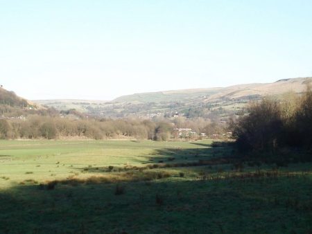
Rivers lose there character hemmed in and stagnating through towns and industry  but when I next joined the Tame it was in pastoral green fields. Amazingly these have been created from  what was the largest refuse tip in the area! All that tranquility was soon disturbed by  passing under the thunderous M67 whose six lane highway has replaced a two lane main road. What will we need in another 25 years?  The remaining few miles into Stockport were all surprisingly rural in country parks and close to the River Tame. The problem was with so many well trodden paths and poor signage one had to sometimes make an educated guess as to the route, keeping close to the river seemed to be a good idea. At the end of all these fields I emerged into Reddish Vale where the world and his dogs were congregating, there was a nearby carpark. The ducks were showing their skills at walking on water. A dismantled railway  gave fast walking, I had a train time in sight, before dropping to the River Tame for its finale. Under the M60, as it bypasses Stockport, one would never normally know that the Tame joins the Goyt at the end of its journey down from the Pennines. Having congratulated myself on reaching this point in good time I was dismayed by the length of traffic dodging streets up to the station to catch that train back to Preston. Another two day route completed in perfect winter conditions, apart from the dazzling low sun, and a good start to 2017.

TAME VALLEY WAY. 1 Denshaw to Stalybridge.

Denshaw, Delph, Dobcross, Uppermill, Mossley, Heyrod –  not names familiar to all. Its freezing and I’m stood outside the Junction Inn on the edge of the Pennines, think ‘Last of the Summer Wine’ country. I find a small waymark and set off down the Tame Valley Way. I love two day mini long distance walks, enough variety and an overnight stay. It’s taken me 5 difficult hours by public transport to arrive here. The metro tram took me out of Manchester to Oldham Mumps Interchange, a grand image which turned out to be a desolate street with a couple of bus stops. I escaped eventually on a local bus into the Pennines. Free at last to set off walking. The infant Tame is a trickle through flooded meadows and yet mills soon appear, they must have been water powered at one time.  Going through the yard of one mill I hear working machinery and looking inside see raw wool being fed into a carding machine and subsequently spun and dyed. Everywhere things were whirling.

I contemplate mill life in the last couple of centuries before most mills have been demolished or used as storage or one man garage workshops. Before conversion of the manager’s  house into a gated luxury property and the humble mill workers’ cottages into desirable commuter residences. There was ample evidence of those in today’s walk.

These valleys have almost a secret existence these days

Of course, I had to get into conversation with an allotment and whippet devotee. One suddenly arrives along the river in Delph, a busy Pennine village of solid stone houses. The chip shop dates back to 1769 – not sure it was serving chips then. Disappointingly my ‘bag’ of chips for eating along the way comes in a polystyrene carton. I’m sure the central library/art gallery was a subject for one of Lowry’s paintings…Anyway onwards along the river through more small settlements with many reminders of their history.The Huddersfield Narrow Canal was joined on the outskirts of Uppermill and the Tame crossed on stepping stones to reach refreshments in the Saints Cafe tucked away in a cobbled weaving square. In the bustling town there is an evocative statue of Ammon Wrigley [1861-1946] a woolen mill worker who won fame for his prose.For most of the afternoon the Huddersfield Canal was followed with the River Tame in close attendance. Short stretches of abandoned railways were also used through reclaimed industrial land, gas works and mining areas. As Stalybridge is approached river, canal, road and railway are hemmed in together, even now the oppressive industrial atmosphere prevails and I was glad to escape to my B & B in Heyrod overlooking the valley.   During the clear day the temperature had not risen above 5° and was plummeting fast. A mistake was to walk north to south into the low winter sun which had me squinting all day. Presumably the same tomorrow.

Reflection of plane's jet stream in the canal.

                             Reflection of plane’s jet stream in the canal.

New Year Miscellany.

Several days have been sunny and cold but windless – perfect for a spot of bouldering at Craig y Longridge. There have been a few more brave souls out on the rock. The crag is owned and managed by the BMC [thankfully for now this acronym has outlasted the suggested change to  Climb Britain] and the climbing fraternity have done us proud, with no antisocial behaviour or littering. However at the parking spot some ‘part time builder’ has found it easier to dump his rubbish in the road than take a trip to the tip.     Happy New Year.

I noticed the above whilst cycling past on a circuit of Longridge Fell roads, much harder than the relatively level Guild Wheel. Thankfully I was alone, I was so out of breath conversation would have been impossible.

Back to the Guild Wheel I was on it again New Years Day, this time walking part of it with a friend who was plotting a short walk in the Fernyhalgh area for his monthly walking group. We found a decent dry circuit with plenty of interest. Passing on route at Ladyewell the old Fernyhalgh School building [now a private day nursery] – my children attended there in the 70s when it was still the village primary, only to be closed against local opposition. There is still evidence of Boys and Girls separate entrances. Nearby is a memorial to local lads lost in WW1, quite an ornate cross for the five.

Ladyewell Nursery. Wikipedia.

Ladyewell Nursery. Wikipedia.

With the same friend a circuit of the Longridge Fell tracks was completed on New Years Eve, we were glad to be in the trees out of the cold wind. The only other people met were dog walkers. A few of the poorer days have been spent at Preston Climbing Wall in a vain attempt to steal some fitness from the season.

Preston Guild Wheel again.

In my last post I mentioned there were a few issues with the ‘Wheel’ but as we were in the Xmas season of goodwill I left them till now. Today has been bright, sunny and freezing with no wind – perfect for another circuit to keep the momentum going. Well wrapped up I cycled from Longridge thus adding an extra ten miles to my clockwise route. Brockholes nature reserve was busy with family parties strolling around and serious telescope wielding birders. There did seem to be a lot of wildlife on the lakes. Onwards again in the parks families were enjoying the good holiday weather. This brings me to the first issue, that of sharing the ‘path’, there are a multitude of users – cyclists, strollers, pram pushers, dog walkers, joggers. On social media there have been unfavourable comments directed at cyclists for their selfish and at times dangerous behaviour. The main issue being speed. I must admit on my visits the majority of cyclists proceed in an orderly manner with due respect to pedestrians. There are only a few head down speedsters. Being old fashioned I have a bell on the bike and use it when approaching walkers as a warning, this seems to work well and we all pass happily. My grumble here is that a significant number of walkers are plugged in to some sound system, don’t hear and tend to stumble into your track becoming a danger to all. Touché.

The Guild Wheel has been a great success as a recreational route since its inauguration in  2012

For walkers and cyclists it is mainly traffic free but recent developments are threatening its viability. There are several new housing developments in the northern section which will, apart from the inevitable loss of open countryside, increase traffic on the presently quiet lanes. Local residents are as much up in arms as the Guild Wheel users. I believe that sections of ‘cycle to school’ lanes are also affected.                                                                                                                      In another area the construction of The Broughton By-pass cuts right across the Wheel and endangers users. I have not seen the proposals for pedestrians and cyclists on its completion.   It is interesting to read correspondence between Guild Wheel campaigners and our political representatives on the County Council. I will leave it to your interpretation as to whom to believe, time will  tell. There is a petition to sign if you have strong views.

Back home warming up in the bath I’ve a warm glow of satisfaction from today’s ride – physical and mental – long may it remain possible.


AROUND THE WHEEL, IF NOT THE WORLD, IN EIGHT CAFES.

      The Roman Soldiers on Preston Guild Wheel have dressed for the festive occasion.

The most clicked page on my posts in the last few years has happened to be the Preston Guild Wheel map –

– it seems to be a popular ride.

This is no blow by blow account of today’s festive ride, I’ve done that before here and there.

Better to look at one of the many YouTube videos of a speeded up trip around the circuit, they remind me of the London to Brighton film shown on the BBC as an interlude back in the days, along with the potter’s wheel.

Anyhow to get back to today’s ride, anticlockwise from Red Scar on a sunny but cold afternoon.  I didn’t have time to call in at all the refreshment stops but made a mental note for a future caffeine indulgence. Other beverages are available.                                                                     [These are the establishments directly on the Wheel, there are several more within a  hundred metres for a grand slam circuit.]

Starbucks. Bluebell Way.Jpeg

The Guild Merchant.  Tag Lane.

Ancient Oak.  Cottam.

Final Whistle Cafe. UCLAN Sports Centre.

The Beach Club Coffee Shop.   Preston Marina.

The Continental.  Riverside.

The Pavilion Cafe.  Avenham Park.

Floating Cafe. Brockholes.There are some ongoing issues with the Guild Wheel but I’ll leave them to a later date.


… so a seasons greetings to you all.


THE WYRE WAY – ROUND THE HORN AND UP THE CREEK.

“Do you think we should abort?”  was Sir Hugh’s opening gambit when we met to walk the remaining section of The Wyre Way. I must admit the morning was foul with mist and rain.  Fleetwood looked bleak. No-one was patronising the promenade snack kiosks. Somehow the sight of the familiar statues greeting the imaginary returning fishermen, they would have endured far worse than us, galvanised me into action.  “Lets just set off and see” was my usual optimistic response. Within 100 yds the rain had stopped and there was a glimpse of brightness, the rest of the day was warm and almost sunny.

When I was walking The Wyre Way a couple of years ago I deemed I had completed the length of the river without this curious add on loop in the Fylde but when Sir Hugh suggested it I couldn’t miss out and risk shame. So here we were striding along the prom.What did we see? We saw the sea. But not at close quarters as the tide was out revealing vast mysterious sand banks. The famous distant views to the Lakeland Hills was denied us today. Leaving the Victorian esplanade area, with its two lighthouses and prominent North Euston Hotel, we wandered past run down beach huts, a yachting pond and on to a leaning coastwatch station. This latter was completed in 2012 and is of startling construction. The promenade/sea wall was closed further on for major works so we used a higher path adjacent to the golf course. In the distance Blackpool Tower.Turning inland we passed Rossall School and followed a few streets to meet up with the Wyre again. Good paths took us between the muddy river and the ICI [now AkzoNobel] plant, still functioning but greatly diminished. A car park appeared along with a multitude of dogwalkers. A fascinating area of boat jetties came next and led into Skipool Creek a centre for sailing but today with the tide still low everywhere looked distinctly muddy. There was a fascinating dereliction to the place, a  mixture of allotment and scrap metal.

Echoes of ICI.

Echoes of ICI.

A final section across low lying muddy fields, which would be flooded at high tide in an hour or so, brought Shard Bridge into view. I remember the old metal toll bridge from my time working in Blackpool when an evening’s drive for a pint in the pub seemed to be crossing into another world. Today the pub is unrecognisable in its reincarnation as a Hotel/Restaurant. I peeped over the terrace to view the ‘path’ I had tried to follow at high tide a couple of years ago. Even today it looked uninviting.The thin winters light was upon us as we reflected on a day well spent.

Simply passing time.

BANG – I thought I had been shot!

The morning had been frosty but bright, and I was out on my bike for a few miles round the country lanes. Well wrapped up I was enjoying cruising downhill into Longridge when there was this explosion from my back wheel which immediately deflated. Luckily only half a mile to wheel the bike home and investigate the damage. The tyre had a large hole in it as had the inner tube. I realised my tyres were old and perished – hence the explosion. Looking back I should have been more circumspect before setting off as my saddlebag had been turned into a mouse nest whilst I’d been an inactive cyclist. They had chewed up a rag, a chocolate bar and a spare inner tube with its packet in my absence.   Next morning it was down to the bike shop for a couple of new tyres and inner tubes – after the horse has bolted.

Nesting saddle bag.

Nesting saddle bag.

Since I’ve been back from sunny Tenerife it has been bright and cold, but dry, here, I don’t normally like this time of year and try to go abroad, but I must admit the weather is superb for November. Hence, the sudden urge to go cycling. Whilst away I managed to violently ‘back heal’ the toilet basin in our small bathroom, no alcohol was involved – well maybe a little the night before. Bruised heals are painful, and I haven’t been keen to do much walking. A session at Preston climbing wall proved how unfit I was compared to my mates who have recently returned from Kalymnos. So afternoons have been spent up at CraigYLongridge, the local bouldering crag. I’ve surprised myself being able to have a session or two whilst the thermometer only showed 6C degrees  providing the sun was shining. A few other brave souls have joined me.

A cold Craigy.

A cold Craigy.

So the point of this post, apart from bicycle maintenance, is just to acknowledge how lucky I am to live within 5mins of climbable rock and within a network of Lancashire lanes in Chipping Vale just made for cycling.

Simple.

TENERIFE GR131. La Laguna – Santa Cruz.

The final chapter, another easy day that wasn’t.

dsc04564

The tram took us back up to La Laguna and that was the easy bit. We walked up the nearest hill, good view back to La Laguna, but our way from there looked awkward so we dropped down to the road again and picked up the ‘correct’ lane further on.  Higher up we met a Dutch couple who seemed to be in completely the wrong place, they were using an alternative Kompass map which didn’t seem much better than ours. As we climbed the lane numerous runners in various states of exhaustion were pounding down. Obviously some sort of training run was in progress and the only person to stop and chat said they had already done 20k on a circuit from La Laguna. Higher up a farmer tending his frisky cattle gave us some indication of a route through to Santa Cruz.  At the highest point we rested whilst more runners came through. A track led off in the right direction through cacti and other prickly shrubs. All was going well and we met up with a  ‘Camino Lecheras’ which promised a continuing way. Research later has shown this was the route for transporting dairy products from La Laguna to Santa Cruz.                                                                                                                                                 This was quoted on one site – La vegetación predominante en esta zona es una variedad del cardonal tabaibal, abundando bejeques, balos, cornicales, faro, incienso, verode, cerrillo, mato risco, tederas, tasaigo, magarza, pitera, gomereta, jediondo, culantrillo y otras.                                                I think we must be missing something.                                                                                                        Anyhow we managed to loose that camino and took our own way down to the road at Valle Jimenez where we thought we had found our route. Crashing through undergrowth brought us onto a lane heading in the right direction. Then it was hopefully  back up a cleared path, Lamesa, seemed to be going somewhere but ran out at the upper road near some transmission stations. We were challenged by security as to what we doing but when we said walking to Santa Cruz our obvious stupidity allowed us through. The embarrassing thing was that we could soon be retracing our steps. At a view point we could see Santa Cruz and decided to make a break for it down ancient terracing. All went well and soon we were on a road which zigzagged all the way into town. We celebrated our completion, almost, with a beer in a cafe near the port.

Next morning we relaxed over breakfast and repacking. A stroll through town to the market and then the emblematic Auditorium, an arching concrete structure. Past the inviting ‘lido’ was the Palmetum where we spent  an hour marveling at the diversity of botany. Back to the bus station for lunch and the transfer to the airport.

Ficus sycomorus.

Ficus sycomorus.

Crinum Asiaticus.

Crinum Asiaticus.


Pandanus.

Pandanus.


Life is not always a bowl of cherries – the morning after at the bus station.

Snow on our local fell has not melted since our return.

So we walked almost coast to coast across Tenerife. The GR131 only existed between Arona and La Esperanza and was excellently waymarked. The bits we did at either end linking to the ports, surely the original idea of a route through the Canaries, were virtually nonexistent. With a little more research we could have found a better way through what is good walking territory, it was good fun trying. Can’t imagine the local authorities will get round to completing the route.

On to the next Island….


TENERIFE GR131. Agua Garcia – La Laguna.

We knew it wouldn’t be easy, the dogs made it worse.

We are now off the official GR131 and trying to cobble together a port to port route which my map shows. At this stage I feel the need to name and shame – Freytag & Berndt 1:50000. From the first day the depicted red line for the 131 has not matched up to what is on the ground but in the middle section we could rely on the official waymarks. We were now on our own at the mercy of said map and Spanish paths. I wonder if there is a better map available.

A bus took us back to last night’s point and we walked along the road for awhile. Turning down the lane of the red line all seemed simple, we were on our way. Every dwelling had some variety of vicious dog barking at us from behind bars, this turned out to be the pattern for the day whenever we passed a dwelling – is the crime rate so high that they need so many barking dogs.  The flowers and fruits by the wayside were a distraction until we were stopped dead by a house built across the lane. Back up and then down the next which thankfully gave us a way out onto other lanes which dodged under the motorway.

dsc04460 We found ourselves in a leafy suburb with  smart mansions. A footpath at the edge of a barranca was picked up and this took us through cork oak and eucalyptus woodlands on a ridge in the right direction. Then it stopped and perhaps we chose the wrong option down through streets to the very edge of the motorway. We figured we were on a slip road so carried on in dangerous proximity to fast moving traffic. With relief we escaped onto a winding road back into the hills. We relocated ourselves on the map and climbed out of the urban streets, as soon as we saw a hill we set off up it on a scrambly path – probably our next mistake. Emerging through dense under growth  onto the top with a trig point, possibly El Pulpito 710m, we reassessed and were nowhere near where we thought. Below us was the runway of Tenerife Airport North which we had at least circumvented. It was fun to watch the planes landing and taking off.

dsc04477A new course was set with more confidence across wide muddy tracks and up into another range of volcanic hills, Montana de la Atalaya. Ridge walking was a joy and we strode out with more ranges of hills on the horizon. Coming back down to housing we lost the plot. We hoped to reach Ermita de San Diego but never got near it and eventually just took the easiest option into La Laguna. On the outskirts dogs were ever present noisily stalking their premises. It was good to be back in the friendly central streets, we picked up our excess luggage at Hotel Aguere and enjoyed a beer in their spacious atrium. We may have walked 20k.Because we were behind schedule tonight’s accommodation was booked in nearby Santa Cruz so we took the modern tram, again so cheap, down to the coast. Our Hotel Pelinor was only a few hundred metres from the tram stop and again fortunately in the old town. The recommended restaurant, La Hierbita, proved a great success.


TENERIFE GR131. Siete Fuentes – Agua Garcia.

Luck strikes again and we find the path.

La Laguna cafe society.

                                                           La Laguna cafe society.

Over beers last night we had several options to talk through, today’s problem was to get back to yesterday’s final point in the woods and we didn’t really know where that was. Unsurprisingly we woke with no clear plan. Breakfast at the bus station and a unanimous decision taken , not difficult with two,  to try a taxi into La Victoria and then as high as he would go. Our willing driver with the help of my GPS took us 600m up narrow lanes before he blanched at the sight of a 1in3 concrete track. Dumped on the pavement our efforts to ask the way encountered the whole of the area’s intellectually challenged.  The next kilometre was some of the steepest roads I’ve ever walked. The whole hillside was given over to viticulture and men were walking up and down effortlessly between plots. We just staggered and perspired under our loads. A game of who could roll a chestnut furthest down the hill was invented to distract us. The ripe chestnuts were falling all around us and several parties were collecting them for the local markets.  At the end of the tarmac we followed a track forever upwards, just when we thought we had gone too high, 1300m, we suddenly emerged at the shelter of Siete Fuentes which we instantly recognised from last night.

Escobon for animal fodder.

                                        Escobon for animal fodder.

Time for a rest and snack. We noticed a functioning tap at the site and this would have been a godsend for a bivvy – please note if that is your intention. Now back on the GR131 and our red wriggly map line all was plane sailing. There was another path marked with ?angel heads wandering into the forest but we never discovered its origin. Council workers were out pruning the laurisilva for environmental reasons thus giving the locals free firewood. We enjoyed the warm sunny weather at this height and thought of England freezing away. Buzzards soared overhead whilst we ate lunch. The official 131 was left in favour of our coast to coast, port to port, quest and at a roadside end the Titsa bus arrived and took us to La Laguna. What a fascinating old town it proved to be and our 18th century Hotel  Aguere was right in the middle of the action. The town had become rich from trading between Europe and the Caribbean when it was safer to live inland than on the piratical coast. This is another of those Canarian towns where all the doors are oversized.Needless to say we made the most of our clement evening wandering the streets and sampling the bars and restaurants, this could be habit forming.


Starting small.

                              Starting small.


TENERIFE GR131. La Caldera – Siete Fuentes.

Lost in the forests.

We were up there somewhere.

We were up there somewhere.

On paper today looked straightforward, a red wriggly line marked on my map. The distance was 30k and the book said 10 hours. Unfortunately the first bus back up through Oratava to La Caldera didn’t leave till nearly nine so we had no chance of an early start. Our plan was to get as far as we could and then get off the mountain somehow. The caldera is now used as a natural amphitheatre and recreational area. When we arrived there were only a few people about and the cafe wasn’t open for coffee.  After a couple of kilometers on a good track the GR131 was signed unexpectedly up a narrow path and it continued climbing for another 500m. Obviously not what our map showed but once committed we had no other choice. The scenery was dramatic on the edge of a barranco with views back to Teide. We traversed above Roque de Topo and then spent hours somewhere on Montana de Joco up and down wooden steps, every time we thought we must be at the highest point the path descended and then climbed again. We clocked 1200m in the day and we thought it was going to be level. Some, most, of the barrancas crossed were steep and rocky and the path had been hewn out of the rock faces. The day was as usual hot and sunny and walking on a bed of pine needles was a delight, the warm smell of resin intoxicating.

Smell that pine.

Smell that pine.

Lunch, the usual tuna roll, was taken on a log which immediately snapped. We discussed our options – the map was of no use at all but the waymarking was good and we just had to follow it as our whereabouts were a mystery. We might have to do the full 30k and calculated finishing in the dark god knows where at about 7.30. I had very little spare clothing with me and we only had one headtorch, this was supposed to be yet another easy day.                                                     I spotted a sign to El Rincon marked on the map and thought this may offer us an escape route in the light, I voted for that although I think JD would have continued to the bitter end . We, perhaps recklessly, abandoned the 131 and wound down the forest road to a junction with confusing signs. A shelter and signs at Siete Fuentes was soon reached, amazingly back on the GR131.  We thought by now we were on our map’s red wriggly line. Several people were out in the forest collecting firewood but none seemed of any help in directing us off the hillside. We plodded on and asked another couple just finishing loading there truck, the conversation was a bit of a blur but before we knew it we were bouncing down the tracks in the back of their van. They took us to La Esperanza and dropped us off at a lonely stop assuring us there would be a bus along at 5.30. It came, we arrived in La Laguna bus station and next we were on a bus back to Puerto de la Cruz by 7.  Sometimes it just happens like that. So instead of walking in the dark, or if tired and lost bivvying unequipped in the forest, we were having a shower and going round the corner for a beer and another superb Canarian meal. Tomorrow would take care of itself.

Siete fuentes.

Siete fuentes.

Our saviours disappearing.


Our route maybe.

TENERIFE GR131. El Portillo – La Caldera, Aguamansa.

A downhill forest trail.

The only bus back up to El Portillo departs the bus station at 9.15 and when we arrive there is quite a queue of walkers and mountain bikers, the Teide National Park is popular. The island’s buses are run by TITSA, an unfortunate name. They proved reliable, comfortable and user friendly with screens updating stops. We never payed more than a few euros for quite long distances, this morning’s journey was an hour long and rapidly ascended hairpins for 2000m. Coffee was soon being enjoyed in the sun at the cafe we had visited yesterday afternoon.

Crossing the road the GR131, still the Anaga-Chasna way, was picked up as a little track heading down rocky ground into the pine forest. The day was warm and sunny and it was a delight to be walking downhill on good tracks. The forest was varied with pines, tree heathers and strawberry trees. Occasional views down to the north coast appeared. We couldn’t find water at the  whiteshrine near Barranco Siete Ojos, Cruz del Dornajito. The day drifted on as we followed the ample 131 signs. At times when we were on a good forest road our track seemed to disappear into the trees only to reach the track further on. It felt we were being kept off the easy trail, used by mountain bikers, in favour of smaller tracks. Towards the end we just followed the forest road to avoid unnecessary ups and downs.

Strawberry Tree.

Strawberry Tree.

We emerged onto the main road next to the entrance to the ‘Caldera’ a tourist hot spot and a few hundred metres of climbing through the trees brought us out at a bus stop for our return to Puerto de la Cruz. Easiest day yet and we would leave the Caldera till tomorrow.  Within an hour we were back in the now familiar back streets and enjoying dinner and an early night.


TENERIFE GR131. Parador – El Portillo.

Across the caldera.

Teide Volcano and Cañadas caldera. Image courtesy NASA

Teide Volcano and the Cañadas caldera.
Image courtesy NASA

The above image gives a superb view of the Caldera, our walk was from middle left to lower central [where the trees start] and was an easy 17k with only 350m of ascent.

We took advantage of a good breakfast in the Parador and retraced our steps round to our path from Guaraja from the other day. There now stretched before us a flat track below cliffs to the SE with Mount Teide towering above us to the NW. If all had gone to plan we would have been descending from up there this morning. We walked through several flat Canadas, which apparently hold water after heavy rain or snow. There was evidence of old huts used by goat herders in the past. This area is also a good environment for Tajinastie, an Echium called Mt. Teide Bugloss, its red flowers were fading when we walked past. The other common plant in this barren landscape is White Broom.  Onwards in the heat with no shade.

Tajinastie.

Tajinastie.

At the end on the road a visitor centre  was busy and we had time to look around the ‘volcano exhibition’ including a video explaining how the Canary Island aboriginals (guanches) believed Guayota, the devil, lived inside Teide. Outside was a ‘botanical garden’ which I was looking forward to visiting to identify the volcanic plants we were seeing. What a disappointment, a scruffy lava hillside with few plants and even fewer labels, Our boots were completely covered in volcanic dust by the end of the day. Down the road was a welcome café where we passed the time waiting for the only bus of the day to take us down to Puerto de la Cruz, the nearest accommodation.

The bus station happened to be a few hundred metres from our good budget hotel, Puerto Azul. Due to a mix up with my booking we were upgraded to a balcony room with clear views up to Teide. I just had a feeling he was mocking us for our failed ascent. Throughout our stay the summit was clear, even at night with the full moon, we got to calling it Mount Tidy. Puerto de la Cruz turned out to be a pleasant place to stay, our humble hotel being right in the middle of the old town with lots of little alley ways and good restaurants. We had to try the local wine but were not impressed – tajinasty.

TENERIFE GR131. The Parador.

A day of rest.

That should really read  “an expensive day of rest

Last night was not good, I was up and down with abdo. pains. It is almost a year to the day since my last episode cramped our progress in Gran Canaria and I can’t believe it’s happened again. Is there something about the Canary Islands?  I skip breakfast and go back to sleep. JD wanders off into the caldera but is soon back because its raining and miserable. We manage to book another expensive night here, there is not much other choice. I resign myself to not going up to the Altavista hut on Mt. Teide tonight and we only had the one reservation. As it happens the afternoon is foul with wind and rain, probably snow higher, so we console ourselves with a coffee in the cafe filled with hapless tourists. The young English couple return from an early morning [pre-permit] ascent of Teide and are in ebullient mood – congratulations. We are treated to a spectacular rainbow behind the hotel towards sunset. The Parador is the only hotel in the Teide Park and seeks to recreate the ambience of a mountain lodge, especially in the public roomsThe evening is made pleasurable by an excellent meal with good wine in the restaurant, I could happily slip into this luxury life, I didn’t say that – back to tomato sandwiches tomorrow. We replan our onward journey on the GR131, scaling Mount Teide will have to wait for another day.

TENERIFE GR131. Vilaflor – Parador Teide.

Ash and lava.

Breakfast was spent with the young English couple, both active fell runners from the Peak District, who were on a tighter more ambitious schedule than us oldies.  Good to see their enthusiasm, we were away before them but soon overtaken!

From the village, the ancient way climbed steadily on a well defined paved path through terracing of vines and into woods. Steady progress was the order of the day as we had 1400m to climb in the hot sun. There were no fuentes  so all liquid had to be carried and frequent refreshment stops made. As it was a Sunday there were more people out walking, running and mountain biking this popular trail.

Distant Guajara mountain.

Distant Guajara mountain.

We were heading for Guajara, 2715m, which we would circle to a col before dropping into the caldera. Highlights today were first all the volcanic ash we walked through and then the amazing lava fields and formations higher on the mountain. The compressed ash was metres thick and all colours, reminders of distant eruptions. Out of interest whilst we were here new low-level seismic activity was reported. Mount Teide  erupted in 1909 and the previous last reported increase in seismic activity dates back to 2003 when a rift opened on the north-east of the volcano. Needless to say the ground didn’t tremble below our feet. A section of eroded white ash was followed by a whole field of black ash up which climbed an endless avenue of a path. The authorities don’t want people wandering everywhere. From the top of the ash field a tortuous rocky path eventually landed us at Degollada de Guajara, 2373m. Gran Canaria was seen to the east. We stopped for lunch whilst walkers were appearing from all directions, this area around the Parador is easily accessible. Also spotted was a Great Grey Shrike. Dropping into the caldera a wide track was followed past weird lava shapes. I realised that I had previously climbed in this area and I recognised some of the routes, some climbers were busy today enjoying the warmth at this height. Mount Teide loomed above.

Degollada de Guajara.

Degollada de Guajara.

Climber in lefthand crack.

Arrival at the Parador was a bit of a shock, cars everywhere and the cafe and terrace packed with people. We booked into our room and sat in the hotel lounge to avoid the melee.

TENERIFE GR131. Arona/Ifonche – Vilaflor.

 A shortened day.

We were a little chastened after yesterday and neither of us feeling ready for a long day with 1400m of ascent, I know I’m getting soft. Walking to the bus station at 7am we suddenly decided to shorten the day by going directly to Ifonche by taxi, saving 7k. This leaves me with another little section to finish some other time but there looks to be a pleasant circular walk from Arona. We were dropped off at a bar, unfortunately closed, and wandered off for a view down the dramatically named Barranco Infierno and distant La Gomera. Once back on the Gr131 waymarks were plentiful as we climbed a ridge between two deep barrancas. Tagaste [white broom], prickly pear cacti and Cistus [rock rose] give way to pine forest. There have been forest fires here but the Canarian Pine is able to regenerate low down from the charred bark. We drop into the Barranco del Rey and then through old terraced plots and the occasional ‘era’ threshing circle. In the next barranco there is a fine old bridge, a good spot for lunch. Going up Montana de la Vica, high point of the day 1600m, there are many paths in the red ash and lots of people heading in the opposite direction. Water pipes are everywhere and down the otherside fields full of potato plants, papas arrugadas is the commonest dish in Canary cafes. Vilafor is a small town with an attractive church square where outside cafes serve beer and coffee. We chat to a young English couple who had passed us earlier in the day.  Our hotel, Rural Vilaflor, is an old house in a quiet side street strangely run by a friendly Russian couple. Tourists disappear in the evening and most cafés close, but we find one open for an average dinner.

TENERIFE GR131. Los Cristianos – Arona.

Escaping the suburbs.

This should have been an easy stroll but we arrived in Arona hot and sweaty after a frustrating morning and a climb of 900m. We had underestimated the climb and distance and come to realise our map is poor. The GR131 didn’t exist on this section. Not a good start and in the evening we need a good meal and wine to lift our spirits.

Playa de la Americas and distant Mount Teide.

Playa de la Americas and distant Mount Teide.

From our airbnb we headed down to the harbour and began a coastal walk – the well known Los Cristianos, Playa de las Vistas and Playa de las Americas. It is already above 20°, people are heading for the beach, joggers are sweating past and the hint of full English breakfasts wafts out of the cafes. In fact we stop off for an orange juice and scrambled egg.        There has been no sign of any waymarks for the GR131 but we follow the red line depicted on my map and head inland. Busy roads are negotiated and the motorway crossed. We are feeling pleased with ourselves until we become trapped in a new housing  maze not shown on the map.  The hills can be seen across vast banana plantations, but there is no way out and we turn tail and head down again, always a humiliating experience. The locals can’t help and thoughts of giving up cross our minds as we traipse the pavements and overheat.  By chance, we meet a Dutch couple doing a circular walk, their GPS points us onto a scruffy lane marked private. At last we are heading into the hills up this narrow road which leads to a water pumping station. A fortunate small arrow points our way and silver paint marks help keep us on a small track up to an aqueduct crossing the now rough hillside towards Roque del Conde.  However familiar plants appear, deep gorges drop away and we feel  in the wilds at last. Steep climbing brings us to a col with views back down to the holiday sprawl. In complete contrast, an isolated pig and goat farm is passed which looks to be in another century. Steep lanes lead into the small town of Arona where lots of walkers seem to be congregating, no doubt having enjoyed pleasanter paths than ours. There is no accommodation here so we hop on a bus, full of walkers, back down to Los Cristianos.

TENERIFE GR131.


JD and myself are back on Tenerife and staying once again in a fabulous airbnb next to the church, Nuestra Señora del Carmen in Los Cristianos. All is peace and tranquility with this family. We go round the corner to the busy locals’ Restaurant Raymond  and enjoy a typical supper, salad and then Merluza with Papas Arrugadas. The house Tenerife wine is good but the large serving of post dinner fire water Orujo  [ a transparent spirit from the distillation of the remains left after pressing the grapes with an alcohol content often over 50%] could mean trouble. Their paella apparently is superb – next time.

The GR131 through Tenerife follows in the main part El Camino Natural de Anaga-Chasna an ancient route crossing the island used when most people lived away from the piratical coast. My map shows the route from the harbour in Los Christianos to the harbour in Santa Cruz, 125k, thus linking with ferries to the other Canary Islands, the original idea of a continuous route through all seven. The Cicerone guide only details it between Arona and La Esperanza, 85.5k, as does the signing on the island, we were to find out later why.

We also intended to visit the summit of Mt. Teide on the way which involved pre-booking the Altavista Refuge on the mountain to avoid the restricted permit system.

ANCIENT WAYS.

Beamsley Beacon and Round Hill.

Two ancients going their own way.

There will be lots of posts with Autumn colours at this time of year, I went abroad a week ago whilst the leaves were green and have returned to spectacular trees. But today I hardly saw a single tree on these bleak moors. The general visibility was poor also but a combination of The Pieman and The Rockman as companions was sure to provide an entertaining day.

I have driven below on the A59 hundreds of time and looked up at the craggy top but I had never ventured up there. By our roundabout stroll we found were reminders of ancient routes long before the present roads. There were numerous old mile/directional stones and many boundary stones suggesting lots of foot and mule traffic at one time. Tracks tend to connect and the places mentioned on the stones give some idea of destinations. What was the nature of peoples travel – monastic or trade routes?  – people certainly wouldn’t have come up here for pleasure. On the map there is also a Roman road shown but no trace of this was passed today. The whole area was rather boggy, an understatement, and progress was slow and must have been troublesome for those who passed before. There is no trace of paved mule routes here, whereas in many Pennine areas these are an outstanding feature. On the map there are mentions of ‘cup and ring’ stone markings but we didn’t notice any, didn’t look hard enough.

Enough of way stones – there didn’t seem to be many obvious paths…Up on the drier heather slope there had been some harvesting of the heather which was bailed up – to be used for what? There was yet another mystery, two detached boot soles.

Having traversed Round Hill [409m] we arrived at Beamsley Beacon itself [393m], a more popular destination being a short walk from the car park. The prominent Beacon was part of the chain of fires that could be lit as warnings during the Napoleonic wars, recent uses of these beacons have been more celebratory. The large stone cairn is thought to be a Bronze Age burial site but has never been excavated. The trig. point bares a memorial to a crashed Lancaster Bomber crew from the Royal Canadian Air Force killed 5th November 1945.Will have to come back for the views.