Tag Archives: Art and architecture.

‘TWIXT WYRE AND LUNE.

Another interesting Lancashire ride plucked from the bikehike cycle routes map, utilising NCR 90 and 6 plus some other bits I made up on the way. Don’t forget, by clicking the pictures may be magnified.

I’ve been reading a book over the last few nights, ‘Lancashire Magic and Mystery’ by a Kenneth Fields. It is far more than the mysterious, delving into the history and culture of the Red Rose County. I’d never heard of Plough Sunday before, a celebration of the start of the agricultural year in the first weeks of January.  The book informed me that in agricultural parishes, a plough would be taken into church for blessing. This morning I found myself wandering around the grounds of Winmarleigh Church, St. Luke’s, and there by the entrance was a plough. I wondered about the connection.

I had stopped initially because of a mausoleum I could see in the churchyard,  it was dedicated to the Reddaway family of Winmarleigh Hall who had been instrumental in the church’s construction in 1875. Lord Winmarleigh, paying the renowned Lancaster architects Paley and Austin for its design and build. He lived across the way in Winmarleigh Hall.

Surprised to find the church door open, I stepped inside. A long nave took my eyes to the chancel, with an impressive organ in the south porch. Whilst I was going forwards, I surprised a lady engrossed in her church duties. We chatted away about the church and its past. Her main concern was the financial support for the church in a small community. I brought up the topic of ‘Plough Sunday’. She remembered, as a child, ploughs being brought into the church but now said that a tractor with a plough draws up outside to be blessed on Plough Sunday. What a wonderful piece of history. (The plough turned out to be a seeding machine)


.

I was on a cycle ride from Garstang, on the Wyre, to Pilling, bordering the Lune. It was all fairly flat drained land, and being so open the westerly headwind seemed troublesome. Once I had turned the corner and was heading to Cockerham, my pedalling became much easier and the miles slipped by. A sign said ‘kill your speed, not a cyclist‘. It didn’t seem to make any difference to the rushing motors. Anyhow, I survived into Cockerham and soon escaped onto a quieter lane signed optimistically ‘The Lancashire Cycleway’.

Dodging around the main road, I was soon on a fast series of lanes over the Lancaster Canal, over the busy A6 and around the Bay Horse and railway. Hollins Lane took me past a friends’ house who were unfortunately away.

Zoom to Pilling.

Zoom to Morecambe power station over the Lune embankment.

Cockerham church.

I took the opportunity to have a look at Shireshead Old Church,1805. It is now used as a recording studio, yet the graveyard seems to be well maintained.  

A steep lane took me down into the Wyre valley, where there are a group of fishing lakes close to the motorway. In the distance was the tower of Forton Service station, Grade II listed along with the churches I visited, and the spire of Scorton church, a well-known M6 landmark. Looming over all is Nicky Nook, 214m.

The River Wyre.

Nick Nook.

Do any pupils use this bus stop?

I cycled along a private road through Wyresdale Park which is now a wedding venue, glamping site and private fishing lake with a popular café for those climbing Nicky Nook. I ignored the café and continued into Scorton where there is a temporary takeaway serving coffee and snacks from a Citroën van. Refreshed, I was soon back at my parked car, no not the Mustang.

ONWARDS TO FLEETWOOD.

On the eleventh hour of the eleventh day of the eleventh month, I was parking up near Blackpool Hospital. I’d missed the silence and the bugle calls. Let’s remember the dead, but not glorify the war. And let’s not make a commercial event out of the date.

I was here to continue cycling up the coastal promenade to Fleetwood that I had started last week.

I was soon back on the front under the tower. Mid-week is much quieter on the promenade, in fact there are very few people about. Those that are seemed to be left over from the night before.

  Off I pedal on the promenade northwards on multi layered promenades, some crumbling Victorian and others modern curving sea defences. The tide is out but coming in fast for the fishermen already setting up their stalls for an afternoon’s pastime. Past fading Norbreck Castle, lots of my photos show fading grandeurs on this stretch of coast.

On past Rossall School, past the drunken coast guards and onto the Fleetwood esplanade with its reminders of past disasters to the local fishing community. Fleetwood has two working lighthouses on shore. There is a third, now defunct, way out in the Wyre Channel. When they are lined up, a ship is on course to enter the River Wyre and the port of Fleetwood, when it was a port with a large trawler fleet. I’d intended catching the ferry across to Knott End, but the winter timetable was against me. I wasn’t prepared to wait an hour.

.

North Pier.

  I’d also had intended riding back on local roads, but looking at the speeding traffic, I decided to just retrace my route on the promenade. That involved cycling into a headwind, but I was feeling fit and was soon back at the tower landmark.

Another successful ride.

TO THE POINT.

  Sunderland Point is cut off twice a day by the tide, I double-check the tables before venturing forth today on my cycle. High tide is 12noon, so I can have a lazy start — don’t I always. My plan is to arrive at the coast after lunch, when the tide should be receding.

In the18th century Sunderland between Morecambe bay and the Lune was a busy port and ship building yard, with ships sailing to Africa and the West Indies. Cotton, sugar, rum, timber and the slave trade, it’s main stay.  When wharves in Lancaster and Glasson Dock developed Sunderland’s trade finished. Many of the houses found here were originally warehouses associated with the port. In time, the point became known as Cape Famine. The hamlet’s two pubs, cargo warehouses, rope and block makers, customs house and shop have long gone. But in Victorian times it found a lifeline as a holiday and bathing resort, Little Brighton,   But holidaymakers eventually preferred the bustling new seaside resort of Morecambe, with its smart buildings and multitude of attractions. Sunderland Point became the sleepy, out-of-the-way place it is today.

I park up at Halton bridge once again, unload my bike and take to the old rail line. There is something wrong — a strange noise coming from my pedals with each revolution. I stop to try to identify the source. Along comes a tattooed, long-haired ageing hippy on his city bike, “what’s the problem, mate?” His probable diagnosis was lack of lubrication. I stand there looking hopeless as he suggests going to his nearby flat to pick up the necessary tools and oils to solve my problem. In a few minutes he is back, we dismantle the left pedal and apply some much-needed oil. I can’t thank him enough. A good Samaritan has uplifted my mood for the day. I pedal off, relieved and immensely grateful.

The Millennium Bridge in the centre of Lancaster is looking stunning in the sunshine.

Easy pedalling has me into Morecambe in no time. The views across the bay to the Lakeland Hills are so much clearer than the other day. I arrive at the information board for the Way of the Roses, a 170-mile ride to Bridlington — now there’s an idea.

The promenade takes me to Heysham and onwards towards the docks. I thought I had spotted a lane going towards Middleton, but ended up in a massive caravan park under the two nuclear power stations. A friendly dog walker told me of a footpath out of the site onto Carr Lane. I found it and escaped onto the coastal lanes to Potts Corner. The end of the road on the edge of Morecambe Bay.

Holiday heaven.

Escape.

The tide was going out as I chatted to a fellow cyclist on a day out from Settle, I’m almost becoming one of the inner circle of cyclists. A kestrel hovers overhead. In the distance, a ferry was heading for the Isle of Man. Vast open spaces.

Some soggy, muddy and saline riding and pushing on a vague track led me towards Sunderland Point.

I arrive at the site of Sambo’s grave on this windswept peninsula. ‘Sambo’, a generic name, had arrived at the Point in 1736, a cabin boy. Probably abandoned, the little African boy perished in the port’s brewhouse.  Deprived of burial in consecrated ground, his body was interred in this field, overlooking the sea. A local man wrote a verse about him 60 years after his death, which is on a plaque on the grave. The grave is regularly visited and is festooned with messages and mementos.  A memorial to the slave trade.

  A wall has been built around the grave and it doesn’t seem to have the desolate atmosphere I remember from my last visit. This is further diminished by nearby structures — a wooden bird hide and an art installation, Horizontal Line Chamber, a camera obscura by Chris Drury.

https://chrisdrury.co.uk/horizon-line-chamber-sunderland-point-morecambe-bay/   is worth a read with its attached YouTube video.

I entered the stone igloo and managed this image for you, an upside down coastal horizon.  A narrow lane leads to the village of Sunderland. A man is working on the old pub’s brewhouse where ‘Sambo’ supposedly died. The pub itself stood on the edge of the harbour, its present owner sitting outside gave me all the history. A line of stone pillars denoting the extent of the wharf. Of course with the tide being out one doesn’t get the full impact of this having been an important  port.

I go along to the southerly terrace of houses which have been converted from former warehouses. Farther on is Sunderland Hall built by a Robert Pearson, a date stone states 1683.  I should have dumped my bike here and walked to the actual point — next time. A good excuse to return to this unique place, there is much more to explore.

Across the water is Plover Light guiding ships into the Lune. Built in 1847 it was lit by paraffin lights until the 1950s when it became fully automated. There is a Pathé News clip of a Mrs Parkinson, the then light keeper in 1948, going about her duties.

https://www.britishpathe.com/video/lighthouse-1

In 2016 it was badly damaged by a passing ship, the light had to be removed whilst reconstructing the stone base took place.  I remember seeing it in its truncated form from Cockersand Abbey in that October with the light housing on the beach…

The afternoon was passing and it was time to ride across the muddy causeway back to the ‘mainland’. The mud flats on either side have an eerie appearance   Once off the marsh I cycle into the little village of Overton, past the historic Ship Hotel and on to find St. Helen’s Church. It is on a hill south of the village, looking out over the Lune and Glasson Dock. Originally 12th century, it has had several restorations and alterations, but retains its Norman doorway.   A signed cycleway alongside the Lune avoided the rush hour traffic. I pass the Snatchems Inn where in the past youths were plied with drink and then ‘snatched’ as crew for the sailing ships leaving the port in Lancaster. When they sobered up they would be halfway to Africa. It is now called the Golden Ball and looks in a sorry state.  In the fading light I catch an unusual view of Ingleborough.

Interestingly, as I approach the Millennium bridge in Lancaster on the far side of the Lune was the wharf, warehouses, and Customs Office of the old Lancaster port, St George’s Quay, which put an end to Sunderland’s prosperity.

I have really enjoyed the peace and relative remoteness of Sunderland Point today, an antidote to our modern hectic lives. Oh! And my pedal was silent and stayed on to the end of the 25 miles.

*****

There are some dramatic YouTube drone videos of this windswept coast with the tides in and out. Such as…

*****

Today’s route –

BRING ME SUNSHINE.

    I hadn’t intended to come to Heysham but the day seemed suited to exploration. I had parked up again at Halton station and cycled into Lancaster on the old line, as I did last week on my trip to Glasson and beyond. My plan today was to continue on the 69 cycle way into Morecambe and then explore the coast northwards. I was soon crossing the Lune on the Millennium Bridge and then taking another old railway line, still cycle route 69, westwards. Two thirds along here I noticed a marked turning perhaps towards Heysham and on a whim diverted off onto what must have been a branch line of the railway. I was now in the hands of the sign setter. At first, I was on a cycleway between horse paddocks, but then I was directed into suburban streets, thankfully traffic free. Signs were followed until I lost them, and then I followed my nose into the inevitable cul-de-sac in Higher Heysham. A bit of backtracking and then a bit of the main road past the C16th Old Hall Inn down to the ferry terminal.  Not the best way into Heysham.

At last the sea was now in sight. The road came to an abrupt end, but I was able to cycle through on a rough path to arrive at Half Moon Bay where there was a café, but every seat was taken. An advantage of cycling over walking is that it is easy to continue on to the next source of refreshment, though that didn’t quite work out.

Half Moon Bay.

Onwards and I found myself in Heysham Village. Lots of quaint alleyways, I remember from years ago a house selling potted Morecambe Bay shrimps, but couldn’t see it today. Soon I’m alongside St. Peter’s Church. It is thought that a church was founded on this site in the 7th or 8th century. Some of the fabric of that church remains in the present church. In the graveyard is an Anglo-Saxon cross and a stone grave. A track goes up onto Heysham Head to the ruined C8th St. Patrick’s Chapel. Most people come here to view the ‘stone tombs’ — a group of six rock-cut tombs and a separate group of two rock-cut tombs. Each tomb has an associated socket, probably intended for a timber cross. I have to say that today with a perfect blue sky and clear views they were magical.

  I found my way back onto the promenade around Morecambe Bay. Views across the water to the Lakeland Fells held my attention as I approached the West End of Morecambe. I was soon alongside the 1930s art deco Midland Hotel. Somewhere along here is the proposed site of the Eden Project North, which is expected to bring back prosperity to this ageing seaside resort. I’d never been down the ‘stone jetty’ to the old lighthouse, it was along here that a fellow blogger described what she thought was the ugliest sculpture, I’m inclined to agree with her.

  Also on the jetty is a bell that only rings at certain high tides. This bell is one of several around the coast of Britain  connecting us with our maritime heritage and a timely reminder of climate change. https://timeandtidebell.org/#

Bay surging, channels filling, sun setting, I ring, I sing. Listen in.”  written by the local artist community is going to be engraved onto the bell.   I must come back one day at high tide.

   The promenade is wide all along the front so cycling was possible without endangering the crowds enjoying views. I don’t stop at every attraction, I came this way back in 2109 whilst walking A Lancashire Monastic Way, but I have to visit Eric Morecambe’s statue on a sunny day like this.   

Commander C G Forsberg. Master Mariner and Marathon Swimmer.


  From time to time I stop and gaze across the water to the Lakeland silhouettes and as I round the Bay, Arnside Knott and Grange become more prominent. “Best view in Britain” one of the locals tells me. I knew of a café at the far end of the promenade where I thought I would get a snack, but time had flown, it was now 3.30 and they had closed.

   The main road had to be used to enter Hest Bank where I found a garage that sold coffee and pies. I sat outside, still enjoying the warm sunshine. It’s always a mistake to ask a local motorist for directions when you are walking or cycling. ‘Go down the road until the traffic lights‘ – no mention of how far that is. ‘Follow the signs to Slyne and at the T-junction turn left to Halton’. After the lights half a mile away, I ended up on the busy A6, there wasn’t a T-junction and I was almost back to the garage where I started. At least I was on higher ground and had a good run down over the M6 into Halton, with the Bowland Fells in the background, and over the narrow bridge to my car, the last in the car park.

  There may not be many more days like this as Autumn draws in — bring me sunshine any day.


*****

SOIXANTE NEUF.

    I thought I’d give this post a sexy title to boost readership. Not that I look at all sexy in my fading Lycra cycling shorts. There should be an age limit for appearing in public wearing Lycra, and whatever it is I am long past it.

  I’ve driven up the motorway, coming off at Junction 36 and found the narrow lane leading down to a car park at the redundant Halton station. This is on the old Morecambe to  Wennington line which closed under The Beeching Act in 1966.  Route 69 of the National Cycle Network connects Hest Bank on Morecambe Bay with Cleethorpes on the East coast and uses this section of line from Morecambe to Caton.  Off I pedal westwards on the 69 into Lancaster. The River Lune is mainly hidden and I don’t recognise much until the Millennium Bridge where the 69 crosses the river. I’m heading to Glasson Dock, so I stay on the south side of the water. There seem to be a multitude of cycle paths in Lancaster and just following my nose I end up under the castle with the priory church looking down on me. A few streets later and I find my way back to the river which is not looking its best, the tide is out exposing lots of mud. I’ll locate the correct way next time.

Halton station.


Soixante neuf.


Under the M6.

The canal aqueduct.


The new Greyhound and Millennium Bridges.


Priory church — getting lost.


Lost.

   Eventually I’m safely on the old railway track heading to Glasson. Lots of cyclists are using this route, I keep leapfrogging various parties as we go at different speeds, and I’m frequently stopping to take pictures of the Lune estuary. I have walked this stretch in the past when I was connecting a Lancaster Monastic Way. It is interesting to contrast walking a route and cycling it. One misses the little details as you ride by and although everyone says hello there is no chance to chat, that is until you reach a café and then can delve into gears and stems. As I don’t know one stem from another, I avoid the busy cyclists’ rendezvous at Glasson and cross over to the little shop which has freshly baked pies and good coffee. Here I can talk to the mature couples who have motored here for a good old-fashioned afternoon out. And of course there are the fishermen with their ready tales of yesterday’s catch.

Glasson across the marshes.

Up the creek?


Lost forever.


Smell that coffee.


Pike?

   A lot of the cyclists head back the way they came, but I’m in for exploring different options that I’ve spotted on the map. So off I go along the rough narrow track, you couldn’t call it a towpath, alongside the Glasson Branch Canal to meet up with the Lancaster Canal. Ahead are the Bowland Hills, looking splendid in today’s sunshine. An easy option would be to follow the canal back to Lancaster, but I’ve walked that stretch many times.

The Glasson Branch

Endless games of fetch the stick.


Junction with the Lancaster Canal.

  So again I go my own way again, threading through Galgate and onto lanes crossing the motorway and leading into the hills. There is only one bit I have to walk up, and then I’m onto the lovely high level road to the scattered houses of Quernmore. From up here are views across Morecambe Bay to the Lakeland Fells with the Bowland hills rubbing at my right shoulder. I sweep down past the isolated Quernmore  church and on to the entrance to Quernmore Estate at Postern Gate which I recognise from our  ‘trespass’ on the straight line from my house to Sir Hugh’s in Arnside.  I daren’t risk cycling through today so I take the busy road down to Caton and am soon back onto  that rail line  — Route 69.

Lancaster University, Morecambe Bay and Black Coombe.

Grit Fell.


Quernmore Church.

Postern Gate — tempted.


Down to Caton.

  This last section back to Halton is impressive by dint of passing over two viaducts above the Crook Of Lune built in 1849 to carry the railway. This is a popular spot today with tourists, walkers and cyclists. There are stunning views up the Lune towards Hornby Castle and Ingleborough. Turner’s painting of the scene, pre railways, shows  the original Penny Bridge carrying a road. This road bridge was rebuilt in 1889 and stands just below the East Viaduct. A long stretch in trees with little sight of the river has me back at Halton Station.

Eastern viaduct.

The Lune valley eastwards.

Crook of Lune road bridge.


Western viaduct.

Halton Bridge.

I go down to the river near the wrought iron lattice bridge built in 1911 from the remains of the Original Greyhound Bridge in Lancaster. Sitting quietly in the sunshine, contemplating the slow flow of water before hitting the motorway. I didn’t need that sexy title  — this landscape has no need of titillation.

*****

A RURAL RIDE FROM LONGRIDGE.

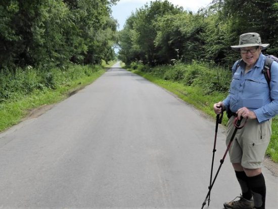
  Not a footpath in sight, not a stile climbed, not a fell summited, and you will be pleased to hear not a church visited. Oh! Well, maybe just one. My heel is playing up just when the weather is bucking up. Not to be defeated, I drag my bike out of the garage and do a few short rides around Longridge. So today I was ready for a longer ride. Out to Bashall Eaves, Cow Ark, Chipping, Whitechapel and back, about 29 miles (47 km) or so.

  Cycling brings a different aspect to one’s locality. No flowers to identify, no birds to watch, no passing conversations. Just the tarmac ahead and that steep ascent looming. Today I concentrate on the inns that I pass, past and present. In the Ribble Valley and Bowland we have been lucky to have had an excellent selection of quality establishments. Rural inns have a long pedigree, their names tell us much of the local history. Unfortunately the country inn has suffered from economic pressures and several hostelries have bitten the dust.  Covid has had a serious effect on the hospitality business.

    On my corner is the Alston Arms, now The Alston which has had several reincarnations since its establishment in 1841. It has survived the COVID lockdowns and  seems as busy as ever with locals, a large outside seating area has helped. Strange that I have not visited since over two years ago, when it was the favourite venue of my friend developing Alzheimer’s disease. She always ordered the same — fish, chips and mushy peas. And they were good!

  The second one encountered on the road is the Derby Arms, recently reopened after a period under a fish franchise, The Seafood Pub Company,  It looked open today for lunch, so all is well, hopefully. The area around here was part of the Derby Estate. The Stanley Family, Earls of Derby, established lands in Thornley here, hence the pub’s name.

  Along the way through Chaigley I pass the former Craven Heifer Hotel. The Craven Heifer became a popular pub name, particularly in the Craven area, so I don’t know how one popped up in Bowland. This hotel was a regular eating place at the end of the last century, it closed Christmas Eve 2008. Since then, it has been a private residence.

  On the way down to the Hodder I passed these gates which are normally locked. Today they were open, and I had a quick peep into their lands, with a lake and a large house in view. No idea who lives here. Chadswell Hall.

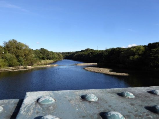
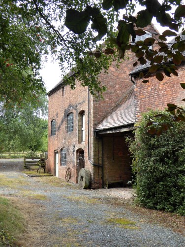
  I stopped off at the Higher Hodder Bridge, the river was as low as I’ve seen for a while. Just up the road is the former Higher Hodder Hotel. This was another hotel with a long period of serving good food and ales. It became well known to the fishermen casting in the Hodder below. I noticed on an old photograph a petrol pump in its forecourt, those days are long gone. Its demise came in 2001 with a severe fire from the kitchen. Bought by a local businessman and converted into apartments. It still has problems with erosion from below where the Hodder flows, undermining the banks. One day it may all fall into the river.

  At the next crossroads I knew of an ancient milestone but had never stopped to investigate, Today I had a good look at it. There was lettering on two sides with mileages.  On the West face  To Preston 10M. To Gisburn M8. On the North face
To Lancaster 16M. To Whalley M3.  1766. It turns out that this is Grade II listed.

  The next pub is the Red Pump in Bashall Eaves. This had been closed for some time when it was resurrected by the present owners in 2014, who turned it into a ‘gastropub’ with accommodation including recently added Glamping Yurts and Shepherd Huts.  I notice that it has restricted opening hours, so calling in for a pint is not always possible. The pub has a connection to a murder mystery  that was never solved.

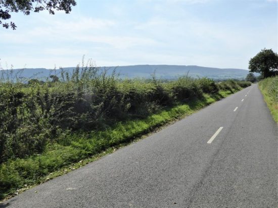
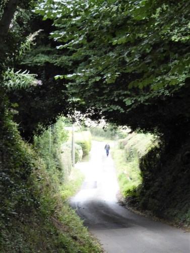
  Some serious pedalling has to be done climbing the road towards Browsholme Hall who have got in on the café scene. No time to visit today. On through the strangely named hamlet of Cow Ark and soon I’m freewheeling down the road which follows the line of the Roman Road from Ribchester to Carlisle and back over the Hodder at Doeford Bridge.

  The Gibbon Bridge Hotel is a little farther on and has a history only going back to 1982 when the family diversified from farming to catering. Over the years the hotel has grown and particularly in recent times with the focus on weddings. They still do a good lunch in the dining room, with magnificent views over the gardens and Chipping Vale.

  Chipping at one time had three pubs in the village. The Talbot has been closed  for years and is looking in a sorry state. Opposite, the Tillotson’s is now open again but has annoyingly random hours, they were missing trade today as lots of tourists were wandering around the quaint village.

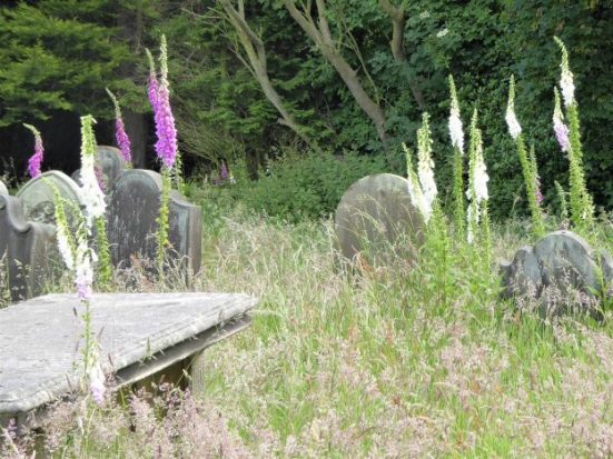
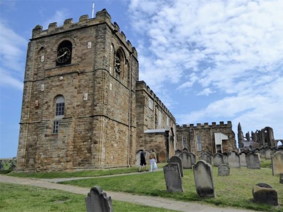
  The Sun has had a renaissance and is now thriving both as a locals’ drinking pub and a reliable eatery. It is reputedly the most haunted pub in Lancashire.  https://www.youtube.com/watch?v=aA1MZp3WYdI  I couldn’t resist a wander around the churchyard looking for Lizzie Dean’s gravestone.

  The Cobbled Corner Café has not reopened — it was a favourite with cyclists.

   The Dog and Partridge just outside the village dates from the 16th century but closed in 2018 and is up for sale for residential development. Sign of the times.

  I now head out to Whitechapel on narrow lanes under the shadow of Beacon Fell, When I first came to this area in the early seventies a curiosity was the Cross Keys Inn run by a farming family. It had irregular hours depending on work on the farm, a quirky bar, a good pool table. Late night sessions were common. At times, if the landlord was busy elsewhere, there was an honesty box for the drinks you had consumed. The inn was known, tongue in cheek, as The Dorchester! It closed over a decade ago but was bought by a local builder who has restored it along with accommodation units and has recently reopened it. Again, as the case with many of these rural pubs they are not open every day, particularly at the beginning of the week, but it is good to see it trading and I’ve promised myself a pint there soon.

   Down the road is yet another Lancashire village, Inglewhite, centred on a village green and a cross. The pub here is called The Green Man and has a date stone of 1809. Green Men go back to pagan times and are a fairly common inn name — the sign here depicts a typical Green Man. This pub has been closed off and on for several years, reflecting the difficulties of successfully running a rural inn. Let’s hope it stays open for the foreseeable future. It was not open today!

Homeward-bound now with tiring legs, I pass the last rural pub — Ye Horns Inn. An 18th century listed building that closed four years ago. It had been run as a family business for decades, famous for its Goosnargh Roast Duck reared down the road, and its unique wooden panelled snug located behind the bar. New owners have developed the site with residential properties, but hope to reopen the pub soon. I await with bated breath. Another unique feature here is the men’s urinal across the road from the pub. Not sure how many drunken patrons were run down on this precarious crossing.

  It is strange that my trip around all these rural inns didn’t involve any alcohol intake but as you saw several are closed for good, others concentrate on dining and others have limited opening. With a bit of organisation and forward planning, a right good pub cycle could be achieved around the eight trading pubs— but whether it would be legal or safe to ride a bike at the end of it would be debatable.

LAST DAY ON THE TWO SAINTS WAY.

Cannock to Lichfield.      7 miles.

  My B&B host gives me a lift back to the Ring Circle Fort, and I’m on my way, downhill to Lichfield.  One was supposed to be able to see the cathedral from up here, but low cloud prevented that. There was good walking up on Gentleshaw Common and then old tracks through woods to come out onto quiet lanes to sleepy Chorley.

Back into the fields I came to Farewell Hall and the Church of St. Bartholomew built on the site of a priory.

For the next two miles I walked along the ancient Cross In Hand Lane, so named from the wooden cross pilgrims would hold as they approached St Chad’s Well. This lane was a joy to walk, in places hewn out between sandstone banks and in others with mature hedges. A scattering of farms were passed along the way, and at the bottom of the last hill a cave reputedly used by Medieval candle sellers to pilgrims.

Medieval cave?

Lichfield was entered alongside the old Pinfold, which has been recently restored.

The house belonging to Erasmus Darwin, the Physician and naturalist and Charle’s grandfather, is now a museum in the shadow of the cathedral. The man himself was looking out of a window. There are many fine houses in Lichfield which is worth a longer visit.

At last the three unique towers of Lichfield Cathedral were seen as I approached the magnificent entrance. A Saxon church was built here to house the bones of St Chad, to be replaced by a Norman Cathedral, the present Gothic structure dates from the 13th and 14th centuries.  One walks down the beautifully vaulted nave, through the chancel and there in front of you is the shrine of St. Chad.

Behind in the Lady Chapel are the famous Herkenrode stained-glass windows rescued from Belgium. St. Chads Head Chapel was closed to the public.

Two relics related to St Chad were on display —  The Lichfield Angel,  a beautiful limestone carving from the chest that contained his bones. The 8th century St. Chad Gospels, from which St Chads cross emblem was derived.

Leaving the Cathedral I notice the statue of St Chad by local sculptor Peter Walker  recently installed in the grounds. He looks a kindly man. The south door is every bit as good as the main one,

I then wander alongside the lake, Stowe Pool originally a 12th century millpond and fishery, to reach St Chad’s Church and Well and my final interpretation board!  When St. Chad arrived in Lichfield, 669, he baptised converts at a local spring and founded a monastery. He was buried here in 672 but his bones moved the Cathedral when it was built in 700. The present day church is mainly from the 14th century with many more recent modifications. Nearby is the Well which has been popular as a pilgrimage place, at one time surrounded by arched walls but now by a simple wooden structure. I’m not sure that the water is very pure.

My journey had come to an end, I have learnt a lot and experienced a good mixture of rural and urban scenery. The route was well thought out in that respect. The churches have been inspiring and whatever your religious views they are beautiful buildings and how well we preserve the past in Britain. The problem of churches being closed occurs anywhere nowadays. The guide book is well written and informative, the instructions are clear. There was no shortage of accommodation (putting my Crewe faux pas aside) or dining possibilities, although Covid precautions are still affecting the latter. As usual, I met relatively few people walking any distance, and only four on The Two Saints Way. I covered 90 miles from Chester to Lichfield, but I have to say I was relieved to know I could now rest my heel for a few days. There has been constant background pain all week, which at times distracted me from my surroundings — I was beginning to feel like a real pilgrim towards the end and possibly should have dipped my foot in St. Chads Well.

*****

DAY SIX ON THE TWO SAINTS WAY.

Stone to Stafford.      11 miles.

*****

  I enjoy a leisurely breakfast, this should be a short day. Another gel pad is added to my right heel, I’m beginning to walk on high heels.

It didn’t take me long to get back onto the way at St. Saviour’s churchyard in Aston. In the porch of the church I noticed a cockerel mounted above the door. Its interesting history was noted..

Behind hedges and walls across the lane is Aston Hall, now a home for retired priests. It was here in 1839 that the bones of St. Chad were found, having been hidden at the time of  the Reformation. They are now strangely in Birmingham Cathedral rather than the more obvious Lichfield. A lady dog walking told me how she discovered many of the local paths around here during lockdown and had noticed the TSW markers. I enjoyed a long stretch through fields with open atmospheric skies, just what you need to put a spring in your step in the morning.

I  then entered a watery nature reserve. A man birdwatching was eager to tell me of a large bull blocking the path at the next stile. He had taken evasive action and clambered along the banks of the stream, he was in no hurry to return. Forewarned, I proceeded carefully and sure enough the bull was lying there with his herd of cows. I never know which breeds are allowed in fields with public footpaths, and I probably wouldst recognise them anyhow. A bull is a bull whichever breed and this was a large one. I couldn’t see any obvious escape route, so I stood and watched for a while before tiptoeing cautiously past against my better judgment. I’m alive to tell the tale.

Burston village was across the canal, a few cottages surrounding a millpond, delightful. Behind and strangely adjoined to the last cottage was a little chapel, St. Rufin’s. (he of the legend)  It is thought there has been a church in this vicinity visited by pilgrims since the Middle Ages.

A peaceful stretch of canal was now followed  with boat owners relaxing or busying themselves with jobs on board.  I watched as boats negotiated the locks, by now I think I would be able to navigate these canals.

The guide book said leave the canal at the ornate bridge…   This took me into the village of Salt, I had promised myself a pint and sandwich in The Hollybush Inn, one of the oldest pubs in the country. Alas, it was closed. An appointed caretaker has been here since last July 2020 keeping an eye on the place. He was sat outside and pleased to chat, but there was no offer of a brew, even when I expressed my disappointment.     There followed a bit of hilly walking and wandering through large fields to come out in a crop being harvested on the edge of an MOD property. The incongruous memorial behind bars told the story of the Battle of Hopton Heath, fought here in 1643 between Royalists and Parliamentarians.    The entry into Hopton  through sandstone cuttings was promising, but the village was mainly modern bungalows.

  My way onwards to Beacon Hill was obvious and the hill promised views to The Wrekin and Cannock Chase. All I got was the approaching dark rain clouds over Stafford..  I’d had no rain all week, but ended up donning waterproofs for the last mile or so through the streets of Stafford. By the time I reached the centre, it was dry. St. Mary’s church was much better cared for compared to Stoke Minster, but unfortunately was closed. The foundations of an earlier Pre-Norman church can be seen  in front of the church.

  The narrow lane leading to the high street passed the largest wooden framed town house in England. Shame they can’t spell ‘phone’    Next door was my comfortable hotel, The Swan an old coaching inn, and opposite was the oldest building in Stafford, St. Chad’s Church,1150. In its grounds was the base of a Medieval stone cross.

*****

DAY FIVE ON THE TWO SAINTS WAY.

Stoke-on-Trent to Stone.     13.5 miles.

  A long day.

Having slept in I crept out of my Airbnb at 9am, nobody else was up. My first priority was to find breakfast. By the station, all the cafés and bars were busy with football supporters topping up their alcohol levels before travelling to Birmingham for a derby match. I found a popular little café near the Cathedral where I had another oatcake, this time with an egg filling.

The Cathedral was large and imposing, but with rather run down grounds, it was not open. The present church is from the 19th century. In the graveyard is a Saxon cross from the earliest 8th century church. The cross has fine carvings, which may be the origin of  The Staffordshire Knot emblem. Another church was built in Norman times and its arches survive in the graveyard. Apparently inside the Cathedral is a memorial to Josiah Wedgwood and also to Stanley Matthews the footballer. I found the graves of Spode and Wedgwood. Time to move on.

The canal was regained for a few miles to get me out of Stoke. A typical stretch of urban towpath but well-used by joggers and cyclists. Somehow, I walked past the Britannia Football Stadium without noticing it, its new name is the awful Bet365 Stadium. I did however spot the sign on the marina — line dancing?

I cut through the backstreets of Trentham and arrived at the entrance to Trentham Gardens, a very popular family destination, I did not have time to visit the Gardens, but I called at their café for my mid-morning brew. Shopping seemed to be the main attraction.

After crossing the River Trent, I passed by an old courtyard, the original entrance to the estate. It seemed a shame it was going to ruin. Across the road was a modern courtyard development  modelled on it giving no doubt very expensive accommodation.

A little church, St Mary’s, was tucked away on the edge of the gardens. In the graveyard was a Saxon cross with  a well-worn Kneeling stone at its base. Pilgrims would have prayed here for centuries.

A steep track led up the hillside into King Woods on a ridge, all part of medieval hunting grounds. Down below, traffic crawled along the M6 on the stretch I broke down on last week, that’s another story. I couldn’t miss the football ground from up here. Despite all the cars and crowds below at Trentham, I was the only person walking along the airy ridge. I was surprised then when I came across a Colditz type wire fenced enclosure. Apparently this is The Monkey Forest, one of the Trentham attractions which must have cost millions to construct. There was no sign of the Barbary Apes that live in there, but I hadn’t paid my entrance fee.

Farther on, I could hear excited voices in the woods and again I was surprised to come across an aerial assault course, the Trentham people certainly know how to extract money from visitors.

I made my own assault of the hill in front of me to come out into the open at the 1st Duke of Sutherland’s statue. His statue was erected here in 1836 as an indication of his service to the local populace. This popularity didn’t extend to his time in the highlands, where he was responsible for much of the Highland Clearances and was hated by the Scots for evermore. His statue on Ben Bhraggie has been threatened with  demolition on many occasions. There were good views down over Trentham Gardens with its lake and the Stoke area in general, and quite a few people had come up here for that reason. (heading photo)

At the bottom of the hill was the little village of Tittensor with the church of St. Luke’s in the middle of a housing estate. It had an attractive timbered tower, a Duchess of Sutherland foundation stone, a bench for refreshments and the now familiar TSW interpretation board.

There was a very pleasant stretch over Tittensor Chase’s sandy heathland. Just visible in the high bracken were a Saxon burial mound and a much larger hill fort, Bury Bank,  which at one time was the capital of Mercia and probably the birthplace of St. Werburgh, a then princess, to  King Wulfhere. This family has gone into folklore from the ‘fact’ that Wulfhere killed two of his sons, Wulfad and Rufin. Read the full story involving St. Chad  here.

Tittensor Chase.

Saxon mound.

Bury Bank, ancient fort ahead.

Then I was back on the Trent and Mersey canal towpath for a mile into Stone. The town makes much of the legend mentioned above. The main street looks similar to many other pedestrianised town centres with its Costa Coffee, Wethespoons, Mountain Warehouse etc.

The St. Michael’s Church was built in 1758 in the grounds of a previous Augustinian Priory, where there was a shrine to St. Wulfad, who was supposed to be buried here under a pile of stones. Today the church was closed so I couldn’t view the stained-glass window dedicated to Wulfad and Rufin. In the grounds was a family Mausoleum of Earl Vincent,  an admiral in the time of Lord  Nelson and a Crompton grave.

Vincent Mausoleum.

Crompton family C17th tomb.

My hotel for the night was out of town. On the way I stopped at a garage to buy some milk and in conversation with the attendant found he had some involvement with the church back in Tittensor. He is doing the Two Saints Way in day sections, we compared experiences, a strange meeting. My hotel, Stone House, was the best of the trip yet.- a sumptuous bath and an excellent Indian restaurant.

*****

DAY FOUR ON THE TWO SAINTS WAY.

Barthomley to Stoke-on-Trent.     12 miles.

  I think I was still in shock this morning, I emptied the coffee sachet into the bin rather than my cup and then I used my asthma spray on my armpits. What more could go wrong?

The advantage of the taxi back to Barthomley was I didn’t have to face that busy road again. The driver was Turkish and on the way I got his life history. He lives in Alderley Edge because that has more say with the girls on dating sites than Crewe would have.      He made out he was also a football agent and told me to look out for an up and coming star at Liverpool – Harvey Elliott.

I’ve inserted an extra heel pad into my right boot.

Well signed and stiled field paths took me south from Barthomley, heading for a valley which the guide book author rated as one of the most scenic stretches on the way. Mill Dale. I wasn’t  that impressed. Once I had found the path down into the valley, I felt hemmed in by fencing. I would have liked to wander by the water. Yes, there were good stretches of water in the distance, but I seemed separated from the reality. This was reinforced at the end near houses where the way ahead was obscured, deliberately? I made my way up into fields above the valley.

I crossed what must have been the M6 and then started climbing a small hill with views back to the Cheshire Plain, Mow Cop to the northeast and then down to villages with a monument to Wedgwood prominent on Bignall Hill behind. I assumed it to be for Josiah Wedgwood of ceramics and pottery fame, but I find out later it is a John Wedgwood, 1760-1839, a local coal mine owner and employer. Within a few hundred yards, the scenery has changed – gentle Cheshire to grittier Staffordshire.

Audley is the first village I come to with a welcome little bakery where I can sit outside in the sun and enjoy a coffee and cheese slice. Naughty but nice.  The route winds its way between villages using green areas which in the past have been a hive of industrial activity. The area was rich in coal, ores and clay. First Leddy’s Field reserve and then the much larger Apedale Country Park. I meet three walkers who lived around here as children and can remember the pits and railways. They are having a nostalgic meet up.

Leaving Leddy’s field.

‘Last of the summer wine’

Apedale.

Walking along the old railway, I make good progress. A park warden tells me of the problems they have had during lockdown with bad parking and litter. They were reduced to a skeleton staff who spent most of the time dealing with the nuisances and now are way behind with their general work. He is a keen walker, having completed many long distance paths, and is proud that the Two Saints Way comes through his patch. In another part of the park there is a heritage centre, museum and narrow gauge railway. Tours of some old mines are possible.

The pit railway.

Nice job!

A steep road, there are a lot of hills today, brings me into Chesterton, an old colliery village, and the outskirts of Stoke. It is urban walking for the rest of the day. The pubs here have closed down, the church has an unkempt appearance and the streets untidy with litter  The café I find specialises in Staffordshire Oatcakes  These are a local delicacy like an oaty pancake, very popular in the Stoke area, I buy one filled with cheese and sit on the steps of the nearby Salvation Army hall to eat it with my coffee. I must look like a tramp.

  An unsavoury park takes me up a hill into the next area of housing where I rely on my phone satnav to navigate me down to the Trent and Mersey Canal.

  The walk along the canal was varied from industrial wastelands to upmarket waterside living. There were reminders of the pottery trade all along the way. I stuck to the canal towpath, whereas the Two Saints Way wandered into the old garden festival site and on to visit the Potteries Museum. I had hoped to see the Staffordshire Saxon Hoard there, but the museum is closed until later in the year, which is a shame.

Best floral display.

Wasteland.

The Round House. Formerly part of the Wedgwood Etruria Pottery works, and built 1769.

I dallied at the junction of the Trent and Mersey with the Caldon Canal. The Etruria Industrial Museum there was closed!

  My Airbnb room in Stoke was not far from the canal in the student area, my hostess is a holistic practitioner and a musician, the house was an oasis of calm. Down the road was an Afghanistan restaurant which served fabulous food, the staff were obviously concerned about their relatives and happenings out there at the moment now under the Taliban. Most won’t be eating as well as I am – Qabuli Pulau.

*****

DAY THREE ON THE TWO SAINTS WAY.

Nantwich to Barthomley.      12 miles.

  I reflect on the temporary healing powers of beer and Brufen as I hobble into Nantwich on a lovely sunny morning. The Church of St. Mary doesn’t open its doors until 10am, so I poke about in the narrow streets with some surprising finds.

Chimney from a wheelwright’s forge and smithy,

The Market Hall.

Good to see it thriving.

Parked up for the day’s shopping.

Immaculate Higgins classic.  I saw the proud owner cycling on quiet lanes later in the day.

  St Mary is an amazing church – cathedral like. You are enthralled as soon as you enter the Nave. Most of the church is C14th, and it is recognised as one of the finest Medieval churches in England.   The splendid, intricately carved Monks stalls with triple canopies and their Misericords grab your attention.     A fine tomb to a Thomas Smith and his wife from the C17th…     …and an effigy of C14th Sir David Cradoc, patron of the church, in alabaster.   A majestic modern stained window depicted life in rural Cheshire, linked into the creation story with Halley’s Comet in the right trefoil, dating it to 1985.    I forgot to look for the several ‘Green Men’ in the church. On the outside there were some fine gargoyles, in the red sandstone.
  At last, I was away and walking through pleasant parks alongside the River Weaver. Dog walkers were in ascendancy – I wonder how long this passion with dogs will last? Nantwich seemed to be a good place to live.

    And then I was in the countryside with well-marked paths leading me on.   I was on my way to Wybunbury, Winbury to you, and I was pleased to find the post office open with coffee and sandwiches available to enjoy on the seat outside. I take every chance I can for a sit down and some caffeine.

  At the end of the village was St. Chad’s tower once a C15th church but now truncated since the demolition of the main part of the church in 1972 due to subsidence. The tower was stabilised in 1832 using methods of under-excavation, later employed to stabilise that leaning tower in Pisa. Apparently it still leans to the north. It is thought that one of the figures at the entrance depicts  St. Chad. A modern St. Chad’s church was passed in the village earlier.

As it was early C20th.

  The path out of the churchyard took me through a wetland reserve and up into horse paddocks with a multitude of stiles, when a simple footpath diversion would have been more sensible.   On the outskirts of Hough I met up with a man and his Springer Spaniel, both as keen as each other on exploring the boggy land in the woods which we traversed. Then it was into fields of tall maize, where you just had to follow a narrow corridor. Somewhere along there I crossed the West Coast mainline, the real one this time. I was glad of a sit down and coffee at the White Lion in Weston. Across the road was the small brick built All Saints’ Church with its unusual semicircular chancel.

  Time was passing on as I walked the narrow lanes to Englesea Brook a small hamlet with a museum devoted to Primitive Methodism. Originated in America, the movement began in England around 1807. It was mainly a working class movement and had a part to play in the establishment of the trade unions.  A prominent tomb in the graveyard is that of Hugh Bourne, one of the pioneers of Primitive Methodism.   Onwards past some fine houses with a few hills to climb at the end of the day.   At last the steeple of St. Bertoline’s Church at Barthomley came into view, standing on Barrow Hill an ancient burial ground. This is where on a visit a few months ago I discovered the Two Saints Trail, it felt good to return here. Each section of the way has an interpretation board erected by http://www.twosaintsway.org.uk

St. Bertoline’s is a handsome church in red sandstone, most of it dating from the 15th century, though there is a Norman doorway built into the north wall. Inside are tombs of past notables in the Crewe Chapel. The chancel was rebuilt in 1925–26 by Austin and Paley, well known church architects from Lancaster. Above the west door are three carved heads, the left one was replaced in 2015 with the homely face of Bishop Peter Forster of Chester. I met the vicar as he came to lock up and of course discussed at length ‘my pilgrimage’.  He had recently come to this church from a Blackpool parish – what a contrast.

  Adjacent to the church is the friendly White Lion Inn where I enjoyed a pint of beer in memory of Dor whose relatives are buried here and who loved this pub.   This has been a long day, five churches, but it was not finished. I had struggled to find accommodation in Barthomley and all I could manage was the Travel Lodge a mile or so away just off the motorway on a busy dual carriage way. I risked life and limb getting there only to find I wasn’t booked in. Not knowing there were two, I had by mistake booked the Travel Lodge in Crewe, a few miles away. They could accommodate me here, but at the cost of £100, the ‘walk in rate’. I laughed at that, as they had never had anybody actually walk in before, cars and lorries only. Helpfully, the receptionist suggested getting me a taxi to the other place and before I knew it I was putting my feet up in my booked room. That was the least expensive way out of the dilemma, and I would book a taxi to take me back to Barthomley in the morning. But I did feel stupid.

*****

The arrow on the map shows my eventual destination.

DAY TWO ON THE TWO SAINTS WAY.

 Tarporley to Nantwich.   12 miles.

  As soon as I arrived in Nantwich I searched out a chemist before they closed. I was in need of more Brufen and some gel heel pads as I had been in increasing pain during the day. I was still considering catching the train home, the station was close by. But let’s see what difference a night’s rest makes. The Railway Inn where I was staying weren’t doing meals, shortage of chefs at the moment with Brexit and Covid. I was content with a pint and a sandwich and that early night.

  This morning I had rejoined the Two Saints Way on the Shropshire Union Canal at the Shady Oak pub for a short stretch to Wharton’s Lock. I’d been here before on the Sandstone Trail which was followed up to Beeston Tor, arriving before the castle opened – another time.

  Then I ended up walking along quiet Cheshire lanes, as apparently the right of way across fields has been disputed, time the Council sorted that problem, it sniffs of rich landowners to me. At least from up here there were good views back of Beeston Castle.

  Bunbury was a spread out village where I stopped off at The Nags Head for a coffee, surprising how many people were drinking in the bar at this early hour.

  St. Boniface church, C15th, was on the highest point and as I arrived a funeral service was just finishing with people milling around outside. Out of respect, I was going to move on, but a chance conversation with the funeral director assured me they would be gone shortly. In fact, this had been a memorial service for a local resident who’d died during last year’s lockdown. A Scottish piper headed the ash scattering procession into the churchyard. Then I eventually looked around the beautiful sandstone church, featuring some outstanding stained-glass and historic tombs. The friendly vicar, who was very proud of his church, was interested in my route and pointed out not to be missed churches further along the way. The day was getting on, so I didn’t visit the Dysart Arms opposite.


I walked on to rejoin the canal at Bunbury locks, where there was the old stabling for express horses of days gone by.  

  Continuing along the canal I passed the equivalent of a motorway service station busy with barges and boating people. It appeared as though some regulars along this stretch were vying for floral boat of the year. I came across an unexpected café at a cheese factory. I don’t often pass a coffee stop, so I was soon ensconced with a brew. Lots of friendly people to chat to and a chance to put my foot up.

  The canal continued alongside a busy road and industrial estates. I was distracted enough to photo all the different flowers on the towpath. Up to 30 different species in a short stretch, I won’t bore you with all the pictures.

  Slowly the walk became more rural as I passed the Middlewich branch of the canal. The waters became much busier with traffic, everybody seemed to be having fun. 

   I decided not to take the Llangollen canal as my heel was playing up, I just continued along the Shropshire Union into Nantwich, a busy section of the canal.

Soon I was in Nantwich, with its many attractive and historic buildings.

  The church could wait until tomorrow, I was in need of a rest.

*****

CaptureTSW 2

DAY ONE ON THE TWO SAINTS WAY.

Chester to Tarporley.  11 miles.

  I started my Two Saints Way  “pilgrimage” in Chester. An early morning train had me there by 9am and the Cathedral is not far from the station.  The Romans built a settlement here with straight intersecting roads in AD 79. It was later inhabited by a Romano/British population, and it remained an important location for the domination of Wales. At the site of the present Cathedral, Christian worship began in late Roman times. A church and abbey were dedicated to St. Werburgh when her remains were moved here, protected by the Roman walls.  At the dissolution,1538,  the abbey was destroyed but the Cathedral subsequently survived. As was normal, additions and alterations took place up to the Victorian era. It has to become one of the best representatives of the Gothic and Perpendicular styles. I went to see the shrine of St. Werburgh. I was greeted by a model railway exhibition!

  Pete Waterman OBE, the record producer and railway enthusiast, has designed a layout to commemorate the work of Chester’s Civil Engineer Thomas Brassey, 1805 – 1870,  who in his lifetime was responsible for many of the railways in Britain and the rest of the world. There is a commemoration bust to him in the cathedral. Lots of excited children and adults were gazing at the little trains whizzing around Pete’s West Coast mainline. Is that the man himself?

  To get back to my purpose down the far end of the magnificent nave of the Cathedral was the shrine to St. Werburgh who looked a little small in her niche.

Elsewhere, there were stained-glass images of both my saints.


  There was much more to explore in the Cathedral, but I haven’t space here for more pictures. My journey had begun.

  The streets of Chester were busy with tourists and shoppers but around the corner was an old cross unnoticed by many, it stands at the  central Roman crossroads.  Then it was shops galore down Bridge Street…

… leading to Newgate, the Roman amphitheatre and St. John’s Church with its attendant Medieval ruined chapel, the first Saxon Chester Cathedral.    I reached the canal and set off Eastwards at last. This area had been the industrial heartland of Chester in the C19th, when it was an important port. There has been a sympathetic preservation of the old alongside modern living. This was the Chester Canal, the first part of the Shropshire Union network. The towpath has been ‘improved’ with tarmac giving fast going, but I found hard going on my heel. More locks followed and at Tarvin Road lock there was a traditional lockkeepers cottage and an unusual round lengthman’s hut.

My first diversion was into the village of Christleton, a wealthy backwater, to visit St. James, a C15th church built on the site of a much older wooden church. Inside were several interesting relics, including a marble font, Millennium stained-glass windows and a wooden carving of a pelican tearing its breast to feed its young.

  Alongside the church on the green was the village well and Victorian pump house.

  I found my way back to the canal, now passing elegant houses and gardens. Fishermen were after perch and roach. One chap I chatted to said he had had 20 catches that day but whilst I was there not a single bite!

  There were no locks on this stretch through the flat Cheshire countryside. Passing a marina, I watched a couple trying to steer their newly hired boat out of the basin.

  Along here I saw my first Way of St. Chad’s roundel marker.

  Onwards the towpath was rather overgrown, not many people walking this stretch. Over to the right was Beeston Tor with its prominent castle, on tomorrow’s walk.

My destination today was Wharton’s Lock, where I intended to have a drink in the Shady Oak pub whilst waiting for a taxi to Tarporley. Alas, the pub was closed, the first of many. I was preparing to walk up the roads to Tarporley when another disappointed couple who had travelled here for a drink offered me a lift. Before I knew it, I was sat in the beer garden of the Forrester’s Arms. That was fortuitous because by then I was limping on my bad heel and ominous thoughts of having to catch the train home tomorrow were in my mind. A good evening meal and a night’s sleep hopefully would put me in a different frame of mind, if not body, tomorrow.


*****

TSW 1


THE TWO SAINTS WAY.

   Whilst visiting Barthomley in Cheshire a few weeks ago I noticed a footpath marker for the Two Saints Way, a route I was unaware of. A bit of research on the LDWA site followed, and the guidebook was ordered.    (Incidentally I use Blackwell’s now for ordering online books. They are competitive with Amazon for price and delivery, are still independent and pay their taxes in the UK.)   The route has been devised as a 92mile (148K) Pilgrimage between the Cathedral cities of Chester and Lichfield. David Pott’s guide-book is well-produced and gives all the background information you need on the Saints and Churches. The directions seem precise and are separate from the descriptive information.

The Two Saints are St. Chad, whose shrine is in Lichfield, and St. Werburgh, enshrined in Chester. They were both alive in the kingdom of Mercia in the 7th century and were prominent in introducing Christianity to the region. In Medieval times, pilgrimages were made between the two cities and onwards. I have completed St. Cuthbert’s Way, The North Downs Way and St. Hilda’s Way in the past, not to mention the Camino de Santiago de Compostela, so this route sits alongside them nicely. I am not overtly religious, but the history and sense of purpose behind these ancient and modern pilgrimages appeal to me and give a theme and focal point to a long-distance walk. In any case, many ancient tracks now followed by our trails were originally used by monks linking their monasteries,  and these became trade routes. Wayside crosses are a common sight on our walking trails.

   St. Werburgh was the daughter of the Mercian King Wulphere, she learnt the Roman Christian faith from her mother and entered a convent at Ely. Over her life, she came to oversee all the convents in Mercia and was respected as a model of Christian virtue. She was buried at Hanbury, Staffordshire, but during a Danish invasion in the C9th her bones were moved to the safety of St. Peter and St. Paul in the walled city of Chester. Her shrine there became a pilgrimage site, and the abbey church became Chester Cathedral. A story links St. Werburgh and a miracle with a flock of geese, and a goose became a symbol of her.

   St. Chad was born around 634 to a Northumbrian family and had his early religious training under St. Aidan at Lindisfarne and then in Ireland. In his life, known for humility and Godliness, he took on many monastic positions and came to Lichfield in Mercia where he would baptise the converted in a holy well. Nearby, he founded St. Mary’s church. He was buried there in 672, but when a new church was built nearby in 700 his remains were transferred there, this was superseded by the present day Cathedral started in 1085. At the Reformation some of his bones were removed and hidden by Catholic families in Staffs, they were found at Aston Hall, on the route, and moved to Birmingham RC Cathedral. St. Chad’s well became a site of pilgrimage. The Gospels of St. Chad, documents from his time, are preserved in the Cathedral and the symbol of St Chad’s Cross was taken from them.

Enough of the history, I am looking forward to walking through traditional English countryside and interesting towns and cities. Hopefully a varied walk. For no good reason I’m starting in Chester and heading to Lichfield.   Uniquely, the Two Saints Way route is referred to as The Way of St Chad in the Chester to Lichfield direction and waymarked with the symbolic cross of St Chad. The route from Lichfield to Chester is referred to as The Way of St Werburgh and waymarked with a goose, her symbol.  So, I’ll be following the Way of St. Chad, but paying homage to St. Werburgh whenever I look back.


*****

Since I wrote this I ‘bruised’ my heel bouldering and have delayed the start of my walk. Wish me luck.

NORTHING 438. OLD ELLERBY TO THE NORTH SEA.

P1030833

Saturday 10th July. 9 miles.

    The morning of our final day starts misty and damp. We struggle to find anywhere to park near the coast – it is all PRIVATE and NO PARKING signs and feels unfriendly. We ask at Low farm and they point us to a secure place in their yard. From Old Ellerby we are a happy to follow little lanes for most of the morning. We see nothing of the hall at Burton Constable. At last, a footpath alongside a drain gives some relief from the tarmac. We meet locals walking the lanes, one couple exercising their two energetic Spaniels. There is talk of drilling in nearby fields – fracking or natural gas? An industrial plant looms out of the mist on a path we do not follow. Our path into Aldbrough shows enough fractures to be worried about.

At Aldbrough, we head for the church and find a seat for some lunch. The Church, St. Bartholomew’s, is from the C12th and built predominantly with course cobbles.P1030818P1030825P1030821P1030822P1030816P1030824

The narrow lane takes us past our parked car and onto the top of the crumbling cliffs – the end of our walk  – or is it. We had seen fishermen on the cliff top and now they were down on the beach, so there must be a way down. All around are private and no entry signs, but I can rely on Sir Hugh to persevere, before we know it we are on the sands. A chat to the fishermen, whom are casting for Skate, and then using GPS we are exactly on the 438 latitude line which we draw in the sand. A satisfying end to our straight line coast to coast from Blackpool started in January 2019. It is unlikely that anyone else has done or will do this walk, making it quite unique.P1030828P1030832P1030854P1030846P1030843P1030841

We return to Low Farm along the crumbling cliff path and buy some fresh eggs from the 5year old who is in charge of the chickens. They are preparing for a family birthday party tonight, it should have been in Ibiza. Friendly people living in a distinctive landscape.P1030855P1030858


*****

CaptureSD38oe to sea._LI (2)

*****

A straight line, 121.78 miles.  We have taken 16 days and I estimate walked 157 miles.

Check out http://conradwalks.blogspot.com/ for an alternative story.

Capture 438line

NORTHING 438. BEVERLEY TO OLD ELLERBY.

P1030765Friday 9th July.      11.5 miles.

We are back at the golf course – dare we park in the President’s space – better not. The road into town leads through the common, the cows have moved to a cooler place. A dog walker tells us that sometimes the cows turn up in the town streets. P1030739

P1030742

P1030740

Our one point of reference is the Minster, and we are amazed at its size and presence. On a more mundane note, we spot the cream boxes of Hull Telephone Department, a separate entity to BT. We do not do Beverley justice as we slink along side-streets, aiming for the all important bridge across the River Hull. P1030747P1030748P1030750P1030751

Time seems to be dragging in the oppressive heat, so we are pleased to come across a café alongside the river. Two no-nonsense mugs of tea revive our flagging spirits.P1030755P1030754

This necessary crossing of the Hull and a major dyke took us just over one mile from our straight line, probably the most we have deviated on the whole walk. Once the bridge is crossed, a new land opens up – flat drained fields as far as the eye can see. Sir Hugh likened it to the ’empty quarter’. Fields of barley, wheat, rape and linseed. We are soon through Weel where complicated footpaths could have taken us south, but we had an eye to a black hashed line on the map following the Holderness drain. This proves to be an accessible and newly cut embankment, and we are soon at Meaux Bridge where a locked gate has to be negotiated. Something tells me that we weren’t supposed to be in there. It pains me to show the picture of Sir Hugh’s struggle.P1030759P1030760

P1030763

The empty quarter.

P1030770P1030777

P1030776

Cornflower and mustard.

P1030787

P1030786

Linseed.

P1030779

Little roads wander through the Benningholme Estate. The highlight along here was whilst we are sitting on a log, a man appears from the nearby house with offers of iced orange. These are very welcome and we spend time in conversation with him and his neighbour. Once the world has been put to rights we resume our journey to Skirlaugh, taking a field path for the last stretch.P1030783

The early C15th Church here takes us by surprise – according to Pevsner, a “gem of the early-perpendicular” style.

P1030791P1030792P1030793

A couple more miles on narrow lanes, crossing the Trans Pennine Trail/Cycleway which ends in Hornsea, and we are back at our car at The Blue Bell  pub in Old Ellerby.P1030794P1030795

It’s been a hot and sweaty day, relieved thankfully by our two unexpected drink stops.

*****

Capture SD38 b to oe_LI

NORTHING 438. NORTH CLIFFE TO BEVERLEY.

P1030735 (2)Thursday 8th July.    10.5 miles.

   You may wonder how we then found ourselves atop of a windmill.

   In hot sunshine we had been walking uphill on a minor road for about 5 miles when we decamped into a field for some lunch. I suggested to Sir Hugh that today’s post would be fairly short as little had happened, he wondered if anything exciting would occur towards the end.  We eventually left the road and found a footpath going in our direction, don’t forget we are following a straight line as close as possible to latitude Northing 438. This we gratefully followed onto the golf course and whilst getting our bearings got into conversation with a friendly chap walking across the course. We asked for the best way to cross towards a windmill we had seen marked on the map. Having explained what we were doing, he wanted to discuss the long distance paths he had walked and also suggested to us the best pub in Beverley – the gas lit Nellie’s.(the White Horse) His wife and friend had by now walked away,  we parted and approached the windmill which was surrounded by a large herd of cattle, so we didn’t get up close. Beverley Minster could be seen down below through the trees. We now made a b-line to the clubhouse, where our car was parked, and whilst photographing the windmill there our man approached again and asked if we would like to go up it. Turns out Brendon is President of the club! He tells us of the history of the course, founded in 1889 and the unusual nature of it being on common land with the cows wandering freely. There are local rules for if your ball lands in a hoof mark or even worse cow dung, apparently the greens are fenced around to keep them free of animals. Next thing we were all climbing the rickety stairs up the inside of the mill, We paused on the second floor to admire the clock mechanism gently ticking away. Once on the top parapet, we had views of the surrounding countryside in all directions. 

P1030719

On the golf course.                                                                                                                                                                                                                                                     

P1030723

P1030727

P1030731

El Presidente.                                                                                                                                                                                                                                                                                                                                                                                  

P1030732


P1030734

P1030736

P1030729

Zoom to Beverley Minster.

A strange but interesting meeting. 

***

   The day had started back at North Cliffe where we parked next to the church, we are using two cars to facilitate this linear walk. The church and hall caretaker appears, so we get some history of the estate and the church. He has been doing this work for 50 odd years and lives in an estate house opposite, we saw the Lodge yesterday – all of a similar architecture. Most interesting is that the founder of the estate was a Samuel Fox, who invented a steel ribbed umbrella superior to his competitors. He went on to establish a large steel producing complex. https://en.wikipedia.org/wiki/Samuel_Fox_(industrialist)  Mr Fox funded the building of this little church, dedicated to St John,  and was buried in its graveyard shortly after its completion in 1887.

The path out of North Cliffe doesn’t exactly go up a cliff, but does climb quite steeply up an escarpment which is the beginnings of the Yorkshire Wolds and into the pretty village of North Newbald. Old cottages surround a village green, complete with church and pub., quintessential English. We investigate a house on the green which had been the village school, the owners appear to give us some history and suggest cups of tea, we politely decline – if we had known what was coming on the road walk we would have accepted their offer.

Climbing the ‘cliffe’


Anybody with a dog or an MX5 gets a picture.

The old school.

It was then we began our hot  and sweaty ascent on minor roads farther into the Wolds. I walked the Wolds Way with Mel way back in 1999, no wonder I don’t recognise it. All up and down between extensive fields.


We eventually escape onto the golf course…

*****

CaptureSD38 nc to b_LI


NORTHING 438. FOGGATHORPE TO NORTH CLIFFE.

Wednesday 7th July. 9.5 miles.

   It was January 2020 when Sir Hugh and I were last over in East Yorkshire, walking our straight line coast to coast. (My comment on that post may explain the naming of our line) No progress has been made since then, for obvious reasons. But today we are back, with four days walking to reach the sea.

   Foggathorpe feels familiar as we pick up the old Market Weighton to Bubwith rail line which is now a pedestrian and cycle route conveniently coinciding with our 438 latitude line. As a railway line goes, this is quite pleasant, with verdant vegetation and a succession of locals with a variety of dogs. We even meet a horse rider trotting along.

 Back on the Bubwith – Market Weighton Line.


Australian Shepherd Dog and Patterdale Terrier.


Cocker Spaniel.


Patterdale x Jack Russell.

   We leave the line at the Old Holme station, where the last lady we met lives on the old station house.

Holme Upon Spalding Moor Station.


Station House.

A minor road is used to bypass the main road through the village, this brings us out  exactly opposite the lane we need to take to reach All Saints Church. It is set on the top of the only hill, 45 m, in the area. We approach through a wonderful flower meadow. It is an ideal spot to find a bench, enjoy the view and have some lunch. The church is Medieval, with some parts dating from the C13th. The limestone stonework is elaborate on the C15th tower, and in parts the softer sandstones show a lot of wear. It is closed, so we wander around the very extensive graveyard. There are several war graves of English and Australian airmen, nearby there used to be an RAF airbase used in the second world war.

War Graves.

  Close by the church on the hill in a field of wheat is the remains of a Royal Observer Corps post from the second world war, this is of interest to Sir Hugh as his father was a member of the Corps. There is not much left to see. There is also evidence of a locked underground bunker which was used during the Cold War years as a nuclear monitoring post.

   A good public footpath ran straight through the crops and linked up at the bottom of the hill with a farm track, which we planned to use to avoid busy road walking. We were aware of possible trespass, and when the first farm vehicle approached we were asked if we had “lost the footpath”. Explaining our route, we were given the go ahead but “to keep our heads down when passing the big house”, this we did. We were walking through an enormous pig farm with muddy pigs everywhere and little tin huts for them to sleep in.

   Our plan works, and soon we are on a quiet road heading east to North Cliff where our car was parked. I suspect we will have to follow many of these lanes to stay close to our line. It looks like we are walking through an estate whose properties have similar architectural features. Our car is parked by the North Cliffe Village Hall next to an old church. 


North Cliff Lodge.


North Cliff Church and Village Hall.

Black clouds appear and thunder reverberates all around us, but we survive without a soaking, although the muggy conditions are unpleasant.

Time to go and find our hotel north of Hull, we may struggle to find much of interest to write about on this walk.

*****


ST. HILDA’S WAY. DAY 4.

Friday, 2nd July. 8 miles. Sleights to Whitby.

I catch the bus back to Sleights and head down to the station to rejoin my route. As well as being on the Esk Valley line, the Whitby – Pickering Heritage uses this section. I had seen steam from trains yesterday and when I heard a hoot this morning I grabbed my camera for a shot of the steam train powering through…

…it turned out to be a diesel hauling the carriages today!

   I soon left the Esk Valley Way and used footpaths gradually gaining height through pleasant farmland. A bit of a hiccough had me vaulting barbed wire to get back on course to Sneaton, a small village in the hills, you have no inkling that the coast is just a couple of miles away. St. Hilda’s Church, Sneaton is set back from the road and yet again it was locked. I’ve chosen a bad time to visit these churches. The graveyard looks like a haven for wildlife. This church is renowned for its stained-glass window depicting Caedmon. Caedmon was a lay brother and herdsman at St. Hilda’s monastery. He had a dream that he could sing and, relating this to Hilda, she encouraged him to compose and sing religious verses, the original hymns? From up here I had my first view of Whitby Abbey, and my continuation was named the Monk’s Walk heading that way. Excellently preserved flagstones for almost a mile, well-worn from the passage of time, and a stone clapper bridge for good measure..

On the outskirts of town, I decided to try and stay high and approach the Abbey from the SE. This worked well, and I was soon on the headland with the Abbey ruins in front of me. That’s when I joined the crowds swarming out of the car park. I hadn’t quite expected the place to be so busy when for the last three days I was mostly alone. I suppose the Abbey is a major attraction and when you throw in Dracula, Scampi and Captain Cook, Whitby is a magnet for tourists.

St. Hilda’s Abbey  was destroyed by Danish invaders in 867. A new Abbey was started in 1078 as a Benedictine monastery. Gradually this became one of Yorkshire’s great houses with 40 monks and a large estate.  It was rebuilt several times in the C14th and C15th, and these are the ruins we see today. Henry V111 put paid to the monastery. Shelling by German warships in 1914 ensured the building deteriorated further.                                                                                                                                                                    (Don’t know what happened to my camera settings there.)

On the headland close to the Abbey is  St. Mary’s Anglican Church, of Norman foundation but much changed over the years, it probably is on the site of St. Hilda’s original monastery.

This was the first church that I had found open, and it had an interesting  interior, most of the floor space being occupied by box pews – some labelled for their occupants .               

Nearby is the Caedmon Cross, erected in 1898, which celebrates the spread of Christianity from St. Hilda’s Whitby and Caedmon and his Hymns  in particular. Hilda is depicted standing on the headless snakes – ammonites, and surrounded by five bishops she taught. In the background can be seen the square tower of St. Hilda’s Anglican Church, my next objective.

   The graveyard is extensive, but apparently starting to fall down the cliffs into the sea. There have been reports of bones on the beach!

I go down those famous 199 steps, join the crowds jostling in the narrow streets and find a café with a free table, I enjoy the traditional Whitby ‘fish and chips’ – not really different to fish and chips elsewhere.

I thread my way through the narrow alleys and steps past the famous Whalebones and Captain Cook.   …to arrive in front of St. Hilda’s Anglican Church. This impressive structure was built in 1888 when it was thought it may become a cathedral, hence its size and apparent rich contents again denied me by Covid restrictions.

   Across town was the more pleasing to my eye St. Hilda’s RC Church. Again apparently it is richly embellished with many references to Hilda.  It is a shame that I have not been able to view the interiors of all these St. Hilda’s churches, particularly for the stained-glass windows depicted her life. 

All I had to do now was walk up to St. Hilda’s Priory at Sneaton Castle. (a different Sneaton to this morning). I was a little dismayed to find it is now a wedding venue.

The Sisters of the Holy Paraclete owned Sneaton Castle, a Georgian property originally built by a Caribbean sugar plantation owner, James Wilson, when he retired to Whitby. The nuns moved into adjacent St Hilda’s Priory in 1915, and the castle was run as a girls’ boarding school and then a retreat, but the increasingly elderly community of nuns, whose numbers have dwindled to around 25, decided to sell up in 2018, realising the castle was making a loss. They have moved to a new priory on another part of the estate. I found it all a little confusing and didn’t take the opportunity to ask if I could view the Norman priory or even the new one.

Castle and Priory.

P1030610

St. Hilda.

*****

*****

That was my 40-mile circuit of this wonderful corner of the North Yorkshire Moors and the Esk Valley completed. Eight St. Hilda’s Churches were passed, as well as other important places of worship. My regret is not being able to view the interior of those churches, however they gave a focus to the walk. The stone trods were a delight, as were the villages, making this a worthwhile and interesting tramp which for the most part you have to yourself.

I think that is enough of going round in circles looking for churches for a while, Sir Hugh is trying to get me back on the straight and narrow.

ST. HILDA’S WAY. DAY 3.

Thursday 1st July. 10 miles. Glaisdale to Sleights.

Today I followed the Esk Valley Way except for my extra loop to visit St. Hedda’s RC Church, Egton Bridge; the Mortuary Chapel, Egton and St. Hilda’s Church, Egton.

   I walk down the road from my hotel past the rail station to arrive at the much photographed Beggar’s Bridge. There are several stories behind its construction.

It was built by a Thomas Ferris in 1619. Ferris was a poor man who hoped to wed the daughter of a wealthy local squire. In order to win her hand, he planned to set sail from Whitby to make his fortune. On the night that he left, the Esk was swollen with rainfall, and he was unable to make a last visit to his intended. He eventually returned from his travels a rich man and, after marrying the squire’s daughter, built Beggar’s Bridge so that no other lovers would be separated as they were. Wikipedia.  

   Whatever the story, it is an elegant bridge in good repair.  

The Esk Valley Way goes across a ford and into the woods, the Coast-to-Coast comes this way too, but I have no recollection of it. The woods are a peaceful haven as one climbs above the river, Stone trods appear and are a feature for the rest of the day.

   These stone paved ways are difficult to date but were thought to have originally connected the large monasteries, they being the only resources to fund such a scheme. Later in the 17th and 18th centuries, they would have extended as more commercial trade routes. I try to imagine this route being busy with packhorses travelling the county. The paving stones are worn from all that trade. Here in the woods is a particularly long section of preserved paving stones, how many more elsewhere have disappeared under tarmac or been destroyed by the plough? There are rocks in the woods which I wonder had been quarried for the paving I’m walking on.

One emerges onto a steep road, one in three, dropping to Egton Bridge. Here, hidden behind the Horseshoe Inn, are two series of stepping stones going across the Esk. A weir and mill race are obvious reminders of the industry on the river.

   Going up the road is St. Hedda’s RC Church. Hedda was a contemporary of Hilda at Whitby. Egton was a hotbed of dissention during the reformation. Its most famous RC priest, Nicholas Postgate, became a martyr, executed at York in 1679. The Roman Catholic congregation however continued to worship in secrecy, and this new church was built in 1866. Today the church is Covid closed, inside apparently is a shrine to Postgate. On the school next door is a statue of St. Hedda.

   Leaving the Esk Valley Way I take to the fields and woods past Lelum Hall Farm and climb steeply out of the valley, again with traces of the trod no doubt heading towards the old chapel.

Off the road at the top is Egton Memorial Chapel and Graveyard. The original C13th chapel of St. Hilda survived the dissolution period and continued as the Anglican Parish church, but it deteriorated and was demolished in 1876. A new St. Hilda’s was built in Egton, see below, but the graveyard has continued in use. The present mortuary chapel was built on the foundations of the old in 1897.  A rather sombre place but with good views across the dales.

   Egton village is spaced out around the wide street with lots of old attractive houses. I ask a man with his dogs the history of some buildings, but it turns out he has just moved here and is slowly finding out himself. He tells me of his restoration plans for his new property, not the retirement he had planned. He did however know about the  surviving ‘hearse house’ down the hill, as well as the house where secret Catholic masses were held.

The village continues down a steep hill, which must be a nightmare in hard winters. The new St. Hilda’s Church was built,1879,  using some stones from the original church. I wander around the outside to spot some old date stones, the church of course being locked.

                                                                                                                                                                                                                                                                                                                                               Back at the bottom of the hill I call in at The Postgate Inn (remember him  – the martyr) for a pint and surreptitiously my vegetable slice from yesterday – delicious.

    Now back on the EVW there is a rather dull track for a mile or so, my attention shifts to the plethora of common hedgerow flowers.

  This must have been a toll road through the estate at one time. The river is never far away, with the old stone paving alongside it. An old priory is mentioned, but now looks like a country residence. I meet up with the Egton newcomer again, he is out walking with his wife and one of the dogs, he knows nothing of the priory.

Further on, stone trods reappear as I walk through Spring Woods and on to elegant Newbiggin Hall with its nearby rusting tractors and paraphernalia collection.

More surviving stone trods cross fields and woods, with Sleights in view on the hillside ahead. I enter the lane close to St. Oswald’s Retreat, where some sisters from St. Hilda’s Priory, Whitby, live.

The lane leads to Sleights Station and a bus stop back to Glaisdale. I’m the only one on the bus, but at the next stop a lady boards and sits right adjacent to me. She obviously doesn’t understand social distancing. I was expecting three days sweat would keep most people away from me. It’s been a long day, and I’m rather weary when I arrive back at the Arncliffe Arms for my second night.

*****