Category Archives: Art and architecture.

CICERONE’S LANCASHIRE – A lazy Sunday Wyre Walk.

Sunday and I take the easy way out again as lunchtime comes around. I pick another walk from Mark Sutcliffe’s Cicerone Lancashire guide. Not wishing to drive far, I find a low level circuit from Great Eccleston in the Fylde. It turns out to be one of the flattest routes in the county, with only a few feet of ascent on the return leg. It was good to get this rural walk out of the way before the cattle are put out into the fields.

My plan when I revisited this book was to maybe do one walk a week as an incentive to get me walking farther, but somehow I’m up to number four in just over a week. So far I’m impressed with Mark’s style, he has chosen well, and his directions have been spot on – suitable for the casual walker. Today’s walk was complicated in places, and yet I didn’t put a foot wrong.

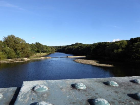
I find a place to park in the main street only to see it is an electric charging point. Having moved the car I walk out of the village past the old pinfold, on across the main road and down a well-used, dog walkers mostly, path to the river Wyre. Here is a fairly unique private toll bridge next to the Cartford Inn. The ‘cart – ford’ prior to the original C18th bridge. In the grounds of the inn are modern staycation ‘pods’. I recognise these from a walk I found for myself last winter, or was it the one before – the pandemic seems to have confused my recall.

Easy walking along the riverbank to a footbridge where I crossed to the road near the extensive and impressive, possibly haunted, grounds of White Hall. I often wonder who owns these multi-million pound properties – Russian oligarchs?

Using farm tracks, I joined The Wyre Way, linking farms in this flat rural landscape. This is the way I should have come on my disastrous attempt on this section when I almost drowned and then lost my map, leaving me with no alternative but to follow the road.

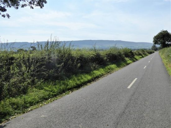
The guidebook said, “head for the grain silo” and it was correct, the silo stood out across the field, one of the tallest I have seen.  In the distance were the Bleasdale fells,  everywhere else was flat,  a strange landscape for one accustomed to the hills.

Turnover Hall was next. There were duck ponds with piles of grain to fatten the birds before they are shot. The Hall is surrounded by hundreds of caravans, whether for sale or in storage I couldn’t make out.  Oh, and just for good  measure, the obligatory junk waiting  to be recycled.

I rejoin the Wyre embankment and walk into St. Michael’s, arriving at the road bridge near the chocolate box cottages and the Medieval church across the way.

You know I like an interesting church when I see one, this one is Grade I listed. It is thought a church existed here, near a safe river crossing, from 640AD. The Domesday book mentions a church on the same site. The present structure dates from the C15th. When you enter the church, the most obvious and unusual sound is the loud ticking of a clock, the giant pendulum hanging on one side of the tower. There are two naves and a northern Chapel. This Butler chapel has older Medieval stained-glass fragments, seemingly randomly incorporated into the windows. In the same window is a C16th Flemish sheep shearing scene. In the west wall is a striking modern window depicting the parable of the ‘sower’. Outside is a ‘Norman’ door and an ancient mounting stone. In the graveyard are  three unusually shaped graves,  these are the ‘Soldiers Stones’ dating from 1643 when a Spanish ship was wrecked on the Wyre estuary and thought to be for Spanish sailors. 

Time to move on, and I take a lane heading towards a large modern house. Whoever built it had visions of grandeur now biting the dust, the house being an empty shell.     

The rest of the afternoon I follow drainage dykes across the landscape, eventually to rejoin the Wyre for the last time before re-entering Great Eccleston.  The two bulls face each other across the high-street, with a period Austin7 on show.                                               

  That’s quite a lot for a lazy Sunday walk in this quiet corner of west Lancashire.

*****  

CICERONE’S LANCASHIRE – Parlick and Fairsnape.

I don’t often stand on the summit of Parlick Pike. If I’m heading up to Fairsnape and beyond, I take the easier traversing path bypassing it to the west, overlooking Bleasdale. But today I’m following another of Mark Sutcliffe’s walks from his Cicerone guide. I’m having a lazy week and doing walks without any planning on my part, just follow the guide step by step.  Marcus Tullius Cicero was a Roman statesman and scholar. His extensive writings showed learning and eloquence and the term Cicerone, to guide and explain, came to be. Hence, the name of the guidebook dynasty started by Walt Unsworth and Brian Evans.

So I’m stood on the pike, 432m, the wind is trying to blow me off it, but the sky is clear, and the sun is bright. A perfect Spring day. The hard work is done,  I can enjoy the rest of the afternoon on one of my favourite walks. This circuit used to be my once a week fell run years ago, I’m just pleased that I arrived here today without stopping, well apart from those sneaky photo stops. Strangely, I nearly always did it the other way around –  I’ve looked into the reasons for choice of route recently.

Down into the dip and then a choice of routes either side of the wall, dogs one side and not the other, but I never understood which or why. The wall is a masterpiece of construction, stretching up towards the summit of Fairsnape. I remember once  seeing a squirrel running along the top of it, bound for Fiensdale?, there is not a tree in sight along the ridge. These walls and fences are excellent handrails when the fell is in thick mist, which it often is. The wind is too strong for the parapenters or gliders, so I have the space and the views down into the bowl of Bleasdale to myself.

The grass has taken on that dry straw colour regularly seen after the winter months when the sun shines on the steep slopes. I was so taken by it a few years ago that I asked a local artist, Rebecca Wilmer, if she could interpret it on canvas. She knew exactly what I meant, and in fact had some slides she had taken of the very hillside matching mine. A commission was agreed, and I proudly have the painting in my living room, not everyone sees it in my eyes or the artist’s, but I saw it up here today.

There is a distant haze from the summit of Fairsnape, 510m, but I know where Blackpool Tower, Morecambe Power Station, the Isle of Man and Black Coombe should be, so I don’t have to linger in the biting wind. Shapes emerge from the summit shelter, where they have been enjoying a sheltered lunch. I was last up here in June last year, when I spent a cold night bivvying near the cairn. But of course this is not ‘the summit’, to visit it you have to run the gauntlet of the local peat bogs in an easterly direction until some stone flags appear leading you to the highest point, 520m. Since my last visit, a large cairn has been built and there is a board telling you how efforts are being made to stabilise the peat hags and reduce the water run off.

It’s all downhill, literally, from here. A good manufactured path leads to a fence from where sunken tracks head on down Saddle Side. I pass the ruin with a tragic history. It is good to be out of the wind, skylarks are singing and once the fields are reached the sound of curlews and lapwings stir strong memories of the upland countryside of my youth. A dip into the valley of Chipping Brook and then the Wolfen estate road leads me back to my car. Wolfen Hall lies below Wolf Fell – possibly the last stronghold of wolves into the C15th.

I followed Cicerone’s guide easily, but I had to branch off to visit the highest point. Mark does not include this in his instructions, but his map does. Ah well, people will find their own way.

Full-frontal Parlick.

Decision time – straight up.

Parlick summit with Fairsnape behind.

That dry yellow grass.

Dogs?

Fairsnape summit’s furniture.

Boot sucking peat.

A reminder that the area was once a military firing range.

Point 520 m, with Totridge Fell in the distance.

The tragic scene on Saddleside.

Spring in the valley.

Wolfen Hall.

***

                                     Artistic impression from Parlick.  Rebecca Walmer. 2010.

*** 

CICERONE’S LANCASHIRE – Rufford and Mere Sands.

Another day, another walk. I was liable to miss the best of this sunny day as I procrastinated in bed with coffee and news feeds on the Ukraine disaster. I feel ashamed to be British as we turn away refugees at our border, Priti Patel is not my favourite politician. I would be all too happy to offer up a couple of my rooms for the most needy, as have done hundreds of Germans. Bugger Brexit and Boris and Putin.

To salvage the day and my mental state, I pick up that volume of Lancashire Walks published by Cicerone. What about 6 miles from Rufford, visiting a nature reserve I had no knowledge of despite being a supporter of Lancs Wildlife Trust.

I park up next to Rufford St. Mary’s Church, which is open to the public today. When I was last here, I learnt of the choir in the past accompanied by musical instruments, including a bassoon played by a Richard Alty. Apparently, the said bassoon is preserved in a case in the church. I was disappointed that I could not find it.

My next disappointment is that I did not visit the NT Rufford Old Hall; instead, as the day was slipping by, I set off along the Leeds Liverpool Canal and looked across to the hall which had a fantastic display of purple blue crocuses in their grounds.

I stretched my legs along the busy towpath, with flat fields all around. To the east, Winter Hill and Great Hill were prominent, but Longridge Fell looked a long way off. Soon I was heading inland and along Sandy Lane. All straight lines and winter fields.

In a yard of lorries, the owner talks of high fuel prices and a lack of drivers. Boris, Brexit and Putin again. He has an awful lot of money tied up in those vehicles.

My entry into Mere Sands Reserve was by the back door over a little footbridge. I hung my binoculars around my neck to look professional. In Medieval times, the whole area was part of Martin Mere. Attempts to drain it commenced in the C17th, and it was planted up as woodland as part of the Rufford Hall Estate. In 1958, it was sold for sand extraction which created the lakes and in 1982 sold to Lancashire Wildlife Trust for a nominal fee, thus creating the reserve we see today. The path winds around the back of the mere, where a hide looks out onto the waters. There are ducks and geese in the distance. Farther on, I came across a couple hand feeding the robins. Coots are diving. All part of a busy little reserve. The café was too busy for my patience, so I carried on to the far end of the reserve. My only criticism is that there were not many places where you get near enough to the water. Oh, and the adjoining roads sound like Silverstone with all the Sunday racers, very distracting.

The abandoned observation post above is of unknown vintage. I found a path alongside a dyke which leads me through the fringes of Rufford, somehow Venice came to mind. And then I’m back on the canal, which has been drained for this stretch, along past the Marina, and I was back into the village. The Hall had already closed, some other time.

What a pleasant way to spend a sunny Sunday afternoon. Another thumbs up to my new Cicerone guide.

SALT OF THE EARTH.

                                             Salt’s Mill.  Oil on two canvasses.  D Hockney 1997.

Titus Salt was born in Morley  on 20th September 1803, the son of a successful wool merchant. He joined the family firm, which became one of the most important worsted companies in Bradford. He took over the running of the firm in 1833 when his father retired, and eventually owned five mills in Bradford. The city became a horror story of the Industrial revolution, with poor working conditions, squalid housing, polluted air and water supplies. Life expectancy, of just over eighteen years, was one of the lowest in the country.

To improve matters, Titus decided in 1850 to move his business to a green field site where he built an industrial community on the banks of the Aire and next to the canal. Salt’s mill, Italianate in style, was the largest and cleanest in Europe. At first his 3,500 workforce travelled from Bradford, but to improve their lot over the years he built housing for them. He integrated into the Saltaire village:  parks, churches, schools, hospital, almshouses, railway station, public baths, libraries and shops. But no Public House. Clean water was piped in, gas for lighting and heating, and outside loos for every house. He did charge a rent for his properties but provided superior living and working conditions, a model of town planning in the C19th.

Titus Salt died in Dec 1876 having given away much of his wealth to good causes. The business continued under his sons but over the years declined, wound up and sold to business syndicates in 1893.  Textile production continued into the mid C20th and finally closed in 1986. The village itself had been sold to the Bradford Property Trust in 1933 thus enabling the houses to be bought by their occupiers.

An outstanding entrepreneur, Jonathan Silver, bought the Mill the following year and within months opened a gallery exhibiting the work of his friend, Bradford-born artist David Hockney. With Silver’s enthusiasm, the mill developed into the vibrant space we see today. He died young, but the enterprise is still run by his family.

Saltaire was added to the UNESCO World Heritage List in 2001, recognised for its international influence on town planning.

Well with all that write up it was time I paid a visit to Yorkshire. A wet Sunday in February was chosen. I drove through the floods down the Aire Valley. You realise the scale of the mill and village as you pull off the hectic suburban road.  The car park was busy despite the foul weather. As well as the historic buildings and the connection with the artist Hockney: the mill now houses cafés, upmarket retail outlets, artist materials, an excellent book selection, antiques, cycles etc. All waiting to make a hole in your wallet, though the parking and entry are free. I had come basically to see Hockney’s artworks, but was impressed with everything else that was on offer. Everything is on a grand scale here, from the size of the stone building blocks to the massive indoor floor spaces.


You enter into the long ‘1853 Gallery’ with works by Hockney from different periods as well as a large selection of artists’ materials, all under the gaze of Titus Salt. The walls are all windows, so ingenuity has been needed to display the Hockney pictures. Time to get  used to the large scale of this place.  Hockney started his career at Bradford College of Art school (1953–57) and the Royal College of Art, London (1959–62), Portraits have always been an important part of his works and some early examples are exhibited here…

Red Celia. Lithograph 1984.

Margaret Hockney. 1997 oil on canvas.

…as well as some of his more recent computer generated portraits.

The next floor up was a gigantic book and poster shop where I had to be extra strict with myself. The queue for the diner looked daunting. Somewhere behind in the depths of the mill was an antique centre, an outdoor outlet and an upmarket home and kitchen showroom.

Having manoeuvred around all these, I arrived in a long gallery with some of Hockney’s abstract offerings from his time in Malibu Beach.

Round the corner was a stunning ceramic installation depicting Batley and Bradford by Philippa Threlfall, 1972.

I eventually found the way up to the top floor where I sat and watched a video of the history of Saltaire from which I gleamed my information for this post. In the next room were some historical artefacts.

As you move around the galleries, there are views out of the windows reminding you of the extent of this building and the surrounding village.

The major Hockney exhibition was on the top floor. In the first space was a video presentation of his iPad and iPhone pictures using the brushes app, which he emailed to friends. They came up three at a time and were a variety of vibrant styles. The larger exhibition was entitled “The Arrival of Spring” – a series of iPad paintings done on different days from his car parked on a Yorkshire Wolds lane from January to May in 2011. He made the most of the portability and speed of using the hi-tech iPad, capturing  subtle changes in the light. He was able to print them out on a large scale

These pictures celebrate fleeting moments of intense beauty, and remind us of the importance – and the joy we get from looking closely.”

I’m ready for Spring – aren’t you? Worth clicking for enlarged images.

I came out of the mill to a broody winter day with hail showers moving in. I wanted to have a look at some nearby Saltaire streets, under the shadow of the mill, before the light disappeared. The terraced houses were obviously now desirable properties, and the shops on Victoria Street appeared prosperous. Chic Yorkshire.

Next time I will give myself more time – a grand day out.

TOCKHOLES – END OF THE DARWEN TRILOGY.

For the third week in a row, we head to the Darwen Moors to complete another part of the footpath jigsaw. This time we park in Abbey Village, as do another 30 or so cars – a Bury rambling group is meeting up. The classic walk out of Abbey is through the Roddlesworth woods, past reservoirs, on route to Darwen Tower. We just managed to get a head start on this section.

Today we were heading in a round about way to Tockholes, that elusive village in the rough pastures west of Darwen Tower. Nobody just happens to drive through Tockholes, you have to search it out via narrow walled lanes, best done on foot as we were.

It is thought from archaeological findings that Tockholes was an ancient settlement from the Bronze Age. What is certain is that a significant Civil War battle took place nearby in the C17th, the remains of horses, cannonballs and bullets were found in a field in the village. After that, it became a centre for weaving and silk production. So what could we see today, there are over 20 listed buildings in the vicinity.

We entered the village from the moors above and came down Silk Hall Lane. The buildings here showed evidence of top floors used for weaving, with those long windows.

The footpath leading down to the rest of the village was a nightmare of awkward stiles and barbed wire, which were difficult for Poppy, the Airedale. Our thoughts turned to Sir Hugh and his wire cutting equipment. We were relieved to emerge opposite the grounds of St Stephen’s Church.  Dating from the reformation in the mid 16th century,  It was rebuilt in 1833 but fell into disrepair and was demolished and rebuilt again in 1961.

We sat in the relatively modern Lychgate (1906) for a brew and then explored the extensive graveyard which is said to contain 20,000 graves. An early C19th sandstone columnar sundial. There was an old school building from 1834 with a strange open air pulpit.  The stone porch of the 1833 building retained as an archway to the present insignificant church. Nearby on a cheese press base an old cross shaft and the rounded  Tocca stone beside it.  These are said to be Saxon, possibly a preaching cross, with the Tocca stone giving rise to the name of the village. ‘Tocca’  a Saxon surname and ‘hol’ a hollow. Probably not ‘touch stone’ as some legends have it, though the rounded stone was thought to have healing properties. We will never know.

‘The Touch Stone’

I seem to remember seeing a pinfold in the village on previous walks long ago, but could find no sign of it today. We did however come across an ancient well, again said to have healing properties, constructed with a so-called Norman Arch taken from a local hall. This would have been the only source of drinking water into the early C20th.

Time was passing, so we followed the ancient lanes past Tockholes Chapel, one of the first established non-conformist Chapels founded in 1662, the current building dating from 1880. Most of the old farmhouses and barns have been restored sympathetically to provide exclusive rural living.

Chapels Farmhouse.

Lower Hill.

I had bad memories of negotiating the rights of way through Red Lee Farms, where we were heading. It all seemed to go well today, we bypassed the lot somehow, which was good for progress, but I was disappointed not to see the old houses. We were back at the cars before the Bury ramblers.

Poppy seemed out of sorts today, I think she was telling us it was time for a change of scenery. Our trilogy is over.

Before we go I must make a mention of Abbey Village where we were parked. The name Abbey Village derives from Whalley Abbey, the major landowner until the reformation. Abbey Mill still remains the focal point of a largely intact early C19 industrial settlement. Established in 1840 by a John Park, it is one of the earliest surviving purpose-built integrated spinning and weaving mills in Lancashire. The rows of workers houses line the main street. The start of migration from cottage industries, as in Tockholes, to the mill towns.

*****

WILD LANCASHIRE MOORS – CARTRIDGE HILL AND MORE.

I may be accused of plagiarism, today’s walk was almost a repeat of Michael’s recent exploration of these parts. I acknowledge his inspiration for this walk and accept that it would be difficult, nay impossible, for me to assemble a post of his standard. My delves into the internet came up with virtually the same history of the area.

We, the Rockman up from Bolton and I, start from the same Royal car park as last week but have another itinerary in mind. We noted the demolished mill’s pond on this occasion and then took the track up the moor. The Stepback Brook, culverted in parts, was followed past a pretty fall and into a sheltered copse known as Lyon’s Den, named after John Lyon, a seven-foot-high giant who apparently constructed a simple house of turf and heather here around 1790. There was no sign of his abode, but all around were signs in the landscape of abandoned coal pits and small stone quarries. The track we were following no doubt served one or the other.

We came out onto the windswept moors with views back to Darwen Tower wrapped in its temporary sheeting. Tracks go in all directions, but we take one to the west, leading to a shoulder with newish fencing and a gate. From there we make our individual ways, picking the driest parts up Cartridge Hill. At 402m this is the highest part of Darwen Moors and neither of us had visited it before. The hill itself was nondescript and rounded but had a stone cairn on the summit and excellent views over the Bolton hills and the Lancashire plain. Even wetter ground brought us down to pick up another pit track, this took us in the right direction under Turn Lowe. In these wild moors, finding a track you can follow relatively easily is a godsend not to be scorned.

Ruins of a farm appeared alongside the track – Higher Pasture Barn. Long since abandoned. I’m reading at the moment a book about the cruel Highland Clearances (On the Crofters’ Trail by David Craig) and I reflect back to all the ruined crofts I used to see on my Scottish stravaiges. In the late 19th and early 20th centuries many farmsteads on these Lancashire moors were abandoned either from natural relocation to the mill towns or by the water boards taking over the land for water catchment areas. A glance at the early OS maps shows their origins. I remember reading a learned history of the fate of the Haslingden Grane valley families when the reservoirs were constructed. A significant social clearing has occurred here on these  moors. Ironically, just down the road, Lower Pasture Barn has been saved from collapse and converted into an expensive luxury country residence.

Higher Pasture ruins.

More fortunate Lower Pasture.

But another extensive ruin was soon to be encountered on this walk. The short stretch of road to get there was a disgusting depository of rubbish – cans, bottles and take away plastic, that Bolton and Darwen can’t be proud of.

Hollinshead Hall has its own Wikipedia entry   I don’t remember visiting it before and was eager to explore the ruins. I wasn’t expecting such an extensive site. First we made use of some of the low walls for a bite to eat whilst a school trip played hide-and-seek. Once we had the place to ourselves, we could wander at will, postulating on the functions of the various spaces. Is there a master plan somewhere? What I had read about was the only remaining intact structure – The Well House and its spring. Probably the reason for the citing of the original C17th buildings, and also at one time a supposed cure for eye problems. We climbed up to have a look at it and to peer through the opening into the interior, where two large troughs are fed by an ornate Lion’s Head. The spring supplying the building is up above it, but I was distracted from further exploration by my phone falling out of a pocket into the precious waters.

The whole valley of the Roddlesworth, once meadows and pastures, has become a plantation after the water board’s purchase. We spend the next hour wandering along its old tracks, picking out sites of buildings slowly disappearing into the greenery. On the moors we meet few but down here dog walkers are out in force. We join some of them in the café for coffee and cake.

*****

ANOTHER DAY OUT WITH POPPY.

January 20.  Darwen Tower.

It’s almost 5 years since I had a day out with Poppy, the Rockman’s Airedale Terrier.

I didn’t remember the car park at Ryal Fold being so large, of course we ended up in different areas before successful rendezvousing. Whilst I was waiting, I got into an emotional conversation with  a gentleman from Darwen. He had walked up through Sunnyside Woods and was heading onto the fells, his local walk. He told me of the loss of his wife of 53 years during lockdown, and also of one of his sons. The conversation became tearful as he recollected their walks together and his now empty house. There is a huge amount of pent-up emotion from the last two years. I seem to come across these people.

The morning was perfect, frosty with bright sunshine, so lots of others were setting off on their perambulations. It was really too soon for a coffee in the café/information centre, so we just picked up the bridleway heading into the fold of hills past the workers cottages of Hollinshead Terrace. A cotton mill had stood where the car park is today. It was stone-built for Eccles Shorrock of Darwen in 1859. (He also owned India Mill in town, seen later today from above). At its peak, the mill had 333 steam-powered looms and employed 150 people. It was demolished in 1903.

National Library of Scotland, 1894 OS.

Once out onto the moor, Poppy went her own way, sniffing from grass to grass, the slow pace suited me. The frozen way led steadily uphill until it came alongside Stepback Brook. We were tempted to continue into the shady gorge and view its waterfall but decided to leave that for another day when we may explore the way farther south and perhaps the remains of Hollinshead Hall as well. No, we climbed up on a zigzag path out onto Darwen Moor. There were signs of disused mining shafts up here, ?coal. More tracks led away from long forgotten sandstone quarries.

A well-used track then headed straight to the tower. From our elevated position down to our right was Darwen, with the chimney of India Mill very prominent. More dogs joined in the fun with Poppy.

85ft high Darwen Tower, more correctly called Jubilee Tower,  was constructed in 1898 to mark Queen Victoria’s Diamond Jubilee, the year before, but more importantly to commemorate freedom of access to the local fells. A dichotomy of interests, nonetheless. It was always known to my children as ‘the space rocket’ seen from afar.

An extract from Wikipedia is worth a read —                                                                                   Packmen, peddlers, farmers, and labourers used tracks and moorland paths to go about their business. In the 1870s the Lord of the Manor of Over Darwen, the Reverend William Arthur Duckworth, blocked ancient rights of way preventing access to the moor even though he was an absentee landlord. Game rights were a valuable commodity, and Duckworth did not wish to have his land devalued by trespassers on the moors. William Thomas Ashton, manager of Eccles Shorrock’s mines at Dogshaw Clough and Entwistle Moss used the moorland footpaths as well to deliver coal to farmers and other customers. Whenever Duckworth’s gamekeepers blocked his way, Ashton cleared the paths. The struggle led to the courts where Duckworth lost and in September 1896 people resumed walking the moorland footpaths. Ashton had died in 1884, his sons led a procession onto the moors in celebration.

Renovations of sorts were being carried out on the tower, and it was cordoned off, cloaked in scaffolding and sheeting.  Over the years there have been several repairs including a new steel dome winched into place by helicopter in 2012., the last time I was up here.

On our way down the badly eroded old quarry track, modern steel industrial units glistened on the Industrial side of Blackburn, with Pendle looking rather diminutive behind. Poppy made friends with some horses in the adjoining paddock. There seemed to be tracks going off in all directions, no doubt reflecting the early industrial past.

We were heading for Sunnyhurst Woods, a public park purchased by Darwen Corporation in 1902 commemorating Edward VII’s coronation. The Sunnyhurst Inn was not open, so we continued and entered the woods through the Lychgate. It was like entering another world of trees, ferns and deep secret valleys. A handy metal seat provided by The Friends of Sunnyhurst Woods was ideal for a drinks break as it was in the sunshine. Once lower down, we came out between the paddling pool and the Greenway Shelter (the bandstand). We realised we had never been farther downstream where there are other attractions – again another time.

Lots of families and dog walkers were making the most of the sunshine and exploring the paths. How lucky to have this area on your doorstep if living in Darwen. We found our way up the valley past Earnsdale Reservoir, with the tower overlording it above. Fields took us to the original C17th farmhouse at Ryal Fold and back to the car park. The Royal Hotel was now open and  people were enjoying a socially distanced and probably cold drink in the garden.

The 4-mile walk was easy, but I didn’t feel that my plantar fasciitis appreciated it. I spent a lot of time chatting to the Rockman so wasn’t concentrating on photography, but here’s a selection….

Darwen Tower across the frosty fields.


Hollinshead Terrace.


Onto the moor…


… leading the way.


The ridge to the tower, Blackburn and Pendle in the distance.


The mill town of Darwen.


Rocket men.


The Rockman, Poppy and friend.


Entering the Rabbit Hole.


Not a day for paddling.


The bandstand.


Follow me, keep up.


Earnsdale Reservoir.

Ryal Fold from Historic England.

The Royal.

Poppy had a great time, hopefully so did the Rockman.

Thanks to Michael of The Rivendale Review fame for reigniting my interest in this area.

*****


LANCASTER, CANALS AND COAST.

I used the abandoned railways of Lancaster for several cycle rides last year, and today I wanted to include the Lancaster Canal in a more varied circuit. Down the Lancaster Canal towpath, along the Glasson Link, take the old railway along the Lune Estuary, old railway to Morecambe, sea front to Hest Bank and complete back on the Lancaster Canal to the aqueduct over the Lune. Almost a figure of eight. Perhaps the map will explain what I intended.

I park up, as usual, at old Halton station. The area is busy with university oarpersons. I have to ride a couple of miles to join the canal at the Lune Aqueduct. I notice for the first time some exclusive looking riverside houses on the far bank, foliage normally obstructs the view. The air is still, allowing various strong aromas to float across from the adjacent industrial units; a hoppy smell, acetone and rubber. These are the only clues as to what transpires behind closed doors. I wonder what finds its way into the river.

You may remember me writing last October about ‘a good Samaritan’ who came to my aid, or more correctly my bike’s. Well, there he is again, I don’t need assistance today but stop for a chat, like old friends, and a photo.

I don’t stop for many other photos after that, as I have documented the area well on other walks.1  2  3  4

There is a ramp leading up to the elevated canal right next to the Aqueduct. A well surfaced towpath leads me quickly through the centre of the city, passing the cathedral and warehouses on the way. I use a couple of crossover bridges which used to take the barge horses over without the need for uncoupling.

Soon I’m out into the countryside and the first people I meet are from my home village, walking the canal in stages, From here on I’m struggling. The towpath is very muddy and narrow. My tyres don’t grip and I slip and slide about, feeling in danger of a headlong dive into the canal. I walk the worst stretches.

Turning off onto the side canal to Glasson brings the same problems with the mud. There are six flights of locks on this stretch. I’m relieved and weary, arriving at Glasson Dock. I head straight over the bridge to my favourite café shop for a welcome rest, coffee and homemade pie, late breakfast/early lunch. I haven’t come far, but my average speed is well below 10mph.

Refreshed, I join the rail track alongside the estuary, the tide is out, for a much quicker ride back into the city. I pass right in front of the old warehouses, Harbour Master’s office and waterfront pubs of the renovated St. George’s Quay I need to explore this area of Lancaster more, the celebrated Maritime Museum is housed here. Ahead is the Millennium Bridge, which takes me across the Lune and onto the familiar rail track to Morecambe. St. George’s Quay is better viewed from this side.

Spot the shopping trolley.

The front at Morecambe is quiet, I have a quick ride down the stone pier before following the Bay around to Hest Bank. Side-streets take me back onto the Lancaster Canal and a much better towpath all the way to the balustraded Lune Aqueduct.

I’m pleased overall with this 28 mile circuit, level all the way with plenty of interest and of course those incomparable views across the bay. The second half of the ride has thankfully been far easier than those muddy canal paths to Glasson, for which I need to find an alternative before next time.

BARBARA HEPWORTH, ART AND LIFE – CATCH IT WHILE YOU CAN.

The artist and sculptor, Barbara Hepworth, was born in 1903 in Wakefield. Her modernistic art took her through Europe, and her final years were spent in St. Ives from the outset of the second world war. She always felt close to her Yorkshire roots, which influenced her work from an early age, so it is fitting that a large exhibition of her life’s output should be based in Wakefield.

Barbara’s early artistic development was nurtured by her school and she won scholarships to Leeds School of Art, followed by the Royal College of Art in London. Her early sculptures were directly carved into wood and stone, developing a modern abstract interpretation of human forms and their relationships to each other and the environment. Later she added holes to her forms, giving them an extra dimension. She travelled to Italy, learning to work with marble and on to Paris, visiting Avant-Garde artists like Picasso. As the war approached, she developed bolder geometric forms and stringed plaster carvings, reflecting the tension of the times. Post-war, now in St. Ives, she started bronze castings and larger metal installations. Her love of music and dance gave us paintings and forms full of intrinsic movement. Experiments with spacial objects came from space exploration, her talent was endless. I hadn’t realised that she died in a fire at her St. Ives studio, May 1975.

***

The Hepworth Wakefield gallery opened in 2011 to house the city’s art, championing  contemporary artists and providing a legacy for Barbara Hepworth. The original art gallery from 1934 had supported her early in her career.

David Chipperfield Architects design used the waterfront setting and industrial heritage of the site. The skylights and floor to ceiling windows introduce daylight into the gallery and give visitors views of the River Calder. The blocky concrete façades echo many of Barbara’s sculptures. Interestingly, the gallery sources the majority of its heating and cooling from the river’s flow.

We drove over the M62 in dire conditions, thankfully as we parked up, in the gallery’s car park, the rain and sleet stopped. A bridge leads across the River Calder, as far as here navigable as the Hebble Canal. The river was in full flow over the weir and the stark gallery seemed to be floating on the water. The e-ticket on my mobile worked, much to my surprise, and we were in. First stop the café where we enjoyed excellent coffee, much appreciated after the stressful driving.

There were 10 large high rooms set out on a clockwise circuit showing her works in roughly chronological order. As mentioned above, the lighting was superb and the tantalising different views of the surroundings gave brief interludes from the art within. Throughout, the signage was more than adequate and the interpretation panels highly informative, from which I gleaned most of my information above. Interspersed between the sculptures were many of her paintings from different eras. One fascinating gallery was set out to explain her techniques and featured many of her ‘tools’. My only regret was that touching was not allowed, presumably as a Covid precaution? Sculptures are meant to be touched.

A grand tour of her life, ideals and art. The exhibition closes on 27th February, as I said, “catch it while you can”.

***

The pictures below were taken on my phone and give an idea of the depth of her work.

Photo Iwan Baan. Hepworth Gallery.

I wasn’t that impressed with the gardens or their installations. Maybe just that time of year.


CYCLING AROUND FARLETON FELL.

I enjoy reading several blogs which have an affinity to my interests and location. I subscribe to a dozen or so and comment regularly, encouragement is always welcome. One such blog is beating the bounds where Mark writes about walking and nature with excellent wild life photography. He is often way behind with his reports and wrote recently of a cycle ride he almost completed, puncture problem, last August. It struck me as being an interesting ride on unfrequented lanes, and so today I parked up at Beetham Corn Mill for a similar journey.

The day was sunny with little wind, and the mist was just clearing from the valley bottoms as I set off. The garden centre was doing a roaring trade, judging by the number of parked cars. The lane was closed a little farther on, but I managed to squeeze past the tarmackers. Over the railway, motorway and canal, this is a major south north communication corridor, I turned onto a quiet lane through the dozen or so habitations that make up Farleton Village. As one proceeds up the motorway, the bulk of Farleton Fell is a landmark to the east.It rises steeply in bands of limestone with prominent scree slopes. There is climbing on the crags, but they were high on the skyline from my present viewpoint. I was going to loop around the northern nose of the fell.

A narrow gated road climbs and cuts across the northern slopes, one would be foolish to come this way in a family car. I did get off and push the steepest section, but then followed a lovely undulating ride through this elevated limestone land, passing the occasional remote farm. The Barbon and Casterton fells were in haze, and I could just make out Ingleborough in the distance. We are just on the edge of the Lake District here, but the high fells were hiding.

A high lane bisects the Farleton and Hutton Roof crags, one for another time. I continued into the hamlet of Hutton Roof. Stopping at the small St. John’s Church, built in 1880–81. The architects were the prolific Lancaster partnership of Paley and Austin whom I keep coming across throughout the NW. It replaced an earlier chapel from1757. The church was closed, but I had a look around the graveyard and came across a roughly hewn limestone memorial with the names of those from the Parish killed in World War One. The vicar of the church at that time was Rev Theodore Bayley Hardy. As chaplain to the British Army, Hardy was the most decorated non-combatant in the First World War, receiving the Victoria Cross, the Distinguished Service Order, and the Military Cross for the unselfish assistance he gave to the wounded. https://en.wikipedia.org/wiki/Theodore_Hardy is worth a read, without wishing to glorify war what a contrast of dedication and humanity compared to some of our present day leaders.

The village of Hutton Roof is one street of farmhouses and stone cottages. We used to park here before taking the steep track up through the bracken to reach the extensive bands of limestone craglets which were a joy to boulder on as the sun set in the west.

It was mainly all downhill now to Burton-in-Kendal, although I did take the little lane through sleepy Dalton en-route, which gave me views to the southwest side of Farleton Fell. Burton was a staging post on the road going north and has some fine C17 and C18th buildings. On the outskirts of town is one of those signposts dating from when this area was Westmorland.

Back across the motorway, canal and railway I cross the busy A6 onto leafy lanes heading to Beetham, but a navigational error brings me back out onto the A6 where fortunately a pavement sees me safely into the village.

By chance, I get into conversation with a local couple. She had been born in Hutton Roof and went to school alongside St. John’s church. They were bemoaning the fact that this whole area, once a backwater, is becoming a tourist hotspot. I felt the lanes I cycled today were a reminder of those ‘Backwater’ days. Highly recommended.

*****

A SECRET SANTA.

In my last post  visiting  the witch’s grave in Woodplumpton, I mentioned a book on Lancashire graveyards that I had mislaid. Well, an unexpected parcel arrived this week from an eBay seller. It contained a copy of the said book – Lancashire, Who Lies Beneath, written by an Elizabeth Ashworth. For a moment or two, I racked my sluggish brain to recall whether I had ordered it myself, no I’m not getting that absent-minded.

I was overjoyed to have a new copy, no doubt the other one will turn up now. Over my morning coffee, I read the chapter on the Fylde Witch, which contained more detail than I recounted in my post. In particular, was a reference to a ritual associated with the grave to protect the locals from her ghost.

“You must walk round it three times and then stand on the stone. Look north, then east, then south and finally west. You then make a wish and run round the church three times, but if you see the devil you must run away even faster!”

If only I had known that at the time.

I have an idea who the Secret Santa may be and will confront him shortly. I am however very grateful for the present and am already planning more graveyard visits. A giant’s grave, a pet cemetery, several of Lancashire’s notables, pit, sea and war disasters, a highwayman and of course more witches. Plenty of ideas.

A RURAL RIDE TO FIND A WITCH.

It was cold on the hands today.

Somewhere I have a book detailing interesting graves in Lancashire, Who Lies Beneath?  I can’t find it at the moment. But I remember visiting Woodplumpton a couple of years ago when I was taking my late friend with advanced Alzheimer Disease for a ride out and a lunch in the splendid Wheatsheaf Inn. After lunch of fish and chips, her favourite, we crossed the road to have a look at St. Anne’s Church. I always wanted to return to search for a curiosity in the graveyard. On a ride some weeks ago, the road to Woodplumpton was closed due to the substantial work on Preston’s Western Relief road. I intended to make amends today and cycle in from a different direction.

I’d come through Inglewhite, Bilsborrow and Cuddy Hill.  After the motorway and A6 it is all fairly flat with a maze of lanes, many seemingly going nowhere. A sort of no man’s land between the motorway and the Fylde. I crossed the Lancaster Canal a couple of times and passed the Plough At Eaves, a pub we used to visit when working in Preston, but that was years ago. The pub is one of the oldest in Lancashire, dating back to 1625. In former times it was variously known as the Plough at Cuddy Hill, the Cuddy Pub and more unusually the Cheadle Plough Inn. It has recently been refurbished, so I wonder what they have done to the cosy inside.

Once in the straggling village of Woodplumpton, I ignored The Wheatsheaf and headed straight to the Medieval church on the other side of the road. Outside the church’s Lychgate were the ancient stocks and mounting block. I found the squat sandstone church open, it was a Sunday, and was impressed with the stained-glass. Those well known Lancaster architects Austin and Paley were responsible for renovations at the beginning of the C20th.

But my main search was outside in the churchyard for the burial place of an alleged witch, a local 17th-century woman named Meg Shelton, also known as the Singleton Witch or the Fylde Hag.

According to legend, she was feared by the local community and tales grew up of her changing shape and form to steal food and create mischief. She died in 1705, crushed between a barrel and a wall. Apparently it was thought that she miraculously escaped from two graves and was then buried head first in a narrow slot, a boulder placed on top of her to prevent further escape. The disturbance of the first two graves could have been caused by vandalism towards her.

I soon found the boulder in the rows of conventional headstones. It was about a metre across and looked a hefty barrier even for a witch. A little brass plaque identified it and there were remains of some flowers placed alongside. I found it strange that she had been buried in consecrated ground, though there was a rumour that she was a mistress to the local lord, who might have arranged her burial.

She died a century after the infamous Pendle Witches, but her kind were still feared by the community. Did she practice the dark arts, using herbal remedies and so-called spells?  Thus earning herself a reputation and being blamed for calamities in the general run of life by the more suspicious locals. Had she been mentally ill, frightening others and becoming marginalised? Or was she just the area’s criminal?  It would be hoped that people’s illnesses or differences would not be victimised in the same manner four centuries later. Perhaps that bunch of flowers shows some understanding.

Whatever the truth in Woodplumpton, there was certainly a bewitching sunset back in Longridge.

CIRCULAR CYCLE TO WHALLEY.

Another sunny-day journey with the over-the-hill cyclist.

As I swooped down into Ribchester, at the back of my mind was the thought that later in the day I would have to regain all the height, plus more. The morning was perfect with blue skies and sunshine, and more importantly to me in my new cycling guise – no wind. A pause to look at the River Ribble at Ribchester Bridge and then along the south side of the valley. The Marles Wood car park looked busy with families setting off for a riverside walk. I enjoyed the quiet lanes that eventually wound into Whalley on the banks of the Calder. I’ve always been intrigued by the row of cottages as you enter the village, today whilst I was taking photographs a couple of residents emerged and told me that they had been built as workers accommodation by a nearby hall. They had no explanation as to why there were two levels of access.

Dropping into Ribchester.

The Ribble, at Ribchester Bridge.

Old St. Leonards Church, Langho.

Whalley bound.

Terrace Row.

River Calder and that viaduct.

Whalley centre.

My favourite café in the village was closed, so I just carried on towards Mitton with its three inns, a hall and a medieval church which I’ve mentioned before.  A fisherman was casting in the Ribble with proud Pendle in the background.

Medieval church and Mitton Great Hall.

  Talking of fishing, the last time I passed this way  the Three Fishes was closed but in recent months it has had a makeover and reopened under Michelin-starred chef Nigel Haworth. He is hoping to make it the best pub restaurant in the area, judging from the prices, I won’t be visiting soon.

The road ahead gave a rather disheartening view of Longridge Fell, my next objective. But first I crossed Lower Hodder Bridge with Cromwell’s Bridge adjacent, you can’t pass it without another photograph. This was the lowest point of the ride and I now had to climb 600 ft back up onto the fell, steady was the word. Once up there, I had a switchback ride all the way back into Longridge and a hot bath to ease my aches.

Kemple End,  Longridge Fell.

Cromwell’s Bridge.

Longridge beyond the reservoir.

***

A couple of extras –

Whilst I was climbing up the fell earlier, I had passed the well-known Pinfold Cross. This is what I wrote last time – The Pinfold Cross is a memorial to a former servant at Stonyhurst College and fiddler, James Wells. It was erected in 1834 at Stockbridge after he died in a quarry accident. On the front is inscribed the legend, ‘WATCH, FOR YOU KNOW NOT THE DAY NOR HOUR.’ Above this is written, ‘OFT EVENINGS GLAD MAKE MORNINGS SAD’. On the left is ‘PRAY FOR THE SOUL OF JAMES WELLS’ and on the right, ‘DIED FEB. 12TH, 1834′.

This is one of a series of crosses associated with Stonyhurst College whose grounds I have mainly skirted today. I did pass one of their gates and had time to ponder the school’s sign. I suppose times have changed and most primary schools now have a pre-school section. It is said that it helps children integrate better and prepare them for the learning experience to come. Oh! And it also provides a baby sitting service for busy parents out at work. What stuck me most was the 3-year-old reference. I couldn’t get it out of my mind and I imagined all these little children being abandoned at the school each day, God forbid if they were boarders. I’m sure it is not as bad as that and the toddlers have a great time.

Lily Allen, whom you may not be acquainted with, wrote a song expressing her own child’s anxiety left at home whilst Mum sang around the world. We have to be careful how we nourish our young offspring. Needless to say, I was humming the tune for the rest of the ride. Here is a version of this touching song where she is accompanied by Jules Holland – I’m only three.

CREEPING INTO CUMBRIA.

Is Arnside in Lancashire or Cumbria?

Do you remember those heady days of ‘lockdown’ when the rules of travel had us all baffled? This little peninsula on the edge of the Lake District always has me wondering which county I’m in  – I could at one stage travel to Silverdale but not to Arnside 3 miles away, Yealand Conyers but not Beetham up the road. Sir Hugh, my friend living in Arnside, had agonising decisions to make. Could he be fined for walking 3 miles south? Well, those days are over for now, so I’m happy to park up above Arnside for a cycle ride around the peninsula, one quarter of which is in Cumbria.

Of course until 1974 Arnside was in Westmorland, with parts of Lancashire across the water in the Lake District, but that’s another story…

Enough of the waffle, let’s get on the bike and go. Well, I don’t go far before stopping to explore a bit of Arnside. It has recently been featured on TV in a programme about coastal villages. The programme is worth a watch on iPlayer for the history it portrays and some fine drone footage. I pause on the front to gaze across the sands and imagine the dangerous tidal bore coming in.

As I write this, I hear of the death of Cedric Robinson, the Queen’s Guide to crossing treacherous Morecambe Bay for 56 years at a salary of £15 per year. I always regret that I haven’t done the crossing, I was booked in on a charity walk three years ago, but flooding made the channels dangerous, and my event was cancelled.

I come across some curiosities –

There is a water fountain dedicated to a young boy who died, aged 4, in 1903.

There is a clock tower dedicated to a Rev. Bamford and family, who lived and worked locally at Oakfield School, 1895-1935.

What must be one of the shortest piers in the kingdom was constructed in 1870, following the building of the railway viaduct in 1857 which stopped ships going up the Kent to the port of Milnthorpe. Across the road was the original port’s Custom House, highlighted in that BBC’s programme. Time to move on, I headed out towards Milnthorpe but turned off onto quiet lanes through the Dallam Hall Estate. They have a herd of Fallow deer here, but today they were being camera shy. The sounds of gunshot on the estate made me feel uneasy. Soon I was dropping into Beetham, with time to have a look around St. Michael and All Angels Church. The tower is reputed to be 12th century. The interior was interesting with some superb carved wooden Victorian chancel screens and a  tomb from 1490 with  two stone effigies believed to be Sir Robert Middleton of Leighton Hall and his wife Anne.  This tomb was damaged in 1647 by soldiers of Fairfax in the Civil War.

Across the road was the C18th  post office and the C17th Wheatsheaf Hotel. The steep hill out of Beetham up to Slack Head defeated me, the first of several today. I was then faced with an even steeper hill into Yealand Conyers. At the top was the old school (now a hostel) and Quaker Meeting House from the C17th. George Fox preached here in 1652. The simple graveyard of the Quaker burial ground was a delightful, peaceful place, so much more edifying than the ornate tombs in other graveyards. Out of interest the list of recent burials showed the majority to have been well advanced in years, maybe I should look into Quakerism – simplicity, integrity, equality, community, and peace. I’m already half way there. The three limestone Yealand villages occupy an elevated position and came into prosperity in the C17 with flax and hemp industries.I have never visited nearby Leighton Hall.


Top of the hill!

The old School.

Quaker meeting house, 1692.

It was mainly down hill into Warton, another village of C17th cottages. At its heart is the George Washington Inn, the Washington family having ties to the area in the past.I couldn’t resist a look into Warton Small quarry, a once time popular roadside climbing venue. It looked overgrown today. Farther up the road. I had to push, is the much larger Warton Main quarry, scene of some epics in the past. Most people avoid the scary long routes, 150ft, on the wall, but a pair were busy today on the upper tier where there are some safer bolted routes.

Warton Small quarry.

Warton main quarry.

Once I’d got my breath back, I enjoyed the switchback road with views over Morecambe Bay. On past the much photographed chimney at Crag Foot which was once used to drain Leighton Moss, home of the Bittern. Some more walking up hills and then I was in and then out of Silverdale. As I tired, I took less photo opportunities, but I couldn’t resist stopping at the little cove for a view across the bay to Morecambe Power Station once again.  On the road below Arnside Knott I have a glimpse of the C16th fortified Arnside Tower before I reach the outskirts of Arnside.

Once back in Cumbria I called in on Sir Hugh  the master modeller. This was a blessing as he plied me with tea and a wonderful Banana Cake, courtesy of his son William.

*****

‘TWIXT WYRE AND LUNE.

Another interesting Lancashire ride plucked from the bikehike cycle routes map, utilising NCR 90 and 6 plus some other bits I made up on the way. Don’t forget, by clicking the pictures may be magnified.

I’ve been reading a book over the last few nights, ‘Lancashire Magic and Mystery’ by a Kenneth Fields. It is far more than the mysterious, delving into the history and culture of the Red Rose County. I’d never heard of Plough Sunday before, a celebration of the start of the agricultural year in the first weeks of January.  The book informed me that in agricultural parishes, a plough would be taken into church for blessing. This morning I found myself wandering around the grounds of Winmarleigh Church, St. Luke’s, and there by the entrance was a plough. I wondered about the connection.

I had stopped initially because of a mausoleum I could see in the churchyard,  it was dedicated to the Reddaway family of Winmarleigh Hall who had been instrumental in the church’s construction in 1875. Lord Winmarleigh, paying the renowned Lancaster architects Paley and Austin for its design and build. He lived across the way in Winmarleigh Hall.

Surprised to find the church door open, I stepped inside. A long nave took my eyes to the chancel, with an impressive organ in the south porch. Whilst I was going forwards, I surprised a lady engrossed in her church duties. We chatted away about the church and its past. Her main concern was the financial support for the church in a small community. I brought up the topic of ‘Plough Sunday’. She remembered, as a child, ploughs being brought into the church but now said that a tractor with a plough draws up outside to be blessed on Plough Sunday. What a wonderful piece of history. (The plough turned out to be a seeding machine)


.

I was on a cycle ride from Garstang, on the Wyre, to Pilling, bordering the Lune. It was all fairly flat drained land, and being so open the westerly headwind seemed troublesome. Once I had turned the corner and was heading to Cockerham, my pedalling became much easier and the miles slipped by. A sign said ‘kill your speed, not a cyclist‘. It didn’t seem to make any difference to the rushing motors. Anyhow, I survived into Cockerham and soon escaped onto a quieter lane signed optimistically ‘The Lancashire Cycleway’.

Dodging around the main road, I was soon on a fast series of lanes over the Lancaster Canal, over the busy A6 and around the Bay Horse and railway. Hollins Lane took me past a friends’ house who were unfortunately away.

Zoom to Pilling.

Zoom to Morecambe power station over the Lune embankment.

Cockerham church.

I took the opportunity to have a look at Shireshead Old Church,1805. It is now used as a recording studio, yet the graveyard seems to be well maintained.  

A steep lane took me down into the Wyre valley, where there are a group of fishing lakes close to the motorway. In the distance was the tower of Forton Service station, Grade II listed along with the churches I visited, and the spire of Scorton church, a well-known M6 landmark. Looming over all is Nicky Nook, 214m.

The River Wyre.

Nick Nook.

Do any pupils use this bus stop?

I cycled along a private road through Wyresdale Park which is now a wedding venue, glamping site and private fishing lake with a popular café for those climbing Nicky Nook. I ignored the café and continued into Scorton where there is a temporary takeaway serving coffee and snacks from a Citroën van. Refreshed, I was soon back at my parked car, no not the Mustang.

ONWARDS TO FLEETWOOD.

On the eleventh hour of the eleventh day of the eleventh month, I was parking up near Blackpool Hospital. I’d missed the silence and the bugle calls. Let’s remember the dead, but not glorify the war. And let’s not make a commercial event out of the date.

I was here to continue cycling up the coastal promenade to Fleetwood that I had started last week.

I was soon back on the front under the tower. Mid-week is much quieter on the promenade, in fact there are very few people about. Those that are seemed to be left over from the night before.

  Off I pedal on the promenade northwards on multi layered promenades, some crumbling Victorian and others modern curving sea defences. The tide is out but coming in fast for the fishermen already setting up their stalls for an afternoon’s pastime. Past fading Norbreck Castle, lots of my photos show fading grandeurs on this stretch of coast.

On past Rossall School, past the drunken coast guards and onto the Fleetwood esplanade with its reminders of past disasters to the local fishing community. Fleetwood has two working lighthouses on shore. There is a third, now defunct, way out in the Wyre Channel. When they are lined up, a ship is on course to enter the River Wyre and the port of Fleetwood, when it was a port with a large trawler fleet. I’d intended catching the ferry across to Knott End, but the winter timetable was against me. I wasn’t prepared to wait an hour.

.

North Pier.

  I’d also had intended riding back on local roads, but looking at the speeding traffic, I decided to just retrace my route on the promenade. That involved cycling into a headwind, but I was feeling fit and was soon back at the tower landmark.

Another successful ride.

TO THE POINT.

  Sunderland Point is cut off twice a day by the tide, I double-check the tables before venturing forth today on my cycle. High tide is 12noon, so I can have a lazy start — don’t I always. My plan is to arrive at the coast after lunch, when the tide should be receding.

In the18th century Sunderland between Morecambe bay and the Lune was a busy port and ship building yard, with ships sailing to Africa and the West Indies. Cotton, sugar, rum, timber and the slave trade, it’s main stay.  When wharves in Lancaster and Glasson Dock developed Sunderland’s trade finished. Many of the houses found here were originally warehouses associated with the port. In time, the point became known as Cape Famine. The hamlet’s two pubs, cargo warehouses, rope and block makers, customs house and shop have long gone. But in Victorian times it found a lifeline as a holiday and bathing resort, Little Brighton,   But holidaymakers eventually preferred the bustling new seaside resort of Morecambe, with its smart buildings and multitude of attractions. Sunderland Point became the sleepy, out-of-the-way place it is today.

I park up at Halton bridge once again, unload my bike and take to the old rail line. There is something wrong — a strange noise coming from my pedals with each revolution. I stop to try to identify the source. Along comes a tattooed, long-haired ageing hippy on his city bike, “what’s the problem, mate?” His probable diagnosis was lack of lubrication. I stand there looking hopeless as he suggests going to his nearby flat to pick up the necessary tools and oils to solve my problem. In a few minutes he is back, we dismantle the left pedal and apply some much-needed oil. I can’t thank him enough. A good Samaritan has uplifted my mood for the day. I pedal off, relieved and immensely grateful.

The Millennium Bridge in the centre of Lancaster is looking stunning in the sunshine.

Easy pedalling has me into Morecambe in no time. The views across the bay to the Lakeland Hills are so much clearer than the other day. I arrive at the information board for the Way of the Roses, a 170-mile ride to Bridlington — now there’s an idea.

The promenade takes me to Heysham and onwards towards the docks. I thought I had spotted a lane going towards Middleton, but ended up in a massive caravan park under the two nuclear power stations. A friendly dog walker told me of a footpath out of the site onto Carr Lane. I found it and escaped onto the coastal lanes to Potts Corner. The end of the road on the edge of Morecambe Bay.

Holiday heaven.

Escape.

The tide was going out as I chatted to a fellow cyclist on a day out from Settle, I’m almost becoming one of the inner circle of cyclists. A kestrel hovers overhead. In the distance, a ferry was heading for the Isle of Man. Vast open spaces.

Some soggy, muddy and saline riding and pushing on a vague track led me towards Sunderland Point.

I arrive at the site of Sambo’s grave on this windswept peninsula. ‘Sambo’, a generic name, had arrived at the Point in 1736, a cabin boy. Probably abandoned, the little African boy perished in the port’s brewhouse.  Deprived of burial in consecrated ground, his body was interred in this field, overlooking the sea. A local man wrote a verse about him 60 years after his death, which is on a plaque on the grave. The grave is regularly visited and is festooned with messages and mementos.  A memorial to the slave trade.

  A wall has been built around the grave and it doesn’t seem to have the desolate atmosphere I remember from my last visit. This is further diminished by nearby structures — a wooden bird hide and an art installation, Horizontal Line Chamber, a camera obscura by Chris Drury.

https://chrisdrury.co.uk/horizon-line-chamber-sunderland-point-morecambe-bay/   is worth a read with its attached YouTube video.

I entered the stone igloo and managed this image for you, an upside down coastal horizon.  A narrow lane leads to the village of Sunderland. A man is working on the old pub’s brewhouse where ‘Sambo’ supposedly died. The pub itself stood on the edge of the harbour, its present owner sitting outside gave me all the history. A line of stone pillars denoting the extent of the wharf. Of course with the tide being out one doesn’t get the full impact of this having been an important  port.

I go along to the southerly terrace of houses which have been converted from former warehouses. Farther on is Sunderland Hall built by a Robert Pearson, a date stone states 1683.  I should have dumped my bike here and walked to the actual point — next time. A good excuse to return to this unique place, there is much more to explore.

Across the water is Plover Light guiding ships into the Lune. Built in 1847 it was lit by paraffin lights until the 1950s when it became fully automated. There is a Pathé News clip of a Mrs Parkinson, the then light keeper in 1948, going about her duties.

https://www.britishpathe.com/video/lighthouse-1

In 2016 it was badly damaged by a passing ship, the light had to be removed whilst reconstructing the stone base took place.  I remember seeing it in its truncated form from Cockersand Abbey in that October with the light housing on the beach…

The afternoon was passing and it was time to ride across the muddy causeway back to the ‘mainland’. The mud flats on either side have an eerie appearance   Once off the marsh I cycle into the little village of Overton, past the historic Ship Hotel and on to find St. Helen’s Church. It is on a hill south of the village, looking out over the Lune and Glasson Dock. Originally 12th century, it has had several restorations and alterations, but retains its Norman doorway.   A signed cycleway alongside the Lune avoided the rush hour traffic. I pass the Snatchems Inn where in the past youths were plied with drink and then ‘snatched’ as crew for the sailing ships leaving the port in Lancaster. When they sobered up they would be halfway to Africa. It is now called the Golden Ball and looks in a sorry state.  In the fading light I catch an unusual view of Ingleborough.

Interestingly, as I approach the Millennium bridge in Lancaster on the far side of the Lune was the wharf, warehouses, and Customs Office of the old Lancaster port, St George’s Quay, which put an end to Sunderland’s prosperity.

I have really enjoyed the peace and relative remoteness of Sunderland Point today, an antidote to our modern hectic lives. Oh! And my pedal was silent and stayed on to the end of the 25 miles.

*****

There are some dramatic YouTube drone videos of this windswept coast with the tides in and out. Such as…

*****

Today’s route –

BRING ME SUNSHINE.

    I hadn’t intended to come to Heysham but the day seemed suited to exploration. I had parked up again at Halton station and cycled into Lancaster on the old line, as I did last week on my trip to Glasson and beyond. My plan today was to continue on the 69 cycle way into Morecambe and then explore the coast northwards. I was soon crossing the Lune on the Millennium Bridge and then taking another old railway line, still cycle route 69, westwards. Two thirds along here I noticed a marked turning perhaps towards Heysham and on a whim diverted off onto what must have been a branch line of the railway. I was now in the hands of the sign setter. At first, I was on a cycleway between horse paddocks, but then I was directed into suburban streets, thankfully traffic free. Signs were followed until I lost them, and then I followed my nose into the inevitable cul-de-sac in Higher Heysham. A bit of backtracking and then a bit of the main road past the C16th Old Hall Inn down to the ferry terminal.  Not the best way into Heysham.

At last the sea was now in sight. The road came to an abrupt end, but I was able to cycle through on a rough path to arrive at Half Moon Bay where there was a café, but every seat was taken. An advantage of cycling over walking is that it is easy to continue on to the next source of refreshment, though that didn’t quite work out.

Half Moon Bay.

Onwards and I found myself in Heysham Village. Lots of quaint alleyways, I remember from years ago a house selling potted Morecambe Bay shrimps, but couldn’t see it today. Soon I’m alongside St. Peter’s Church. It is thought that a church was founded on this site in the 7th or 8th century. Some of the fabric of that church remains in the present church. In the graveyard is an Anglo-Saxon cross and a stone grave. A track goes up onto Heysham Head to the ruined C8th St. Patrick’s Chapel. Most people come here to view the ‘stone tombs’ — a group of six rock-cut tombs and a separate group of two rock-cut tombs. Each tomb has an associated socket, probably intended for a timber cross. I have to say that today with a perfect blue sky and clear views they were magical.

  I found my way back onto the promenade around Morecambe Bay. Views across the water to the Lakeland Fells held my attention as I approached the West End of Morecambe. I was soon alongside the 1930s art deco Midland Hotel. Somewhere along here is the proposed site of the Eden Project North, which is expected to bring back prosperity to this ageing seaside resort. I’d never been down the ‘stone jetty’ to the old lighthouse, it was along here that a fellow blogger described what she thought was the ugliest sculpture, I’m inclined to agree with her.

  Also on the jetty is a bell that only rings at certain high tides. This bell is one of several around the coast of Britain  connecting us with our maritime heritage and a timely reminder of climate change. https://timeandtidebell.org/#

Bay surging, channels filling, sun setting, I ring, I sing. Listen in.”  written by the local artist community is going to be engraved onto the bell.   I must come back one day at high tide.

   The promenade is wide all along the front so cycling was possible without endangering the crowds enjoying views. I don’t stop at every attraction, I came this way back in 2109 whilst walking A Lancashire Monastic Way, but I have to visit Eric Morecambe’s statue on a sunny day like this.   

Commander C G Forsberg. Master Mariner and Marathon Swimmer.


  From time to time I stop and gaze across the water to the Lakeland silhouettes and as I round the Bay, Arnside Knott and Grange become more prominent. “Best view in Britain” one of the locals tells me. I knew of a café at the far end of the promenade where I thought I would get a snack, but time had flown, it was now 3.30 and they had closed.

   The main road had to be used to enter Hest Bank where I found a garage that sold coffee and pies. I sat outside, still enjoying the warm sunshine. It’s always a mistake to ask a local motorist for directions when you are walking or cycling. ‘Go down the road until the traffic lights‘ – no mention of how far that is. ‘Follow the signs to Slyne and at the T-junction turn left to Halton’. After the lights half a mile away, I ended up on the busy A6, there wasn’t a T-junction and I was almost back to the garage where I started. At least I was on higher ground and had a good run down over the M6 into Halton, with the Bowland Fells in the background, and over the narrow bridge to my car, the last in the car park.

  There may not be many more days like this as Autumn draws in — bring me sunshine any day.


*****

SOIXANTE NEUF.

    I thought I’d give this post a sexy title to boost readership. Not that I look at all sexy in my fading Lycra cycling shorts. There should be an age limit for appearing in public wearing Lycra, and whatever it is I am long past it.

  I’ve driven up the motorway, coming off at Junction 36 and found the narrow lane leading down to a car park at the redundant Halton station. This is on the old Morecambe to  Wennington line which closed under The Beeching Act in 1966.  Route 69 of the National Cycle Network connects Hest Bank on Morecambe Bay with Cleethorpes on the East coast and uses this section of line from Morecambe to Caton.  Off I pedal westwards on the 69 into Lancaster. The River Lune is mainly hidden and I don’t recognise much until the Millennium Bridge where the 69 crosses the river. I’m heading to Glasson Dock, so I stay on the south side of the water. There seem to be a multitude of cycle paths in Lancaster and just following my nose I end up under the castle with the priory church looking down on me. A few streets later and I find my way back to the river which is not looking its best, the tide is out exposing lots of mud. I’ll locate the correct way next time.

Halton station.


Soixante neuf.


Under the M6.

The canal aqueduct.


The new Greyhound and Millennium Bridges.


Priory church — getting lost.


Lost.

   Eventually I’m safely on the old railway track heading to Glasson. Lots of cyclists are using this route, I keep leapfrogging various parties as we go at different speeds, and I’m frequently stopping to take pictures of the Lune estuary. I have walked this stretch in the past when I was connecting a Lancaster Monastic Way. It is interesting to contrast walking a route and cycling it. One misses the little details as you ride by and although everyone says hello there is no chance to chat, that is until you reach a café and then can delve into gears and stems. As I don’t know one stem from another, I avoid the busy cyclists’ rendezvous at Glasson and cross over to the little shop which has freshly baked pies and good coffee. Here I can talk to the mature couples who have motored here for a good old-fashioned afternoon out. And of course there are the fishermen with their ready tales of yesterday’s catch.

Glasson across the marshes.

Up the creek?


Lost forever.


Smell that coffee.


Pike?

   A lot of the cyclists head back the way they came, but I’m in for exploring different options that I’ve spotted on the map. So off I go along the rough narrow track, you couldn’t call it a towpath, alongside the Glasson Branch Canal to meet up with the Lancaster Canal. Ahead are the Bowland Hills, looking splendid in today’s sunshine. An easy option would be to follow the canal back to Lancaster, but I’ve walked that stretch many times.

The Glasson Branch

Endless games of fetch the stick.


Junction with the Lancaster Canal.

  So again I go my own way again, threading through Galgate and onto lanes crossing the motorway and leading into the hills. There is only one bit I have to walk up, and then I’m onto the lovely high level road to the scattered houses of Quernmore. From up here are views across Morecambe Bay to the Lakeland Fells with the Bowland hills rubbing at my right shoulder. I sweep down past the isolated Quernmore  church and on to the entrance to Quernmore Estate at Postern Gate which I recognise from our  ‘trespass’ on the straight line from my house to Sir Hugh’s in Arnside.  I daren’t risk cycling through today so I take the busy road down to Caton and am soon back onto  that rail line  — Route 69.

Lancaster University, Morecambe Bay and Black Coombe.

Grit Fell.


Quernmore Church.

Postern Gate — tempted.


Down to Caton.

  This last section back to Halton is impressive by dint of passing over two viaducts above the Crook Of Lune built in 1849 to carry the railway. This is a popular spot today with tourists, walkers and cyclists. There are stunning views up the Lune towards Hornby Castle and Ingleborough. Turner’s painting of the scene, pre railways, shows  the original Penny Bridge carrying a road. This road bridge was rebuilt in 1889 and stands just below the East Viaduct. A long stretch in trees with little sight of the river has me back at Halton Station.

Eastern viaduct.

The Lune valley eastwards.

Crook of Lune road bridge.


Western viaduct.

Halton Bridge.

I go down to the river near the wrought iron lattice bridge built in 1911 from the remains of the Original Greyhound Bridge in Lancaster. Sitting quietly in the sunshine, contemplating the slow flow of water before hitting the motorway. I didn’t need that sexy title  — this landscape has no need of titillation.

*****

A RURAL RIDE FROM LONGRIDGE.

  Not a footpath in sight, not a stile climbed, not a fell summited, and you will be pleased to hear not a church visited. Oh! Well, maybe just one. My heel is playing up just when the weather is bucking up. Not to be defeated, I drag my bike out of the garage and do a few short rides around Longridge. So today I was ready for a longer ride. Out to Bashall Eaves, Cow Ark, Chipping, Whitechapel and back, about 29 miles (47 km) or so.

  Cycling brings a different aspect to one’s locality. No flowers to identify, no birds to watch, no passing conversations. Just the tarmac ahead and that steep ascent looming. Today I concentrate on the inns that I pass, past and present. In the Ribble Valley and Bowland we have been lucky to have had an excellent selection of quality establishments. Rural inns have a long pedigree, their names tell us much of the local history. Unfortunately the country inn has suffered from economic pressures and several hostelries have bitten the dust.  Covid has had a serious effect on the hospitality business.

    On my corner is the Alston Arms, now The Alston which has had several reincarnations since its establishment in 1841. It has survived the COVID lockdowns and  seems as busy as ever with locals, a large outside seating area has helped. Strange that I have not visited since over two years ago, when it was the favourite venue of my friend developing Alzheimer’s disease. She always ordered the same — fish, chips and mushy peas. And they were good!

  The second one encountered on the road is the Derby Arms, recently reopened after a period under a fish franchise, The Seafood Pub Company,  It looked open today for lunch, so all is well, hopefully. The area around here was part of the Derby Estate. The Stanley Family, Earls of Derby, established lands in Thornley here, hence the pub’s name.

  Along the way through Chaigley I pass the former Craven Heifer Hotel. The Craven Heifer became a popular pub name, particularly in the Craven area, so I don’t know how one popped up in Bowland. This hotel was a regular eating place at the end of the last century, it closed Christmas Eve 2008. Since then, it has been a private residence.

  On the way down to the Hodder I passed these gates which are normally locked. Today they were open, and I had a quick peep into their lands, with a lake and a large house in view. No idea who lives here. Chadswell Hall.

  I stopped off at the Higher Hodder Bridge, the river was as low as I’ve seen for a while. Just up the road is the former Higher Hodder Hotel. This was another hotel with a long period of serving good food and ales. It became well known to the fishermen casting in the Hodder below. I noticed on an old photograph a petrol pump in its forecourt, those days are long gone. Its demise came in 2001 with a severe fire from the kitchen. Bought by a local businessman and converted into apartments. It still has problems with erosion from below where the Hodder flows, undermining the banks. One day it may all fall into the river.

  At the next crossroads I knew of an ancient milestone but had never stopped to investigate, Today I had a good look at it. There was lettering on two sides with mileages.  On the West face  To Preston 10M. To Gisburn M8. On the North face
To Lancaster 16M. To Whalley M3.  1766. It turns out that this is Grade II listed.

  The next pub is the Red Pump in Bashall Eaves. This had been closed for some time when it was resurrected by the present owners in 2014, who turned it into a ‘gastropub’ with accommodation including recently added Glamping Yurts and Shepherd Huts.  I notice that it has restricted opening hours, so calling in for a pint is not always possible. The pub has a connection to a murder mystery  that was never solved.

  Some serious pedalling has to be done climbing the road towards Browsholme Hall who have got in on the café scene. No time to visit today. On through the strangely named hamlet of Cow Ark and soon I’m freewheeling down the road which follows the line of the Roman Road from Ribchester to Carlisle and back over the Hodder at Doeford Bridge.

  The Gibbon Bridge Hotel is a little farther on and has a history only going back to 1982 when the family diversified from farming to catering. Over the years the hotel has grown and particularly in recent times with the focus on weddings. They still do a good lunch in the dining room, with magnificent views over the gardens and Chipping Vale.

  Chipping at one time had three pubs in the village. The Talbot has been closed  for years and is looking in a sorry state. Opposite, the Tillotson’s is now open again but has annoyingly random hours, they were missing trade today as lots of tourists were wandering around the quaint village.

  The Sun has had a renaissance and is now thriving both as a locals’ drinking pub and a reliable eatery. It is reputedly the most haunted pub in Lancashire.  https://www.youtube.com/watch?v=aA1MZp3WYdI  I couldn’t resist a wander around the churchyard looking for Lizzie Dean’s gravestone.

  The Cobbled Corner Café has not reopened — it was a favourite with cyclists.

   The Dog and Partridge just outside the village dates from the 16th century but closed in 2018 and is up for sale for residential development. Sign of the times.

  I now head out to Whitechapel on narrow lanes under the shadow of Beacon Fell, When I first came to this area in the early seventies a curiosity was the Cross Keys Inn run by a farming family. It had irregular hours depending on work on the farm, a quirky bar, a good pool table. Late night sessions were common. At times, if the landlord was busy elsewhere, there was an honesty box for the drinks you had consumed. The inn was known, tongue in cheek, as The Dorchester! It closed over a decade ago but was bought by a local builder who has restored it along with accommodation units and has recently reopened it. Again, as the case with many of these rural pubs they are not open every day, particularly at the beginning of the week, but it is good to see it trading and I’ve promised myself a pint there soon.

   Down the road is yet another Lancashire village, Inglewhite, centred on a village green and a cross. The pub here is called The Green Man and has a date stone of 1809. Green Men go back to pagan times and are a fairly common inn name — the sign here depicts a typical Green Man. This pub has been closed off and on for several years, reflecting the difficulties of successfully running a rural inn. Let’s hope it stays open for the foreseeable future. It was not open today!

Homeward-bound now with tiring legs, I pass the last rural pub — Ye Horns Inn. An 18th century listed building that closed four years ago. It had been run as a family business for decades, famous for its Goosnargh Roast Duck reared down the road, and its unique wooden panelled snug located behind the bar. New owners have developed the site with residential properties, but hope to reopen the pub soon. I await with bated breath. Another unique feature here is the men’s urinal across the road from the pub. Not sure how many drunken patrons were run down on this precarious crossing.

  It is strange that my trip around all these rural inns didn’t involve any alcohol intake but as you saw several are closed for good, others concentrate on dining and others have limited opening. With a bit of organisation and forward planning, a right good pub cycle could be achieved around the eight trading pubs— but whether it would be legal or safe to ride a bike at the end of it would be debatable.