Tag Archives: Lancashire

LONGRIDGE SLATE POETRY – Dark clouds gathering?

On many of my local walks up on Longridge Fell since the pandemic started I highlighted the uplifting poems written on slate and scattered about the region. I still do not know the originator of these pieces of art. Each one has been chosen for its content – nature and the environment; humanity, compassion and hope.

Today I have a stroll around the village itself to discover even more poems.

When I wrote about Longridge in March it was virtually a ghost town, but time has moved on, we have relaxed and ventured out shopping again. The coffee shops have a new lease of life. Today in the blue sky and sunshine the streets were busy, but with many people wearing their masks between shops. A new normal as the infection rate rises?  The virus’s hand is on our shoulder warning us of a bleak Winter to come. In that context the poems take on a life of their own – interpret them as you wish, but we should embrace  their optimism.

The latest slates in no particular order…

There may be more painted slates lying unnoticed in the village, I’ll keep looking. I think we may need their solace in the months to come.

On my walk I had a song constantly nagging at my mind …

LITTLEDALE. A bittersweet day.

                                                                   Bowland at its best.

I walked here a week ago, August Bank Holiday Monday. We had planned it to avoid the crowds. Sir Hugh’s write-up is already published.

On my drive home I had a phone call to say my friend with dementia and motor-neurone disease had suffered a turn for the worse. Was I glad I had not taken the motorway, it was jam packed. My little car sped through the by lanes and I arrived along with the paramedics. There was little they could do except offer sincere empathy, likewise the on call doctor who came shortly afterwards. Thankfully she could be nursed, unconscious, at home. Two days later she passed away peacefully. I’ve lost two of my best friends this year.

A week later I have loaded my photos but am unable to give a  commentary.

Baines Crag carpark.

Artle Beck.

Crossgill Farm, 1681, typical of the area.

The former St. Anne;s Chapel. 1752.

Littledale Free Church, 1849, now a store.

Littledale Hall and buildings, C19 gothic style. Now a ‘therapy centre’.

Sir Hugh entering upper Littledale.

Leafy Littledale.

Over to Roeburndale – another day.

Littledale – there and back.

I want one of these when the time comes.

Littledale Hall again.

Caton Moor wind turbines.

Slopes of Clougha with the infant River Condor.

Looking back towards distant Ward’s Stone Fell.

Baines Crag.

A steep end to the day.

*****

HAVE YOU BEEN TO LOWGILL? THE FAR SIDE OF BOWLAND.

This all happened a few days ago. I’d driven up the minor road from Slaidburn which heads over the hills to Bentham. As I crossed the watershed at the Cross of Greet I became aware of the vast landscape ahead of me. The Yorkshire peaks of Ingleborough and Whernside, the Barbon Fells and the distant Lakes overlooked a barren landscape of upland moor. There is nothing but sheep up here and they tend to sit on the road creating an additional hazard. I’m on my way to meet up with Sir Hugh whom I’ve not seen for 6 months due to Covid problems.

From the Taham Fell road, there is a turning to Botton Head, a culdesac, more of that later and then a sign to the mysterious Lowgill. I drove down the steep narrow lane hoping nothing would come the other way. We have arranged to meet in the village near the school where parking is just possible.

We had an idea of a route up and down the valley of the Hindburn River using paths and lanes.

The paths turned out to be little used and finding the bridges to cross the numerous streams became a challenge. The first path took us up to the little Church of the Good Shepherd, erected in 1888 by the Lancaster church architects Austin and Paley. Well named as these Tatham Fells are home mainly to sheep.The road leading up to it was 1in4 with an acute bend which must make attending Sunday service in an icy winter exciting.

The Hindburn was running high and the water was the colour of a well-brewed Pekoe tea. The way we chose ran alongside for a while. The name, as in neighbouring Roeburndale, is from the deer that roamed these parts in large numbers. I imagine there will still be a few about when you are not looking, as are red squirrels apparently.

We were in pathless sheep pastures with the occasional old barn helping navigation, distant Ingleborough kept popping up on the horizon.

For a while we walked alongside the River Hindburn.

Lower Thrushgill was the first inhabited house we came across, tastefully restored from its 1798 origins. At one point the path going by it seemed to head straight into their conservatory. Out on the lane we met up with a friendly deaf and mute man clutching a poorly photocopied map of the area, we helped him on his way by pointing out hopefully the correct route. He was the first person we’d seen all-day but shortly afterwards we met a lady and boy with their dog. The boy had been bathing in the river – simple pleasures reminiscent of my own childhood.

Approaching Botton Head.

We crossed the river and walked up to Botton Head Farm at the head of the valley. This old farm dating from the C17th is at the end of that culdesac road I’d notided on my drive over. The farmer, had he seen us coming? emerged for a chat which pleasantly gave us some history of farming in the area and more. He had lived here all his life and seen most of the surrounding farms abandoned and bought for restoration as country residencies. The land becomes rough, suitable only for sheep and the scattered barns no longer needed. A dying breed. At least he put us on the right track for a lost bridleway which had us searching for stiles and bridges. A magic spot by a side stream served lunch in the sunshine.

The lost ways were ‘followed’ to a farm building strangely named Swans and then a track to the road at Ivah. Here we met up with the lady and her dog, now much friendlier [ the dog that was] and coming down the lane a jubilant walker doing sign language. He had completed his circuit, thankfully our earlier directions had proved correct and helpful. Despite his limitations, we made out that he was ‘buggered’ from the day’s exertions. We weren’t that tired as we strolled down the lane to the few houses that make up Lowgill.

An impressive marble monument was in a prominent position by the road remembering four souls lost in WW1.

Until 1960 there used to be a public house here, The Rose and Crown, this may have been it…A lot of the houses had collections of presumably local stones from the fields. They looked like tortoise shells and felt heavy. I need to correspond with ‘the Rockman’ for their origins – he came up with name  ‘septarian nodules’. Concretions of sedimentary rock and minerals from the Cretaceous seas 50 – 70 million years ago.

So our six-mile exploration of this hidden Bowland valley had been a complete social distancing success. We parted with ideas of another equidistant meetup and walk in the near future.

My quandary was whether to take the easy option of going north to link up with the motorway home or go back over those lonely hills. The latter won so it was topdown for a road trip as good as anywhere in England.

Barbon Fells, Whernside and Ingleborough.

Cross of Greet road


Distant Pendle.

Source of the Hodder.

Roman road from Newton.

THE OTHER END OF THE FELL.

                               Longridge Fell from the south, Kemple End is the steep bit at the right.

The fell in question is Longridge Fell, may I remind you it is the most southerly named ‘fell’. It rises to all of 350m and is a 6 miles long escarpment with a steep northern side and a gentler southern slope. The town of Longridge sits at its western end. My recent, infrequent, walks have been at the western end so today I explore the eastern end above Hurst Green where it drops steeply to the River Hodder. I have a particular path I want to explore.

I start in Hurst Green near the Shireburn Almshouses, they were first built in a commanding position on Longridge Fell itself in 1906 but were moved and rebuilt in Hurst Green in 1946 for Stonyhurst College workers.

Hurst Green Almshouses.

I set off on one of my favourite paths that goes alongside Dean Brook which has found its way down from the fell and here is in a little gorge where it was harnessed to provide bobbin mills with power. Today, after last night’s rain it was flowing energetically through its twists and turns. Alongside is Sand Rock an old quarry which I diverted to see. I have climbed here in the past but it tends to be damp and green. There is a good view of the bridge from up here.

The lane leads on past Greengore … … an old hunting lodge, and heads gently up towards Longridge Fell which on this slope is covered extensively with forestation. At the road I go left to pick up the forest track going higher onto the fell. It was near here that a fire broke out recently due to those dangerous disposable barbeques and their idiotic owners.

A sidetrack leads up onto the ridge where you pass through a wall stile to sudden extensive views; Chipping Vale to the Bowland Fells, Beacon Fell and the Fylde coast leading to Morecambe Bay and distant Black Coombe. A short boggy walk by the wall brings you to the summit Trig point, Spire Hill. There are usually a few people wandering around up here. Now out northeast are the three Yorkshire Peaks.

Heading eastwards I soon enter the dark forests where paths remain wet throughout the year. Further, on Hare Hill, is an area of older Scots pines I call the enchanted forest, where paths seem to disappear amongst the shapely trees draped in moss. I’ve bivied up in this spot several times, magic evenings with owls hooting and deer wandering by.

I emerge onto a forest track which leads to an open area with views this time into the heart of the Trough of Bowland whilst way down below are scattered farmsteads. There are some logs to rest awhile.

In the sunshine butterflies, mainly Red Admirals, flit about the purple heather which is just coming to its prime.

Onwards is a much smaller path in the trees on the edge of the steep northern scarp, the land just drops away from you. When I first explored these forests 50 years ago there were no paths at all, but over time this one has become established and now appears as a dotted line on the 1:25,000. In recent years with the advent of mountain bikes, a lot of tracks have become badly eroded – my feet are certainly wet by now.

As this narrow track, now hemmed in by young spruce trees, starts to drop down the fell end I’m on the lookout for that public footpath I want to explore. It drops down back NWesterly on an old rake. At one time this was through mature trees but these were felled a few years ago, I’ve not used it since. There is little sign of it amongst the new growth and I have to take a GPS reading to determine where it starts, there are vague traces of it so I build a stone cairn to mark the spot.

SD687408

As I go downhill the now reedy rake becomes more discernable but difficult to walk on. It needs more traffic but most don’t know of its existence so I’ll report it in the hope of some maintenance by the forestry people, they should have reinstated it soon after their felling operations.

Coming down to the forest edge a stile allows me to walk along an old sunken, and boggy, track. There is a bench here remembering a Liverpool hiker. I stop for a snack looking out over the peaceful Chaigley countryside with old friends Waddington Fell and Pendle in the haze. I imagine how the man must have enjoyed his trips to this part of the country escaping the urbanity of his home city.

Sir Hugh will be pleased to read that my next destination after Turner Fold was Kemple End. Here I wander past the cottages to reach a path going down the fell. This path follows the line of an old sledge way used for taking stone down from the quarries here to Hurst Green for the construction of the Shireburn family’s great hall which became Stonyhurst College. On a whim I decide to take an unknown, to me, footpath leading more directly down the fields. I come out by a delightful farmhouse, Throstle Nest, tucked away from society. The owner is strimming his verges, I stop for a chat and to compliment him on his residence. I’m the first person he’s seen on the path for months. He laughs that last weekend he travelled to the Dales to climb Great Whernside but the car parks were packed and the Covid hordes all over the hills. He won’t be leaving his Lancashire haven again during the viral pandemic. Of course, we then get to pontificating on when and how it will end so I forget to take a picture of his house but his view is good.

The public footpath goes through an unusual squeeze wall and straight across the front of the Stonyhurst College giving up-close views of the architecture and a vista of the ponds and straight drive in the reverse direction.

By the church which is unfortunately closed, I have my next ‘virus’ conversation with a mother and daughter. The daughter is reading philosophy and French at Oxford and is due to start her year abroad in Nantes. The uncertainty of the pandemic is giving her a few extra worries.As there was nobody around I took the opportunity to have a look at the old mill restoration. It dates back to 1840 when it was powered by water from the ponds for flour milling. Later in the C19th a steam engine was installed. Last time I passed it was falling into disrepair but has since been fully restored to function as a retreat centre. Apparently there are remains of a fives court which I missed.

The field paths back to Hurst Green are busy as I’m now on part of the Tolkien Trail. It is conveniently thought that J R R Tolkien, whilst staying at the college where his son was a pupil, may have used the local countryside as inspiration for his popular Lord of the Rings. You enter into the village past some pretty cottages,

I have enjoyed this splendid outing showing some of the best scenery in this part of Lancashire and have gone into more detail than usual in the hope that some of you will be tempted to visit but maybe keeping to the well worn tracks.

Another version of this walk in reverse and including a bit of the Hodder is here.

*****


LONGRIDGE FELL ANTIQUITIES.

                                                                            Thornley Hall Fell Cairn.

I’ve not been for a walk for a couple of weeks – too busy posting about Hen Harriers.

Part 1.

It was good to get out today with JD for a gentle stroll up Longridge Fell. It needed to be gentle in view of my physical state and the oppressive heat we are experiencing. By the way, we are not the antiquities in the title.

We follow the usual track up from the parking at Cardwell House, there are stone marker posts, but instead of taking the panoramic path overlooking Chipping Vale I suggest we carry straight on to look for a cairn circle marked on the map and mentioned in online sites.

At the place marked on the map all we found was a modern pile of stones [red dot on map] with no evidence of a circle, which is often the case.

Thornley Hall Fell Cairn.

So on we went and now off track managed to fall foul of some boggy areas just as JD was praising his trainers and saying how waterproof they were or as it turned out weren’t. The trig point on Spire Hill looked as though it had been recently repainted a very bright white, for a short period a few years ago it was a lurid yellow. Views were hazy. We walked on through the trees and onto the familiar forest tracks catching up on each others news whilst we had been in lockdown. A pleasant couple of hours but a failure on the antiquities exploration.*****


Part 2.

A liittle more research online –  https://thejournalofantiquities.com and https://www.megalithic.co.uk – and I was ready for another walk up the fell with the sole purpose of tracking down the circles.

Jeffrey Hill Cairn Circle.

Jeffrey Hill Cairn Circle. SD64444045 200 yards NE of the car park there is a Bronze Age cairn circle which is not marked on the OS map. It is a circular feature of loose stones, some of which have been placed here in more recent times. Sadly, the site has become overgrown with heather, but in all it measures between 25-30 feet in diameter. Close to the remains of the cairn circle there is a rectangular earthwork. This was perhaps an entrance (portal) to the site. It is very difficult to make out.

Thornley Hall Fell Cairn. SD64524047 A little further away, in the same direction and close to the Roman road to Ribchester, are traces of hut circles together with a tumulus/burial mound, now difficult to see at ground level.

I arrived back at the pile of stones marked on the map and pictured above which I now think corresponds to Thornley Hall Fell Cairn.

I traced my way back through the rough ground until I was at the correct grid reference for Jeffrey Hill Cairn Circle and found the stones depicted on the websites. It was impossible to make out any circle.

                                                   Jeffrey Hill Cairn Circle.

Across the fell in a NE direction I could see a metal fenced enclosure which I’d visited before but thought deserves another look. It appeared to be Victorian style fencing with a tumbled gate leading into a 12ft by 10ft empty space. I can find no reference to this structure apart from an oblique mention of locked gate to a beacon. I would have thought that any beacon would have been higher on the fell. I walk back none the wiser.

*****

*****

That was the finish to my short visit to this end of the fell but for the sake of completeness I’ll mention another antiquity at the Eastern end, near Kemple End – the  Anglo Saxon cross sometimes known as the Paulinus Cross which I visited recently.


RAPTOR ON THE LAWN.

Most days I see a Sparrow Hawk flying through my garden scattering the smaller birds and sometimes disappearing with a tit or sparrow. Yesterday as if on cue, it was Hen Harrier Day celebrating our raptors – https://www.henharrierday.uk/ I noticed out of the corner of my eye a pile of feathers on the lawn and a Sparrow Hawk devouring its prey. I hastily gathered my phone and took a few shots through the kitchen window and then it was away. The feathers, there was nothing else left, were possibly from one of the collared doves that frequent the garden.

Longridge is being built up with many green spaces, hedges and trees disappearing. This will have a marked effect upon the local wildlife. Within a couple of weeks, as well as the usual birdlife I’ve watched a hedgehog walking across the lawn and now a Sparrow Hawk. I wonder for how much longer will I witness these events?

HEN HARRIER DAY Saturday 8th August 2020


 I would like to draw your attention to the event below.

 Hen Harriers and other raptors have been persecuted for years and our local Bowland Hen Harriers have all but disappeared when once they were a regular sight. Grouse moor [mis]management has been implicated in their demise.

  Several organisations have been trying to highlight this problem and seek some better legal protection for our magnificent birds of prey. One such group, Hen Harrier Action, have staged events in the last few years to bring this to greater public attention.  This year due to Covid they have had to change plans and go virtual online. The details for their YouTube presentation is included below – it sounds an interesting and informative agenda and I think many of you could fruitfully dip into it.


It’s Hen Harrier Day this Saturday (8th August 2020) and this year it’s going online. Although we’ll miss the physical annual gathering at venues up and down the country, this year there’s actually far more scope to reach a huge audience, many of whom may previously have been unaware of the scandalous mismanagement of the UK uplands.

https://henharrierday.uk/online
https://www.youtube.com/HenHarrierDayUK

STOCKS RESERVOIR – THE OTHER WAY ROUND.

Last week my planned trip to Stocks was aborted by a last-minute decision to walk up Croasdale. I was back today though and parked at a remote spot on the hill road from Slaidburn to Bentham just short of the Cross of Greet bridge over the River Hodder, yes I renew my acquaintance with this lovely river. The Hodder Valley up here was dammed in the 1920s to create Stocks Reservoir.  For an informative history, http://www.dalehead.org/ is worth consulting.

As is usual with my walks at the present I don’t set off till lunchtime when the weather is hopefully on the mend. Where I park, avoiding the busy honeypots, gives me easy access to the waymarked circular walk around the Reservoir. Incidentally, my last visit here with Sir Hugh and JD was last July almost to the day. That was a bright sunny day whereas today was dull and windy and I decided to walk anticlockwise for a change.

Immediately I was inserted into a procession of walkers who were already halfway round. It’s a busy Sunday. Behind me, a commotion erupted as a couple with a dog off the lead, despite all the notices, were frantically calling its name, Max, as it charged off after the sheep. They charged off after the dog and all ended up in a heap on the hillside, I had no sympathy and walked on.

The route I was walking was originally a rail track from a quarry providing stone for the dam. It took me past the fishermen’s cafe and centre, where I couldn’t resist a coffee, served with all the Covid precautions we are having to get used to.

Onwards past the stately mansion built by the waterboard.

From the dam I watched fishermen stood in the water or more sensibly sat in a boat, not a fish was landed.

After that were open meadows with views up the water. I would think it was fifty-fifty as to the number of walkers going my way and those completing the circuit clockwise. I’ve often debated on how we choose the way around a circular walk – prevailing weather conditions, the best views, ease of ascents, the guidebook description etc. I wonder if left-handers have a different mindset? Whatever my circuit today gave different aspects to previous visits.

At the road, I met all the mountain bikers spilling out of Gisburn Forest and all the cars parked in and out of the car park. The lockdown has highlighted selfish and illegal parking.

Once past the parking I had the trail to myself once again giving me time to nibble away at the abundant wild raspberries. United Utilities have done an excellent job of keeping us walkers off the road on a permissive path that has a good feel as it winds through the bushes.

Occasional walls remind one of the previous village that occupied this valley. I popped into one of the bird hides along here but not much was happening, cormorants were drying their wings on a promontory on the far side of the water and a kestrel was hunting closer by.

A steady pull up a lane brought me to the site of New House farm of which there is only a barn still standing, the web site I mentioned has photos of the old farms. Great views back down from up here over Stocks with Pendle in the distance.

I’m almost full circle but first, have to drop down to cross the footbridge over the River Hodder and climb up on a flagged path past more ruins to where I am parked.

Here I bizarrely meet a young lady with a baby in a pram and a couple of working dogs. , “He was teething so I’ve come out to settle him”,   She lives just up the lane in one of the most remote farmhouses in Lancashire, it was Yorkshire once. She bemoans the fact that the area is becoming more accessible and well known. there are even boy racers on the road.

*****


THE HODDER FROM BOTH SIDES.

                                                                       LOWER HODDER BRIDGE.

Back in time, the River Hodder was a boundary between Lancashire and the West Riding of Yorkshire in these parts. The Upper and Lower Hodder bridges are inscribed accordingly and tonight I tread both sides.

My evening stroll starts from the Higher Hodder Bridge and follows the woods on the south side of the river. To be honest you don’t get good views of the river when the trees are in full leaf. I do however spot a fly fisherman wading in on the opposite side.

My path goes up and down to eventually arrive at the Stonyhurst Park Cross and on down to another cross which has been decapitated. Here a side stream is crossed by an ornate bridge and down below on the river banks are the remains of bathing huts used by pupils of Stonyhurst and the preparatory Hodder Place in past times. The river here has several natural weirs creating suitable bathing pools. It looked tempting today but I think a special trip is called for with support from like-minded friends.


Bathing Huts, Early C20.

There is a steep little climb away from the river towards Hodder Place [now residential apartments] but I didn’t think it was that steep…

A mile of easy walking alongside the Hodder brings one to the Lower Hodder Bridge and of course its historic companion ‘Cromwell’s Bridge’.  He is said to have marched his army over on the way to Stonyhurst and on to fight the Battle of Preston in 1648.  I do have to admire its shapely three arches. Across the bridge, a stile leads me into fields on what would have been the Yorkshire side. You climb high above the river which is not visible at this time of year through the trees. All is peaceful. This is all lovely walking country, green fields, grazing sheep and Lancashire hills. A contrast to the woods I’d walked through on the other side. The medieval Mitton Church could be seen across the way, that’s where I walked a couple of weeks ago by the River Ribble. The rivers meet less than a mile away.

A short stretch of road and I’m back in fields heading down to the Hodder again under Kemple End the eastern limit of Longridge Fell. The Higher Hodder bridge brings me back to my start point – I could almost walk it again.

The Hodder upstream.

                                                            HIGHER HODDER BRIDGE.

*****

COVID FREE CROASDALE – PURE NOSTALGIA.

“I may not have gone where I intended to go, but I think I’ve ended up where I needed to be”  Douglas Adams.

After a late breakfast Sunday, I set off to Slaidburn for a gentle walk around Stocks Reservoir. I was enjoying the drive over with the roof down listening to the West Indians scoring too freely in the Test match. As I came over the rise on the road up from Cow Ark there in front of me were the Three Peaks of Yorkshire, a view I always thrill to. Out of the corner of my eye were the Bowland Fells, vying for attention. I was aware of the half-hidden valley of Croasdale and realised I hadn’t visited it for a year or so. A quick change of objective and I found myself parked up in that little pull off at the very top of Woodhouse Lane. I pondered on how many times I’ve parked there over the years especially in the early years of this century when we were developing the bouldering potential of the Bull Stones higher up the valley. We would race up the track to climb all-day and then most nights come down in the dark, we knew every twist of the route.

Of course, we were not the first to come this way. The Romans forged a road over the fells, probably adopting ancient ways, linking Ribchester with Carlisle. Some of the culverts on this The Hornby Road date back to the Romans. Later there was trade between the Monasteries of Yorkshire and the coast, wool one way and salt the other, hence the other name for this route, Salter Fell Track. A metal marker on the track commemorates the 400th year anniversary of the Lancashire Witches being dragged this way to their trial and execution in Lancaster.

It was a Lancashire Witches Walk waymark on the fell gate that reminded me of probably my last visit here whilst undertaking that excellent way. At the time a group of workmen were repairing a section of road just past the bridge. A gully was undermining the road and an expensive shoring up exercise was underway. That has been completed and the repairs extended up what was a very rough section of road by resurfacing with limestone chippings which look out of place in this gritstone environment. No doubt this has all been done using taxpayers funds and yet the only people to benefit from it are the shooting fraternity who have a lodge further up the track.

Few people walk up this valley and today the only people I see are motorcyclists who are able to travel right through from Slaidburn to Hornby a classic moorland journey. The man himself, A Wainwright described it as the best moorland walk in England although I’m not sure what he would have had to say regarding the motorcycles.

My more modest aim today is just to reach the gate near the summit and then traverse back along the hillside visiting the Bull Stones. I’ve brought my binoculars along as this area used to be a good place to see Hen Harriers, but alas no more due to persecution from ‘hands unknown’.  Many of you will know the story of Bowland Beth. So I don’t see harriers but I do spot a pair of kestrels, some stonechats and more excitedly two ring ouzels.

I sit under a favourite boulder and eat some lunch whilst gazing down the valley with Pendle in the far distance, there is not a soul in sight. The only sounds are the occasional bleating of sheep and the cries of seagulls which come inland here.

I continue along the edge of the rocks, past the spring of sparkling water where I know I can refresh myself even in the middle of summer. Around the corner, the continuation of the rocks is at a higher level and I make my way slowly up to them. I’m aiming for one particular group where there is a 50-degree slabby rock which we called ‘super slab’ on our first visit, I’m inclined to overdramatize but it is super. Perfect clean steep rock, rippled slightly with the odd pebble for a finger hold. 

Somebody produced a video featuring this slab so you can see what I’m going on about –

After lovingly fingering the start of the climb, I don’t have my rock shoes with me, I make my way to the end of the rocks, the Calf Stones.

Down below is that massive stone trough carved from an in-situ boulder. Time for another sit and contemplative look down the valley towards Pendle. I have time to examine the minutiae of the lichen growing into the gritstone.   I then head down to pick up a hidden sheep trod in the bracken that I know will take me across the rough hillside to join an estate track down to the ford. It had been at the back of my mind all afternoon as to whether I would be able to safely cross the stream here. One winter it was impossible and we had to make quite a detour to find a way across. Today, despite the recent rainfall and the stream flowing quickly, I seemed to just hop across.

Just follow the path.

Back on the main track, I had time to reminisce on times staying in the barn visible down below. It has been overhauled by United Utilities partly to preserve the unique sheepfolds that surround it.  Once with my eldest grandson, we had two nights there and were treated to hen harrier flypasts both evenings as we sat by a campfire eating baked beans and sausages, magic.

From up here, I could see in the distance a small section of Stocks reservoir where I could well have been. Another time.

*****

A STONYHURST CROSSES WALK.

FIVE NINE CROSSES AND A  STONE.

I have read of five old crosses at different locations around the Stonyhurst estate and have come across them on local walks. Apparently, pupils from the school used to visit each cross in an annual pilgrimage on Palm Sunday. I was keen to know more and maybe link the crosses myself. I phoned a recently retired Stonyhurst schoolmaster who was interested in the history of the school but he knew nothing of the crosses’ pilgrimage. As it is now the summer holidays there is nobody at the school to ask further.

Internet searching gave me this –  “In the countryside around Stonyhurst, 5 crosses are situated, and on 16th March 2008 (Palm Sunday), a pilgrimage was made from the College to all of them.  This entailed a 5-mile walk that completely encircled the College, and showed off the wonderful countryside in a dramatic way.  It is hoped to repeat the same next year, and even make it an annual event. Fr John Twist, Stonyhurst College Chaplain, led the group on an attractive circular walk,”

The Pinfold Cross is a memorial to a former servant at Stonyhurst College and fiddler, James Wells. It was erected in 1834 at Stockbridge after he died in a quarry accident. On the front is inscribed the legend, ‘WATCH FOR YOU KNOW NOT THE DAY NOR HOUR.’ Above this is written, ‘OFT EVENINGS GLAD MAKE MORNINGS SAD’. On the left is ‘PRAY FOR THE SOUL OF JAMES WELLS’ and on the right, ‘DIED FEB. 12TH, 1834′.

Cross Gills Farm Cross is thought to have come from a church. An old wives’ tale records how a farmer had to replace the cross when his cattle died after he had thrown the original into the river.

Hague’s Cross stands above the River Hodder in the woods close to the former Jesuit preparatory school, Hodder Place. A new cross was fixed to the ancient base in 1910, and was blessed on 12 June 1910 by the Jesuit provincial, Father Sykes; the origin of the base is unknown.

Woodward’s Cross base is close by above the Stonyhurst swimming pools in the Hodder. Both these crosses are said to be memorials for young Jesuits who drowned in the river.

Saint Paulinus Cross stands at Kemple End on Longridge Fell and is a listed monument believed to date from Anglo-Saxon times. It may well mark a spot at which Saint Paulinus of York preached.

Left to my own devices I started to plot a route but I came up with four more crosses on the 1:25,000 map.

Park Cross in a plantation high on the Stonyhurst estate  I can find no information except it first appeared on maps in 1910. I went to look for it in early June.

Hurst Green Cross in a garden off the village green In Hurst Green itself is Grade II listed – ‘The cross was possibly restored in the 19th century. It is in sandstone and has a base of three square steps. On the cross head is a roughly punched trefoil shape.’

Also on the village green are two more modern crosses, one for the Boer War and the other WW I & II.

*****

This last Saturday was set fair and I was free in the afternoon to walk around the Stonyhurst estate visiting the now nine crosses. Parking during Covid19 has been difficult in popular walking areas and when I arrived Hurst Green was just about full. My start was delayed talking to a local resident about all things viral and the latest village gossip.

First stop was the village green where there the two obvious large modern crosses stand. The WW one on a roundabout and the Boer War memorial, Celtic design, on the green.   But I could find no sign of the Grade II listed one on the west side of the green I even investigated the rockery stones of an adjacent garden.    So that was a bad start, two out of three.

WW Memorial. Three-sided – Aighton, Bailey and Chaigley.

Commemorates the services of Frederick Sleigh, first Earl Roberts KVCO, and his companions in arms, the Soldiers and Sailors of the Empire, who fought in South Africa 1899-1902

.

I crossed the road by the Shireburn Alms to locate a field path dropping down to the River Ribble and there at the gate was yet another ‘slate poem’ this time a simple one.

Green fields led down to the Ribble close to where an aqueduct crosses over. There were several groups of walkers coming along the banks almost at the end of their Tolkien Trail.

I was heading upstream to find a path branching up towards a conical hill with a cross clearly seen on its top. This is the Cross Gills Cross. Unfortunately, the field it was in was surrounded by an electrified fence with the public right of way on the wrong side. A bit of crawling had me through. [I’m sure if you ask permission at Cross Gills Farm up the lane they would allow you access] The carved base of the cross looks much older than the rest which corresponds to its history. There were great views of Pendle from up here. Having crossed the main road tracks wound into the immaculate cricket ground of the college with its C19th brick pavilion. I skirt the college by Hall Barn, Gardener’s Cottage and Woodfields to enter open countryside.

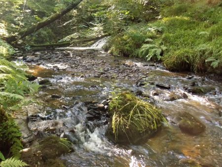
The path enters the Over Hacking Woods and descends steep steps to the River Hodder. Near here are the ruins of bathing sheds used by the boys when swimming in the river in days gone by.

By the little stone bridge over a side stream I notice the base of Woodward’s Cross close to the river.  It is not marked on the modern 1:25,000 map but I later find is shown on the 1894 edition.

The path climbs again and at the top of the steps, I see the Hague’s Cross.

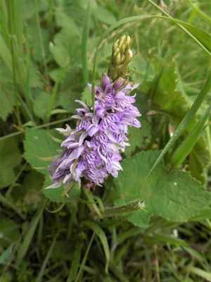
Onwards through the woods with occasional glimpses of the Hodder. I have to pay attention as I’m looking for a side path leading up to Rydding’s Farm, it is not marked but I climb the hillside to a stile on the skyline. A good place to rest with a drink and snack. Whilst perched up here in the field below a man is training his black retriever to fetch. He has some sort of gun that goes off with a loud bang and shoots out a plastic ‘ball’ a considerable distance. The dog had no difficulty retrieving with a few whistle prompts from his master. All this no doubt trying to simulate a shot pheasant.

I now have to climb further towards Kemple End for the next cross. The footpath near the top enters an enclosure but fortunately  I can go round the end of the wall into the field where the Paulinus Cross is found. It is a strange shaped weathered cross sitting in a large base. Legend says that St, Paulinus preached here during his Christian mission to Northern England around 619 – 633 AD. It is certainly a commanding situation with views over the Ribble Valley and further afield.

I was soon on the Old Clitheroe Road which with virtually no traffic was pleasant to walk along on the side of Longridge Fell passing some interesting properties on the way.

On a previous recce to the next cross, I’d ended up in the replanted forest which was extremely difficult to walk through. I’d spotted a short cut across a field avoiding the worst. Tonight the field was full of cows with their calves, I hesitated at the gate but reckoned I could go round the herd without disturbing them. It was only when I was halfway across I spotted the bull in amongst his ladies. I was quickly over the wall into the woods and only 100 yds to the Stonyhurst Park Cross on its hillock. I wouldn’t think anybody has been here since my last visit. Somebody must know something of its history.

My escape track from last time was virtually obliterated by tall bracken and if I hadn’t known it was there I would have had problems. The track appeared and took me out – as far as the ford over the stream, last time I hopped across dry footed but today it was in flood. I spotted a nearby log bridge but that took some nerve and concentration to commit to its slippery surface.

I emerged back onto the bridleway near the distinctive Greengore, a previous hunting lodge.

The little footpath into the woods is easy to miss. The path drops down to that stream again but this time there is a sturdy bridge.

The way now goes past Higher Deer House another reminder of Stonyhursts past, today there were only cattle in the park. Notice the evening light.

This little chap needed a helping hand to escape the grid –

The farm lane brought me onto the road close to my next cross, the prominent Pinfold Cross with its thoughtful inscriptions.

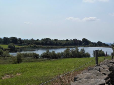
I was on the home leg now, down the lane to Stonyhurst College lakes and up the long drag to the Virgin Mary Statue. At the top I noticed, I think for the first time, Cromwell’s Stone. According to tradition, Cromwell, on the way to the Battle of Preston in 1648 stood on this stone and described the mansion ahead of him as “the finest half-house in England” as at that time the building was incomplete. For more legends and history of Stonyhurst, this site is worth a read –  https://lancashirepast.com/2018/03/11/stonyhurst-hall-and-college/

Cromwell’s Stone.

Hurst Green had returned to its peaceful self when I arrived back at my car about 7pm. I’d had a good 9-mile walk in grand Lancashire countryside, visited 8 crosses and a stone but it was still niggling me that I couldn’t find the listed cross on the green. As I drove away I spotted a lady tidying her rockery adjoining the green. An opportunity I couldn’t miss. Parked up I enquired of her about the cross. She was a little reticent at first but once I’d explained my pilgrimage she volunteered the fact that the cross was inside her neighbour’s garden and no they didn’t want people wandering in. We passed the time of day and as I was about to go she kindly said I could just about see it from her garden. And there was the Grade II Listed Hurst Green Cross hidden behind an Acer, a short cross on a large base.    Can you see it?

*****

*****

OS GRID REFERENCES.

WWI/II Memorial.                       SD 6853 3792

Boer War Memorial.                  SD 6851 3793

Hurst Green Cross.                    SD 6843 3791

Cross Gills Cross.                        SD 6955 3785

Woodward’s Cross base.           SD 6998 3999

Hague’s Cross.                             SD 6988 3998

Paulinus Cross.                            SD 6864 4044

Stonyhurst Park Cross.              SD 6717 3986

Pinfold Cross.                              SD 6825 3980

Cromwell’s Stone.                       SD 6834 3854

Since this post there has appeared Facebook a page researching the history of Hurst Green and Stonyhurst which has well researched information on all these crosses. https://www.facebook.com/hurstgreenandstonyhursthistory/

A BIT OF DUTTON.

Dutton, like Mitton, is a scattered community, a few houses here and there. It is bounded on the south by the River Ribble and stretches high up onto Longridge Fell.

This evening, recently the days have been showery but the evenings sunny, I wanted to explore again the gorge-like Duddel Brook which runs through the middle of Dutton. Since I was last here I have read a little more and found some old maps of the area necessitating another visit to examine the Dutton mill remains. On one map it is labelled as a Bone MIll which suggests to me grinding bones to manufacture bone meal but another source implies a combing mill, comb as in cotton spinning rather than hair care. Perhaps it was both at different periods. Whatever, there is a weir, a mill race or leat, a millpond and a wheelhouse to be discovered.

OS 1892

My path through fields is clear and soon I enter the wooded valley and come across the wheelhouse. Above is a large mill pond partially silted in. From there I can trace a mill race above the stream to a weir where the water was diverted. All very plain to see.

Wheel House

Wheel House.

Wheel pit.

Millpond.

Mill race.

Mill race.

Mill race.

Weir.

Weir and start of the race.

My way onwards up the valley crossed a footbridge and climbed high on the western bank before dropping back down near a waterfall where the water was forded, there were no stepping stones. All very delightful.

Back out in open fields hares dashed away in front of me. I came out onto the main road near the junction with Gallows Lane. One of the ‘slate poems’ that have appeared during lockdown was propped up here.

I crossed the road to a driveway and followed it down past the barking dog at Grindlestone [grind stone] Farm. The track was bordered by an old iron railing usually the sign of an estate boundary. If I had continued I would have come onto the Ribble Way into Hurst Green but I turned off at an unsigned and apparently little used bridleway.

From up here, there were views down to the River Ribble at Sales Wheel. I found it difficult to find the way through the copses but then picked up white markers taking me to the Ribble through Dewhurst Farm with its piles of logs for firewood.

A nice little path through meadows brought me out onto Gallows Lane near those picturesque cottages of Lower Dutton. The origin of the name of the lane possibly goes back to the days when serious miscreants were tried at the town courthouse in the White Bull, Ribchester, and taken to gallows at the upper end of the lane, A sobering thought for maybe stealing a sheep.

*****

The red arrow marks the mill.

THE RIBBLE BETWEEN MITTON AND CLITHEROE.

The clock on the tower of Mitton Church says 4.30. I’m glad I’ve delayed my departure until the sun has come out leaving a beautiful evening for my walk.

I’ve walked the East bank of the Ribble up to Clitheroe several times, it is on the Ribble Way.  I’ve often contemplated walking back down the other side. The problem was there didn’t appear to be a public footpath going south from Edisford Bridge which would mean walking some distance on a busy road.  A closer look at the 1:25,000, however, showed a black dotted field path on that section so maybe there was a way. Time to find out.

Mitton is a rather amorphous district of scattered farms and houses, Great and Little Mitton are separated by the Ribble just north of where the Hodder joins.  Mythe in Old English means the joining of two rivers. The Shireburn family of Stonyhurst were the principal lords.

 All Hallows Church where I parked is in Great Mitton and has C13th origins with a C15th tower. Today it was closed [Covid precautions] so I was unable to visit the interior famous for its Shireburn tombs and wooden artefacts from nearby monasteries. So instead I wandered around the graveyard coming across the sundial dated 1683 and an unusual cross with an ancient C14th rounded head featuring crucifixion carvings. From the graveyard is a lovely view down to the Ribble with proud Pendle Hill in the background.


Neighbouring the church is C16th Great Mitton Hall now smartly renovated with classy gardens visible over the wall. This is not to be confused with Mitton Hall, now a wedding venue, down the road in Little Mitton. The Three Fishes pub opposite the church has been closed for some time now.

I crossed over the Ribble on Mitton Bridge, another classic view of river and hill in heading photo, to reach the temporarily closed Aspinall Arms. This was once a coaching inn known as the Mitton Boat. A ferry boat operated across the River Ribble before the present road bridge was built in the C19th. This was the border between Lancashire and Yorkshire before the reorganisation.

A signed path goes down the side of the inn into fields alongside the River Ribble. There is quite a high banking along here and sand martins were in evidence swooping low over the water ‘chattering’ as they fly past. After a short way, a rather elegant aqueduct crosses the river, the pipes carrying water from Haweswater in the Lakes to Manchester.

A farm road is reached and followed almost to Clitheroe. Taking this photo I managed to get an electric shock from the unseen live wire I was bending over! A calf was brand new in a field and there were new countryside signs on display.

A riverside path continues to Edisford Bridge. It was along here the last time I passed that I had a wonderful view of a Kingfisher. No such luck today as the river is running very fast from all the rain we have endured. The campsite hidden in the trees was packed with people taking advantage of the easing of coronavirus lockdown.

I sat by Edisford Bridge for a drink taking in the scenery. This is a place where there was a ford before the present bridge was constructed, although it goes back to Medieval times. I crossed the bridge and found there was the start of a path going downstream although it wasn’t signed. A muddy section led to a gate into woods, this was now designated a concessionary path so I was confident of a way back.

A long bend of the river was closely followed at the edge of a large meadow. This side of the river was much quieter. A couple of girls were frying some sausages up for a picnic supper in the warm evening sunshine. I met another couple walk in the other way and they assured me of a route back to Mitton. The sand martins were again plentiful. At one point I disturbed a family of mallards which took to the fast-flowing water, I was concerned for the ducklings that seemed to be swept away but they ended up in a calm stretch by the other bank.

Steps led away from the river and a field was crossed signed by large yellow dots. A strange seat carved from a trunk with a couple of Bears was not that comfortable. This brought me onto the Public Footpath having avoided any road walking. Now that was what I would call a sensible concessionary path serving a good purpose and well used.

Stiles led through the lush fields. Looking back there were fine views of Waddington and Newton Fells, all familiar ground. Eventually, a narrow enclosed path brought me out onto the road less than 100 yards from the church.

A very satisfying walk of about 4.5 miles, one I will repeat. Beautiful English countryside and curiosity satisfied.

The clock now read 6.30.

*****

CHIPPING HIGH LANES.

“You deserve a holiday!”  said the email from booking.com.

I’m being bombarded with adverts from holiday organisations desperate for me to spend money with them and fly off in the middle of this pandemic. I’m not fooled by Boris’s assurances of  “air bridges” to avoid quarantine, where is the medical evidence for that? And what may change whilst you are away? The only good outcome of his policy is that the crowds who inundated our beaches will be jumping on planes to take them to the ‘Costas’. They will find the Spanish police know how to administer crowd control with hefty fines and prison sentences.

Anyhow, would you want to sit on the beach with a mask on and then queue for an hour or so for your Sangria?

Homegrown firms [eg Booking.com Airbnb Tripadvisor] are also trying to tempt me away in Britain. I know hotels and B&B’s are in a desperate state but can you imagine how the experience of an otherwise pleasant country house hotel would be at present.

At least some of these firms are advising booking with a cancellation option but even that might not be straight forward, read the small print. Here is Booking.com’s special notice –  For bookings made from 6 April 2020, you should take into account the risk of Coronavirus (COVID-19) and associated government measures. If you don’t book a flexible rate, you may not be entitled to a refund. We advise you to closely follow any travel advice from your local government and health organisations, and we recommend booking a flexible rate with free cancellation, in case your travel plans need to change.

You’ve guessed it I won’t be going anywhere just yet. Probably not this year if the deadly virus is still about. Let’s wait and see, I’ve successfully shielded for nearly 4 months now so I’m sure I can continue. In answer to booking.com’s suggestion that “I need a holiday” – no I don’t, I’ve had one for the length of lockdown so far.

Maybe though I need a change of scenery. but they sensibly won’t let me into Scotland or Wales just yet. The next best thing this afternoon as the sun comes out is to drive 5 miles to Chipping, olde worlde and mentioned in the Domesday Book. I have a walking route planned around the quiet country lanes. I park near the Church of St. Bartholomew opposite The Sun Inn. This is where my story starts

Lizzie was a maid living in the Sun, in the year 1835. She met up with a local lad who claimed the deepest love for her and proposed to her, she gladly accepted, However, two days before the wedding, James told Lizzie he had fallen in love with her friend Elsie and called off their wedding day. He now planned to marry Elsie in the church opposite.

On the day of the wedding  Lizzie went up to the pub attic overlooking the churchyard, she wrote a suicide note, placed a rope around her neck, and died. The note in her fist read “I want to be buried at the entrance to the church so my lover and my best friend will always have to walk past my grave every time they go to church.”

Her grave is situated near the old entrance – 

But the story doesn’t end there. For almost 200 years the ghost of Lizzie has haunted the Sun Inn and the churchyard opposite. Just ask anyone in the village. There is an old yew tree near her grave which has one branch supported by an iron tripod.

Sorry, I became rather distracted there.

My walk leaves the village up the lane towards former water mills which helped Chipping thrive in the early industrial years. None is working now, Kirk Mill has been preserved but is looking rather forlorn. Originally a corn mill, then a cotton mill it ended its life as part of the Berry Chair Works. Its large crane was used to unload timber from the lorries. The cottages surrounding it were still used by workers when I moved into the area in the ’70s. It eventually closed its doors in 2010. Above the main building is the large mill lodge famous nowadays for its ducks.

The narrow lane continues steeply up the hillside passing the site of Tweedy’s Mill, a former foundry and previously a cotton mill. Now there is housing and Proctor’s Cheeses. At one time there were half a dozen water mills on this section of Chipping Brook.

Brief glimpses of the fells appear through the trees. Above Wolfen Mill, an old bobbin mill, I take the lane into the fells. I chase butterflies up the hill and buy some free-range eggs at the stall on Saddle Side farm track.

Red Admiral.

Today I’m not going further into the fells so I turn down a newly tarmacked route to Windy Hills Farm where there is a recent barn conversion, presumably they have paid for the road improvement. At the moment it looks out of place up here but it provides a warm bed for the lambs. Onwards on the familiar track to the extensive sheep rearing Laund Farm with views opening up to Waddington Fell, Pendle Hill and Longridge Fell.  Laund was the ancient word for an open space for deer and I now walk down through it, admiring the mature trees and lush greenery, part of the Leagram Estate. A perfect evening.

Back in Chipping, I walk up to the Sun Inn where the story started.


*****


MY LIMESTONE NATURE RESERVE.

Not far away in Clitheroe are several nature reserves based on old limestone quarries. I have been jealous recently of the walks and discoveries of a fellow blogger in those reserves, especially the sight of a Bee Orchid!

Normally at this time of year I’m out in France at a friend’s house in the Lot area, The garden there and the surrounding countryside have provided me with lots of different orchids and other flora as well as interesting birdlife. Not to be this year.

I’ve not been driving far in lockdown and I keep on exploring places local to Longridge. Just down the road from me limestone comes to the surface in the Vale of Chipping and Whitewell area. Quite possibly the same series as over at Clitheroe when the whole area was under the sea, I’m no geologist. This set me thinking, plenty of time for that, why don’t I investigate further and see what I can discover. Of course, the weather has taken a turn for the worse, but I manage a short initial visit to a nearby limestone quarry.

I have a little book Limekilns and Limeburning Around the Valleys of Hodder and Loud [a snazzy title]

Many farms burnt limestone, the lime being used to improve the land and in building mortar. So small limestone outcrops and kilns are commonplace. Later commercial activity developed [18 -19th century] and the book describes this at Arbour Quarry in Thornley. An early photograph shows a limekiln as a substantial structure within the quarry. Work probably stopped in the early 1900s.

I have vague memories of wandering through this quarry 30-40 years ago and there was a  limekiln in evidence. The book suggests there were two. Time to have another look.

The quarry is fenced off, but a public footpath passes close by. I find a gate and walk in, a couple of roe deer disappear into the distance [a good start]. The quarry floor is a well-grassed over and there are mounds all around. At one end is a large pond with resident ducks. So where do I begin?  I can not see any obvious limekiln, so I decide to wander about and look at the vegetation. Everywhere is very reedy and boggy, not like a limestone quarry at all. There are buttercups, hawkweeds, ragged robins and vetch in profusion, and then I start to notice the orchids on the drier areas.

There are, now obvious to me, Common Spotted Orchids but there are also some paler flowered ones with less distinctive markings. Take a picture and try and identify later. Small Tortoiseshell butterflies were everywhere.

Nothing else dramatic was obvious, my feet were getting wet, black clouds were zooming in – time to go. I had found some orchids but was no wiser as to the Limekilns. I need to do some research on the latter and return tomorrow.

Back home I look at some old OS maps –The limekiln appears to be in the NW corner of the quarry near the entrance. So this afternoon I  return to seek it out. I enter the quarry as before but now as I pass between mounds I look back up to the right and there is masonry. I scramble up and find a few rows of dressed stones which must have formed the top of the kiln as seen in the old picture. The top opening has been filled in.  I cannot find the apex stone depicted in the book, a lot of the stones will have been removed and used elsewhere. There are some remnants of a paved track going up the banking. What a shame this magnificent kiln wasn’t preserved.

I attempt to encircle the quarry looking for the kiln on the far side but end up in some very boggy ground and every mound is grassed over. Anyhow, I’m pleased to have found the main kiln.

I will come back on a dry, sunny day when it is less windy and the butterflies are on the wing. You never know I might find some other species of orchids.


CARR SIDE CATCHUP.

My last post looking at Carr Side Fishing Lakes left an unanswered question which some of you were concerned about. Does the public footpath continue past the lakes?

True to my word I was back there today to find out. Nobody had used the footpath down the field and with all the rain the little beck was overflowing, I managed to get my feet wet trying to jump it. I pushed through the gate as before and this time with jeans on battled through the nettles with indifference. The water’s edge seemed devoid of birds, perhaps they had heard me coming.

The map shows the FP going straight through the lakes, something I wasn’t prepared to do. So I followed the fishermen’s trail to the right past their little wooden hut. There was nobody about. I now came across a couple of green painted waymarks which I had missed before so I knew I was probably OK. Some rough ground was traversed above the first lake before dropping onto the trail around the second lake. Another waymark guided me to the exit gate through the boundary fence and out of the private property.

I was now in a small paddock which led to a conspicuous stile, another swollen stream was difficult to cross but then I could complete a short circular walk with no trouble. I passed the two Carr Side Farms and walked back along the road.

So I have to report there is no obstruction to the FP and in fact it is well waymarked and easy to follow. All the minor difficulties are in the adjoining fields where I ended up with wet feet!

Full marks to Carr Side Fishing Lakes.


Since I was last out the frothy heads of Meadowsweet seems to have come into bloom and there fragrance was noticeable in the hedgerows. I can still smell it now.

WORTH A LOOK – Carr Side Lakes.

When I was up on Longridge Fell the other day I looked down onto the farms and fields of Thornley in the Vale of Chipping. Near Thornley Hall, two lakes in wooded surroundings took my notice and I identified them on the map for further exploration. There seemed to be a public footpath heading to them, in fact going right through them. I’ll call them Carr Side Lakes.

By afternoon today, most of the thundery weather had passed and the sun came out. I debated whether to cycle along but feared a soaking so I drove there and parked in a handy layby. A footpath sign pointed into the field but the stile looked unused. The ponds couldn’t be seen from the road as there was a good tree cover but the backdrop of the Bowland Fells was impressive.   I wandered down, there was no sign of a path whereas most paths have been well walked during the lockdown. I was regretting wearing zip-off shorts when I had to push through a patch of nettles and brambles to reach a gate in a wire fence. There seemed to be a continuous Stalag type fence, was it electrified, encircling the ponds. The gate wasn’t locked but was difficult to open because of lack of use and a heavy counterweight. I looked around for any gun towers and pushed through.

More nettles followed before I emerged onto a decent track encircling the first lake. There was no clue as to where the public footpath went. Waterbirds, coots and waterhens, were swimming away with some loud alarm calls. Dark shapes were swimming just under the surface, I wondered if they were otters. I regretted forgetting my binoculars along with my zip-off trouser legs sat on the kitchen table at home.

On the far side, I could see a fisherman so I strolled around to ask him about the access situation, I definitely felt that I was in the wrong place. He turned out to be friendly and chatty. His set up consisted of a tent with brew facilities, comfy chair and about five rods. He had been here since 4.30 this morning. The ‘otter shapes’ I’d seen were in fact giant carp which he had been trying to catch all day. Last week he had caught a 24lb carp and he proudly showed me the picture on his phone. The fence enclosure was to keep out fish predators as well as the public. He had no idea about the public footpath but suggested I could walk on to the second lake and have a look. I could find no obvious way out although I suspect there should be one as I was able to get in in the first place.

I spent some time watching Canada Geese with their young, I counter 12, floating about the lake. By my feet I find a lonely orchid, the leaves had spots so I think it is a Common Spotted Orchid.Looking back south there above was Longridge Fell from where I’d first spotted these lakes. I retraced my steps and escaped but determined to return not just with binoculars but wearing trousers so I can explore further this delightful place.

It is certainly worth another look.

…IT’S EXERCISE AFTER ALL.

When I pulled my curtains open this morning at about 7am people were already taking their daily exercise. They were the wise ones as the forecast was for the hottest day of the year by this afternoon. I considered, indeed almost succumbed to a quick breakfast and away. But no my daily sloth had me back in bed with the first coffee of the morning. I seem to be getting through vast amounts of ground coffee, there is another delivery expected tomorrow morning.

A second coffee followed as I sorted through my emails etc. A friend living in France has been in severe lockdown but now because of their diligence is allowed out to live more or less normally. He sent me a recent picture of his 3-month scruffy beard.

My enthusiasm for exercise fluctuates with the day, At the weekend I did a couple of decent walks. Yesterday I could not even summon the effort to drive across to East Lancs to climb with my friends – I’m still not convinced about keeping to 2m social isolation on such escapades.

Today would have been lovely up on Parlick and Fairsnape but I haven’t yet got my head around the risk factors of high moorland walking. Last week a group of people I know, local fell runners, had a simple run up Beacon Fell which ended up with a helicopter rescue of one of them. I know I’m becoming paranoid. All the excitement and hullabaloo of opening shops and pubs passes me by. Note that the medical establishment, which the politicians are casting aside, have issued warnings of progressing out of lockdown too rapidly. So I’ll be keeping to my relative shielding and the 2 metres distancing for a few more weeks until I can see we may have turned a corner.

So where do I go today?

Yes, you have guessed it – Longridge Fell. I opt for a simple circuit around the lanes up and down from Longridge onto the western half of the fell.

My enthusiasm increases with every few hundred feet of climbing. I take a keen interest in the flora on the verges. There is virtually no traffic to disturb me. I watch butterflies flitting over the flowers and marvel at the dedication some photographers must have to produce even the simplest of shots. See https://beatingthebounds.wordpress.com/ for an idea of what can be achieved locally.

At the point where the road went left, I decided to carry on and pick up tracks leading to the trig point. By now I was walking freely and could have continued for miles to the east with no way of getting home. As I climbed higher the heather which a week ago was nondescript was beginning to flower. I suspect this summer with all the moisture and now the heat we should have a good display on the fells. There is nothing finer than a purple hillside. Oh and I noticed a few small bilberries beginning to appear – get out the pie-dish.

Ir was only when I was on the summit ridge that I met anybody. A man with two young girls who had been collecting sheep’s wool, the oldest, about 5, suggested her mother could make a sheep out of it which seemed perfectly reasonable. A young man looking for a different way off the fell, no he didn’t have a map. I sent him on his way with precise directions but I had doubts as to his navigational skills. A young couple, new to the area, taking selfies on the edge of the escarpment with Chipping Vale below and the Bowland Fells in the background.

Reaching the car park I was admiring a modern smart fourth-generation Mazda MX 5, [I have a 15-year-old Second Generation convertible.] It turned out to belong to the young couple so we had an extended conversation on a wide variety of topics before they sped off down to Chipping with the wind in their hair.

I was now on my homeward stretch down past the golf course with hazy Longridge ahead. I reached the little reservoir at the top of Longridge where I was on the lookout for grebes which often nest here. Some youngsters had climbed over the wall and were settling into a picnic above the water’s edge, all strictly private water board land. I jokingly admonished them for trespassing and said they didn’t want to be caught there when the water bailiff came around. I’d only walked about 50 yards when round the corner came the Waterboard van which stopped and gave a severe telling off to the youths who slinked away looking rather crestfallen.

By the time I reached home, it was far too hot to contemplate gardening.

Maybe tomorrow I’ll be away with the larks.

*****


BEACON FELL BY THE BACK DOOR.

I knew Beacon Fell car parks would be full on a Saturday. I knew Brock Bottoms car parks would also be full. The Covid-19 crisis is bringing everybody out into the countryside, no doubt the coast as well. Shouldn’t we be encouraged by all these people exercising in the countryside? Well no – the amount of litter I saw today and the inconsiderate and illegal parking problems were distressing and that was on a walk when I tried to avoid the hot spots. I’m becoming more and more disillusioned with the British public the longer this lockdown carries on. Selfish and ignorant people are certainly spoiling it for the rest of us. Rant over – almost.

Having said all that I’ve just enjoyed a lovely evening’s walk without meeting hardly a soul, although I came close.

For a change of scenery, I wanted to visit Beacon Fell. I often walk there and back from home on field paths in a round of 12 miles but today I only had a few hours to spare late in the day. Consulting the map I reckoned I could walk along the Brock River and climb up to the fell without encountering the crowds.

Having parked my car on a quiet lane about 5 miles drive from home I set off at 4pm. The lane dropped me down to the River Brock near the popular car park. There were cars parked all over on double yellow lines as an overflow from the official carpark. The noise from the throngs of people by the river was all-pervading. Picnics, barbecues and drinking was the name of the game, all crammed together on the riverside. I’ve never understood the idea of bringing all your urban trappings into the countryside, but maybe they don’t have gardens or parks at home.

My plan was to walk upstream on little paths by the river and in fields, I never met another person – what a contrast. The Brock was fairly low after the dry weather we have had. I saw a couple of Dippers but otherwise all the birds were anonymous, singing hidden in the trees. The path is good with duckboards over the boggy areas. A solitary cottage is passed well isolated from the virus. Onwards through woods just above the river. An old ford in the Brock is reached at the bottom of Snape Rake Lane, there is a footbridge alongside.  I can remember driving down here once many years ago,  fording the river awkwardly in my landrover to drive up the other side only to find the gate at the top locked. A quick turn around and retreat had me coming back through the difficult ford rather red-faced.  My reckless years. Today I was content to sit and look at the peaceful scene.

Climbing away from the river up the steep lane brought me into the woods high above the river.

I then followed quiet lanes up the northern side of Beacon Fell with improving views of the Bleasdale Hills. In the hedgerows tall Foxgloves, white Bramble flowers and wild Dog Roses were in profusion.

I knew a forest break that cut back right up the slopes of Beacon Fell. After the natural woods alongside the Brock, this appeared sterile and eerily silent.

At the top was the friendly old crocodile carving studded with coins.

I was soon at the trig point without meeting anybody.

Although on the way down towards the car park and cafe people were wandering about. it was here that I started coming across blatant littering less than 100m from bins. Obviously, the culprits expect someone else to come along later and clear it all up. The cafe and toilets remain closed because of the Coronavirus pandemic.

My way off the fell was through the Memorial Forest where you can purchase a plot and a tree as your fitting memory. Another memorial was a field of native trees donated by a former Countryside Ranger, a simple inscribed stone commemorated the gift.

Buzzards were flying above on the evening thermals.

A previously coppiced beech wood was traversed out onto the lane where my car was parked.

Well satisfied with that circuit,

*****


BLEASDALE BELONGS TO ME.

Do you remember those summer evenings after a day in the hills?  The day’s heat floating in the air. The stillness, no wind except for perhaps a gentle breeze wafting some floral scents from below.  The low light is diffused, the summits hazy. Maybe the odd midge or two disturbing your sun flushed face and arms. The stove is purring with the prospect of soup. All is well.

Last night if I closed my eyes I was there.

I was actually in Bleasdale enjoying a stroll around the estate roads. This area is much quieter than Longridge Fell and as I walked through I felt I was the only person on the planet.  It was a perfect evening and I savoured the warm sunshine which brought out those memories of summers past.

It is ironic that this has probably been one of the best few months for backpacking in many years and here we are in lockdown. Still, if I can have Bleasdale to myself  I’m not complaining.

*****