Tag Archives: Long Distance Walks

WAINWRGHTS WAY. 6. HOLME TO HAWES BRIDGE [NATLAND]


A bit of limestone.

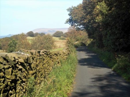
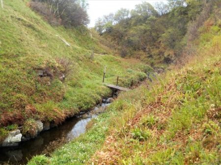
This walk gets better and better. We are lucky today with the weather, sun and heavy showers. We only had a few of the latter, whenever Sir Hugh put his waterproofs on the sun came out. The walk out of Holme was easy along a couple of quiet lanes which brought us to Holme Mills the linen mill I mentioned in my last post. A delightful spot with its mill pond but we had taken the wrong way and were well off course. Rewind back into Holme and we started again, this time picking up the path alongside Holme Beck with a series of squeeze stiles. These iconic stones become a feature of the day linking fields together.

We then had a few flooded fields to negotiate to reach the A6.

Safely across the floods with Farleton in the background.                                         

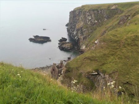
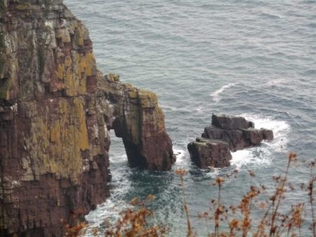
Now little lanes, between occasional characterful cottages, ran parallel to the A6 but in a different time zone. This is limestone country.


We passed the fortified farmstead of Beetham Hall, built to defend the locals from marauding Scots.

A Wainwright. 1975.

Next, we were in Beetham, a little hamlet with a long history from the Doomsday Book. I didn’t know about the village stocks until today but I’ve spent many hours in the village pub, the C17th Wheatsheaf Inn. What made Beetham prosperous was the corn mill dating from the C12th and we passed it on the River Bela.

What followed was a promenade through the parkland of Dallam Tower with its Fallow Deer wandering freely. We exited by a bridge over the River Bela before it slides into the Kent Estuary.

Milnthorpe was bypassed on an enclosed path climbing a little ridge with superb views of the Kent Estuary and the Lakeland fells ahead. Across the way was St. Anthony’s Tower a ‘folly’ erected in 1832 as a memorial to the passing of the Great Reform Act, they did things like that in those days. A folly to remember ‘Brexit’  would be very appropriate – but where would you erect it?

A Wainwright. 1975.

We popped out onto the A6 and walked down the pavement until a lane going right. Paths were followed into Heversham, crossing at one point the disused Furness rail line linking Arnside to the main west coast line at Hindcaster. We passed Dallam school, a well-respected establishment. Lunch was taken on a seat in the churchyard of St. Peter’s. There was an ancient cross [?C8th] in the porch but the inside of the church was uninspiring Victorian, having been ‘restored’ by the Lancaster firm of architects Sharpe, Paley and Austin. They were responsible for a large amount of work on churches and country houses in the north-west.

Avoiding the A6 surprisingly steep paths over little hills gave good views down the Kent Estuary, ahead to Scout Scar above Kendal and distant Kentmere with the HIgh Street range we have to tackle. Eventually, we dropped down to Levens Hall, its topiary hedges hidden behind high walls. I was looking forward to the walk alongside the River Kent in Levens Park as I have passed it so many times without venturing away from the car. It didn’t disappoint. It was a delight. Competing with Dallam Park the path climbed above the winding river through mature trees, Bagot Goats walked past us and Black Fallow Deer sprinted by.

Don’t get in my way.


Leaving the park we had a short stretch on the line of the Lancaster Canal with its incongruous field bridges. We left the canal at the aqueduct and skew bridge in Sedgwick visited on another occasion.

Today we walked down past Sedgwick Hall, the previous home of the Wakefield family, of gunpowder fame, to rejoin the River Kent.

A Wainwright. 1975.

A lane brought us onto its banks at a suspension bridge. The original bridge here was built in 1858 to take workers across the river to the gunpowder works on the west bank [now a caravan site] it was washed away and replaced by the current bridge,1875.

The river could be heard roaring ahead and soon we were above a gorge with great views down to the rushing waters.  The river then had a short peaceful passage before rushing once again under Hawes Bridge, all very exciting and a fitting end to today’s walk.


A Wainwright. 1975          

For videos of the river in spate have a look at Sir Hugh’s http://conradwalks.blogspot.com/2019/10/wainwrights-way-holme-to-crowpark-bridge.html

*****

WAINWRIGHT’S WAY. 5. HORNBY TO HOLME.

Let it rain.

The good weather had to end – it had been raining all night and I was half expecting a ring from Sir Hugh to call off today’s walk. No, not really, he is far more resolute than that. And anyhow it would be drier by late morning, I do miss Dianne Oxberry giving us the NW forecast but there are some interesting successors.


The River Wenning in Hornby was probably running a good two feet higher than when I finished my last walk.

Hornby was short-lived and we were on a lane passing the motte and bailey of  Castle Stede, C10th, somewhat obscured by trees and rain. Down below was our first view of the River Lune which we crossed on the graceful Loyn Bridge. Wainwright sketched thsese in his Lune edition. It was here we left Bowland which has provided some excellent walking in a thankfully relatively unknown backwater.

A Wainwright. 1980.

We splashed our way through soggy fields, struggled over slippy awkward stiles, jumped or waded through little temporary rivers; all the time the rain came steadily down. Everywhere was drowning.  After the Gothic style Storrs Hall a tarmacked lane gave some respite although it was more like a river in parts [damp heading photo]. It climbed over pleasant hills but the views were minimal, vaguely ahead was Hutton Roof an area of limestone outcrops which we regularly climbed on. My camera was safely stashed most of the time.

Unhelpful.

Storrs Hall.

I’d never heard of the River Keer before although I must have crossed it many times by road, rail and canal as it winds its short way onwards through Carnforth to Morecambe Bay. Today it was a raging stream barring our progress but hidden in the trees was a small bridge. Unfortunately, a sign stated it was closed as it had been partially washed away in floods, we had no option but to trust it as we couldn’t have waded the fast-flowing water.  I sent Sir Hugh across first.

Pleased with ourselves for overcoming that problem we were nearly run down by a train whilst crossing the Morecambe to Leeds line.

Oh! and it was still raining into the early afternoon. More importantly, we had just left Lancashire and entered Cumbria, formerly Westmorland. Westmorland was a county of the Lake District until in 1974 it along with Cumberland and bits of Lancashire became Cumbria. Wainwright must have had a soft spot for Westmorland because he brought out an academic book on its history and villages – Westmorland Heritage, 1975, now out of print and expensive second hand.

More ups and downs followed on paths that receive very little usage. Eventually, there was a glimmer of blue sky as we reached a better path on a ridge, it was nearly two before we found somewhere dry to sit and eat a spot of lunch.  Here our topic of conversation turned from Brexit to Sir Hugh’s flask which he was convinced was not his, maybe the top was but certainly not the body. It seemed to pray on his mind as he was still debating it as we started on our way.

My camera had not been used much in the wet weather but now as things cleared we had views of Morecambe Bay, Arnside Knott and the southern Lakes. When I use the term ‘Lakes’ I am really referring to the Lake District and particularly its hills, odd that we use such a  contraction.

The distant ‘Lakes’.

Arriving at a familiar road leading out of Burton up to Hutton Roof, we are less than a mile from the former but WW climbed a wall and took us on a circular tour of the land around Dalton Hall [which we never glimpsed]. There didn’t seem to any logic for this but I suspect Nick Burton is taking us on a voyage of discovery based on AW’s Westmorland book. No complaints, except the extra mile, as the estate was quintessential English parkland of a certain era. A wonderful selection of trees planted way back when.

Dalton Old Hall Farm.

A pair of ‘kissing trees’.

We eventually arrived in Burton-in-Kendal, to give it its full name. People drive, too quickly, through its narrow main street, I’ve probably been guilty of that, but on foot you realise the wealth of architectural buildings in the village. At one time Burton was an important stopping off point on the Lancaster to Kendal carriageway. It became an important corn market in the C17-18 and its wealth is reflected in its houses. The canal and then the railway took all its trade to Kendal and it has not really improved since then. I was sorry to see the Royal Hotel, in the centre next to the market cross, looking closed and derelict, we used to drink a pint or two here after a climbing evening on Hutton Roof or Farlerton.

A Wainwright. 1975.

Our next objective was to join the Lancaster Canal for a mile or so into Holme. We followed a lane signed from when Burton had a station, the mainline trains just fly through now……as does the motorway with Farleton Crag above.

We took to the more sedate towpath of the Lancaster Canal for our final mile into Holme. I have walked this stretch before and the towpath was just as muddy. No boats use this northern section which has been cut off from the rest of the system by the motorway. Below us at one point is Holme Mill with its lake, at one time a flourishing C19 linen mill with flax grown locally. On the other side of the canal are some well-preserved coke ovens.

At bridge 149 we climbed out into Holme which we will have more time to explore on our next stage of WW. Apart from some dampness of my socks I had coped with the day’s rain and floods which had given us an extra perspective to a simple walk.

*****


WAINWRIGHT’S WAY. 4. DUNSOP BRIDGE TO HORNBY.

The heart of Bowland.

I knew this would be a long arduous day so I did it out of sequence in the good weather mid-September. I used devious tactics to complete the walk but I’m happy to write it up as it should be.

Head of Whitendale. A Wainwright. 1981.

Following a coffee at Puddleducks Cafe,  I set off along the lane out of Dunsop Bridge heading into the fells. A gentle stroll, alongside the Dunsop River, leads to the prominent Middle Knoll where the water board roads divide, one going left into the Brennand Valley the other going right into Whitendale. Wainwright’s Way follows the latter but I know a better way.  Cross the river and follow a path up the right bank before climbing into Costy Cough and picking up a level path all the way to Whitendale Farm.

Middle Knoll.

Costy Clough.

Whitendale Farm.

There is lots of interest along this path but today the highlight was seeing a Hen Harrier rising from the valley and fluttering up the fell. This is a rare sight these days as their population over grouse moors has been drastically reduced by foul means. Bowland should have a decent population of Hen Harriers, a book well worth seeking out is Bowland Beth by David Cobham which highlights major issues in UK conservation.

At Whitendale Farm, part of the Duchy of Lancaster, paths go in several directions. WW goes up the valley following the Whitendale River. The dogs in the kennels give you a good send-off. This is shooting country and bred pheasants are everywhere. The grouse shooting this year has been restricted due to the Heather Beetle devastating large areas. It is usually a squelchy route up the valley and today is no different. A few random boardwalks don’t really help but the waymark posts keep one in the right direction. I plod upwards in the heat with the occasional submerged leg.

Side valleys often have Ring Ousels and Dippers but none today.  A post on the Hornby Road beckons and I’m soon sat on a convenient rock for a snack, I could probably sit here for hours before another person appeared.  This old road over Salter Fell has been described as one of the best moorland walks in England. The Romans came this way en route from Manchester to Carlisle and then the packhorses, bringing salt to Lancashire and wool to the coast. The Lancashire Witches were dragged across to Lancaster Court for sentencing and hanging. I’m surprised that WW comes up Whitendale, a difficult route rather than the easier way from Slaidburn, AW was familiar with both. His Bowland Sketchbook from 1981 illustrates the area well and he had a certain respect for relatively unknown Bowland, not much has changed from his time.

I set off along the good track, below on the left is the head of Whitendale and way above the rocks of Wolfhole Crag. All is wild and remote. the track follows the slopes of Salter Fell for a good way before views open up to the west. The infant Roeburn River gradually gains volume running west, To the north Ingleborough and its neighbours stand out, a little hazily in the afternoon sun. The silence is only disturbed by a couple of motorcyclists making the through trip.

Upper Roeburndale.

A lone cyclist comes the other way. The track goes on and on and slowly loses height towards Higher Salter Farm. There are hazy views of the Lakes, Howgills and the Barbon Fells. The last time I was up here was on The Lancashire Witches Walk which at Higher Salter veers off to Littledale and Caton Moor.


Higher Salter Farm.

Higher Salter Farm.  A Wainwright. 1981.

Today I carry on past Middle Salter to Lower Salter where there is a small Methodist chapel. Built in 1901 it will have been a meeting place for the far-flung farms in Roeburndale. It was open so I rested a while in its plain interior.                                                                                                                                                                               Looking back up the Salter Fell Road Mallowdale Pike is prominent, described by AW as “one of the few fells in Bowland with a graceful outline”  It is an outlier of the Clougha Pike/ Ward’s  Stone range. The road drops further to cross the Roeburn, a river of hidden delights. WW follows the road for almost a mile with the bonus of good views to the Northeast but I notice concessionary paths possibly by the river, I haven’t time to explore today but make a mental note to return.

Reaching Back Farm the way goes steeply down into the heavily wooded valley on a path that gets little use. There are signs of occupation: yurts, sheds, coppicing, vegetable plots, orchards between the trees. Looks like an organic environmental settlement but there is nobody about. http://www.middlewoodtrust.co.uk/

A narrow wooden bridge crosses the river into more orchards. There is still no sign of anybody about. I suspect that one of those concessionary paths would bring you here without the road walking. Anyhow, I gain a cart track leading up through the woods and fields to arrive at a small road heading back down to a converted mill. Wray Mill started as a woolen mill but adapted to produce silk, cotton a nd bobbins, it closed in the 1930’s.  Kitten Bridge, nice name, crosses the Roeburn and a little track leads straight into Wray.

This bridge was washed away in the August 1967 floods along with cottages at the lower part of Wray. I’m not sure that I’ve ever been in Wray before, it’s off the beaten track. Anyway, the Main Street off the main road is a pleasant collection of cottages with a homely feel to it. There aren’t many buses so I have to continue a further mile through fields to Hornby. Ingleborough is over my right shoulder all the way and ahead is Hornby Castle, its C13 base obliterated by a C19 Gothic building. I join the River Wenning for the last stretch into the village.

A Wainwright 1980.


Shares
26

WAINWRIGHT’S WAY. 3. LONGRIDGE FELL TO DUNSOP BRIDGE.

Across Chipping Vale.

Here I am back at the trig point on Longridge Fell, it is a beautiful, cold but sunny Autumn day. Sir Hugh has joined the fun and we’ve taken one car to Dunsop Bridge and driven back to park below the fell. I’m sorry we are not keeping to AW’s use of public transport.

A warm-up walk and a catch-up chat soon sees us on the ridge with the compulsory visit to the summit trig. A few people are wandering about up here not wanting to miss the good weather. After a photo session and orientation of distant hills, mainly the Fairsnape ridge, Bowland and the Three Peaks, we find the steep rake dropping down into the Vale of Chipping, spread out below us. Our distant destination of Dunsop Bridge visible in the folds of the fells. This brings us to the road next to the Bradley Hall complex of buildings. WW says to go through the complex but our more modern map says go round the diversion to the left. This is the start of troublesome field navigation for the next mile or so. The waymarks run out, the paths run out, the stiles disappear, the fields get boggier and we are left to our own devices, no fences were damaged, no wires cut when we finally stumbled down a ladder stile onto the road next to Doeford Bridge. I think it took us longer than we realised.

A sign tells us we are entering the Queen’s land which we enjoy for the rest of today

.

This beautiful sandstone bridge spans the Hodder just downstream from where the River Loud joins having come out of Chipping Vale. The bridge is sketched in AW’s Bowland book.

Doeford Bridge. 1981. A Wainwright

There was a good volume of water today after several days of heavy rain. Having crossed another field we dropped down to the Hodder which had looped round a different way.  I wanted to have a look at the stepping stones next to Stakes farm so we made the short diversion, there was no way you could have crossed the river here today. Luckily we found a bench overlooking the river and stopped for lunch.

AW?

Behind us was Stakes Farm an early C17th house with mullioned windows and a plaque in Latin, translation please. Amazingly a brick extension has been built into the angle between the two wings.

We follow fields just above the river. The area between Longridge Fell and the Bowland fells is beautiful and unknown countryside, especially in today’s sunny weather, backed by the dark hills. Across the river used to be a ‘Wild boar park’ but it has closed recently. We cross the road into more fields running above the Whiewell Gorge where the river runs deep in the woods. [It is on the opposite bank that you can find the Fairy Hole caves.] Views into the Bowland Fells surrounding Dunsop Bridge keep us going.

I think we are following one of the aqueducts taking water out of the to industrial Lancashire, the distinctive Waterboard gates accompany us. We drop down past a graveyard and pop out onto the road next to the famous Inn at Whitewell. There is time to have a look into the adjacent Church of St. Michael with its striking stained glass window.  We resisted calling at the inn as time was drifting on and I think once seated it would have been difficult to get going again. A permissive path close to The Hodder leads deeper into Bowland with the next feature sketched by AW – Burholme Bridge.

Above us on the right was the distinctive Birkett Fell scene of one of our recent struggles. Our pace was slowing and instead of the familiar track by the river to Thorneyholme we crossed the pipe bridge, erected by Blackburn Borough Waterboard in 1882. with its unusual turnstile gates at either end. The way along the river was convoluted as we bypassed Root Farm famous for Kettledrum, a Derby winner bred hereabouts. Our arrival into Dunsop Bridge was unfortunately too late to have tea at Puddleducks Cafe.

Dunsop Bridge.   A Wainwright 1981.

We reflected on this wonderful crossing of Chipping Vale, Lancashire at its very best but wondered why 8 miles seemed so far. I was glad I’d divided this stage of WW into two enjoyable days, days to be savoured.

Here is an evening photo of the rake we descended from Longridge Fell early in the day.

Possibly Sir Hugh may have a different view of the day.   http://conradwalks.blogspot.com/

*****

WAINWRIGHT’S WAY. 2. WHALLEY TO LONGRIDGE FELL.

The Ribble at Dinckley.

A Ribble Valley walk of history, graveyards and conversations along the way.

As I wait for a bus to take me to Whalley a lady of a certain age enquires as to my journey, I’m in boots with a rucksack and attached walking poles.  When I tell her of crossing the Ribble at Dinckley Bridge she recollects a time when a ferryman would take you over for a penny. It was like that in AW’s early years when he explored the Ribble Valley north of his home in Blackburn.

My bus deposits me in the middle of busy Whalley at 12.30, I’m a late starter these days. Wainwright’s Way takes me past the ancient parish church, I make a mental note to revisit between 2 and 5 when it is open. I do however make the effort to seek out some Saxon crosses in the churchyard.

I walk past the Abbey grounds which I visited last weekend.   The lane out of town actually goes through the oldest West Gate.  It has an impressive ceiling but is somewhat diminished by the road passing through it. Almost immediately you pass through another arch, that of the railway viaduct, the longest and largest in Lancashire. 48 arches of immaculate brickwork. A functional ‘Old Sol’s Bridge’ crosses the Calder River, built in 1993 to replace the 1909 one of Solomon Longworth, a local mill owner. Backstreets of Billington, old and new, take me out through horsey country to cross the A59 and into a more rural scene. I wander across fields which have the clearest signing and stiles  I’ve come across, an example for other farmers to follow.  Although I’m aiming for Longridge Fell in the distance the view of Pendle behind me is ever present.

I recognise Old Langho Church, built using stones from Whalley Abbey after the dissolution. I take a picture to compare with AW’s Ribble Sketchbook.

A Wainwright. 1980.

I then make the effort to seek out, in a far graveyard, the memorial to 600 who died in the nearby Brockhall Hospital. The tablet is inscribed …

‘In an isolated institution located to the northeast of this stone there lived from 1904 to 1992 a large number of people who were thought to be too strange, too difficult or too challenging to be cared for in their own communities. The institution, in turn, was called Lancashire Inebriates Reformatory (1904) Brockhall Hospital for Mental Defectives (1915) Brockhall Hospital for the Mentally Subnormal (1959) Brockhall Hospital for Mentally Handicapped People (1974) and Brockhall Hospital for People with Learning Disabilities (1991). Although those who lived there carried heavier burdens than most they were part of our common family.

‘Brockhall Hospital closed its doors in 1992 and the land on which it stood was acquired by Gerald Shimon Hitman of Newcastle upon Tyne who raised this stone as a memorial to those who ended their days in the hospital and are buried here. God full of compassion grant perfect rest beneath the shelter of your presence to these your children who have gone to their eternal home. Master of mercy, cover them in the shelter of your wings forever and bind their souls into the gathering of life. It is the Lord who is their heritage. May they be at peace in their place of rest.’

Poignantly, Gerald Hitman, mentioned on the memorial is buried nearby.

I pop into the old Bull Inn for a pint but am dismayed at the internal  ‘improvements’ that have totally destroyed the place. What a shame, another pub ruined, I shan’t be returning.

The footpath now goes alongside a development of ‘luxury lodges’ extending into the open countryside. A lady occupant says that they are holiday lets but that quite a few are permanent homes. How to get around our flimsy planning regulations. Another field ruined.

A steep drop leads to a hidden footbridge over a lively Dinckley Brook. I’ve never been here before. Soon a lane is reached, the line of a Roman Road from Ribchester to Ilkley. At a farm along here, I watch as a golfer practises his drives across the fields, he has spent his life as a dairy farmer and only now has time for leisure pastimes. He too remembers, as a child, the ferry at Dinckley and much more.

At last, I’m on the lane dropping to the Ribble, Longridge Fell is ahead.  Two local ladies on their daily walk are also keen to chat refreshingly about the area until they realise they have to rush for the school pickup.

Dinckley Hall is too far away to observe behind ‘new’ barn conversions but the new shiny bridge is glimpsed below replacing the suspension bridge damaged by floods. The river scenery here is stunning and timeless. [heading photo]

A Wainwright. 1980.

Over the bridge The Ribble Way is joined – an ill-fated long-distance path but with perhaps the best-designed logo The lane up to Hurst Green goes on forever but there is an inn at the top if required. From up here, there is a view back to Whalley NabI had a snack sat on a bench next to a war memorial cross which unusually refers to The Boer War. It is inscribed – This cross commemorates the services of Frederick Sleigh first Earl Roberts K.G.V.C.and his companions in arms the soldiers and sailors of the Empire who fought in the South Africa Campaign 1899-1902.

Opposite on a small roundabout is the WW1/WW2 memorial. Higher in the village are the Shireburn Almshouses, sketched by AW, but when he was wandering this area as a youngster were still up on Longridge Fell. Erected in 1706 but removed and rebuilt in 1946 in the village providing accommodation for Stonyhurst employees. I’ve never discovered why they were high on the fell in the first place.

Hurst Green Almshouses.

A Wainwright. 1980.

Stoneyhurst College is intricately associated with the village and much has been written about it.  Up the road, circumventing the graveyard, The Our Lady Statue looking down the avenue to the College has been restored and is shining bright, I think I preferred it as before. It is not marble but steel painted white. That famous view is also timeless, that’s not me yomping up the road.

My accent of Longridge Fell continued by picking up an old bridleway, a favourite of mine, alongside lively Dean Brook with its old bobbin mills and then past buttressed Greengore, an ancient hunting lodge.

The day was passing and the forecast predicted rain by 5pm.  There has been a lot of change up here with storm and fungus damage to the trees so I used local knowledge to find my own familiar tracks to the summit. The Bowland Hills across the Vale of Chipping were darkening and rain was spreading across the Fylde towards me. I reached my previously stashed cycle and hurtled down to Longridge just in time. I shall regain Wainwright’s Way at the summit trig point when time and weather allow.  Bring on Bowland.

*****

WAINWRIGHT’S WAY. 1. BLACKBURN TO WHALLEY.

Escaping the city.

My train was full of lively pre-match Blackburn supporters. Most didn’t have tickets and exited the station somehow, I was glad I wouldn’t be on their train after the match. AW was a lifelong Rovers supporter.

Outside the station, as I gathered my bearings I was struck by the number of expensive-looking cars, with modified exhausts and booming stereos, cruising around aimlessly at high speeds. I refrain from comment.

I began the long walk up Audley Range. Mills at the lower end near the canal have gone and been replaced by budget shopping units. From the canal upwards AW would have had almost a mile of two-up, two-down terraced housing. There has been demolition in parts giving little cul-de-sac estates. a mosque and many Asian shops but the higher you get the more you are attuned into AW’s time when he trudged up and down from the centre to number 331, his birthplace and where he lived until 1931 when he married. Until 1935 a tram ran halfway up before going to Queen’s Park.

I couldn’t resist calling in at one of the little Asian ‘Sweet Shops’ to buy a couple of samosas for my lunch.

Fittingly there is a plaque on 331 to commemorate Wainwright though I wonder whether any of the Asian population hereabouts will realise the significance. Opposite his house is an open space formerly a brickworks producing the millions of bricks for the housing and mills.

I reached busy roads on the edge of town. Up here AW attended primary schools, now demolished under ring roads and Tescos. I was glad to turn down to the Leeds – Liverpool Canal at Gorse Bridge. The canal would have been lined by warehouses and mills and here is one of the last, the derelict Imperial Mill once employing 300 until closing eventually in 1958. Many of the mills diversified into minor industries after cotton had crashed.

The canalside walk took me past the Whitebirk Estate, shops and car salerooms, and under the maize of roads connecting with the motorway system. One always sees things differently from a canal and then the next time I drive around these roads I’ll reminisce to myself and try and spot the canal. I ate my samosas as I walked the towpath and realised they had quite a kick to them.

Before long I was in a more rural landscape and leaving the canal to climb steeply up onto the ridge of Harwood Moor. An old bridge is crossed, this is the line of the former Blackburn to Padiham railway. The industrial landscape is left behind and suddenly you have a view of Longridge Fell, the Bowland Hills, Yorkshire peaks and Pendle. It was these northern edges of Blackburn that AW  explored as a youngster and subsequently with work colleagues. A certain Harry Green wrote a regular walking column in the newspaper and produced some guidebooks to the area and into the Ribble Valley and Longridge Fell.  One of AW’s walking companions, Lawrence Wolstenholme, kept a diary of Harry Green inspired walks and his descendants still have a copy of Rambles by Highway, Lane and Field Path. H Green 1920. So it is certain that they walked these trails out of Blackburn.

I entered a farmyard patrolled by a bull and hesitated before rushing to the other side and safety. All the fields up here seemed to contain frisky bullocks so I did a little creative road walking to get me on my way. I was soon on a higher ridge with even more extensive views.

Looking back to Blackburn.

Longridge Fell and the distant Bowland Fells.

Down a reedy path to the Dean Clough Reservoirs with Pendle in the background and then I make my own way up above them to come out onto Moor Lane above Langho, it was only last week that I visited The  Lord Nelson Inn here for lunch. Its a very basic but friendly pub with good beer and a limited home-cooked menu,  a couple came in and asked about dining “have you a gluten-free option?”   “No!” was the simple answer.

I didn’t have time today to call in for a pint but marched off along the virtually traffic-free Moor Lane. At one point I glimpsed a deer eyeing me through the trees. Whalley Nab is at the end of the lane directly above Whalley and the River Calder. The River Calder flows through Whalley to join the Ribble, leaving behind its industrial hinterland where in the distance can be seen the Martholme Viaduct which carried the aforementioned Blackburn to Padiham railway. I had a birds-eye view of the Ribble Valley and Whalley, making out the street plan and the more famous railway viaduct over the Clitheroe – Blackburn line I travelled this morning. The Ribble Valley was one of AW’s many sketchbooks done in later life, Nick Burton has illustrated his text with some of these sketches.  It will be interesting to compare AW’s views with my own as I proceed.

A Wainwright 1980

Before I knew it I was crossing the Calder into the busy main street. The impressive 13thC church was closed. Whilst waiting for my bus I had a very short time to look round the Abbey ruins, free entry today – Heritage Week or something. They deserve more so I’ll return for a longer visit.


I’ve finished the first stage of Wainwright’s Way and I’m looking forward to the rural walking to come.

*****

WAINWRIGHT’S WAY – AN INTRODUCTION AND A VIEW OF BLACKBURN’S PAST.

Wainwright’s Way is a 123-mile long-distance route linking the place where he was born, a Victorian terraced house in Audley Range, Blackburn, with his final resting place, by Innominate Tarn on Haystacks in the Lake District.

The walk follows in his footsteps linking his youthful walks, the sights he sketched and wrote about in Lancashire and Westmorland, time in Kendal before entering the Lake District, land of his Pictorial Guides to the Lakeland Fells.

I have obtained a guidebook written by Nick Burton which as well as giving a route description goes into detailed aspects of Wainwright’s life. Nick’s first chapter is devoted to AW’s time in Blackburn and suggests a short tour of the sights that he would have been familiar with. I have already made a ‘pilgrimage’ to his Memorial on the hills above Blackburn and now I’ll explore the town centre.

Wainwright lived in Blackburn from 1907 until  1941. How different the town would have been when he went to school and from the age of 13 worked as a clerk at the Town Hall. Blackburn had been a boomtown based on the cotton industry which was slowly contracting, mills were still dominant and the pollution and noise must have been all invading. Rows and rows of basic housing accomodated the workforce of which many faced poverty in the slumps of the 20s and 30s. The town centre reflected its former glory with buildings of Victorian splendour and daily AW would walk to work at the Town Hall in the centre. So much has changed as Blackburn has been redeveloped but Burton tries to show you a glimpse of AW’s time. There’s not much left. The town seems to have suffered from the bulldozer more than others.

Nick Burton.

The bus station from where he departed for adventures further afield has been moved and the station forecourt ‘modernised’.

The Cathedral stands centre stage, the land around it has become a pleasing open space. There are tombs of past notaries such as the Fielden and Peel families. Queen Victoria’s statue occupies one corner while closer at hand is a modern statue.

Variety theatres have disappeared from hereabouts and the centre is dominated by a large shopping mall cum market. On Darwen Street is the old Post Office now a thriving Wetherspoons.

On a corner is the ornate old Lloyds Bank and then the remains of a Victorian Exchange Arcade. Northgate survives but with a poor selection of shops. Ahead is Gladstone’s statue pointing to King George’s Hall and courts.

Across the way is the impressive terracotta Technical School and behind is the shell of Blakey Moor Higher Elementary School where AW was briefly a pupil in 1919-20 before leaving for a job at the Town Hall.

The Italianate Town Hall is still standing and now connected to a multistorey extension overlooking the statue of W H Hornby a cotton baron who became Mayor in 1857.

Nearby are two other Victorian buildings from AW’s time. The scruffy Cotton Exchange, a cinema in the early 20th century,  and the former Library now a museum.

Georgian Richmond Terrace is mainly legal offices but was built for rich local gentlemen before they moved out to the countryside when the railways came.

James Street retains its cobbles if nothing else.

Alongside St. John’s Church is the earliest church in the town, started in 1789.  Recently run as an arts centre it was gutted by fire earlier this year and looks lost and forlorn. Somewhere in the grounds is a memorial stone to the Thwaites family, local brewers.

Speaking of which their town centre brewery is being demolished since they have moved away. The sight of dray horse waggons a memory. Past the bingo hall, Penny Street has become a large soulless car park next to the new bus station.

Nick Burton suggests a diversion up Old Eanam Road past the old Soho foundry to view a few remaining canalside buildings and wharves. Despite the coming of the railways, there would have still been commercial canal traffic in AW’s time.


In Nick Burton’s book, AW’s sketches from his many books are used to supplement the descriptions. I can find none of Blackburn.

Back to the station and time to escape to the country.


A HISTORICAL FOLLOW-UP – AROUND WADDINGTON.

A comment from Sir Hugh on my last post, – ‘You seem to have an endless supply of walks full of historical interest.’ made me realise that there is so much history embedded in walking the rural ways of Lancashire. I was intrigued by the part played by Henry VI in the War of the Roses and his subsequent hiding out in our part of Lancashire, the internet giving a version of history at your fingertips. Having been in safekeeping at Bolton Hall, Bolton-by-Bowland he escapes to Waddington Hall. Whilst staying here in 1465 he is betrayed and the Yorkist Talbots from Bashall Hall come after him but he manages to escape down secret stairs only to be caught at the Hipping [Stepping] Stones over the Ribble at Brungerley. He ended up in the Tower of London. So there are quite a few places to visit on today’s walk.

When I parked up on the lane at  Backridge there was mist in the Ribble Valley, Pendle was hiding but the castle in Clitheroe was visible. That was where I was heading and a clear path was discernible through the grass so without any thought or effort I’d arrived at Edisford Bridge and its eponymous Inn.

Tucked away behind a hedge is Edisford Hall of which I was previously unaware and today unable to get a good view of. The hall was apparently the site of a leper colony back in the 13thC. More history denied to the majority, the rich and powerful tend to keep their wealth and property hidden. I cannot deny them their privacy though, an ongoing theme in this post.

Edisford Bridge is medieval and the original ribs can be seen under some of the arches. The inscription on the parapet reminds one of the previous boundaries. The surrounding fields were the scene of a vicious battle [they all were] 900 years ago, but today all was tranquil with holidaymakers enjoying the sunshine on the banks of the Ribble.

I always find the route of the Ribble Way difficult to follow through this edge of Clitheroe. There are open spaces [for how long] but nothing is waymarked, then you are passing old cottages before being sucked into a modern housing estate, the likes of Kingfisher Way and Heron Mews.    Out past allotments the river is gained and followed to Brungerley. Last night’s thunderstorms had put more power into the water at a weir. Across from here one could see on the far bank Waddow Hall, idyllically situated above the river. An old house built in Tudor times by the Tempest family but modified by Jacobean additions.

Further on a family were preparing for a roasting and hi jinks in the river just before the bridge – ‘Brits on holiday’. Hottest day of the year?

Brungerley Bridge was built in the early 19th C, It was at the stepping stones here in the past that King Henry VI was captured. A steep stile climbs onto it, now with the obligatory safety rail.

Over the bridge a path is found into the grounds of Waddow Hall, unfortunately it goes round the back of the buildings. Waddow was bought by the Girl Guides Association in 1928 and it keeps its secrets well hidden, but not their exciting climbing tower which I sneaked a blurry picture of, sorry.

Coming out of the grounds a quiet road winds into Waddington 3/4 mile away. I know this village fairly well from eating in the three public houses and wandering around the church. The main street has a stream running down the middle with attractive and well-kept memorial gardens. For a short time in 1990 it became Granada’s “The Television Village” with its own broadcasts from the village hall.

I knew nothing of Waddington Hall, hidden behind high walls in the centre of the village, its origins going back to the 12thC. It was restored in 1901 by the Waddington family. It was here Henry VI attempted to escape from Yorkist followers.

Up the road is a long-standing café with an unusual frontage of metal posts, their famous pies were cooling off in the kitchen window – another time.

The prominent church is unusually dedicated to St. Helen. the tower is the oldest part from 1501. Inside there are some intricate wooden details. Nearby are the village stocks.

But by now the Lower Buck Inn was beckoning, and I succumbed to a pint of the finest Bowland Brewery’s Blonde Ale. They even allowed me to eat my own sandwiches in the beer garden. This is a great traditional village inn run by the same family for years. Try it sometime, even the dogs have their own brew.

Refreshed I found a hidden path, undoubtedly ancient judging by the clapper bridge, leading out of the village and into open fields with views opening up of Pendle, down to the Ribble Valley at Whalley and round to Longridge Fell. I passed in front of the impressive Colthurst Hall for which I can find no information, although there is A King Henry’s Grove nearby on the map.

An old bridleway leaving the road at Braddup House, Whinny Lane, was marked on the map and I decided to follow it up the fell to an area I hadn’t been to for ages. This was at the base of Waddington Fell which I had explored whilst trying to link up paths for my Longridge Skyline Walk, LSW.  It was good to be out in the high country again and I followed that route all the way back to Backridge.

Up here I was surrounded by hills, Waddington Fell, Pendle and Longridge Fell all felt within touching distance, time for a panoramic shot including all three.

On the way back I passed Talbot Bridge with its date stone obliterated by moss and age. 

The house above the bridge was originally a pub, The Woolpack giving an idea of the passing trade. Next door a Swiss-like house has appeared since my last visit, very twee.

My next point of call was the more graceful Saddle Bridge, 17thC but rebuilt last century, over Bashall Beck which has come down from Talbot Bridge. This packhorse bridge is also known as Fairy Bridge from a local legend.

Soon I was on a familiar track passing the intriguing Bashall Hall. This extensive building dates from the 16thC but has had many changes since in different stiles. It hides behind high garden walls but I managed a few more views today.  

It was from this house that the Talbots set out to capture King Henry VI. So I’ve come full circle on what has been an outstanding walk for historical interest and the best Lancashire scenery.

*****

JOHN O’GROATS TRAIL. Reflections.

Inverness to John O’Groats – 147 miles of coastal walking.

A trail of two halves, not just the way I did it but geographically also. The first half to Helmsdale is rural walking often along the shoreline whereas the northern half is rugged cliff top walking. Over the years many LEJOG walkers have ended up walking the dreaded A9 to finish their Odyssey which must be an anti-climax. Local walkers, Caithness Waybaggers, started looking at a coastal route away from the road and an American Jay Wilson who’d settled in the area became enthused by the idea. In 2016 a charity was established to promote the walk – Friends of the John O’Groats Trail and they have their own website http://www.jogt.org.uk/

Volunteers have worked hard on researching and way-marking a route, with more funding stiles and bridges have started to appear and the route is getting publicity and more people are walking it.  A ranger, Jim Bunting, has been appointed with funding for a year which will help push things forward.

I first became aware of the route last year when I was planning a week’s walking to help complete my own personal LEJOG walk which I’d been doing for over 50years without realising it. I’d recently finished off gaps down in the west country and was left with the way north of Inverness. So last summer I set off from Inverness with the main idea of staying off the A9, it was only when on the way that I fell into step with the JO’GTRAIL. Waymarks were rare but the walking was easy, mainly on small lanes and tracks with lots along the low coastline – lovely sandy beaches which could be used at low tides for easy walking and a quick swim when needed. Seals were constant companions along the coast. There was a bed at the end of every stage. I was enthused.

Fast forward almost a year, interrupted by illness, and I’m back on the trail. This time I have a  Harveys Map which I hardly used – too small a scale for my eyes, but more importantly a draft guide from the powers that be. This was a work of art, Wainwright style, which will hopefully come to publication. [I’ve donated to the cause for the use of it and whatever else]  I worry about commercial intrusions from the likes of Cicerone. The volunteers who have put so much into the route deserve their guide to be definitive.

A lot changed in a year and waymarking is coming on a treat. They have adopted an octagonal emblem reflecting the octagonal house of the legendary  Jan de Groot  and his brothers, Dutchmen of the 15th century who plied a ferry from the Scottish mainland to Orkney, Their house was one room, with eight windows and eight doors, to admit eight members of the family; the heads of different branches of it, to prevent their quarrels at the table.

This northern half of the trail is ‘not for the inexperienced’ as is the mantra – a trail in progress.

Despite the main road being within a few miles inland you feel very isolated on the cliffs. Many fences have to be climbed without stiles as yet, lots of barbed wire to rip your best Gortex pants to bits. Depending on which side of the fence you find yourself there are the dangers of frisky risky cattle or crumbling cliff edges.

Crossing rivers can be a challenge depending on rainfall and tides. I was impressed by some of the bridge-building that has recently taken place. I was also impressed by the depth of fast-flowing water on other unbridgeable burns. Take care!

Despite all that this trail is an experience not to be missed. The geology is amazing, the birdlife incredible, the flora unique, whales and dolphins common sights, historical sites around every headland, the local population welcoming. The geos [sea inlets] are outstanding even if they seem to double the distance of each day’s walk. The little simple harbours, most long ago abandoned, are evocative of the herring fishing industry of the 18/20th centuries. A novel by Neil M Gunn, a native of Dunbeath, The Silver Darlings refers to the sight of the masses of fish visible to clifftop watchers. As the shoals were spotted small boats would be launched from the harbours to maximise the haul.

What more do you want?

I can foresee that once established and trodden [the summer bracken growth is a problem] this will become one of the most sought after challenging walks in Britain. I’m glad I walked it in its infancy for the adventure it provided.

Enjoy.

Now, what about JOG to Cape Wrath?


JOHN O’GROATS TRAIL – 14B. Nybster to John O’Groats.

Journey’s end?

The same bus driver picked me up this morning as had transported me back yesterday, he was keen to know where I was heading today. By the time he dropped me off at Nybster we were on first name terms, they’re a friendly lot up here.

Walking down to the small harbour the weather was awful, maybe I’d misjudged the forecast. Anyhow I was on my way. There were a couple of geo’s and the odd sea stack for starters though the rain was getting on the camera lens.

Ahead in the mist were some castle ruins on a headland. Bucholie Castle dates from a 12th-century Norse nobleman but what remains today is from a 15th-century rebuild.

By now the rain had thankfully stopped but the wind remained strong.

Lovely open walking around Ness Head brought Freswick Bay into view. On a sea stack fulmars were kings of their castle. The other house/tower/castle call it what you like has Norse origins which are normal in Caithness. I was able to wade a stream, have lunch and then walk leisurely across the beach towards Skirza Head.

A diversion sign took me on minor roads to avoid some clifftop properties although I was tempted to go direct. Maybe access negotiations are delicate so I didn’t want to inflame matters. At least I didn’t end up in the field with this chap.

I arrived back on the coast at a small harbour.

Rough and dramatic walking along the cliffs covered in Sea Thrift, it seemed to take me an age to get around Skirza Head and a couple of geos. There were lots of seabirds on the cliffs with guillemots doing their best penguin impersonations.

Ravens meanwhile were doing their best acrobatic displays, I wonder if they are responsible for this egg stealing. More likely to be Herring Gulls.

Yet more dramatic clifftop walking with my first distant view of Duncansby Head and its stacks.

Then I was peering down into the largest geo I’d seen, Wife Geo. A complicated chasm with stacks and caves within its depths.

Open boggy moorland lay ahead and then the impressive Stacks of Duncansby held my attention for some time. I came round Duncansby Head below the lighthouse and joined the masses milling about in a car park. Some were whale watching.  Stroma, Hoy and South Ronaldsay were just visible in the mist.

I left the road as quick as I’d joined it and took a bearing across the open moor to the Bay of Sannick, I was the only person on its beach. A bit of scrambling around the headland, Ness of Duncansby, and I was on a made gravel path heading straight to the circus of John O’Groats.

A couple from the Wirral took my picture at the appropriate signs, I bought a postcard for my old walking buddy Mel who is now on kidney dialysis. I enquired without joy at the TI office about bus times, had a coffee from the kiosk who gave me the correct bus times – one in 5 minutes.

I’m now in Thurso for the evening before a long train journey home tomorrow and reflections on my journey.

*****

JOHN O’GROATS TRAIL – 14A. Keiss to Nybster.

An historic episode.

No not me reaching  J O’Groats – but a short walk past some historic sites.

I woke early. uneasy about the weather. The forecast had been dire with heavy rain and strong winds and looking out of my window that’s just how it was. I wanted to enjoy Duncansbury Head and my arrival at JO’Groats so some quick decision making came into action at breakfast.

“May I stay an extra night here?”   –   “No problem”

“May I change my reservation with you to tomorrow night?”   –   “No problem”

“What are the bus times?”   –   ” ??? ”

Decision made, between mouthfuls of Muesli.  I would do a short walk and hopefully catch a bus back and hope tomorrow is better.

There was nobody out on the coast this morning, not that I’ve met many people all week. Just after the small harbour of Keiss there was a Broch. The information board suggested that it had been of some importance in the Middle Iron Age.  I was unimpressed by the pile of stones.

So onwards passing WW2 pillboxes to a prominent castle built in the late 16th century by the Sinclair clan [them again]. When it fell into disrepair they built a new one nearby.

The cliffs are low now and the rock strata giving horizontal beds exposed at low tide. The path ran outside fields and one enthusiastic sheepdog ran alongside protecting his patch, I was hoping the fence was intact.

By now I was soaked and suddenly realised I’d dropped my camera somewhere so it was back about a mile to eventually find it near a stile I’d had difficulty negotiating. At one point I was obviously on the wrong side of the fence when I had to balance along the top of a slippery wall hanging on to the barbed wire. Everything’s getting wetter and wetter including my camera.

A few interesting geos were passed as usual.

Then the larger Nybster Broch appeared, here one could clearly see the circular structures. Nearby was an impressive monument to Sir Francis Tress who had excavated the site in the 1890s. There were a couple of other monuments nearby, for what reason I don’t know.

I was cold and wet but soon on a bus back to the comfort of my hotel. A drink in the bar at lunchtime was entertaining listening to the locals, though every other Scottish word seems to begin with an F.

Well rested for tomorrow.

*****

PS. Just noticed on the JOGT facebook page for today – I think I made the right choice.

JOHN O’GROATS TRAIL – 13. Wick to Keiss.

A dreich day on Sinclair Bay.

Not so many photos today, it rained.

Near my b&b in the old part by the harbour was a building  – Telford House, further research shows that the famous engineer and architect Thomas Telford designed the area, Lower Pulteneytown, and harbour which allowed the herring industry to flourish from the beginning of the 19th century.

Wick is also in the Guinness Book of Records for having the shortest street in the world. Ebenezer Place is just 6ft 9in long. The street is one end of the Mackays Hotel built in 1883 by Alexander Sinclair who returned to Scotland having made his fortune in America.

Nonetheless I can’t say I was sorry to leave Wick, maybe I’m being harsh.

In view of the weather I had thought of taking a short cut on roads to Ackergill but the guide suggested it would be a shame to miss Noss Head and Castle Sinclair.

The forecast was for rain all day but as I walked along to Staxigoe it was the wind causing discomfort rather than the light drizzle. I used the shelter of a bus stop to weatherproof myself for the rest of the day. The little harbour at Staxigoe had all the usual features of an old herring port but there was also an unusual barometer pole from 1850 to help the fishermen gauge the conditions at sea, fairly bleak today.


Walking on the road led to Noss Farm, the guide mentions a sign ‘Walkers Welcome’,  it’s covered over – I wonder what happened? Some pleasant cliff walking followed, although the cliffs are much lower the scenery is still very dramatic. Grey seals lazed on the flat rocks and in the bay their heads were bobbing above the waves. A couple of geos were passed with small flat sea stacks.

The way towards the lighthouse was across marshy ground with several varieties of orchids growing. No idea what they are.The lighthouse is still operational and has its own letterbox with a quirky sign, where else would you find this – must be a lovely community around here.

When I saw Castle Sinclair Girnigoe ahead the longer route was vindicated. An impressive and evocative structure in a stunning setting. It has a long and varied history as is common with these Scottish outposts. The powerful Sinclair family were residents from the early 14th century to the mid 17th century. By now the wind was bringing in heavy showers so it was head down across the fields to Ackergill Haven. Up the lane was a scattering of houses and what looked like a village hall, wondering about some shelter I approached the open door to find an active gym with people doing their stuff. It seemed incongruous out in this remote place.


Round the back the route was signed into a field containing inquisitive, nervous and sturdy cattle, I crept around an adjacent field.

I think these are whale bones, on a wall…

There was a private driveway leading to Ackergill Tower, a stately looking building possibly a shooting lodge, surrounded by high walls. I found a relatively sheltered corner with a picnic table, perfect for lunch.

At this stage I was still relatively dry but once out of the shelter of the estate buildings the way went onto exposed sand dunes. Ahead in the mist was a golf clubhouse and I had visions of hot coffee, alas all was locked – no golf today.

Pushing on I was able to avoid the taxing ups and downs of the sand dunes and walk along the beach, it was a long beach. The birdlife was different, waders at the water’s edge and terns flying overhead.

I came to the crossing of the River Wester and realised how deep and fast flowing it was on the beach made worse because of high tide. I was prepared to bypass it all together until a little inland the water was wider and I paddled across, I was already soaked anyhow.

The next obstacle was the railway for launching pipelines into the sea.

At Keiss there is a small sheltered harbour and beyond it I could just make out Noss Head back across Sinclair Bay. One can imagine the relief of those fishermen when they returned from stormy seas to harbour. There is not much else here.

Appropriately my lodging is the Sinclair Bay Hotel, cosy and warm with some decent food and ale. The forecast for tomorrow looks grim. Sweat dreams.

*****

JOHN O’GROATS TRAIL – 12. Whaligoe to Wick.

There’s no rush – too much to see.

I slept in. A relaxed breakfast followed so I didn’t set off till after 10am. There was no rush as it was drizzling slightly, I’d only gone a few fields when I saw a sign for Puffins. Sure enough on a small cliff near the path the little birds were arriving prior to nesting. I made my way along the narrow ledge to relish the experience. Along came the farmer who’d seen my approach, not to admonish me but to engage in good old honest chat. He had an interesting history and was full of information about the locality. Further up the trail as I walked inland he reappeared to take a picture for the JOGTrail Facebook page.

The next few hours were a delight on a mainly good path alongside the continually interesting coastline. Lots of large Geo’s to get round, sea stacks galore and the prolific bird life.

Ellen’s Geo.

Stack of Ulbster.

Sarclet Haven

Riera Geo

Riera Geo

At the massive Broad Geo I met a party coming southwards and found that their leader was no other than Jim, the new path warden, more conversation followed. This was a great spot for bird watching – I told you there was too much to see.

Mainly guillemots.

Razorbills

Broad Geo

A little further on and along comes the highest sea arch in Britain, the Needle’s Eye at the head of Ashy Geo.Off shore are a couple of hundred new wind turbines, I could just make them out.

I became lost once or twice on the broader, lower fenced areas, beware of your best waterproof trousers on the barbed wire fences.

The cliffs now are much lower but still show a diversity of geo’s, stacks and caves.

By the time I arrrived at Old Wick Castle my enthusiasm was waning.  It is one of the oldest castles in Scotland, though originally built in the early 12th century by Norse kings who then ruled Caithness, it was well situated between defensive geos.

Minor roads through industrial areas, probably most connected to off-shore work. The harbour was busy, you can catch a boat to the Orkneys from here.

My simple b and b by the harbour had the steepest stairs up to the second floor, no pity on the weary.

Wick town centre was a little run down, but I managed to find a cheerful Italian for supper.

Accommodation – Harbour Guest House, 6 Rose Street.

*****

Out of interest here is the elevation profile for the day –

JOHN O’GROATS TRAIL – 11. Lybster to Whaligoe Steps.

Stacks of stacks.

For this section the guide keeps mentioning to look back at the views – so I often did. A reminder that if the sea is on the right in my photos I’m heading North, if on the left I’m looking South.

Halfway through breakfast my landlady was called away by a friend who’s car had broken down, leaving me to fend for myself. On her return we put the world to rights so I didn’t leave till after 10.30 with a gift of two hardboiled eggs in my pocket. I walked down that main street like John Wayne, everyone stayed indoors.

The first stile just out of the village seemed to have been appropriated from a swimming pool. After crossing a small burn I was on the cliffs using a tortuous path, more of a narrow sheep trod. I realised that keeping within the narrow line made me walk like a catwalk model. The day was just clearing and the views opening up.

In the first large geo [sea inlet] was an abandoned building presumably related to the herring trade of the 18/19 centuries. The first of several small harbours and geos which all involved a considerable inland detour and descent/ascent to cross streams.


A disturbing sight alongside the fence was a tip of some farmer’s rubbish, where does he think it will go?

Once round White Head a stream had to be crossed between pretty waterfalls.

Back on the cliff top the roller coaster ride continued with lots of stacks and arches along the way. One of the finest stacks had a stone cairn on its summit implying an ascent in the past. Everywhere were birds mainly fulmars, kitiwakes, razorbills, guillemots and shags.

The long abandoned Clyth Harbour was a delight.

Back on slightly lower cliffs the path was easier to follow towards a disused lighthouse and it was here I saw a pair of Orcas, actually I heard their blowing first and then watched them swimming away only surfacing occasionally. Along this stretch were several skerries, low rocks off the coast, The rock strata here is much more horizontal ideal for drying cormorants and a diving shag.

Past the lighthouse I found a lunchtime stone, enjoyed the sun and watched the birds flying by.

Line Geo was spectacular and the cliff edge path getting round it equally so. The cliff ledges are home to thousands of birds, the noise is deafening in some of the geos. Kittiwakes, razorbills and guillemots.

Halberry Head was my next objective.

The massive Stack of Mid Clyth. big enough to be called a dependancy, is in fact a giant sea arch.


Another hairy crossing of a large geo on a narrow track. More sea stacks and and caves followed. This is possibly the best days walking so far and I was enjoyingmyself. More was to come in the next mile with Long Gate Geo showing outstanding hidden depths.

After that I was lost in gorse bushes and dropped too low down the cliff slope. My first attempt of climbing back up through the inpenetrable gorse led to retreat and a further detour that left me scrambling up the very edge of the deep Red Geo. I thakfully came out close to the A99 road. The final few fields seemed awkward, one final geo and I was glad to see ahead my lodgings for tonight. The famous Whaligoe Steps Cafe, though it looked uninspiring from the outside. The weather was just closing in as I arrived, I can’t believe I’ve only walked 7 miles, a lot has happened.

I was made very welcome by John and Edna and their two Highland Terriers, an Aswam tea revived me sufficiently to go down the 300+ Whaligoe steps to the original herring harbour in the geo. It was a quiet low tide and all was tranquility. I sat and was able to watch some of the birds at close quarters.

Fulmar.

Shag

Razorbills

Climbing back up those steps I thought of the women carrying baskets of herrings to the store which is now the cafe.

I dined well on authentic Ramen noodles.

*****


JOHN O’GROATS TRAIL – 10. Dunbeath to Lybster.

Close to the edge.

Harbour to harbour.

I awoke early and looked out onto the camping site, the backpacking lady had broken camp and was well on the way, never to be seen again. The eclectic international selection of camping vans were asleep.

The sea mist was in as I left the B and B and wandered down to the little harbour.   In a shed there was a restored fishing craft used in these parts in the 18 – 19th centuries, the heyday of the herring fishing industry. Old pictures showed the harbours on this coast packed with these vessels. I can’t imagine going out to rough seas in one of these small boats.  Further along was an old ice house for storing the fish.

The day’s climbing began up onto the first headland, the cliffs along this stretch were rugged and varied with sea stacks and arches. The path was close, often too close, to the edge giving spectacular views down. The walking was easier than the last two days and I made good progress with time to stare.

Further along where the path moved into inland fields the guide suggested walking on the road to avoid cattle. I was only too pleased to conform as I don’t like meeting bulls. The A9 was surprisingly quiet and I walked on for maybe half a mile then realised I was cut off from the coastal path by a high deer fence which took some precarious manoevers to overcome. I crossed a field towards the coast passing perhaps some ancient stones only to find myself up against another deer fence.

My climbing technique had improved and I was soon back on route on a much gentler, lower cliff top still with lovely inlets and stacks. The weather was improving and the sun had burnt back the mist.

I was now approaching Latheronwheel harbour and a few more walkers were out. A track lead down and over a surprisingly sturdy bridge onto the road which climbed towards the village. I took off at a bend to regain the headland with more sea stacks.

The next stretch of cliffs were grassy and apparently home to puffins but perhaps they haven’t arrived yet. There was a lengthy diversion inland to get over the deep Burn of Latheron.

Back on the open cliff tops there was a strange stone structure, not marked on the map,  perhaps a beacon or lookout.  I had a rest and snack on Robbery Head taking in the views up the coast and watching the birdlife. Looking back at the cliffs there were some amazing foldings in the rocks. There’s certainly plenty to see on this walk.

Robbery Head.

The day was moving on and there were still more ups and downs ahead. The next down was over the Forse Burn and then up to a headland with the precarious looking remains of the medieval Forse Castle. It reminded me of that game where you remove a brick without it all falling down – Jenga.  Below was a beach with a ruined building, presumably related to the herring fishing.  I was tempted to drop down to investigate when I met a mother with two lads who were going down using a fixed rope, it all looked very exciting.

There was an even steeper drop into the Achsinegar valley. Down here just above the sea were the extensive and evocative ruins of a herring processing station from 1810.

Rough ground followed below Swiney Hill. I found a seat and fine viewpoint above Lybster bay. Then soon I was above Lybster harbour, the last of the day, as a little boat came in probably from visiting lobster pots.

The main street of Lybster is far wider than most towns, nobody seems to know why.

A shop next to my friendly b and b provided supper. I’ve just found my first tick despite being extra cautious.

Accommodation – Bolton House B & B  Main St Lybster

*****

JOHN O’GROATS TRAIL – 9. Berriedale to Dunbeath.

Misty clifftop walking – but lots to see.

The excellent weather of yesterday couldn’t last and I spent most of today in drizzle, not that it mattered much as I was looking below at the cliffs and all the birdlife.

Yesterday’s bus driver welcomed me aboard for the short trip back to Berriedale,I was the only one alighting.  I avoided the temptation of the cafe and made my way down to the harbour, I don’t think many boats tie up here.  A bouncy suspension bridge crosses over to a row of cottages above the rocky bay. Proper ornithologists have their telescopes trained on the conveniently placed cliffs, I spot kittiwakes through my pocket binoculars but fulmars are also pointed out to me. The waves are crashing into the shingle beach.

A green path heads up towards a small cemetery but there I become lost in earthworks for another straightening of the A9, as if it is not fast enough already. My frustration is tempered with good views back down to the harbour. A bit of bashing through gorse soon has me back on track but on the wrong side of a fence which can create a problem.

Once on the clifftop I kept mostly outside of fences and walls – this was proper cliff walking  – right on the edge. A good head for heights is useful in some places and I wouldn’t like to be here in a gale.

The Bluebells are late flowering up here and they give a colourful show with Pink Campions and Greater Stitchwort

In rough land there was someone’s private bird hide, I imagined the owners bragging at a cocktail party “oh we have our own private hide  – don’t you?”   It did have a fantastic view though.  A little further just entering some trees was a box containing a signing-in book for the trail, only about 25 had done so this year.

Ahead the headlands were all a bit vague in the murk but here was my first sea arch.

Through a high cliff the Allt na Buaidhe stream tumbles in a spectacular waterfall, it was a bit short of water today.

I worked my way round to the valley of the stream where there was a new footbridge to cross. Strangely a path had been strimmed to the very edge of the falls, a every dangerous spot, Samaritans help number needed, but good views back to that small sea arch. You would have to lie on your stomach to look over at the waterfall – I didn’t.

The path to nowhere…

Moving on I was getting ready for lunch and spotted a stone bench, this turned out to be the perfect viewpoint for watching the birds on the An Dun headland and it’s massive arch.

I dont think I’ve ever seen so many birds, literally thousands on every ledge available. Mainly Guillemots and Razorbills. The latter are distinctive closeup.

The Kittiwakes and Fulmars tended to stay aloof.

After all that excitement in the next bay was The Cleft sea stack, it remained in sight for some time.

The going became difficult in long rough grass with only faint sheep trods to follow. However a group of sheep startled by me proceeded ahead creating a path as they went – a good idea for helping open up the trail.

Another stack appeared as I traversed high above the sea.

Diversions inland around Dunbeath Castle weren’t too bad how does this fit with the so called Scottish right to roam?

The gates to Dunbeath Castle are not overly friendly to walkers, a lot of these estates have been bought by rich foreigners who would like to keep the likes of us off the land. I didn’t get the feeling that there was much opposition to this denial of the right  to walk wherever as allowed by Scottish law. Maybe time for a mass tresspass.

The old A9 entered the scattered community that is Dunbeath, everywhere was shut.

An old path goes down to the Dunbeath harbour from where there is have a steep climb to my B and B.

That felt like a long short day.

Accommodation – Inver Park House B & B

*****


JOHN O’GROATS TRAIL – 8. Helmsdale to Berriedale.

Baptism of fire.

As soon as I was on my way this morning the familiar sounds and smells of the coast came flooding back. I was glad to be here though this is supposed to be the most arduous day of the whole trail.

A gentle stroll along from the harbour, just above the beach, and then at a ruin a sudden dog leg climb towards Navidale, a few houses and a cemetery. For the rest of the day I was well above the sea but it was ever-present. The Ord of Caithness was prominent ahead, I am in Caithness for the rest of the trail.

The most notable detail throughout today’s walk was the gorse, I have never seen it so brightly coloured before and in places I became heady with its coconut fragrance.

Easy walking through rough fields was tempered by the lack of waymaking on this stretch. Apparently some landowners don’t want markings but you are still free to walk across their land in Scottish Law. There were a few small burns to cross and then indistinct trods climbed gorse slopes to meet a more distinct track heading back down again. You could easily get lost hereabouts. Somewhere along here a couple of WW2 lookout huts were passed and waymark posts appeared. The Ord burn was easily crossed and then height gained steeply into the moorland of Ord of Caithness. Fairly random trails across damp moorland were followed almost to the A9 road and yet I felt a long way from civilisation.

The sounds of the sea were still prominent despite being well above it. Below was the green table, a flat promontory and site of an ancient fort. A secluded bay to its north gave an idea of the birdlife to come.

The green table.

Shags or comorants?

The ground became boggier but as there has been little rain in the last two weeks it was pleasant to walk on rather than troublesome.  A burn was followed gently downhill past ruined buildings from the 19th century and a recognisable broch from the iron age with its chambered entrances.

Over the next steep stile the ground dropped away alarmingly into the deep ravine of Ousdale Burn. Attempts are in progress at building wooden steps but for now I was grateful for the trees I could swing off [opening photo]. Eventually down the burn was no problem as a bridge has been recently erected, there is a surprisingly large amount of new infrastructure appearing. I must make a donation to the charity responsible, I suspect a lot is a labour of love.

Of course it was steep up the other side of the ravine.

One came closer to the sea and seabirds were flying everywhere whereas before it was mainly smaller birds amongst the gorse.

Sheep trods weaved over the headland between the gorse bushes, a tough section. Then there were the ruined buildings of Badbea and there in front was the monument to honour the tough families forced off the land in exchange for more profitable sheep. Life at Badbea would have been harsh, many residents emigrated in search of a better life and the memorial commemorates many of them. A good spot for some lunch. Having seen nobody all day suddenly people started appearing from nowhere, well actually the close-by A9, all attracted by the ‘clearance village’ signs.

Through the gorse there was much bird song and I managed to capture a photo of a Brambling on the monument itself.

Easy walking on heathery tracks continued over the headlands, if not quite on the edge of the cliffs close enough to hear and see more seabirds. Inland were the Caithness hills with the conical peak of Morven, at 706m the highest, in the background.

Two towers, navigational aids from the 19th Century were useful markers today. They were aligned for approaching Berriedale harbour and used to carry lights, the Duke of Portland’s Candlesticks.

More headlands appeared ahead but I’d done enough for today. The harbour of Berriedale was below and dropping down to the A9 I headed for the renowned River Bothy tearooms for tea and cake whilst waiting for a bus to take me to my B and B in the scattered village of Dunbeath.

Its been a long day and fortunately I didn’t go far astray in sometimes difficult terrain. A good start to my week and not as arduous as I was expecting mainly because the bracken has only just unfurled, wait till it’s head high.

Accommodation – Inver Park House B & B

*****


JOHN O’GROATS TRAIL. [Episode 2] Helmsdale to John O’Groats – a continuation.

Stacks of Duncansby, copyright Ken Crossan

Last summer I had a week walking up the coast from Inverness to Helmsdale on what is to be the John O’Groats Trail.   http://www.jogt.org.uk/

This was the penulitmate section of my 50 odd years linking Lands End to John O’Goats on foot.

I realised the trail was in the process of being developed by a gang of volunteers and I had little information. Most of the time I was able to walk at my will on beaches and minor roads in the general south to north direction. Occasionally I came across white  waymarks and stiles showing the proposed route.

This year I’ve been able to glean more information and have a download of the draft guide book as well as an optimistic Harveys Map of the route.

For this next part of the trail there are warnings of difficult walking over rough pathless ground, awkward or non existent stiles [take thick gardening gloves to negotiate the barbed wire], ticks and cattle, high summer vegetation [carry a sickle],dangerous river crossings  but also dramatic cliff tops, sea arches and stacks, abundant bird life, historic harbours and welcoming villages.

Can’t wait to get started.

I’ve a train ticket to Helmsdale, a 10hr journey, where I’m booked into the friendly Belgrave Arms. The forecast is good . It’s time to complete the trail.

There was some excitement at Perth where it was lassies day at the races.

As I passed through the highlands I couldn’t help but notice how what had been pony tracks were now harsh landrover highways. On reflection it must be 20 years since I’ve climbed a Munro.

After Inverness the train followed part of the coast I walked last year and I even spotted a backpacker heading north . I’m now waiting for my meal in the hotel with gorgeous evening light across the bay. I can’t help but notice the gorse covered hills looming up above the coast – tomorrow morning’s start.

Helmsdale across the bay from the train.  Dirty window.

The hills above Helmsdale.

Helmsdale harbour

For reference in my subsequent posts if the sea is on the right in photos I’m heading north if it’s on the left I’m looking back.


*****


MORE OF THE RIBBLE WAY AND DINKLEY BRIDGE.

Following on from last Saturday’s walk from Hurst Green, JD and I decided on a section of the Ribble Way taking in the newly opened Dinkley Bridge.

We parked at Marle Wood carpark and crossed the road away from the river into fields rising above the valley behind what was Salesbury Hall. Unfamiliar views opened up over the Ribble Valley with Longridge Fell in the background as we ascended, and then suddenly Pendle was alongside us. No sooner than we were up, we were down, back at Ribchester Bridge over the Ribble. We were guided alongside properties converted from the former De Tabley Arms.

Downstream past the de Tabley.

Upstream.

Here we joined the Ribble Way, which goes upstream alongside the river as you would expect, but before long is diverted away from it because of anglers ‘rights. This has been a problem for this long-distance path in several places, thus depriving the walker of beautiful stretches of the river, an access problem that was never resolved, and I think resulting in the walk never gaining the popularity it could have. It feels a little neglected now.

The woods hereabout always have evidence of flooding, lots of twigs and logs, along with lots of plastic, but it is a delightful stretch nonetheless. Soon we were at Dinkley Bridge, reopened after several years since flood damage. The old suspension bridge has been replaced with an elegant, modern-looking structure with ramps at either end for access. Hopefully, it stands well above flood levels; it certainly doesn’t wobble like the old one.

I searched my photos for a picture of that suspension bridge in vain, so here is one from Lancashire Life.

On the far side, we rejoined the riverbank for the stroll downstream, which gave the best views of the bridge. We walked through fresh wild garlic, the bluebells were just starting to colour, wood sorrel, celendines and wood anemones were plentiful.   This mile alongside the river is popular because of the car park, which gives access to the shingle banks, goes through Marle Wood and looks over Sale Wheel, a whirlpool on a bend.

Long may this spring weather last.

*****

NORTHING 438. HORSFORTH TO BARWICK IN ELMET.

It would be a challenge to find green footpaths across the north of Leeds so we ate a hearty breakfast. If we weren’t doggedly following SD38 we could have used the waymarked Leeds Country Way which skirts northern Leeds. Away at 9am the morning was cool but promised a clear day. Within a street or two of our hotel we entered Meanwood Park for an interesting mile of varied park and woodland – what a good start to the day. Even the incursion into strange David Lloyd territory gave us open access across a park into Moortown where we watched but failed to photo a low flying Red Kite, what a magnificent bird – how can people shoot them out of the skies?

Meanwood Park.

Anyone for the gym?

Blackthorn in profusion.

Our next aim was Roundhay Park and we had no option but to take to the pavements weaving through quiet streets.

Classic walking territory.

The park was busy with families enjoying the warm sunshine and open spaces. Our first priority was a coffee at the Mansion House overlooking the park. A stroll through the grass down to the lower lake, here we left the crowds and climbed up through the woods to cross Leeds Golf Course out onto a lane by Cobble Hall.

Grand entry to Roundhay Park.

Expensive coffee break.

Looking back at the Mansion.


Across another busy road was an industrial area where we thought we may be able to creep through to Red Hall, but no such luck new building is in progress and the whole area fenced and gated. We stood around wondering about some form of trespass when only 10yds away was a signed permissive path going in our direction. We skipped along pleased with our SD38 fortune and came out the other side en route.

No way …

… but how lucky are we?

A mile and a half straight rural road looked promising on the map but turned out to be the highway from hell, our worst section of the whole trip, I suspect it was a short cut out to the A1[M].

With relief we found a footpath, time for lunch and some peace and quiet. The scenery changed becoming rolling open fields, the start of the Wolds. Our destination was Barwick in Elmet a busy little village with a cross, the largest maypole I’ve ever seen [26m], a few good-looking pubs and more importantly a bus stop to Leeds.

Barwick in Elmet.

Leeds centre on a Saturday was all a buzz and we were glad to catch the crowded train back to Skipton. Two excellent days walking across the Bradford – Leeds corridor on surprisingly green paths.  We are now over halfway across our 438 line and looking forward to rural walking to the coast.

*****