Category Archives: Art and architecture.

“both the water of life and the river of death”

Amazon_logo.svg

The walking  and even the gardening has been put aside, and I’m spending a lot of time reading whilst it rains outside. My cousin has just published a comprehensive history of the parish of Bolton by Bowland. (Spot the B connection). He has lived there for many years and has spent much of his time researching the history, geology, genealogy, ecology and everything else interesting relating to the village and surrounding area. I’m already well through my complimentary copy and have learnt so much more of our nearby neighbourhood and English history in general.

(Our Craven Parish. Bolton by Bowland.  John Pallister.  ISBN 978-1-911138-39-6.  Amazon doesn’t stock it. When I see John next week I’ll find out where it is available.)

That brings me to that other subject – my aversion to Amazon. I don’t like to be controlled by some giant all invading corporation.  I have no wish to subscribe to Amazon Prime when I try to order a paperback. Can one control the internet?  I suspect not. Unfortunately all of us are hooked, even by innocently reading this post you are being tracked. I use the independent Blackwell’s or Abe books wherever possible. I now find out that Abe, even though they support smaller suppliers, is connected to Amazon!  What is the future for independent bookshops? They need the internet to sell their hidden volumes and yet Amazon must be contributing to the physical bookshops closing every week.  “both the water of life and the river of death”  is a quote from Simon Armitage, our current Poet Laureate

I’m presently into Simon Armitage, with an ongoing project to visit the Stanza Stones, his poems carved into Pennine rocks by Pip Hall.  http://www.stanzastones.co.uk/

Walking Home by Simon, his journey on the Pennine Way back to his home in Marsden. is a book I have just finished. A modern troubadour paying his way by poetry recitals in a variety of venues along the way. I found his writing engaging and romped through the volume. So it was back to Abe for the follow-up Walking Away. a similar trip bringing to life the SW Coastal Path. All Points North is a gritty and amusing  predecessor. He certainly does have a passion for observation and words.

It’s still raining, so I will start on something different, the next book.  A Celebration of Lakeland in Winter by a John Pepper. A recommendation from George at  Lakeland Walking Tales ‹ Reader — WordPress.com  That’s the value of blogging and linking into far more professional sites than mine.

My simple reading list is endless, and maybe I have added to yours.

THE CRAVEN LIME WORKS.

P1020519

I’m enjoying a lunchtime pint of Tetley Bitter in the Craven Heifer in Stainforth. The last time I was here was at the end of February 2020 when I stayed a night mid-walk.  “It was Chinese New Year, and they were fully booked in the restaurant for a Chinese Banquet, but the chef was able to cook a fish and chip supper for me before festivities commenced.” There was talk in the bar of a new virulent virus spreading in China. We all know what happened next. P1020561

Hopefully the virus is now behind us, and it is good to be walking in Limestone Country. The barman says the pub closed during lockdown and only reopened under new managers last year. It is still owned by Thwaites, the present landlord has a five-year lease but grumbles that trade hasn’t really picked up. One problem is that the village is becoming dominated by holiday cottages, not many locals left, and the cottages are only occupied less than half the time. Who would want to run a pub in these cash strapped days?    I finish my pint and bid them good day.

I’m halfway on a short walk mainly devised to explore the Craven Lime Works. It was only recently that I was made aware of this Industrial Heritage site on the delightful Walking Away  site. I must have walked and driven past dozens of times without realising its existence.

There is further information from these two sites.

 Visit Settle – Craven Lime Works & Hoffman Kiln “Without doubt the centrepiece is the huge Hoffmann Kiln. Built in 1873 it is a huge industrial scale lime kiln” 

and more thoroughly  Craven and Murgatroyd lime works 400m north east of Langcliffe Mill, Langcliffe – 1020888 | Historic England

Good, that’s saved me trying to interpret and explain everything.

There is no signage off the road north of Langcliffe, but Hoffman Kiln Road  sounds promising, it leads to a large new purpose built office and light industrial complex in the grounds of the former lime works. A lot of money has been spent by Craven District Council, with help from European cash – we are going to miss that. I only hope this is a successful enterprise as at the moment the majority of the units are standing empty.P1020623

The almost hidden car park for the Industrial Heritage site is impressively large even with electric charging points. It is situated directly below the massive old quarry on the hillside that supplied all the limestone for the kilns. We used to climb up there in the distant past, I think that is discouraged now. Today I am the only car parked on the site. P1020635

P1020619

I wander into the ‘preserved’ site, the interpretation boards are very good. This has been a vast industrial complex  – limestone from the quarries, converted in coal-fired kilns to lime which was transported off site by the integrated railway. As well as the kilns there are so many other associated ruins to see – inclines, winding houses. weigh bridges, water courses, tunnels, old rails, tram ways, spoil heaps.  The operation lasted from the mid C19th to the 1940s.

Capturelome works1909

1907 OS map.

First I look at the remains of the buttressed bases of a pair of massive vertical Spencer steel kilns. Difficult to visualise the scale of this operation that provided purer lime from the beginning of the C20th. P1020508P1020507

Back round onto the quarry floor and a dilapidated weigh house. P1020514

And then along to the Hoffman Kiln – wow it’s massive, think football pitch. In I go, you don’t need a torch as the frequent limestone inlet arches give enough light, in fact a magic image. I’m enthralled. There are the vent  holes for the smoke up to the now demolished central chimney; there are the holes in the roof for the coal inlets; there are the ageing firebricks; there are the miniature stalactites from the slow seepage over the years. Are there bats or giant spiders in here? I walk around the massive kiln twice, and even think about a third, this is so atmospheric. P1020629

P1020521

P1020624

P1020528

P1020529P1020527

P1020525

P1020543

P1020627

At the far end is a tunnel which accommodated a line bringing stone from the quarry above. A waterway used for counterbalancing a crane lower down delivering fuel into the kiln from the roof. Ingenuity far beyond our present engineers involved in the HS2 going above budget from week to week. They can’t even sort out the Euston terminus after 10 years, money down the drain, revised plans costing another £5bn!  How many cycle lanes could you build for that amount of money.

P1020534P1020535

The only part of the complex that wasn’t viable was the separate Murgatroyd quarry and overhead triple kiln next to the railway at the northern end of the site. A smaller scale operation which collapsed in 1887. Today I couldn’t make out the tops of the three kilns for the abundant vegetation, I realise now I should have dropped down to see the lower outlet of the kilns. P1020548

P1020549

Industrial history satisfied I walk through the fields up to Stainforth and my pint. I come back, not on the familiar riverside path but on a higher way through Stainforth Scar. Gently climbing out of the meadows into the trees on the scar and emerging on the limestone plateau. The way ahead is etched into the fields, signs of an ancient passage way to Winskill Farm. 1675 says the date stone with the initials NBCB. What history could these walls tell. It is surrounded by what look like traditional meadows with a variety of flowers and butterflies.P1020569

P1020590

P1020587

P1020573P1020558

From up here looking back over my right shoulder is the prominent Smearsett Scar and distant Ingleborough. Over my left shoulder Pen-y-ghent has suddenly appeared quite close by.P1020579P1020581

There are some tempting ways leading to Attermire Scar from here, but I’m only looking for a short day. My path is clear through stiles in the extensive network of fields and old lanes. The view is down the shallow valley with its patchwork of fields to Langcliffe. That’s where I was planning to head, part of Wainwright’s Pennine Journey, until I spot a vague path/sheep trod going between a wall and the Langcliffe Quarry, now alongside. Will it take me on a shortcut?  I said I was looking for a short day especially after that pint. Worth a try and yes it brings me out into the Lime Works without any serious obstruction, but don’t necessarily follow me on any of these walks. Mine was still the only car in the car park.P1020596

P1020592

P1020601

P1020608

P1020603

P1020617

I would highly recommend a visit to the Craven Lime Works with or without a walk.

***

CaptureHoffman Kiln. (3)

A SHORT WALK FROM HURST GREEN.

P1010994 (2)

***

I was deterred by these signs on what I thought was a right of way the other day. I didn’t have a map at hand, so I opted out and walked up the lane. There is a hidden side to Hurst Green, large expensive properties guarding their privacy, but public footpaths shouldn’t be lost or walkers intimidated. Officially all Public Footpaths should be signed where they leave a public highway but speaking to officers on the Local Authority these signs regularly disappear. P1020010

The morning’s heavy rain has passed, and I’m back armed with the latest 1:25,000 map and approach from the other end near the old bobbin mill on Dean Brook. There are predictably no waymarkers, but the start of the path is clear above the Brook. I walk past properties that were probably mill workers’ cottages in the past and soon come out onto the lane, The Dean, which drops from the village crossing the brook and climbs back into the countryside. Curiosity satisfied I’m on my way. P1020006P1020007P1020008

The quiet road heads upwards with views over the Ribble Valley opening up to the south. I know there is a path somewhere leaving it to climb Doe Hill , but I can’t find it initially in the heavy vegetation. Is that it, hidden away?

P1020012

The Ribble Valley.

P1020013

There is a stile in there somewhere.

Once into the field I can see the trig point, Doe Hill, one I’ve never knowingly visited before, a short distance away. More interesting is the nearby clump of beech trees, maybe 30 or 40, all growing as one. How long have they been here – a couple of hundred years or more? There is a vestige of a wall enclosing them, who planted them and why? A magic place, I half expect a troupe of fairies to be dancing around., it is  the summer solstice after all. Whatever it is a good viewpoint – Longridge Fell, Pendle and the Ribble Valley. P1020017P1020020P1020024P1020028

P1020035

I pick my way across fields full of buttercups, finding stiles in the appropriate places and come back out onto the lane heading to Greengore, a C16th hunting lodge for the Shireburn family, which I’ve photographed many times before. There appears to be some building work going on at an adjacent barn, let’s hope it doesn’t distract from the Grade II listed Greengore property. P1020037P1020038P1020040

I knew of the sturdy bench at the junction of lanes and was glad to sit for some refreshment, it was still a very muggy day. The lane dropping to Dean Brook, yes the same one, is bordered by hedges full of roses and honeysuckle, with foxgloves pushing through the bracken. P1020043

P1020045

P1020041P1020044P1020046

Crossing the bridge I am reminded of bringing my children and then my grandchildren here for the simple pleasure of ‘pooh sticks’. Even today I can’t resist dropping a stick upstream and watching it emerge farther down. P1020048

Hidden away just off the track is Sand Rock, all that remains of a large sandstone quarry  used in the construction of Hurst Green Itself. I divert here to see if my lost favourite orange cap is anywhere to be found, I last had it on when I came looking in here at the rock face a few days ago. Some lower boulder problems are chalked up, evidence of recent interest. We climbed a route up the middle of the quarried face, Vanilla Slice E2 5c, in 2002, it looks impossible to me now. No sign of my cap. P1020054P1020050

Onwards alonside the brook cascading down the soft sandstone rocks which have been smoothed into  beautiful curves over the ages. Plainly visible today are the remnants of the dam footings and ongoing leat supplying the bobbin mill farther down valley (where I started my walk today). P1010981P1010983

***

I’m back at my car after this short, 2.5 mile, but interesting exploratory walk. The black clouds have blown away, and the sun is beginning to come out. I have another site I want to look at, the Stonyhurst Roman Catholic cemetery just up the road. I’ve always been fascinated by the mausoleum type chapel visible through the railings from the roadside, but never visited. Going through the gates into the cemetery one is immediately drawn to a white statue of Christ with Pendle as a backdrop. The cemetery is laid out with mature coniferous trees forming stately corridors between the many vaulted graves. The Mortuary Chapel is dated from 1825, but I can’t find out if it is dedicated to any particular family. Does anybody know more details? P1020056P1020002

P1020058P1020062

P1020076P1020069

P1020063

Detail from a window.

P1020064

Through a window, showing it to be a chapel rather than a mausoleum.

***

CaptureHurst Green. (2)

IT’S SPRING AT SIZERGH.

P1000578 (2)

At 10 o’clock this morning I was stood in a queue waiting for my latest, I’ve lost count of how many, Covid booster. Nervous pleasantries were passed with the vaccinator nurse. I was thankfully not as old as most of the other customers. Never felt a thing. So back out into the Lidl car park on a beautiful sunny morning, no time for shopping, Soon I was home for a delayed breakfast. Despite warnings of possible side effects, take paracetamol and rest, let’s get out and enjoy the Spring weather.

At the back of my mind was a short walk from Sizergh Castle highlighted recently by fellow blogger John Bainbridge and others. Native daffodils in the woods aroused my curiosity. Noon found me parked in the grounds of Sizergh Castle, along with many more. My NT card saved me £9 in parking fees. Not for me the delights of the garden or castle, I strode purposefully upwards. The National Trust here have been at work creating a serviceable path to  Holeslack Farm, under scaffolding but with its original orchard attached. Not many followed me. Wild garlic in profusion. 

P1000505

P1000508P1000512

P1000514

A quiet lane took me up to the church of St. John the Evangelist. Thankfully it was open, and I was able to get a good view of the stained-glass windows and the painted mural, a memorial to the lost from the WW1.  P1000524

P1000521P1000522P1000523

Outside there was a view over the Kent Estuary with Arnside Knott on one side and Whitbarrow the other. The main event however, the Lakeland Hills, was a hazy distant blur though the  plaques showed me what should be seen on a clear day. Worth returning for.P1000536 P1000531

Out onto Scout Scar all was blue sky, the limestone ridge dotted with low growing trees. One can wander at will up here, but I stuck to a path along the edge of the escarpment watching the line of cliffs unfold with the Lyth Valley down below. I didn’t know the path dropping off this western side, but the map indicated a cairn. The cairn appeared and what a fine one. The track off was clear, but first I sat on the edge for a break whilst I had the views, though the far hills still hazy. I ate the last of my Xmas cake and topped up on water, a buzzard flew majestically below me. P1000537

P1000542

P1000545

P1000554

P1000550

P1000559

The way down was steep and stony through the trees. All of a sudden you are into pastures full of sheep belonging to Barrowfield  a wonderfully situated homestead. The farmer was sorting out his lambs, an age-old routine not changed for generations. P1000556

P1000577

Back into woods a narrow path threaded its way down the valley. New growth was appearing on the trees, the young beech leaves the brightest green. Continuing on a lane I bypassed Brigsteer and stayed high to the remote cottages at Well Garth. Then down through fields to Park End a picturesque C17 farm. P1000579P1000581

P1000586P1000589

P1000593

P1000594P1000596

A couple of fields, and I was into Brigsteer Woods. I just followed whichever path seemed to be in the right direction. These woods were traditionally coppiced, so light gets through to the forest floor. Everywhere were woodland flowers – primrose, cowslip, celandine, dog violet, dandelion, bluebell, wood anemone, wood sorrel, wild strawberries the list goes on. But I was too late for the native daffodils, they were well past their best. P1000604

P1000608

Native daffodils?

Out of the woods there was a short stretch through what had been an ancient deer park presumably connected with the castle estate. Back at the Castle the café was doing a roaring trade in ice creams, I was surprised by the number of children about – some must have longer holidays than others. I couldn’t resist a wander around the grounds and gardens before leaving. P1000612P1000642

P1000613P1000617P1000629P1000619P1000632P1000636P1000634

A varied area worth more exploration. I should visit Brigsteer village and maybe have a look at the bird hide on the edge of the mosses. Even a trip around the castle.

***

CaptureSizegh. (2)

MORE MORECAMBE.

DSC00181

You may wonder why I keep coming back to the Bay. My cycling is for leisure and pleasure these days, and there is no pleasure on the busy roads around Longridge. The old railways, cycleways and canal up here are ideal and one has the added benefit of the ocean breeze and those views across the bay. Oh, and it’s all relatively flat.

I suspect that sometimes I am bewitched by that view and neglect little details on the promenade. Well today I paid more attention to what was under my feet, I mean wheels, and I ended up walking stretches of the front so as not to miss things.  I had arrived onto the front near Heysham via a new route, for me, which diverged off the old railway/cycleway and wound its way through the White Lund Industrial Estate, lovely.

From the start at Sandylands I notice several, about three dozen, round interpretative discs set into the promenade telling the story of Heysham, Morecambe and the Bay. A quirky addition to the front. For a more detailed history and lots of old photographs and archive material it is worth visiting the Maritime Museum on the quayside in Lancaster. Morecambe has certainly had a chequered history – but the future with The Eden Project hopefully under way should be more positive. It is frightening to realise that I am part of that recent history, bringing my family up to the amusement parks and aquarium still in existence 50 years ago and now no longer. I try to remember if the central pier, mentioned more than once in the discs, was still standing on our visits. It is suspicious that there were so many fires on the derelict piers. DSC00195

DSC00182

DSC00189

DSC00190

DSC00193

DSC00203

DSC00208

DSC00210

DSC00211

DSC00209

DSC00217

DSC00226

DSC00229

DSC00230

DSC00232

DSC00192

Capturepier

Morecambe in the 1940s. The two piers highlighted.

So there you have it. On the way I passed this house painting, an old pier/breaker, a couple of turrets and these elegant Edwardian terraces. Fading glories.

DSC00228

DSC00218

DSC00248DSC00221As I approached the west end of Morecambe I was intrigued by a large building set back from the front. The building now known as The Battery once marked the boundary between Morecambe and Heysham. (in 1928 the two districts merged). In the nineteenth century the site was occupied by an old mill and the area was later used as a firing range, with an artillery battery stationed there because of fear of an invasion by the French. The mill, then known as The Roundhouse, was used for storing ammunition. The Battery Inn was built in 1863 and in 1900 it expanded to become The Battery Hotel, later acquired by Thwaites Brewery and functioned into the 1980s. It has recently been bought by a property developer for conversion into luxury flats. I’m not sure whether much progress has been made.

DSC00237

I don’t think the adjacent Beach Cafe is the best of architectural designs.

DSC00243

My informative circles had finished, but something on the road caught my eye –  half a car to cut your motoring costs, an effective advertising gimmick.

DSC00252And what’s more on the other side of the road a series of artistic panels brightening up an otherwise drab development hoarding at the former Frontier Land. I now remember Eunice from the Mouse House mentioning them here and here in far more detail than my pictures below. Local artists are highlighted. Several showing Eric the town’s celebrated son.


DSC00254

DSC00261

DSC00256

DSC00258

DSC00264DSC00263DSC00266DSC00260DSC00268

I hope the Midland Hotel is given anew coat of paint before Eden arrives.

DSC00240

By now my hands were frozen in the cold northerly wind whipping down the promenade. Time to get cycling again. On past the Midland, Happy Mount Park, Hest Bank and onto the Lancaster Canal back to Lancaster. I had just about warmed through by the time I reached my car at Halton. It’s only half an hour back down the motorway, but I have a sense of lingering guilt that I shouldn’t be driving farther than I’m cycling.

***

CaptureMorecambe

ALL QUIET ON THE WESTERN FRONT.

DSC00050

A calm sunny day out of the blue. A day that shouldn’t be wasted. Cycling will be better for me than all that weight-bearing walking on my dodgy knee. Yes it has officially become dodgy. Most people parked up on the front at Fleetwood are content to sit in their cars with the heater on, gazing out across the Wyre Estuary to Morecambe Bay. Somehow the statue of the waiting family took on a more poignant significance as the nation waits for news of Nicola Bulley who has vanished higher up the Wyre at St. Michaels.

DSC00048

In a sombre mood I pedal off along the seafront, Rossall, Cleveleys, Bispham, North Shore, The Golden Mile, the Pleasure Beach and South Shore. All familiar landmarks of the Fylde Coast at Blackpool. There are few people about, despite the sun it is still chilly. Mainly dog walkers. I eat my sandwich at Squires Gate, I’ve come far enough and turn around to do it all again in reverse. This is a favourite ride of mine, flat all the way with lots of interest and all that good ozone and vitamin D producing light.

DSC00017

The peaceful winter promenade.

DSC00007

Mary’s Shell in the tide. The Ogre was under water – more of them and the Mythic Coast another time.

DSC00031

The tower silently watching.

DSC00011

A Ringed Plover? posing. Not a grouse in sight.

I stop briefly to chat to a fisherman casting into the sea from the shingle beach, it’s high tide. Dabs and cod could be on the menu tonight but the only catches I witness are seaweed. A patient sport angling.

DSC00004

What’s for supper?

That was it really. All quiet on the western front.

DSC00023

CICERONE’S LANCASHIRE – THE UPPER WYRES.

DSC03324Down on the River Wyre in St. Michael’s a tragic drama is transpiring, a 45-year-old local lady, Nicola Bulley, has gone missing whilst walking her dog by the river. You will have seen it on the national news, the trauma her family are going through as the days pass, without resolution, doesn’t bear thinking about.

***

The River Wyre comes out of the Bowland Hills above Abbeystead, the Tarnbrook Wyre and the Marshaw Wyre join forces there and head off into the Fylde to reach the sea at Knott End/Fleetwood. A dramatic journey. I walked the whole of the Wyre Way in 2014, can’t believe it is so long ago. Today I’m parked up in a lay-by alongside the Marshaw Wyre at Tower Lodge as suggested by Walk 11 in Mark Sutcliffe’s Cicerone guide book, exploring these two upper Wyres.

I’ve just driven through the ‘Trough’ from Dunsop Bridge, a way through the hills beloved of NW Lancashire cyclists. There were plenty this morning, the forecast being good with sunshine and little wind. In fact the last time I came this way was on my cycle way back in 2014, I remember it being a tough ride in this direction. I would need an electric bike I think for such exploits now. I have previously walked a version of this route in reverse, again in 2014.

I thought the lay-by might have been full by the time I turned up at 11am, but there were only a couple of cars. Boots on and immediately a steady uphill begins. By chance, I’m heading into The Duke Of Westminster’s territory once more. I was disparaging about grouse moors in my recent post on Clougha Pike, so today I start optimistically with only healthy thoughts of the great outdoors. I can’t believe it the first WW stone marker, of which there were many better examples along the way, depicts a rifle and a grouse. Condescending bastards.

DSC03281

Putting that aside I march over the hill to views of the Clougha Pike/Ward’s Stone ridge above the Tarnbrook Wyre. I’m glad I’m not going up there today – it’s a tough long walk, although the Duke’s new motorway had made it easier in parts. We used to go up there to climb/boulder on Thorn Crag before it was open access, often resulting in being forcibly ejected. The CRoW act of 2000, despite its limitations, has been a gentle step forward. I cross the infant Tarnbrook Wyre without much thought to its journey from up on Ward’s Stone.DSC03285

DSC03312

DSC03310

The last time I came through Tarnbrook, an old farming settlement at the end of the road, I got talking to an elderly gent, born and bred there and the last remaining permanent resident. (his family checked up with him every day). I doubt be is still here as the properties all seem to be in the process of modernisation – for rich incomers or holiday lets? A lot of history possibly lost.

DSC03306DSC03304

Turning my back to the hills I make my way across multiple fields westwards. Yes the stiles are rickety and not easy to spot in the low light. A few adjustments are needed after my phone GPS mapping is consulted, in the past I would have been much more careful with map and compass.

DSC03314

DSC03319

A friendlier waymarker.

Abbeystead is reached without too much trouble and the Tarnbrook Wyre, (header photo) now more sizeable is crossed at Stoops Bridge, a popular parking area. The hamlet is the centre of the Duke’s Abbeystead estate with the mock Elizabethan estate offices, cottages and old stables.

DSC03323

Gated entrance to the Duke’s Abbeystead House.

DSC03325DSC03327

My path takes off from the road at the far end of the village, taking me high above the Reservoir and then down below the dam and a footbridge over the Wyre. The reservoir is silting up and there is a constant cascade of water over the beautifully curved dam. All very dramatic.

DSC03330DSC03333DSC03334DSC03335DSC03338DSC03346

The concessionary path alongside the water is in a dreadful state. Too many feet on the muddy terrain. There is an alternative higher path to the south via Marl House and Hawthornthwaite, longer but more sustainable.  It takes an age of slippery sliding to reach dry land again near the Stoops Bridge parking.DSC03347DSC03350DSC03356DSC03349

DSC03351

The Tarnbrook meets the Marshaw Wyre.

Then the parkland of Abbeystead House, the raison d’être of the area, is traversed with tantalising views of the enormous property. Lots of fields and stiles often high above the Marshaw Wyre. I must have fallen asleep and come out onto the road well off route. My map shows it all.

DSC03357

DSC03362DSC03363DSC03367

The Marshaw Wyre is then followed closely back up the Trough road to those well known pines alongside the river. Tower Lodge was a welcome sight. I was getting tired and have measured my route as 8.5 miles as opposed to Mark’s 7.25. Some of that was me getting lost.

DSC03376DSC03379DSC03381DSC03384

I have reservations about this walk, yes stunning scenery in parts but lots of field stiles to negotiate, needing careful navigation. The section to the south of Abbeystead Reservoir is horrendous, muddy and awkward. I think the route would be more balanced starting in Abbeystead, with an option to take the difficult reservoir 1.5 mile loop. The road up Marshaw was tedious at the end of the day, it would be so much more enjoyable early in a walk that gradually gained height and then brought you back anticlockwise down to Abbeystead.DSC03377

***

CaptureWyre Way

CICERONE’S LANCASHIRE – LONGRIDGE FELL NEVER EASY.

DSC03107

Up on Longridge Fell we were doing OK until the guide, walk no 23 of Mark Sutcliffe’s book, said to take a jink right in the trees. We already had jinked right awhile back as the fallen trees from last year’s storm Eunice?, blocked our tracks. But others had come this way recently, in fact quite a path had developed. We bushwhacked on. For once, I wasn’t the leader, Phreerunner was running but not as phree as he thought.

When Martin (aka Phreerunner) had included in his Friday walks Longridge Fell I couldn’t refuse to accompany him. I secretly knew the problems ahead but didn’t want to spoil the fun, it’s not Cicerones fault. I thought it a good idea to bring JD into the mix for some local support.

We had left Hurst Green alongside the delightful Dean Brook with its bobbin making history. The stream bed was carved by the water into Daliesque shapes. Resisting the urge to take another photo of Greengore we move on and across fields I don’t usually travel. Lanes and then a boggy path brought us out onto the top ridge where a simple stroll led to the summit trig point, 350 m. The light on the Bowland Hills was flitting from one area to another, but the three peaks never put in a show. Time for coffee and snacks.

DSC03096

Shireburn Alms Houses.

DSC03097DSC03098

DSC03101

The onward path disappears into a dark plantation, and already we start meeting obstructions. When I was up here early last year I found it impossible to make safe progress. It was slightly better today as Martin forged forward bent double to avoid the branches. We made it through to more open ground and then found with the use of our phones a path going in the right direction. It is fairly chaotic up here at present, a shame that the forestry workers can’t spare a day with a couple of chain saws to clear a way.

DSC03105

As we left Hurst Green earlier this morning we passed the Shireburn Alms Houses and I related as to how they were originally built higher up on the fell in the earlyC18th and subsequently moved stone by stone down into the village around 1946. Well now we were above their original site on the fell next to the ‘blue lagoon’ reservoir. It wasn’t blue today in the rather dull conditions. The foundations can still be seen if one looks around, we didn’t.

Across the road, over a wall and down some fields, the directions lacked clarity here. We ended up in someone’s garden with a couple of wild eyed dogs snapping at our heels. We escaped and found our way down a ravine, the correct stile now visible behind us. It always amazes me, and I’ve said it too many times, that landowners don’t put signage up through their property and maintain the stiles – it’s not asking too much. If you buy a country property you will be well aware of any rights of way coming through it. Time to start issuing fines, I know that will never happen.

We skirted around Stoneyhurst School, admiring the architecture and the long stately drive. I think this was all new for Martin, and I shall be interested in his write-up for the walk on his blog. Soup and rolls back at Chez BC completed an excellent ‘Friday Walk’  May meet up again when he moves his troops to Silverdale in a couple of weeks time, or should I make the effort and travel down to Cheshire for somewhere new?

DSC03112

I didn’t take many photos, it was all too familiar, or so I thought, and we were busy chatting. There is a better report here.

***

tempsniphurst green

PRESTON GUILD WHEEL, MISCELLANEA.

  Henry II granted Preston the right to have a Guild Merchant controlling trade in the town. That was back in 1179. Holding the Guild every 20 years probably started in 1542, membership would only change every other generation. Bringing together the town’s merchants, craftsmen and traders led to pageantry, feasting and processions. Six centuries later Preston still celebrates the Guild (though there has been free trade since 1790) every 20 years.

  There is a local saying “once in a Preston Guild” due to the 20 years gap – the equivalent of “once in a blue moon”. We like to be different up here.

  The last Guild was 2012 and to celebrate it Preston and Lancashire County Councils devised this 21mile ‘green route’ circling the city nearly all off-road. It was opened in August 2012, and though not as green as it used to be is a lasting legacy to the city and its Guild celebrations. LCC has devised an auditory commentary by scanning the QR codes attached to the mile markers. I must get round to trying them.

  Known locally simply as The Guild Wheel, GW, it also has a Sustrans cycling route number – 622.

CaptureGuild Wheel

***

I haven’t been on the Guild Wheel since last September’s aborted ride. Let’s see what today brings.

I get off to walk the steep track down Red Scar into Brockholes Nature Reserve. I’ve had enough mishaps recently, I don’t want to tempt fate, who is on strike today? Maybe the Nurses or the Ambulances. Better safe than sorry or worse.

DSC03061

Without binoculars, it is pointless to stop off at the bird hides, though I do recognise some swans from a distance.

DSC03063

The ride alongside the Ribble is the greenest section of the GW and whilst the sun was shining the river took on a liquid silver appearance.DSC03068

The route brings you right into the heart of the city where the Old Tram Bridge linked Penwortham to Avenham Park. It was built originally by the Lancaster Canal Company in 1802 to link the Leeds Liverpool canal system to the isolated Lancaster Canal using carts to transport the commodities. The arrival of the railways led to the closure of the tramway in 1858. Recent inspections of the bridge have shown it to be on the verge of collapse, and it was closed for good in 2019. There has been a strong local campaign for some sort of restoration, both from a historical view and more importantly as a leisure facility, it being a popular pedestrian crossing of the Ribble in the city. Costings were proving prohibitive but then along comes ‘levelling up’ and Preston has received a £20 million grant from the government. Good news, going hand in hand with Eden Project I mentioned in my last post.

DSC03073DSC03075

Avenham and Miller Parks are looking splendid. Proud Preston.

DSC03077DSC03078

DSC03076

It’s 21 miles whichever way you choose to go.


Alongside the GW they are raising the river defences in Broadgate, the work is taking two years and already is causing traffic chaos at that end of the city.

DSC03079

DSC03082

‘Ullo John! Gotta New Motor?

Once I’m past the city of cars I’m on a new piece of tarmac alongside the junction with the Western Distributor Road system, it will soon be open. The GW then goes under the new bridge spanning the Ribble Link Canal.


DSC03085

Western Distributor links, that’s Longridge Fell in the background.


DSC03086

I call in as usual at my favourite café on the GW, the Final Whistle, in the grounds of the university sports fields. Toasted teacake and a coffee £2.95. Whenever I have a toasted tea cake I’m reminded of my sadly departed mate, big Tony, who couldn’t start a day’s climbing without his toasted tea cake and a pot of tea. We had a list of cafés throughout the north-west serving this delicacy. Great times.

DSC03089

A robin is always on hand to help clear up the crumbs.

DSC03091

Nothing much else to report, the housing estates are still proliferating on every space i the Cottam area eating up the green spaces, but what about these catkins in the sunshine – a harbinger of better days to come.

DSC03093

DÉJÀ VU ON THE LUNE.

DSC03052The place, the time, the circumstances.

Here I am looking into a flood on the cycle track to Glasson. Did it all happen two weeks ago? What am I doing here again? I ask myself, I curse myself. I’ve been impatient and obviously unrealistic. I’m not thinking straight. The water has not had a chance to recede. We’ve had snow melt loading the Lune. This time I don’t put a wheel into the water but just turn around and pedal back with my tail well and truly tucked.

I’d only come out on this fairly grim day for some exercise to build up the knee muscles. There is a limit to what you achieve on the static bike in front of the telly. And my limit is almost zero. There is nobody about, I long for the Spring when the friendly tea van will be once again parked up at Halton Station.

DSC03047

Loneliness of the long distance cyclist…

Let’s make the best of it, cross the Millennium Bridge and head back to Morecambe. I come in at the west end, considered the most run down part of town, for a good reason. But last week the government has given £50 million towards the Eden Project, levelling up. Planning permission has been granted, so now it is a matter of securing all the finances and starting the scheme on site. Our Prime Minister has been up here, controversially by plane, to try and spin the occasion. Unfortunately a simple seat belt error has put him into deeper waters.  I try to envisage the site but think I am on the wrong side of the Stone Jetty. The Midland Hotel will be close by and benefit from the investment as I am sure the rest of Morecambe will. Shame about the present rail non-station. Wouldn’t it have been great if they could have reused the Victorian Station and have visitors arriving in style. Car parking will become a problem.

DSC03048

Change of plan, the other side of the Lune.


DSC03057

West End of Morecambe.


CaptureEden

Will I ever see it like this?

I’ve a splitting headache developing and go in search of painkillers. I’ve had problems since my blackout and injury a few weeks ago and don’t feel with it. Morrisons Petrol outlet serves me well. I enjoy another tasty cheese and onion slice from Kennedy’s bakery in the Festival Market. A combination of Brufen and pastry get me going again. But the pain gets worse and worse on the right side of my scalp. Glad to be back at the car, bike packed into the boot , I cancel my planned visit to Sir Hugh, fasten my seat belt and head home. It is only then that I realise since removing my cycle helmet that the pain has gone. Must have been localised pressure on my skull all along. Numbskull!

A strange day really. Jamais vu?

THE WITCH’S GRAVE – LYTHAM.

DSC03040 (3)

I was in Lytham a couple of days ago seeking out the memorials relating to the Mexico ship disaster of 1886 which led to the deaths of 27 lifeboatmen. The worst loss of life in the history of the RNLI. Chatting to one of the locals on the Lytham Promenade, he enlarged on the Cliftons of Lytham Hall, an interesting family by all accounts, and the influences they had had on the town over the centuries. He mentioned the mysterious Witch Wood.

Witch Wood is what’s left of The Big Wood, a 5,000 acre site, once part of Lytham Hall Home Park. The Cliftons ran into financial trouble and sold off the estate to Guardian Royal Exchange in 1963. Somewhere along the line the local council gifted the remaining derelict Witch wood to Lytham St. Annes Civic Society who proceeded to create a narrow strip of woodland, a green corridor in the heart of the town. Undergrowth was cleared and new native trees planted.  A plaque says the woodland was officially opened by Prince Phillip in 1974.

DSC03036

DSC03046

The Western Exit, notice the cobble wall of Lytham Hall estate.

DSC03043

My visit, with cycle in tow, was going to be brief. The approach, after visiting St. Cuthbert’s Church, was along an old private driveway, now open to pedestrians, over the railway into the old Clifton Estate.

I’d been told of the Witch’s Grave inside these woods. Spoiling the story, not a female scary Witch but a horse belonging to John Talbot Clifton, the squire of Lytham Hall. The horse, Witch, had an accident in 1888 within the woods and a gravestone apparently marks its resting place.

Once in the woodland strip do I go left or right to find the grave? I go left, westwards, along a well-used path, no cycling allowed says the sign. Fair enough. The narrow wood is bounded on the south by the railway and to the north by a largely hidden housing estate. It should be easy to spot the grave especially at this time of year with little undergrowth. Of course, I don’t really know what I’m looking for. After walking a few hundred yards I have not found the gravestone. I turn around and head back.

A local couple are walking towards me – “excuse me, do you by any chance know where the Witch’s grave is?” ” Yes you must have passed it back there – it’s on the right in the trees” They offer to show me where, and I retrace my steps once more. It is evident they are very proud of their wood and extol the virtues of the Lytham Civic Society and all the good work the volunteers do. They are not too keen on irresponsible dog owners or cyclists. I wheel my bike quietly beside me. Next thing my guides and I are at the far western end of the wood where it joins the road without encountering the grave. They apologise, explaining they were distracted by our conversation. I apologise for troubling them and turn tail to try again.

Along the way I gather up more ‘knowledgable’ locals in my quest. “I think it is in the other half of the wood” is a popular opinion. So over the driveway and into the eastern half of the wood, we spread out scouring the undergrowth. They begin to lose interest but say they will shout if they find it as they scatter off onto side paths. I retreat to the western half as advised by the next group of locals, one who had walked these paths as a child believing in the Witch and fairies in the trees. For a while I follow them but begin to doubt their reliability and hang back, bicycle still in tow. That’s about a dozen locals I’ve consulted so far, it can’t be so difficult, surely. Back to the central driveway.

At last a pleasant lady with spaniel, must be local. I repeat my request and all of a sudden positivity arrives. She marches me without any fuss to the spot maybe a hundred yards away which I must have passed half a dozen times. I thank her profusely, she looks at me wondering whether I will be able to find my way out.

To be honest the gravestone is small and not that obvious in the trees. The stone is inscribed  – The Witch. Died Jan 5th 1888Satisfied, I can continue on my way now, not daring to mount my bike till well out of the wood. I cannot give you a grid reference for the stone – best of luck if you go in search. Try asking a local.

DSC03038DSC03039

***

tempsnipwitch

A STIRRING TALE.

Capturemexico.

                                         The stricken Mexico.     E Krause/The Atkinson

“The sea ran mountains high, and the breaking water was fearful”. Coxswain William Clarkson Lytham, Lytham Lifeboat Charles Biggs.

***

The tracks and lanes are still icy up here in Longridge. I want to get out on my bike, so opt for the hopefully snow free and safer Fylde Coast, there have been more than enough ‘accidents’ in my posts of late.

Has everybody had the same idea? The roadside car parks are all full and a mass of mainly dog walkers throng the promenade. And bracing is the word that comes to mind. The bracing was in the arctic breeze from the south, and it was in a southerly direction that I started. It will be easier on the return is once more my reasoning.

I’m always focused when pursuing a mission, and I’m on a mission today. I’ve been reading about the wreck of the sailing ship Mexico on the sands of the Ribble Estuary on the 9th December 1886. Worth a read here.

Basically the Mexico out of Liverpool became stranded on Ainsdale sands in a violent storm. Lifeboats from Southport, Lytham and St. Annes were launched. Those from Southport, Eliza Fernley, and St. Annes, Laura Janet. were both wrecked in the storm with the loss of 27 local men, (2 had survived from the Southport boat) . The Lytham boat, Charles Biggs, however rescued the 12 crew of the Mexico and rowed them to safety. An heroic effort but the single biggest loss of life in the whole history of the RNLI.

There are a series of related monuments and memorials scattered around the Ribble Estuary towns, Lytham, St. Annes and Southport. I’m only concerned with the first two today. Despite all my cycling exploits on this stretch of coast I have previously been unaware of this important history. How often must we go about with our eyes closed?

***

First up is probably the most prominent, the St Annes lifeboat monument, depicting a lifeboatman, on the South Promenade, It is almost hidden behind walls in the ornamental St. Annes Promenade Park, next to the public conveniences, no wonder I’ve passed it by in the past. A William Birnie Rhind designed it in 1887. A colossal statue carved in sandstone with the names of the 13 lost from the St. Annes lifeboat, Laura Janet, The attached notice encapsulates the story. DSC02998DSC02992

DSC02991

Up a main road, and I was at St. Annes Parish Church. Commissioned by Lady Clifton in the early 1870s, one of Paley and Austin’s, and named in memory of her aunt who was called Anne. (the Clifton family from Lytham Hall were prominent in the area for centuries) It was built as a chapel of ease to the then parish church of St Cuthbert in Lytham. Here are buried five from the Laura Janet boat. It is heartening that the Laura Janet Memorial has had a recent refurbishment funded by the local Civic Society. I found it in a forest of elaborate memorials, a sandstone Celtic Cross inscribed with the names of the men. The Church, Lychgate and Memorial are all grade II listed. Notice the pebble detail in the walls, a common architectural feature in St. Annes and Lytham.

DSC02982DSC02969DSC02971DSC02972DSC02981

Winding back through side streets I find the original St. Annes Lifeboat House, on East Bank Road, now a funeral parlour but with a blue plaque to commemorate the disaster, and an unusual weather vane. It seems odd that this boathouse was so far inland whilst the new one is on the shore.

DSC02983DSC02984

After a pleasant cycle down the promenade I was at the site of the original Lytham Lifeboat House on the edge of the estuary. In the summer months it is open as a museum to the lifeboatmen. It was from here that on that fateful day in 1886 that the Lytham boat, Charles Biggs, rescued the 12 crew members of the Mexico. DSC03004 (2)

DSC03013

DSC03012On the marsh shore are a couple of anchors caught up in a trawl net by a fishing boat in the 1980s. The larger one is of the type lost from the Mexico. The other dates back to the late C18th used by warships from the time of Admiral Nelson.

DSC03009

Time to find the memorial in the graveyard of St. Cuthbert’s Church a few blocks inland. From the promenade I made my way through Lowther Park (more of that another time). The church dating from 1835 stands alongside a busy road, but the graveyard is peace and quiet. The Laura Janet Memorial was easy to spot, being the tallest around. A Gothic pinnacled tabernacle. Plaques told of the crew and where they are buried.

DSC03023DSC03031

DSC03030DSC03028DSC03029

Whilst I was hereabouts I discovered the Witch Wood – but again I will leave that for another time. All that remained was to cycle back up the promenade, thankfully with the wind behind me, to where I had parked on North Promenade.

The RNLI is a charity saving lives at sea and deserving our support. How much of the infrastructure of Britain now relies on dedicated volunteers and funding raised by the public?

DSC03032

***

THE CREW OF THE ST. ANNES LIFEBOAT LAURA JANET.

William Johnson, 35  (Coxswain)
Charles Tims, 43       (2nd Coxswain)
Oliver Hodson, 39      (Bowman)
James Bonney, 21
Nicholas Parkinson, 22
Richard Fisher, 45
James Johnson, 45
John P Wignall 22
Reuben Tims, 30
Thomas Parkinson 28,
Thomas Bonney, 35
James Dobson, 23
James Harrison, 19

THE CREW OF THE SOUTHPORT LIFEBOAT ELIZA FERNLEY.

Charles Hodge  (Coxswain)
Ralph Peters     (2nd Coxswain)
Benjamin Peters
Peter Wright
Thomas Spencer
Thomas Rigby
Timothy Rigby
Harry Rigby
Thomas Jackson
Peter Jackson
John Ball
Henry Hodge
John Robinson
Richard Robinson

The Southport crew have their own memorial and burials in Southport across those treacherous sands. Next time I visit there I will be on the lookout.

***

CaptureMexico

1. St. Annes Lifeboat Monument.   2. Laura Janet Memorial, St. Annes Church.   3. Old St. Annes Lifeboat House.   4. Old Lytham Lifeboat House.   5. Laura Janet Memorial, St. Cuthbert’s Church.  W. Witch Wood.

TURNERS AT THE TATE.

DSC02742

Started in 1984, the Turner Prize is named after the British painter JMW Turner (1775-1851), more of him later.  It is an award presented annually to a visual artist born in or based in Great Britain in recognition of an outstanding exhibition of his or her work. It is considered the highest honour in the British art world, though the winner is often controversial. High profile winners in the past include Anish Kapoor, Grayson Perry, Damien Hirst and Steve McQueen. Originating at Tate Britain, the Prize now travels out of London in alternate years to other venues in the UK. This year the Tate at Liverpool’s Albert Docks was hosting it.

The Albert Docks area down on the river front has over the years I have been visiting established itself as one of the better tourist attractions in the port. A complex of dock buildings and warehouses opened in 1846, and was the first structure in Britain to be built from cast iron, brick and stone, with no structural wood becoming the first non-combustible warehouse system in the world.

It was revolutionary in its design as ships were loaded and unloaded directly from or to the warehouses. The dock became a popular store for valuable cargoes such as brandy, cotton, tea, silk, tobacco, ivory and sugar. However, within 50 years, larger and more open docks were required.

The complex was damaged during WW2 air raids on Liverpool. With the general decline of docking it finally closed in 1972. After ten years of dereliction, the redevelopment of the dock began in 1981, when the Merseyside Development Corporation was set up, with the Albert Dock being officially re-opened in 1984 as a tourist and retail attraction. The retail side has not prospered but now bars and restaurants complement the cultural scene. Whatever, it represents the great prosperity of the Port Of Liverpool in the last two centuries.

In the 1980s it was decided to create a ‘Tate of the North’.  This would be a gallery dedicated to showing modern art and encouraging a new, younger audience. First The Maritime Museum moved in then in 1985, James Stirling was commissioned to design the new Tate Gallery. His designs left the exterior of the building almost untouched, but transformed the interior into an arrangement of simple, elegant galleries suitable for the display of modern art. It opened to the public in May 1988.

Coming full circle 2008 marked the year Liverpool was named European Capital of Culture. To celebrate this, in 2007 the gallery hosted the Turner Prize, the first time the competition was held outside London. A major step forward for art in the provinces. It is back here after 15 years and that is why I was in Liverpool on a wild January day.

DSC02917

DSC02738

The waterfront had a wintery Venetian atmosphere, I walked past the tacky outlets selling Beatles and LFC paraphernalia to enter the Tate at the far end. Lovely scouse accents greeted me, directing me to the top floor for the four selected Turner Prize exhibits.

Each was on a large scale, well presented in the spacious galleries. The four were Heather Phillipson, Ingrid Pollard, Veronica Ryan and Sin Wai Kin. To be honest I had not come across any of them. Have you?

https://youtu.be/sbW4jrrPRfY


First up was Heather Phillipson, a room full of delights. Multimedia – videos, music sounds, sculptural installations – all coming at you from different directions. Complex and absurd, nothing is what it seems and there is a sense of menace – in the artist’s words “all may be on the verge of collapse” The video of clouds and swans had me entranced whilst in the background all sorts of clanking noises were going on.

I felt a little let down with Veronica Ryan. Maybe it was too complex for me. “There’s a kind of subtle autobiographical component to the work, and the jury feel that she’s extending the language of modern contemporary sculpture in new and subtle ways,” The room was a quiet space with salvaged articles brought to life and references to her Caribbean upbringing and even the Covid crisis. 

Next up was the lively Sin Wai Kin. He has created a fictional world of his own with characters exploring commercialism, racism and sexuality. All shown with cardboard cut-outs, videos and music. Very disturbing to my sheltered upbringing, a complicated mesh of relationships vividly portrayed.

Lastly, but not least, Ingrid Pollard. Again of Caribbean heritage who has been photographing scenes since childhood. Her racial differences in our culture always fascinated her and her present exhibition reflects that. Photographs of ‘Black’ people within our British culture form one space. In the other is the moving ‘Bow Down and Very Low’ which centres around a young girl from a film screenshot combined with a kinetic installation of mechanical bowing. “We share some things in common and that’s the beginning of the conversation“.


So who won, well the judges decided upon Veronica Ryan. Their decision would have been influenced by her recent Windrush dedicated installation in Hackney, tropical fruits for all to enjoy. The prize is for the latest works of the artist not necessarily just the Tate exhibition. 

CaptureTurner.

Veronica Ryan in Hackney.

*

A break was needed in the friendly café.

*

The nineteenth-century artist J.M.W. Turner( 1775 – 1851) was a figure who had been innovative and controversial in his own day.  Today he is considered to be one of the greatest British artists. Turner, himself, had wanted to establish a prize for young artists, so it was fitting to name the prize after him. At the moment Tate Liverpool is also hosting an exhibition of some of his seascapes alongside an auditory interpretation by Lamin Tofana. Dark Waters. That’s where I was heading next.

DSC02920

There are two rooms showing Turner’s sketches and finished paintings accompanied by the music of Lamin.

Turner had a long-lasting fascination with the sea, the ships that sailed it and the dangers they encountered. He was influenced by notable sailing disasters of the time and also the links to the slave transportation prevalent in the C18/19th. Liverpool was of course a major seaport in those days.

Lamin Fofana, an electronic music producer and DJ, was born in Sierra Leone and lived in Guinea before moving to the United States in his early teens to escape the civil war. Lamin’s music reflects the diversity of his upbringing. Complex and otherworldly, his music reflects immigrants struggle to define their place in a new environment through creative expression. 

On display are some of Turner’s sketch books, he never travelled without one. The sketches are exquisite –  a few lines depicting the power of the oceans. There are more of his finished sketches framed on the walls, all capturing the moods of the water. And then there were about a dozen of his most famous oils. Time to stand and stare, and marvel at his artistry capturing light and movement. All the while in the background were Lamin’s hauntingly evocative sounds. 

DSC02786

DSC02777

DSC02774

DSC02770

DSC02758DSC02763

Gazing out of the window was a scene worthy of a Turner sketch, the River Mersey being whipped up in the strong winds. All enhanced by Lamin’s music.

DSC02779


There was much more to view at the Tate, but my two main objectives had been fulfilled, and they had both exceeded my expectations. Time to hit the motorway before the traffic builds.

WINTER IN MORECAMBE.

DSC02554I can’t believe it but on a cold winter’s morning I get mixed up again with a half-marathon run along the cycleway from Halton into Lancaster. Back in the summer I was in the mixt of a larger run, and it proved frustrating on the narrow paths.

DSC02532So today I took an early opportunity to seek escape up the ramp onto the Lancaster Canal Aqueduct, over the Lune and into quiet countryside. Only the odd dog walkers were met before I disembarked onto the promenade leading around the Bay to Morecambe.

DSC02536

The Lakeland hills were in greyness, but there was an attractive brightness over towards Arnside Knott and Grange on the far side of the Kent estuary. The tide was well out with a lot more sand exposed than I’ve seen before. Wading birds followed the water’s edge but too far away to identify with the naked eye. I couldn’t work out if the scenes with the exposed sands appeared better or gloomier than usual, certainly they were in Winter mode.

DSC02537DSC02541DSC02543

The few promenaders with their dogs were well wrapped up in the cold weather. I was soon into town and past Eric’s statue. I was on a mission to have a closer look at the Winter Gardens building, temptingly described in one of Eunice’s recent posts.

DSC02546

Alas, it was all closed up as she had warned us, but I was hoping the café would be operating, but no. I was tempted by Brucciani’s next door, but I had no bike lock. I certainly wasn’t tempted by the noisy amusement arcade on the other side. Adversely this seemed to be the busiest place of the few open on the prom.

DSC02548

DSC02549I was now wheeling by cycle along the pavements. The old station with its impressive frontage was next. Peeping inside there was a rather lacklustre Xmas fayre in progress. The room was presumably the old spacious waiting hall, in its heyday this station would have been extremely busy bringing tourists to the heart of Morecambe. ‘Bradford-by-the-Sea’. The new station is a bleak platform in an industrial waste – so much for thoughtful planning.

DSC02553DSC02550

I wandered around the corner to the Festival Market, busier than the station, selling all things cheap and cheerfully. I knew a café inside where I could safely sit with my bike and watch the world go by. Most of the world in here seems to be obese, a sad reflection on deprived Northern areas? Levelling up is never going to catchup (brought up in PMQ today). The Eden project, if the government gives their share of finances, (brought up in PMQ today) would certainly help Morecambe to throw off its undeserved downtrodden reputation. It could have a lot to offer.DSC02555

I was aware of that reputation as I cycled a particularly dingy rubbish strewn route out of town. There have been knife attacks here recently, and I have often observed druggy characters in the shadows. Nobody is immune from the social deprivations in our modern society. One can’t blame the immigrants, legal or otherwise for everything. We have too much home-grown crime already. There was an interesting article on Byline Times this week on how it felt to be an Albanian in the UK at the moment. I have tried to be objective, I like Morecambe, but there is an underbelly of seediness in the winter air.

Needless to say I was soon into Lancaster, over the Millennium Bridge and racing back to Halton passing the finish line of the half-marathon on the way. It felt good to be out on the bike again.

DSC02558

A HURST GREEN VARIATION.

DSC02475With the trees almost bare of leaves we saw extra detail today on our stroll out of Hurst Green. Mike had phoned me the night before thinking it could be a dry day, at least in the morning. My knee was painful from Saturday’s walk around the Silverdale area, but I didn’t like to put him off – I have done so several times recently. I picked him up as his car was looking worse for wear after a close encounter with an HGV. He is slowly working his way through the maze of insurance reports.

Parking up opposite the Bayley Arms which is sadly once more deserted and neglected. It is a difficult time for the hospitality trade, but it would appear that it was being poorly managed according to the ubiquitous Tripadvisor. Hurst Green is in the civil parish of Aighton, Bailey and Chaigley. I’m mentioning this because Mike spotted the pub’s alternative name spelling at odds with the ‘official’. The parish is stuffed with listed buildings many associated with Stonyhurst College and estate.  The diverse architecture of the area does make it an ideal rambling venue for anyone with a historical interest. I restrain myself from photographing most of the gems passed today, well only a couple. The rest are hidden in my previous posts.

We suspect the Tolkien Trail will be very muddy, and it is becoming overused. So we head in the other direction dropping down to Dean Brook with its remnants of the water powered industries of previous centuries. Bobbin and spindle workings were common hereabouts supplying the flourishing Lancashire cotton mills. Mill races, previous ponds and evidence of damming seem more obvious today in the sunshine. The water is very lively after heavy rain. I used to bring my children and subsequently grandchildren along here, it was a favourite spot for ‘pooh sticks’ launched from the bridge and then followed downstream as far as possible. Today you would not have able to keep pace. DSC02476

I divert from the path to show Mike the abandoned Sand Quarry which provided the building blocks for much of Hurst Green. I had forgotten how extensive it had been, again everything looked clearer with the bare trees. Years ago Simon and I climbed an exciting route up the middle of the largest rock face using many of the features left by the quarrymen – shot holes and incut slots. It all looked overgrown today – nature slowly taking over.

DSC02477DSC02478

Onwards we went up the old cart track from the bridge. How many times have I photographed Greengore, an old hunting lodge, but today I found a different angle which highlighted its impressive southern frontage.

DSC02479Once on the top road we just ambled along catching up on the news, there were few cars to disturb us. Down the lane back to Stonyhurst we passed the well known Pinfold Cross commemorating a worker’s untimely death. Cometh the hour. DSC02481

And on past what had been the stables for the horse-drawn sledges pulling stone down from Kemple End Quarry, better quality than Sand Rock, to build the college and its houses. You can still follow the line of the sunken track up the fellside. The tumble down barn has been recently restored and upgraded to an upmarket holiday cottage.

We debated which route to take back to the village – go right and stay on the road all the way or continue down and follow a way through Stonyhurst College. We went for the more interesting latter knowing that it would entail a muddy section towards the end.

The college forefront was busy with coaches ferrying pupils around. The main building is under wraps for some restoration but the elaborate finials and roofline of St. Peter’s Church was just waiting to be photographed against the autumn sky. Here is my modest result – only to be approached by ‘security’ to say no photography. Why? Children’s dormitories. What in the church? I hope I don’t offend anybody with my picture.

DSC02482

The muddy stretch has been improved by a short section of tarmacked track on the hill heading into Hurst Green. We entered in by the old smithy and the Almshouses and it started raining as we drove home over the fell Cometh the hour.

***

Capturehurst green

CICERONE’S LANCASHIRE – the darker side.

DSC02244

I’m being unkind there, the darker side of the Pennines is actually in the White Rose county. But it is often gloomy as you drive down through these eastern Lancashire valleys with the prominent Peel Tower watching over you.

Walk 28, Holcombe Moor from Ramsbottom promised “A non-too-demanding walk from the endearingly quirky of Ramsbottom up onto the moors and back in time for coffee and cake – or a pint – in one of many inviting bars and cafés” That turned out to be a little short on the detail, both good and bad, but we are out for adventure and discovery after all.

Ramsbottom, forget the corny jokes, is, or was a solid Lancashire Mill town. Wikipedia as usual has more than enough information. It is now an apparently thriving, on the evidence of all the people there today, shopping destination. Its strength is the number of independent businesses both basic and frivolous. Parking was not easy on a busy Saturday. The station, one of the main attractions, with sometimes steam hauled trains up the valley on the East Lancs Railway was just around the corner. Only diesels today but come later and there will be Santa Specials.DSC02246DSC02245DSC02251DSC02253

DSC02254

Relics of the past.

I’ll gloss over the first stretch through a modern industrial landscape. But all of a sudden one is out into open fields with the River Irwell alongside. I’d been here before on the  Irwell Sculpture Trail which at the time seemed very short of sculptures. Today I was noticing things new like the ‘stone hedge’ bordering a field, the nod to industrial heritage on the site of Cross End Mill, (a C19th dye, bleach and subsequent textile print works) the little allotments and a modern day communal food bank.

DSC02258DSC02269

Capture Cross End

DSC02270

The path deposited me in the isolated hamlet of Strongstry, a couple of back to back streets which must have provided housing for mill workers in the past. There seemed to be a sense of community with book banks and bird feeding stations. A nice place to live.

DSC02277DSC02271DSC02276DSC02275

Now for the interesting and unexpected bit, underplayed in the book. A scramble up alongside a lively stream in a hidden, rocky, tree lined gorge. Pure delight for 3/4 of a mile and 500 feet of climbing. Well done the National Trust who care for this land.

DSC02289DSC02283DSC02286DSC02285

Out the top and across the road the character of the walk changes as open moorland is reached with increasing views over all those industrial valleys. The arrival at the top was greeted with a plethora of signs warning of the dangers of the MOD firing range, with more regulations than you could throw a bomb at. There were no red flags or explosions today, so I could happily trip along the ridge of Holcombe Moor.

DSC02300

DSC02299

The main point of interest was a stone monument erected in 1902 on the substantial base of an ancient Pilgrim Cross. The inscriptions told of the way to Whalley Abbey in the C12th.

DSC02310DSC02311DSC02313DSC02312

From there I could have made a beeline to the distant Peel Tower over Harcles Hill, but the going looked boggy, and besides, I was following Mark’s footsteps. His way was no less boggy but had views down into the steep sided valley of Red Brook south of Bull Hill. I’m not certain I took the right track; there were so many, but eventually, I homed in on Peel Tower after an arduous half hour or so, again underplayed in the guide. It was a lot taller than I had remembered, 128ft in fact, and today, as always, the destination of many family groups coming up the short way from Holcombe. Built in 1851 with a public subscription to mark gratitude to locally born Sir Robert Peel for repealing the complicated Corn Laws, which were causing starvation in the agricultural workers. Political intrigue was as complicated then as it is today. I think of him more for his reform of the criminal justice system and the establishment of Police Constables, ‘peelers’.

DSC02314

A murky tower in the distance.

DSC02317

Arduous conditions – welcome to winter walking.

DSC02322

Bull Hill – I’ve never knowingly visited.

DSC02329

Tried an arty shot with the ‘towers’ of Manchester in the background. It didn’t come off.

DSC02332

Look at the size of the figures.

I found a good stone to sit on overlooking the valley and opened my lunch box containing my lovingly handcrafted egg and tomato salad sandwich. Placing it on the stone behind me whilst I poured some hot tea. Reaching for the anticipated sandwich, it had disappeared. I had to look twice, but it just wasn’t there. The culprit was a silent poodle who must have crept up behind me; there he was, finishing off my lunch higher up the hill. I suspect his owner was hiding out of shame.

DSC02338

There’s a dog up there…     I’m on my way down.

Rested but not fed I started to make my way down steep tracks, past a Millennium Bench, and lanes through Holcombe. A mixture of old stone cottages and extravagant new properties, the former predominating the lower I went. My intention was to stop off for a pint in the Shoulder of Mutton pub and phone the plastic bag man living nearby for him to join me in what was once one of our haunts after climbing. But alas, the place was boarded up, ‘landlord needed’. It is not a good time for pubs. So down steeply, and I mean steeply, into Ramsbottom.DSC02340DSC02341DSC02343

DSC02348

A Lowry’esque church – Holcombe.

DSC02351The streets were still busy. I was disappointed to see also that the Grant Arms in the centre had closed; I stayed there on the Irwell Sculpture Trail; it was pretty grotty at the time I must admit. It is now a financial investment office. You can see why traditional pubs suffer as quite a few small bars were scattered around, offering a good range of beers often home-brewed, cocktails and a bright environment. They were all full of happy people.DSC02357DSC02355

DSC02353

Maybe here lies the answer…

DSC02359

…more likely here in a modern bar.

I was pleased to see that the welcoming Chocolate Café across the way was still in business; it was always a haven on shopping trips. All things chocolate.DSC02358

Anyhow, a change of plan, and we were soon sat in The Garsdale on the edge of Bury enjoying a beer and chewing the fat, as they say in these parts.

A superb varied walk full of interest but a little more demanding than Mark suggests, or am I getting old? Surely not. Thanks for sticking with me.

CaptureRamsbottom.

CICERONE’S LANCASHIRE – Easington Fell again.

DSC02193

My usual ploy of a leisurely start to the day, drinking coffee, catching up with the news and maybe a crossword or two seemed to be sensible as the rain hammered down. Another coffee whilst I scanned the Cicerone Lancashire Guide for an accessible walk more testing than the Blacko one a couple of days ago, delightful though that was. (Today’s turned out to be a tough test of eight difficult miles)

This post became rather long and rambling, I can only apologise now.

I was soon driving out to Grindleton in the Ribble Valley. Several flooded roads did not bode well, perhaps I should have brought Wellingtons. But the forecast was for improvement, and I’ll go with that. The route in question , Walk 20, included an ascent of Easington Fell. I’ve been up there many times. A good friend used to live in Grindleton, and we often did circuits above the village. The last time I was up there was in lockdown 2020 when I approached from the north out of Harrop Fold. The day did not go well, and I was lost for some time (more than I would like to admit) in mist on the fell. I did not want a repeat of that fiasco. 

I parked in Grindleton which looked rather sad with both of its pubs closed. They were working on one, formerly the Buck Inn, but progress is slow. The Duke of York sits forlornly on the opposite corner.

DSC02241

The Duke becoming derelict.


DSC02242

Not likely! The old Buck Inn, why the name change? Looks like corporate management.

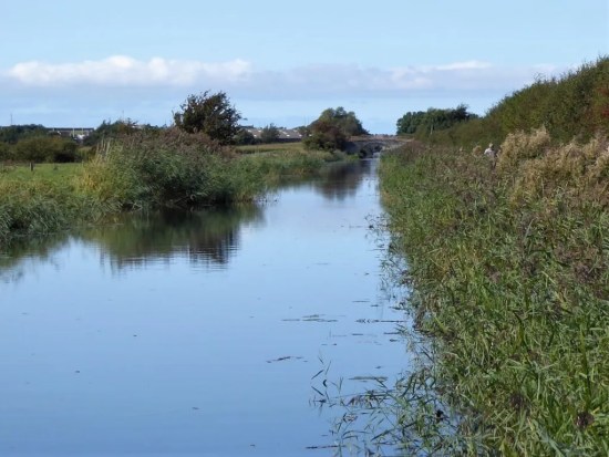
I walk through some lovely woodlands and above the old Greendale Mill originally powered by the lively valley stream.

DSC02162DSC02163DSC02164

I found this on the internet, TCW.

In the 1850s and 60s a quarter of the adults in the village were hand loom weavers of cotton, but industrial mills were being developed apace and depriving the domestic workers of their livelihood. It would have been seen as a benefit to Grindleton when a mill was built there, providing jobs without the workers having to make arduous journeys further afield, perhaps to Preston or Blackburn. Greendale Mill was built in about 1868 by the Grindleton Industrial Association Ltd with space for 180 looms. It straddled a brook and was driven by a water turbine and a 15hp steam engine, which was powered by a huge coal-fired boiler 7ft in diameter and 25ft high. By 1871 the mill had been leased to a tenant, Timothy Marsden. He employed about 50 people and had 100 looms.

At about 12.50pm on Tuesday, September 26, Marsden was seen stoking the furnace to get the boiler steam pressure up. Two or three minutes later there was a shattering explosion. Shocked mill workers rushed out and saw the boiler house had been blown to bits. Masonry and roof slates lay everywhere, covering the surrounding fields up to 200 yards away. A pall of steam hung over the mill and the surrounding area, and there was a deathly silence.

Three or four men entered the boiler house and found the boiler had been torn from its brick setting and thrown across the room, its metal plates ripped apart, and the rivets sheared through. Timothy Marsden was lying on the floor, an oil can in his hand, gasping for air and making rasping sounds. He was severely scalded on his back, arms and legs, and he had a deep gash on his head.

The workers carried him into the cotton warehouse and a doctor arrived. Slipping in and out of consciousness and deeply shocked, Marsden asked what had happened and when told he said, ‘Poor me! What shall I do?’ With some difficulty his clothes were cut off. He asked to be taken to his home in Darwen, about 20 miles away, so he was carefully wrapped in blankets and loaded on to a horse-drawn cart for the journey. The doctor tended to the terrible scalds and the head wound for the rest of the week, but Marsden contracted lockjaw and died on the Sunday night, five days after the accident.

An inquiry was held at the Duke of York Inn, a few hundred yards from the mill, on the afternoon of Tuesday, October 14, and the jury returned a verdict of accidental death.

Damage to the building cost £500 (about £60,000 now) to repair, and the mill was not fully operational until early the next year. Cotton manufacturing continued until 1930. After that, felt was made for hats, and then engineering components. In 1960 the site was acquired by a haulage firm. It is now a storage facility. 

The area round the mill, about 20 acres, is now owned by the Woodland Trust which planted it with broadleaf trees in 2000 to commemorate the Millennium. There are a number of damson trees to reflect the fact that Grindleton was once home to a jam factory.

I thought that was worth the read.

Now on Green Lane leading up the fell. At one time this was a pebble stoned way. Bits of tarmac keep appearing to give access to the scattered houses. 

DSC02167DSC02169DSC02168

I remember White Hall from some previous visit. Its price is now £2 million. 

DSC02170

DSC02172

A touch of colour on the way.

Upwards and onwards I pass the extensive grounds and properties of Cob House. One of the grandest overlooking the Ribble Valley and no doubt valued at more than £2 million. I often muse as to who lives in these mansions, local businessman come good or a crook doing bad.

DSC02173

A little farther up a Bridleway slopes off to the left into a valley with the isolated Simpshey Hill straight ahead. My memory clicks back to 1989 when I was introducing one of my son’s to off-road ‘cycle packing’, the other son has more sense. We camped down by the little stream and were surprised if not scared by a large black mink approaching us as we cooked our beans. We didn’t sleep easy. That was the time when animal rights activists were releasing the animals from the mink farms, much to the detriment of the local otter population.

DSC02175

Simpshey Fell and valley.

DSC02178

West Clough Brook.

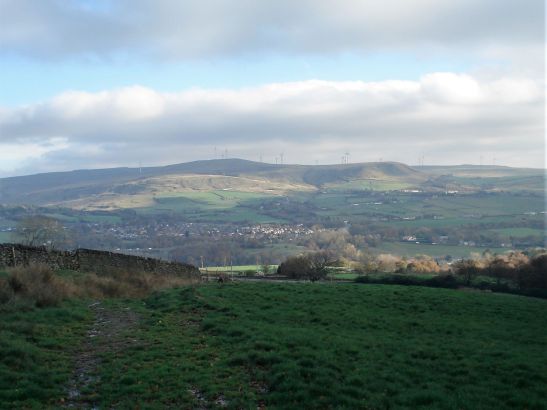
I worked my way around Simpshey and then Easington Fell with its forest appeared, it looked a long way. In fact, I ended up walking continuously uphill for nearly 4 miles and was glad of a sit down on an old wall for a bite to eat. From up here Pendle was prominent on the horizon, as always, and swinging round the Bowland Fell were all a bit hazy in the moist atmosphere.

DSC02182 (2)

The long way up to Easington Fell in red.

DSC02184I knew that the next section around the north side of the forest would be hard going. I aim for a pile of stones, marked as ‘The Wife’ on some maps.

DSC02188

The wife.

From there is rough ground, climbing the ‘rusty gate’ mentioned in Mark’s guide, up to another pile of stones marking the summit of Easington Fell, 396 m. (Header photo) The good views into Yorkshire and the Three Peaks were obscured, but I could see my way along the plantation edge. What is not readily apparent is the condition of the ground, it deteriorates into a reedy boggy nightmare where I was concerned I would sink without trace. By now the wetness had spread up to my waist, and I was tiring in the heavy going. I was looking for a way through the forest and was concerned it maybe blocked by all the storm damage from last winter. The easy option would have been to continue outside the trees on an undulating course to Beacon Hill, but I was keen to follow the guide. An indistinct post showed the way into a fire break which thankfully was clear of fallen trees.

DSC02191

That rusty gate – first of many obstacles.


DSC02205

Distant Beacon Fell.


DSC02206

Rough going – what lies beneath?

DSC02202

DSC02201

Trouble ahead?


DSC02208

That elusive fire break.

At its end I joined the Shivering Ginnel, an ancient walled route through these hills. ‘Shivering’ because it was so often a cold north-easterly wind that blew through here.

DSC02209

Shivering Ginnel.


DSC02210

How many have passed this way.

It was a relief to break out onto the open moor at Beacon Hill. The ground around the summit seems to have been disturbed, mining activity or a more ancient burial ground? Does anybody know?  Pendle has to appear in the background of the Summit photo. The River Ribble is somewhere down below.DSC02212DSC02217

DSC02213I’m soon off the fell and on a lane past Scriddles Farm. Don’t know the derivation, but we have had some lovely S’s today – Simpshey, Shivering and Scriddles.

Across a stile is a ‘Shepherd’s Hut’ with a great view and the obligatory ostentatious hot tub – but who uses these bacterial baths especially with a public footpath coming through. DSC02219

DSC02220The next mile or so was not the best, unmarked paths and crumbling stiles. To make matters worse the afternoon light was rapidly deteriorating. I followed this way in reverse a while back with Sir Hugh and The Rockman, we struggled then but the intervening years have not been kind to all those stiles. Most were difficult and a couple downright dangerous. The guide underplays this section, some acrobatic agility is needed together with the more detailed 1:25000 map, I resorted to phone navigating technology and the landowners could be more helpful.

DSC02222

Slowly rotting away.


DSC02224

Rights of way have a knack of disappearing in horsey country. I’ve nothing against horses.


DSC02225

Somewhere down there.


DSC02226

Don’t look down.

I was glad to reach the ancient sunken track leading straight back to Grindleton.

DSC02233

DSC02227

Jelly Ear fungi – edible but just too nice to pick.


DSC02166

Any ideas?

There is a choice of ways through the village – the Main Street with some impressive houses.  or the back ally with its cottages. Little ginnels run between the two, and I notice there is a marked trail around the village.DSC02236DSC02237DSC02239DSC02238DSC02240DSC02159

A pleasant place to live apart from those two derelict pubs. 

CICERONE’S LANCASHIRE – Gentle Pendleside.

DSC02123I

It’s been a while since I walked alongside Mark Sutcliffe, he of Cicerone’s Walking in Lancashire guide. Apart from a short road walk around Longridge Fell with JD the other day I’ve languished in the house. Time to get going again and test my knee out. I scan the chapters looking for something undemanding. I toss up between Blacko hills, (Chapter 27) and the Clarion House walk on Pendle. The former looks the easiest, even if the latter looks the more interesting. The fact that it was Halloween Eve never crossed my mind as I delved into Pendleside. On reflection the immediate Pendle area would have been chock-a-block. (I like that word)  Lucky choice.

My mood in the morning was as gloomy as the weather, but I had enjoyed that extra hour in bed. The weather improved alongside my mood, I was just glad I was in the car post walk when the afternoon deluge hit the area. The M65 virtually came to a halt as the skies blackened and gallons of water came down from somewhere. I’m now safely home.

Let’s park up at Higherford, there is a bridge here now over Pendle Water. I struggle with the car park machine, ‘it’ knows I’m here and will charge me later on my return – that preys on my mind for much of the walk.

Across the way is Pendle Heritage Centre. I think I was too early for its attractions – tearoom. gardens and museum. Maybe later but then it is too late. Park Hill House below has associations with the Bannister family later to run the sub 4 minute mile. I do spot the first Tercet on The Lancashire Witches Walk .DSC02105DSC02104

Alongside the water I get into my stride. Autumn is everywhere. There are reminders of previous mill operations, but I am soon out into the countryside.DSC02114DSC02119DSC02120

DSC02118

DSC02122

I’m heading towards Blacko Tower.

 A plaque reads Built by J Stansfield1890 Restored 1950. Approximately 30ft high. Built as a folly. Circular. Coursed rubble. Widely spaced battlements. Two steps up to a plain doorway. Spiral stone staircase inside leading to observation platform. Prominent hilltop landmark. 

Such a shame there is no public access, it must be a fine viewpoint. Time for the citizens of Blacko to stage a protest march. I make a mental note to return mid-week and make a clandestine ascent.DSC02127

Today I’m content to follow vague contouring paths on the rough hillside past farms to Malkin Tower Farm. Maybe the site of a ‘witches coven’ in 1612 from where the women were marched off to Lancaster to be tried and executed. There is lots of speculation as to the true version of events. All is quiet today with the farmer’s wife subtly showing me the diverted way. A few arrows would have helped, but all is mysterious around here. DSC02129 At the next farm I weave through a complicated series of gates in their garden. Enquiring of a lady, to confirm my way, that few people walk through here – she says “most get lost”. I doubt the irony strikes her. Again a few yellow arrows wouldn’t go amiss. At last, I’m free and walk down a lane to another farm, Whitemoor Bottom. The guide says take the footpath on the right, but there is no obvious way –  I strike boldly through the farmyard and onwards down the fields. This is horsey country and barriers keep appearing, is it this side of the wires or the other? Determination sees me through, and I drop into a wooded gully with little sign of others coming this way. But I’m on course and eventually come out onto a lane at Holly Bush Farm. Sand Hall, which looks as though it should be listed, is passed, and the lane takes me to Foulridge Reservoir.DSC02132DSC02135

DSC02136

Time for lunch, so I climb up to the dam for a bird’s eye view of the reservoir. It’s depleted of water and the only action from the sailing club is a model yacht race.DSC02137DSC02144

A bridle way takes me to join the canal as it emerges from the mile long Foulridge Tunnel, completed in 1796! A way mark confirms it is the Leeds – Liverpool Canal. Maybe I should walk its historic length one day.DSC02146DSC02149DSC02150

DSC02154

Halfway down the locks a path takes me through a pasture and into an upmarket estate. As I progress down the main road the older stone houses typical of these mill villages appear, Weavers cottages now desirable properties. On the corner by the packhorse bridge is the old toll-house (early C19th) with a board listing prices – almost as complicated as the pay machine in the car park.DSC02115DSC02106 (2)DSC02107

A good start to my winter walking, shorter than the guide book suggests, and not a ghost or witch in sight.

DSC02121

*****

Foulridge

ON THE CUSP OF AUTUMN, MORECAMBE BAY AGAIN.

P1090432

We are on the cusp, one day distinctly chilly the next balmy sunshine. I’m confused,  already having titled posts the ‘End of Summer’ and ‘Autumn Calling’. But Summer is putting up a good fight with Autumn this year. Today was certainly on the side of Summer.

The bike is in the back of the car so why not go up to the Lune Valley, yet again you may say, but I do discover a few more gems.

Halton old station. Alas, the tea van is no longer here, probably finished for the season, hopefully she will return next year with that life giving coffee. The slipway is busy with university oarsmen and women out on the river for morning training. The old Station is now the center for the boat crews from the University. P1090410

I pedal a short distance to the magnificent Lune Aqueduct carrying the Lancaster Canal over the river. A steep ramp takes me up to it, and immediately I’m in a different environment. Interpretation boards detail the history of the aqueduct. Find it on Google. There is a metal plaque commemorating the building of the aqueduct, designed in collaboration between Central Lancaster High School and the artist, Rachel Midgley which I hadn’t spotted before.  All the hustle and bustle below has disappeared, and I’m off along the towpath into quiet Lancashire countryside.   A few miles of riding to where I know there is a link to the Coastal Bay Way.P1090442

P1090411P1090412

P1090419P1090418

I’ve not done this ride in this direction before despite scores in the opposite way. It all looks different, and it gives me different perspectives of the canal and then of the Bay. I should have looked behind me on previous trips. The views across the bay to the Midland Hotel and pier and the distant Lakeland Hills are always quality.P1090422

Bracing is the term for Morecambe promenade today. There are white horses in the bay. But the sun is shining and the wind, though fresh, not a great hindrance to cycling. Hardy souls, mostly elderly and well wrapped, are out with their dogs.

I take a trip down the old stone jetty with its Cormorant motifs, but decide against a coffee there as the café is in the shade. Fortuitously I have come at the right tide as the Tidal Bell is tolling its mournful note. I have not heard this before. See here for more information. P1090438P1090435

Past the Midland yet again without visiting! Heading inland I venture into the wonders of the covered Festival Market and amidst the varied stalls, full of cost of living bargains, I find a bakery – time for my favourite – a cheese and onion slice. This one was top class, hence I will give them a plug.P1090439

I pedalled back to Lancaster, not in the panic mode of last time when I feared I had lost my phone and money. Over the Millennium Bridge and back to Halton. A lone canoeist is braving his way through the centre of town.

P1090440To lengthen the ride and enjoy the weather I continued to the Crook of Lune where the river does a U turn spanned by the two bridges of the old railway. Here is the lovely view up the Lune towards Hornby Castle and Ingleborough, immortalised by Turner who painted the scene from higher up. 

P1090451

I’m home early in time for a bit of bouldering up at Craig Y Longridge whilst the sun was keeping the rock warm. An invigorating day amongst those of lassitude and hospital appointments.

Lastly here is one more statue installation on the Bay that took my eye, I’ve not noticed before, and I can’t find anything about it.P1090429

PEACEFUL EASY LANCASHIRE.

I’ve got this peaceful easy feeling.

It is that sort of day; no wind, sun shining, rural Lancashire, the bike cruising effortlessly, no traffic, virtually no sounds. What more could you want. I’m on a linear canal ride where time has stood still, almost a parallel universe. The canal takes you along without you realising where you are in relation to familiar roads and settlements. I could be in Rotterdam or anywhere  – sorry that is a link to a recent post. But I meet people, interesting people in this parallel universe.

At the start I chat to an elderly cyclist who is setting off on his electric bike admitting it is heavy, and you can’t pedal it if the battery dies on you. He suggests that if you are over eighty then this is for you – well I have a few years of proper pedalling ahead of me. He speeds off and I never catch up.

There was the lady by the swans, they are here every year she says, using the canal towpath as a route to and from her shops. How lucky she is and I think she knew. There were seven cygnets, all strengthening their wings ready for a first flight, enchanting.

I pass, incognito, through Lancaster City at times elevated above the streets and housing. I have a picture in my mind of what would happen if the banks broke. That must be linked to my childhood stories of the little Dutch guy with his thumb in the leaking dam. Lots of the converted canal warehouses are now student accommodations, how lucky are they. There are some iconic canal features along here where the horses could cross from one side of the towpath to the other side without unhitching. I’ll leave that to your imagination.

Now in the countryside I chat to a houseboat owner, probably a former dropout but now elevated in my esteem to an interesting canal dweller. He may have the advantage over the rest of us in our current cost of living crisis. How the worm turns. Drifter.

A dog walker talks of his previous life as a travelling rep. No more motorway hold-ups for him.

The towpath takes me through shady cuttings and open fields. I don’t look at my phone to see where I am, preferring to let things happen. I can’t get lost. A southerner recently moved to these parts is interested in my route, but I have the feeling he won’t be tackling anything more than a gentle walk to the pub. How judgemental is that?

It seems to take an age on rather overgrown and awkward paths, I’m not as agile on the bike as before, talking decades here, and I’m very wary of skidding off the path head first into the canal. I walk some of the way. Picking ripe sweet blackberries was a joy. I was in no rush.

Eventually I reach the junction with the Glasson canal built to link the port of Glasson with Lancaster. And then the railway came. More of that later.

I’m still in that peaceful easy feeling as I continue without meeting a soul through fields towards the coast. It was along here that I witnessed a heron trying to swallow a wriggly eel earlier this year.

Glasson is as busy as ever with motorcyclists and tourists of a certain age, so I head across the bridge to the little shop where I’m in time for one of their freshly baked cheese and onion slices. Sat in the sunshine with a coffee – perfect. It must be high tide as the lock gates to the ocean are open.

I’ve taken a long time to cycle 12 miles to Glasson, what with all the stops and awkward sections, but now it is head down on the old railway, which superceded the canal I’ve just been following. Back into Lancaster and on to Halton Station. That has set me up for autumn and thoughts of trans Pennine trails.

I switch the radio on when I’m in my car, but this time there is no déjà vu link to the Eagles from way back then. Here it is nonetheless.  I may have played this before in other contexts, but it is a favourite of mine and perfectly reflected this sunny day’s ride. California dreaming.

I highly recommend this 20 mile off-road circuit, after a short ascent to reach the Lancaster Canal on the period Aqueduct it is flat all the way even if a little rough towards Galgate. The section to Glasson is totally rural and as peaceful as you could wish.

CaptureGlasson.