Tag Archives: Walking.

RAIN BEFORE SEVEN…

P1000341

                                                                      A wet Longridge Fell.

…dry by eleven.

This piece of optimism is presumably based on the weather in NW Britain, where early-morning rain could mean it has been raining all night. The front producing it may then blow through giving way to fine weather later in the day, though not necessarily by eleven. It had certainly been raining most of the night when I awoke this morning at six, and it still was at nine. A couple of coffees, a poached egg and the crossword later I wondered about getting out. I wasn’t in a rush, just going local, so let’s give it to twelve to be certain.

My previous foolproof method of forecasting the day involved looking out of my bedroom window. If I couldn’t see Longridge Fell it was raining, if I could see the fell it was going to rain. Such is life up here. But now Barratt’s have built some ghastly houses in front of me, so I can’t see the fell at all. What does that say about the weather?

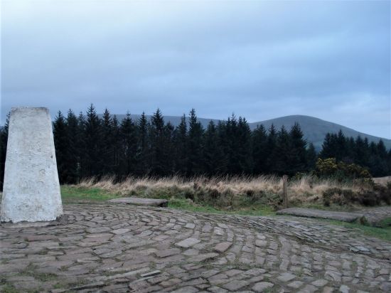
Parked up at Jeffrey Hill to do my usual short round on this end of Longridge Fell. Why not incorporate a litter pick whilst I’m at it, haven’t done one for a few weeks and after Easter I expect a good collection. The clouds over Bowland still suggest rain but is that some brightness behind me coming in from the coast on the strong winds? We can but hope, and anyway I’m fully waterproofed.

P1000340

Rain in the Trough of Bowland. 

P1000337

Behind me brightening across the Fylde?

To my surprise, or should that be pleasure, there is very little litter heading up to the trig point. I suspect someone else is helping out. Apart from the phantom orange peeler all I find is the usual d** p** b**s, no surprise there. It is also no surprise to see, in the distance I’m afraid, a couple walking with their dogs off the lead. There are signs everywhere suggesting this is not a good idea due to ground nesting birds at this time of year. Tell me if I am becoming pedantic.P1000352

I splash on through the bogs, we have had a lot of rain, to the trig point, Bowland remains  gloomy. The wind is behind me but still has a cold bite to it. Families coming the other way are frozen, and the children look miserable. They have the time to thank me for my  litter efforts. Whenever I meet people whilst I’m in litter clearing mode, a conspicuous bag and a grabber, they all say they should do the same – if only 5% did that would be a success. P1000344

Approaching the edge of the woods I’m surrounded by a dozen barking dogs. All loose and followed not that closely behind by a couple of ‘professional’ dog walkers. I stand my ground, I’m getting more confident with the canine species these days – there are so many of them. Pleasantries over I suggest that on the fell the dogs should be on lead. Of course their guardians have come from a different direction and claim there were no warning notices. We walk along together, and I explain about ground nesting birds – lapwings, curlews, skylarks, grouse, plovers etc in this area. The dogs are a delight to watch as they know their way and jockey for front position. A diverse selection of breeds all getting on together. I begin to wonder that as they are staying on this side of the wall and not transgressing onto the open fell I may have been a little harsh on their human friends. Dog walking has become big business these days as people who bought dogs for companionship now need to go back to work. We part company as they go off down the forest track. Out of interest later in the day I drive round to their point of access onto the fell and there are no signs warning of ground nesting birds. Fair enough. P1000349

I’m soon back on the road and the weather, as prophesised, is improving  so I incorporate a loop around Cowling Brook Plantation. I had noticed some litter starting to appear in this woodland of late. There wasn’t much to be honest but my d** p** b**s  total now was above a dozen. I enjoy my ventures into this plantation and feel the need to preserve it. There is so much unidentified bird song in the trees today. It would be good to come here with a proper birder and learn to recognise the calls. Any offers?

The little Cowling Brook coming down from Gannow Fell is in full lively flow heading to Knowle Green where it used to power the bobbin and cotton mills. P1000355

On the short stretch up the road into the strong wind the carrier bag was getting heavier, and I was in danger of repetitive strain injury from the trigger on my grabber. P1000357

The sun was shining once back at the car and indeed we have just had an almost good red sunset. Red Sky at night  Shepherd’s delight, another ancient folk law.  A red sky sunset tells us the worst of the weather has now eased, with higher pressure and improving weather approaching from the west for the following day. Red skies appearing when dust and small particles are trapped in the atmosphere by the important  high pressure.

P1000362

What will tomorrow bring?

***

CaptureLONGRIDGE FELL (2)

CICERONE’S LANCASHIRE – ALMOST INTO YORKSHIRE.

P1000294 (2)I couldn’t resist a decent hill day as the weather remained fine. All change next week. ‘Head east old man’ was my mantra as I sped along the M65. Everyone else was going west to Blackpool or the Lakes. Boulsworth Hill my objective. So far so good, but the last chapter of Mark Sutcliffe’s Lancashire Cicerone guide would have had me parking above Wycoller. If there ever was a honeypot then Wycoller deserves that title. A secluded village of agricultural and hand loom workers in the C16th to C18th. Along came power looms in the C19th in nearby Lancashire towns and the population moved out. By 1896 the majority of people had moved away from the village, and it was virtually deserted. But a renaissance occurred in the mid C20th, the area was incorporated into a Country Park and people started moving back into the village renovating the properties. I well remember Longridge acquaintances of mine telling me of their plans for one of the houses in the 70s. I suspect you would have needed a bottomless purse to go ahead.  For more information look at Wycoller (abandonedcommunities.co.uk)

The village is a now a conservation area and is closed to outside traffic. The car park on Trawden Road is the one suggested for this walk. Today, Easter Sunday I suspect it would be probably full by the time I arrived and you have to pay. So I decided to park up in Trawden village on the line of the walk. This worked well, makes the walk more balanced and avoids backtracking at the end. I will give details at the end of the post.

Out of the car I was soon winding my way up a lane into the hills, slightly more directly than Mark’s route. Footpaths then led past isolated farms. I came across two unusual stone stiles with a circular centre and  exits into three separate fields, difficult to describe and difficult to photo, but I have never seen anything like them before. On down an ancient track into Wycoller.

P1000201

Early fields with the amorphous Boulsworth on the horizon. 

P1000202

Early crows’ nests in the bare trees. A walled enclosure like a pinfold. 

P1000211

P1000213

P1000214A good start to the day, although by now it was after noon. The expected crowds were milling around in the hamlet. Crossing and recrossing the series of bridges over the stream. For the record …P1000218P1000217P1000234

The information centre/café appeared closed, but some enterprising folk were running a mobile coffee shop, it was too early for me. This walk gives you the opportunity to explore Wycoller if you haven’t been before. I had a look around the remains of the hall and was reminded of the time when I slept in the fireplace Inglenook whilst on a two-day trip around the Pendle Way. At the time I was unaware of the phantom horse ghost story associated with the hall.  If I had known I may have slept elsewhere. P1000224P1000223

You have had enough historical homework on the area so far, and it is time to move on. There are ways either side of the stream, but the important junction is well signed leaving the Pendle Way and the Bronte Way to take a concessionary path alonside Turnhole Clough. (the Bronte connection being that Wycoller Hall may have been the inspiration for Ferndean Manor Jane Eyre’s residence with Rochester after the fire at Thornfield. The Bronte Way is a worthwhile short/long distance way)

Families were enjoying the country park with Easter picnics whilst high above the sci-fi Atom, one of Lancashire’s panopticons, looked down on us. P1000227P1000229

I don’t think I have been in Turnhole Clough before and I enjoy strolling through the trees above the lively beck. This sort of concessionary path should be more commonplace, I can think of several areas crying out for access. It just needs the local authority and landowners to come to some agreement, maybe pushed by interested rambling groups. P1000238

P1000239

P1000242

Anyhow, eventually the Clough brings me out onto open moorland. Above on the skyline is a row of rounded gritstone boulders which look interesting. I have a hill to climb today, so I’m not keen to add extra height wandering off route to them. There is a path up towards them but when I later search on the UK database there is no mention of them being climbed upon. I now regret coming so close without visiting, all I have are some telephoto pictures. What are they 10, 20 or even 30ft high, it is difficult to tell? Another day. P1000243P1000250P1000251

The book states you come out at the bailey bridge and cross it, but the concessionary path actually brings you back onto the Pennine Bridleway/Bronte Way above the bridge.  Now we head across open moorland on this ancient flagged mule track.

P1000252

Perfect wild camp site in the upper Turnhole Clough. 

P1000259

Which way? 

P1000264P1000269

Up and down until the barn where a signed path heads upwards to Boulsworth. This is a relatively new way so tends to just head upwards, none of the characteristics of worn winding historic routes. All is well until a fence is crossed and then the brutal 1000ft climb rears up steeply in front of you. I’m too old for this game but plod on at a slow pace being glad I stopped for an energising bite to eat back in the clough. Sometime later I breasted the ridge at some prominent gritstone boulders, Little Chair stones. Onwards past more boulders, The Weather Stones, I give them names in my imagination or am I hallucinating? Any suggestions?

P1000270 (2)

Start of the ascent. 

P1000275

The steepening. 

P1000282

Forever onwards to the Little Chairs. 

P1000288

P1000290

P1000291

P1000293

Up at last to the trig point at 518 m, Lad Law. There was nobody else here. Panoramic views over Lancashire and Yorkshire but now a little hazy. Am I actually in Yorkshire, well not quite but a stone’s throw away paths head deep into Bronte Country to the east. It all looks very bleak.

P1000298

Lad Law trig 518 m.

P1000302

A hazy distant Pendle over the Coldwell Reservoirs.

Turning back into Lancashire I head off downhill past the prominent Abbot Stone, too steep to contemplate bouldering.

P1000309

The Abbot.

P1000311P1000317

Boggy ground has me back on the Bridleway where after a few yards a stile takes me into fields and alongside Gilford Clough. Farther over to the right is Lumb Spout waterfall, a hidden gem. Maybe Mark missed a trick there, worth a diversion if you know where it is.

P1000320

Gilford Clough

I’m content to walk down the lane past an assortment of farmhouses, cottages, hen houses, barking dogs and allotments back into Trawden. A village where the residents run the library, pub, shop and community centre.

P1000323

Trawden FC?

P1000324

Free cooperative seeds. 

P1000327

Is they Islay? 

P1000325

Yes it is Spring but not summer.

***

My parking was on Lanehouse Lane just past the bowling green area alongside an old cotton mill where there is adequate room close to where the route enters and exits the lane. SD916380 

I was glad of this choice for it meant after a long tiring descent I was saved the climb back over to Wycoller completed  earlier. The map makes sense.

Captureoulsworth hill

A VERY GOOD FRIDAY.

P1000193I have a few ideas for some hilly walks now the weather has improved, but they would involve travelling on the busy Easter roads, so I manage to procrastinate the morning away. Let’s just stay local and have a wander up Longridge Fell checking out a few bird habitats at the same time. I’m keen to see the Great Crested Grebes performing their mating dance on the little reservoir at the top of the village. This is where I park my car. Craig Y Longridge is busy with climbers.

As I’m putting my boots on along come JD and his friend Danny. In a couple  of weeks they are off to do a pilgrimage walk through Portugal to Santiago de Compostella and are out for a brisk training walk. May I join you I ask? Yes as long as you can keep up with us. All very friendly. They set off at speed up the road, my ‘un’fitness showing. I let them do the talking whilst I try to get my breath back. Fortunately there is soon a rest break whilst they remove clothing layers, the day is hotting up along with their pace. They stuff their clothes onto rucksacks which they are carrying for training purposes.

Now into rhythm I begin to enjoy the walk as we  climb up onto Longridge Fell, my original destination. There are daffodils and primroses along the verge and bird song in the air. Young lambs play in the fields. Aren’t we lucky to have this on our doorstep?

Instead of following their intended route up the lane to the kennels I take them off on a track through the fields, past the little reservoir, on by the long abandoned quarries and just below the expensive farm conversion to meet up with the lane leading to the plantations. They claim they had never been that way before, but I doubt their memories. They stop on the ridge for a drink, I suck on an orange. Then along the balcony path above Chipping Vale to the crowded parking on Jeffrey. The first people we had met all afternoon.

We have a quick look into Cardwell Quarry where JD and I used to climb years ago as I had seen a barn owl there the other day. We see a couple of small falcons fly out – ?merlins. In the corner I spot the barn owl, get a hurried long shot (photographically I hasten to add) before it sees us and flies out – what a wonderful bird. Now I know where it roosts I creep in another day and try and get some better images. JD is surprised to see the amount of significant rock fall that has occurred over the years. Quarries are inherently unstable, one just hopes that you are not hanging on when the rock decides to part company. Anyway climbing is banned here ever since some unruly and aggressive behaviour towards the farmer from some youths partying in there. I only hope they weren’t climbers, not that it makes any difference to the ban.

It’s all downhill on the road back to Longridge past the golf course. As part of their training they feel obliged to call in for a drink. We sit on the sunny balcony enjoying a beer whilst the golfers go over their good and bad shots of the day. All very pleasant. Resisting the temptation to stay longer we are soon back into town. I had had my walk up the fell in slightly different circumstances to those envisaged and thoroughly enjoyed the banter. It has turned out a very Good Friday after all.  I’m envious of their upcoming peregrination.

A pot-pourri of images :-

P1000168

A Great Crested Grebe.  

P1000196

A busy Craig Y Longridge.

P1000190

A couple of pilgrims.

P1000191

A Million pounds. 

P1000194

A busy Jeffrey car park.  

P1000198

A distant Barn Owl. 

P1000197

A lot of recent rock fall.

***

CaptureLongridge Fell.

CICERONE’S LANCASHIRE – let there be light.

P1000084The clocks have changed, but my body hasn’t caught up as yet. Today had a sparkling alpine start and promised to be the best of the week. I struggled to get up having lost an hour somewhere. But with the minimum of faffing I’m away by 10.30. It only takes me a half hour to drive out to Dunsop Bridge. I know the sun doesn’t set tonight until after 7pm, so there is no rush, that’s the way I like it.

 Walk number 12, Whin Fell and Brennand, of Mark Sutcliffe’s guide promises – Another classic hill walk  combining steep climbs, big views and pleasant riverside rambling in the secluded hills and dales at the heart of the Forest of Bowland, 

 He has covered Bowland well with ten walks on my back door. Today I parked up just off the Trough road as recommended. Soon I was following a permissive path alongside Langden Brook. Oyster Catchers seem to have taken over many of our rivers but in the background I could plainly hear Lapwings and Curlews. This is open fell country,but since 1960 their numbers have dropped by 85%.P1000019P1000020

P1000023

Crossing Langden Brook.

Back on the road I pass the farmstead of Sykes.

P1000025The lime kiln gives a clue as to the bedrock hereabouts, but I shall soon be high in gritstone country.P1000026

The Trough of Bowland road snakes ever so slowly up the valley. I branch off right and have my own hill to climb.

P1000038The track soon peters out, and I’m left on boggy pathless territory forever upwards. This is designated as a bridleway, and I remember coming this way on a mountain bike 35 years ago with my son. No chance now. This area is isolated from the usual Bowland haunts, and I’m surprised to meet three walkers descending the pass. A friendly trio and we exchange banter. They have driven up from Manchester,  preferring this area to the crowded Peak District. They soon become a dot on this vast landscape as they descend towards the Trough Road and I struggle upwards. Across the way Totridge Fell keeps its head above most of the fells around here.

P1000039 (2)

P1000050

P1000063

The last time I was up here I continued to the top of Whin Fell with views to Morecambe Bay and beyond. This certainly feels like the centre of Bowland. Today I was conserving my energy to complete a rugged 7-mile circuit. and I soon reached the boggy col. Way down in the valley was Brennand Farm – the promised land. All I had to do was traverse Ouster Rake. It wasn’t as bad as I remember it. Over the years a groove has been eroded into the hillside making it feel far less exposed. But come a harsh winter and this becomes an icy trap where there have been several accidents. I still don’t believe I have cycled this route. I find a flat rock and eat my sandwich gazing down into the Brennand Valley, I must follow it higher into the hills one day, I don’t think I have ever been to the evocatively named Whitendale Hanging Stones.

P1000059

P1000078

P1000077

P1000069Looking back I was surprised to see how steep and craggy are the northern slopes of Whin Fell. At Brennand Farm (notice how it complements Sykes Farm passed earlier) all is pleasant with newborn lambs in the fields, no Spring walk is complete without some lamb photos. On down the Brennand Valley and then strangely back upwards to join Whitendale.P1000087

P1000092

P1000097

P1000101

P1000104

Looking back up the Brennand Valley.

From the water catchment works under Middle Knoll the River Dunsop gathers pace down the valley. All very familiar to me. I, too, gather pace alongside it on the good tarmacked water board road. I stop to try, unsuccessfully, to capture a photo of the Dippers merrily skimming down the river.  Sometimes Kingfishers flash up this section . There has been a lot of tree felling along here in the last few years. I’m soon onto those boggy fields I traversed last week to get me back onto the Trough road below Mellor Knoll and Totridge, and my car. There is plenty of light left for further exploration. Don’t get your Middle Knoll get confused with the Mellor Knoll.

P1000106

Joining Whitendale.


P1000108

Middle Knoll overlooking the Dunsop Valley.

P1000109

P1000113

Across the fields with Mellor Knoll and Totridge ever present.

CaptureWhin Fell

Post script. You will recall my horror the other day at the erosion being caused in the beech woods on the lower slopes of Totridge Fell above the Inch Perfect Trail Bikes outfit. Well let’s take the bull by the horns and drive up to their headquarters. It’s a long lane up to ‘New Hay Barn’ as it was. Now the centre for trail bike riding with accolades from Lancashire Tourism. I must admit they have developed a professional trail biking heaven. Lots of  manufactured technical obstacles in the lower fields for the enthusiastic biker.  I enter the impressive shop full of no doubt expensive bikes and kit, electric ones being top of the range. Videos are playing of the destruction they are doing to the hillsides. All very Formula One. 

P1000117P1000119P1000116

Simon the manager is on the defensive as I casually say I had been on the public bridleway on his land last week and was distressed  to see the erosion and damage being perpetrated in the beech woods above. He asserts that all has been verified planning wise, though I doubt the fine details. He seems to imagine, erroneously, that the bikes don’t go as high as the woods. His main grouse is dog walkers at loose amongst his trail bikes, albeit on a public bridleway. Being in a mellow mood I forget to ask him who actually owns the land (is it Duchy Land?) and does he have marshals out on trial days to warn the public  of the surrounding danger. We part with him saying he will have to have a trip up into the woods where I am showing concern. He has not seen the last of me. This is an Area of Outstanding Natural Beauty after all. Or is it?

Calm down. As I leave ahead of me is one of my favourite Bowland venues, Kitcham Hill Woods on Birkett Fell. All peace and quiet, long may it remain so, but I do wonder who will be looking after our countryside in the future.

P1000118 (2)


CICERONE’S LANCASHIRE – Whitewell, Mellor Knoll and the Hodder.

DSC00293 (1)

Haredon rook connects with Langden Brook which connects with the Hodder just after the River Dunsop, itself formed from the Brennand and Whitendale  waters, has joined in. In this part of Bowland there is a lot of water flowing off the hills down the Hodder towards the Ribble. So much water that I couldn’t safely cross the stepping stones at Whitewell this morning. Walk number 14 of Mark Sutcliffe’s Cicerone Lancashire. 

DSC00448 (1)DSC00445

The day promised the best weather of the week – sunny,mild and dry. And it was. I adjusted and parked up at Burholme Bridge a little farther up the Hodder.

The climb up the quiet road was a good warm-up before taking the footpath through the field.  It felt good to see Lapwings flying around and a couple of Curlews in the distance. I was in limestone country and all around were little outcrops and caves, I have explored some of these in the past so was content to walk by. The lane leads into the hills and a far off farm under Totridge Fell, but the bridleway goes off right into the woods. At one time there were numerous hen houses scattered about, true free-range poultry, but today there only seemed to be one shed left standing. 

DSC00300

Unnamed limestone caves.


DSC00307

The ‘last’ Whitmore hen house.

The path through these woods, Lower Fence, has always been boggy but since recent felling matters have improved somewhat. As height is gained views open up into the heart of Bowland above Dunsop. Leaving the firs a contrasting beech wood is entered. I have always enjoyed this high woodland stretch – beautiful beech trees with Totridge Fell towering above and views down through the trees to the twisting Hodder where I had parked. The farm below has hosted off-road motorbike trailing for some time, but it was confined to the lower fields and contrived obstacles. Inch Perfect Trials. There is now evidence that they are riding higher up into these ancient woods causing erosion and damage to the tree roots. Their promotional video illustrates this clearly. No doubt the land belongs to the organisation but, call me a spoil sport,  I don’t feel this is appropriate in the wild surroundings. Worryingly they seem to have received several Lancashire tourism awards. We don’t need that sort of tourism. Let’s not forget we are in the Forest of Bowland, a recognised Area of Outstanding Natural Beauty. I certainly would not like to walk this Public Bridleway when they are out to play. Who should I complain to? The King, if this is Duchy land? Now I’m home and writing this I am even more incensed – they are going to destroy that beautiful beech wood.

DSC00316

How it should remain.


DSC00313

Encroaching trails.


DSC00319

The Hodder Valley below.


DSC00322

What it is becoming.


DSC00323

Erosion…


DSC00321

…erosion


DSC00325 (1)

Destruction.

Maybe my mind was distracted, but I went astray at the col between Totridge and Mellor Knoll. It is easy to do so on the featureless ground. But basically all routes lead down to Hareden in the end. Incidentally if you are up here it is easy to gain the 344 m summit of Mellor Knoll, although there are no rights of way. Why wasn’t it included in the CRoW act’s open access land?

DSC00334 (1)

Mellor Knoll.


DSC00338 (1)

Off track.


DSC00344 (2)

Haredon, can you spot the car on the trough road?

At the farm a trailer was full of sheep presumably off to market. When I asked the little girl with her mother if they were her sheep she proudly said yes. the mother quickly intervened to say that they were going on holiday. Very diplomatic. 

DSC00349

Going on holiday!


DSC00352

Haredon Farm. 1690.


DSC00350

Always a warm welcome.

it was flat walking down the valley into Dunsop Bridge, but the weather had clouded over and become much colder, don’t we have a mixed climate. Mark’s route fortunately brings you past Puddleducks café, still functioning as an outside venue, I enjoyed a coffee. 

DSC00354

Hareden Brook, haunt of Dippers.

DSC00355

Langden Brook.

DSC00401

Puddleducks in the old post office.

DSC00405

On past that 100.000th BT phone box often considered the centre of Great Britain. Down the avenue of tall Redwoods to Thorneyholme Hall, once owned by the Townley family of Burnley, known for breeding race horses. Their land agent Richard Eastwood had success in the 1861 Derby with Kettledrum. It is believed that St. Hubert’s Church in the village was partly financed though the horse’s winnings. More of that later.DSC00408DSC00411 (1)

The path down the valley alongside the Hodder, now joined by the Dunsop and Langden Rivers, is always a joy surrounded by all those familiar hills. This is a good place to watch Sand Martins but of course they haven’t returned yet. The river bank in parts is being eroded, and the path has been changed with the introduction of those modern metal kissing gates which I don’t feel are very sympathetic with our countryside. That is the last of my gripes.   

DSC00415

Langden Brook joining the Hodder under the watchful eye of Mellor Knoll.

DSC00417

What’s wrong with the old one?

Since I was last along here the farm at  Burholme has had its rendering removed exposing lovely warm sandstone. The farmer busy with his lambs tells me it has C14 origins. Their Lonks are not to be messed with.DSC00423

DSC00419

By the time I was back at the graceful Burholme Bridge the sun was shining again.

DSC00436

I then drove back along to Dunsop Bridge to have a look at St. Hubert’s which I had become more aware of through  this blog.  All the history is there to read and I won’t repeat it. See also its listed building entry. The church sits squatly by the road leading to the Trough of Bowland.  The striking feature externally is the large white marble angel guarding the Towneley family vault. Inside I found very little lighting to fully appreciate the fittings. The exquisite stained-glass windows however showed up really well. Their leaflet describes a painting of Kettledrum, but I was unable to locate it. Mary Towneley  of more recent equestrian fame is also buried here. 

DSC00388

DSC00391 (1)

A good walk in the best Bowland scenery, which in truth I have done many times before at all times of the year, but never get tired of. (I did exactly the same walk on May 1st 2019.)  If you are intending to follow the Cicerone route in full come when the river is down so the stepping stones can be traversed and maybe a pint taken in the Inn at Whitewell.  There is a concessionary path off the road from near Burholme Bridge directly back to the Inn at Whitewell which would save some of the repetition of his route. 

DSC00451 (1)DSC00458                

CaptureHaredon

DSC00448 (1)

SOME FULWOOD WOODS.


DSC00440

David Attenborough has just told me and the rest of you on his latest TV documentary that the UK has the worst woodland density of any European country. That does not surprise me given our government’s rough shod treatment of our environment. They don’t even approve of Attenborough’s climate predictions. Who would you trust our natural treasures to – David  or Sunak, Hunt, Coffey et al.  We are woefully short of natural diversity and though it is small scale  The Woodland Trust charity have something to offer on a local level and potentially a wider scale the more people know of them and their work. But how much more we need to do to re-establish our natural woodlands after years of local destruction for housing, transport, agriculture and sterile forestry plantations.

This was to be an afternoon of exploration which will be of little interest to most of you. Fulwood lies to the north of Preston hard by the M6. A land of suburbia, upmarket houses and expensive cars. And it is spreading fast to link up with Broughton and Cottam. New estates appear by the month and roads struggle to cope with the traffic. Alongside the motorway industrial units and office blocks use up most of the remaining land. So what is a ‘mountain man’ like me doing here? Well for a start mountains are off the agenda until hopefully the knee has improved. Secondly I noticed on a walk on the Preston Guild Wheel last week lots of tempting linear woodland walks. Most of them signed and presumably maintained by The Woodland Trust charity. A fellow blogger Clare highlighted some woods in the area a year ago, and I have to thank her for that. It lit a spark in me, and I am off to discover what has been hidden under my feet or wheels all those years. 

A bit of research on The Woodlands Trust website  showed an interactive map of all their woodlands. I focused in on the Fulwood ones.

Capturewoodland Trust

Armed with a sketch map I left Fulwood Row onto the Guild Wheel through Hindley Hill Woods. ( Fernyhalgh Woods  according to the Woodland Trust Map, but let’s not quibble. On the east side of the Motorway alonside Savick Brook they are named Squire Anderton’s Woods. I traversed these on my Haighton walk last week) This is all familiar territory but once I crossed Longsands Lane I diverged from the GW north into Midgery Woods, crossing Savick Brook, and going uphill towards the constant drum of the motorway. The path goes alongside the motorway for 300 metres with expensive looking houses to its other side, they must be glad of the belt of trees to give them some insulation from the noise. One could carry on along here all the way to Moss Leach Woods, but I’d had enough of the noise so took a pleasanter path through trees over the roundabout and re-emerged back onto the GW at Midgery Lane. I followed the Wheel northwards until I came to the entrance to Moss Leach Woods on the right. I had a quick foray in the woods towards the motorway out of interest before continuing.


The Guild Wheel.


Savick Brook.

Heading to the Motorway.

On the map is marked Cromwell’s Mound in a field just off the Guild Wheel – I had never noticed it before. A public footpath crosses the field here just south of the mound which to my surprise was clearly visible, although I need a better photo. ‘Cromwell’s Mound  fieldwork remains in good condition and is a rare example of a monument associated with the Second Civil War of 1648.’  For the full history behind this mound have a read here.  The developers have encroached upon this historic site with the planning departments colluding.

A fuzzy Cromwell’s Mound.

I should have just carried on across the field but instead retraced my steps and followed a narrower path continuing in the Moss Leach woods by the stream. This was very muddy and came out at the same place as the Public Footpath – lesson learnt. I was now on the busy Eastway, again I could have gone straight across, but I wanted to look at the strip of woods heading south from the road just past the roundabout. Walking alongside this road is not pleasant. Thankfully the strip of woodland was signed, and I enjoyed a good stretch.  I probably passed over the moat of the demolished Broughton Tower along there somewhere, another one to come back to. The path narrowed alongside houses, and then the way continued onto Tower Lane, showing cobbles in places near Tower Farm. This made up lane. now between upmarket properties, came to a T-junction. With the lack of knowledge of any other ways I turned left and soon reached Eastway again.  I walked down the grass verge, there being no footway, until I reached the entrance to Mason’s Wood. Looking at the map I could have reached this point  more easily from the Guild Wheel, cutting out the loop to Cromwell’s Mound. but that wasn’t the point today.   

North end of what had been Tower Lane.

Tower Farm.


How much?


Eastway – best avoided.

Mason’s Wood was a gem. a deep wooded valley with the path winding along it. Little bridges lead to paths rising to the housing on the west bank, whilst hidden on the left was Preston Golf Club. This could become a favourite of mine. The wild garlic was just leafing up. 

Entrance to Mason’s Wood.

DSC00388 (1)DSC00389 (1)

At the end a footbridge took me across Savick Brook and onto the edge of the smart looking golf course, complete with its usual warnings and arrows. But all went well until a muddy exit back onto Eastway which I then followed until Fulwood Hall Lane on the right. To escape from the busy road I ducked down here and found a path following Savick Brook upstream. I still had to cross and recross the busy roads again at the roundabout to continue upstream. That bit needs sorting out.

Savick Brook again.


Preston Golf course.

DSC00418


The light was fading, I hadn’t set off until 3pm due to faffing, so I increased my pace along the good path. This linear wood is called Sandybrook, another Woodland Trust site, and is three quarters of a mile long. (Header Photo of Sandybrook) All these hidden woods. It was only in this section, bordering onto the Brookfield estate that I encountered any serious litter. Most of the woods had been clear of rubbish and thankfully poo bags.

Entrance to Sandybrook.

At the end I emerged back onto Fulwood Row, the end of my walk, just as the rain started. Here were present day reminders of the natural habitats we must have lost whilst this area was being and still is being developed, but credit to The Woodland Trust for preserving some of these linear wild life spaces.

Extending Fulwood Row!


This is a fairly mundane write-up, out of necessity, to find, explore and possibly link up the various woods. There is so much green space hiding away from the busy roads in the area, Strangely I feel I have had a good ‘country’ walk today. What must it be like when the bluebells are out and the trees showing much more greenery? Already I can see how to tweak the route to avoid the dreaded Eastway, yet still experiencing the best bits. Today I  walked about six miles, but I think an excellent route of about four miles avoiding roads would be possible. The green lungs of Fulwood. My convoluted route is shown on the map below, but I’m sure there will be more to come of these woodland walks in the heart of the city. (Is Fulwood in the city?)

The Woodland Trust site shows two more woods I didn’t or couldn’t incorporate into today’s walk. Asda Wood and Clough Copse. I will make a separate trip to these, and maybe incorporate a bit of shopping at Asda at the same time. Additionally, their website has some very good information on tree identification and other matters natural. Worth a visit and a donation at https://www.woodlandtrust.org.uk/

***

CaptureFULWOOD

CANAL AND COASTAL CALM, UNTIL…

DSC00392

What a relief to find Sir Hugh at home, I needed a cup of tea and a sit down. I had just struggled to finish a 25mile bike ride. As I left Morecambe along the old railway line I seemed to be tiring fast despite having eaten well. Cyclists seemed to flash past me, I made the excuse they must have electric assistance. I had just travelled through what I consider a dodgy section of the cycleway. A haunt of drug addicts and other undesirables. One had just tried to punch me as I passed, try ducking and slipping on a bike. He just missed, probably because he was drunk.

After a few more hundred yards I was coming to a standstill. Only then did I look at my back wheel – the tyre appeared awfully flat. I suspect I had ridden over some glass in that dodgy area. Five miles back to my car at Halton, should I just battle on. I did have a spare inner tube on me, but it would take quite a while to fix in these cold conditions, so I peddled on becoming slower and slower. At a bench entering the city I stopped –  A. for a rest and B. to try and pump up the tyre. The former helped, but the latter lasted about 50 yards before I was reduced to a crawl again. Only three miles to go, so I got off and walked for long stretches The afternoon’s rain was coming in fast, so I remounted and pedalled as best I could to reach the car just as the down pour started. I was knackered and hence the need for a visit to Sir Hugh. I can sort out the puncture tomorrow at my leisure, why is it always the back wheel with all its complicated derailleur gears?

The day had started far more optimistically, cold but dry as I pedalled up onto the Lancaster Canal Aqueduct over the Lune. We have had some topsy-turvy weather this week. But now all was peace and quiet, even the dog walkers stopped and held their precious pouches until I had passed. Good progress was made along the towpath, here in reasonable repair – in contrast to that leaving Lancaster to the south, which can be a nightmare on a bike. My plan was to extend my usual route by cycling onwards to Carnforth. I love this elevated stretch above Hest Bank and Bolton-le-Sands with views down to the coast. Carnforth was busy with a market in progress. My route took me past the infamous station, the last time I visited it for a ‘brief encounter’ in June ’22 I ended up with Covid. I hesitated before repeating the process but the thought of coffee and cake was too much. I had awoken this morning to find I had no bread or little else to concoct a sandwich. All was cheery and friendly in the 1940s café –  a good latte with  a slice of iced flapjack did the trick.

DSC00363

Lancaster Canal Aqueduct over the Lune.


DSC00366

Sailing high above Hest Bank.


DSC00369

Woodland approaching Carnforth.


DSC00373

Brief Encounter.

Refreshed I continued alongside the River Keer, under the threatening Main Quarry on Warton Fell. Deceptive bends and plastic icebergs re-emerge into my conscience, it was always a frightening place to climb. Onwards without destroying the peace.

DSC00383

Warton Crag and quarry across the marshes

Soon I was back on the canal, reversing my morning’s route. If only I had just ridden back along it to Lancaster.  Bur no, I could not resist turning off at Hest Bank to cruise down to the promenade and follow the Bay into Morecambe. It’s becoming a habit. The tide was out and one could hardly make out the sea.  It’s different every time I come along here, that’s the charm of Morecambe’s seafront.  I sat on a bench looking out across the bay.

DSC00395

Bench on the bay.


DSC00299

Morecambe’s cormorants.


DSC00399

Low tide walk about.

Then all my troubles started.

***

CaptureCarnforth.

***

As a footnote I have to thank Sir Hugh for his hospitality at short notice. A few of you I know follow his blog and will be aware of is modelling skills. Well here is the professor in his modelling den.

DSC00402

HAIGHTON VARIATIONS IN TURN.

DSC00350

***

An urban rural walk.

Call me a wimp or whatever, but I’m keeping my walks to lowland lanes at the moment. Good surfaces and a modest distance. I’m rather pleased I didn’t cycle today as to start there was a fresh wind which seemed much stronger than the forecast suggested.

Haighton is a scattered farming community to the east of the M6 between Fulwood,Preston and Grimsargh. Possibly best known for the C17 Haighton Manor, a well respected and longstanding dining establishment.  I have included walks through Haighton in the past  here and here and briefly here.

Coincidentally these other variations were all walked in the early quiet Spring months, as of now.  “For everything there is a season” Ecclesiastes 3:1-8.  A time, add another turn for Haighton. Also, time for a tune, a bit of optimism doesn’t go amiss at present. I remember hearing many other artists covering this song during  the 60s live folk scene in London.

A good reason to repeat parts of those walks today is that Haighton Green Lane was closed to through traffic due to new gas mains being installed. It is normally a busy rat run route in and out of north Preston with speeding motorists, not the safest of pedestrian routes.

I find a small parking space at the bottom end of Cow Hill and stroll down the hill to cross Londonderry Bridge over Savick Brook which winds its way down from Longridge. Ahead are the gates and security cameras of Haighton House, once  the residence of David Moyes when he managed Preston and then Everton. I slip up a narrow bridleway alongside the noisy kennels and climb into the woods. DSC00319

At the top was always a gate securely guarded by a fierce mastiff. The PROW went through the farmyard, but he ensured that one followed the ‘illegal’ diversion around buildings. But today the gate is open with no sign, hopefully, of the dog, but I still take the long route just to be sure. The amount of accumulated waste building materials dumped alongside the rural lane farther on has grown since I was last along.  DSC00321DSC00323

I come out onto Haighton Green Lane at the top. It is indeed closed to traffic but being a Sunday no work is taking place, (no wonder road schemes go on for months – one would think that if a closure was in place the contractors should work at full pace) Despite the narrow route some drivers try to squeeze through only to back up when they meet another vehicle. On the whole though the lane is peace and quiet.

DSC00326 I’m tempted to go off down Fernyhalgh Lane past the old school (where my children started) the church and Ladywell Shrine, a shortcut back to Savick Brook. But no, I need the mileage and the day is fine, so I continue on the road whilst it is virtually traffic free. There are some fine houses along here as well as the original farms. DSC00328

DSC00327Crossing the M6 motorway I stop to watch the southbound lanes coming to a standstill., a well-known black spot. Preston Bypass, as it was known then in 1958, was the first motorway to open in the UK.  Since those days it has been incorporated into the M6 with new junctions and carriageways. I try to avoid driving on busy motorways with their frequent hold-ups and after my frightening experience of breaking down last year on a ‘smart’ section of motorway that has been reinforced.

DSC00332

By now we are now on the edge of the countryside. Housing developments are met, creeping out of Preston along the once country road on both sides. I am no stranger to these as they are also engulfing the Preston Guild Wheel cycle route which I now turn onto. I slip past industrial units, smart new office blocks and the back of an Asda superstore. But it is traffic free and not so bad. Lots of people use these stretches for recreation, strolling, dog walking and cycling. Walking today instead of my usual cycling I notice more connecting footpaths going off in all directions and stretches of linear woodlands inviting investigation, many signed by that admirable charity The Woodland Trust. That gives me an idea for a time researching them and a day of exploration and maybe linking them together. When I think back I seem to member Clare of  Dreams and Adventures at Cosy Cottage  writing about them during lockdown.

DSC00336

DSC00334

DSC00340

The section of the Guild Wheel through Hindley Hill Woods above Savick Brook is always a delight and I turn off onto Fernyhalgh Lane, though I notice more woodland paths on the north side of the Brook I could have used. DSC00342DSC00344

Now back under the motorway, at the bridge I don’t climb to Ladywell  shrine but take the road into the grounds of Haighton House. A lovely stretch through the well-kept estate alongside the river. Then a more wild stretch above the convoluted water, an Ox-Bow Lake is obvious and soon there will be more, even the path has been washed away here. DSC00348

DSC00349

DSC00356

I’m soon back at Cow Hill and a climb up the lane to my car. DSC00358

The temperature had by now slowly nudged into double figures and I felt decidedly overdressed, but I’m not going to complain.  It was still only noon when I arrived back home, so I had time for a short bouldering session up at Craig y.   I was the only one there, I wonder why, after the crowds last Sunday. Compare and contrast,as my art teacher used to say.

DSC00360

This Sunday.

DSC00277

Last Sunday.

Variety is the spice of life.

***

tempsniphaighton

IN LIKE A LION…

DSC00304This week I have been alternating short walks and flat cycle rides with nothing of note to report. Everything came to a standstill yesterday with the collision of cold winds from the north with a front from the south. Amber warning. My son cancelled a lunchtime visit from Manchester and I watched the snowflakes falling in the afternoon. During the night things must have turned nasty as today I woke to a couple of inches of snow. (The radio told of far worse conditions in the Pennines) It was interesting to try and identify the  tracks across my back garden, one doesn’t know what transpires in the night. Something I should resolve either with sitting up into the wee hours or more likely installing a motion detecting camera.

By mid-morning the sun had appeared and traffic started using my road. Time to get out and about. The tossed coin said walk. So I did. A brand-new pair of lightweight boots had arrived in the post. Helly Hansen and looking perfect for summer walking – right let’s try them out in some snow. Living in Longridge I am lucky to be able to walk from my doorstep into the open countryside or as I did today up onto the fell. The route on roads was one of my regular runs way back then. I knew it would give me good Bowland views with the minimum of hassle.

Once out of the village ‘Forty Acre Lane’ gave me those promised views. I’m not sure which side the ‘forty acres’ are on but never mind the vista across Chipping Vale to the hills is uplifting. The snow on the south slopes was visibly melting as I walked but showed up the features of the Parlick, Fairsnape and Totridge Fells in great detail. Virtually no cars passed me, the road was just thawing enough for them. There were still drifts in the gateways. The golf course was closed, perhaps prematurely as the afternoon was perfect.

DSC00306 DSC00305

DSC00303

The usual crowd of cars was parked up at Jeffrey Hill. From up here the northern slopes of Pendle Hill were plastered with snow – they usually have it worse in East Lancashire. I was in two minds to take to the fells with the rest of them and visit Spire Hill, instead keeping to the road but no sooner had I decided this I was tempted off into Cowley Brook Plantation. My favourite getaway place. It was a joy to tread virgin snow through the trees. Silence was everywhere except for those little birds singing unseen. DSC00310

Back out on the lower road I trudged back along the switchbacks to Longridge as the temperature started to fall again. The roadside gorse was a brilliant yellow.DSC00302

How good that sunshine must have done for my endomorphins.

***

CaptureLongifdge fell

DISAPPOINTMENT.

DSC00167

I was actually in Cowley Brook woodland that is on the fell road below Geoffrey Hill. As I entered through the small pedestrian gate I could hear and then see a small flock of common crossbills high up the Scots pine”   Grimsargh Wildlife Forum. 21 February at 15.22.

Having read that this morning and not having seen a Crosshill for years I was parked up by the plantation after lunch. I entered through the same small gate and wandered into the pines. I could hear what I thought were Crossbills somewhere in the depths…

♫ Red Crossbill – song / call / voice / sound. (british-birdsongs.uk)

…but I could not see them. I wandered up and down the plantation just above the brook, stopped and listened, scanned with my binoculars – but not a sighting. I completed a loop around the plantation, still hearing them in places, I concluded that I’m not very good at bird spotting, swallowed my pride and disappointedly headed back.

DSC00161

As I was walking around I was disappointed to see that it has been necessary for United Utilities to display on several trees notices reminding dog owners to remove their dog’s mess. That is despite large notices at the entrance gate advising on sensible conduct. It struck me that if they, the dog owners, don’t heed this then the additional signs will have little effect. What a shame that this little wild life area is suffering from urban park mentality and that the ‘wildness’ is being polluted, in my opinion, by additional signage.DSC00164

Back at the gate I had my third disappointment- a great pile of rubbish, overwhelmingly dog poo bags. Perhaps these had been collected by someone, but why not bag them and remove them from the site. On the gate are some bin liners for people to deposit their poo bags (Why not take them home in the first place?) and maybe one of these had burst or been damaged by animals – there are deer, foxes and crows about. Whatever, it is a right mess for someone to clear up – presumably United Utilities. I don’t know how frequently the warden visits. All very unsatisfactory.

DSC00165

I may return tomorrow on my quest to spot a Crossbill, but by then they could be anywhere in the forests on Longridge Fell.

KEEPING IT LOCAL.

DSC00142
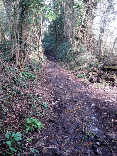
I may have used this title for a post in the past. Whilst fellow bloggers are exploring Manchester, White Nancy, Covid and Wildlife crimes I’m content with a walk around my local lanes. After my drubbing, is that a word, the other day on the Guild Wheel cycle route contentment is the prime objective. I live on the edge of the countryside, but only just with all the new developments, so for many walks I don’t need my car – just set off from the front door.

The road out of the village past the cricket ground is far busier than I ever remember it, a speedway to Chipping. That is why for my cycling these days I prefer the off-road routes. Anyhow, I’m walking today. Storm Otto blew itself out here in the morning and now the sun is shining. As I was saying the road is busy and after a stretch where the footpath ends I resort to evasive action crossing and recrossing to have a straight view of the traffic and hopefully them me. All along are views of the Bowland Hills tempting me to the north. Past that archetypal country inn.

DSC00143

Is that a Kestrel in the tree?

DSC00145

I survive to where I turn up a side lane heading for Longridge Fell. Those white railings, sited on corners for better through visibility, are slowly disappearing – a rural crime.

DSC00148I stop to talk to a farmer about the winters we never have these days. (tempting fate I know). Along comes a car which stops to reveal a dog walking friend fresh off the fell and heading for a nearby farm café, a good catch up ensures. I’m then admiring the hedge layering skills along the way and am lucky enough to come across the skilled labourer himself. A chain saw now makes the labour easier, but he has to be careful with the final close cut. A bill hook finishes off the branch severing, leaving a slender life giving, bent over, horizontal, stem for further growth. The whole process is to keep the hawthorn hedge thick at the base and stock proof in the future.  He seems happy in his work and as he says ” jobs a goodun”

DSC00150

DSC00152

DSC00154

DSC00151

There is a steep hill ahead of me but I have no problem which is reassuring after my last outing mentioned above. (my Covid test was negative by the way)  On the way up my mind wanders to future projects – Simon Armitage’s Stanza Stones, finishing off my Cicerone series, getting back on the rock, visiting friends afar not seen since before the lockdown and dare I hope getting back to the Canary Islands. Dreams. Inshallah.

DSC00156 (2)

I scan the reservoir for grebes, but the water is too rough today, I’m hoping to catch them in their courting display this year after last year being entertained by the chicks being carried on their mother’s back. DSC00157

Down through the housing estates and I call in at JD’s for a welcome coffee and plans. A ghostly barn owl quarters across the remaining fields in front of his house. He alerts me to this signage along the road which I had not noticed before – see me after school.

DSC00159Not bad for a local walk of 5 miles.

Capturethornley

A GENTLE SIDE TO BOWLAND.

DSC00117

Forget the rugged and isolated high tops of the Bowland Fells with their difficult peaty ways. This walk is for children, dogs and geriatrics like me.

Mike, or should I bestow on him a blog monicker of ‘metal Micky‘ used by his nearest and dearest after his second hip replacement, is going walking in the Canaries and is keen to get some miles under his belt. I put him off yesterday whilst I had a well-earned rest from our walk around the wells of Silverdale. No pun intended and no excuse today, I even went for an early start, so he could be home by 3pm for the televised rugby. We juggled a couple of routes and plumped for what is called locally the Little Bowland area. CaptureLittle Bowland.

A gentle start into the Leagram Estate with a peer over the wall at their extensive snowdrop dell which I managed to gain entry to last year. The fallen oak in the parkland from then has been cleared.

DSC00107

A drift of snowdrops.

DSC00108

A stately Leagram Oak.

The farm at Chipping Lawn (lawn derived from ‘laund’, a Medieval grassy area for deer) was heaving with lambs of all ages, weaned off their mothers. The mothers can then continue to be milked for Bowland Ewes Cheese. The youngsters meanwhile suck on dummy dummies for powdered milk. That is the evolved technical face of farming today.

DSC00112

A mob of lambs.

DSC00111

Suckling station.

We move on up the fell, passing Birchen Lee where a couple are busy laying flags. They are happy to chat about the locality. I know he crafts handmade furniture from seasoned oak which I would like to see, but I’m reluctant to distract him from his labours. We move on.

I have no spare coins to buy some free-range eggs at the Saddle Side farm road end. We move on up the lane going nowhere except a couple of properties at isolated Burnslack in the bosom of Bowland. We don’t go that far but turn off on an ancient bridleway along the base of the fells to Lickhurst, another isolated group of farmsteads now being gentrified as is the norm. I could tell some stories of these farms 50 years ago when reaching them in winter was an epic journey. Let’s leave them in peace, I don’t even take a picture, but there are some on my posts somewhere if you care to look.

DSC00115

Our high bridleway over Stanley to LIckhurst.

Let’s extend the walk and give us both a bit more exercise. So instead of following the lane down over fords we cross a little footbridge, and suddenly we are in limestone country. Coral atolls out of an ancient ocean floor, from whichever period, producing Limestone Reef Knolls. They are very obvious around here.

DSC00118

Coral reefs ahead.

DSC00128

Dinkling Green farmsteads our are turnaround point, we could have continued over the hills to Whitewell and beyond. We are in a beautiful green bowl of meadows below the high gritstone fells and the adjacent Limestone knolls. We meet a couple who live here who expound the virtues of their natural environment, there is no denying it.

DSC00120

Dinkling Green

DSC00124

The green side of Bowland. 

DSC00125

Local residents heading home for lunch.

Then that iconic red phone box in the middle of nowhere. It must have been essential at one time.DSC00131

We couldn’t walk past our friends’ house at Greystoneley without a knock, next thing we are seated in their kitchen enjoying conversation, coffee and cake. That’s what friends are for. They have had problems in this area with off-road vehicles.DSC00132

The 3 o’clock deadline is getting closer as we continue down the bridleway, over the ford and past the giant limekiln.  We opt for a hopefully quicker finish along the quiet road rather than the difficult to follow field paths.

DSC00134

Back in the parkland.

The exercise has done us both good, I’m relaxing in the bath whilst presumably ‘metal Micky’ is watching England thrash the Italians – or are they?

This circuit is recommended for anybody wanting to explore the foothills of Bowland and its farming communities. Just follow the map.

A ROUND OF THE SILVERDALE WELLS.

DSC00088

                                                                         Across the Lots.

After our confrontation with the car park attendant, sorted by flashing our RSPB membership cards, we set off, not to watch the birds, but in search of the wells in the parish of Silverdale, that delightful scattered village. Martin had the instructions, Carol, Keith and I just followed on. Thankfully he was an expert guide and his write-up here has a map of our route.

This is limestone country but where this is underlaid by non-porous rock water will collect either as a surface ‘pond’ or seep out of the layer as a spring. The past inhabitants of Silverdale utilised this for collecting water in wells and tanks. A piped supply from the Thirlmere Aqueduct didn’t arrive until 1938.

Here is a selection of today’s photos. I would need longer to sort out our route which I will do in the future and gladly repeat the walk with my mates.

DSC00063

Bank’s Well.


DSC00067

Dogslack Well.


DSC00071

Walkers’ traffic lights. Cross at green.


DSC00073

C15th Arnside Tower.


DSC00079

Well hidden Elmslack Well.


DSC00085

The muddy cove – go back, go back.


DSC00095

The more evident Woodwell.


DSC00098

This way, honest.


DSC00101

Burton Well – the last on the circuit.

An excellent morning’s walk in good company.

CICERONE’S LANCASHIRE – THE UPPER WYRES.

DSC03324Down on the River Wyre in St. Michael’s a tragic drama is transpiring, a 45-year-old local lady, Nicola Bulley, has gone missing whilst walking her dog by the river. You will have seen it on the national news, the trauma her family are going through as the days pass, without resolution, doesn’t bear thinking about.

***

The River Wyre comes out of the Bowland Hills above Abbeystead, the Tarnbrook Wyre and the Marshaw Wyre join forces there and head off into the Fylde to reach the sea at Knott End/Fleetwood. A dramatic journey. I walked the whole of the Wyre Way in 2014, can’t believe it is so long ago. Today I’m parked up in a lay-by alongside the Marshaw Wyre at Tower Lodge as suggested by Walk 11 in Mark Sutcliffe’s Cicerone guide book, exploring these two upper Wyres.

I’ve just driven through the ‘Trough’ from Dunsop Bridge, a way through the hills beloved of NW Lancashire cyclists. There were plenty this morning, the forecast being good with sunshine and little wind. In fact the last time I came this way was on my cycle way back in 2014, I remember it being a tough ride in this direction. I would need an electric bike I think for such exploits now. I have previously walked a version of this route in reverse, again in 2014.

I thought the lay-by might have been full by the time I turned up at 11am, but there were only a couple of cars. Boots on and immediately a steady uphill begins. By chance, I’m heading into The Duke Of Westminster’s territory once more. I was disparaging about grouse moors in my recent post on Clougha Pike, so today I start optimistically with only healthy thoughts of the great outdoors. I can’t believe it the first WW stone marker, of which there were many better examples along the way, depicts a rifle and a grouse. Condescending bastards.

DSC03281

Putting that aside I march over the hill to views of the Clougha Pike/Ward’s Stone ridge above the Tarnbrook Wyre. I’m glad I’m not going up there today – it’s a tough long walk, although the Duke’s new motorway had made it easier in parts. We used to go up there to climb/boulder on Thorn Crag before it was open access, often resulting in being forcibly ejected. The CRoW act of 2000, despite its limitations, has been a gentle step forward. I cross the infant Tarnbrook Wyre without much thought to its journey from up on Ward’s Stone.DSC03285

DSC03312

DSC03310

The last time I came through Tarnbrook, an old farming settlement at the end of the road, I got talking to an elderly gent, born and bred there and the last remaining permanent resident. (his family checked up with him every day). I doubt be is still here as the properties all seem to be in the process of modernisation – for rich incomers or holiday lets? A lot of history possibly lost.

DSC03306DSC03304

Turning my back to the hills I make my way across multiple fields westwards. Yes the stiles are rickety and not easy to spot in the low light. A few adjustments are needed after my phone GPS mapping is consulted, in the past I would have been much more careful with map and compass.

DSC03314

DSC03319

A friendlier waymarker.

Abbeystead is reached without too much trouble and the Tarnbrook Wyre, (header photo) now more sizeable is crossed at Stoops Bridge, a popular parking area. The hamlet is the centre of the Duke’s Abbeystead estate with the mock Elizabethan estate offices, cottages and old stables.

DSC03323

Gated entrance to the Duke’s Abbeystead House.

DSC03325DSC03327

My path takes off from the road at the far end of the village, taking me high above the Reservoir and then down below the dam and a footbridge over the Wyre. The reservoir is silting up and there is a constant cascade of water over the beautifully curved dam. All very dramatic.

DSC03330DSC03333DSC03334DSC03335DSC03338DSC03346

The concessionary path alongside the water is in a dreadful state. Too many feet on the muddy terrain. There is an alternative higher path to the south via Marl House and Hawthornthwaite, longer but more sustainable.  It takes an age of slippery sliding to reach dry land again near the Stoops Bridge parking.DSC03347DSC03350DSC03356DSC03349

DSC03351

The Tarnbrook meets the Marshaw Wyre.

Then the parkland of Abbeystead House, the raison d’être of the area, is traversed with tantalising views of the enormous property. Lots of fields and stiles often high above the Marshaw Wyre. I must have fallen asleep and come out onto the road well off route. My map shows it all.

DSC03357

DSC03362DSC03363DSC03367

The Marshaw Wyre is then followed closely back up the Trough road to those well known pines alongside the river. Tower Lodge was a welcome sight. I was getting tired and have measured my route as 8.5 miles as opposed to Mark’s 7.25. Some of that was me getting lost.

DSC03376DSC03379DSC03381DSC03384

I have reservations about this walk, yes stunning scenery in parts but lots of field stiles to negotiate, needing careful navigation. The section to the south of Abbeystead Reservoir is horrendous, muddy and awkward. I think the route would be more balanced starting in Abbeystead, with an option to take the difficult reservoir 1.5 mile loop. The road up Marshaw was tedious at the end of the day, it would be so much more enjoyable early in a walk that gradually gained height and then brought you back anticlockwise down to Abbeystead.DSC03377

***

CaptureWyre Way

CICERONE’S LANCASHIRE – GRIT AND GROUSE.

DSC03171

Most of this afternoon there were voices in the air telling me to ‘gobackgoback‘.  I was on the doorstep of the Duke of Westminster’s (check him and his family out on Hugh Grosvenor, 7th Duke of Westminster – Wikipedia) back garden, his vast acreage of grouse shooting moorland. I’m not sure that I had been this particular way. When I started exploring this area the CRoW act of 2000 hadn’t been passed and so this piece of land would have been no go, not that I always took any notice of those restrictions.

I get to muse on grouse shooting. If the red grouse is a native bird to the UK then surely it should be protected, along with other birds, under the Wildlife and Countryside Act, 1981. In view of this how do the aristocracy and landed gentry get away with the annual massacre for ‘sport’ on their estates? The two don’t seem to go hand in hand. But life is never fair, certainly not if you are a grouse. I’m anti shooting and hunting, so I declare my bias, but somewhere I found this, worth considering…

grouse

No doubt the Duke gets financial recompense for some of his land being ‘open access’. The worst aspect of this on these moors is the ‘Unregulated tracks and roads’. A minor road has been created, without the usual planning restraints, right through the centre of what should be a wild area, we are short of those. See my picture later in the post.

Anyhow, I’ve had my grouse about shooting, so back to my walk. Walk 3 of Mark Sutcliffe’s Cicerone guide to walks in Lancashire, Clougha Pike and Grit Fell. The Rigg Lane car park has a notice that it is locked in the evenings, though no time is stated. That makes me nervous from the start. And my start is late, delayed till midday after a morning of frequent heavy showers.

As I said I’ve never knowingly used this approach to Clougha Pike, although I’ve been up there many times. It is a pleasant way through a wooded glade with a tumbling stream as an accompaniment. I struggle to understand the geology, all landslips and jumbles of gritstone boulders. Steadily upwards, actually quite steeply in parts through the gritstone outcrops. Once onto the open fell the way is well trodden, rough in places, most footsteps are heading to the Pike.DSC03130

DSC03133DSC03136DSC03141

The guide mentions a right-hand ladder stile, a wooden gate and a kissing gate on the way and these are crucial to finding the correct way.

By now you are on the summit ridge and there is an easier walk up gritstone slabs to the Trig point and stone shelters of Clougha Pike, 413 m. Previous visits have given me wonderful views over Lancaster and Morecambe Bay. Today all was a little hazy. It was even more hazy ahead on the way along the ridge to Grit Fell, 467 m, with its modest cairn. ‘Gobackgoback’.DSC03157DSC03159DSC03163

That incongruous estate road is reached and followed back on itself.  A minor diversion to an old quarry used for roofing stones, the grit here splits in the best way for flat roofing shingles. But there is something else here Andy Goldsworthy’s three stone pods. I’m alone, so the usual photo opportunity goes missing.P1000719 (2)

Back on that road for a short stretch to a rocky outcrop on the right, not left as in the guide, where a narrow path heads downhill through the heather due north. Its origins become plain soon as old abandoned grouse butts are passed. The modern shooter has posh new butts closer to the road, so they don’t have to walk too far. One of the butts makes a good base for some lunch, it is nearly 3pm. All around is murky. ‘gobackgoback‘ is the constant cry as grouse take to the wing, far too rapidly for me to shoot – with my camera.DSC03180DSC03181

The path deteriorates in boggy ground but then suddenly brings you to the edge of the deep and delightful Littledale with the infant Conder River dropping on the left. I possibly went wrong here and managed to climb back up onto the moor on an inviting green track instead of following the valley base. No matter they both meet up on the road, particularly ugly and out of place here, which drops into Otter Geer Clough.

DSC03184

The path disappears…

DSC03186

… before dropping into Littledale.

DSC03191

The infant Conder.

DSC03192

Back up again.

DSC03196

I told you it was ugly.

It’s along here I have my close encounter with a Red Grouse, probably protecting its breeding territory.DSC03238DSC03243DSC03247

I’m soon at the bridge carrying the Thirlmere Aqueduct which passes within half a mile of my house on its way to Heaton Park in Manchester. The water is gravity fed, an outstanding feat of Victorian engineering, and takes just over a day from source to destination. There is a varied long distance walk that follows close to its course. Whilst here I can’t resist a quick look into the nearby quarry where I helped my friend Pete develop some climbing routes maybe 30 years or so ago.DSC03253DSC03254

Being close to the car park there are more people about, and I drop into conversation with an elderly gent. Delightfully old-fashioned and attired in cobbled together clothes with several safety pins holding it all together. We chat about this and that, him advocating the benefits of regular exercise and making the effort to get out whatever the weather. He leaves me and sets off to try and discover a way up the rocky fell above us. a true character.DSC03259

It’s a pleasant stroll back through the gorse reaching the car just as darkness descends, thankfully the gate is still open.DSC03261

I’ve done variations of this walk before here and there, but I think this one from the Cicerone book gives the best route. Top class scenery and all round interest. Last words from the grouse, ‘gobackgoback‘.

LONGRIDGE FELL – THE EASY WAY.

DSC03115

Ignoring the title of my last post I’m up here again, doing it the easy way from Cardwell House , on Jeffrey Hill. And definitely staying out of the trees this time.

All part of my irregular three-mile litter picking circuit. I have been a bit lax recently and not kept up to my original monthly round. But no matter, the plethora of the Covid lock-down years has passed. There is room to park, though there are few takers this misty damp afternoon. There are always good pickings in the first hundred yards or so. I ignore the underpants in the car park and concentrate on the dog poo bags, a record today of 13, 10 of them full. The only person I meet is a dog walker, hopefully a responsible one as I bite my tongue and don’t grumble about the mess. By the way green doggy bags are no more environmentally friendlier than black ones – take them home, please. Rant over.DSC03114

I keep to my plan  – up to the summit, good pickings here as usual, cross over and come back down alongside the wall to the road. Cola cans outnumber Lucozade, for a change. The odd glove or hat, a helium balloon, Cadbury’s chocolate the favourite. One glass beer bottle.

DSC03113

I hope that if the fell looks clean people will be less inclined to drop their rubbish. Is there any evidence for this? This is my bit of fell after all, not that I want you to think I’m over obsessive about its cleanliness. (can you be over obsessive?) Once on the short stretch of road there is more to contend with. Some I will leave for the ‘council’ to deal with. Was it part of an organised litter pickup to be collected later or more likely a deliberate drive out and dump mentality? I’d better just stick to the fell.

DSC03120

By the time I was back at the car my bag was overflowing and feeling decidedly heavy. Job done.

DSC03122DSC03123

“What do you think of it so far?”  was one of Eric Morecambe’s catchphrases – and the reply from somewhere offstage – RUBBISH.

CICERONE’S LANCASHIRE – LONGRIDGE FELL NEVER EASY.

DSC03107

Up on Longridge Fell we were doing OK until the guide, walk no 23 of Mark Sutcliffe’s book, said to take a jink right in the trees. We already had jinked right awhile back as the fallen trees from last year’s storm Eunice?, blocked our tracks. But others had come this way recently, in fact quite a path had developed. We bushwhacked on. For once, I wasn’t the leader, Phreerunner was running but not as phree as he thought.

When Martin (aka Phreerunner) had included in his Friday walks Longridge Fell I couldn’t refuse to accompany him. I secretly knew the problems ahead but didn’t want to spoil the fun, it’s not Cicerones fault. I thought it a good idea to bring JD into the mix for some local support.

We had left Hurst Green alongside the delightful Dean Brook with its bobbin making history. The stream bed was carved by the water into Daliesque shapes. Resisting the urge to take another photo of Greengore we move on and across fields I don’t usually travel. Lanes and then a boggy path brought us out onto the top ridge where a simple stroll led to the summit trig point, 350 m. The light on the Bowland Hills was flitting from one area to another, but the three peaks never put in a show. Time for coffee and snacks.

DSC03096

Shireburn Alms Houses.

DSC03097DSC03098

DSC03101

The onward path disappears into a dark plantation, and already we start meeting obstructions. When I was up here early last year I found it impossible to make safe progress. It was slightly better today as Martin forged forward bent double to avoid the branches. We made it through to more open ground and then found with the use of our phones a path going in the right direction. It is fairly chaotic up here at present, a shame that the forestry workers can’t spare a day with a couple of chain saws to clear a way.

DSC03105

As we left Hurst Green earlier this morning we passed the Shireburn Alms Houses and I related as to how they were originally built higher up on the fell in the earlyC18th and subsequently moved stone by stone down into the village around 1946. Well now we were above their original site on the fell next to the ‘blue lagoon’ reservoir. It wasn’t blue today in the rather dull conditions. The foundations can still be seen if one looks around, we didn’t.

Across the road, over a wall and down some fields, the directions lacked clarity here. We ended up in someone’s garden with a couple of wild eyed dogs snapping at our heels. We escaped and found our way down a ravine, the correct stile now visible behind us. It always amazes me, and I’ve said it too many times, that landowners don’t put signage up through their property and maintain the stiles – it’s not asking too much. If you buy a country property you will be well aware of any rights of way coming through it. Time to start issuing fines, I know that will never happen.

We skirted around Stoneyhurst School, admiring the architecture and the long stately drive. I think this was all new for Martin, and I shall be interested in his write-up for the walk on his blog. Soup and rolls back at Chez BC completed an excellent ‘Friday Walk’  May meet up again when he moves his troops to Silverdale in a couple of weeks time, or should I make the effort and travel down to Cheshire for somewhere new?

DSC03112

I didn’t take many photos, it was all too familiar, or so I thought, and we were busy chatting. There is a better report here.

***

tempsniphurst green

THE WITCH’S GRAVE – LYTHAM.

DSC03040 (3)

I was in Lytham a couple of days ago seeking out the memorials relating to the Mexico ship disaster of 1886 which led to the deaths of 27 lifeboatmen. The worst loss of life in the history of the RNLI. Chatting to one of the locals on the Lytham Promenade, he enlarged on the Cliftons of Lytham Hall, an interesting family by all accounts, and the influences they had had on the town over the centuries. He mentioned the mysterious Witch Wood.

Witch Wood is what’s left of The Big Wood, a 5,000 acre site, once part of Lytham Hall Home Park. The Cliftons ran into financial trouble and sold off the estate to Guardian Royal Exchange in 1963. Somewhere along the line the local council gifted the remaining derelict Witch wood to Lytham St. Annes Civic Society who proceeded to create a narrow strip of woodland, a green corridor in the heart of the town. Undergrowth was cleared and new native trees planted.  A plaque says the woodland was officially opened by Prince Phillip in 1974.

DSC03036

DSC03046

The Western Exit, notice the cobble wall of Lytham Hall estate.

DSC03043

My visit, with cycle in tow, was going to be brief. The approach, after visiting St. Cuthbert’s Church, was along an old private driveway, now open to pedestrians, over the railway into the old Clifton Estate.

I’d been told of the Witch’s Grave inside these woods. Spoiling the story, not a female scary Witch but a horse belonging to John Talbot Clifton, the squire of Lytham Hall. The horse, Witch, had an accident in 1888 within the woods and a gravestone apparently marks its resting place.

Once in the woodland strip do I go left or right to find the grave? I go left, westwards, along a well-used path, no cycling allowed says the sign. Fair enough. The narrow wood is bounded on the south by the railway and to the north by a largely hidden housing estate. It should be easy to spot the grave especially at this time of year with little undergrowth. Of course, I don’t really know what I’m looking for. After walking a few hundred yards I have not found the gravestone. I turn around and head back.

A local couple are walking towards me – “excuse me, do you by any chance know where the Witch’s grave is?” ” Yes you must have passed it back there – it’s on the right in the trees” They offer to show me where, and I retrace my steps once more. It is evident they are very proud of their wood and extol the virtues of the Lytham Civic Society and all the good work the volunteers do. They are not too keen on irresponsible dog owners or cyclists. I wheel my bike quietly beside me. Next thing my guides and I are at the far western end of the wood where it joins the road without encountering the grave. They apologise, explaining they were distracted by our conversation. I apologise for troubling them and turn tail to try again.

Along the way I gather up more ‘knowledgable’ locals in my quest. “I think it is in the other half of the wood” is a popular opinion. So over the driveway and into the eastern half of the wood, we spread out scouring the undergrowth. They begin to lose interest but say they will shout if they find it as they scatter off onto side paths. I retreat to the western half as advised by the next group of locals, one who had walked these paths as a child believing in the Witch and fairies in the trees. For a while I follow them but begin to doubt their reliability and hang back, bicycle still in tow. That’s about a dozen locals I’ve consulted so far, it can’t be so difficult, surely. Back to the central driveway.

At last a pleasant lady with spaniel, must be local. I repeat my request and all of a sudden positivity arrives. She marches me without any fuss to the spot maybe a hundred yards away which I must have passed half a dozen times. I thank her profusely, she looks at me wondering whether I will be able to find my way out.

To be honest the gravestone is small and not that obvious in the trees. The stone is inscribed  – The Witch. Died Jan 5th 1888Satisfied, I can continue on my way now, not daring to mount my bike till well out of the wood. I cannot give you a grid reference for the stone – best of luck if you go in search. Try asking a local.

DSC03038DSC03039

***

tempsnipwitch

SPY IN THE FIELD.

DSC02928

I came across this temporary CCTV installation on my walk across the fields this morning. Notice how blue the sky is.DSC02927

Placed in a field next to tracks leading to isolated farms and a back way into Ferraris Country Hotel. Four solar-powered cameras pointing around the compass. Have there been recent burglaries or fly tipping? I am sure it’s not to watch the animals or ramblers. Further enquiries are needed.

I was out for a short brisk walk in the countryside behind my house, there had been overnight light snow which always gives a different atmosphere to the familiar, making the fells look higher and more majestic. There was a satisfying crunch underfoot, mine were the only footprints. Though there were prints of rabbits, hare, deer, and the odd bird who had passed by earlier. The snow was rapidly melting in the fields but compacting to an icy danger on the lanes.

DSC02925

The Bowland Fells.

DSC02922 (2)

Longridge Fell.

                                                                                                                                                          Soon I was heading up an icy Mile Lane back into the village for a bit of shopping.DSC02933

The remaining snow had a rosy glow in tonight’s Turneresque sunset.

DSC02964

***

Capturegill bridge.

A QUICK VISIT TO BEACON FELL.

DSC02570

It had to be a quick visit. It was nearly 3.00 when I parked in the quarry, darkness comes before 4.00 and that is when the rain was due.

Aren’t we lucky to have a Country Park on our doorstep? Ready-made trails, sculptures, wildlife and views. Just great for a short visit and a burst of exercise when you can’t think of anything else. I tend to follow whichever path I find myself on, one can’t get lost for long and all will eventually lead upwards to the summit trig point at 266 m. Since thinning of trees has been carried out in the last decade there is a better variety of habitat. The only downside at the moment is that the visitor centre is closed, post Covid or council savings? I wonder what has happened to all the volunteers. Also don’t expect to find the previously excellent café open, they are only doing a takeaway service Thursday to Sunday.

DSC02728DSC02732DSC02729DSC02731

Yesterday I walked quickly around the darkening forest and then out and up to the open fell top. There always seems to be somebody up there, the ‘green lungs’ of Preston. I was soon back at the car satisfied with my quick visit. The rest of the week looks rubbish.

Beacon Fell Country Park – Lancashire County Council

***

Capturebeacon fell